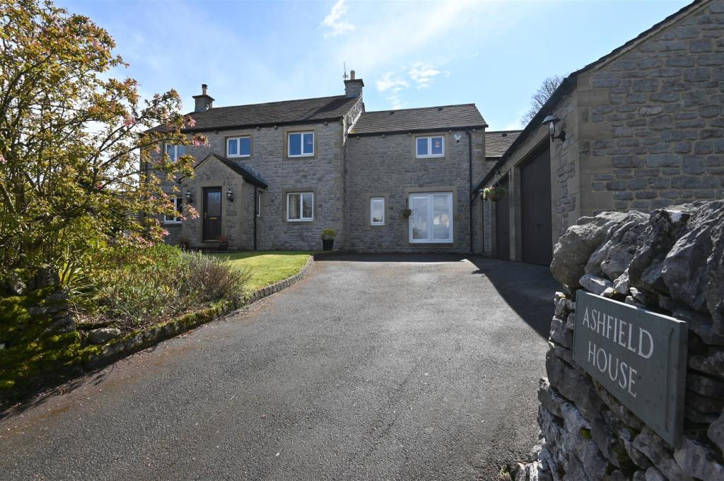
Ashfield House
SCHOOL LANE, BUXTON, TADDINGTON, DERBYSHIRE SK17 9TW
DSC_0230.jpg DSC_0213.jpg DSC_0241.jpg DSC_0243.jpg DSC_0258.jpg DSC_5338.jpg DSC_5305.jpg DSC_0249.jpg DSC_0236.jpg DSC_5274.jpg DSC_5285.jpg DSC_5276.jpg DSC_5287.jpg DSC_5296.jpg DSC_5289.jpg DSC_5302.jpg DSC_0221.jpg DSC_0226.jpg DSC_0209.jpg DSC_0211.jpg DSC_0223.jpg Outside 4.jpg DSC_5307.jpg DSC_5294.jpg
/ 24
Property details
Floor area
244 m²
Year built
England and Wales: 1983-1990
Last sold
£678,000 Sep 2021
Price per m²
£2,664/m²
Local average
£444,400 (+46.3%)
Deprivation
Decile 5 (14,553 of 33,755)
Street crime
1 incident within 1 mile (Apr 2026)
Key features
- Double Garage & Generous Off Road Parking
- Adjoining Open Countryside
- Spectacular Views
- Thriving Village With A Calendar Of Events
- Country Inn
- Flexible Living Accommodation
- Easily Commutable Distance To Buxton, Bakewell & Manchester
- Lady Manners School Catchment
- EPC: D
- Viewings: Bakewell office
Additional details
- Parking
- Yes
- Garden
- Yes
Description
£650,000 - £675,000 Guide Price.
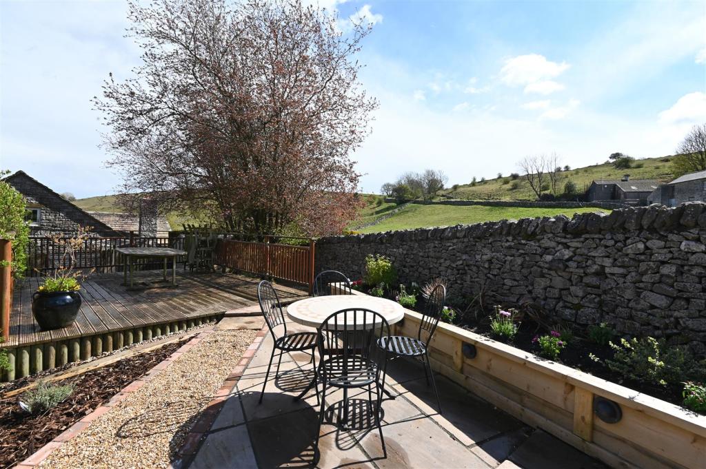
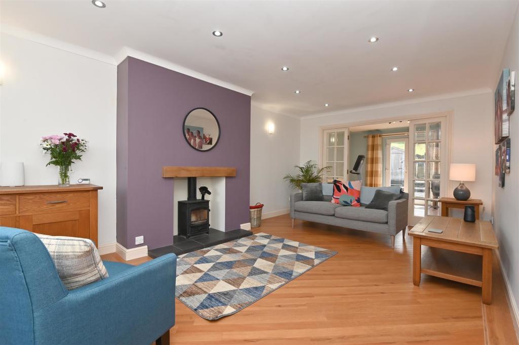
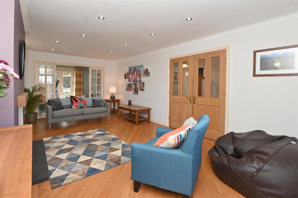
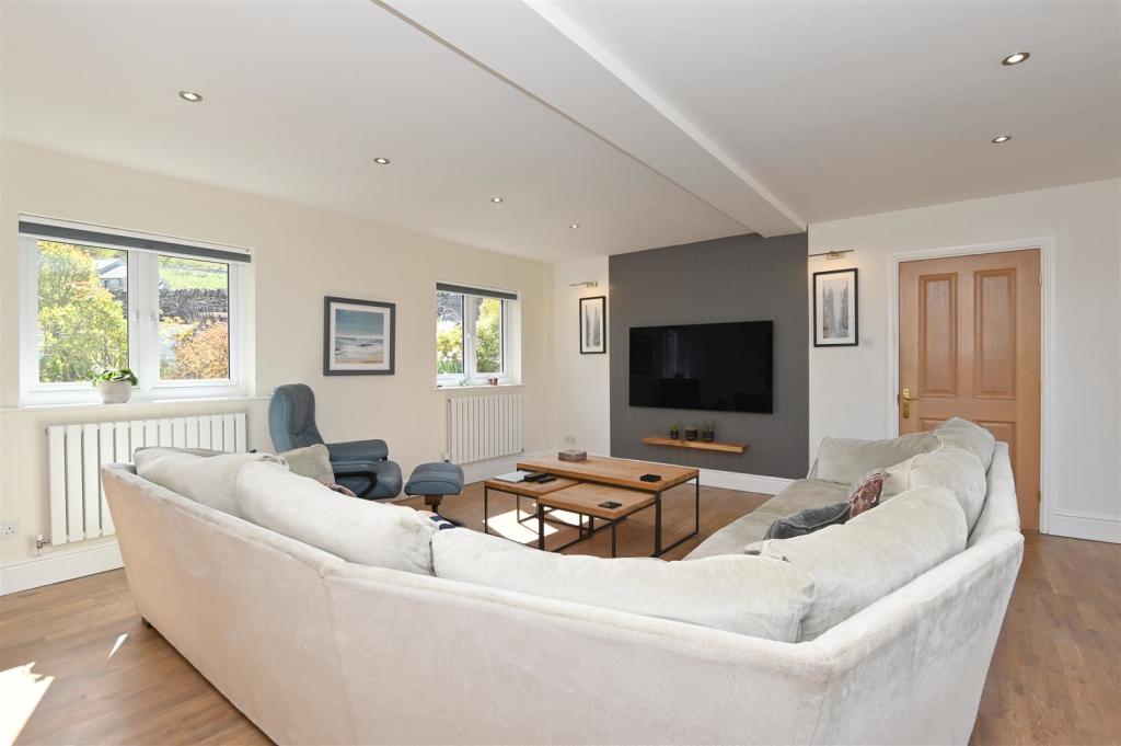
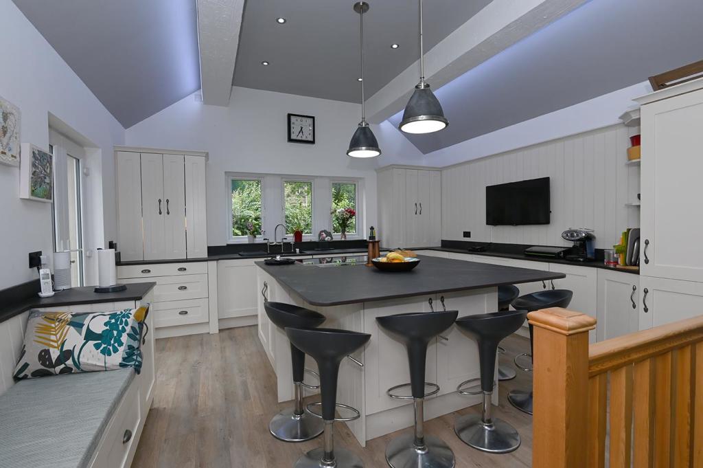
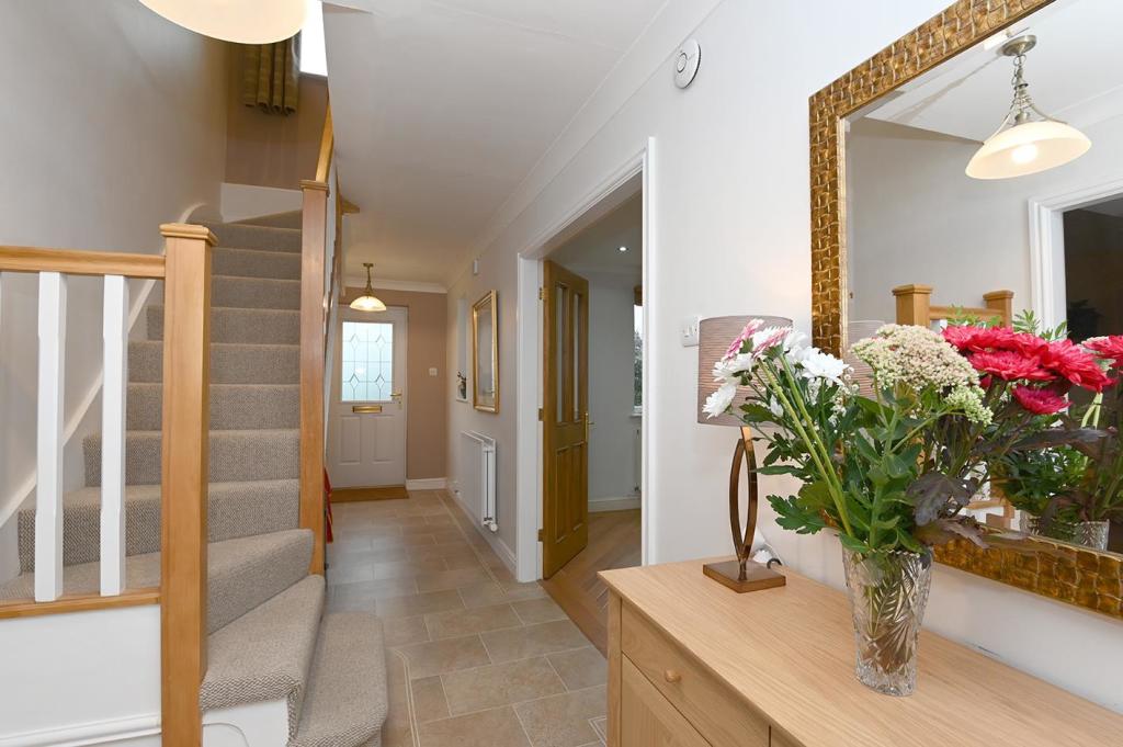
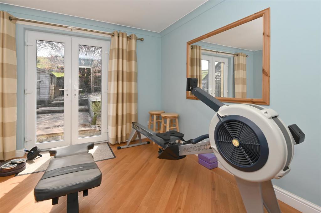
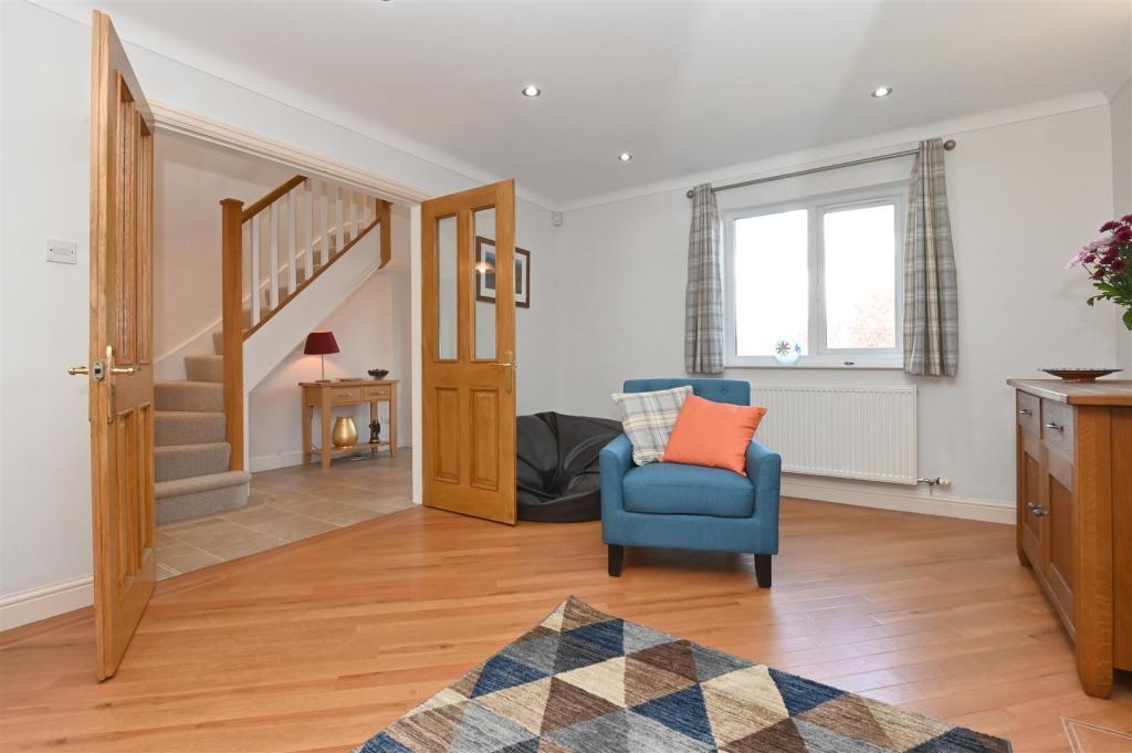
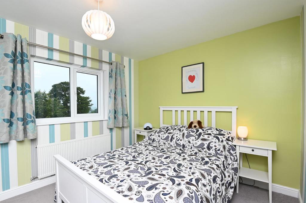
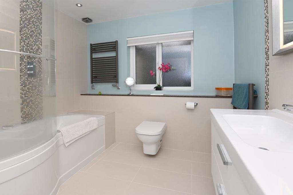
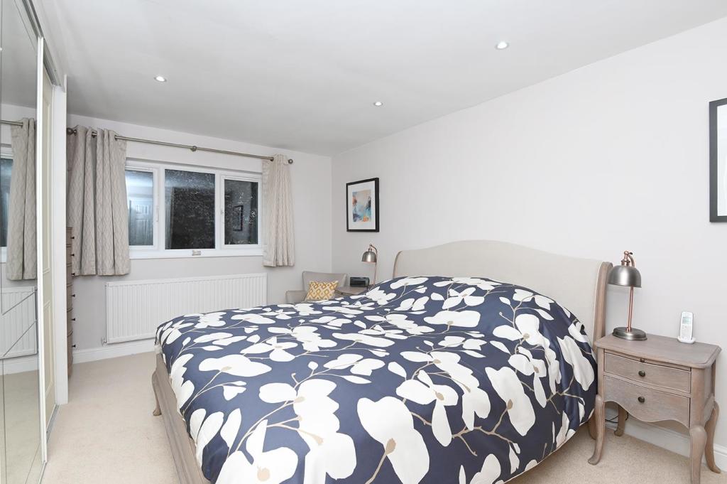
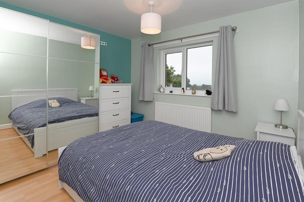
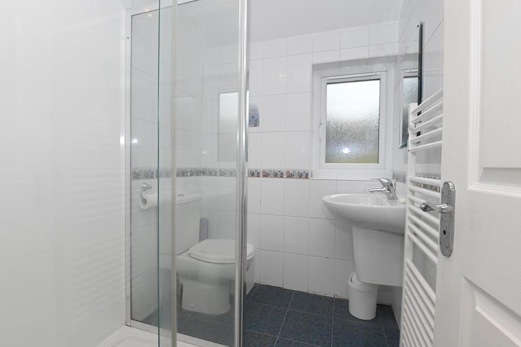
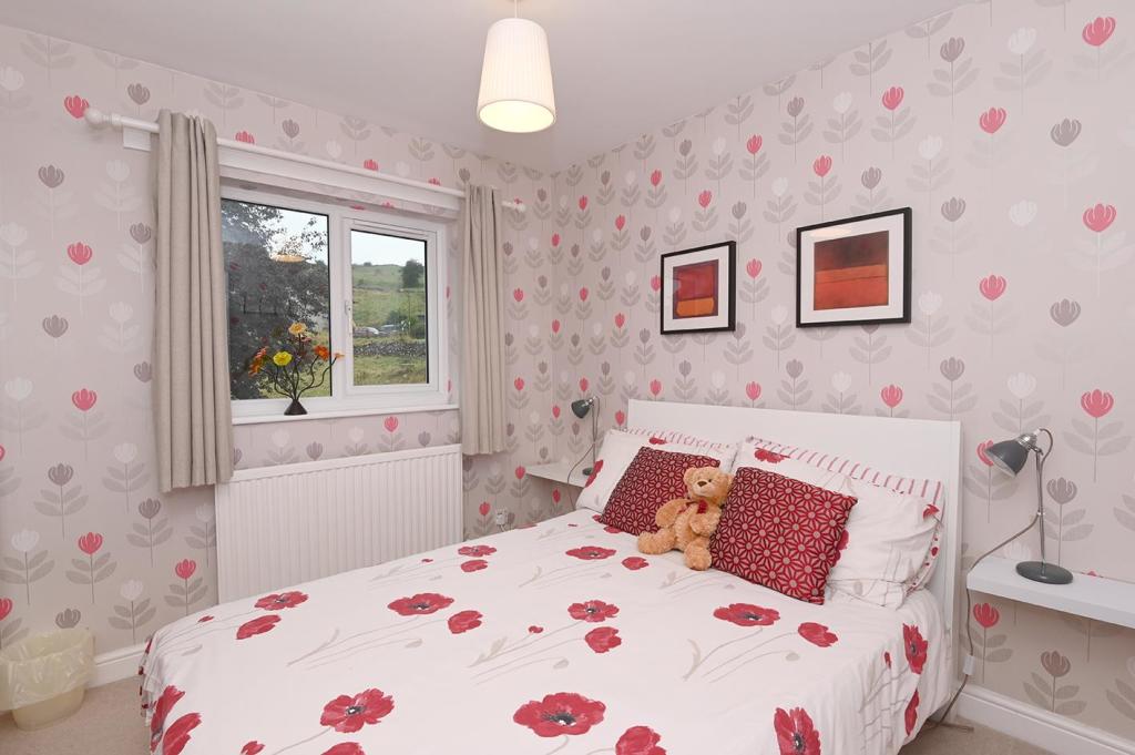
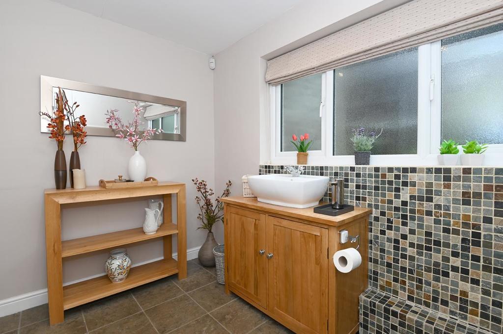
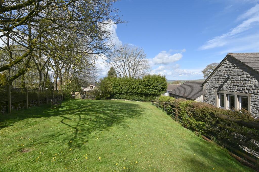
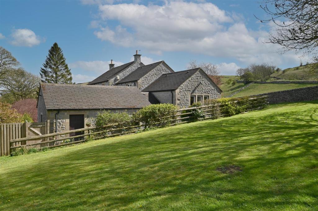
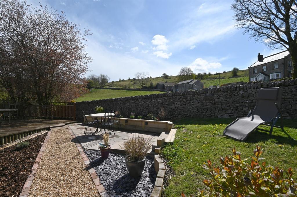
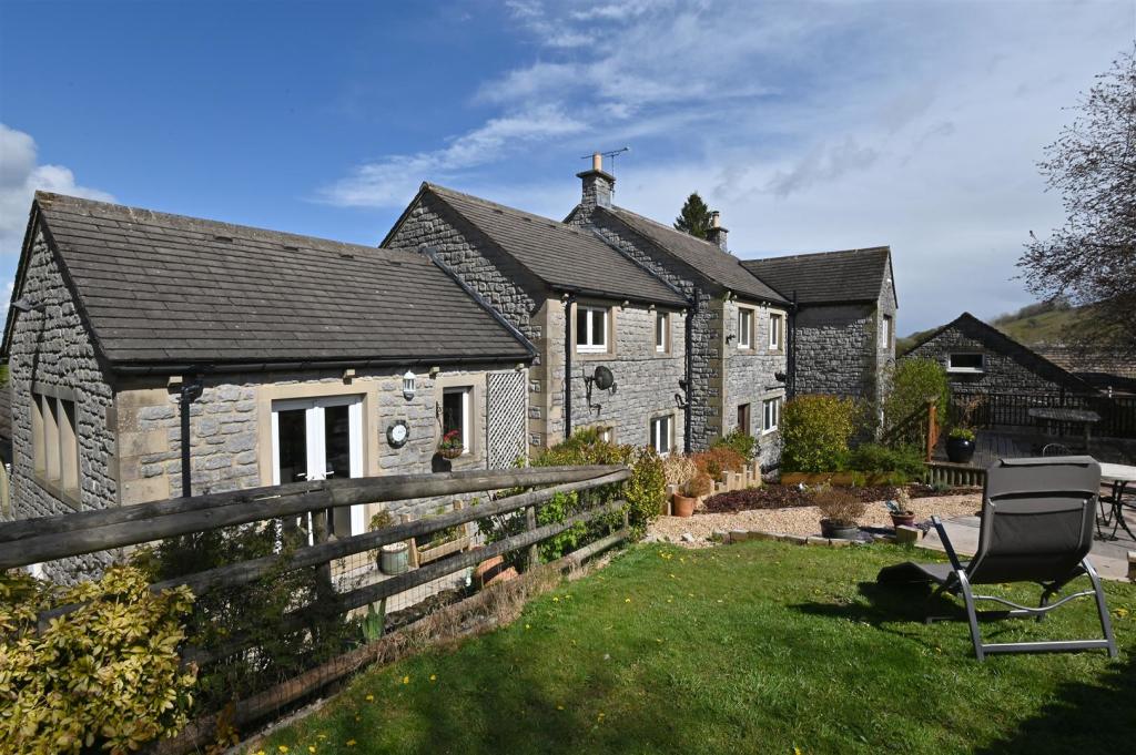
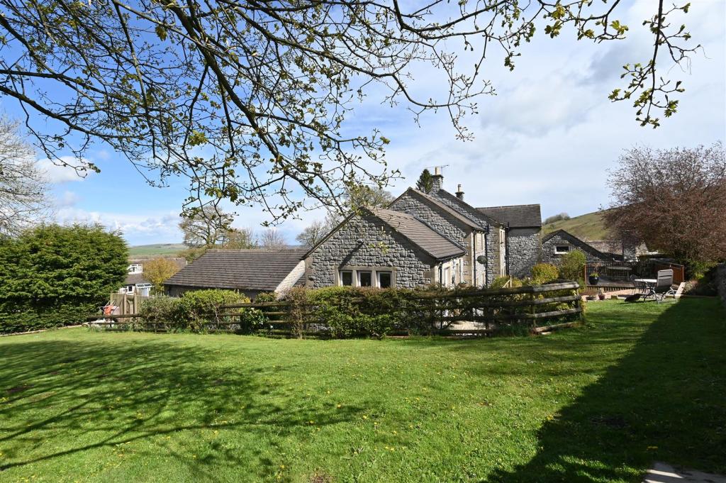
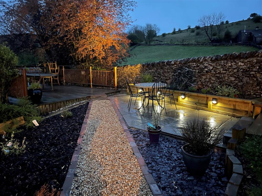
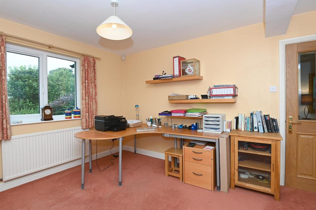
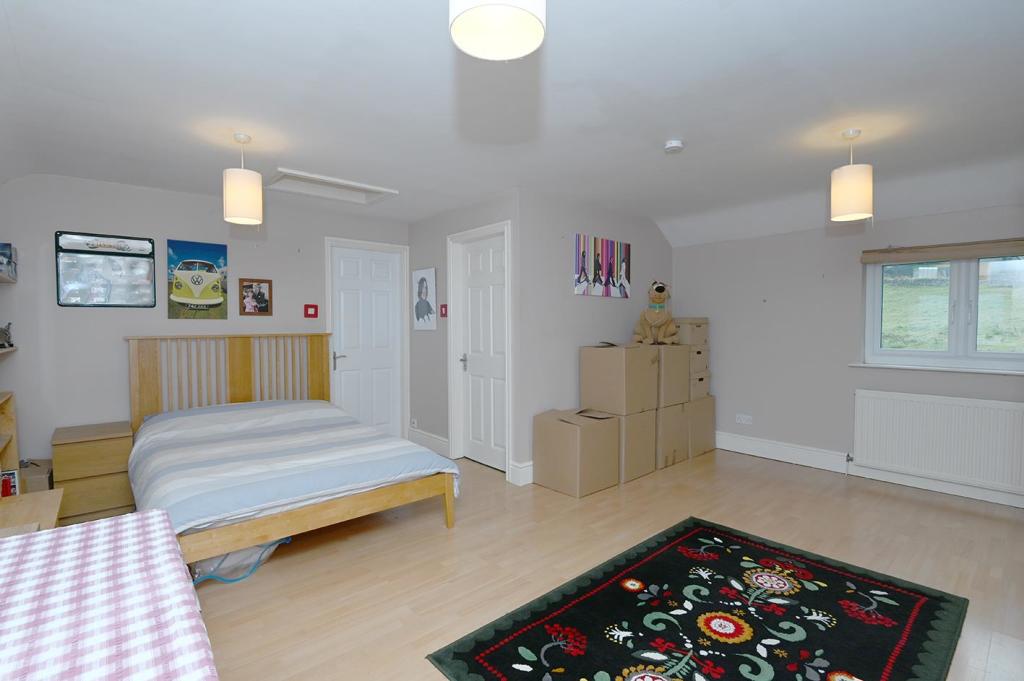
A substantial five bedroom detached property nestled in attractive landscaped gardens and boasting ample off road parking for several vehicles and a double garage. The property occupies a peaceful setting in the popular rural village of Taddington, enjoying magnificent views across the surrounding Peak Park countryside. Beautifully presented throughout, offering light, spacious, flexible living, ideally suited for a dependent relative or home worker. With high quality fittings throughout. The accommodation comprises: four reception rooms, perfect entertaining, stylish living kitchen with integrated appliances and doors opening onto the paved seating terrace, separate utility room and W/C. Five double bedroom, two en-suites and luxurious family bathroom. The gardens border the property and include decked and paved seating terraces enjoying glorious far reaching views across the adjoining Derbyshire hills.
Listed by
Bakewell
Saxton Mee
Reference: 106572191
EPC ratings on this postcode
We don't have a matched EPC for this property yet. Below are efficiency scores and details for other addresses on this postcode.
| Address | Current | Potential | Floor area | Age band | Type |
|---|---|---|---|---|---|
| 1 Hillside Croft, School Lane, TADDINGTON | 87 | 98 | 98 m² | — | Detached |
| 10, School Lane, Taddington, BUXTON | 32 | 75 | 88 m² | England and Wales: 1950-1966 | Detached |
| 11 School Lane, Taddington, BUXTON | 31 | 63 | 88 m² | England and Wales: 1930-1949 | Detached |
| 12, School Lane, Taddington, BUXTON | 38 | 66 | 89 m² | England and Wales: 1930-1949 | Detached |
| 2 Hillside Croft, School Lane, TADDINGTON | 87 | 98 | 98 m² | — | Detached |
| 7 School Lane, Taddington, BUXTON | 50 | 86 | 81 m² | England and Wales: 1950-1966 | Terraced |
| 7, School Lane, Taddington, BUXTON | 26 | 68 | 88 m² | England and Wales: 1950-1966 | Detached |
| Ashfield House, School Lane, Taddington, BUXTON | 66 | 74 | 244 m² | England and Wales: 1983-1990 | Detached |
| Priestdale House, School Lane, Taddington, BUXTON | 67 | 90 | 178 m² | England and Wales: 1983-1990 | Detached |
| Priestdale House, School Lane, Taddington, BUXTON | 63 | 88 | 174 m² | England and Wales: 1950-1966 | Detached |
| Priestdale House, School Lane, Taddington, BUXTON | 64 | 81 | 179 m² | England and Wales: 1950-1966 | Detached |
| Priestdale House, School Lane, Taddington, BUXTON | 66 | 83 | 147 m² | England and Wales: 1950-1966 | Detached |
| The Gables, School Lane, Taddington, BUXTON | 44 | 66 | 161 m² | England and Wales: 1930-1949 | Detached |
| The Old Parsonage, School Lane, Taddington, BUXTON | 50 | 69 | 260 m² | England and Wales: before 1900 | Detached |
| The Old Parsonage, School Lane, Taddington, BUXTON | 54 | 78 | 277 m² | England and Wales: before 1900 | Detached |
Flood risk
Zone: 1
Risk: Low
Job (default Low)
Floorplans
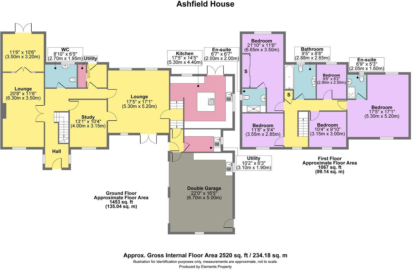
Ashfield House.jpg
EPC Graphs
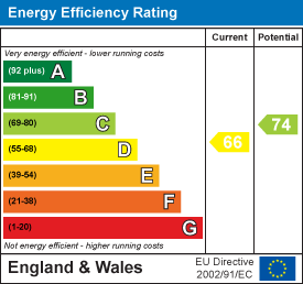
EE Rating
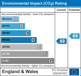
EI Rating
Price history
| Event | Date | Price | % change |
|---|---|---|---|
| Sold | 30/09/2021 (4 years ago) | £678,000 | — |
Source: HM Land Registry Price Paid Data. Crown copyright.
Sold Comparables
Same street and nearby sales within 0.25 miles (last 5 years). Data from Land Registry Price Paid.
| Address | Price | Date | Type |
|---|---|---|---|
| THE NOOK MAIN STREET, TADDINGTON, BUXTON, DERBYSHIRE DALES, DERBYSHIRE, SK17 9TU | £300,000 | 16/09/2022 | Detached |
| Same street 11 SCHOOL LANE, TADDINGTON, BUXTON, DERBYSHIRE DALES, DERBYSHIRE, SK17 9TW | £302,500 | 26/08/2022 | Semi-detached |
| CROSSE CHANCE COTTAGE MAIN ROAD, TADDINGTON, BUXTON, DERBYSHIRE DALES, DERBYSHIRE, SK17 9TR | £251,500 | 29/07/2022 | Detached |
| MARLBOROUGH HOUSE MAIN STREET, TADDINGTON, BUXTON, DERBYSHIRE DALES, DERBYSHIRE, SK17 9TU | £445,000 | 20/04/2022 | Detached |
| LANE HEAD COTTAGE HUMPHREY GATE, TADDINGTON, BUXTON, DERBYSHIRE DALES, DERBYSHIRE, SK17 9TS | £330,000 | 11/03/2022 | Detached |
Street average: £302,500 (1 sale)
Area average: £331,625 (4 sales)
Capital growth trend
Land Registry outcode average: last 12 months vs 5y and 10y ago (from sold prices).
House Price Index (HM Land Registry — official index, not sold-price averages): Derbyshire Dales. Series: Detached. As of March 2026.
Rental Range
Estimated market rent for Derbyshire Dales. Low = conservative, Realistic = average, Optimistic = best case.
Based on Local Authority from postcode lookup → Derbyshire Dales.
LHA (30th percentile) floor for Peaks & Dales: £898/mo (Apr 2025 – Mar 2026)
Location
Address
School Lane
Nearby
Nearest stations, universities and amenities (distance from property).
| Type | Name | Distance |
|---|---|---|
| Bus stop | Main Road | 0.0 miles |
| Shop | The Tech Division | 2.6 miles |
| Shop | NT Gibbs | 2.9 miles |
| Hospital | Buxton Hospital & Corbar Birth Centre | 4.8 miles |
| Train station | Buxton | 5.2 miles |
| University | University of Derby, Buxton | 5.3 miles |
| Train station | Buxton Miniature Railway | 5.3 miles |
| Hospital | Corbar hall | 5.5 miles |
| University | University of Derby | 11.2 miles |
Street-level crime
| Category | Count |
|---|---|
| Violence and sexual offences | 1 |
| Total incidents | 1 |
Within 1 mile during Apr 2026. Source: data.police.uk (England & Wales).
Schools nearby
Nearest open schools with Ofsted ratings (England). Closed schools are not shown. Data from Get Information about Schools and Ofsted.
| Name | Type | Distance | Ofsted |
|---|---|---|---|
| Taddington and Priestcliffe School | Primary | 0.1 miles | Good — 10 Sep 2024 |
| Flagg Nursery School | Nursery | 1.8 miles | Outstanding — 8 Jul 2015 |
| Litton CofE Primary School | Primary | 2.9 miles | Outstanding — 28 May 2012 |
| Monyash CofE Primary School | Primary | 3.0 miles | Good — 22 Mar 2017 |
| Bishop Pursglove CofE (A) Primary School | Primary | 3.1 miles | Good — 15 Jun 2015 |
Rental Comparables
Loading rental comparables for this postcode. Refresh in a few minutes.
Rent-driven metrics
Based on Area rent estimate.
- Rent ratio — Monthly rent ÷ purchase price (1% rule). 1%+ = strong, 0.8–1% = okay, <0.8% = weak for cashflow.
- Max investor price — Rent ÷ 0.8%; the price at which rent would be 0.8% of price (Stoke-style target).
- Target investor price — Rent ÷ 1%; the price at which rent would be 1% of price (strong cashflow band).
- Gross yield — Annual rent as % of purchase price (no costs).
Enter House Number
Enter the house number to help us retrieve more accurate pricing history and property data.
Please log in to submit or correct the house number for this listing.
Log in to continue