Duffryn Street
Ferndale CF43 4, CF43 4EP

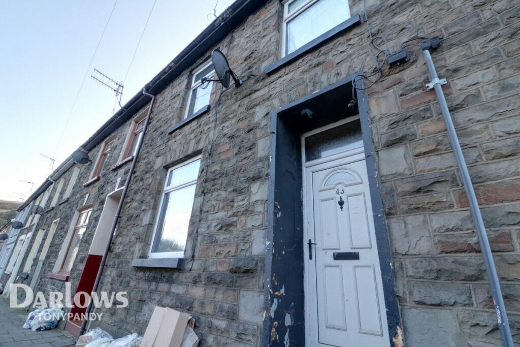
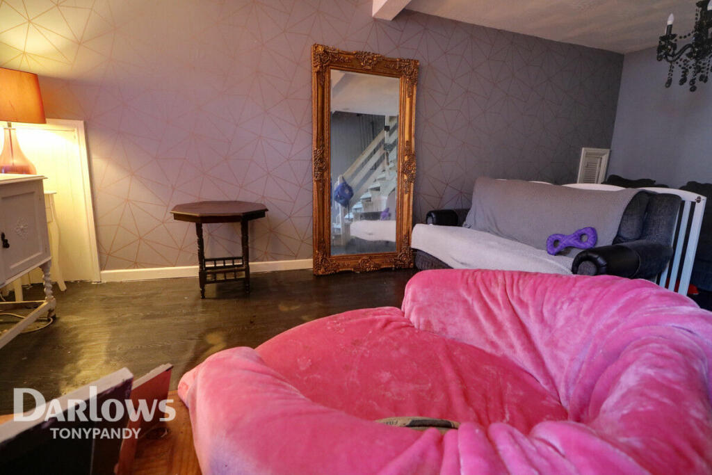
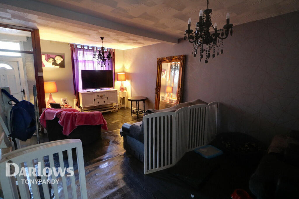
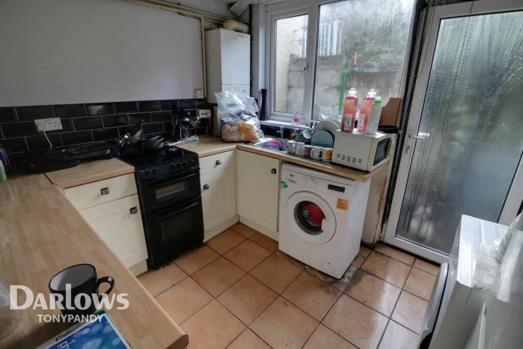
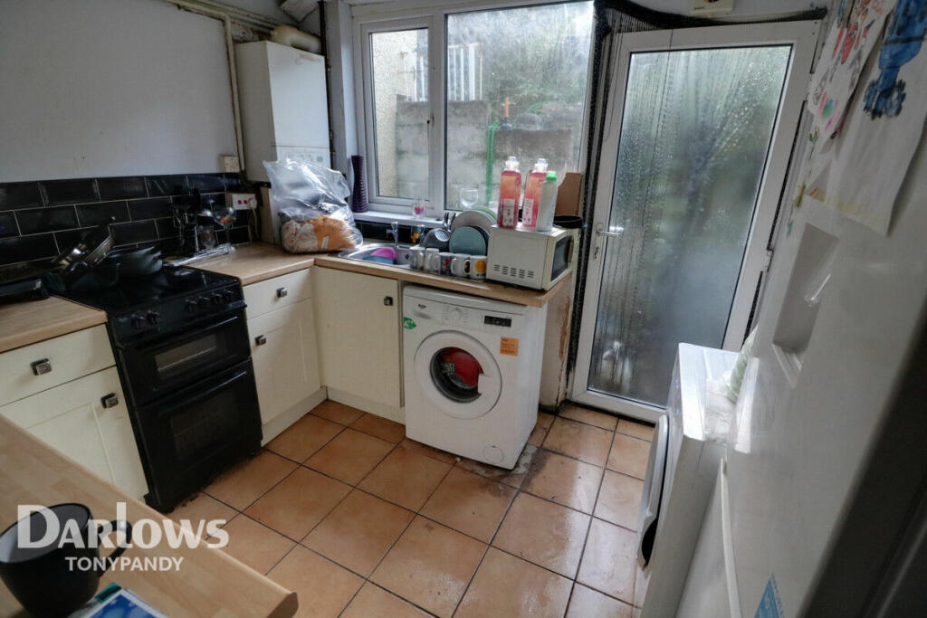
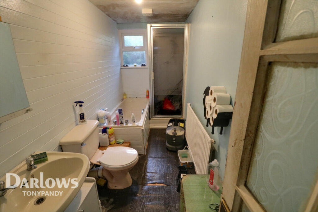
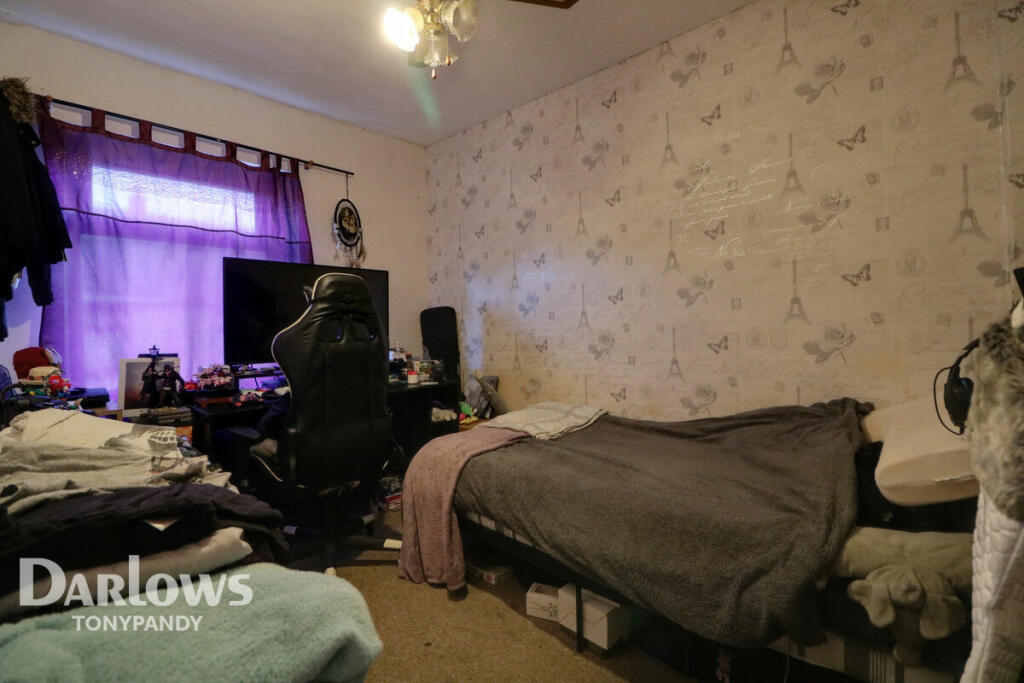
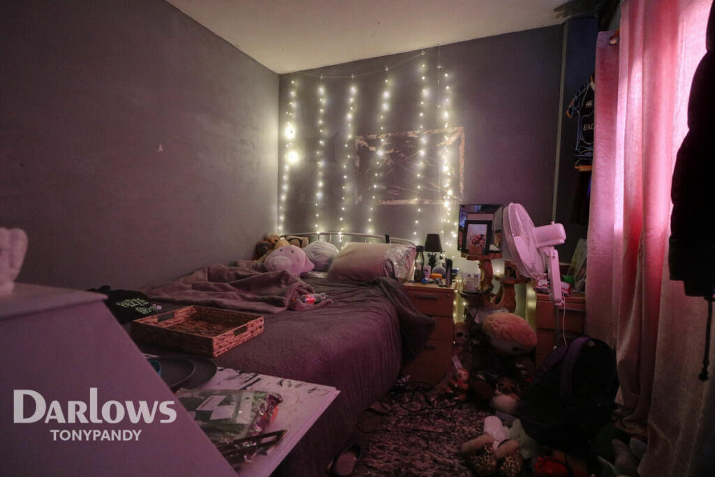
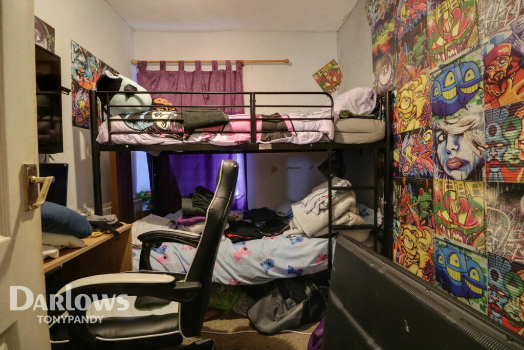
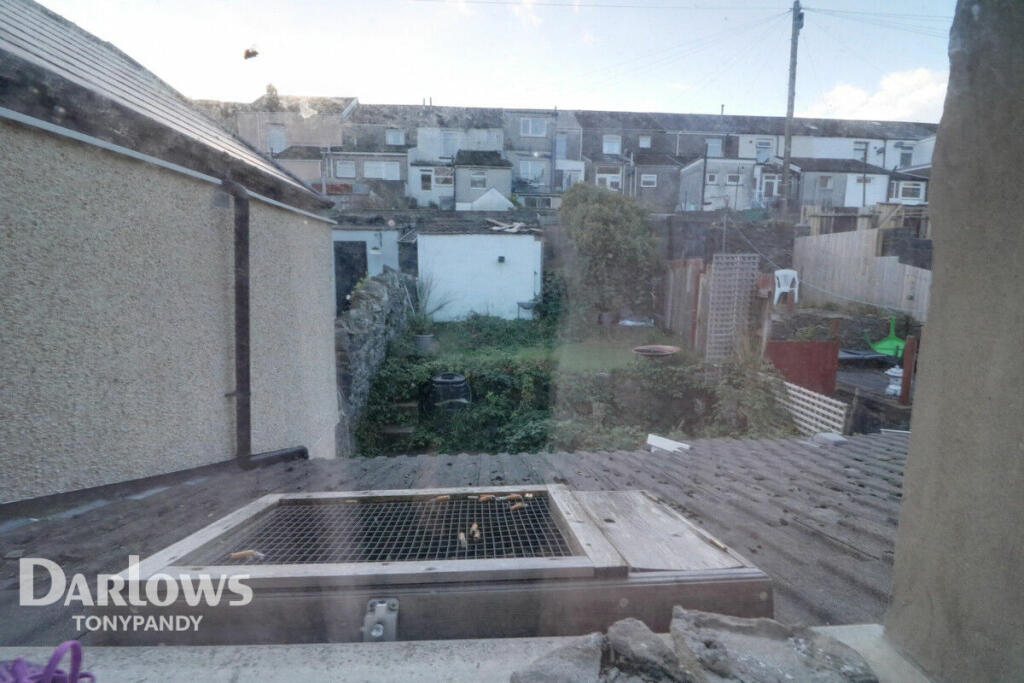
Photo 1 Photo 2 Photo 3 Photo 4 Photo 5 Photo 6 Photo 7 Photo 8 Photo 9 Photo 10 Photo 11
/ 11
Property details
Tenure
FREEHOLD
Council tax band
A
Last sold
£40,000
Local average
£87,716 (-25.9%)
Street crime
27 incidents within 1 mile (Apr 2026)
Key features
- INVESTMENT
- CURRENTLY LET
- OPEN PLAN LOUNGE
- KITCHEN
- GROUND FLOOR BATHROOM
- THREE BEDROOMS
- GARDEN TO REAR
Additional details
- Garden
- Yes
Description
Listed by
covering Tonypandy
Spicerhaart
Reference: 131530406
EPC ratings on this postcode
We don't have a matched EPC for this property yet. Below are efficiency scores and details for other addresses on this postcode.
| Address | Current | Potential | Floor area | Age band | Type |
|---|---|---|---|---|---|
| 39a, Duffryn Street, FERNDALE | 43 | 74 | 79 m² | England and Wales: 1900-1929 | Terraced |
| 40 Duffryn Street, FERNDALE | 70 | 87 | 73 m² | England and Wales: before 1900 | Terraced |
| 40, Duffryn Street, FERNDALE | 55 | 91 | 61 m² | England and Wales: 1900-1929 | Terraced |
| 40, Duffryn Street, FERNDALE | 56 | 84 | 71 m² | England and Wales: 1900-1929 | Terraced |
| 41, Duffryn Street, FERNDALE | 47 | 86 | 77 m² | England and Wales: 1900-1929 | Terraced |
| 41, Duffryn Street, FERNDALE | 48 | 84 | 74 m² | England and Wales: before 1900 | Terraced |
| 42, Duffryn Street, FERNDALE | 43 | 78 | 78 m² | England and Wales: 1900-1929 | Terraced |
| 42, Duffryn Street, FERNDALE | 44 | 73 | 77 m² | England and Wales: before 1900 | Terraced |
| 43 Duffryn Street, FERNDALE | 69 | 87 | 68 m² | England and Wales: 1900-1929 | Terraced |
| 43, Duffryn Street, FERNDALE | 65 | 88 | 76 m² | England and Wales: 1900-1929 | Terraced |
| 45 Duffryn Street, FERNDALE | 65 | 72 | 51 m² | England and Wales: before 1900 | Flat |
| 45a Duffryn Street, FERNDALE | 61 | 71 | 44 m² | England and Wales: before 1900 | Flat |
| 48 Duffryn Street, FERNDALE | 64 | 88 | 83 m² | England and Wales: before 1900 | Terraced |
| 50, Duffryn Street, FERNDALE | 63 | 86 | 69 m² | England and Wales: before 1900 | Terraced |
| 51 Duffryn Street, FERNDALE | 69 | 89 | 64 m² | England and Wales: before 1900 | Terraced |
Flood risk
Zone: 1
Risk: Low
Job (default Low)
Floorplans
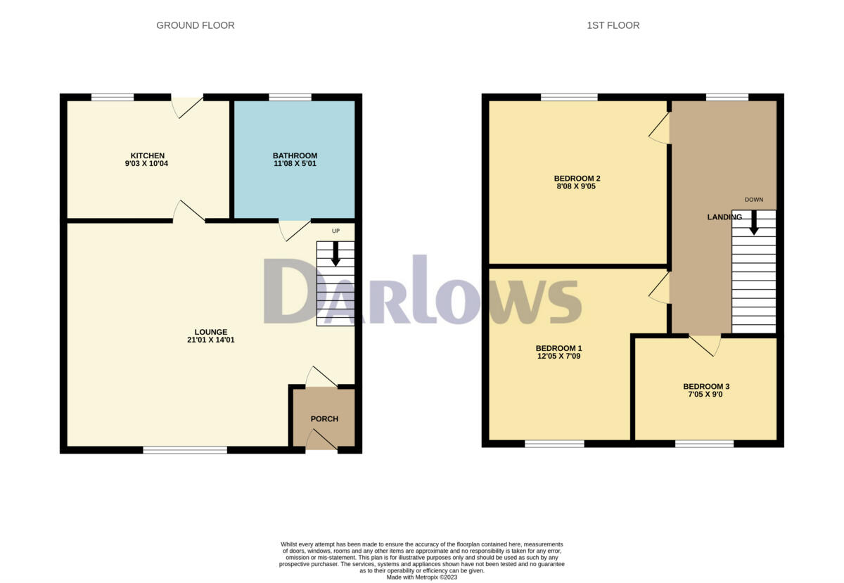
Floorplan 1
EPC Graphs
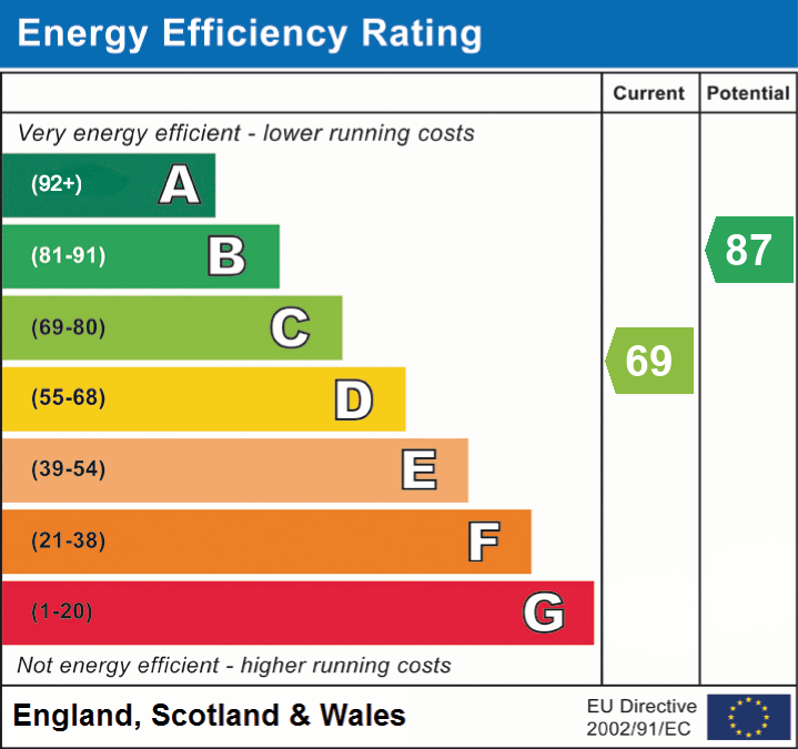
EPC 1
Price history
0% since 2013
| Event | Date | Price | % change |
|---|---|---|---|
| Sold | 01/01/2013 (13 years ago) | £40,000 | 0% |
| Sold | 01/01/2013 (13 years ago) | £40,000 | — |
Source: HM Land Registry Price Paid Data. Crown copyright.
Sold Comparables
Same street and nearby sales within 0.25 miles (last 5 years). Data from Land Registry Price Paid.
| Address | Price | Date | Type |
|---|---|---|---|
| 40 NEW STREET, FERNDALE, RHONDDA CYNON TAFF, CF43 4SN | £87,000 | 16/01/2026 | Terraced |
| 19 HIGH STREET, FERNDALE, RHONDDA CYNON TAFF, CF43 4RN | £72,500 | 06/01/2026 | Terraced |
| 5 KING STREET, FERNDALE, RHONDDA CYNON TAFF, CF43 4LB | £185,000 | 12/12/2025 | Terraced |
| 31 RHONDDA TERRACE, FERNDALE, RHONDDA CYNON TAFF, CF43 4LF | £75,000 | 10/12/2025 | Terraced |
| 21 NEW STREET, FERNDALE, RHONDDA CYNON TAFF, CF43 4SN | £90,000 | 09/12/2025 | Terraced |
| 32 BRYNHYFRYD TERRACE, FERNDALE, RHONDDA CYNON TAFF, CF43 4LD | £164,000 | 27/11/2025 | Terraced |
| 65 ALBANY STREET, FERNDALE, RHONDDA CYNON TAFF, CF43 4SL | £200,000 | 27/11/2025 | Terraced |
| 15 TUDOR STREET, FERNDALE, RHONDDA CYNON TAFF, CF43 4LL | £155,000 | 21/11/2025 | Terraced |
| 16 THE STRAND, FERNDALE, RHONDDA CYNON TAFF, CF43 4LY | £110,000 | 21/11/2025 | Terraced |
| 27 UNION STREET, FERNDALE, RHONDDA CYNON TAFF, CF43 4HD | £67,500 | 31/10/2025 | Terraced |
| 30 BROWN STREET, FERNDALE, RHONDDA CYNON TAFF, CF43 4SF | £77,000 | 03/03/2025 | Terraced |
| 30 BROWN STREET, FERNDALE, RHONDDA CYNON TAFF, CF43 4SF | £77,000 | 03/03/2025 | Terraced |
| 12 FREDERICK STREET, FERNDALE, RHONDDA CYNON TAFF, CF43 4HR | £110,000 | 21/12/2023 | Terraced |
| 36 RHONDDA TERRACE, FERNDALE, RHONDDA CYNON TAFF, CF43 4LF | £129,500 | 21/12/2023 | Terraced |
| 25 LAKE STREET, FERNDALE, RHONDDA CYNON TAFF, CF43 4HL | £72,000 | 18/12/2023 | Terraced |
| 64 REGENT STREET, FERNDALE, RHONDDA CYNON TAFF, CF43 4HA | £85,000 | 08/12/2023 | Terraced |
| 5 AYRON STREET, FERNDALE, RHONDDA CYNON TAFF, CF43 4HY | £57,500 | 05/12/2023 | Terraced |
| 11 LAKE STREET, FERNDALE, RHONDDA CYNON TAFF, CF43 4HE | £85,000 | 31/10/2023 | Terraced |
| 82 DUFFRYN STREET, FERNDALE, RHONDDA CYNON TAFF, CF43 4EL | £117,000 | 20/10/2023 | Terraced |
| Same street 48 DUFFRYN STREET, FERNDALE, RHONDDA CYNON TAFF, CF43 4EP | £100,000 | 13/10/2023 | Terraced |
| 78 BRYNHYFRYD TERRACE, FERNDALE, RHONDDA CYNON TAFF, CF43 4HT | £80,000 | 29/09/2023 | Terraced |
| Same street 45 DUFFRYN STREET, FERNDALE, RHONDDA CYNON TAFF, CF43 4EP | £60,000 | 14/10/2022 | Terraced |
| Same street 54B DUFFRYN STREET, FERNDALE, RHONDDA CYNON TAFF, CF43 4EP | £135,000 | 15/10/2021 | Terraced |
Street average: £98,333 (3 sales)
Area average: £104,800 (20 sales)
Capital growth trend
Land Registry outcode average: last 12 months vs 5y and 10y ago (from sold prices).
House Price Index (HM Land Registry — official index, not sold-price averages): Rhondda Cynon Taf. Series: Terraced. As of March 2026.
Rental Range
Estimated market rent for Rhondda Cynon Taf. Low = conservative, Realistic = average, Optimistic = best case.
Based on Local Authority from postcode lookup → Rhondda Cynon Taf.
Location
Address
Dyffryn Street
Nearby
Nearest stations, universities and amenities (distance from property).
| Type | Name | Distance |
|---|---|---|
| Bus stop | Fountain Street | 0.2 miles |
| Shop | North Road Motors | 0.6 miles |
| Bus stop | Heol Pendyrus | 1.1 miles |
| Shop | Lidl | 1.2 miles |
| Hospital | Priory Hospital Ty Cwm Rhondda | 1.2 miles |
| Train station | Ystrad Rhondda | 1.4 miles |
| Hospital | Ysbyty Cwm Rhondda | 1.6 miles |
| Train station | Llwynypia | 1.8 miles |
| University | Merthyr Tydfil College | 6.5 miles |
| University | USW Glyntaff Upper Campus | 7.0 miles |
Street-level crime
| Category | Count |
|---|---|
| Violence and sexual offences | 8 |
| Public order | 6 |
| Anti-social behaviour | 4 |
| Criminal damage and arson | 3 |
| Vehicle crime | 3 |
| Drugs | 2 |
| Burglary | 1 |
| Total incidents | 27 |
Within 1 mile during Apr 2026. Source: data.police.uk (England & Wales).
Schools nearby
Nearest open schools with Ofsted ratings (England). Closed schools are not shown. Data from Get Information about Schools and Ofsted.
| Name | Type | Distance | Ofsted |
|---|---|---|---|
| Darran Park Primary School | Other | 0.1 miles | — (No rating) |
| Y.G.G. Llyn-y-Forwyn | Other | 0.1 miles | — (No rating) |
| Blaenllechau Infant School | Other | 0.6 miles | — (No rating) |
| Tir Gwaidd Nursery School | Other | 1.0 miles | — (No rating) |
| Penrhys Infant School | Other | 1.1 miles | — (No rating) |
Rental Comparables
Rental listings exist nearby, but none matched the 3-bedroom count for this property.
Rent-driven metrics
Based on Area rent estimate.
- Rent ratio — Monthly rent ÷ purchase price (1% rule). 1%+ = strong, 0.8–1% = okay, <0.8% = weak for cashflow.
- Max investor price — Rent ÷ 0.8%; the price at which rent would be 0.8% of price (Stoke-style target).
- Target investor price — Rent ÷ 1%; the price at which rent would be 1% of price (strong cashflow band).
- Gross yield — Annual rent as % of purchase price (no costs).
Enter House Number
Enter the house number to help us retrieve more accurate pricing history and property data.
Please log in to submit or correct the house number for this listing.
Log in to continue