FLAT 9
COSSINGTON COURT, COSSINGTON ROAD, WESTCLIFF-ON-SEA, SOUTHEND-ON-SEA SS0 7NG
£1,095 pcm
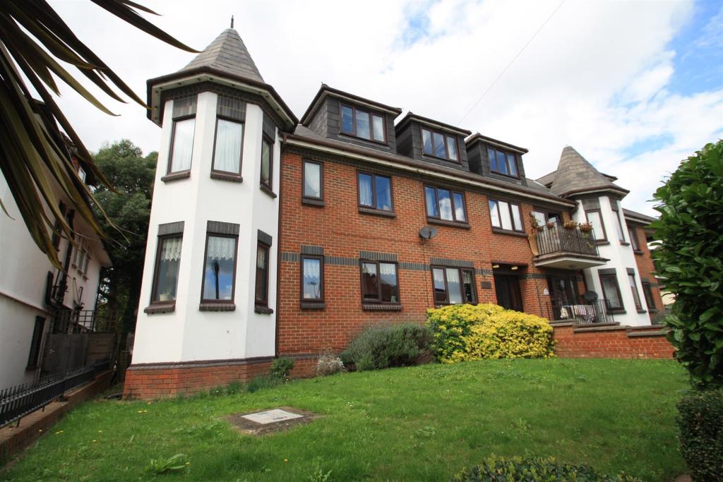
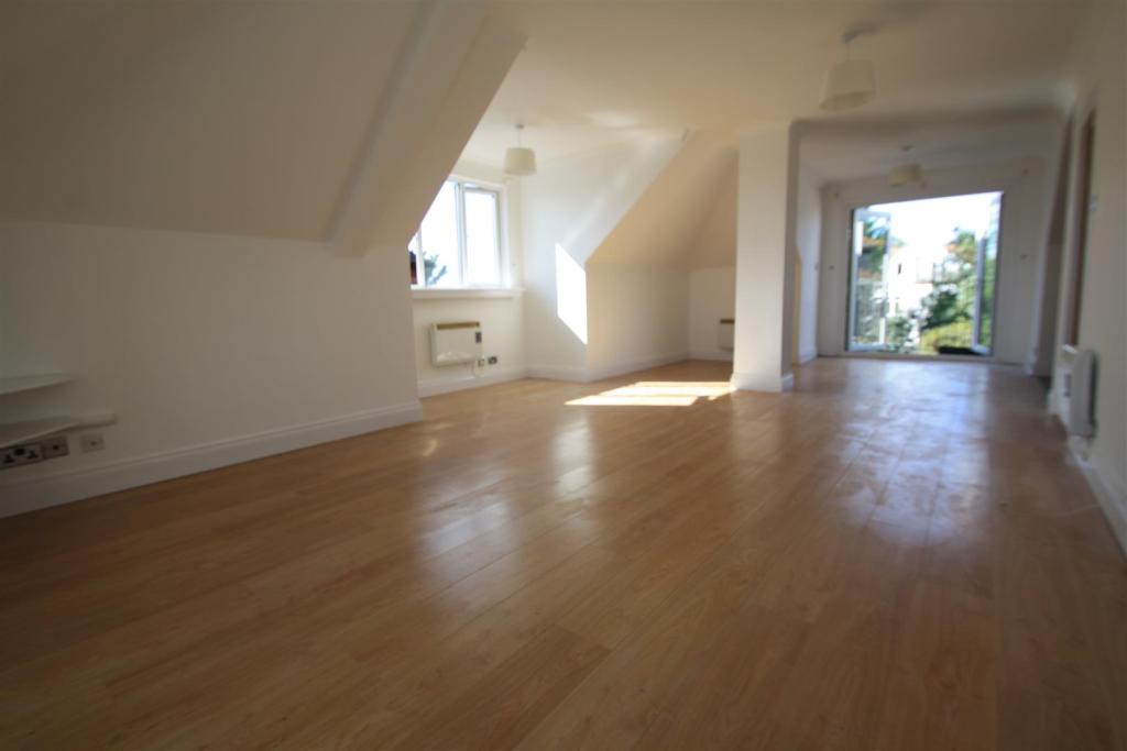
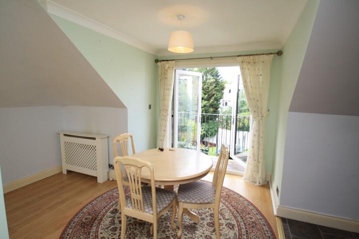
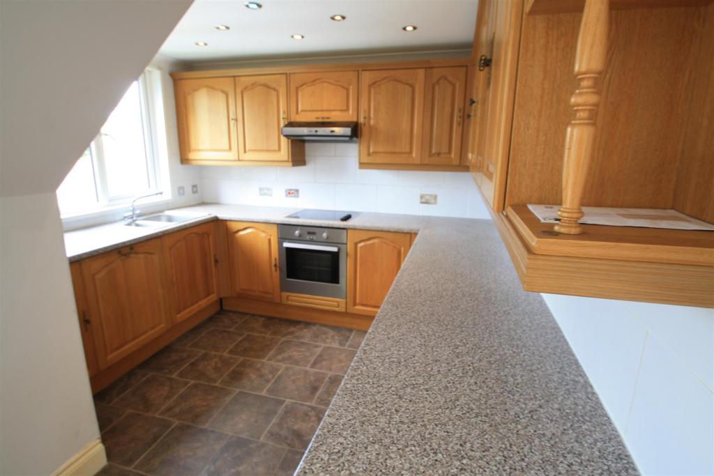
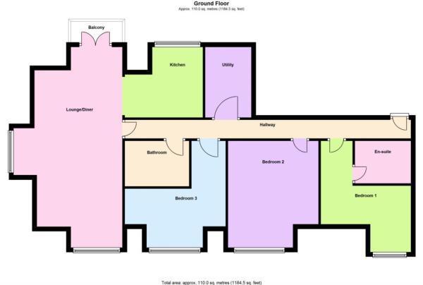
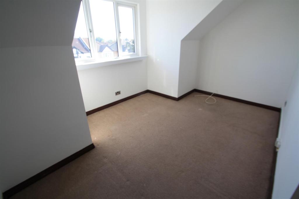
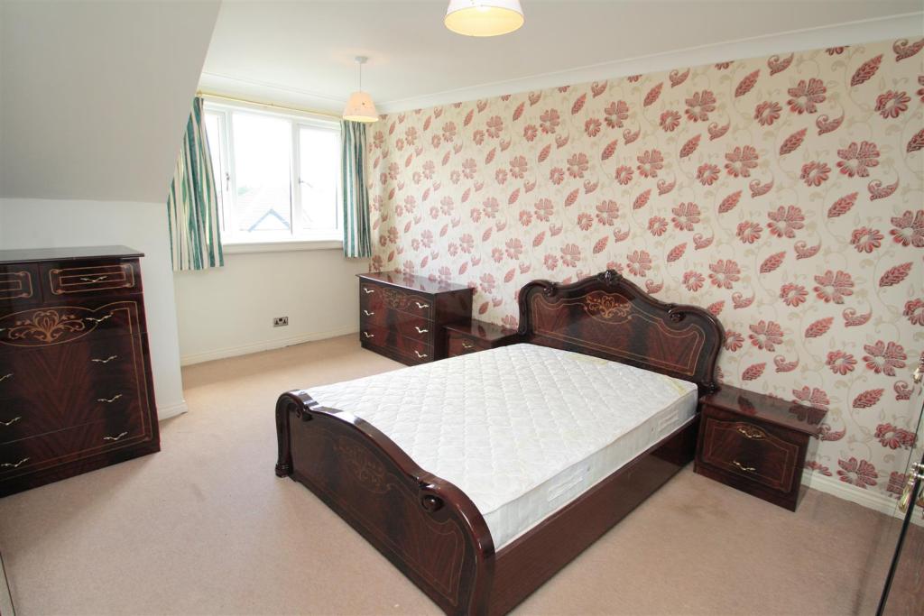
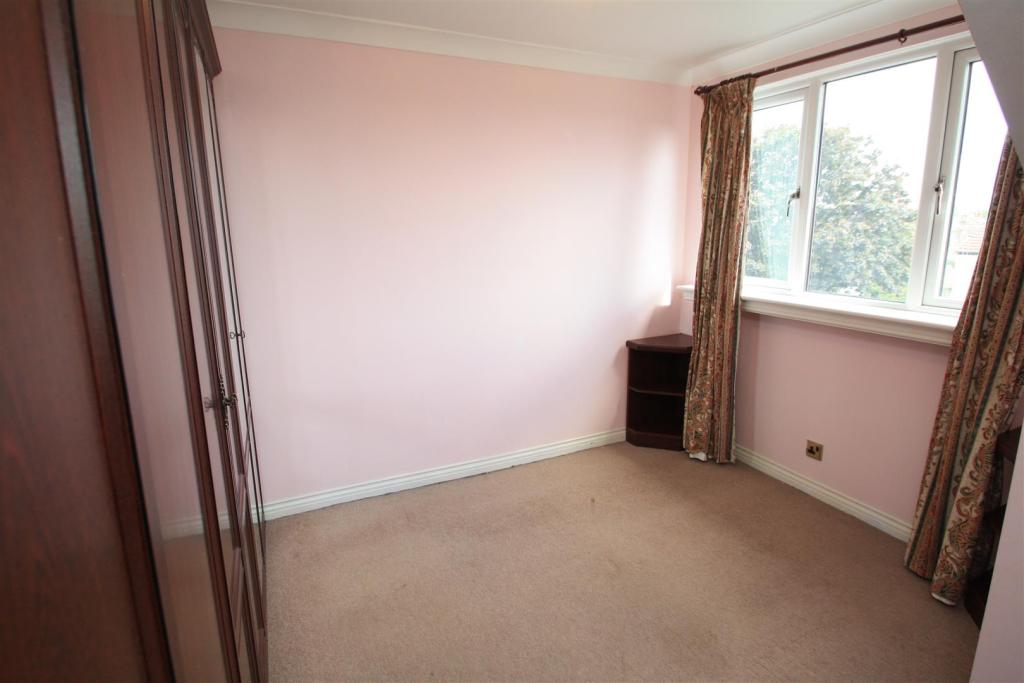
Photo 1 Photo 2 Photo 3 Photo 4 Photo 5 Photo 6 Photo 7 Photo 8
/ 8
Property details
Floor area
100 m²
EPC rating
D
Year built
England and Wales: 1983-1990
Deprivation
Decile 2 (3,761 of 33,755)
Street crime
839 incidents within 1 mile (Apr 2026)
Key features
- Large Accommodation
- Three Double Bedrooms
- Close to Westcliff Station
- Close to Hamlet Court Road
- Top Floor Apartment
- Purpose Built Block
- Private Balcony
- Communal Garden
- En-Suite To Master Bedroom
Additional details
- Parking
- Yes
Description
Listed by
Westcliff-On-Sea
Appointmoor Estates
Reference: 60535947
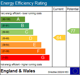
EPC Rating & Upgrade Cost
Current rating: D
Potential rating: C
Inspection date: 11/03/2014
Expiry date: 10/03/2024 (expired)
Current heating cost: £665/year
Potential heating cost: £395/year
Est. upgrade cost to C: £1,355
Recommendations
- Increase loft insulation to 270 mm (£100 - £350)
- Low energy lighting for all fixed outlets (£80)
- Fan assisted storage heaters and dual immersion cylinder (£900 - £1200)
Flood risk
Zone: 1
Risk: Low
Job (default Low)
EPC Graphs
EE Rating
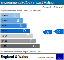
EI Rating
Rental Range
Estimated market rent for Southend-on-Sea. Low = conservative, Realistic = average, Optimistic = best case.
Based on Local Authority from postcode lookup → Southend-on-Sea.
LHA (30th percentile) floor for Southend: £1,097/mo (Apr 2025 – Mar 2026)
Location
Address
Cossington Road
Nearby
Nearest stations, universities and amenities (distance from property).
| Type | Name | Distance |
|---|---|---|
| Shop | King of Green | 0.1 miles |
| Shop | Rekindle | 0.1 miles |
| Bus stop | Canewdon Road | 0.2 miles |
| Bus stop | Unknown | 0.2 miles |
| Train station | Westcliff | 0.2 miles |
| Train station | Southend Central | 0.7 miles |
| University | University of Essex | 0.7 miles |
| Hospital | Wellesley Hospital | 1.7 miles |
| Hospital | Rochford Hospital | 3.1 miles |
Street-level crime
| Category | Count |
|---|---|
| Violence and sexual offences | 347 |
| Shoplifting | 116 |
| Anti-social behaviour | 98 |
| Criminal damage and arson | 50 |
| Public order | 45 |
| Vehicle crime | 44 |
| Drugs | 35 |
| Other theft | 35 |
| Burglary | 20 |
| Other crime | 14 |
| Bicycle theft | 11 |
| Possession of weapons | 11 |
| Robbery | 10 |
| Theft from the person | 3 |
| Total incidents | 839 |
Within 1 mile during Apr 2026. Source: data.police.uk (England & Wales).
Schools nearby
Nearest open schools with Ofsted ratings (England). Closed schools are not shown. Data from Get Information about Schools and Ofsted.
| Name | Type | Distance | Ofsted |
|---|---|---|---|
| St Bernard's High School | Secondary | 0.1 miles | Good — 22 Jun 2012 |
| Compass Community School Boleyn Park | Other | 0.2 miles | Good — 27 Jul 2023 |
| Milton Hall Primary School and Nursery | Primary | 0.3 miles | Good — 17 Jun 2024 |
| Barons Court Primary School and Nursery | Primary | 0.3 miles | Outstanding — 25 May 2017 |
| St Helen's Catholic Primary School | Primary | 0.4 miles | Good — 23 Mar 2023 |
Rental Comparables
Residential lets from OpenRent and Rightmove for the area (same bedroom count). Use to validate rent estimates. Student lets are excluded.
| Title | Rent | Beds | Distance | As seen on |
|---|---|---|---|---|
| 3 Bed Flat, Alexandra Road, SS1 | £2,450/mo | 3 | 0.37 miles | OpenRent |
| 3 Bed Flat, The Leas, SS0 | £2,100/mo | 3 | 0.47 miles | OpenRent |
| 3 Bed Flat, Baxter Avenue, SS2 | £1,385/mo | 3 | 0.57 miles | OpenRent |
Average rent: £1,978/mo (3 listings)