Vale Cottage
HIGH STREET, FARINGDON, UFFINGTON, OXFORDSHIRE SN7 7RP
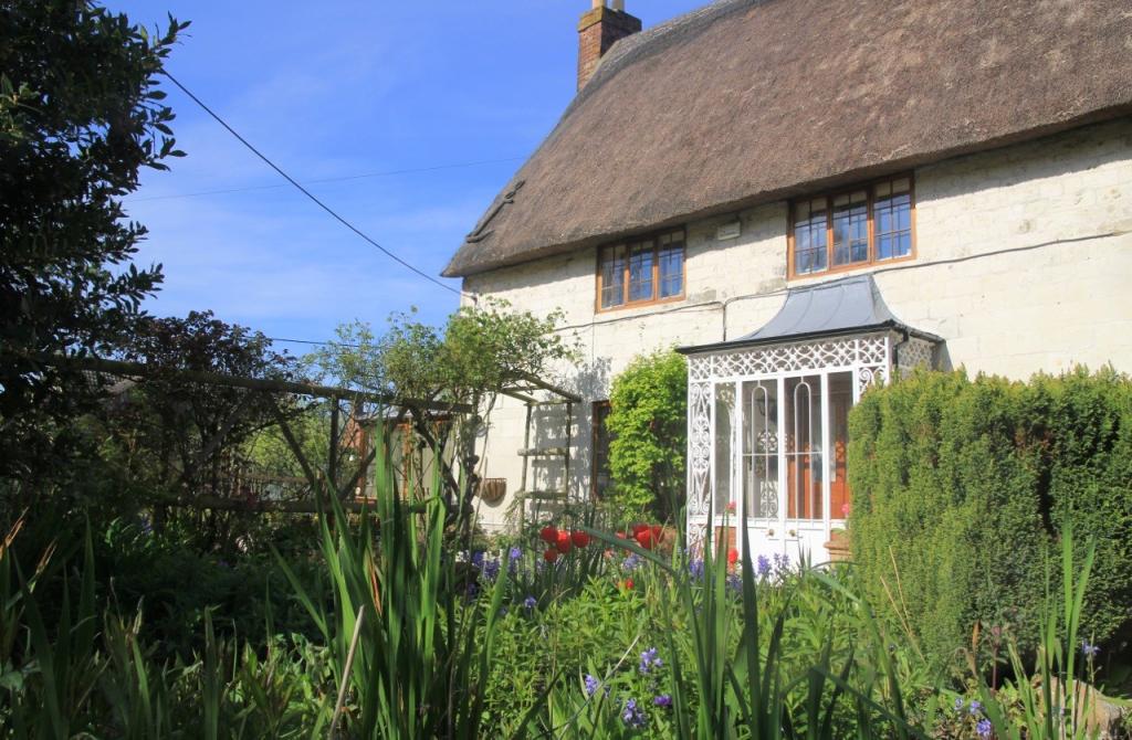


Photo 1 Photo 2 Photo 3 Photo 4 Photo 5 Photo 6 Photo 7 Photo 8 Photo 9 Photo 10 Photo 11 Photo 12
/ 12
Property details
Tenure
FREEHOLD
Floor area
167 m²
Year built
England and Wales: before 1900
Last sold
£475,000 Mar 2017
Price per m²
£2,904/m²
Local average
£373,879 (+29.7%)
Deprivation
Decile 7 (20,703 of 33,755)
Street crime
3 incidents within 1 mile (Apr 2026)
Key features
- A viewing is essential to appreciate the charm and flexibility of this property...
- Impressive sitting room with open fire
- Elegant dining room with wood burning stove
- Kitchen and separate huge utility
- A wealth of Period Features
- Approximate floor area of 2457 SQ.FT (228.2 SQ.M)
- Annex/home office potential
- 3 First Floor Bedrooms
- Ground Floor 4th Bedroom/Study
- Deceptively spacious Grade II Listed Cottage
Additional details
- Parking
- Yes
- Garden
- Yes
Description
The entrance hall with stairs to the first floor leads into a generous sized sitting room to the right with a large open fire and attractive marble surround and mantelpiece. To the left of the hall is the dining room, again with a large open fire place with wood burning stove. Through the dining room is a south facing garden room, with double doors leading to the garden.
At the rear of the house is a back hall, off which is a light kitchen boasting an array of bespoke handmade kitchen units under an oak work top. Across from the kitchen is a downstairs shower room and study - which could be combined to provide a 4th bedroom with en-suite - and to the rear of the house is a small pantry and a large laundry/utility room.
Upstairs are 3 generous sized bedrooms, two of which have feature fireplaces within them. Completing the first floor is a family bathroom.
The Cottage is accessed through a vehicular and pedestrian gate with driveway which wraps around the side of the house. The front garden is well stocked with mature plants and shrubs.
At the rear is an extensive carport providing parking for cars or storage, which leads to a workshop and separate store, all of which have the potential to be converted into annex accomodation/a home office. A paved courtyard links the rear of the house to the carport/workshop and store.
Listed by
Faringdon
Preece and Co (UK) limited
Reference: 41919579
EPC ratings on this postcode
We don't have a matched EPC for this property yet. Below are efficiency scores and details for other addresses on this postcode.
| Address | Current | Potential | Floor area | Age band | Type |
|---|---|---|---|---|---|
| 2 New Cottages, High Street, Uffington, FARINGDON | 58 | 82 | 79 m² | England and Wales: 1967-1975 | Detached |
| Apple Tree Cottage, High Street, Uffington, FARINGDON | 40 | 73 | 96 m² | England and Wales: 1950-1966 | Detached |
| Apple Tree Cottage, High Street, Uffington, FARINGDON | 39 | 85 | 80 m² | England and Wales: 1950-1966 | Detached |
| Brook Cottage, High Street, Uffington, FARINGDON | 48 | 68 | 133 m² | England and Wales: before 1900 | Detached |
| Curtis Cottage, High Street, Uffington, FARINGDON | 65 | 97 | 113 m² | England and Wales: before 1900 | Detached |
| Janecroft, High Street, Uffington, FARINGDON | 46 | 76 | 131 m² | England and Wales: 1967-1975 | Detached |
| Long Thatch, High Street, Uffington, FARINGDON | 54 | 63 | 215 m² | England and Wales: before 1900 | Detached |
| Packers Forge, High Street, Uffington, FARINGDON | 37 | 72 | 169 m² | England and Wales: before 1900 | Detached |
| Pear Tree Cottage, High Street, Uffington, FARINGDON | 48 | 69 | 215 m² | England and Wales: before 1900 | Detached |
| Pear Tree Cottage, High Street, Uffington, FARINGDON | 46 | 73 | 229 m² | England and Wales: before 1900 | Detached |
| The Anchorage, High Street, Uffington, FARINGDON | 86 | 94 | 152 m² | — | Detached |
| The Coach House, High Street, Uffington, FARINGDON | 57 | 67 | 187 m² | England and Wales: 1983-1990 | Detached |
| The Coach House, High Street, Uffington, FARINGDON | 38 | 73 | 155 m² | England and Wales: 1967-1975 | Detached |
| The Sombornes, High Street, Uffington, FARINGDON | 53 | 71 | 184 m² | England and Wales: 1991-1995 | Detached |
| Top Corner, High Street, Uffington, FARINGDON | 34 | 41 | 159 m² | England and Wales: 1967-1975 | Detached |
Flood risk
Zone: 1
Risk: Low
Job (default Low)
Floorplans

Floorplan 1
Price history
| Event | Date | Price | % change |
|---|---|---|---|
| Sold | 01/03/2017 (9 years ago) | £475,000 | — |
Source: HM Land Registry Price Paid Data. Crown copyright.
Sold Comparables
Same street and nearby sales within 0.25 miles (last 5 years). Data from Land Registry Price Paid.
| Address | Price | Date | Type |
|---|---|---|---|
| 6 FREEMANS CLOSE, UFFINGTON, FARINGDON, VALE OF WHITE HORSE, OXFORDSHIRE, SN7 7SH | £345,000 | 28/11/2025 | Semi-detached |
| Same street PEAR TREE COTTAGE HIGH STREET, UFFINGTON, FARINGDON, VALE OF WHITE HORSE, OXFORDSHIRE, SN7 7RP | £1,100,000 | 15/11/2023 | Detached |
| MAY COTTAGE UPPER COMMON, UFFINGTON, FARINGDON, VALE OF WHITE HORSE, OXFORDSHIRE, SN7 7RU | £435,000 | 06/09/2021 | Semi-detached |
| 1 HILL VIEW, UFFINGTON, FARINGDON, VALE OF WHITE HORSE, OXFORDSHIRE, SN7 7RZ | £365,000 | 11/08/2021 | Semi-detached |
Street average: £1,100,000 (1 sale)
Area average: £381,667 (3 sales)
Capital growth trend
Land Registry outcode average: last 12 months vs 5y and 10y ago (from sold prices).
House Price Index (HM Land Registry — official index, not sold-price averages): Vale of White Horse. Series: Semi-detached. As of March 2026.
Rental Range
Estimated market rent for Vale of White Horse. Low = conservative, Realistic = average, Optimistic = best case.
Based on Local Authority from postcode lookup → Vale of White Horse.
LHA (30th percentile) floor for Coventry: £997/mo (Apr 2025 – Mar 2026)
Location
Address
Uffington, Vale of White Horse, Oxfordshire, England, SN7 7RP, United Kingdom
Nearby
Nearest stations, universities and amenities (distance from property).
| Type | Name | Distance |
|---|---|---|
| Bus stop | Shotover Corner | 0.1 miles |
| Shop | Absolutely Gorgeous | 3.4 miles |
| Shop | Watchfield Opticians | 3.4 miles |
| Hospital | Wantage Community Hospital | 6.1 miles |
| University | University of Oxford | 7.9 miles |
| Train station | Richard Jefferies Halt | 8.7 miles |
| Train station | Lakeside | 8.8 miles |
| University | Royal Agricultural University (Cultural Heritage Institute) | 10.3 miles |
| Hospital | Marlborough House | 10.7 miles |
Street-level crime
| Category | Count |
|---|---|
| Violence and sexual offences | 2 |
| Criminal damage and arson | 1 |
| Total incidents | 3 |
Within 1 mile during Apr 2026. Source: data.police.uk (England & Wales).
Schools nearby
Nearest open schools with Ofsted ratings (England). Closed schools are not shown. Data from Get Information about Schools and Ofsted.
| Name | Type | Distance | Ofsted |
|---|---|---|---|
| Uffington Church of England Primary School | Primary | 0.2 miles | Good — 27 Sep 2022 |
| Longcot and Fernham Church of England Primary School | Primary | 2.3 miles | Requires improvement — 15 Jan 2023 |
| Shellingford Church of England (Voluntary Aided) School | Primary | 2.9 miles | Good — 24 May 2012 |
| Folly View Primary | Primary | 3.4 miles | Good — 15 Mar 2013 |
| Stanford In the Vale CofE Primary School | Primary | 3.5 miles | Good — 13 Mar 2013 |
Rental Comparables
Rental comparables are temporarily unavailable while listing-site fetches are paused. Try again later.
Rent-driven metrics
Based on Area rent estimate.
- Rent ratio — Monthly rent ÷ purchase price (1% rule). 1%+ = strong, 0.8–1% = okay, <0.8% = weak for cashflow.
- Max investor price — Rent ÷ 0.8%; the price at which rent would be 0.8% of price (Stoke-style target).
- Target investor price — Rent ÷ 1%; the price at which rent would be 1% of price (strong cashflow band).
- Gross yield — Annual rent as % of purchase price (no costs).
Enter House Number
Enter the house number to help us retrieve more accurate pricing history and property data.
Please log in to submit or correct the house number for this listing.
Log in to continue