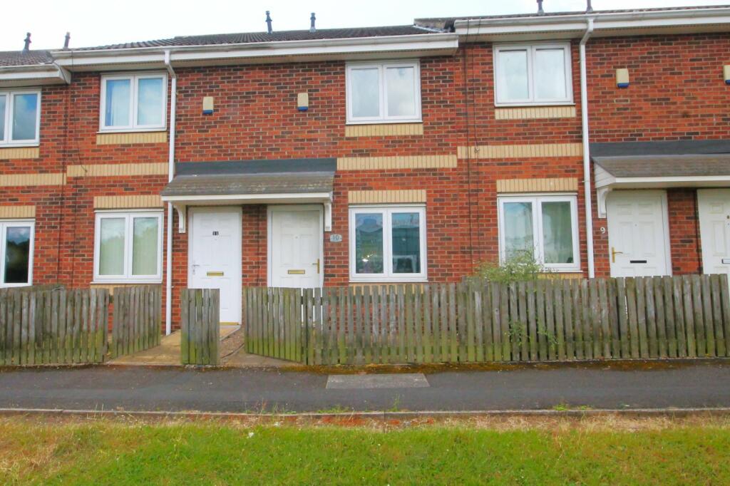
Talbot Street
Stockton-on-Tees, Durham, TS20, TS20 2AY

Property details
Council tax band
A
Deprivation
Decile 2 (3,874 of 33,755)
Street crime
553 incidents within 1 mile (Apr 2026)
Additional details
- Parking
- Yes
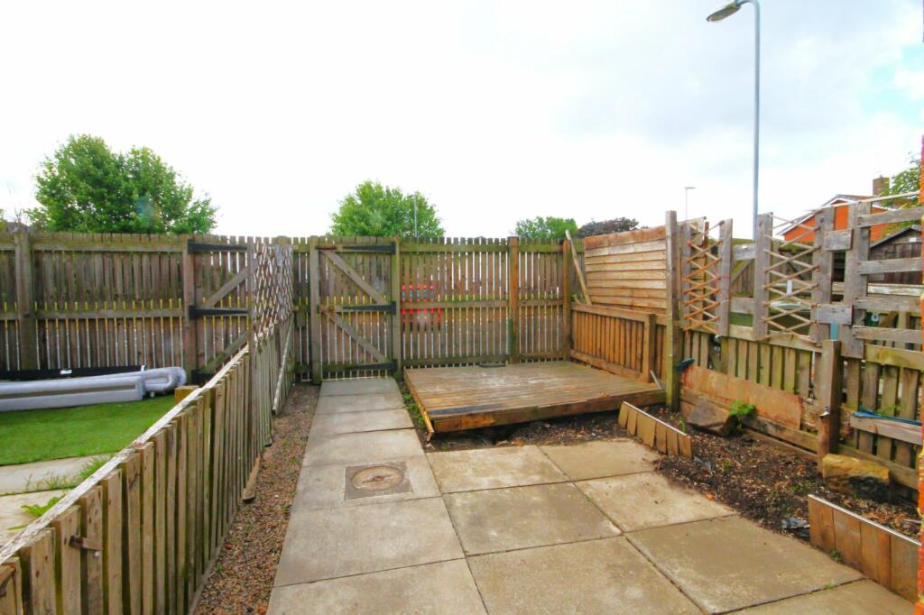
- Garden
- Yes
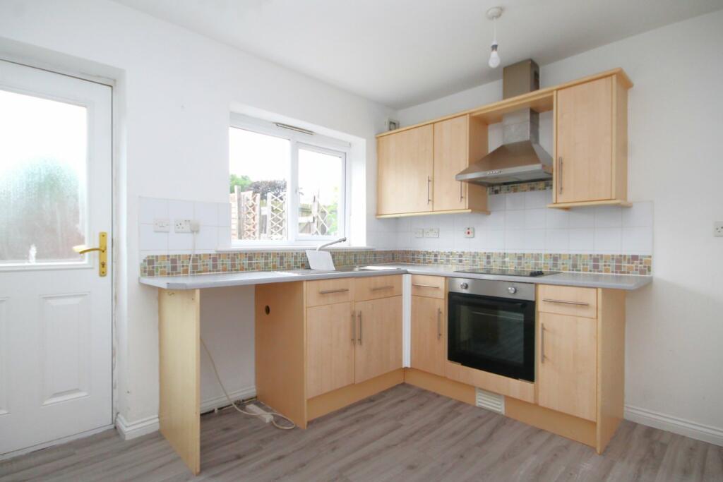
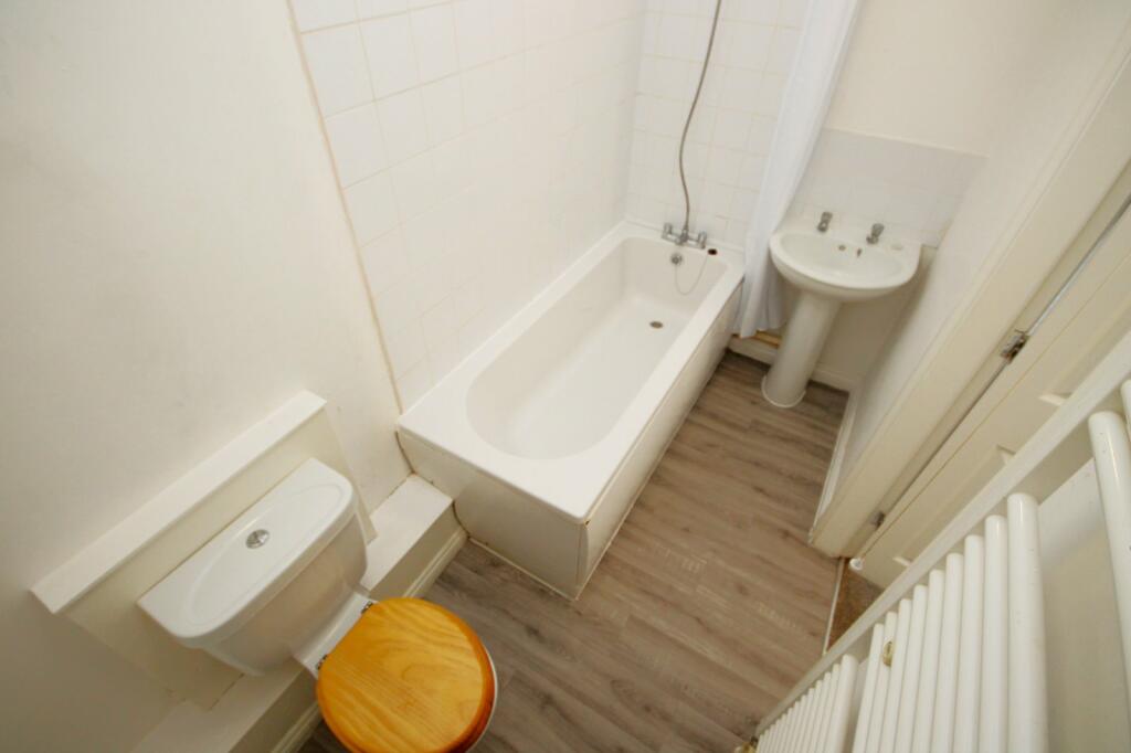
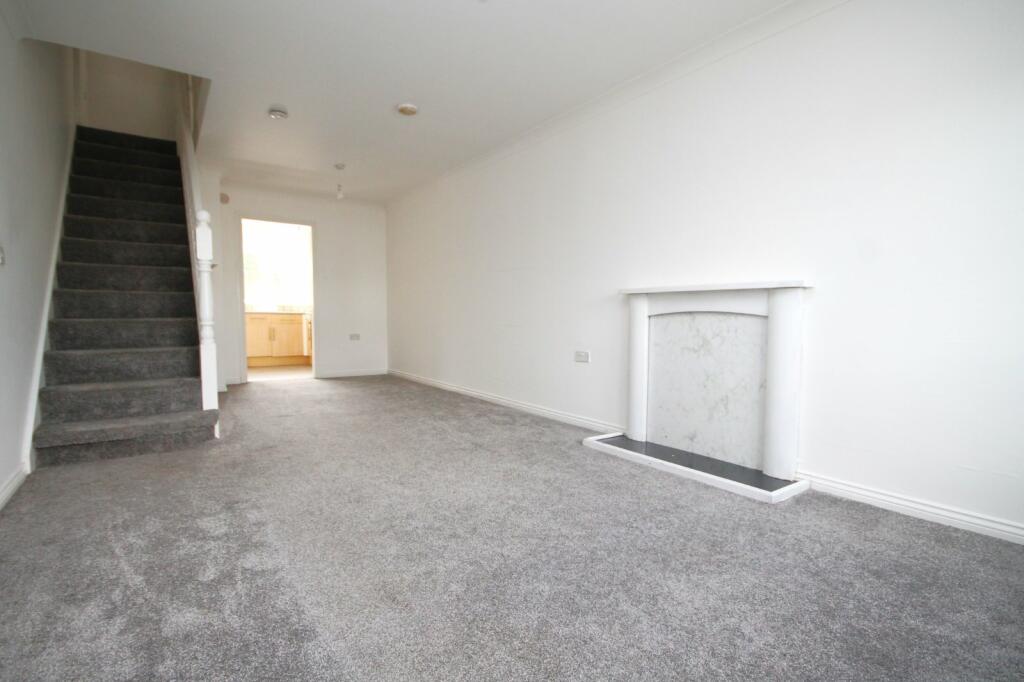
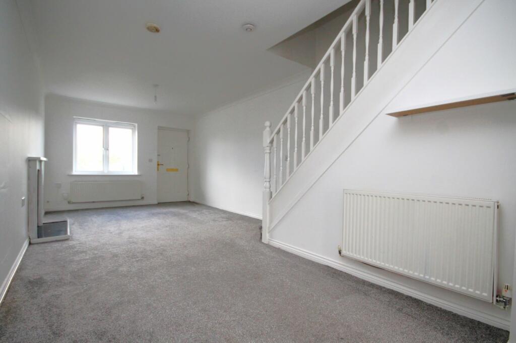
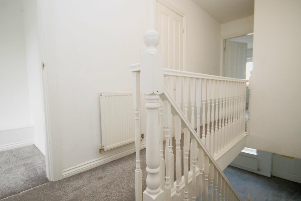
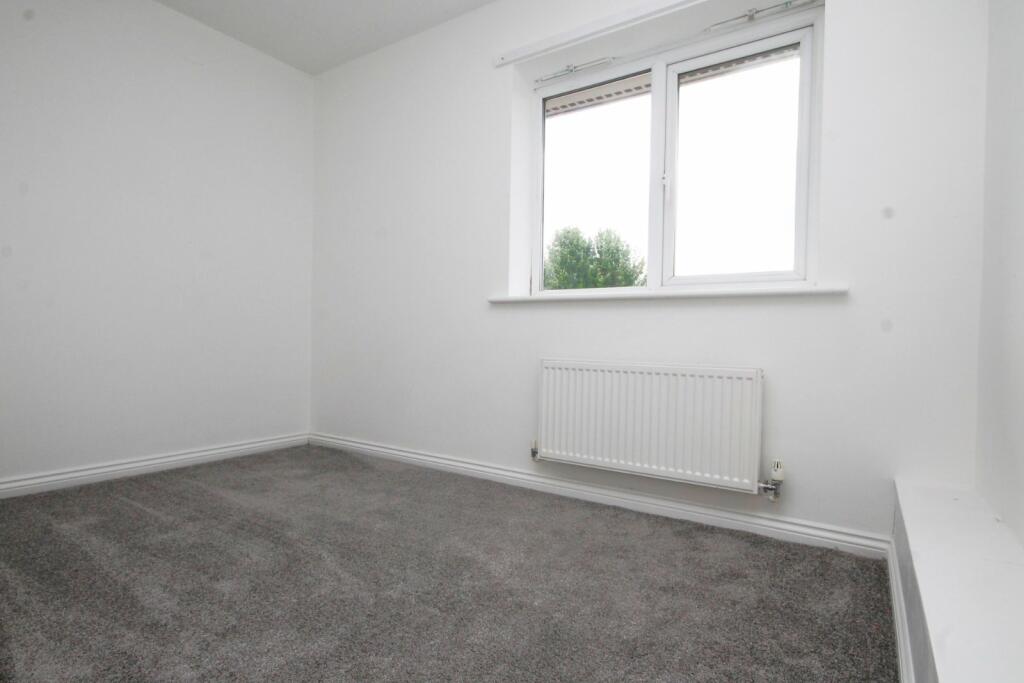
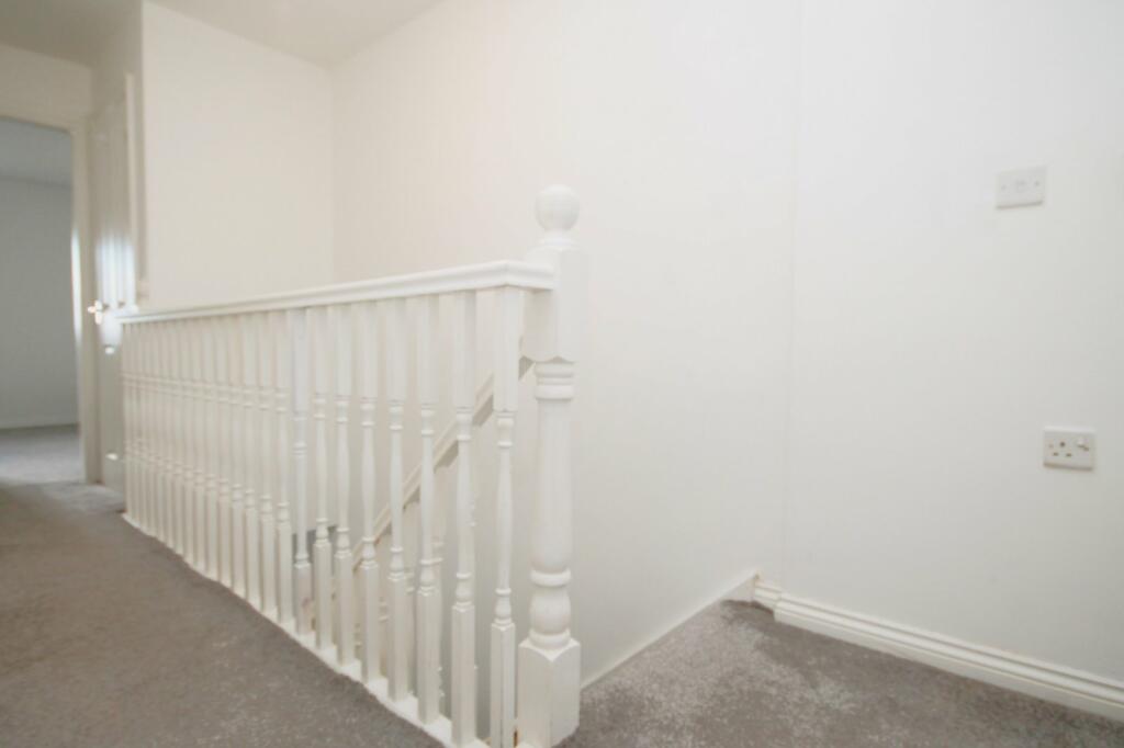
Description
IMPORTANT NOTE TO POTENTIAL PURCHASERS & TENANTS: We endeavour to make our particulars accurate and reliable, however, they do not constitute or form part of an offer or any contract and none is to be relied upon as statements of representation or fact. The services, systems and appliances listed in this specification have not been tested by us and no guarantee as to their operating ability or efficiency is given. All photographs and measurements have been taken as a guide only and are not precise. Floor plans where included are not to scale and accuracy is not guaranteed. If you require clarification or further information on any points, please contact us, especially if you are traveling some distance to view. POTENTIAL PURCHASERS: Fixtures and fittings other than those mentioned are to be agreed with the seller. POTENTIAL TENANTS: All properties are available for a minimum length of time, with the exception of short term accommodation. Please contact the branch for details. A security deposit of at least one month’s rent is required. Rent is to be paid one month in advance. It is the tenant’s responsibility to insure any personal possessions. Payment of all utilities including water rates or metered supply and Council Tax is the responsibility of the tenant in every case.
STO230210/2
Listed by
Stockton-on-Tees
LSL - Rogers Stewart
Reference: 149675516
EPC ratings on this postcode
We don't have a matched EPC for this property yet. Below are efficiency scores and details for other addresses on this postcode.
| Address | Current | Potential | Floor area | Age band | Type |
|---|---|---|---|---|---|
| 1 Talbot Street, STOCKTON-ON-TEES | 68 | 82 | 78 m² | England and Wales: 1950-1966 | Terraced |
| 10, Talbot Street, STOCKTON-ON-TEES | 75 | 89 | 67 m² | England and Wales: 2003-2006 | Terraced |
| 11, Talbot Street, STOCKTON-ON-TEES | 77 | 91 | 66 m² | England and Wales: 2003-2006 | Terraced |
| 12 Talbot Street, STOCKTON-ON-TEES | 74 | 87 | 67 m² | England and Wales: 1996-2002 | Terraced |
| 14, Talbot Street, STOCKTON-ON-TEES | 77 | 92 | 67 m² | England and Wales: 2003-2006 | Terraced |
| 15, Talbot Street, STOCKTON-ON-TEES | 77 | 92 | 60 m² | England and Wales: 2012 onwards | Terraced |
| 16, Talbot Street, STOCKTON-ON-TEES | 76 | 90 | 68 m² | England and Wales: 2003-2006 | Terraced |
| 17 Talbot Street, STOCKTON-ON-TEES | 71 | 88 | 69 m² | England and Wales: 2003-2006 | Terraced |
| 17, Talbot Street, STOCKTON-ON-TEES | 77 | 90 | 69 m² | England and Wales: 2003-2006 | Terraced |
| 18 TALBOT STREET, STOCKTON-ON-TEES, STOCKTON-ON-TEES | 75 | 89 | 67 m² | England and Wales: 2003-2006 | Terraced |
| 3 Talbot Street, STOCKTON-ON-TEES | 72 | 87 | 80 m² | England and Wales: 1967-1975 | Terraced |
| 4, Talbot Street, STOCKTON-ON-TEES | 73 | 87 | 78 m² | England and Wales: 1950-1966 | Terraced |
| 5, Talbot Street, STOCKTON-ON-TEES | 68 | 83 | 81 m² | England and Wales: 1967-1975 | Terraced |
| 6 Talbot Street, STOCKTON-ON-TEES | 70 | 84 | 68 m² | England and Wales: 1996-2002 | Terraced |
| 6, Talbot Street, STOCKTON-ON-TEES | 75 | 90 | 68 m² | England and Wales: 2007-2011 | Terraced |
Flood risk
Zone: 1
Risk: Low
Job (default Low)
Floorplans
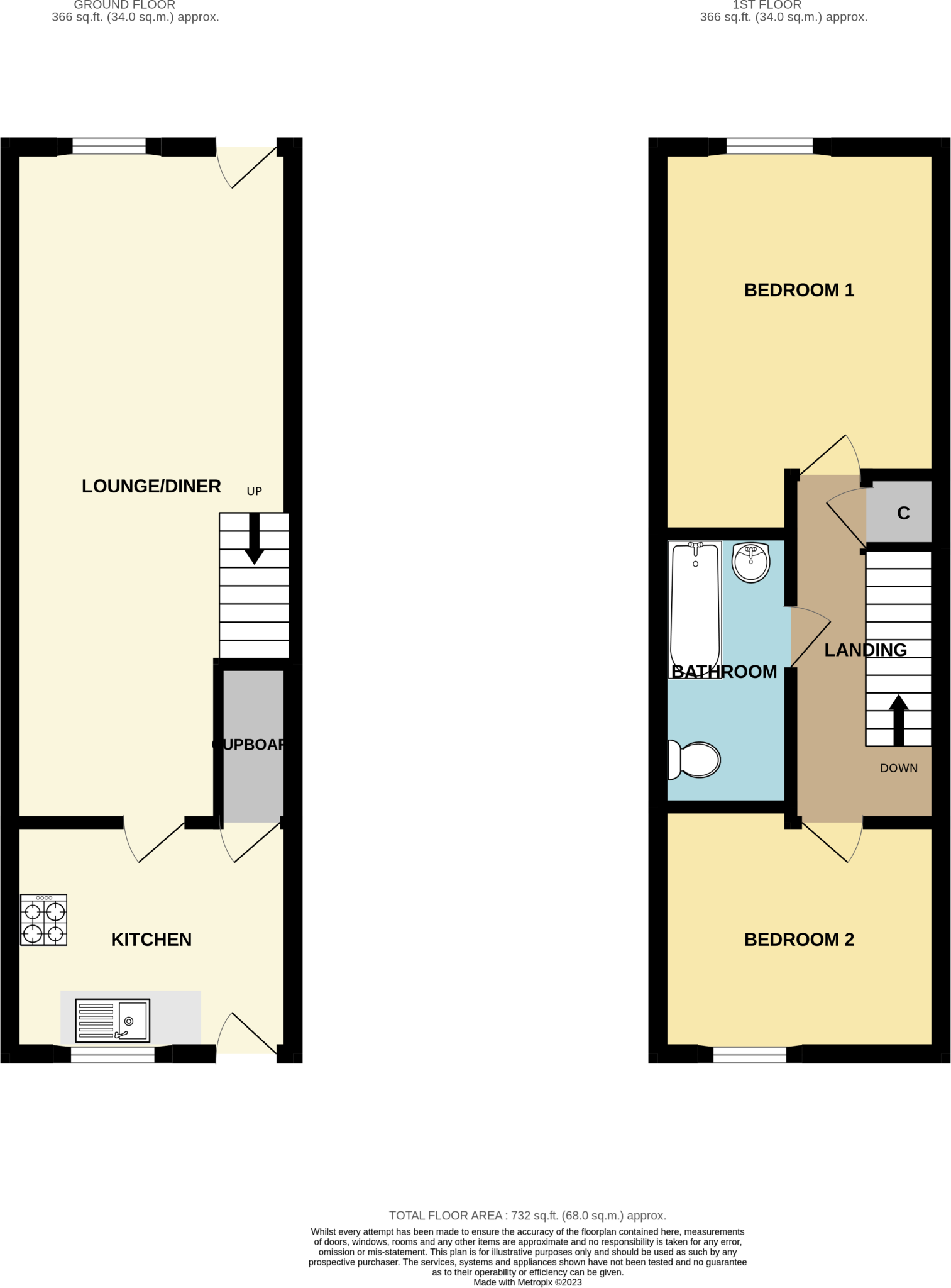
Floorplan
EPC Graphs

EPC Rating Graph
Rental Range
Estimated market rent for Stockton-on-Tees. Low = conservative, Realistic = average, Optimistic = best case.
Based on Local Authority from postcode lookup → Stockton-on-Tees.
LHA (30th percentile) floor for Teesside: £474/mo (Apr 2025 – Mar 2026)
Location
Address
Talbot Street
Nearby
Nearest stations, universities and amenities (distance from property).
| Type | Name | Distance |
|---|---|---|
| Shop | Unknown | 0.1 miles |
| Bus stop | Tilery Road | 0.1 miles |
| Train station | Stockton | 0.6 miles |
| University | Durham University, Queen's Campus | 1.0 miles |
| Train station | Thornaby | 1.1 miles |
| Hospital | Butterwick Hospice | 1.7 miles |
| Hospital | The Nuffield | 1.7 miles |
| University | Teesside University | 2.9 miles |
Street-level crime
| Category | Count |
|---|---|
| Violence and sexual offences | 220 |
| Anti-social behaviour | 83 |
| Criminal damage and arson | 49 |
| Public order | 39 |
| Shoplifting | 30 |
| Vehicle crime | 30 |
| Other theft | 26 |
| Burglary | 23 |
| Other crime | 16 |
| Drugs | 15 |
| Robbery | 13 |
| Possession of weapons | 6 |
| Theft from the person | 2 |
| Bicycle theft | 1 |
| Total incidents | 553 |
Within 1 mile during Apr 2026. Source: data.police.uk (England & Wales).
Schools nearby
Nearest open schools with Ofsted ratings (England). Closed schools are not shown. Data from Get Information about Schools and Ofsted.
| Name | Type | Distance | Ofsted |
|---|---|---|---|
| North Shore Academy | Secondary | 0.1 miles | Outstanding — 21 Sep 2021 |
| Tilery Primary School | Primary | 0.3 miles | — (Inspected (no overall grade)) |
| Norton Primary Academy | Primary | 0.6 miles | Good — 8 May 2019 |
| The Oak Tree Academy | Primary | 0.7 miles | Good — 13 Oct 2019 |
| Mill Lane Primary School | Primary | 0.7 miles | Good — 26 Jun 2023 |
Rental Comparables
Rental comparables are temporarily unavailable while listing-site fetches are paused. Try again later.
Enter House Number
Enter the house number to help us retrieve more accurate pricing history and property data.
Please log in to submit or correct the house number for this listing.
Log in to continue