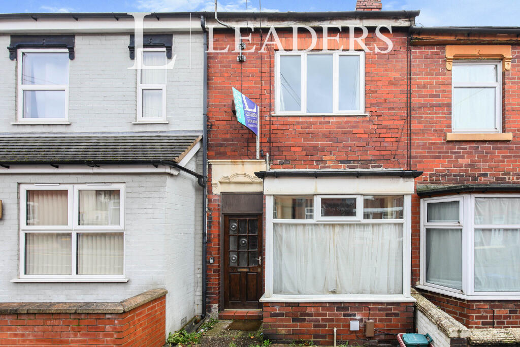
Watlands View
Newcastle, ST5, ST5 8AG
£595 pcm


Property details
Council tax band
A
Deprivation
Decile 6 (16,958 of 33,755)
Street crime
210 incidents within 1 mile (Apr 2026)
Key features
- NO DEPOSIT OPTION AVAILABLE
- Modern One Bedroom Apartment
- Close to Newcastle Town Centre
- Available July!
Additional details
- Heating
- Gas central
- Parking
- Yes
Description
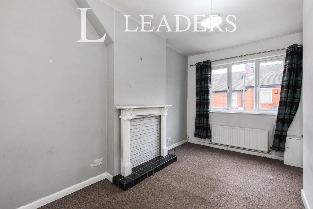
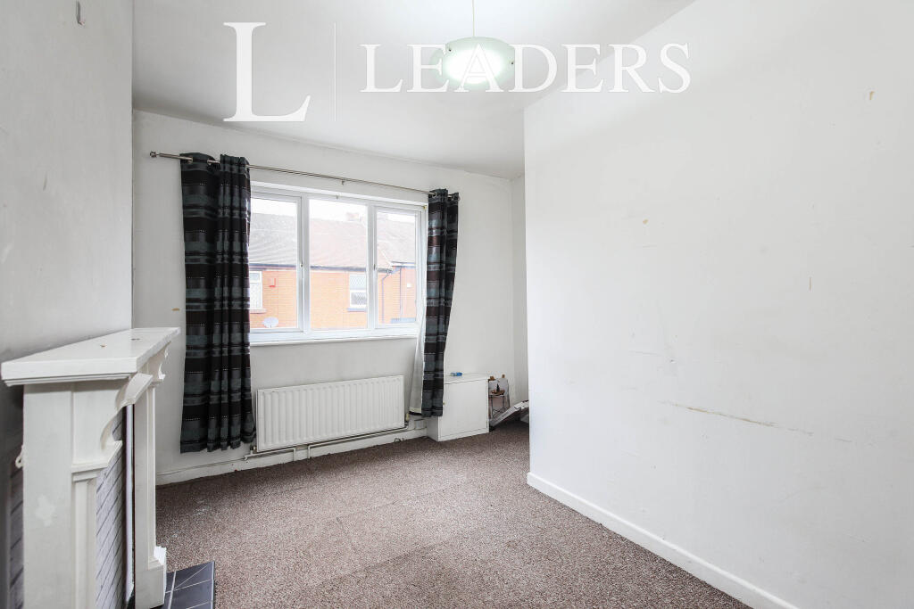
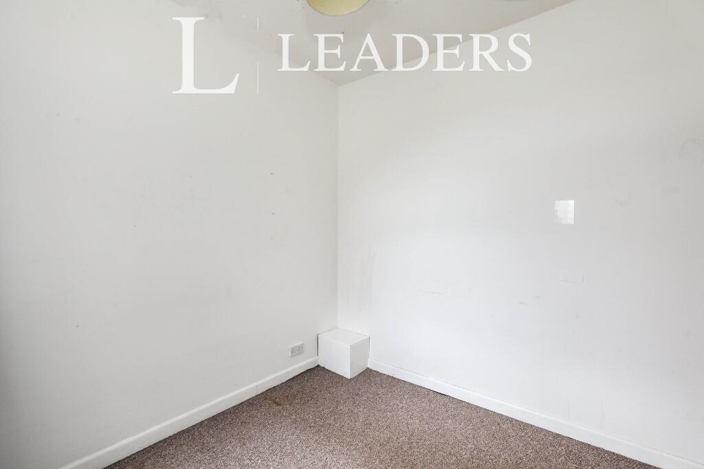
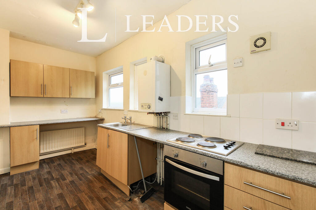
This well-presented one-bedroom first-floor flat is offered on an unfurnished basis and is ideally located in the sought-after area of Porthill. With excellent access to Newcastle-under-Lyme and a range of local amenities, it offers the perfect balance of comfort and convenience.
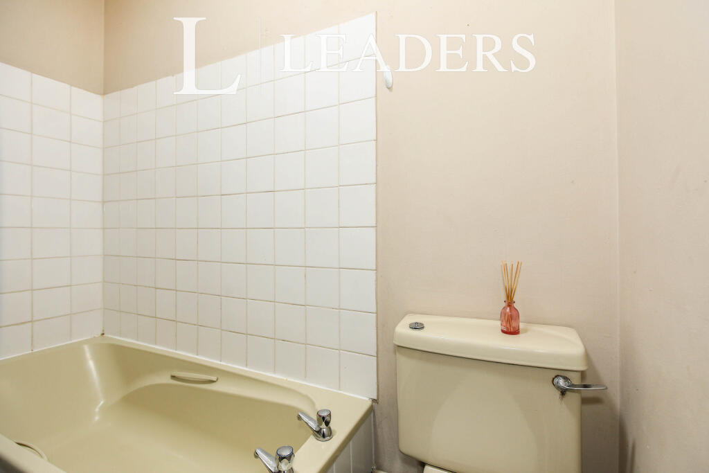
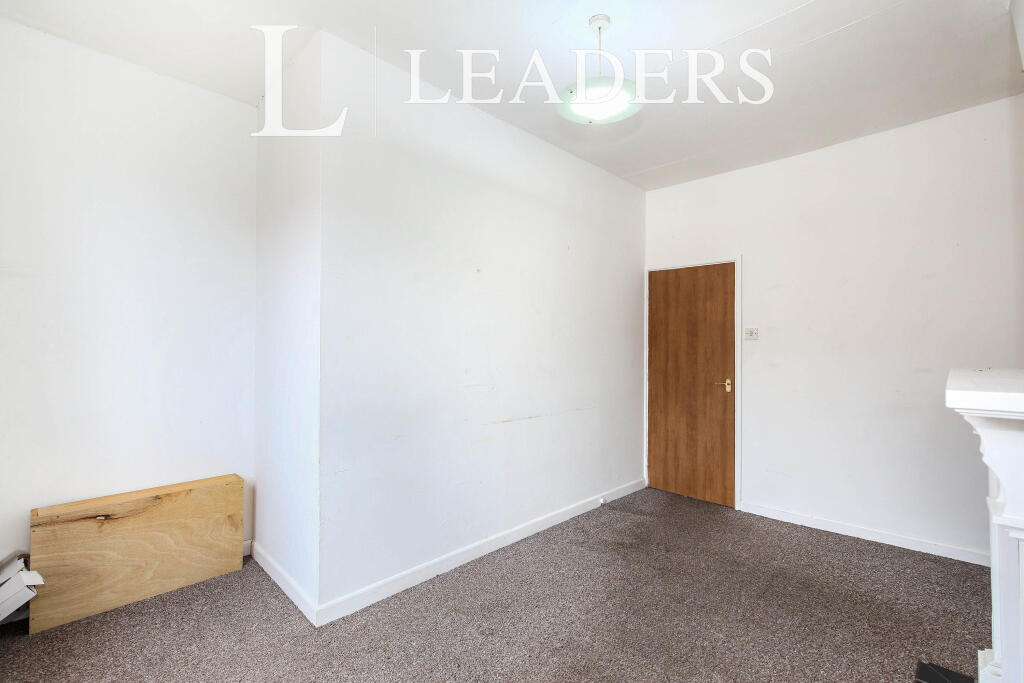
The accommodation briefly comprises a spacious lounge, a generously sized kitchen equipped with an integrated oven and hob, a double bedroom, and a modern three-piece bathroom.
Additional features include gas central heating and UPVC double glazing throughout.
EPC Rating D. Council Tax band A. A holding deposit of 1 weeks’ worth of rent is required to reserve this property and a security deposit of 5 weeks rent is payable prior to move in OR you can opt for our No Deposit Option. Call us now to register your interest!
Broadband and Mobile Phone: Ofcom suggest that Ultrafast broadband is available to this property Via Fibre Broadband and 5g Mobile signal may be available on some networks. Information regarding broadband options and phone signal can be obtained from the Ofcom broadband and mobile coverage checker.
Please note: This property is of standard construction. Gas central heating and mains supplied water. Street parking is available with this property.
Listed by
Hartshill
Leaders and Romans Group
Reference: 89104020
EPC ratings on this postcode
We don't have a matched EPC for this property yet. Below are efficiency scores and details for other addresses on this postcode.
| Address | Current | Potential | Floor area | Age band | Type |
|---|---|---|---|---|---|
| 101 Watlands View, NEWCASTLE | 57 | 77 | 75 m² | England and Wales: 1900-1929 | Terraced |
| 103, Watlands View, NEWCASTLE | 60 | 79 | 78 m² | England and Wales: 1930-1949 | Terraced |
| 105, Watlands View, NEWCASTLE | 69 | 86 | 75 m² | England and Wales: 1900-1929 | Terraced |
| 109 Watlands View, NEWCASTLE | 70 | 86 | 75 m² | England and Wales: 1900-1929 | Terraced |
| 109 Watlands View, NEWCASTLE | 14 | 77 | 72 m² | England and Wales: 1900-1929 | Terraced |
| 111, Watlands View, NEWCASTLE | 65 | 89 | 81 m² | England and Wales: 1900-1929 | Terraced |
| 111, Watlands View, NEWCASTLE | 25 | 89 | 72 m² | England and Wales: 1900-1929 | Terraced |
| 113, Watlands View, NEWCASTLE | 70 | 86 | 82 m² | England and Wales: 1900-1929 | Terraced |
| 115, Watlands View, NEWCASTLE | 60 | 83 | 66 m² | England and Wales: 1900-1929 | Terraced |
| 117 Watlands View, NEWCASTLE | 62 | 80 | 73 m² | England and Wales: before 1900 | Terraced |
| 119 Watlands View, NEWCASTLE | 66 | 79 | 75 m² | England and Wales: 1900-1929 | Terraced |
| 125 WATLANDS VIEW, PORTHILL, NEWCASTLE UNDER LYME | 60 | 81 | 75 m² | England and Wales: 1900-1929 | Terraced |
| 127 Watlands View, NEWCASTLE | 59 | 83 | 75 m² | England and Wales: 1900-1929 | Terraced |
| 131 Watlands View, NEWCASTLE | 70 | 87 | 84 m² | England and Wales: 1900-1929 | Terraced |
| 131, Watlands View, NEWCASTLE | 67 | 89 | 80 m² | England and Wales: before 1900 | Terraced |
Flood risk
Zone: 1
Risk: Low
Job (default Low)
Rental Range
Estimated market rent for Newcastle-under-Lyme. Low = conservative, Realistic = average, Optimistic = best case.
Based on Local Authority from postcode lookup → Newcastle-under-Lyme.
LHA (30th percentile) floor for Staffordshire North: £424/mo (Apr 2025 – Mar 2026)
Location
Address
Loring Terrace South
Nearby
Nearest stations, universities and amenities (distance from property).
| Type | Name | Distance |
|---|---|---|
| Bus stop | St Andrew's Church | 0.2 miles |
| Shop | Unknown | 0.2 miles |
| Shop | The co-operative food | 0.2 miles |
| Train station | Longport | 0.7 miles |
| Train station | Silverdale | 1.7 miles |
| Hospital | Haywood Hospital Walk-in Centre | 2.1 miles |
| Hospital | Royal Stoke University Hospital | 2.2 miles |
| University | Keele University | 3.0 miles |
| University | University of Buckingham Crewe Campus | 9.1 miles |
Street-level crime
| Category | Count |
|---|---|
| Violence and sexual offences | 78 |
| Anti-social behaviour | 48 |
| Public order | 17 |
| Criminal damage and arson | 16 |
| Vehicle crime | 13 |
| Burglary | 11 |
| Other crime | 8 |
| Other theft | 8 |
| Shoplifting | 7 |
| Drugs | 2 |
| Possession of weapons | 1 |
| Robbery | 1 |
| Total incidents | 210 |
Within 1 mile during Apr 2026. Source: data.police.uk (England & Wales).
Schools nearby
Nearest open schools with Ofsted ratings (England). Closed schools are not shown. Data from Get Information about Schools and Ofsted.
| Name | Type | Distance | Ofsted |
|---|---|---|---|
| Cedars - Newcastle, Moorlands and Darwin Bases | Other | 0.2 miles | Good — 26 Jun 2015 |
| Kaleidoscope School | Other | 0.2 miles | Good — 10 Dec 2023 |
| Oaklands Nursery School | Nursery | 0.3 miles | Outstanding — 15 Feb 2013 |
| Ellison Primary Academy | Primary | 0.4 miles | Good — 14 Sep 2023 |
| The Orme Academy | Secondary | 0.5 miles | Good — 9 Jul 2024 |
Rental Comparables
Residential lets from OpenRent and Rightmove for the area (same bedroom count). Use to validate rent estimates. Student lets are excluded.
Average rent: £629/mo (37 listings)
Enter House Number
Enter the house number to help us retrieve more accurate pricing history and property data.
Please log in to submit or correct the house number for this listing.
Log in to continue