Nile Street
Burslem, Stoke-on-Trent, ST6, ST6 2AF
£950 pcm
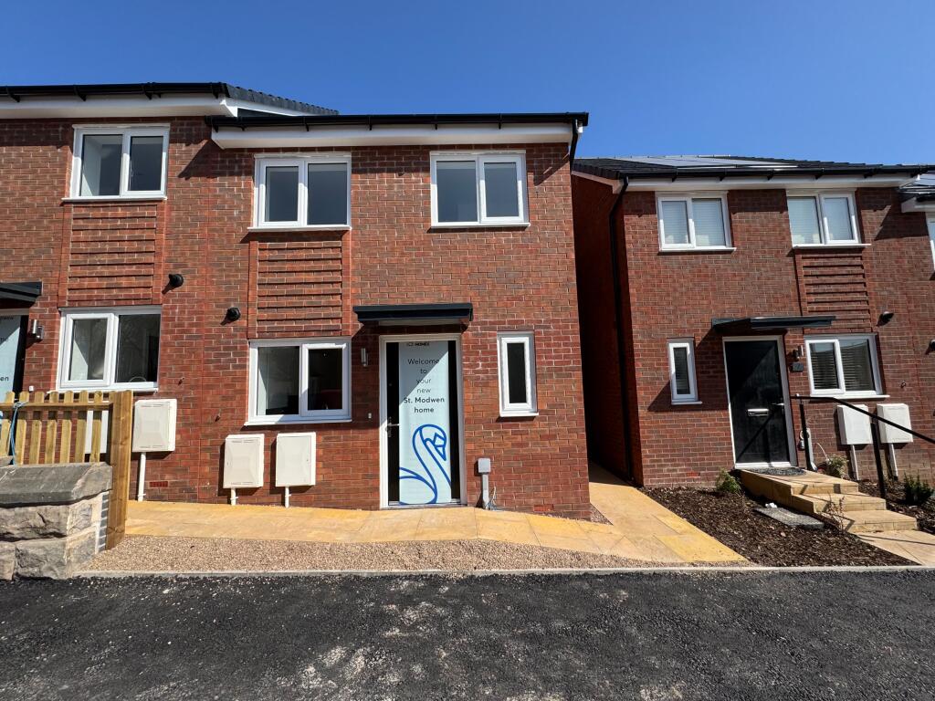
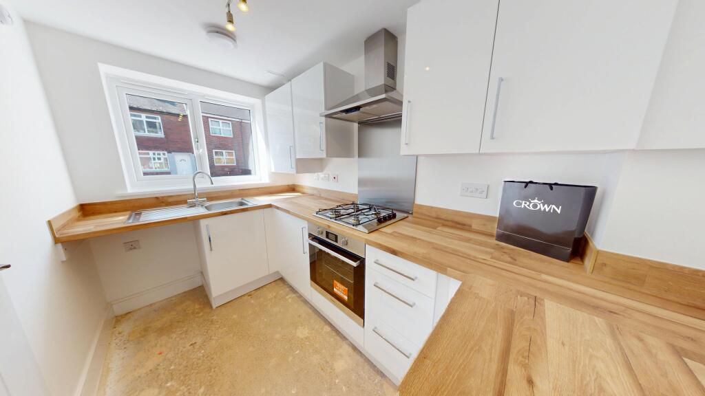
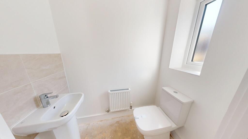
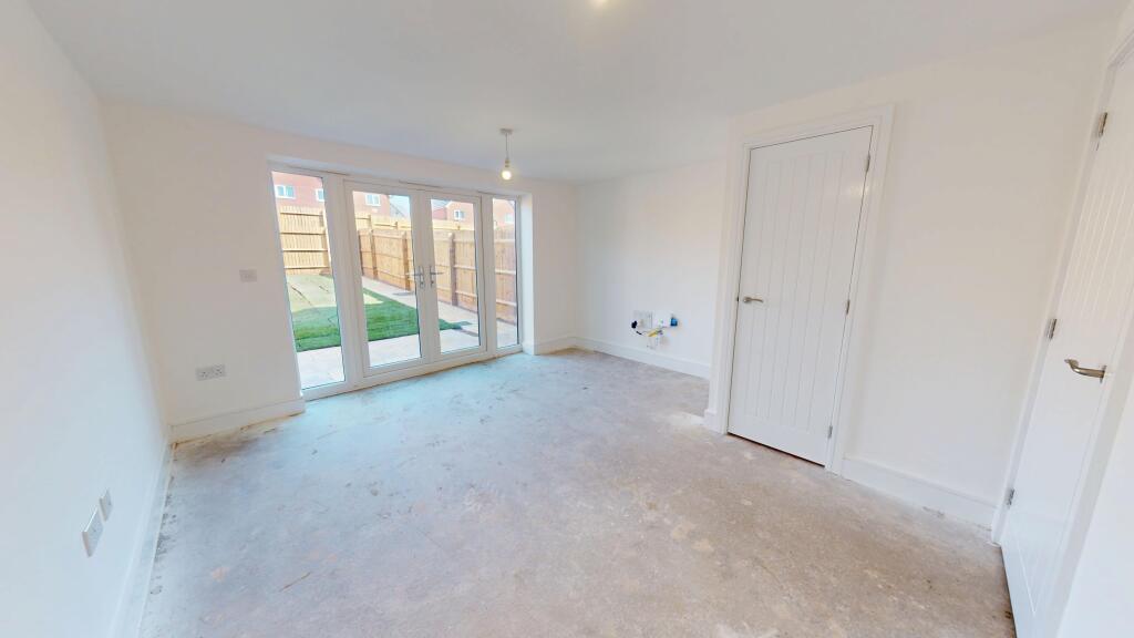
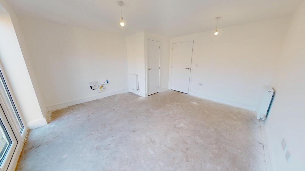
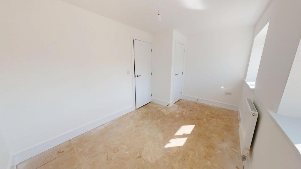
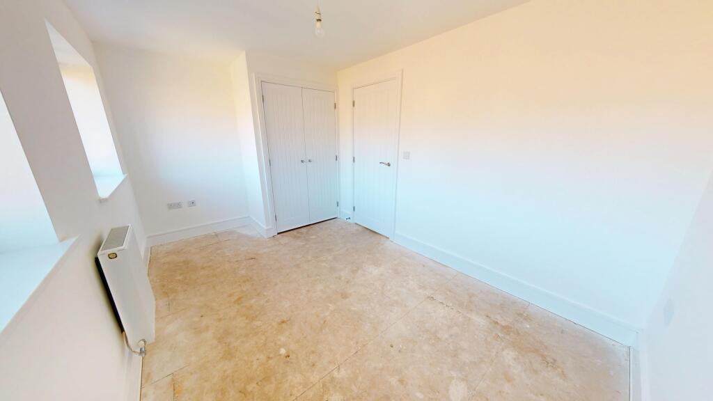
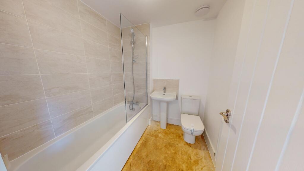
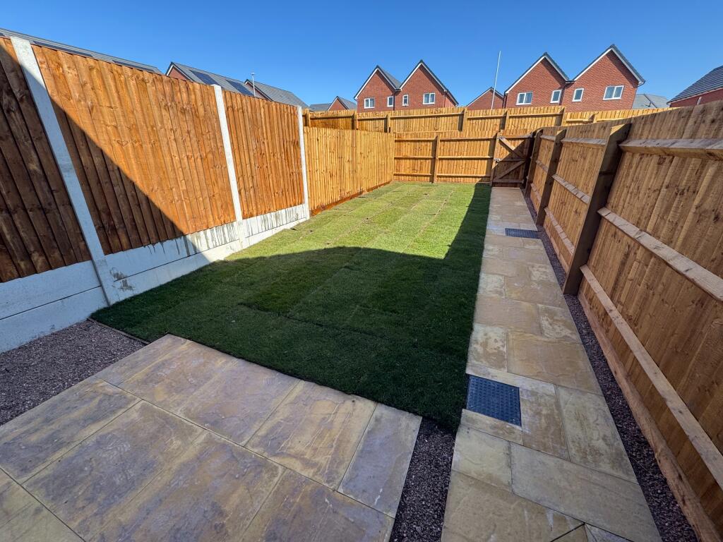
Photo 1 Photo 2 Photo 3 Photo 4 Photo 5 Photo 6 Photo 7 Photo 8 Photo 9
/ 9
Property details
Council tax band
B
Street crime
411 incidents within 1 mile (Apr 2026)
Key features
- Part of a Recently Built Development
- Off Road Parking
- Entrance Hallway
- Modern Kitchen
- Downstairs WC
- Family Bathroom
- Two Double Bedrooms
- Lounge
- Double Glazing
- Gas Central Heating
Additional details
- Heating
- Gas central
- Parking
- Off street, Private
- Garden
- Private garden
Description
The accommodation in brief comprises; entrance hallway, downstairs WC, lounge/diner, fitted kitchen, landing, two double bedrooms and family bathroom. There is an enclosed rear garden with gated access leading to the car park which provides allocated parking spaces. EPC rating: A.
Listed by
Stoke-On-Trent
The Property Franchise Group
Reference: 87837948
EPC ratings on this postcode
We don't have a matched EPC for this property yet. Below are efficiency scores and details for other addresses on this postcode.
| Address | Current | Potential | Floor area | Age band | Type |
|---|---|---|---|---|---|
| 1, Nile Street, Stoke-on-Trent | 90 | 90 | 58 m² | — | Detached |
| 11, Nile Street, Stoke-on-Trent | 93 | 93 | 72 m² | — | Terraced |
| 12a, Nile Street, STOKE-ON-TRENT | 64 | 79 | 85 m² | England and Wales: 1900-1929 | Flat |
| 12a, Nile Street, STOKE-ON-TRENT | 68 | 75 | 86 m² | England and Wales: before 1900 | Flat |
| 13, Nile Street, Stoke-on-Trent | 94 | 94 | 72 m² | — | Terraced |
| 14b, Nile Street, STOKE-ON-TRENT | 63 | 73 | 43 m² | England and Wales: before 1900 | Flat |
| 14c, Nile Street, STOKE-ON-TRENT | 58 | 64 | 59 m² | England and Wales: 1930-1949 | Flat |
| 15, Nile Street, Stoke-on-Trent | 93 | 93 | 72 m² | — | Terraced |
| 1A, Nile Street, Stoke-on-Trent | 90 | 90 | 58 m² | — | Detached |
| 3, Nile Street, Stoke-on-Trent | 93 | 93 | 58 m² | — | Detached |
| 32 Nile Street, STOKE-ON-TRENT | 72 | 88 | 56 m² | England and Wales: 1991-1995 | Terraced |
| 32, Nile Street, STOKE-ON-TRENT | 69 | 87 | 58 m² | England and Wales: before 1900 | Terraced |
| 32, Nile Street, STOKE-ON-TRENT | 62 | 88 | 58 m² | England and Wales: 1900-1929 | Terraced |
| 34, Nile Street, STOKE-ON-TRENT | 61 | 89 | 60 m² | England and Wales: 1930-1949 | Terraced |
| 36, Nile Street, STOKE-ON-TRENT | 70 | 88 | 61 m² | England and Wales: 1930-1949 | Terraced |
Flood risk
Zone: 1
Risk: Low
Job (default Low)
Floorplans
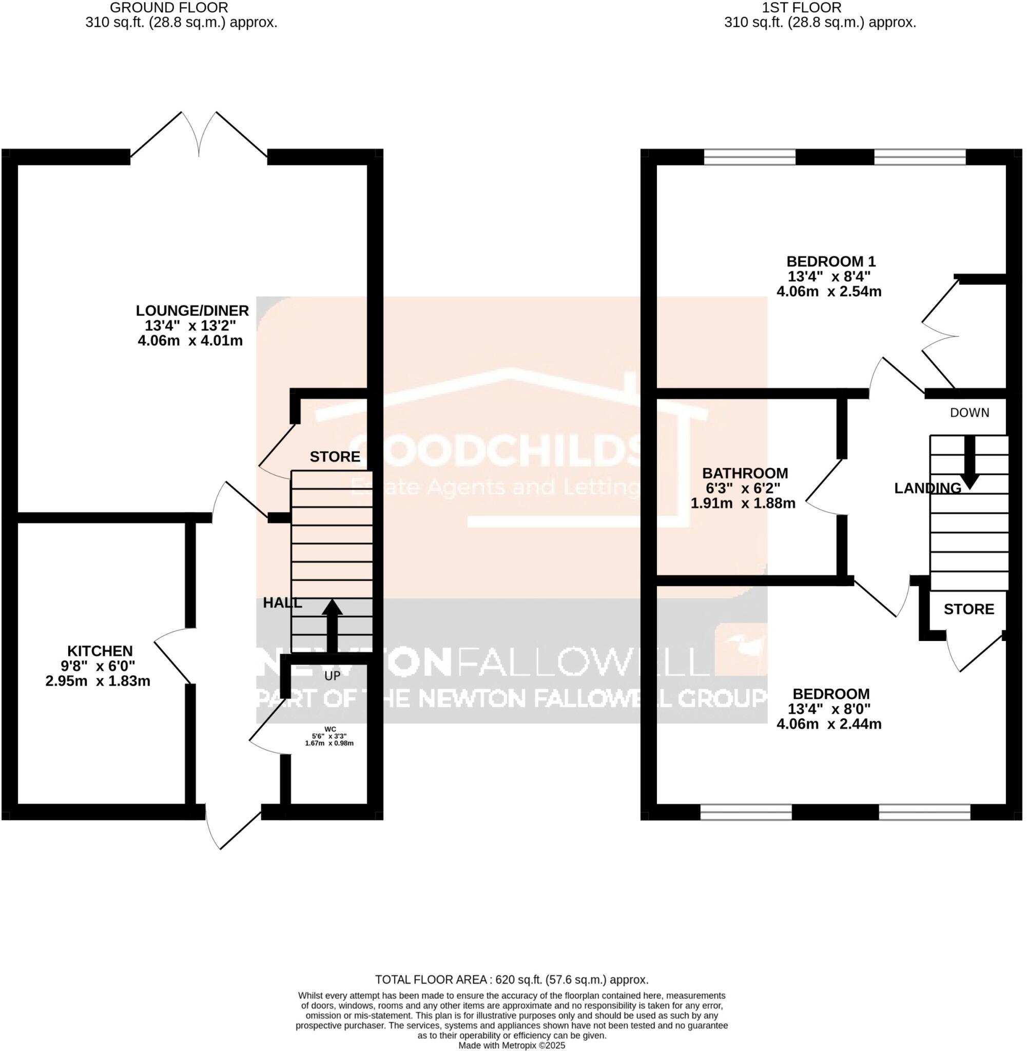
Floorplan
Rental Range
Estimated market rent for Stoke-on-Trent. Low = conservative, Realistic = average, Optimistic = best case.
Based on Local Authority from postcode lookup → Stoke-on-Trent.
LHA (30th percentile) floor for Staffordshire North: £479/mo (Apr 2025 – Mar 2026)
Location
Address
Nile Street
Nearby
Nearest stations, universities and amenities (distance from property).
| Type | Name | Distance |
|---|---|---|
| Shop | B&M | 0.1 miles |
| Shop | Chapel Lane Garage | 0.1 miles |
| Bus stop | 3A | 0.2 miles |
| Bus stop | Newcastle Street, Dale Street | 0.4 miles |
| Hospital | St Augustine's Hospital | 0.8 miles |
| Hospital | Haywood Hospital Walk-in Centre | 0.8 miles |
| Train station | Longport | 0.9 miles |
| University | University of Staffordshire Stoke Campus | 2.5 miles |
| Train station | Stoke-on-Trent | 2.6 miles |
Street-level crime
| Category | Count |
|---|---|
| Violence and sexual offences | 118 |
| Anti-social behaviour | 105 |
| Public order | 33 |
| Other theft | 32 |
| Shoplifting | 27 |
| Burglary | 23 |
| Vehicle crime | 22 |
| Criminal damage and arson | 17 |
| Drugs | 11 |
| Other crime | 9 |
| Robbery | 6 |
| Possession of weapons | 4 |
| Bicycle theft | 3 |
| Theft from the person | 1 |
| Total incidents | 411 |
Within 1 mile during Apr 2026. Source: data.police.uk (England & Wales).
Schools nearby
Nearest open schools with Ofsted ratings (England). Closed schools are not shown. Data from Get Information about Schools and Ofsted.
| Name | Type | Distance | Ofsted |
|---|---|---|---|
| North Road Academy | Other | 0.4 miles | Requires improvement — 2 Apr 2023 |
| Saint Nathaniel's Academy | Primary | 0.4 miles | Good — 20 Jun 2024 |
| Moorpark Junior School | Primary | 0.5 miles | Good — 11 Jul 2016 |
| The Valiant School | Other | 0.5 miles | — (No rating) |
| Jackfield Infant School | Primary | 0.6 miles | Good — 18 Jan 2023 |
Rental Comparables
Residential lets from OpenRent and Rightmove for the area (same bedroom count). Use to validate rent estimates. Student lets are excluded.
| Title | Rent | Beds | Distance | As seen on |
|---|---|---|---|---|
| Nile Street, Burslem, Stoke-On-Trent, ST6 | £950/mo | 2 | 0.04 miles | Rightmove |
| Moorland Road, Burslem, Stoke-on-Trent | £715/mo | 2 | 0.1 miles | Rightmove |
| 2 Bed Terraced House, Glendale St, ST6 | £695/mo | 2 | 0.17 miles | OpenRent |
| 2 Bed Terraced House, Glendale St, ST6 | £695/mo | 2 | 0.17 miles | OpenRent |
| Lingard Street, Burslem, Stoke-on-Trent, ST6 | £750/mo | — | 0.26 miles | Rightmove |
| Lyndhurst Street, Burslem | £695/mo | 2 | 0.41 miles | Rightmove |
| Federation Road, Burslem | £625/mo | 2 | 0.43 miles | Rightmove |
| Hamil Road, Burslem | £745/mo | 2 | 0.46 miles | Rightmove |
| Patricia Rose Close, Stoke-On-Trent, ST6 | £1,035/mo | 2 | 0.47 miles | Rightmove |
| Jackfield Street,Burslem, Stoke-on-Trent | £700/mo | 2 | 0.48 miles | Rightmove |
| Stanfield Road, Stoke-On-Trent, ST6 | £700/mo | 2 | 0.49 miles | Rightmove |
| May Street, Burslem, Stoke-on-Trent, Staffordshire, ST6 | £625/mo | 2 | 0.5 miles | Rightmove |
| Dartmouth Street, STOKE-ON-TRENT | £750/mo | 2 | 0.53 miles | Rightmove |
| Wade Street Burslem | £750/mo | 2 | 0.55 miles | Rightmove |
| Macclesfield Street, Stoke-On-Trent, ST6 | £725/mo | 2 | 0.56 miles | Rightmove |
| Lindley Street, Stoke-On-Trent | £650/mo | 2 | 0.57 miles | Rightmove |
| 25 Morton Street | £700/mo | 2 | 0.59 miles | Rightmove |
| Burgess Street, ST6 | £795/mo | 2 | 0.67 miles | Rightmove |
| Tudor Court, Sunnybank, Stoke-on-Trent | £700/mo | 2 | 0.69 miles | Rightmove |
| Bowlers Close, Festival Heights, Stoke-on-Trent, ST6 | £800/mo | 2 | 0.71 miles | Rightmove |
Average rent: £746/mo (33 listings)
Enter House Number
Enter the house number to help us retrieve more accurate pricing history and property data.
Please log in to submit or correct the house number for this listing.
Log in to continue