47 DALE ROAD
BUXTON, BUXTON, DERBYSHIRE SK17 6NJ
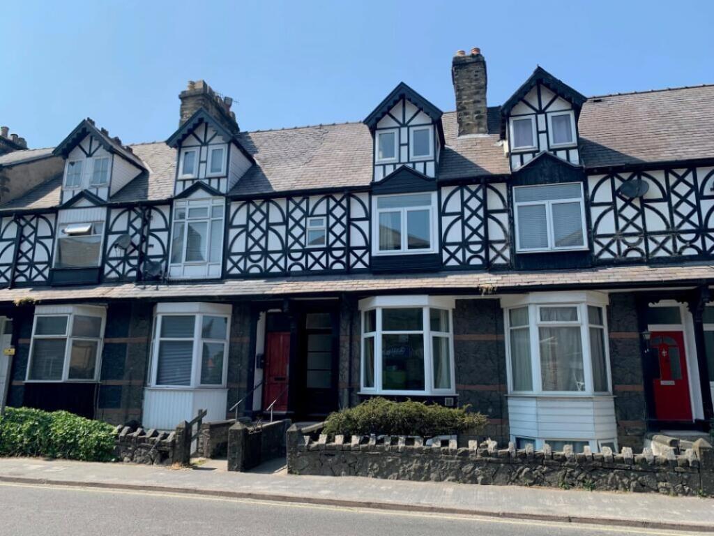
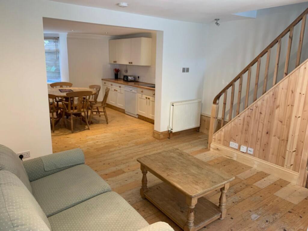
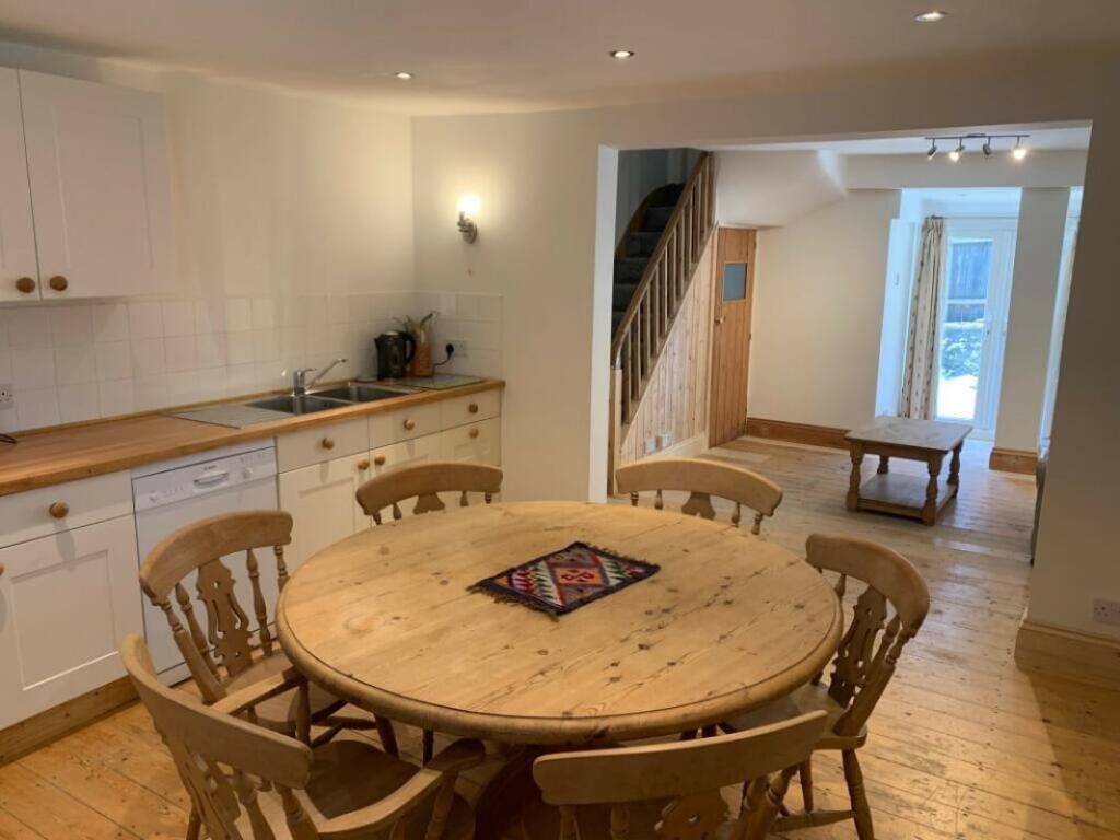
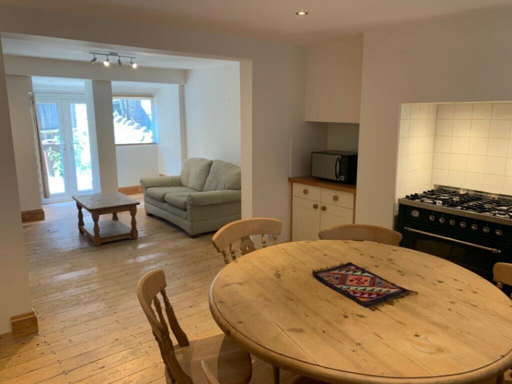
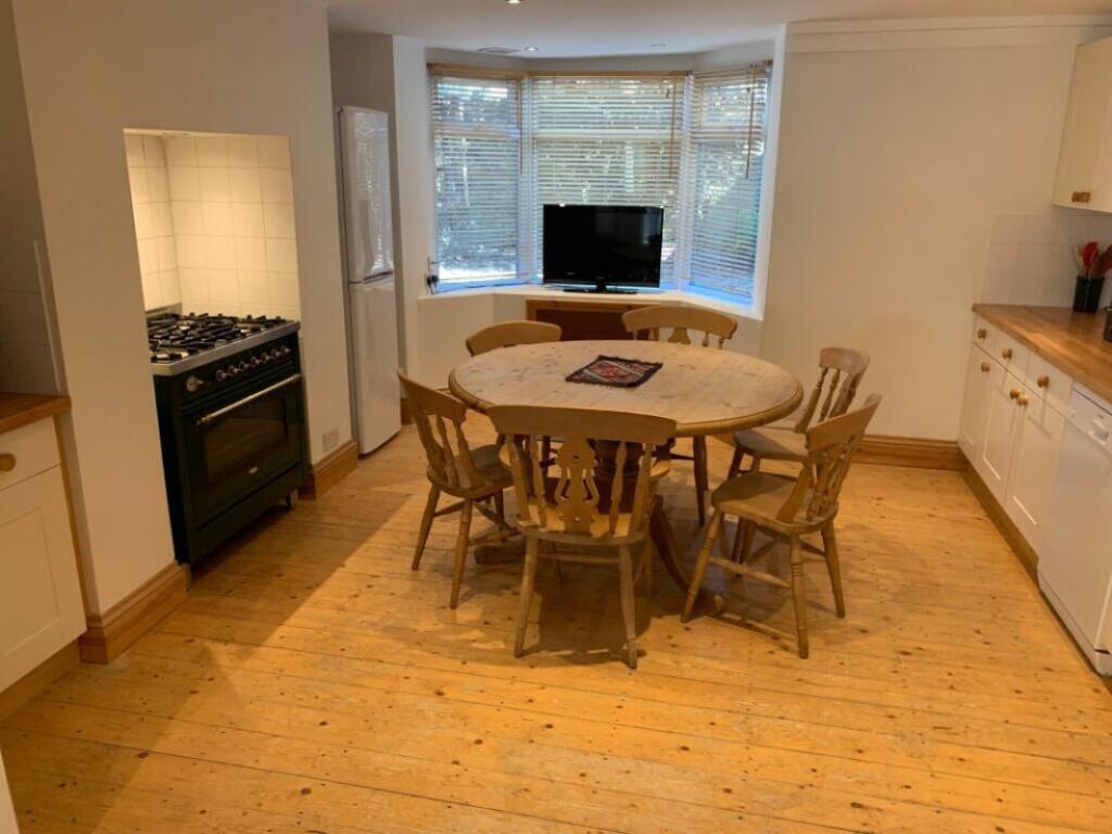
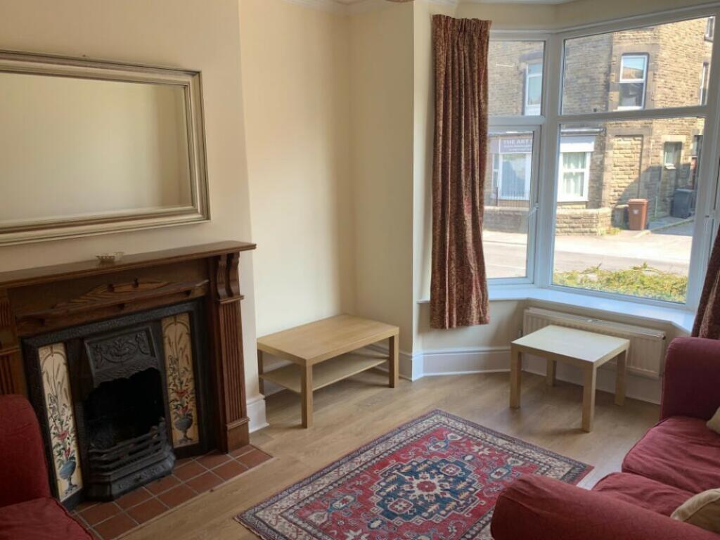
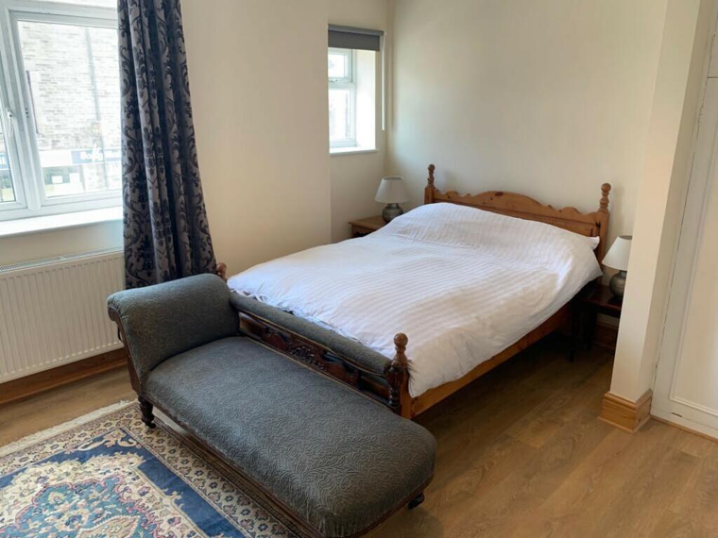
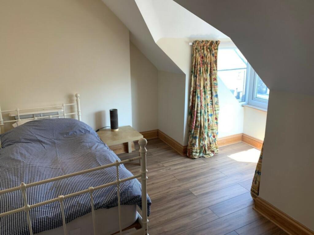
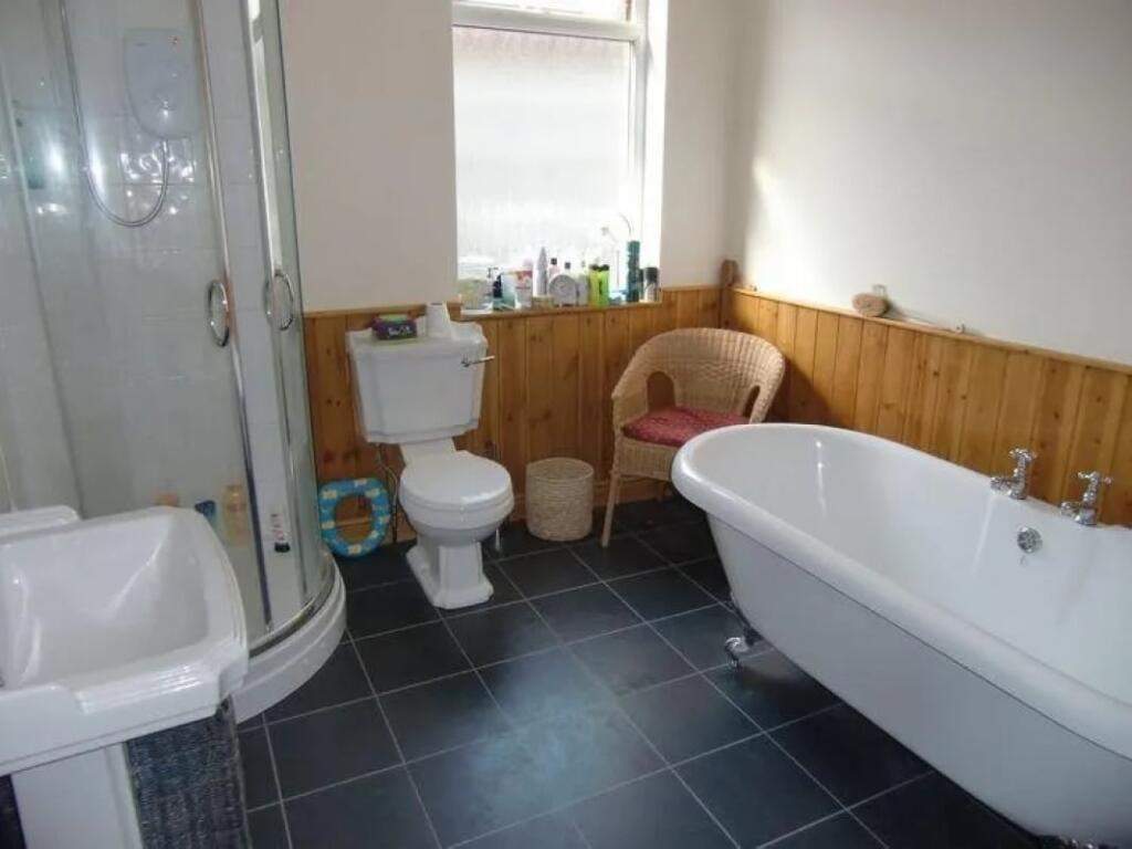
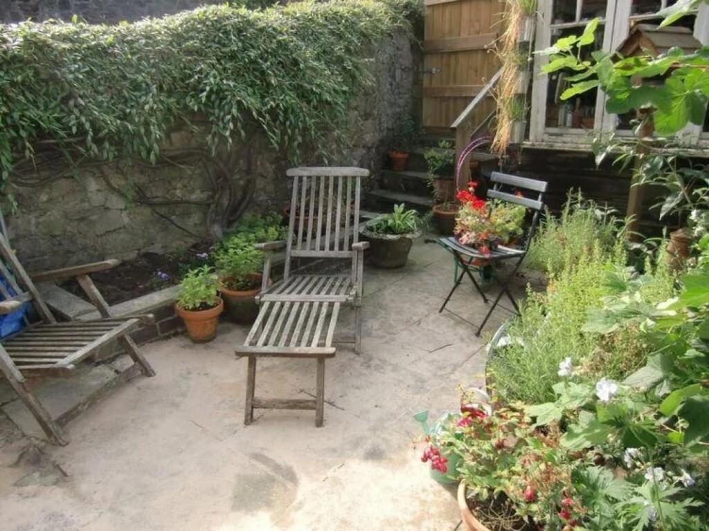
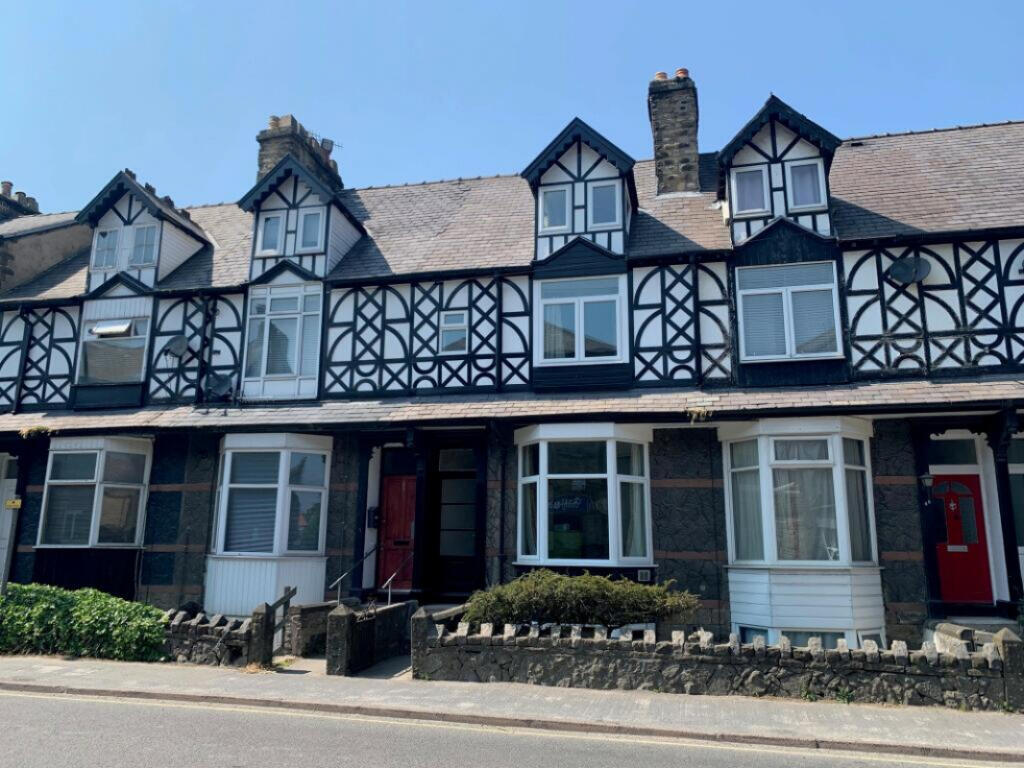
Photo 1 Photo 2 Photo 3 Photo 4 Photo 5 Photo 6 Photo 7 Photo 8 Photo 9 Photo 10 Photo 11
/ 11
Property details
Tenure
FREEHOLD
Floor area
113 m²
Council tax band
B
EPC rating
C
Year built
England and Wales: 1900-1929
Last sold
£140,000 Jun 2007
Price per m²
£2,080/m²
Local average
£240,873 (-2.4%)
Deprivation
Decile 7 (20,377 of 33,755)
Street crime
206 incidents within 1 mile (Jun 2026)
Key features
- Victorian 4 / 5 bedroom mid-terrace town house with open plan family living space in a convenient town centre location close to all local amenities.
- No Upward Chain
Additional details
- Heating
- Open fire, Gas central
- Parking
- On street
- Garden
- Enclosed garden, Rear garden
Description
A Stunning Victorian Mid-Terrace Town House in the Heart of Buxton
We are delighted to present this exceptional 4 / 5-bedroom mid-terrace town house, nestled in the heart of Buxton's vibrant town centre. This beautifully maintained Victorian property boasts a wealth of character and charm, offering a unique blend of period features and modern comforts.
Accommodation
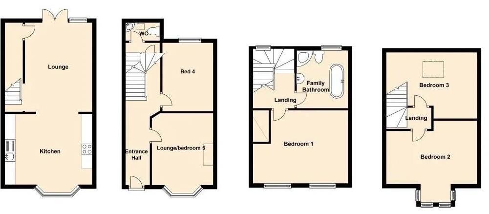
The accommdation over 4 floors can easily be configured as either 5 bedrooms and 1 reception room or 4 bedroom and 2 reception rooms. All the bedrooms are generously proportioned each with plenty of natural light with the master bedroom featuring ample built in storage cupboards.
Living Space
The property's crowning glory is its stunning open-plan family living space, which seamlessly combines the kitchen, dining area, and lounge with french doors leading to the small fully enclosed rear yard.
This spacious room is perfect for entertaining, with plenty of room for a large dining table and comfortable seating area. The property benefits from a recently fitted Kitchen with plenty of drawer / cupboard space, solid oak work surfaces and dedicated spaces for a free standing range cooker, dishwasher and fridge/freezer.
The property has gas fired central heating to radiators with a new boiler having been fitted in November 2025. There is separate plumbing for a washing machine and tumble dryer in the under-stairs cupboard adjacent to the open plan family living space.
Exterior
To the rear of the property is a small fully enclosed yard with raised flower beds and space for a small garden shed.
Room Dimensions
Ground Floor:
Hall
lounge / bedroom 5 14' 0" into bay x 11' 0" (4.27m x 3.35m)
bedroom 4 10' 7" x 9' 0" (3.23m x 2.74m)
half landing
WC
Basement Open Plan Living Space:
sitting room area 5 14' 2" x 14' 0" (4.32m x 4.27m)
kitchen/diner area 13' 7" x 12' 3" (4.14m x 3.73m)
First Floor:
landing
bathroom 10' 6" x 8' 7" (3.2m x 2.62m)
master bedroom 13' 1" x 11' 9" (3.99m x 3.58m)
2nd Floor:
landing
bedroom 2 13' 2" x 11' 11" into dormer narrowing to to 8'2 (4.01m x 3.63m into dormer narrowing to 2.49m)
bedroom 3 11' 2" x 9' 2" (3.4m x 2.79m)
ENQUIRIES
For all enquiries, viewing requests or to create your own listing please visit the Emoov website. If calling, please quote reference: S6488
Listed by
Chelmsford
Griffin Residential Limited
Reference: 174749402
EPC Rating & Upgrade Cost
Current rating: C
Potential rating: B
Inspection date: 20/06/2023
Expiry date: 19/06/2033
Current heating cost: £2,086/year
Potential heating cost: £1,570/year
Est. upgrade cost to C: £19,900
Recommendations
- 50 mm internal or external wall insulation (£4,000 - £14,000)
- Floor insulation (suspended floor) (£800 - £1,200)
- Upgrade heating controls (£350 - £450)
- Solar water heating (£4,000 - £6,000)
- Solar photovoltaic panels, 2.5 kWp (£3,500 - £5,500)
Flood risk
Zone: 1
Risk: Low
Job (default Low)
Floorplans
Floorplan
EPC Graphs

Energy Performance Certificate
FENSA Certificates
This property has 1 FENSA certificate(s) on record, indicating window/door installations by FENSA-approved installers.
FENSA Certificate #5125867
Property Details
Street: 47 Dale Road
Town: BUXTON
Postcode: SK17 6NJ
Installation Details
Items: 7 windows
Certificate Issued: 22/10/2007
Work Completed: 03/10/2007
This certificate data was retrieved from FENSA's database
What is FENSA? FENSA (Fenestration Self-Assessment Scheme) is a government-authorised scheme that monitors building regulation compliance for replacement windows and doors. Certificates indicate that work was completed by FENSA-approved installers.
Price history
| Event | Date | Price | % change |
|---|---|---|---|
| Listed for sale | — | £234,995 | +67.9% |
| Sold | 29/06/2007 (19 years ago) | £140,000 | — |
Source: HM Land Registry Price Paid Data. Crown copyright.
Sold Comparables
Same street and nearby sales within 0.25 miles (last 5 years). Data from Land Registry Price Paid.
| Address | Price | Date | Type |
|---|---|---|---|
| 13 HEATH STREET, BUXTON, HIGH PEAK, DERBYSHIRE, SK17 6LT | £312,000 | 01/10/2025 | Terraced |
| 6 GRANGE ROAD, BUXTON, HIGH PEAK, DERBYSHIRE, SK17 6NH | £450,000 | 31/01/2025 | Terraced |
| 6 ASH STREET, BUXTON, HIGH PEAK, DERBYSHIRE, SK17 6LL | £275,000 | 03/06/2024 | Terraced |
| 24 HOLLINS STREET, BUXTON, HIGH PEAK, DERBYSHIRE, SK17 6LQ | £168,000 | 05/04/2024 | Terraced |
| 75 BENNETT STREET, BUXTON, HIGH PEAK, DERBYSHIRE, SK17 6NA | £197,950 | 19/12/2023 | Terraced |
| 83 BENNETT STREET, BUXTON, HIGH PEAK, DERBYSHIRE, SK17 6NA | £235,000 | 27/10/2023 | Terraced |
| 19 OTTER COURT, BUXTON, HIGH PEAK, DERBYSHIRE, SK17 6ZD | £214,000 | 29/09/2023 | Terraced |
| 46 BENNETT STREET, BUXTON, HIGH PEAK, DERBYSHIRE, SK17 6NB | £160,000 | 24/07/2023 | Terraced |
| 12 DARWIN AVENUE, BUXTON, HIGH PEAK, DERBYSHIRE, SK17 6NF | £355,000 | 07/06/2023 | Terraced |
| Same street 37A DALE ROAD, BUXTON, HIGH PEAK, DERBYSHIRE, SK17 6NJ | £82,000 | 05/04/2023 | Flat |
| Same street 51 DALE ROAD, BUXTON, HIGH PEAK, DERBYSHIRE, SK17 6NJ | £200,000 | 04/04/2023 | Terraced |
| 32 BENNETT STREET, BUXTON, HIGH PEAK, DERBYSHIRE, SK17 6NB | £150,500 | 04/04/2023 | Terraced |
| 15 OTTER COURT, BUXTON, HIGH PEAK, DERBYSHIRE, SK17 6ZD | £290,000 | 02/02/2023 | Terraced |
| 6 DALE SIDE, BUXTON, HIGH PEAK, DERBYSHIRE, SK17 6NN | £128,000 | 09/12/2022 | Terraced |
| 10 CROWESTONES, BUXTON, HIGH PEAK, DERBYSHIRE, SK17 6NZ | £359,950 | 01/12/2022 | Terraced |
| 10 DARWIN AVENUE, BUXTON, HIGH PEAK, DERBYSHIRE, SK17 6NF | £420,000 | 29/11/2022 | Terraced |
| LADDER COTTAGE MARKET STREET, BUXTON, HIGH PEAK, DERBYSHIRE, SK17 6LF | £285,500 | 28/11/2022 | Terraced |
| 2 SMITHY LANE, BUXTON, HIGH PEAK, DERBYSHIRE, SK17 6EP | £157,500 | 28/11/2022 | Terraced |
| 13 BENNETT STREET, BUXTON, HIGH PEAK, DERBYSHIRE, SK17 6NA | £138,256 | 18/11/2022 | Terraced |
| 36 CROWESTONES, BUXTON, HIGH PEAK, DERBYSHIRE, SK17 6NZ | £355,000 | 18/11/2022 | Terraced |
| 7 HEATH STREET, BUXTON, HIGH PEAK, DERBYSHIRE, SK17 6LT | £187,500 | 15/11/2022 | Terraced |
| 8 SOUTH STREET, BUXTON, HIGH PEAK, DERBYSHIRE, SK17 6LB | £140,000 | 04/11/2022 | Terraced |
| Same street 41 DALE ROAD, BUXTON, HIGH PEAK, DERBYSHIRE, SK17 6NJ | £172,250 | 07/12/2021 | Terraced |
Street average: £151,417 (3 sales)
Area average: £248,958 (20 sales)
Capital growth trend
Land Registry outcode average: last 12 months vs 5y and 10y ago (from sold prices).
House Price Index (HM Land Registry — official index, not sold-price averages): High Peak. Series: Terraced. As of May 2026.
Rental Range
Estimated market rent for High Peak. Low = conservative, Realistic = average, Optimistic = best case.
Based on Local Authority from postcode lookup → High Peak.
LHA (30th percentile) floor for Peaks & Dales: £898/mo (Apr 2025 – Mar 2026)
Location
Nearby
Nearest stations, universities and amenities (distance from property).
| Type | Name | Distance |
|---|---|---|
| Shop | Steve's Tyres & Exhausts | 0.1 miles |
| Shop | Morrisons Daily | 0.1 miles |
| Bus stop | Buxton, London Road / Five Ways Junction | 0.1 miles |
| Bus stop | Buxton, Terrace Road / Market Place (Stop E) | 0.2 miles |
| Hospital | Buxton Health Centre | 0.2 miles |
| Train station | Buxton Miniature Railway | 0.3 miles |
| Train station | Buxton | 0.4 miles |
| University | University of Derby, Buxton | 0.5 miles |
| Hospital | Buxton Hospital & Corbar Birth Centre | 0.5 miles |
| University | Tovell Building, Buxton & Leek College | 11.1 miles |
Street-level crime
| Category | Count |
|---|---|
| Violence and sexual offences | 72 |
| Anti-social behaviour | 44 |
| Public order | 21 |
| Shoplifting | 20 |
| Criminal damage and arson | 19 |
| Burglary | 9 |
| Other theft | 6 |
| Vehicle crime | 5 |
| Drugs | 4 |
| Other crime | 3 |
| Bicycle theft | 1 |
| Robbery | 1 |
| Theft from the person | 1 |
| Total incidents | 206 |
Within 1 mile during Jun 2026. Source: data.police.uk (England & Wales).
Schools nearby
Nearest open schools with Ofsted ratings (England). Closed schools are not shown. Data from Get Information about Schools and Ofsted.
| Name | Type | Distance | Ofsted |
|---|---|---|---|
| Buxton Infant School | Primary | 0.2 miles | Good — 30 Jan 2024 |
| Buxton Junior School | Primary | 0.3 miles | Good — 1 Dec 2017 |
| Buxton and Leek College | Other | 0.4 miles | — (No rating) |
| Buxton Community School | Secondary | 0.5 miles | Good — 6 Jun 2013 |
| St Thomas More Catholic Voluntary Academy | Secondary | 0.6 miles | Requires improvement — 9 Feb 2023 |
Rental Comparables
Loading rental comparables for this postcode. Refresh in a few minutes.
Rent-driven metrics
Based on Area rent estimate.
- Rent ratio — Monthly rent ÷ purchase price (1% rule). 1%+ = strong, 0.8–1% = okay, <0.8% = weak for cashflow.
- Max investor price — Rent ÷ 0.8%; the price at which rent would be 0.8% of price (Stoke-style target).
- Target investor price — Rent ÷ 1%; the price at which rent would be 1% of price (strong cashflow band).
- Gross yield — Annual rent as % of purchase price (no costs).