31 WANSBECK ROAD
BEDFORD, BRICKHILL, BEDFORD MK41 7UE
£370 pcm
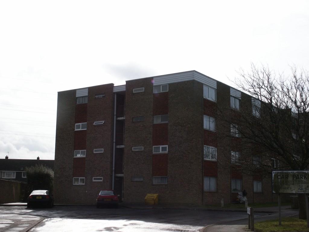
Photo 1
/ 1
Property details
Floor area
95 m²
Deprivation
Decile 3 (9,434 of 33,755)
Street crime
62 incidents within 1 mile (Apr 2026)
Additional details
- Parking
- Yes
Description
Listed by
Bedford
Cooper Beard Estate Agency Limited
Reference: 24004736
EPC Rating & Upgrade Cost
Fetching EPC data… Refresh this page in a moment.
Flood risk
Zone: 1
Risk: Low
Job (default Low)
FENSA Certificates
This property has 2 FENSA certificate(s) on record, indicating window/door installations by FENSA-approved installers.
FENSA Certificate #3374816
Property Details
Street: 31 Wansbeck Road
Town: BEDFORD
Postcode: MK41 7UE
Installation Details
Items: 2 windows
Certificate Issued: 09/01/2006
Work Completed: 29/11/2005
This certificate data was retrieved from FENSA's database
FENSA Certificate #706415
Property Details
Street: 31 Wansbeck Road
Town: Bedford
Postcode: MK41 7UE
Installation Details
Items: 2 windows
Certificate Issued: 29/05/2003
Work Completed: 02/05/2003
This certificate data was retrieved from FENSA's database
What is FENSA? FENSA (Fenestration Self-Assessment Scheme) is a government-authorised scheme that monitors building regulation compliance for replacement windows and doors. Certificates indicate that work was completed by FENSA-approved installers.
Rental Range
Estimated market rent for Bedford. Low = conservative, Realistic = average, Optimistic = best case.
Based on Local Authority from postcode lookup → Bedford.
LHA (30th percentile) floor for Bedford: Apr 2025 – Mar 2026
Location
Nearby
Nearest stations, universities and amenities (distance from property).
| Type | Name | Distance |
|---|---|---|
| Shop | Morrisons Daily | 0.2 miles |
| Shop | Coral | 0.2 miles |
| Bus stop | Severn Way | 0.3 miles |
| Bus stop | Irthing Close | 0.3 miles |
| University | University of Bedfordshire Polhill Campus | 1.5 miles |
| Train station | Bedford | 1.9 miles |
| Train station | Bedford St Johns | 2.2 miles |
| Hospital | Bedford Hospital SDEC - Same Day Emergency Care | 2.3 miles |
| Hospital | The Manor | 2.7 miles |
| University | Cranfield University | 9.4 miles |
Street-level crime
| Category | Count |
|---|---|
| Violence and sexual offences | 25 |
| Anti-social behaviour | 14 |
| Vehicle crime | 5 |
| Burglary | 4 |
| Other theft | 4 |
| Public order | 4 |
| Criminal damage and arson | 2 |
| Shoplifting | 2 |
| Drugs | 1 |
| Other crime | 1 |
| Total incidents | 62 |
Within 1 mile during Apr 2026. Source: data.police.uk (England & Wales).
Schools nearby
Nearest open schools with Ofsted ratings (England). Closed schools are not shown. Data from Get Information about Schools and Ofsted.
| Name | Type | Distance | Ofsted |
|---|---|---|---|
| St Thomas More Catholic School | Secondary | 0.1 miles | Good — 8 Nov 2023 |
| Scott Primary School | Primary | 0.3 miles | Good — 4 Mar 2019 |
| Brickhill Primary School | Primary | 0.4 miles | Good — 16 Dec 2014 |
| Pilgrims Pre-Preparatory School | Other | 0.7 miles | — (No rating) |
| Hazeldene School | Primary | 1.0 miles | Good — 8 Feb 2016 |
Rental Comparables
Residential lets from OpenRent and Rightmove for the area. Bedroom counts vary — use the Beds column to compare like-for-like lets. Student lets are excluded.
| Title | Rent | Beds | Distance | As seen on |
|---|---|---|---|---|
| 4 Bed Semi-Detached House, Plover Way, MK41 | £1,850/mo | 4 | 0.49 miles | OpenRent |
| 4 Bed Detached House, Eagle Gardens, MK41 | £2,800/mo | 4 | 0.73 miles | OpenRent |
Average rent: £2,325/mo (2 listings)