119 MONTAGU STREET
SWINDON, SWINDON SN2 2HN
£875 pcm
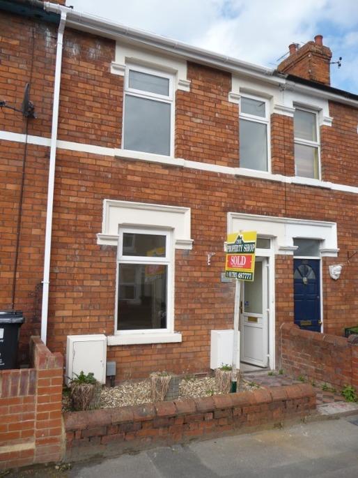
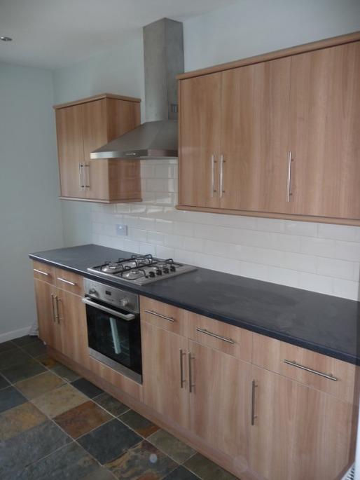
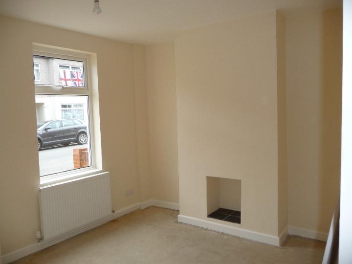
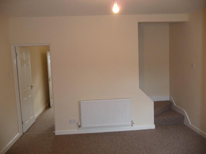
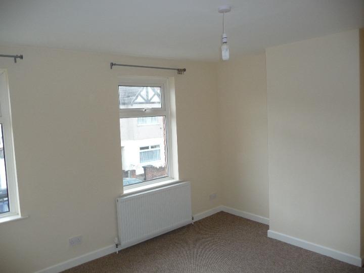
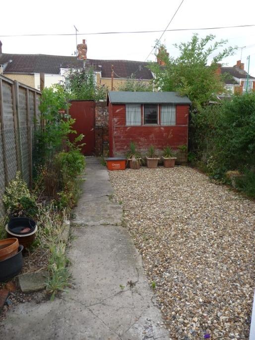
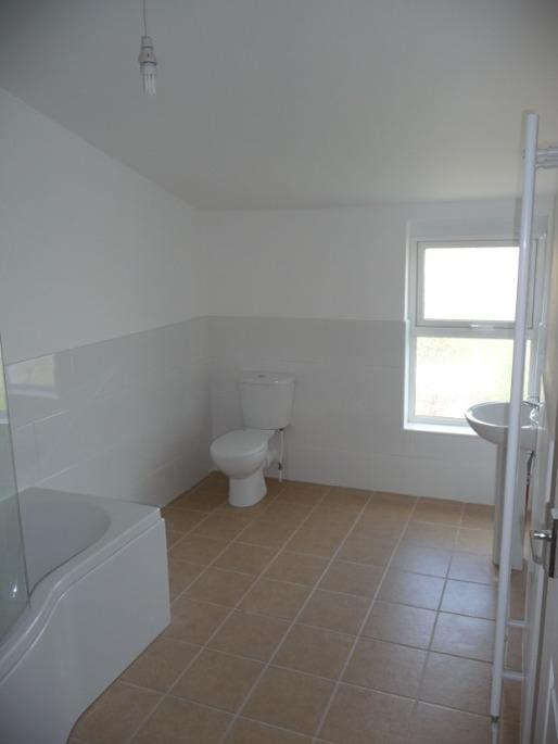
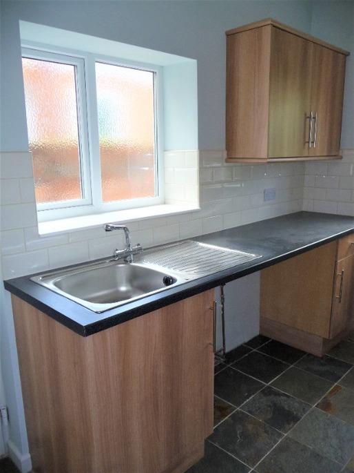
Photo 1 Photo 2 Photo 3 Photo 4 Photo 5 Photo 6 Photo 7 Photo 8
/ 8
Property details
Floor area
81 m²
EPC rating
C
Year built
England and Wales: 1930-1949
Deprivation
Decile 7 (22,415 of 33,755)
Street crime
394 incidents within 1 mile (Apr 2026)
Key features
- Listing Code: 098289
- 2 Bedrooms (1 Double)
- 1 Bathroom
- Has a garden
- Available from: June 7th
- Storage Cupboards
- Parking
Additional details
- Garden
- Yes
Description
Newly decorated 2 bedroom house in quiet, convenient city centre location.
This lovely Victorian mid-terrace house is situated in the popular Rodbourne area. The property is just a short walk from local amenities including the shopping outlet, local restaurants, shops and the train station. It is close to Swindon town centre, with good access to the M4.
The house is unfurnished with a lounge; spacious dining room, kitchen, equipped with an integrated oven and hob. The first floor has two good size double bedrooms and a large family bathroom. Further benefits include uPVC double glazing throughout, gas central heating, an enclosed rear garden and on street parking.
Unfortunately, we cannot accept pets in this property or smokers
The property is available from the 13th November 2021.
Important: There are no Tenant Application Fees, you will be dealing directly with the landlord
Council tax band: B
Listed by
Bristol
Bunk
Reference: 115876760
EPC Rating & Upgrade Cost
Current rating: C
Potential rating: B
Inspection date: 15/12/2025
Expiry date: 14/12/2035
Current heating cost: £803/year
Potential heating cost: £560/year
Est. upgrade cost to C: £17,700
Recommendations
- Cavity wall insulation (£900 - £1,500)
- Floor insulation (solid floor) (£5,000 - £10,000)
- Solar photovoltaic panels, 2.5 kWp (£8,000 - £10,000)
Flood risk
Zone: 1
Risk: Low
Job (default Low)
FENSA Certificates
This property has 2 FENSA certificate(s) on record, indicating window/door installations by FENSA-approved installers.
FENSA Certificate #7455994
Property Details
Street: 119 Montagu Street
Town: SWINDON
Postcode: SN2 2HN
Installation Details
Items: 2 windows
Certificate Issued: 22/06/2010
Work Completed: 11/10/2009
This certificate data was retrieved from FENSA's database
FENSA Certificate #5818729
Property Details
Street: 119 Montagu Street
Town: SWINDON
Postcode: SN2 2HN
Installation Details
Items: 3 windows
Certificate Issued: 28/07/2008
Work Completed: 21/11/2007
This certificate data was retrieved from FENSA's database
What is FENSA? FENSA (Fenestration Self-Assessment Scheme) is a government-authorised scheme that monitors building regulation compliance for replacement windows and doors. Certificates indicate that work was completed by FENSA-approved installers.
Rental Range
Estimated market rent for Swindon. Low = conservative, Realistic = average, Optimistic = best case.
Based on Local Authority from postcode lookup → Swindon.
LHA (30th percentile) floor for Swindon: £783/mo (Apr 2025 – Mar 2026)
Location
Nearby
Nearest stations, universities and amenities (distance from property).
| Type | Name | Distance |
|---|---|---|
| Shop | Morrison Food And Wine | 0.1 miles |
| Bus stop | Meadow Road | 0.2 miles |
| Shop | Home Bargains | 0.2 miles |
| Bus stop | B&Q | 0.3 miles |
| University | Oxford Brookes University - Swindon Campus | 0.5 miles |
| University | Royal Agricultural University (Cultural Heritage Institute) | 0.7 miles |
| Train station | Swindon | 0.9 miles |
| Hospital | Marlborough House | 1.1 miles |
| Train station | Taw Valley Halt | 2.2 miles |
| Hospital | The Ridgeway Hospital | 2.9 miles |
Street-level crime
| Category | Count |
|---|---|
| Violence and sexual offences | 103 |
| Anti-social behaviour | 72 |
| Shoplifting | 44 |
| Criminal damage and arson | 42 |
| Vehicle crime | 41 |
| Public order | 25 |
| Other theft | 19 |
| Drugs | 12 |
| Bicycle theft | 9 |
| Burglary | 8 |
| Robbery | 7 |
| Other crime | 5 |
| Possession of weapons | 4 |
| Theft from the person | 3 |
| Total incidents | 394 |
Within 1 mile during Apr 2026. Source: data.police.uk (England & Wales).
Schools nearby
Nearest open schools with Ofsted ratings (England). Closed schools are not shown. Data from Get Information about Schools and Ofsted.
| Name | Type | Distance | Ofsted |
|---|---|---|---|
| Even Swindon Primary School | Primary | 0.2 miles | Good — 9 Jan 2015 |
| UTC Swindon | Secondary | 0.6 miles | Requires improvement — 25 Jun 2024 |
| Robert Le Kyng Primary School | Primary | 0.6 miles | Good — 12 Oct 2011 |
| Westlea Primary School | Primary | 0.8 miles | Good — 18 Jul 2023 |
| Ferndale Primary School & Nursery | Primary | 0.8 miles | Good — 28 Feb 2014 |
Rental Comparables
Residential lets from OpenRent and Rightmove for the area (same bedroom count). Use to validate rent estimates. Student lets are excluded.
| Title | Rent | Beds | Distance | As seen on |
|---|---|---|---|---|
| 2 Bed Flat, Wiltshire Court, SN1 | £1,050/mo | 2 | 0.86 miles | OpenRent |
Average rent: £1,050/mo (1 listing)