16 AVENUE ROAD
LONDON, HIGHGATE, GREATER LONDON N6 5DW
£3,358 pcm
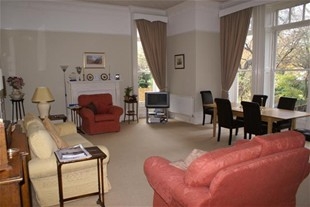
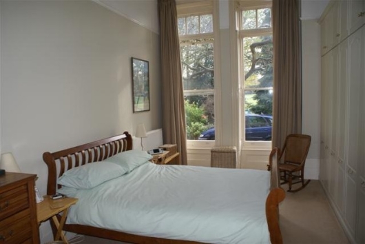
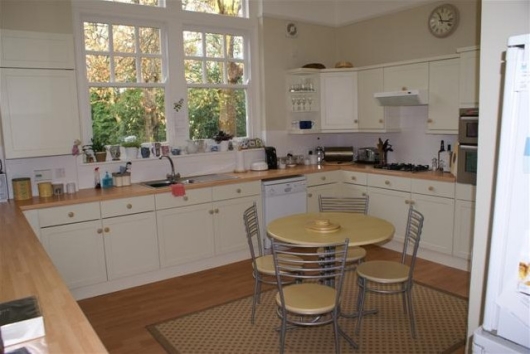
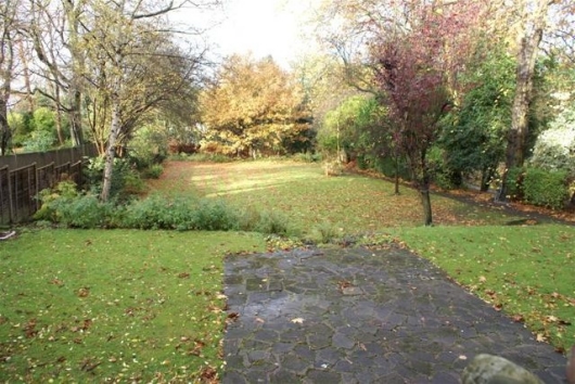
Photo 1 Photo 2 Photo 3 Photo 4
/ 4
Property details
Deprivation
Decile 9 (28,833 of 33,755)
Street crime
817 incidents within 1 mile (Mar 2026)
Key features
- Central Heating
- Garden
- Washing Machine
- Parking
- White Goods
Additional details
- Parking
- Yes
- Garden
- Yes
Description
Listed by
Highgate
Barbara Gibson Properties
Reference: 14656964
EPC Rating & Upgrade Cost
Fetching EPC data… Refresh this page in a moment.
Flood risk
Zone: 1
Risk: Low
Job (default Low)
FENSA Certificates
This property has 1 FENSA certificate(s) on record, indicating window/door installations by FENSA-approved installers.
FENSA Certificate #11395241
Property Details
Street: 16 Avenue Road
Town: LONDON
Postcode: N6 5DW
Installation Details
Items: 3 windows
Certificate Issued: 04/01/2016
Work Completed: 02/11/2015
This certificate data was retrieved from FENSA's database
What is FENSA? FENSA (Fenestration Self-Assessment Scheme) is a government-authorised scheme that monitors building regulation compliance for replacement windows and doors. Certificates indicate that work was completed by FENSA-approved installers.
Rental Range
Estimated market rent for Haringey. Low = conservative, Realistic = average, Optimistic = best case.
Based on Local Authority from postcode lookup → Haringey.
LHA (30th percentile) floor for Huntingdon: £947/mo (Apr 2025 – Mar 2026)
Location
Nearby
Nearest stations, universities and amenities (distance from property).
| Type | Name | Distance |
|---|---|---|
| Bus stop | Hornsey Lane | 0.2 miles |
| Shop | Londis | 0.2 miles |
| Shop | Rewild | 0.3 miles |
| Train station | Highgate | 0.6 miles |
| Train station | Crouch Hill | 0.7 miles |
| University | Central Belsize Square | 2.6 miles |
| University | Paris Dauphine University - London Campus | 3.2 miles |
| Hospital | Moorfields at Hoxton | 3.3 miles |
| Hospital | Proton International @ UCLH | 3.6 miles |
Street-level crime
| Category | Count |
|---|---|
| Anti-social behaviour | 215 |
| Violence and sexual offences | 215 |
| Vehicle crime | 64 |
| Public order | 57 |
| Shoplifting | 56 |
| Other theft | 49 |
| Burglary | 40 |
| Criminal damage and arson | 34 |
| Theft from the person | 28 |
| Robbery | 25 |
| Drugs | 14 |
| Bicycle theft | 9 |
| Possession of weapons | 8 |
| Other crime | 3 |
| Total incidents | 817 |
Within 1 mile during Mar 2026. Source: data.police.uk (England & Wales).
Schools nearby
Nearest open schools with Ofsted ratings (England). Closed schools are not shown. Data from Get Information about Schools and Ofsted.
| Name | Type | Distance | Ofsted |
|---|---|---|---|
| Coleridge Primary School | Primary | 0.2 miles | Outstanding — 20 Apr 2015 |
| Whitehall Park School | Primary | 0.3 miles | Good — 24 May 2017 |
| Ashmount Primary School | Primary | 0.3 miles | Good — 9 Jul 2023 |
| Margaret McMillan Nursery School | Nursery | 0.3 miles | Good — 4 Mar 2013 |
| Kestrel House School | Other | 0.4 miles | Outstanding — 25 May 2023 |
Rental Comparables
Residential lets from OpenRent and Rightmove for the area (same bedroom count). Use to validate rent estimates. Student lets are excluded.
| Title | Rent | Beds | Distance | As seen on |
|---|---|---|---|---|
| 3 Bed Flat, Crescent Road, N8 | £2,950/mo | 3 | 0.11 miles | OpenRent |
| 3 Bed Flat, Hazellville Road, N19 | £3,000/mo | 3 | 0.3 miles | OpenRent |
| 3 Bed End Terrace, Jessie Blythe Lane, N19 | £2,500/mo | 3 | 0.4 miles | OpenRent |
| 3 Bed Flat, Crouch Hill, N4 | £2,600/mo | 3 | 0.5 miles | OpenRent |
| 3 Bed Flat, Archway, N19 | £2,950/mo | 3 | 0.57 miles | OpenRent |
Average rent: £2,800/mo (5 listings)