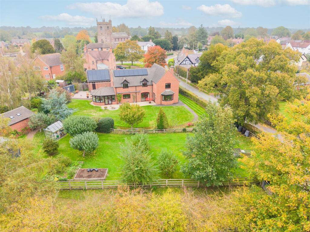
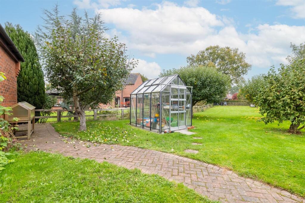
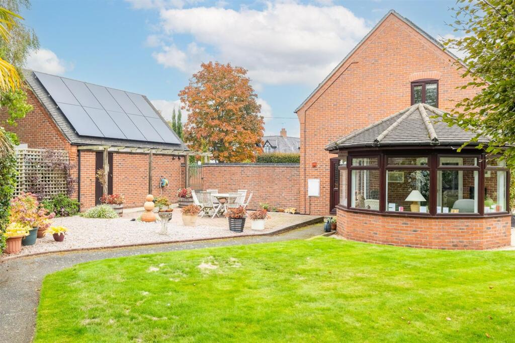
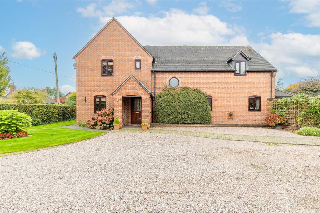
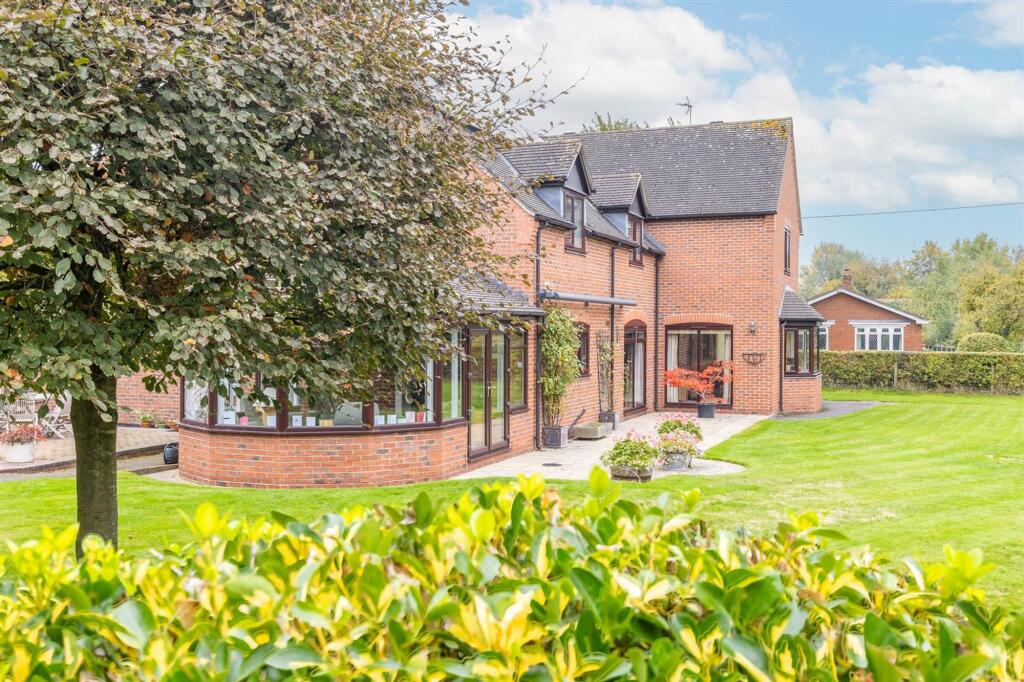
South End
NEW ROAD, NANTWICH, WRENBURY, CHESHIRE CW5 8HF

Stonington-2.jpg Stonington-7.jpg Stonington-1.jpg Stonington-25.jpg Stonington-24.jpg Stonington-21.jpg Stonington-44.jpg Stonington-8.jpg Stonington-4.jpg Stonington-6.jpg Stonington-14.jpg Stonington-16.jpg Stonington-19.jpg Stonington-20.jpg Stonington-22.jpg Stonington-23.jpg Stonington-12.jpg
/ 17
Property details
Last sold
£55,000 Apr 1997
Local average
£303,844 (+179.7%)
Deprivation
Decile 5 (15,717 of 33,755)
Street crime
5 incidents within 1 mile (May 2026)
Additional details
- Parking
- Yes
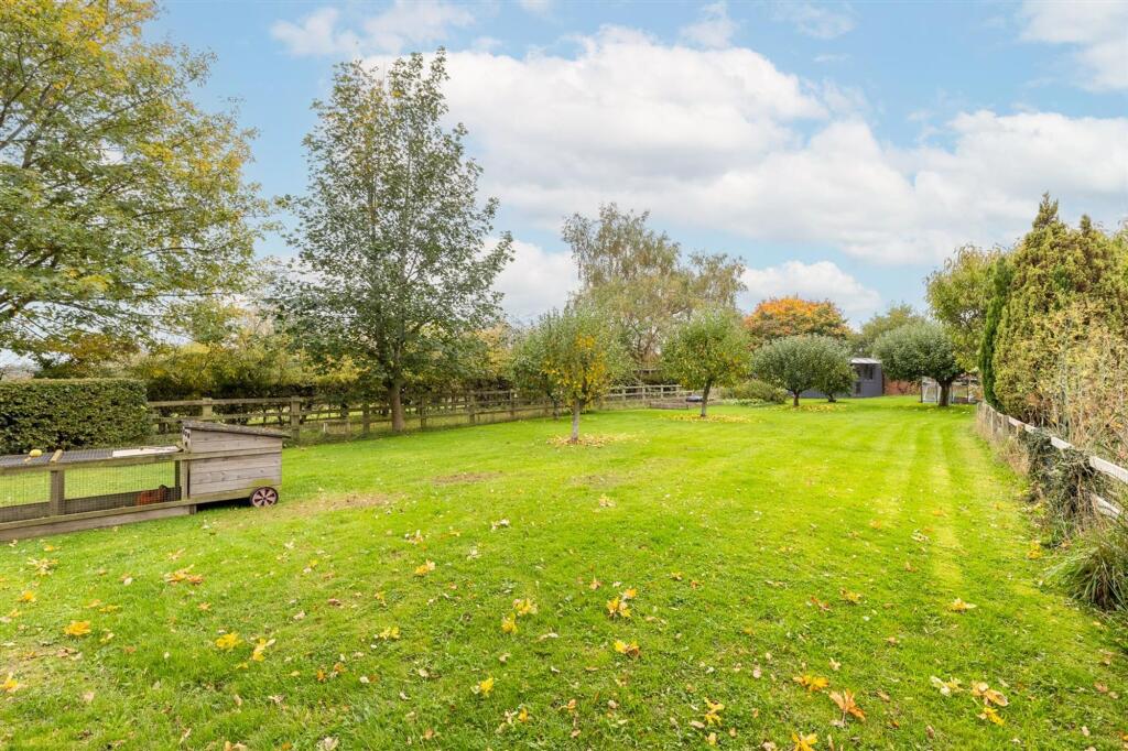
- Garden
- Yes
- Restrictions
- No
- Rights of way
- No
- Flooded in last 5 years
- No
- Flood defences
- No
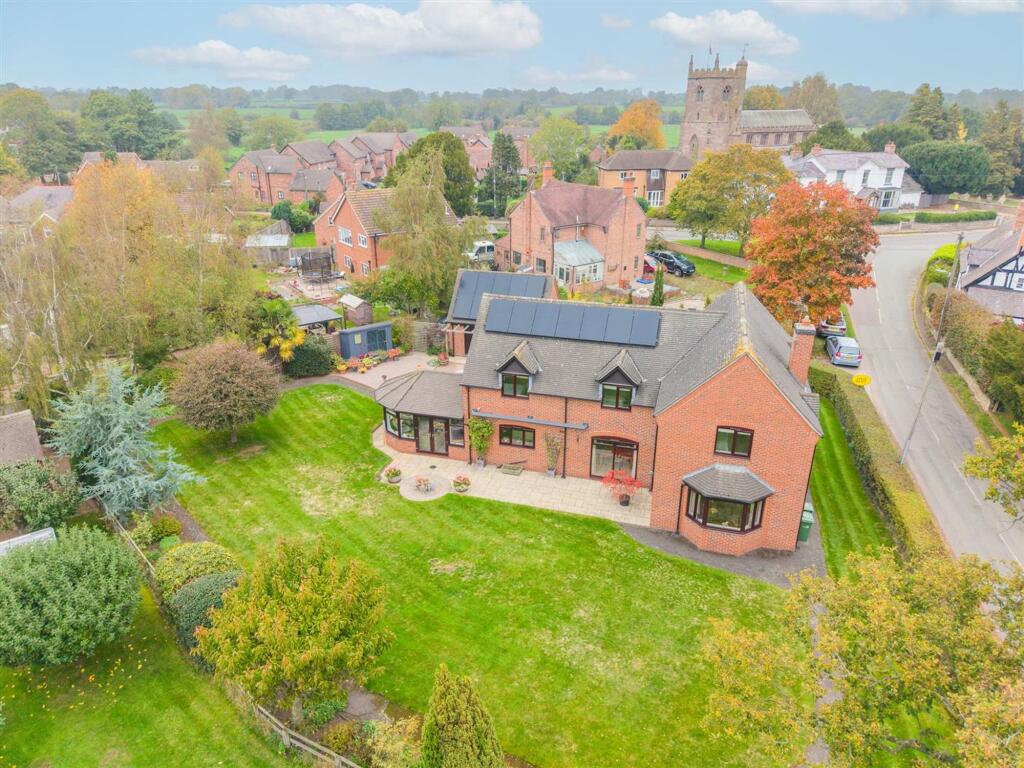
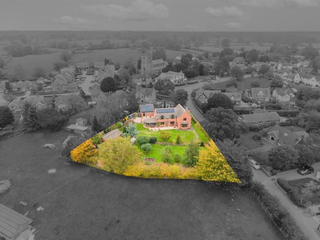
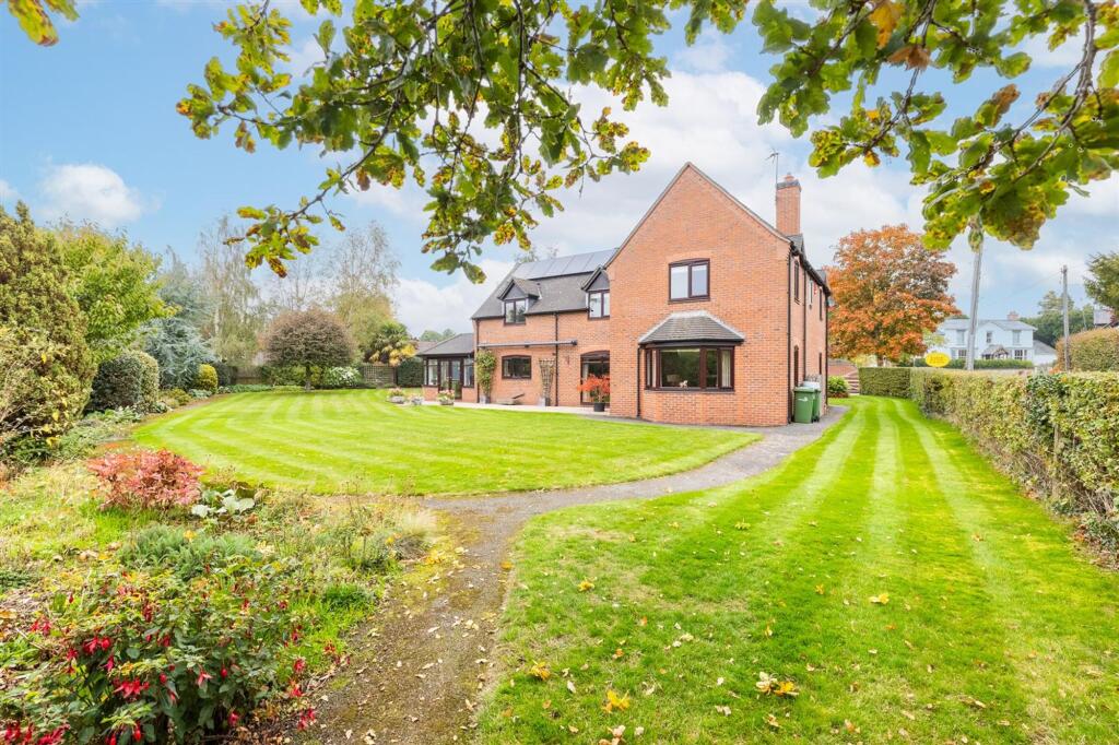
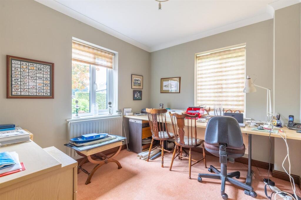
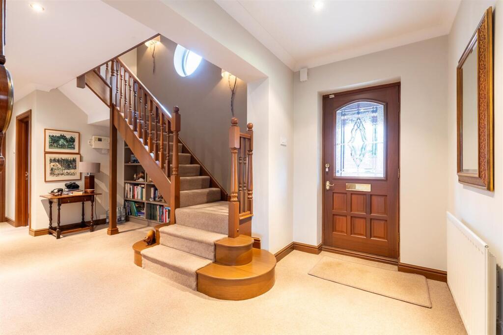
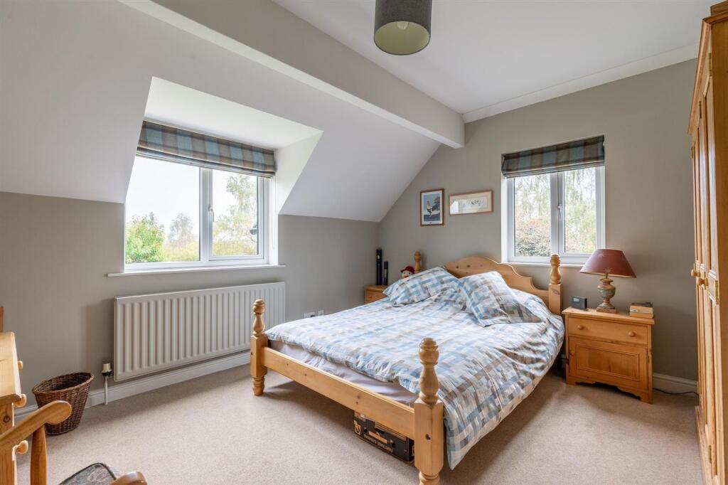
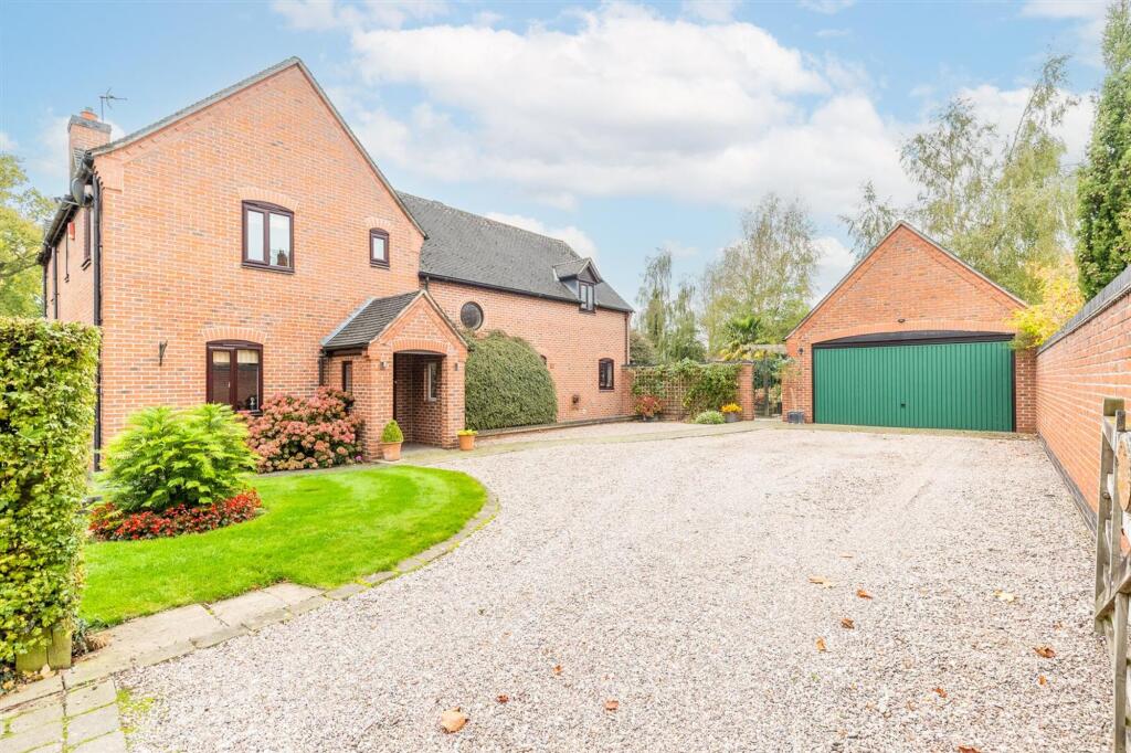
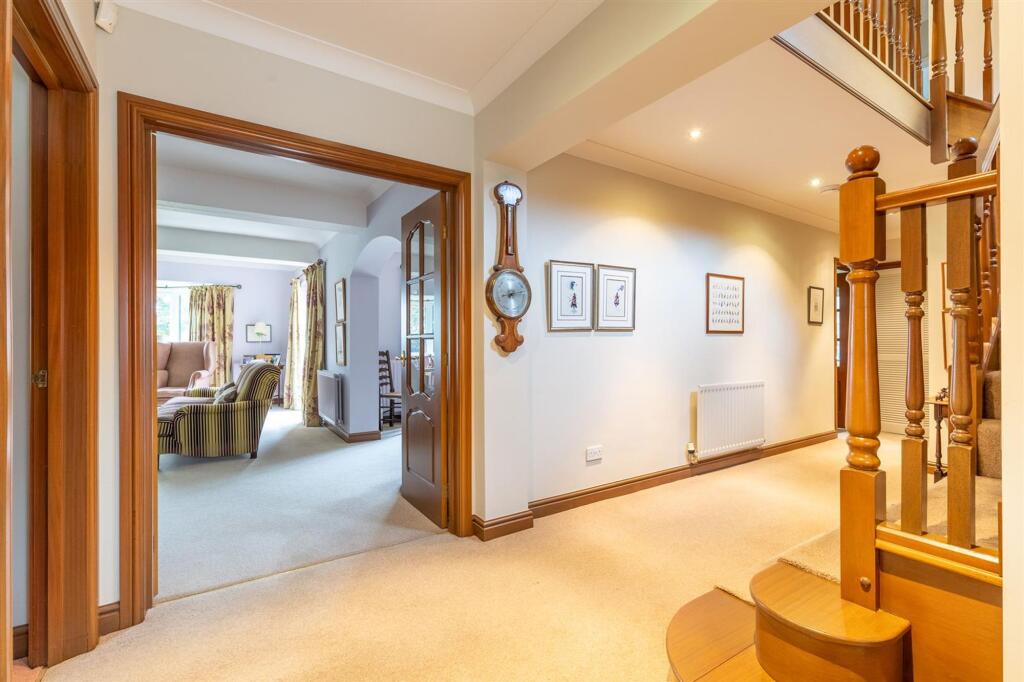
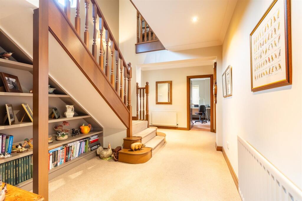
Description
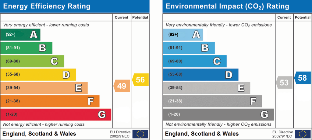
EPC Rating: E
Listed by
Nantwich
Gascoigne Halman - Connells
Reference: 171246638
EPC ratings on this postcode
We don't have a matched EPC for this property yet. Below are efficiency scores and details for other addresses on this postcode.
| Address | Current | Potential | Floor area | Age band | Type |
|---|---|---|---|---|---|
| Hazel Dene, New Road, Wrenbury | 58 | 77 | 97 m² | England and Wales: 1930-1949 | Bungalow |
| Hazel Dene, New Road, Wrenbury, NANTWICH | 58 | 77 | 97 m² | England and Wales: 1930-1949 | Detached |
| Ridgeway, New Road, Wrenbury | 51 | 69 | 99 m² | England and Wales: 1930-1949 | Bungalow |
| Ridgeway, New Road, Wrenbury, NANTWICH | 51 | 69 | 99 m² | England and Wales: 1930-1949 | Detached |
| Rose Glen, New Road, Wrenbury | 40 | 85 | 93 m² | England and Wales: 1930-1949 | House |
| Rose Glen, New Road, Wrenbury | 43 | 58 | 91 m² | England and Wales: 1900-1929 | House |
| Rose Glen, New Road, Wrenbury, NANTWICH | 43 | 58 | 91 m² | England and Wales: 1900-1929 | Detached |
| Rose Glen, New Road, Wrenbury, NANTWICH | 40 | 85 | 93 m² | England and Wales: 1930-1949 | Detached |
| Springfield, New Road, Wrenbury | 47 | 87 | 92 m² | England and Wales: 1930-1949 | House |
| Springfield, New Road, Wrenbury, NANTWICH | 47 | 87 | 92 m² | England and Wales: 1930-1949 | Detached |
| Stonington, New Road, Wrenbury | 49 | 56 | 240 m² | England and Wales: 1991-1995 | House |
| Stonington, New Road, Wrenbury, NANTWICH | 49 | 56 | 240 m² | England and Wales: 1991-1995 | Detached |
| Wayside, New Road, Wrenbury | 65 | 83 | 130 m² | England and Wales: 1950-1966 | Bungalow |
| Wayside, New Road, Wrenbury, NANTWICH | 65 | 83 | 130 m² | England and Wales: 1950-1966 | Detached |
| Yew Tree Lodge, New Road, Wrenbury | 40 | 59 | 124 m² | England and Wales: 1967-1975 | Bungalow |
Flood risk
Zone: 1
Risk: Low
Job (default Low)
Floorplans
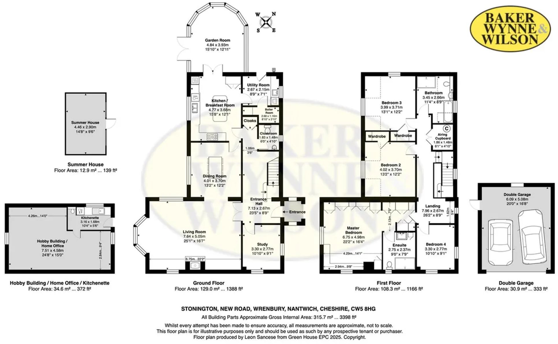
All
EPC Graphs
EPC 1
Price history
| Event | Date | Price | % change |
|---|---|---|---|
| Listed for sale | — | £850,000 | +1445.5% |
| Sold | 04/04/1997 (29 years ago) | £55,000 | — |
Source: HM Land Registry Price Paid Data. Crown copyright.
Sold Comparables
Same street and nearby sales within 0.25 miles (last 5 years). Data from Land Registry Price Paid.
| Address | Price | Date | Type |
|---|---|---|---|
| 28 PINSLEY VIEW, WRENBURY, NANTWICH, CHESHIRE EAST, CW5 8HP | £275,000 | 21/10/2022 | Other |
Area average: £275,000 (1 sale)
Capital growth trend
Land Registry outcode average: last 12 months vs 5y and 10y ago (from sold prices).
House Price Index (HM Land Registry — official index, not sold-price averages): Cheshire East. Series: All dwelling types. As of April 2026.
Rental Range
Estimated market rent for Cheshire East. Low = conservative, Realistic = average, Optimistic = best case.
Based on Local Authority from postcode lookup → Cheshire East.
LHA (30th percentile) floor for Bolton and Bury: £947/mo (Apr 2025 – Mar 2026)
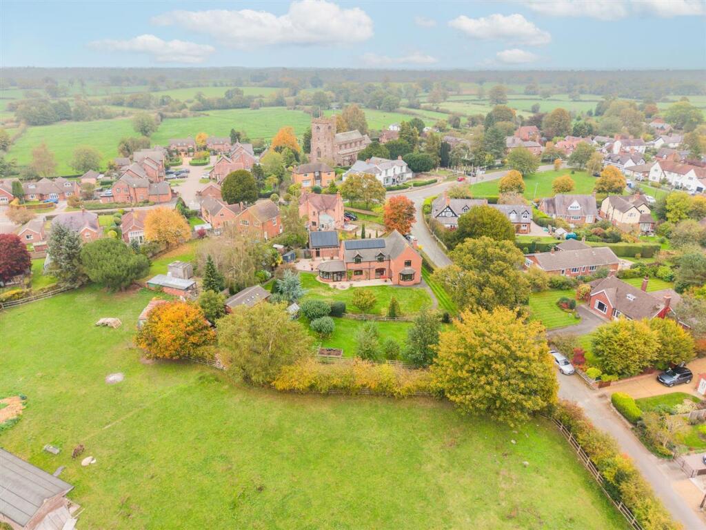
Location
Address
New Road
Nearby
Nearest stations, universities and amenities (distance from property).
| Type | Name | Distance |
|---|---|---|
| Bus stop | Wrenbury, Nantwich Road / St Margaret's Church | 0.1 miles |
| Shop | Wenbury Village Stores | 0.1 miles |
| Shop | Unknown | 0.3 miles |
| Train station | Wrenbury | 0.7 miles |
| Train station | Nantwich | 4.6 miles |
| Hospital | Whitchurch Community Hospital | 4.7 miles |
| Hospital | Leighton Hospital | 8.5 miles |
| University | University of Buckingham Crewe Campus | 9.1 miles |
Street-level crime
| Category | Count |
|---|---|
| Violence and sexual offences | 4 |
| Possession of weapons | 1 |
| Total incidents | 5 |
Within 1 mile during May 2026. Source: data.police.uk (England & Wales).
Schools nearby
Nearest open schools with Ofsted ratings (England). Closed schools are not shown. Data from Get Information about Schools and Ofsted.
| Name | Type | Distance | Ofsted |
|---|---|---|---|
| Wrenbury Primary School | Primary | 0.3 miles | Good — 6 Mar 2018 |
| Sound and District Primary School | Primary | 2.3 miles | Good — 24 Apr 2024 |
| Acton Church of England Primary Academy | Primary | 4.2 miles | Good — 22 Nov 2023 |
| Whitchurch CofE Junior Academy | Primary | 4.7 miles | Good — 18 Sep 2023 |
| Whitchurch CofE Infant and Nursery Academy | Primary | 4.9 miles | Good — 1 Jul 2013 |
Rental Comparables
Loading rental comparables for this postcode. Refresh in a few minutes.
Rent-driven metrics
Based on Area rent estimate.
- Rent ratio — Monthly rent ÷ purchase price (1% rule). 1%+ = strong, 0.8–1% = okay, <0.8% = weak for cashflow.
- Max investor price — Rent ÷ 0.8%; the price at which rent would be 0.8% of price (Stoke-style target).
- Target investor price — Rent ÷ 1%; the price at which rent would be 1% of price (strong cashflow band).
- Gross yield — Annual rent as % of purchase price (no costs).
Enter House Number
Enter the house number to help us retrieve more accurate pricing history and property data.
Please log in to submit or correct the house number for this listing.
Log in to continue