Avondale Circle
Stafford, ST18, ST18 0YZ
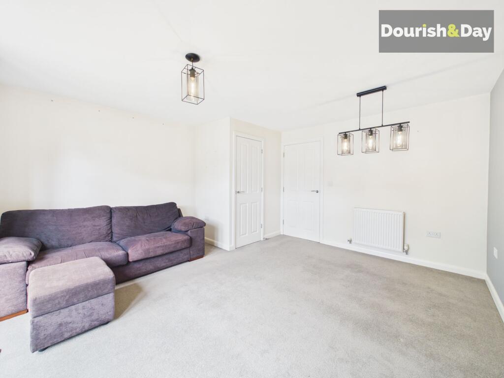
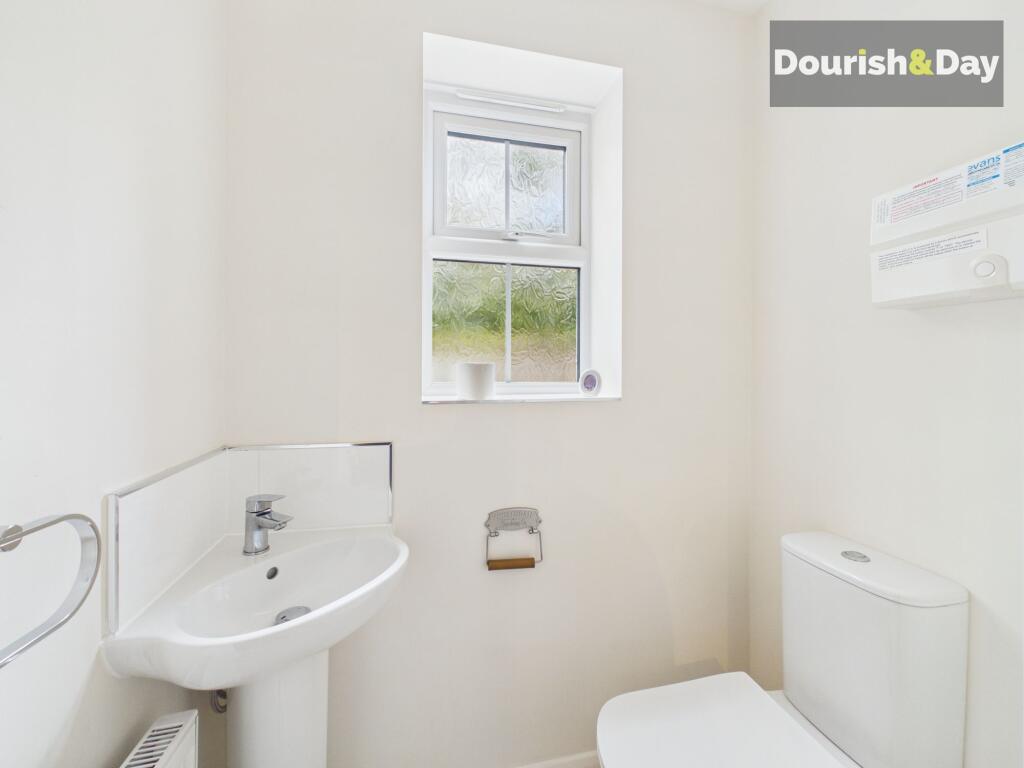
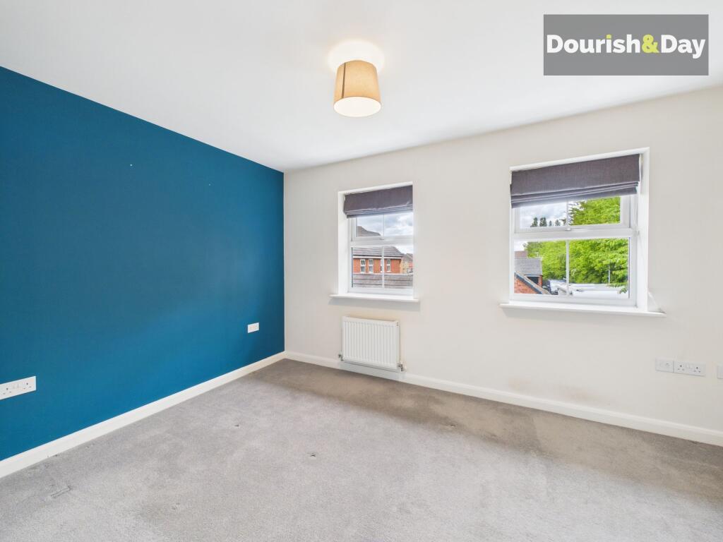
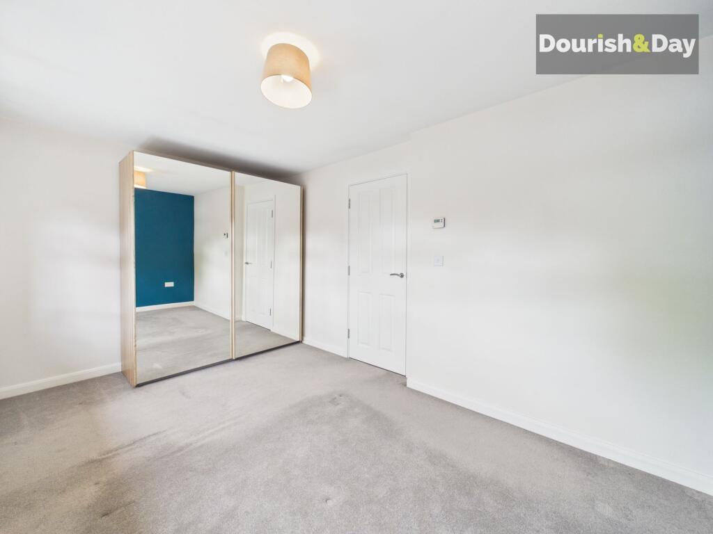
Property details
Tenure
FREEHOLD
Council tax band
C
Last sold
£175,000
Local average
£366,875 (-41.4%)
Street crime
46 incidents within 1 mile (Aug 2026)
Key features
- Modern Two Bedroom Property
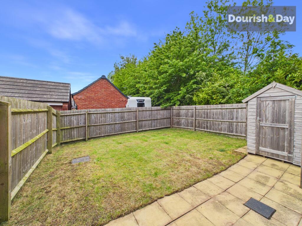
- Private Low Maintenance Rear Garden & Driveway
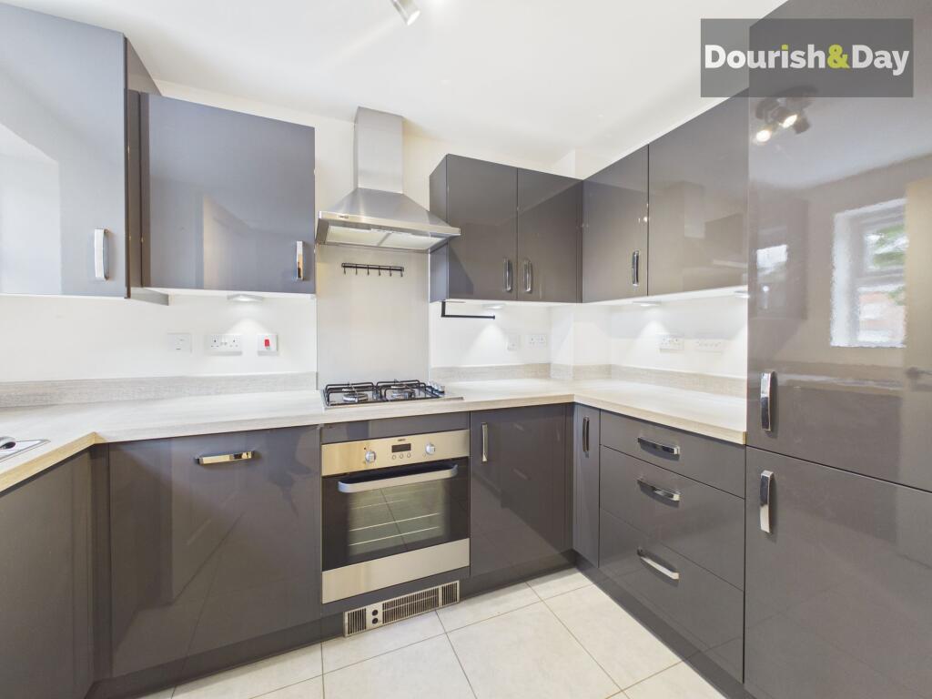
- Fitted Kitchen With Integrated Appliances
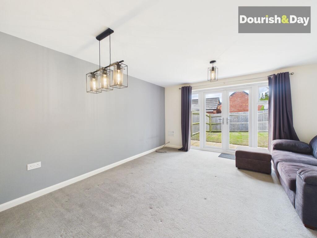
- Open Living / Dining Room
- Guest WC & Family Bathroom
- No Upward Chain
Additional details
- Electricity
- Mains supply
- Broadband
- FTTP (fibre to the premises)
- Water
- Mains supply
- Sewerage
- Mains supply
- Heating
- Gas central
- Parking
- Yes
- Garden
- Front garden, Rear garden
- Listed property
- No
- Restrictions
- No
- Required access
- No
- Rights of way
- No
- Flooded in last 5 years
- No
- Flood defences
- No
Description
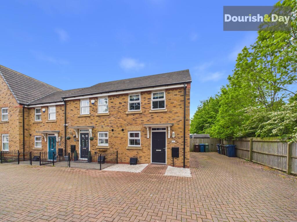
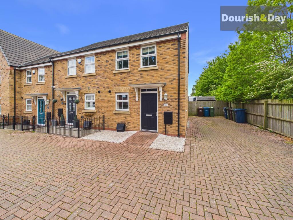
If you feel like you are running around in circles on your search for your next home then head straight to Avondale Circle as we have what you will be looking for! This well-presented home is located on a modern development just outside Stafford town centre, with shops, commuter links, and the mainline railway station all within easy reach.
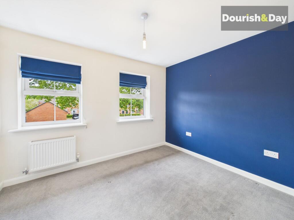
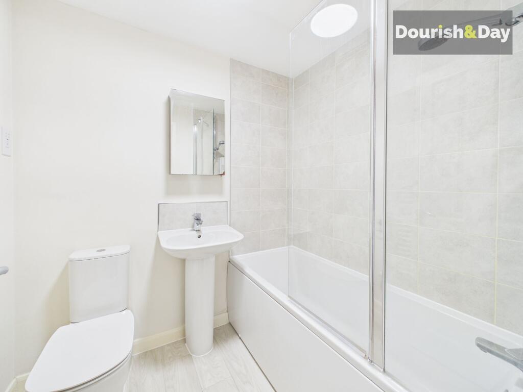
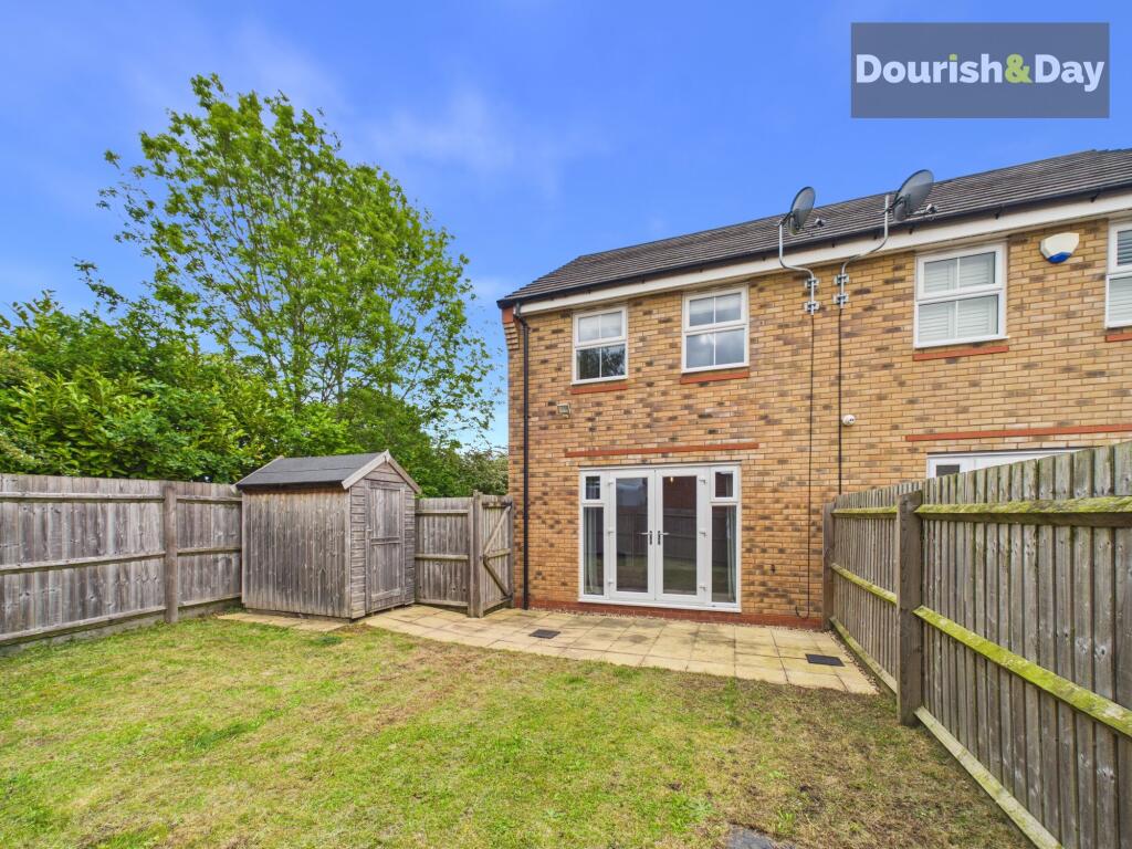
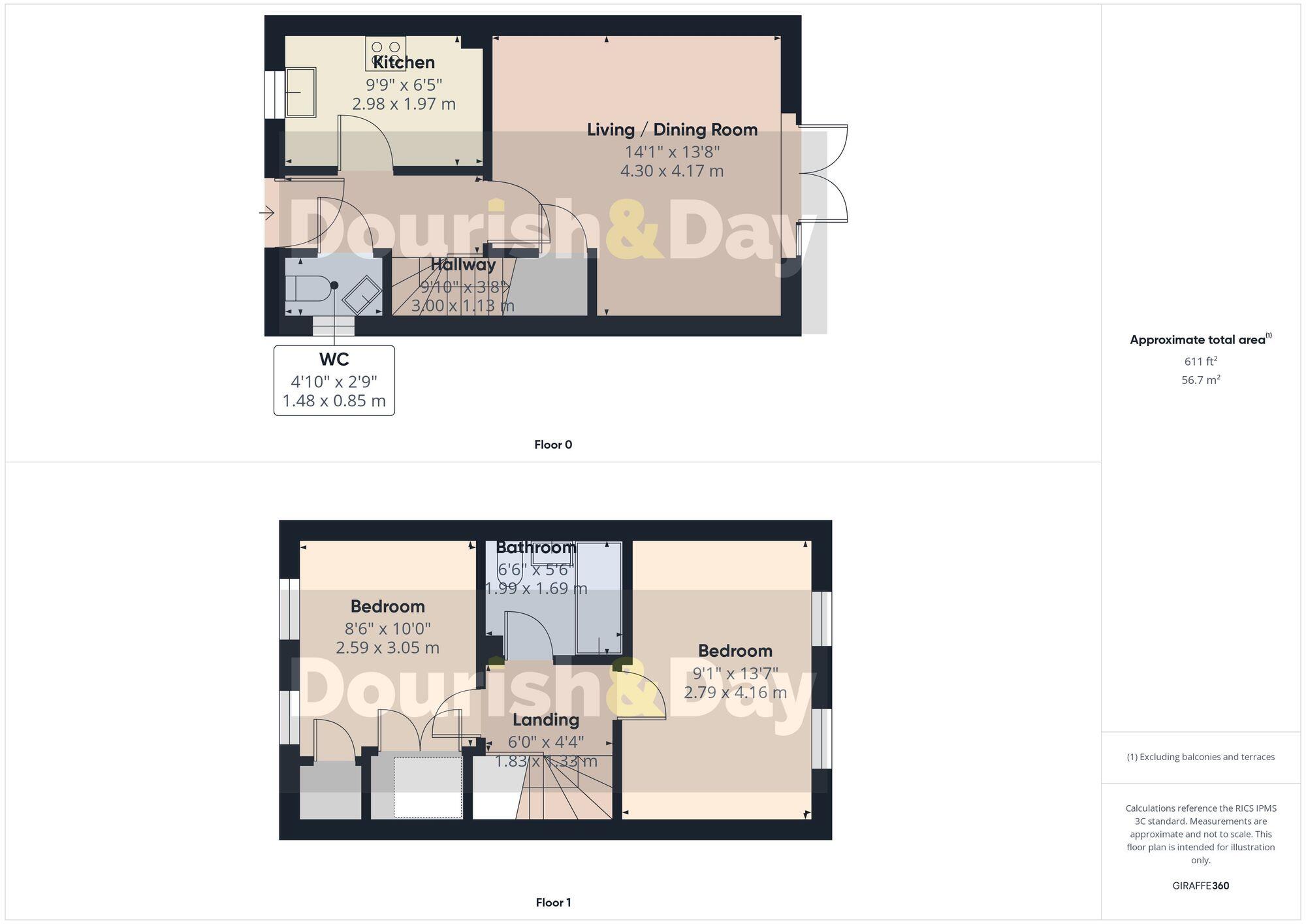
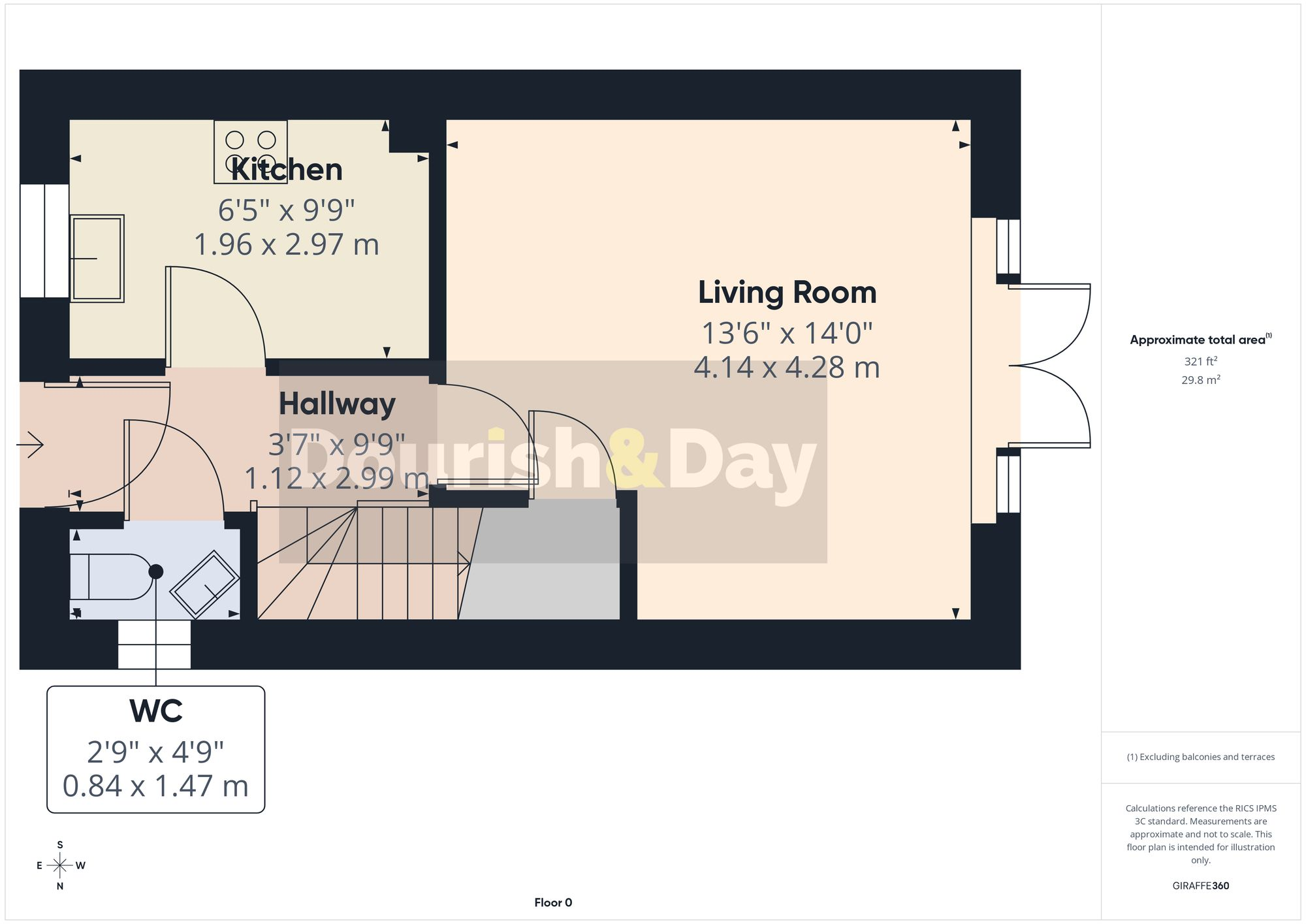
Ideal for a young family or professional couple, the property offers well-planned accommodation comprising an entrance hallway, guest WC, a modern kitchen, and a spacious living/dining room with French doors opening onto the rear garden—perfect for entertaining or relaxing. To the first floor, there are two generously sized double bedrooms and a contemporary family bathroom.
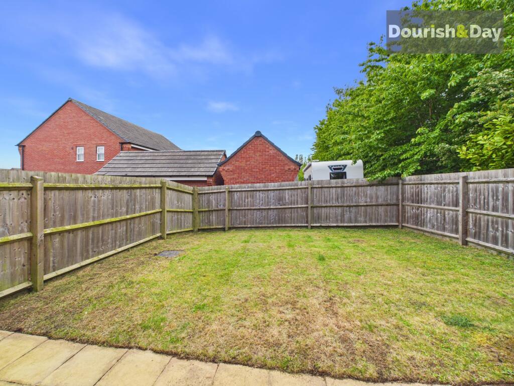
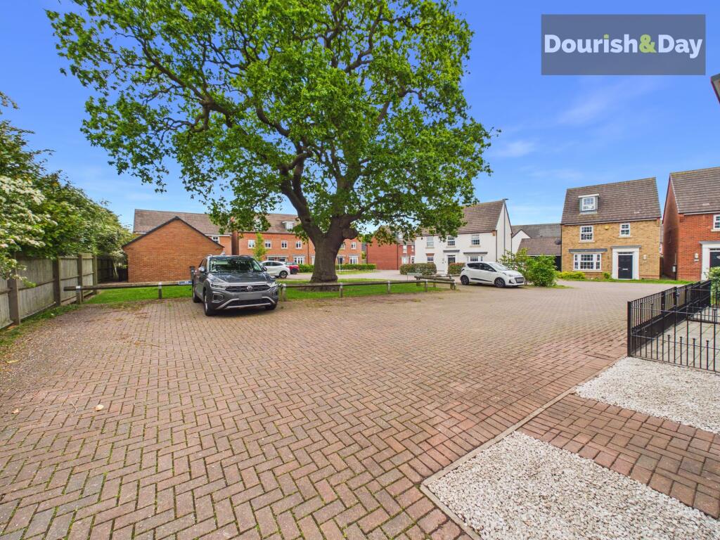
Externally, the property enjoys a quiet position away from the main road of the development, with allocated parking and a private, enclosed rear garden.
Offered with no upward chain, this is a fantastic opportunity to purchase a move-in ready home in a popular and convenient location.
EPC Rating: B
Listed by
Stafford
Dourish & Day
Reference: 166117007
EPC ratings on this postcode
We don't have a matched EPC for this property yet. Below are efficiency scores and details for other addresses on this postcode.
| Address | Current | Potential | Floor area | Age band | Type |
|---|---|---|---|---|---|
| 1, Avondale Circle, STAFFORD | 84 | 93 | 125 m² | — | Detached |
| 11, Avondale Circle, STAFFORD | 85 | 94 | 113 m² | — | Terraced |
| 13, Avondale Circle, STAFFORD | 85 | 95 | 113 m² | — | Terraced |
| 15, Avondale Circle, STAFFORD | 86 | 95 | 113 m² | — | Terraced |
| 17, Avondale Circle, STAFFORD | 84 | 94 | 113 m² | — | Terraced |
| 19, Avondale Circle, STAFFORD | 84 | 95 | 106 m² | — | Detached |
| 21, Avondale Circle, STAFFORD | 84 | 95 | 106 m² | — | Detached |
| 3 Avondale Circle, STAFFORD | 84 | 94 | 115 m² | — | Detached |
| 42, Avondale Circle, STAFFORD | 85 | 94 | 113 m² | — | Detached |
| 46, Avondale Circle, STAFFORD | 84 | 93 | 134 m² | — | Detached |
| 47, Avondale Circle, STAFFORD | 83 | 96 | 78 m² | — | Detached |
| 48, Avondale Circle, STAFFORD | 84 | 93 | 139 m² | — | Detached |
| 49, Avondale Circle, STAFFORD | 83 | 96 | 78 m² | — | Detached |
| 5 Avondale Circle, STAFFORD | 84 | 94 | 115 m² | — | Detached |
| 50, Avondale Circle, STAFFORD | 85 | 93 | 139 m² | — | Detached |
Flood risk
Zone: 1
Risk: Low
Job (default Low)
Registered land (INSPIRE)
This location falls inside an HM Land Registry INSPIRE registered freehold polygon.
Plot: ~227 m² (0.06 acres)
Source: HM Land Registry INSPIRE Index Polygons.
Floorplans
All
Ground Floor
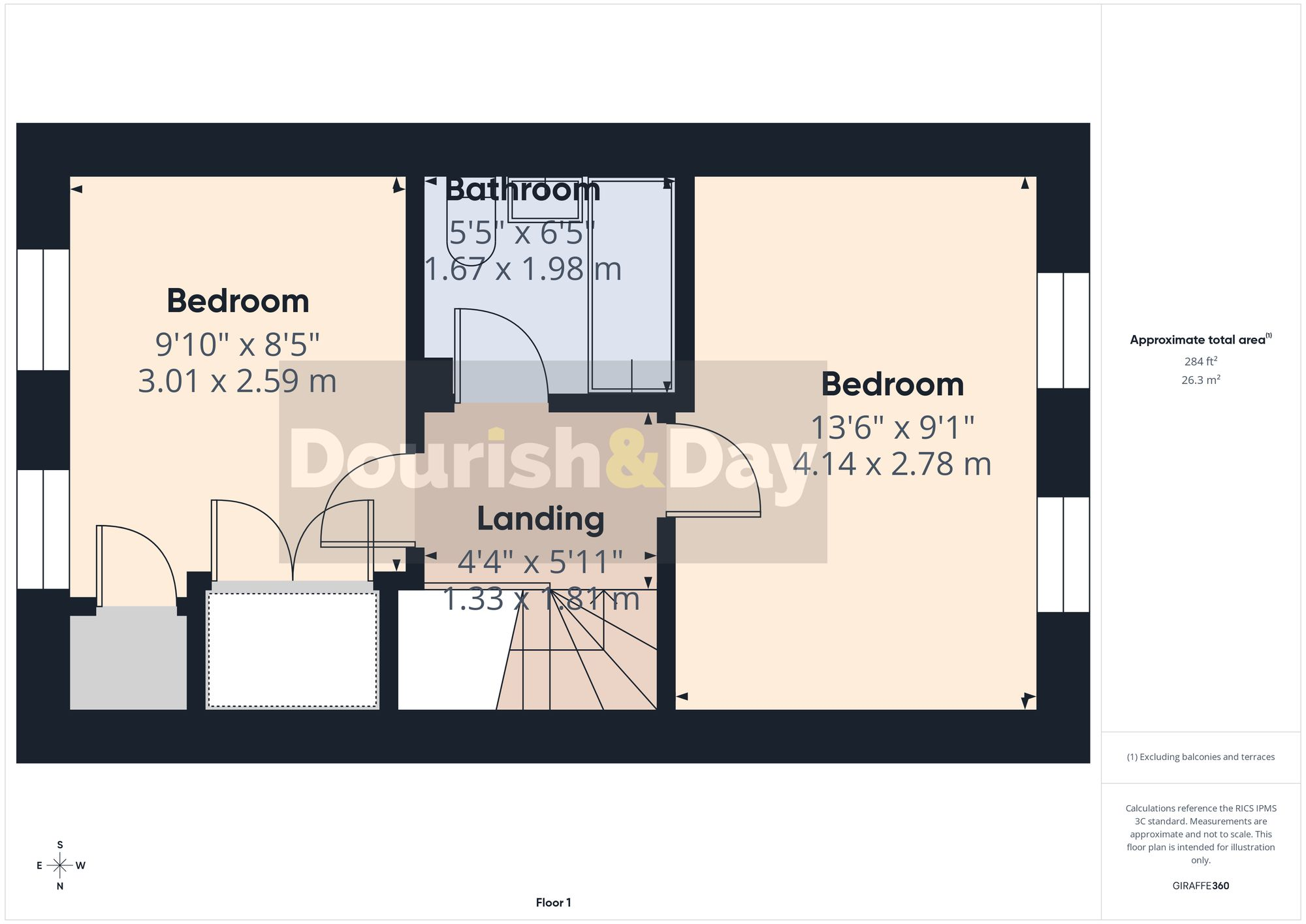
First Floor
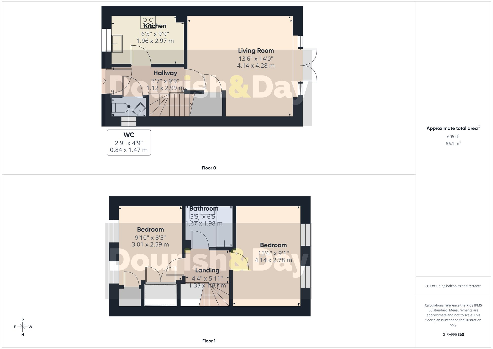
All
EPC Graphs
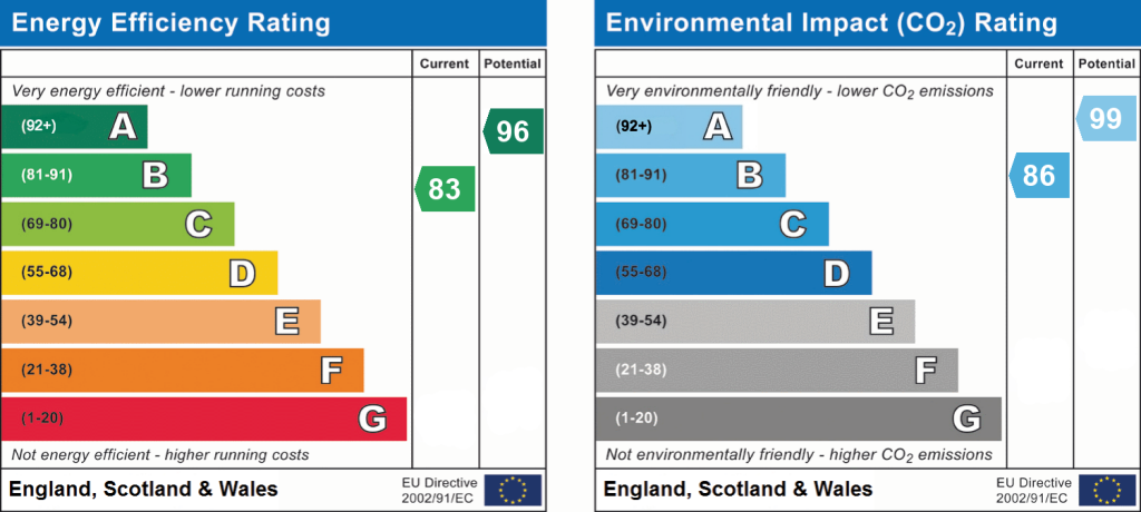
EPC 1
Price history
| Event | Date | Price | % change |
|---|---|---|---|
| Listed for sale | — | £215,000 | — |
Source: HM Land Registry Price Paid Data. Crown copyright.
Sold Comparables
Same street and nearby sales within 0.25 miles (last 5 years). Data from Land Registry Price Paid.
| Address | Price | Date | Type |
|---|---|---|---|
| Same street 23 AVONDALE CIRCLE, STAFFORD, STAFFORDSHIRE, ST18 0YZ | £280,000 | 09/01/2025 | Semi-detached |
| 2 ARCHFORD GARDENS, STAFFORD, STAFFORDSHIRE, ST18 0ZR | £100,000 | 26/05/2023 | Terraced |
| 12 HOLDEN PARK, STAFFORD, STAFFORDSHIRE, ST18 0ZQ | £240,000 | 26/05/2023 | Terraced |
| Same street 21 AVONDALE CIRCLE, STAFFORD, STAFFORDSHIRE, ST18 0YZ | £277,000 | 20/01/2023 | Semi-detached |
| Same street 49 AVONDALE CIRCLE, STAFFORD, STAFFORDSHIRE, ST18 0YZ | £255,000 | 16/12/2022 | Semi-detached |
| 54 NORTHBURGH AVENUE, STAFFORD, STAFFORDSHIRE, ST18 0GW | £90,000 | 21/11/2022 | Terraced |
| Same street 37 AVONDALE CIRCLE, STAFFORD, STAFFORDSHIRE, ST18 0YZ | £260,000 | 17/11/2022 | Semi-detached |
| Same street 29 AVONDALE CIRCLE, STAFFORD, STAFFORDSHIRE, ST18 0YZ | £331,500 | 11/11/2022 | Semi-detached |
| Same street 38 AVONDALE CIRCLE, STAFFORD, STAFFORDSHIRE, ST18 0YZ | £230,000 | 28/10/2022 | Terraced |
| Same street 41 AVONDALE CIRCLE, STAFFORD, STAFFORDSHIRE, ST18 0YZ | £194,000 | 17/10/2022 | Terraced |
| Same street 51 AVONDALE CIRCLE, STAFFORD, STAFFORDSHIRE, ST18 0YZ | £263,000 | 27/09/2022 | Terraced |
| Same street 9 AVONDALE CIRCLE, STAFFORD, STAFFORDSHIRE, ST18 0YZ | £275,000 | 30/06/2022 | Semi-detached |
| 16 HOLDEN PARK, STAFFORD, STAFFORDSHIRE, ST18 0ZQ | £245,000 | 11/02/2022 | Terraced |
| Same street 48 AVONDALE CIRCLE, STAFFORD, STAFFORDSHIRE, ST18 0YZ | £376,000 | 30/11/2021 | Detached |
| Same street 27 AVONDALE CIRCLE, STAFFORD, STAFFORDSHIRE, ST18 0YZ | £260,000 | 27/10/2021 | Semi-detached |
Street average: £272,864 (11 sales)
Area average: £168,750 (4 sales)
Capital growth trend
Land Registry outcode average: last 12 months vs 5y and 10y ago (from sold prices).
House Price Index (HM Land Registry — official index, not sold-price averages): Stafford. Series: Terraced. As of July 2026.
Rental Range
Estimated market rent for Stafford. Low = conservative, Realistic = average, Optimistic = best case.
Based on Local Authority from postcode lookup → Stafford.
LHA (30th percentile) floor for Mid Staffs: £623/mo (Apr 2025 – Mar 2026)
Location
Address
Weston Road
Nearby
Nearest stations, universities and amenities (distance from property).
| Type | Name | Distance |
|---|---|---|
| Bus stop | Staffordshie University | 0.2 miles |
| Bus stop | Staffordshire University | 0.2 miles |
| University | Staffordshire University Centre for Health Innovation | 0.4 miles |
| Shop | TRT MOBILE MECHANICS AND WORKSHOPS | 0.5 miles |
| Hospital | County Hospital | 0.7 miles |
| Shop | Weston Road Launderette | 0.9 miles |
| Hospital | St George's Hospital | 1.3 miles |
| Train station | Stafford | 1.9 miles |
| Train station | Amerton Station | 3.9 miles |
Street-level crime
| Category | Count |
|---|---|
| Violence and sexual offences | 25 |
| Anti-social behaviour | 6 |
| Bicycle theft | 3 |
| Criminal damage and arson | 3 |
| Public order | 3 |
| Other crime | 2 |
| Other theft | 2 |
| Vehicle crime | 2 |
| Total incidents | 46 |
Within 1 mile during Aug 2026. Source: data.police.uk (England & Wales).
Schools nearby
Nearest open schools with Ofsted ratings (England). Closed schools are not shown. Data from Get Information about Schools and Ofsted.
| Name | Type | Distance | Ofsted |
|---|---|---|---|
| Veritas Primary Academy | Primary | 0.3 miles | Good — 21 May 2018 |
| The Weston Road Academy | Secondary | 0.3 miles | Good — 23 Oct 2013 |
| St John's CofE Primary Academy | Primary | 0.6 miles | Good — 15 Jul 2019 |
| St Leonard's Primary School | Primary | 0.9 miles | — (Inspected (no overall grade)) |
| Leasowes Primary School | Primary | 1.2 miles | Outstanding — 13 Mar 2024 |
Rental Comparables
Rental comparables data is not available for this property.
Rent-driven metrics
Based on Area rent estimate.
- Rent ratio — Monthly rent ÷ purchase price (1% rule). 1%+ = strong, 0.8–1% = okay, <0.8% = weak for cashflow.
- Max investor price — Rent ÷ 0.8%; the price at which rent would be 0.8% of price (Stoke-style target).
- Target investor price — Rent ÷ 1%; the price at which rent would be 1% of price (strong cashflow band).
- Gross yield — Annual rent as % of purchase price (no costs).
Enter House Number
Enter the house number to help us retrieve more accurate pricing history and property data.
Please log in to submit or correct the house number for this listing.
Log in to continue