Boylestone
Ashbourne, DE6 5AA
Property details
Tenure
FREEHOLD
Local average
£472,987 (+217.1%)
Deprivation
Decile 6 (18,895 of 33,755)
Street crime
0 incidents within 1 mile (Jun 2026)
Key features
- Rural development opportunity
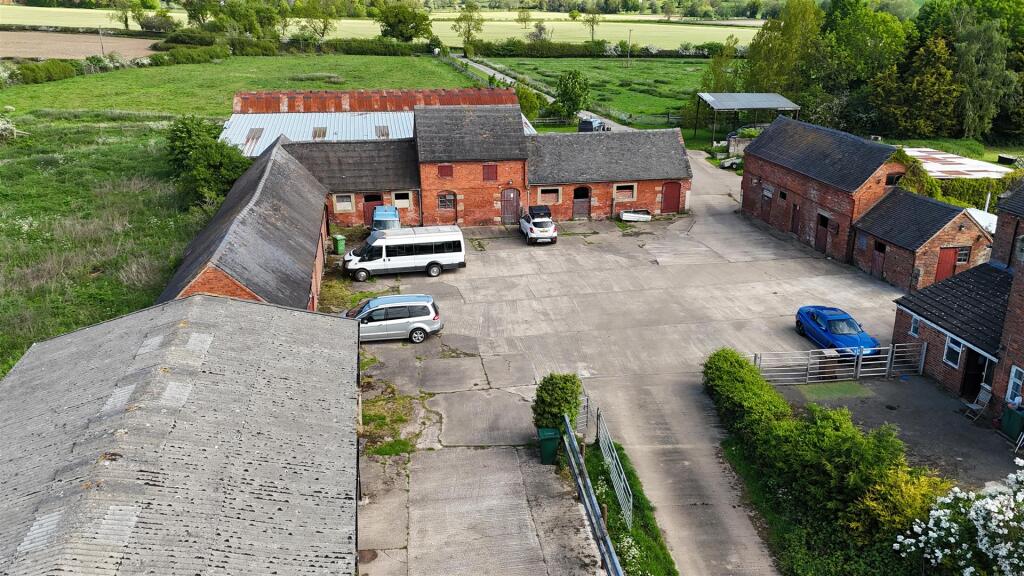
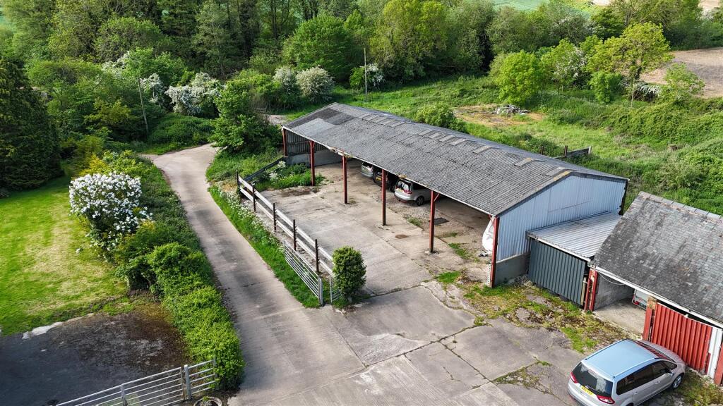
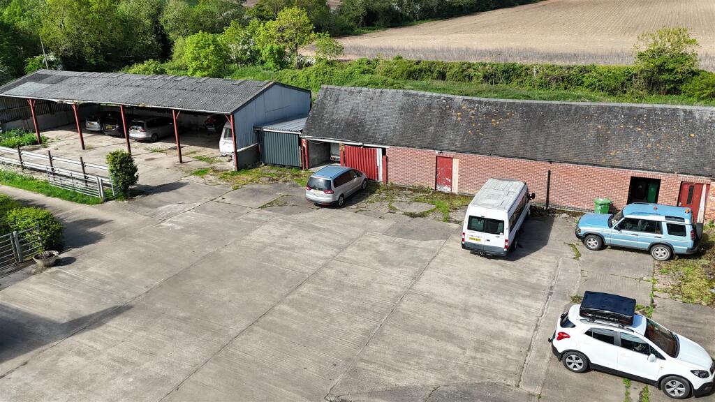
- Class Q planning permission granted for the conversion of agricultural barns into 9 dwellings
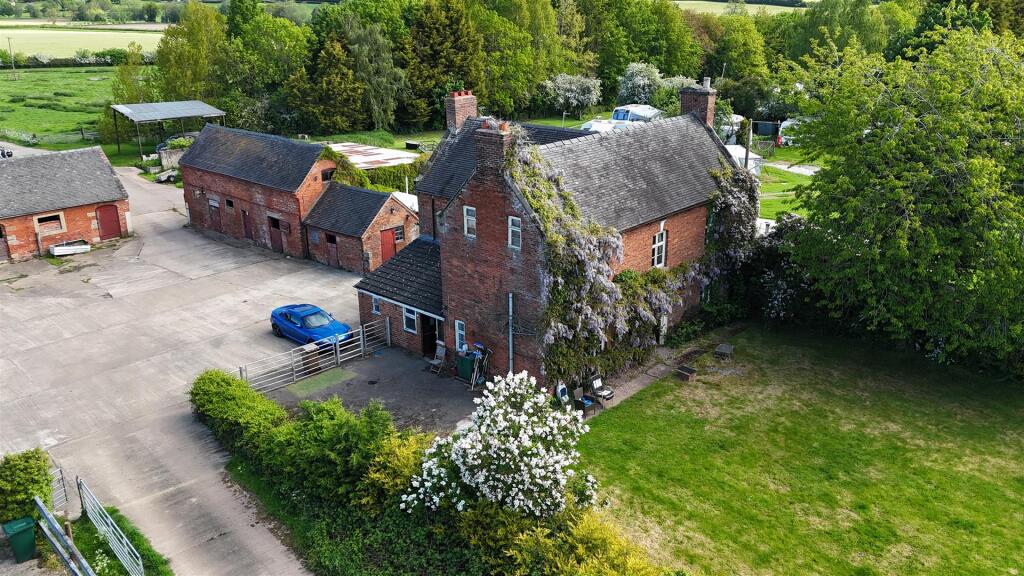
- Atttractive red-brick losted farmhouse requiring modernisation
- Furhter planning application awaiting determination of selected agricultural barns and the erection of five new-build dwellings.
Additional details
- Garden
- Yes
Description
- Class Q planning permission granted for the conversion of agricultural barns into 9 dwellings.
- Attractive listed red-brick farmhouse requiring modernisation.
- Further planning application currently awating determination of selected agricultrual barms and the erection of five new-build dwellings.
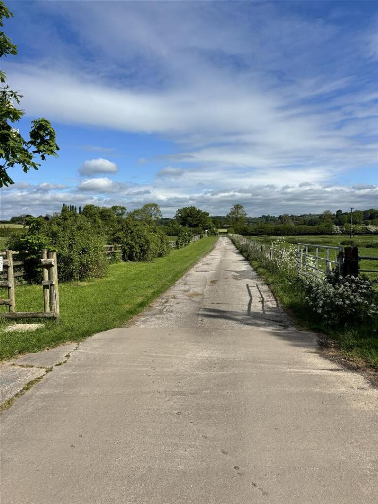
Location - Lees Hall Farm is located within the small village of Harehill, forming part of the civil parish of the sought-after village of Boylestone. The property enjoys a peaceful rural setting whilst remaining conveniently accessible to the nearby market towns of Ashbourne and Uttoxeter, lying approximately 7 miles south of Ashbourne and 10 miles north-west of Uttoxeter. The city of Derby is approximately 16 miles to the east, with these together providing an extensive range of amenities, schools and services.
The larger village of Boylestone, located approximately 1 mile to the south-east, offers a traditional rural community with local amenities nearby, whilst the surrounding area is predominantly agricultural in nature, characterised by rolling countryside, quiet country lanes, public footpaths and bridleways. Good road links are available via the A50 and A515, providing access to the wider Midlands road network.
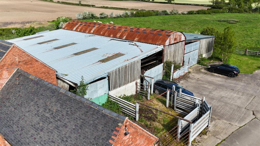
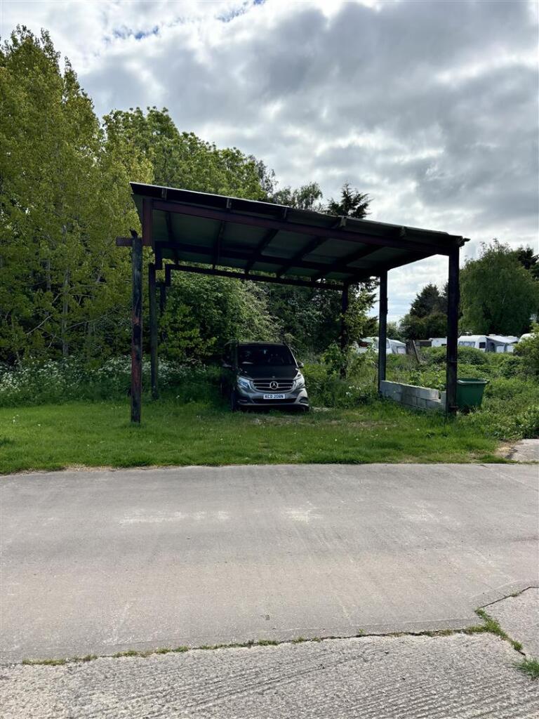
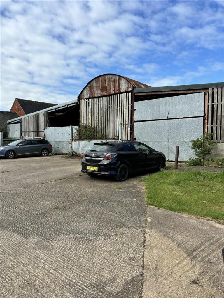
Description - An opportunity to acquire a rural residential development site extending to approximately 3.15 acres (1.27 hectares), comprising a Grade II listed red-brick farmhouse, a substantial range of traditional and modern farm buildings, and an associated yard area, situated in a rolling countryside location in South Derbyshire.
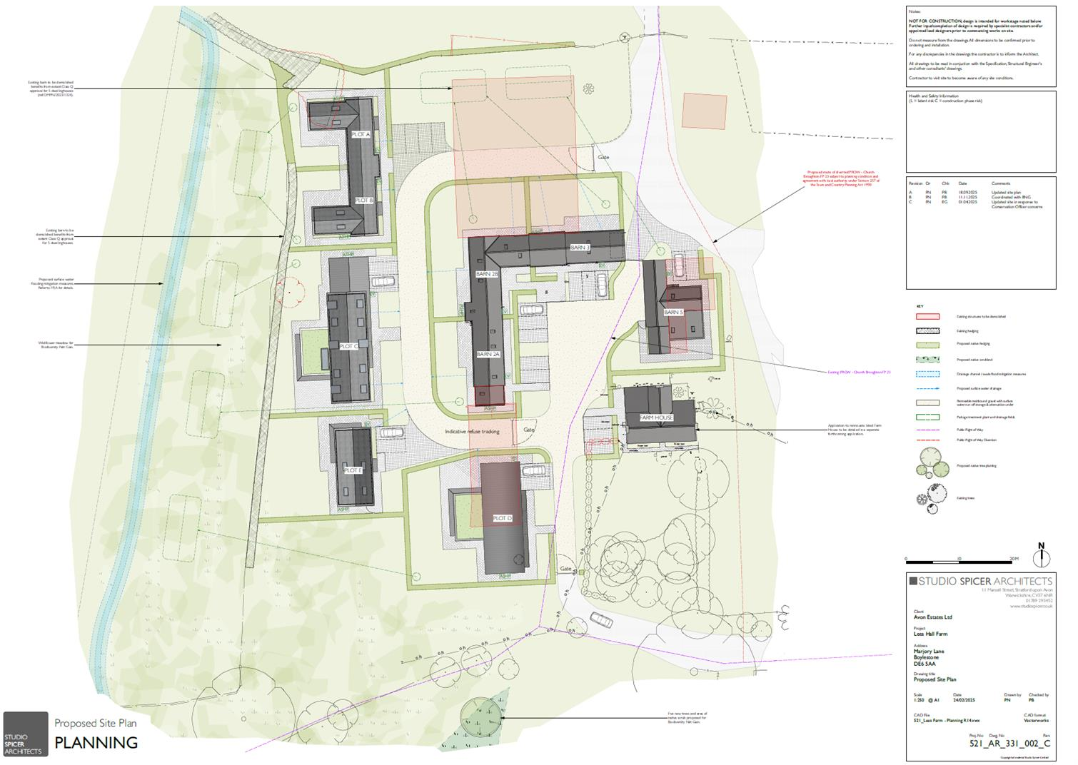
The site offers substantial development potential and benefits from Class Q planning approval for the conversion of existing agricultural buildings into residential units. In addition, a planning application has been submitted seeking consent for the demolition of the existing agricultural buildings and the construction of new residential dwellings.
Situated within open countryside yet conveniently located close to local services and transport links, the property occupies an attractive and accessible rural setting.
Planning Permission - Currently, the site benefits from Class Q planning permission to convert the existing agricultural buildings into 9 dwellings.
Planning Application References:
DMPN/2023/1324 (approval for conversion of into 5 dwellings)
DMPA/2024/1156 (aprpoval for conversion into 4 dwellings)
In addition, there is currently an application submitted to South Derbyshire Local Authority to demolish some of the existing agricultural buildings and built new build dwellings, which is currently awaiting decision:
DMPA/2025/1591 (Demolition of 2 existing agricultural buildings (one of which benefits from prior approval for residential conversion for 5 dwellings ref. DMPN/2023/1324), the change of use, conversion and extension of existing agricultural barns to up to 4 residential dwellings and erection of up to 5 new-build dwellings).
The Farmhouse - The farmhouse has a breadth of retained period features, and benefits from a kitchen, large walk in pantry, WC, storeroom, sitting room and dining room to the ground floor, two double bedrooms with ensuites, one single bedroom, main bathroom, with two further subtantial attic rooms and a third attic room which contains the water tank. The farmhouse has a Gross Internal Area of approximatly 3200 square feet.
Tenure - The property will be sold freehold with vacant possession.
Services - The property is connected to mains electricity, water, gas central heating and a private drainage system.
Viewing - Viewings to be by appointment only. Please contact Eloise Baker or Peter Chennells.
Land Registry - The site is registered with the Land Registry on the below title number:
DY230644 (Part Of)
Method Of Sale - The property is offered for sale via private treaty.
Rights Of Way, Wayleaves And Easements - The agent is not aware of any rights of way, wayleaves or easements. The Property is sold subject to and with the benefit of all rights of way, easements, wayleaves and other rights, whether mentioned in these particulars or not.
Local Planning Authority - The site lies within the South Derbyshire Local Authority.
Further Information - For any further information please contact Eloise Baker or Peter Chennells at the Andrew Granger Rural Office in Loughborough:
Peter Chennells
Tel:
E-mail: peter.
Eloise Baker
Tel:
E-mail: eloise.
Disclaimer - These particulars are intended as a guide only and do not form part of any contract. All descriptions, plans, dimensions and other details are given in good faith but should not be relied upon as statements of fact. Prospective purchasers must satisfy themselves as to their accuracy by inspection or otherwise. The Property is offered subject to contract, prior sale and withdrawal without notice.
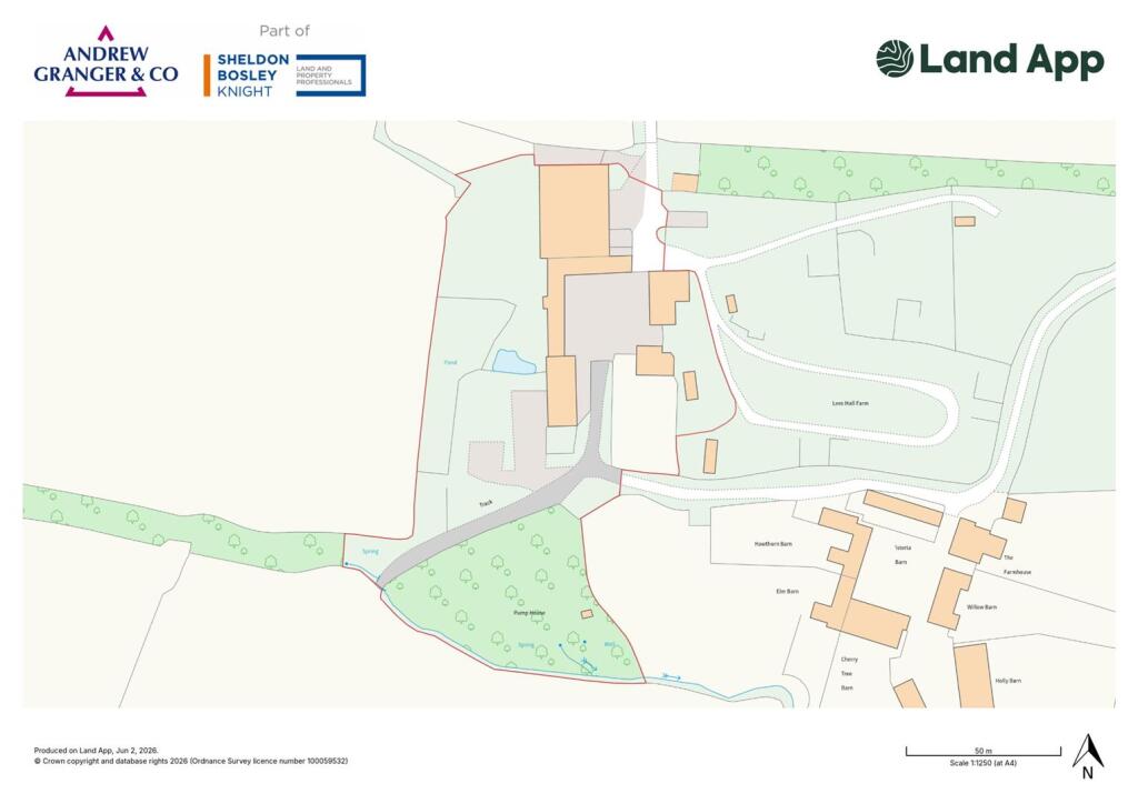
Plan - The plan with red lines are based on Ordnance Survey data and provided for reference purposes only. The vendor not the Vendor's agent are responsible for defining the boundaries or the ownership.
Listed by
Loughborough
Sheldon Bosley Knight
Reference: 91871241
EPC ratings on this postcode
We don't have a matched EPC for this property yet. Below are efficiency scores and details for other addresses on this postcode.
| Address | Current | Potential | Floor area | Age band | Type |
|---|---|---|---|---|---|
| 1 Sunnyside, Chapel Lane, Boylestone, ASHBOURNE | 36 | 94 | 143 m² | England and Wales: 1900-1929 | Detached |
| Cottage Farmhouse, Boylestone, ASHBOURNE | 65 | 82 | 213 m² | England and Wales: before 1900 | Detached |
| Harehill Cottage, Boylestone, ASHBOURNE | 43 | 81 | 158 m² | England and Wales: before 1900 | Detached |
| Hayloft Cottage, Chapel Lane, Boylestone, ASHBOURNE | 58 | 89 | 118 m² | England and Wales: 1996-2002 | Detached |
| New House Farm, Boylestone, ASHBOURNE | 66 | 80 | 207 m² | England and Wales: 1900-1929 | Detached |
| Penfold House Farm, Boylestone, ASHBOURNE | 69 | 76 | 454 m² | England and Wales: 2003-2006 | Detached |
| Riddings Barn Cottage, Chapel Lane, Boylestone, ASHBOURNE | 22 | 63 | 76 m² | England and Wales: 1900-1929 | Detached |
| Sapperton Wood Farm, Boylestone, ASHBOURNE | 1 | 59 | 261 m² | England and Wales: 1900-1929 | Detached |
| The Old Post Office, Boylestone, ASHBOURNE | 53 | 87 | 218 m² | England and Wales: before 1900 | Detached |
| The Old Post Office, Boylestone, ASHBOURNE | 29 | 47 | 204 m² | England and Wales: before 1900 | Detached |
| Yew Tree Cottage, Boylestone, ASHBOURNE | 47 | 87 | 163 m² | England and Wales: before 1900 | Detached |
| Younds Cottage Farm, Boylestone, ASHBOURNE | 48 | 77 | 182 m² | England and Wales: 1983-1990 | Detached |
| Younds Cottage Farm, Boylestone, ASHBOURNE | 54 | 82 | 183 m² | England and Wales: 1967-1975 | Detached |
Flood risk
Zone: 1
Risk: Low
Job (default Low)
Registered land (INSPIRE)
This location falls inside an HM Land Registry INSPIRE registered freehold polygon.
Plot: ~2,892 m² (0.71 acres)
Source: HM Land Registry INSPIRE Index Polygons.
Floorplans
Screenshot 2026-05-29 170149.png
Price history
| Event | Date | Price | % change |
|---|---|---|---|
| Listed for sale | — | £1,500,000 | — |
Source: HM Land Registry Price Paid Data. Crown copyright.
Sold Comparables
Same street and nearby sales within 0.25 miles (last 5 years). Data from Land Registry Price Paid.
| Address | Price | Date | Type |
|---|---|---|---|
| THE FARMHOUSE MARJORY LANE, HAREHILL, ASHBOURNE, SOUTH DERBYSHIRE, DERBYSHIRE, DE6 5AA | £925,000 | 06/05/2022 | Detached |
Area average: £925,000 (1 sale)
Capital growth trend
Land Registry outcode average: last 12 months vs 5y and 10y ago (from sold prices).
House Price Index (HM Land Registry — official index, not sold-price averages): Derbyshire Dales. Series: Detached. As of May 2026.
Rental Range
Estimated market rent for Derbyshire Dales. Low = conservative, Realistic = average, Optimistic = best case.
Based on Local Authority from postcode lookup → Derbyshire Dales.
LHA (30th percentile) floor for Peaks & Dales: Apr 2025 – Mar 2026
Location
Address
Littlefield Road
Nearby
Nearest stations, universities and amenities (distance from property).
| Type | Name | Distance |
|---|---|---|
| Bus stop | Village Hall | 1.8 miles |
| Bus stop | Portway Head | 2.1 miles |
| Shop | Alkmonton Tractors | 2.1 miles |
| Shop | Sticky Fingers | 2.3 miles |
| Train station | Tutbury and Hatton | 4.3 miles |
| Train station | Uttoxeter | 5.0 miles |
| Hospital | Saint Oswald's Hospital | 6.8 miles |
| Hospital | Outwood Site | 7.4 miles |
| University | University of Derby - Markeaton Street Campus | 10.1 miles |
| University | University of Derby | 10.2 miles |
Street-level crime
| Category | Count |
|---|---|
| Total incidents | 0 |
Within 1 mile during Jun 2026. Source: data.police.uk (England & Wales).
Schools nearby
Nearest open schools with Ofsted ratings (England). Closed schools are not shown. Data from Get Information about Schools and Ofsted.
| Name | Type | Distance | Ofsted |
|---|---|---|---|
| Church Broughton CofE Primary School | Primary | 2.2 miles | Good — 26 Feb 2016 |
| Sudbury Primary School | Primary | 2.3 miles | Requires improvement — 16 Jul 2023 |
| Longford CofE Primary School | Primary | 3.0 miles | Good — 8 Dec 2011 |
| Marston Montgomery Primary School | Primary | 3.0 miles | Requires improvement — 19 Dec 2023 |
| St. Peters Church of England First School | Primary | 3.7 miles | Requires improvement — 21 Sep 2022 |
Rental Comparables
Loading rental comparables for this postcode. Refresh in a few minutes.
Rent-driven metrics
Based on Area rent estimate.
- Rent ratio — Monthly rent ÷ purchase price (1% rule). 1%+ = strong, 0.8–1% = okay, <0.8% = weak for cashflow.
- Max investor price — Rent ÷ 0.8%; the price at which rent would be 0.8% of price (Stoke-style target).
- Target investor price — Rent ÷ 1%; the price at which rent would be 1% of price (strong cashflow band).
- Gross yield — Annual rent as % of purchase price (no costs).
Enter House Number
Enter the house number to help us retrieve more accurate pricing history and property data.
Please log in to submit or correct the house number for this listing.
Log in to continue