Albert Terrace
Newcastle, ST5, ST5 8BD
£350 pcm
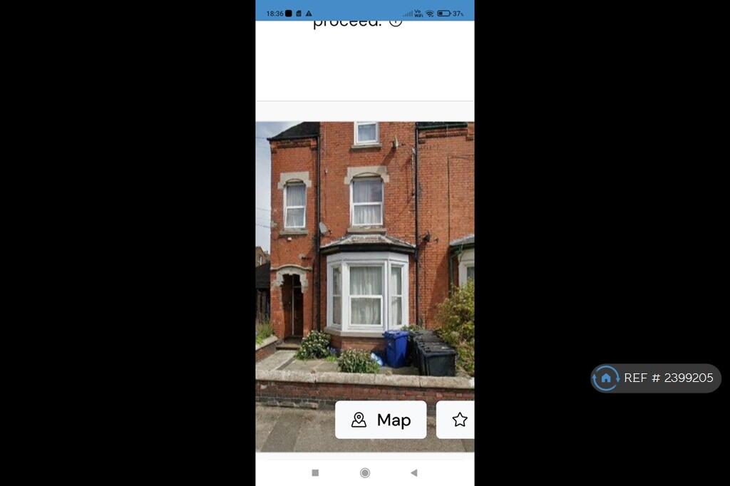
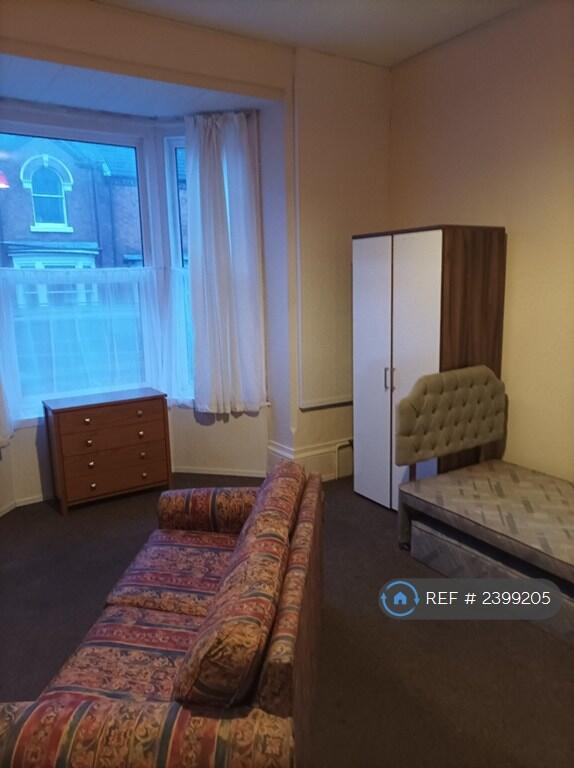
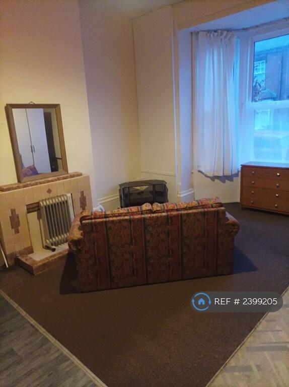
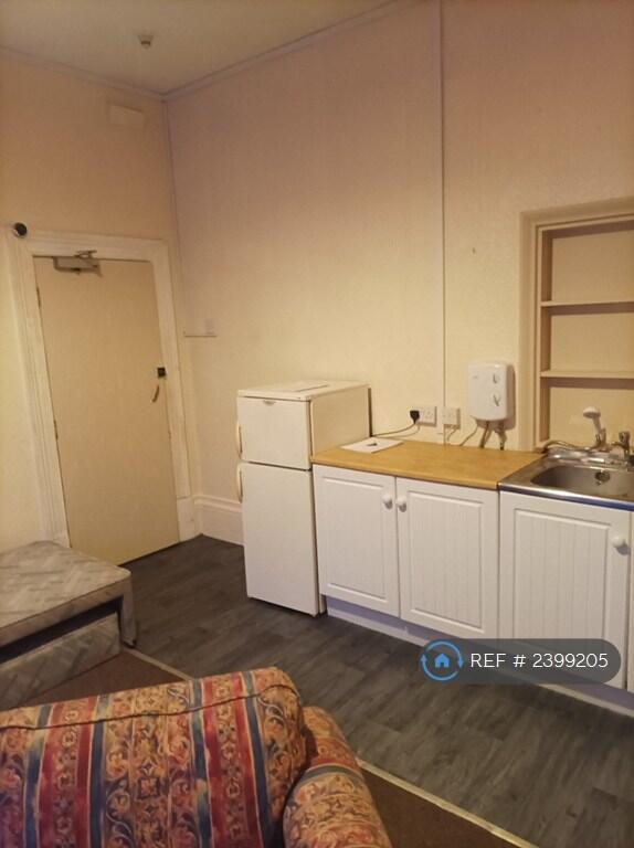
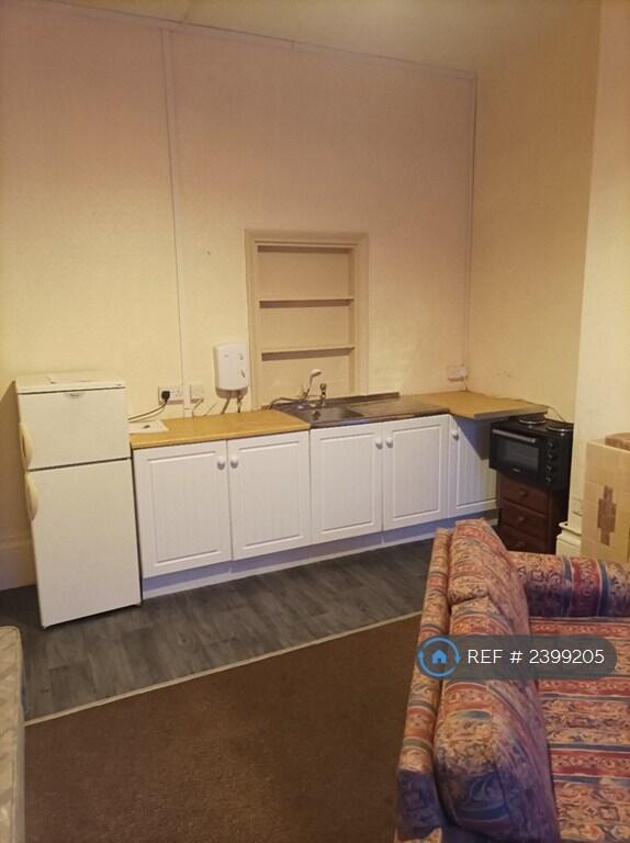
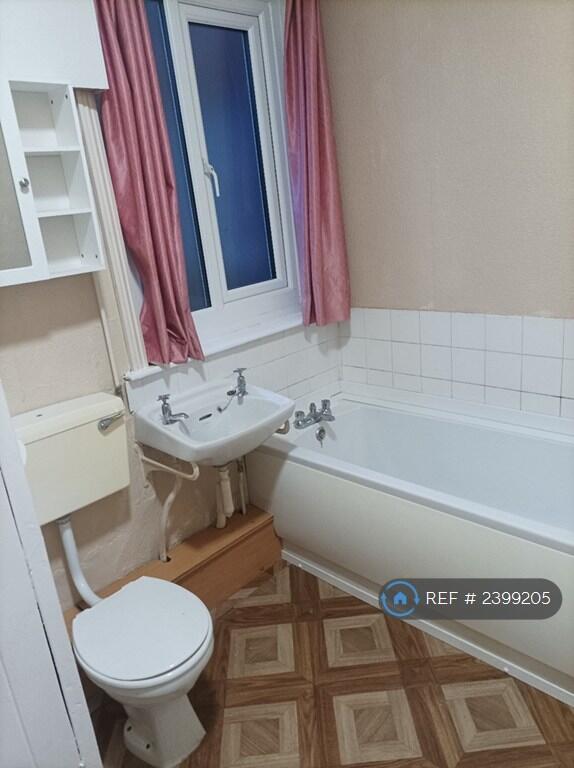
Photo 1 Photo 2 Photo 3 Photo 4 Photo 5 Photo 6
/ 6
Property details
Deprivation
Decile 6 (17,214 of 33,755)
Street crime
182 incidents within 1 mile (Apr 2026)
Key features
- No Agent Fees
- Students Can Enquire
- Property Reference Number: 2399205
Additional details
- Parking
- Private
Description
We are proud to offer this delightful 1 bedroom, 1 bathroom flat in a great location.
Available to move in from 19 February 2026, this property benefits from available parking. Property is offered furnished.
Viewing highly recommended. Contact OpenRent today for more details or to arrange a viewing!
Summary
Rent £350.00 per month (£80.77 per week)
Deposit / Bond is £0.00
Minimum tenancy is 6 months
Maximum number of tenants is 1
Summary & Exclusions:
- Rent Amount: £350.00 per month (£80.77 per week)
- Deposit / Bond: £0.00
- 1 Bedrooms
- 1 Bathrooms
- Property comes furnished
- Available to move in from 20 February 2026
- Minimum tenancy term is 6 months
- Maximum number of tenants is 1
- Students welcome to enquire
- No Pets, sorry
- Smokers considered
- Not Suitable for Families / Children
- Bills not included
- Property has parking
- No Garden Access
- EPC Rating: C
If calling, please quote reference: 2399205
Fees:
You will not be charged any admin fees.
Contact today to book a viewing and have the landlord show you round!
Request Details form responded to 24/7, with phone bookings available 9am-9pm, 7 days a week.
Listed by
London
Techbeard Ltd
Reference: 172465025
EPC ratings on this postcode
We don't have a matched EPC for this property yet. Below are efficiency scores and details for other addresses on this postcode.
| Address | Current | Potential | Floor area | Age band | Type |
|---|---|---|---|---|---|
| 1, Albert Terrace, NEWCASTLE | 57 | 77 | 111 m² | England and Wales: 1930-1949 | Terraced |
| 10, Albert Terrace, NEWCASTLE | 66 | 85 | 82 m² | England and Wales: 1900-1929 | Terraced |
| 14, Albert Terrace, NEWCASTLE | 59 | 77 | 110 m² | England and Wales: 1900-1929 | Terraced |
| 15, Albert Terrace, NEWCASTLE | 45 | 69 | 160 m² | England and Wales: before 1900 | Terraced |
| 18 Albert Terrace, NEWCASTLE | 60 | 82 | 139 m² | England and Wales: 1900-1929 | Terraced |
| 19 Albert Terrace, NEWCASTLE | 57 | 74 | 129 m² | England and Wales: 1900-1929 | Terraced |
| 2 Albert Terrace, NEWCASTLE | 48 | 70 | 92 m² | England and Wales: 1900-1929 | Terraced |
| 2, Albert Terrace, NEWCASTLE | 40 | 79 | 84 m² | England and Wales: before 1900 | Terraced |
| 20, Albert Terrace, NEWCASTLE | 54 | 76 | 122 m² | England and Wales: 1900-1929 | Terraced |
| 22, Albert Terrace, NEWCASTLE | 64 | 81 | 142 m² | England and Wales: before 1900 | Terraced |
| 23, Albert Terrace, NEWCASTLE | 58 | 80 | 130 m² | England and Wales: before 1900 | Terraced |
| 25 Albert Terrace, NEWCASTLE | 59 | 84 | 159 m² | England and Wales: before 1900 | Terraced |
| 25, Albert Terrace, NEWCASTLE | 7 | 79 | 126 m² | England and Wales: 1900-1929 | Terraced |
| 27, Albert Terrace, NEWCASTLE | 53 | 77 | 156 m² | England and Wales: 1900-1929 | Terraced |
| 29 Albert Terrace, NEWCASTLE | 66 | 81 | 144 m² | England and Wales: before 1900 | Terraced |
Flood risk
Zone: 1
Risk: Low
Job (default Low)
Rental Range
Estimated market rent for Newcastle-under-Lyme. Low = conservative, Realistic = average, Optimistic = best case.
Based on Local Authority from postcode lookup → Newcastle-under-Lyme.
LHA (30th percentile) floor for Staffordshire North: £424/mo (Apr 2025 – Mar 2026)
Location
Address
Albert Terrace
Nearby
Nearest stations, universities and amenities (distance from property).
| Type | Name | Distance |
|---|---|---|
| Bus stop | Marsh Avenue | 0.1 miles |
| Shop | The co-operative food | 0.2 miles |
| Bus stop | Boulton Street | 0.2 miles |
| Shop | Coral | 0.2 miles |
| Train station | Longport | 0.7 miles |
| Hospital | Bradwell Hospital | 0.9 miles |
| Hospital | St Augustines Hospital | 1.4 miles |
| Train station | Silverdale | 1.9 miles |
| University | University of Staffordshire Stoke Campus | 2.3 miles |
Street-level crime
| Category | Count |
|---|---|
| Violence and sexual offences | 65 |
| Anti-social behaviour | 46 |
| Public order | 16 |
| Criminal damage and arson | 15 |
| Vehicle crime | 10 |
| Burglary | 9 |
| Other theft | 9 |
| Other crime | 6 |
| Shoplifting | 4 |
| Drugs | 1 |
| Possession of weapons | 1 |
| Total incidents | 182 |
Within 1 mile during Apr 2026. Source: data.police.uk (England & Wales).
Schools nearby
Nearest open schools with Ofsted ratings (England). Closed schools are not shown. Data from Get Information about Schools and Ofsted.
| Name | Type | Distance | Ofsted |
|---|---|---|---|
| Cedars - Newcastle, Moorlands and Darwin Bases | Other | 0.2 miles | Good — 26 Jun 2015 |
| Ellison Primary Academy | Primary | 0.2 miles | Good — 14 Sep 2023 |
| St Margaret's CofE (VC) Junior School | Primary | 0.3 miles | Good — 1 May 2014 |
| Oaklands Nursery School | Nursery | 0.3 miles | Outstanding — 15 Feb 2013 |
| The Orme Academy | Secondary | 0.3 miles | Good — 9 Jul 2024 |
Rental Comparables
Residential lets from OpenRent and Rightmove for the area (same bedroom count). Use to validate rent estimates. Student lets are excluded.
Average rent: £636/mo (36 listings)
Enter House Number
Enter the house number to help us retrieve more accurate pricing history and property data.
Please log in to submit or correct the house number for this listing.
Log in to continue