Hockerley Avenue
Whaley Bridge, High Peak, Derbyshire, SK23, SK23 7RT
Property details
Tenure
FREEHOLD
Council tax band
F
Local average
£395,556 (+32.7%)
Deprivation
Decile 8 (25,552 of 33,755)
Street crime
31 incidents within 1 mile (Mar 2026)
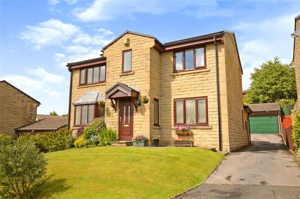
Key features
- Double Fronted Detached
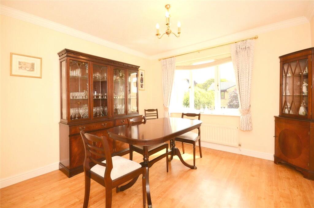
- Two Receptions
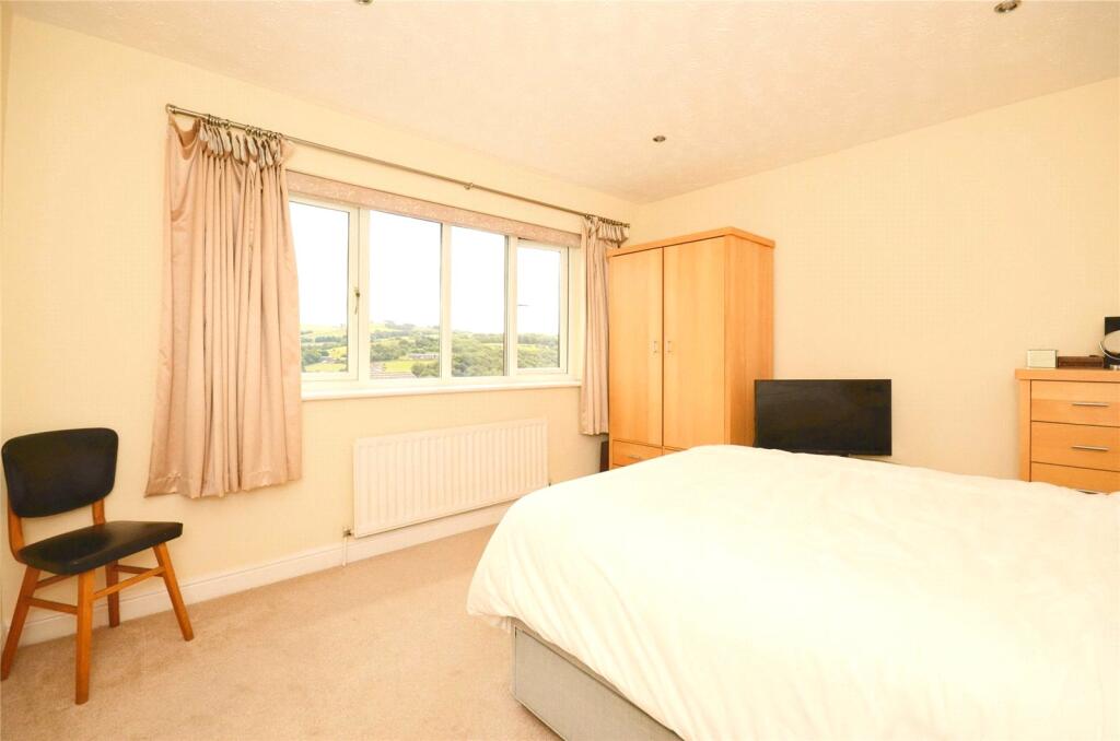
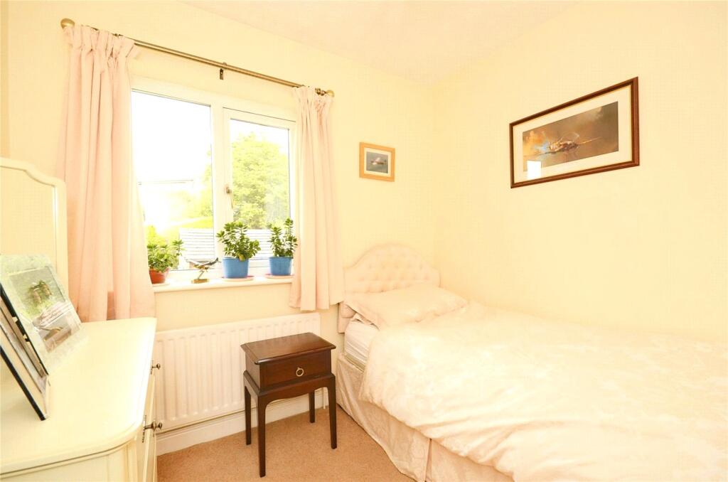
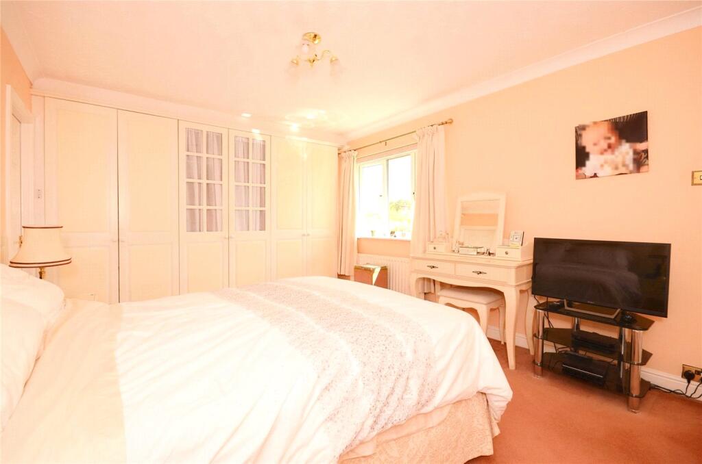
- Four Bedrooms
- Two Bathrooms
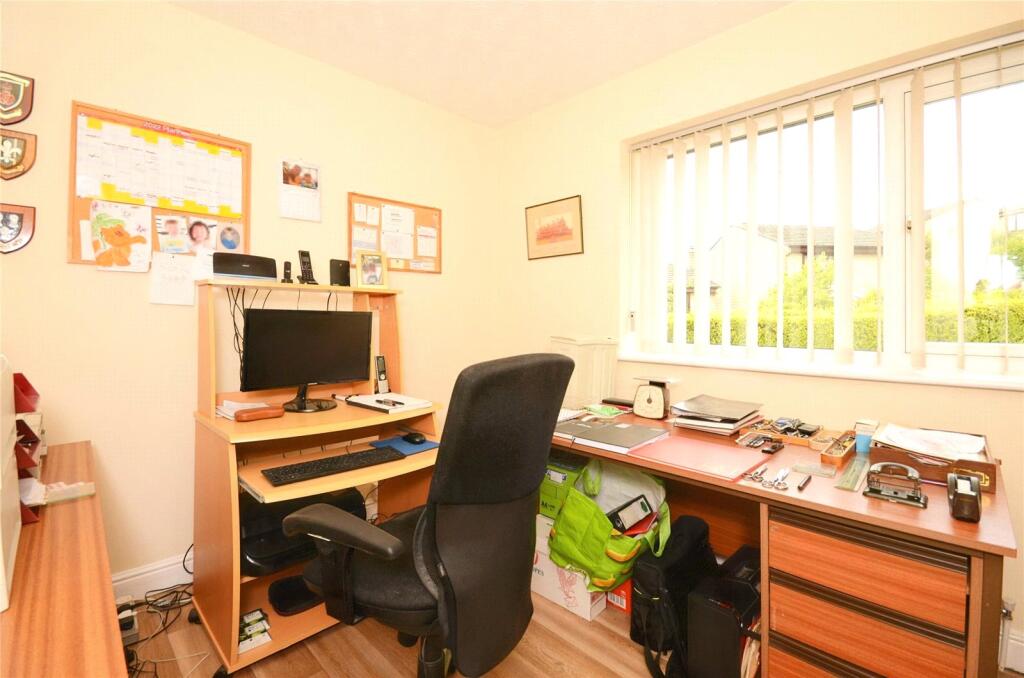
- Study/Office
- Utility Room
- Detached Double Garage
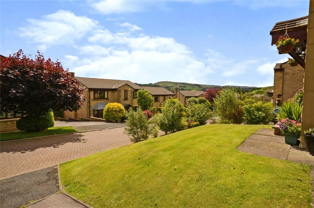
- Sought After Location
Additional details
- Parking
- Yes
- Garden
- Yes
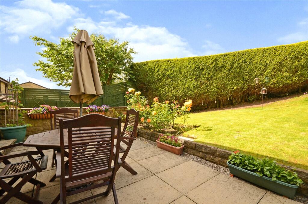
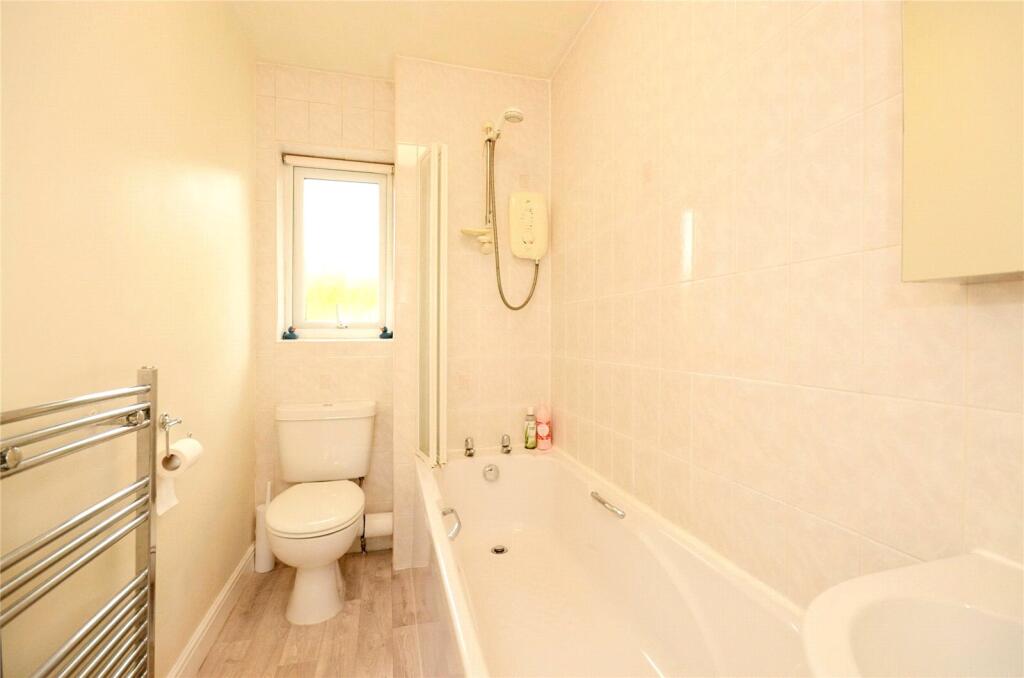
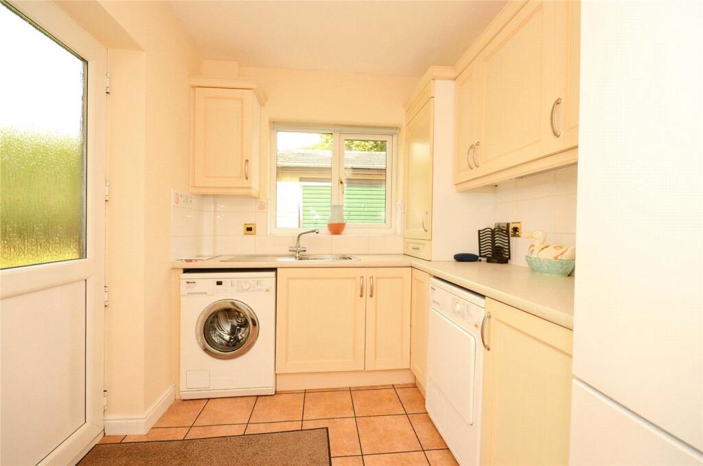
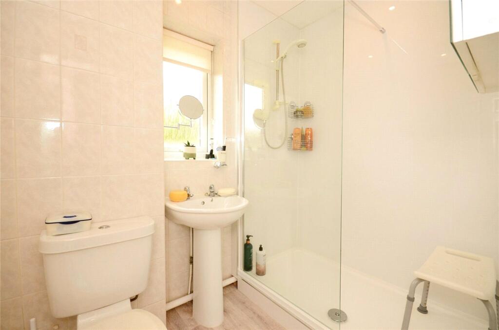
Description
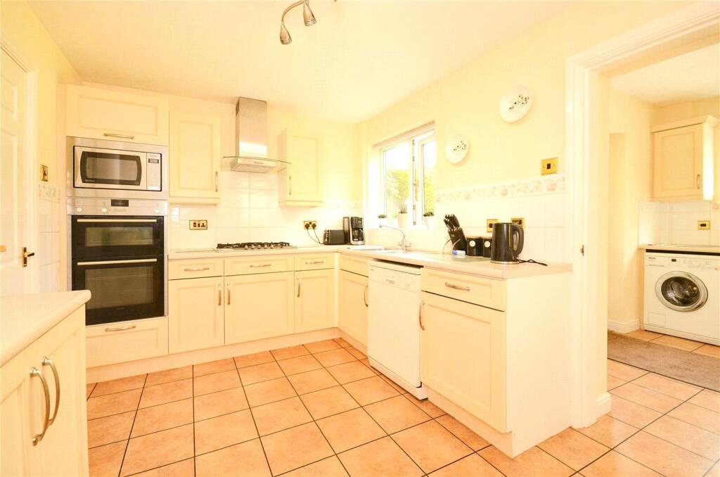
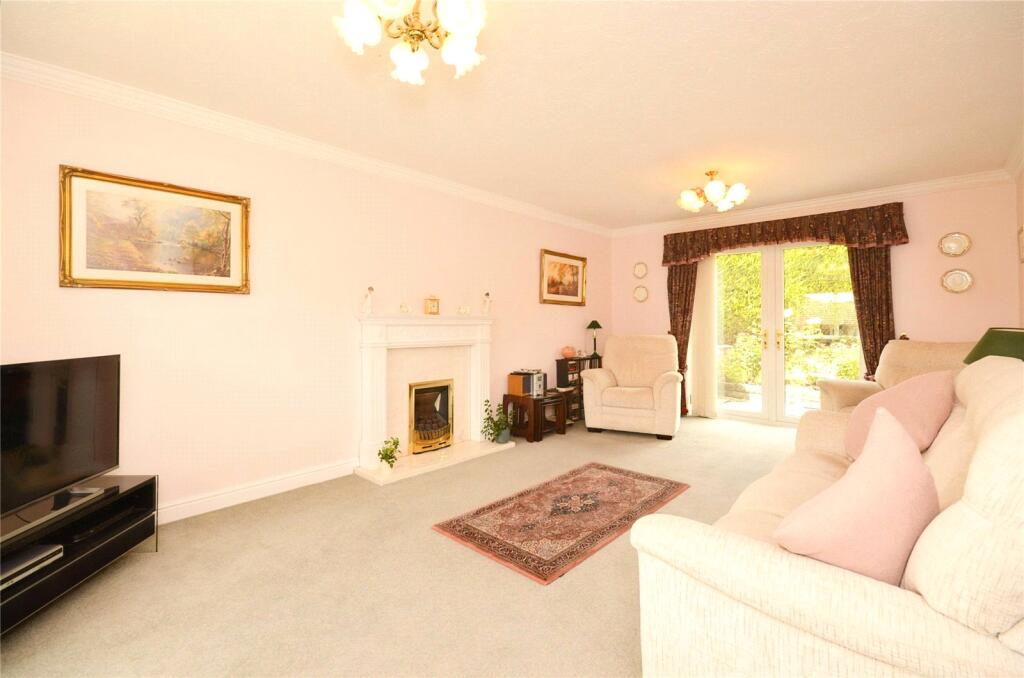
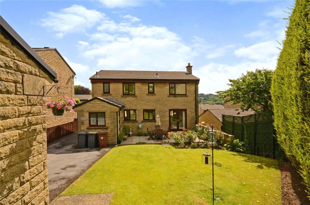
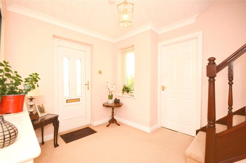
Welcomed by an inviting entrance hall, the ground floor offers a downstairs WC, a generous 20'0" x 11'10" lounge, a separate dining room, and a versatile study/office ideal for home working. The well-appointed fitted kitchen is supported by a practical utility room, providing excellent everyday convenience. Upstairs, the landing leads to four well balanced bedrooms, a modern family bathroom, and a private en-suite to the principal bedroom. Externally, the property continues to impress with a long driveway offering ample off-road parking, culminating in a detached double garage. The setting, space, and views combine to make this an exceptional family home.
Listed by
Disley
Countrywide UK Sales - Connells
Reference: 174614471
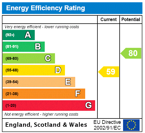
EPC ratings on this postcode
We don't have a matched EPC for this property yet. Below are efficiency scores and details for other addresses on this postcode.
| Address | Current | Potential | Floor area | Age band | Type |
|---|---|---|---|---|---|
| 10 Hockerley Avenue, Whaley Bridge, HIGH PEAK | 82 | 83 | 128 m² | England and Wales: 1991-1995 | Detached |
| 10, Hockerley Avenue, Whaley Bridge, HIGH PEAK | 68 | 80 | 131 m² | England and Wales: 1991-1995 | Detached |
| 15, Hockerley Avenue, Whaley Bridge, HIGH PEAK | 59 | 80 | 129 m² | England and Wales: 1991-1995 | Detached |
| 18 Hockerley Avenue, Whaley Bridge, HIGH PEAK | 70 | 76 | 133 m² | England and Wales: 1991-1995 | Detached |
| 18, Hockerley Avenue, Whaley Bridge, HIGH PEAK | 53 | 78 | 135 m² | England and Wales: 1983-1990 | Detached |
| 21 HOCKERLEY AVENUE, WHALEY BRIDGE, WHALEY BRIDGE | 67 | 76 | 163 m² | England and Wales: 1991-1995 | Detached |
| 24 Hockerley Avenue, Whaley Bridge, HIGH PEAK | 58 | 77 | 130 m² | England and Wales: 1991-1995 | Detached |
| 8, Hockerley Avenue, Whaley Bridge, HIGH PEAK | 68 | 80 | 132 m² | England and Wales: 1991-1995 | Detached |
| 9, Hockerley Avenue, Whaley Bridge, HIGH PEAK | 60 | 82 | 100 m² | England and Wales: 1996-2002 | Detached |
Flood risk
Zone: 1
Risk: Low
Job (default Low)
Floorplans
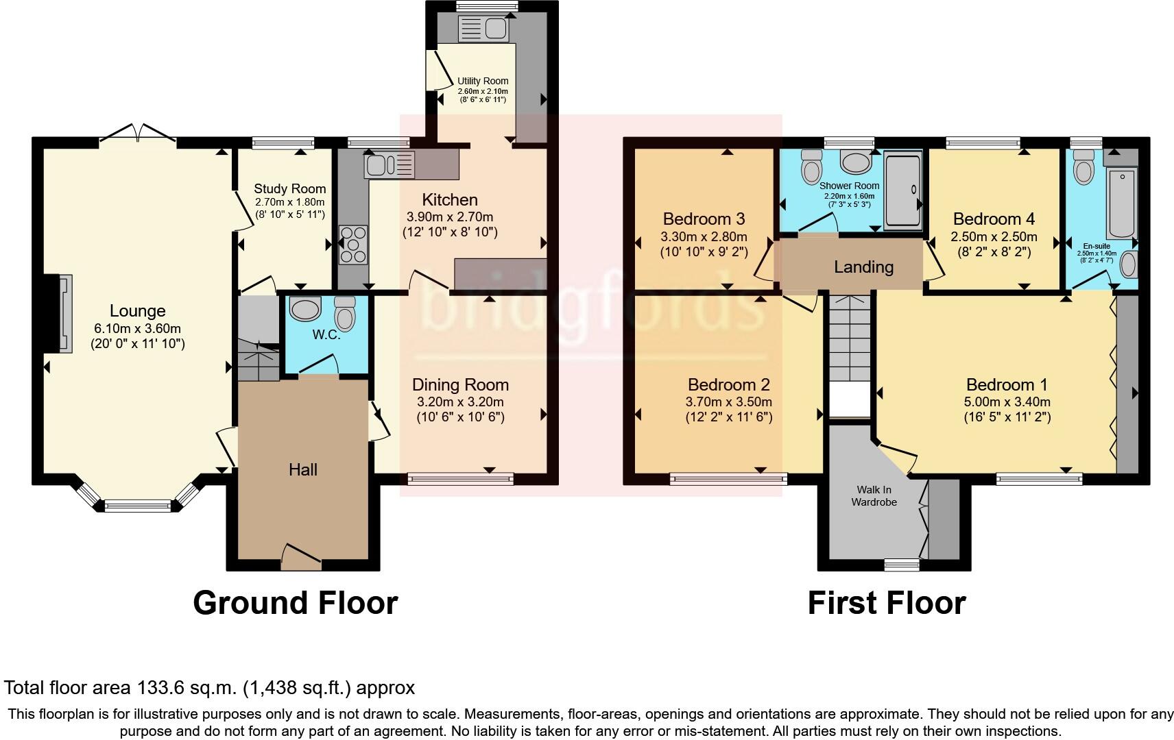
FLOOR-PLAN
EPC Graphs
EPC Rating Graph
Price history
| Event | Date | Price | % change |
|---|---|---|---|
| Listed for sale | — | £525,000 | — |
Source: HM Land Registry Price Paid Data. Crown copyright.
Sold Comparables
Sold comparables data is not available for this property.
Capital growth trend
Land Registry outcode average: last 12 months vs 5y and 10y ago (from sold prices).
House Price Index (HM Land Registry — official index, not sold-price averages): High Peak. Series: All dwelling types. As of February 2026.
Rental Range
Estimated market rent for High Peak. Low = conservative, Realistic = average, Optimistic = best case.
Based on Local Authority from postcode lookup → High Peak.
LHA (30th percentile) floor for Southern Greater Manchester: £1,396/mo (Apr 2025 – Mar 2026)
Location
Address
Hockerley Avenue
Nearby
Nearest stations, universities and amenities (distance from property).
| Type | Name | Distance |
|---|---|---|
| Shop | Alton Cars | 0.2 miles |
| Bus stop | Jodrell Road | 0.3 miles |
| Shop | Soothe | 0.3 miles |
| Train station | Whaley Bridge | 0.4 miles |
| Bus stop | Whaley Bridge, Buxton Road / opposite Railway Station | 0.4 miles |
| Train station | Furness Vale | 1.0 miles |
| Hospital | Cavendish Hospital | 5.7 miles |
| University | University of Derby, Buxton | 6.0 miles |
| Hospital | Buxton Health Centre | 6.3 miles |
| University | University of Manchester Fallowfield Campus | 11.9 miles |
Street-level crime
| Category | Count |
|---|---|
| Public order | 8 |
| Violence and sexual offences | 8 |
| Shoplifting | 5 |
| Anti-social behaviour | 4 |
| Criminal damage and arson | 3 |
| Burglary | 1 |
| Other theft | 1 |
| Possession of weapons | 1 |
| Total incidents | 31 |
Within 1 mile during Mar 2026. Source: data.police.uk (England & Wales).
Schools nearby
Nearest open schools with Ofsted ratings (England). Closed schools are not shown. Data from Get Information about Schools and Ofsted.
| Name | Type | Distance | Ofsted |
|---|---|---|---|
| Whaley Bridge Primary School | Primary | 0.6 miles | Good — 22 Sep 2022 |
| Taxal and Fernilee CofE Primary School | Primary | 0.8 miles | Good — 14 May 2012 |
| Furness Vale Primary and Nursery School | Primary | 1.0 miles | — (Inspected (no overall grade)) |
| Buxworth Primary School | Primary | 1.0 miles | Good — 1 Dec 2022 |
| High Peak School | Other | 1.5 miles | Good — 26 Jan 2023 |
Rental Comparables
Loading rental comparables for this postcode. Refresh in a few minutes.
Rent-driven metrics
Based on Area rent estimate.
- Rent ratio — Monthly rent ÷ purchase price (1% rule). 1%+ = strong, 0.8–1% = okay, <0.8% = weak for cashflow.
- Max investor price — Rent ÷ 0.8%; the price at which rent would be 0.8% of price (Stoke-style target).
- Target investor price — Rent ÷ 1%; the price at which rent would be 1% of price (strong cashflow band).
- Gross yield — Annual rent as % of purchase price (no costs).
Enter House Number
Enter the house number to help us retrieve more accurate pricing history and property data.
Please log in to submit or correct the house number for this listing.
Log in to continue