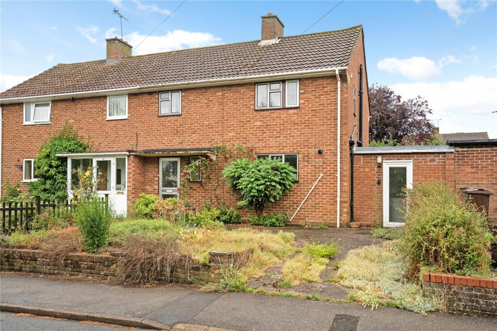
81 CAESARS ROAD
ST ALBANS, WHEATHAMPSTEAD, HERTFORDSHIRE AL4 8PA
Property details
Tenure
FREEHOLD
Floor area
83 m²
Council tax band
D
EPC rating
C
Year built
England and Wales: 1967-1975
Last sold
£480,000 Nov 2024
Price per m²
£5,964/m²
Local average
£735,017 (-32.7%)
Deprivation
Decile 9 (30,220 of 33,755)
Street crime
30 incidents within 1 mile (Apr 2026)
Key features
- Three bedroom semi detached house
- Two reception rooms
- Requires full modernisation
- Potential to remodel and extend subject to planning
- South facing rear garden
- Off street parking
- EPC Rating = C
Additional details
- Parking
- Yes
Description
Description
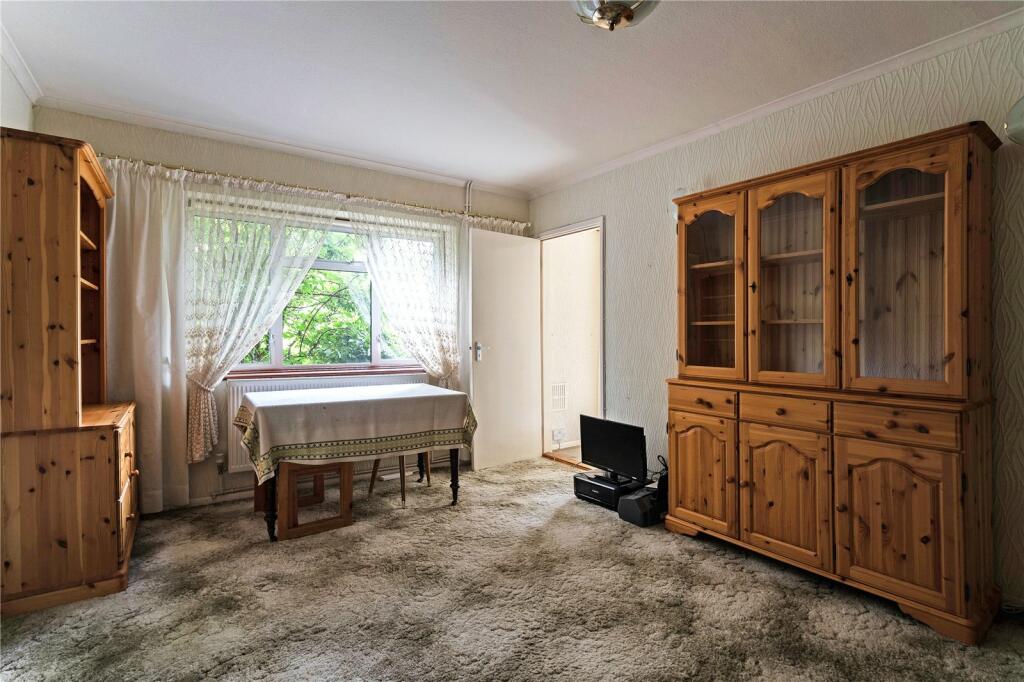
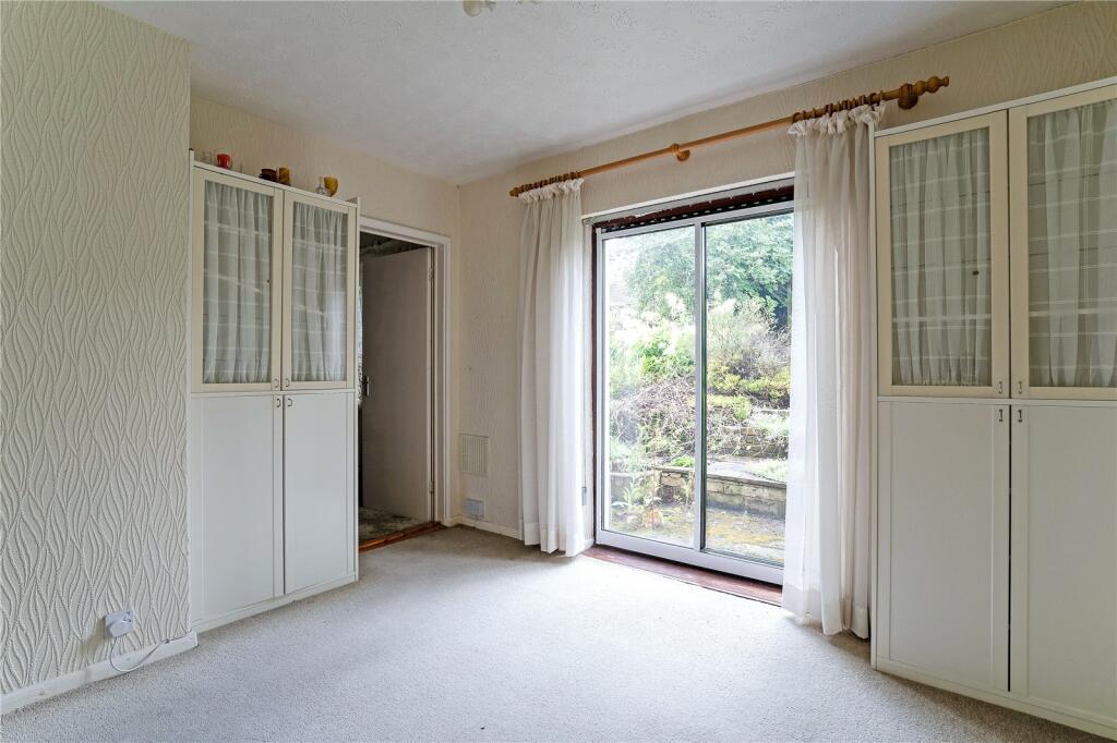
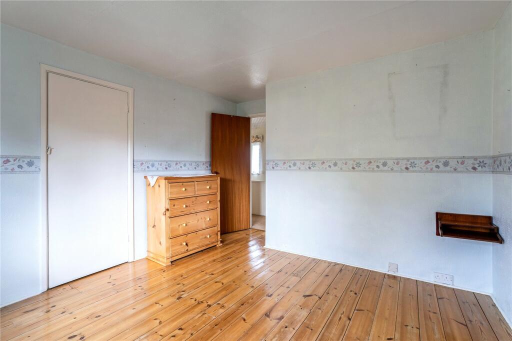
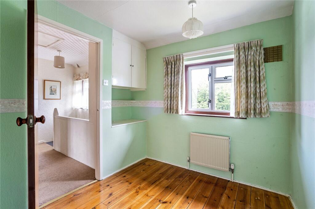
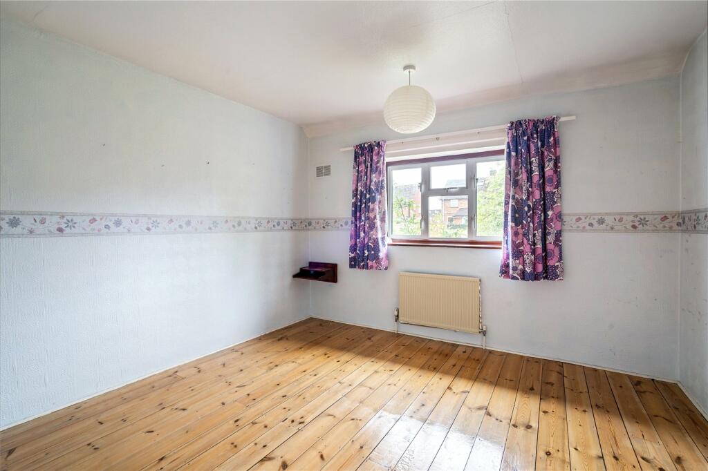
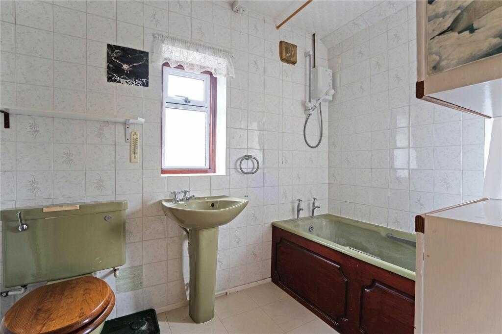
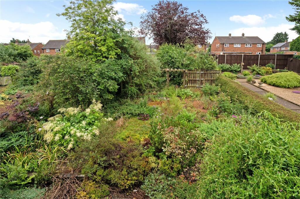
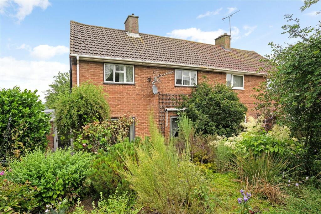
This three bedroom semi detached house offers an opportunity for any buyer to come in and create their own home. Requiring full modernisation the house has great potential to remodel and extend subject to the necessary permissions.
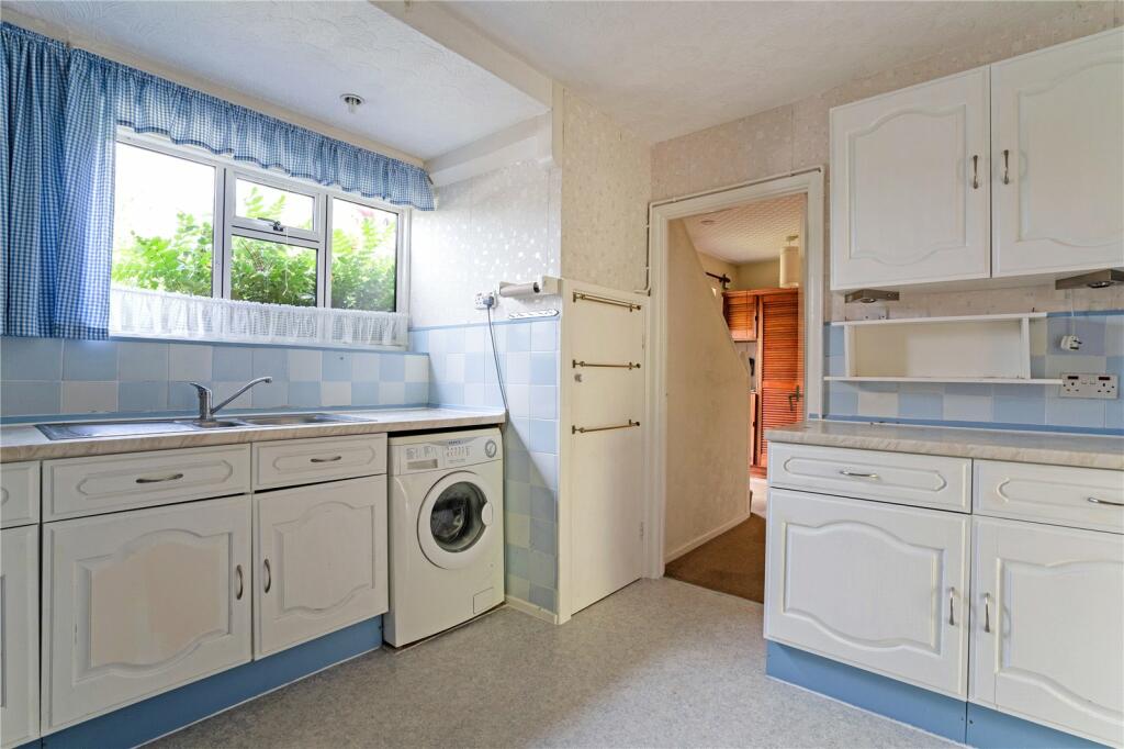
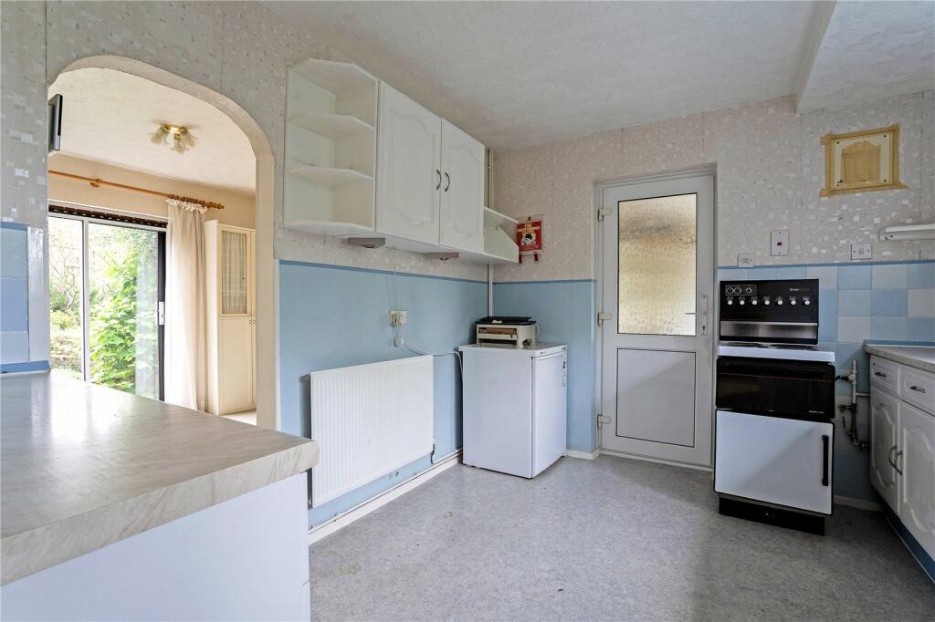
Arranged over the ground there is a sitting room and dining room situated to the rear of the house, a fitted kitchen to the front and access to a utility area.
Upstairs there are three double bedrooms, two of which have built in wardrobes, a family bathroom and loft access.
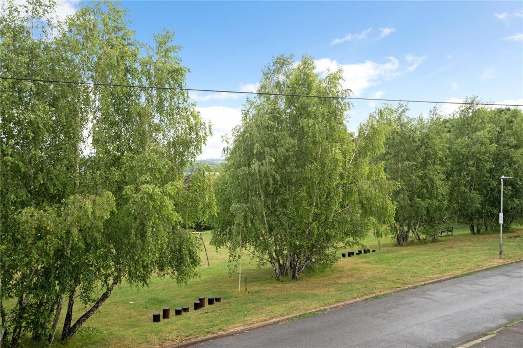
Externally the house benefits from a good size south facing rear garden and off street parking to the front.
Location
Approx mileages: Harpenden town centre (with mainline station into St Pancras International from 22 minutes) 3.5 miles, St Albans city centre (with mainline station) 4.8 miles, Welwyn Garden City centre (with mainline station into London Kings Cross from 30 minutes) 5 miles, M1 junction 9 7.0 miles,
London Luton airport 7.9 miles
Caesars Road is situated less than half a mile from the pretty and historic village centre of Wheathampstead, which offers a good range of shops, pubs and a Tesco Express
Wheathampstead lies about. 3.5 miles east of the delightful tree-lined high street of Harpenden with its distinctly village feel, offering supermarkets, numerous boutiques and traditional independent shops, restaurants, bars and bistros
While St Albans city centre is about. 5 miles distant and offers a wider range of shops and amenities. Harpenden and St Albans are renowned for their private and state schools and both have numerous leisure and sporting facilities
For the commuter, Harpenden and St Albans provide mainline stations, which provide fast and frequent train services into London St Pancras International (from 25 and 18 minutes respectively). Road communications are excellent with the M1 (junction 9) being just 7 miles distant, and the A1M being 5.5 miles distant. Both motorways provide a direct link to the M25.
Square Footage: 1,080 sq ft
Listed by
Harpenden
Savills
Reference: 137647448
EPC Rating & Upgrade Cost
Current rating: C
Potential rating: B
Inspection date: 29/06/2023
Expiry date: 28/06/2033
Current heating cost: £971/year
Potential heating cost: £899/year
Est. upgrade cost to C: £14,500
Recommendations
- Floor insulation (solid floor) (£4,000 - £6,000)
- Solar water heating (£4,000 - £6,000)
- Solar photovoltaic panels, 2.5 kWp (£3,500 - £5,500)
Flood risk
Zone: 1
Risk: Low
Job (default Low)
Floorplans
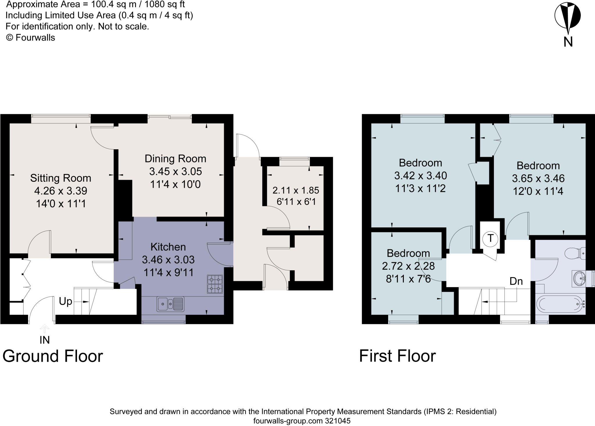
Floorplan
EPC Graphs
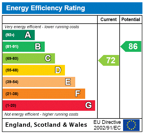
EPC Rating Graph
FENSA Certificates
This property has 1 FENSA certificate(s) on record, indicating window/door installations by FENSA-approved installers.
FENSA Certificate #1203142
Property Details
Street: 81 Caesars Road
Town: Wheathampstead
Postcode: AL4 8PA
Installation Details
Items: 3 windows
Certificate Issued: 17/11/2003
Work Completed: 03/10/2003
This certificate data was retrieved from FENSA's database
What is FENSA? FENSA (Fenestration Self-Assessment Scheme) is a government-authorised scheme that monitors building regulation compliance for replacement windows and doors. Certificates indicate that work was completed by FENSA-approved installers.
Price history
| Event | Date | Price | % change |
|---|---|---|---|
| Sold | 06/11/2024 (1 year ago) | £480,000 | — |
Source: HM Land Registry Price Paid Data. Crown copyright.
Sold Comparables
Same street and nearby sales within 0.25 miles (last 5 years). Data from Land Registry Price Paid.
| Address | Price | Date | Type |
|---|---|---|---|
| 5 GARRARD WAY, WHEATHAMPSTEAD, ST ALBANS, HERTFORDSHIRE, AL4 8PE | £630,000 | 05/12/2025 | Semi-detached |
| 59 WICK AVENUE, WHEATHAMPSTEAD, ST ALBANS, HERTFORDSHIRE, AL4 8PZ | £640,000 | 21/03/2025 | Semi-detached |
| Same street 75 CAESARS ROAD, WHEATHAMPSTEAD, ST ALBANS, HERTFORDSHIRE, AL4 8PA | £455,000 | 08/09/2023 | Terraced |
| OVERSTRAND, 33 THE HILL, WHEATHAMPSTEAD, ST ALBANS, HERTFORDSHIRE, AL4 8PW | £635,000 | 07/07/2023 | Semi-detached |
| 51 THE HILL, WHEATHAMPSTEAD, ST ALBANS, HERTFORDSHIRE, AL4 8PR | £670,000 | 15/12/2022 | Semi-detached |
| 7 GARRARD WAY, WHEATHAMPSTEAD, ST ALBANS, HERTFORDSHIRE, AL4 8PE | £655,000 | 09/12/2022 | Semi-detached |
| 43 SAXON ROAD, WHEATHAMPSTEAD, ST ALBANS, HERTFORDSHIRE, AL4 8NZ | £625,000 | 14/10/2022 | Semi-detached |
| 58 SAXON ROAD, WHEATHAMPSTEAD, ST ALBANS, HERTFORDSHIRE, AL4 8NZ | £525,000 | 31/08/2022 | Semi-detached |
| 2 CONQUERORS HILL, WHEATHAMPSTEAD, ST ALBANS, HERTFORDSHIRE, AL4 8NT | £690,000 | 10/08/2022 | Semi-detached |
| 9 CAESARS ROAD, WHEATHAMPSTEAD, ST ALBANS, HERTFORDSHIRE, AL4 8NR | £650,000 | 05/08/2022 | Semi-detached |
| 14 GARRARD WAY, WHEATHAMPSTEAD, ST ALBANS, HERTFORDSHIRE, AL4 8PE | £730,000 | 27/07/2022 | Semi-detached |
| 21 WICK AVENUE, WHEATHAMPSTEAD, ST ALBANS, HERTFORDSHIRE, AL4 8QD | £805,000 | 15/07/2022 | Semi-detached |
| 12 BUTTERFIELD ROAD, WHEATHAMPSTEAD, ST ALBANS, HERTFORDSHIRE, AL4 8PU | £795,000 | 11/07/2022 | Semi-detached |
| 1 LOUFENWAY MEWS, WHEATHAMPSTEAD, ST ALBANS, HERTFORDSHIRE, AL4 8PE | £424,950 | 25/06/2021 | Semi-detached |
Street average: £455,000 (1 sale)
Area average: £651,919 (13 sales)
Capital growth trend
Land Registry outcode average: last 12 months vs 5y and 10y ago (from sold prices).
House Price Index (HM Land Registry — official index, not sold-price averages): St Albans. Series: Semi-detached. As of March 2026.
Rental Range
Estimated market rent for St Albans. Low = conservative, Realistic = average, Optimistic = best case.
Based on Local Authority from postcode lookup → St Albans.
LHA (30th percentile) floor for South West Herts: £1,496/mo (Apr 2025 – Mar 2026)
Location
Nearby
Nearest stations, universities and amenities (distance from property).
| Type | Name | Distance |
|---|---|---|
| Bus stop | Walnut Court | 0.1 miles |
| Shop | Village Barbers | 0.3 miles |
| Shop | Gentlemen's Field | 0.3 miles |
| Train station | Harpenden | 2.6 miles |
| Train station | Welwyn Garden City | 3.8 miles |
| University | University of Hertfordshire | 5.9 miles |
| University | University Of Bedfordshire | 6.9 miles |
| Hospital | Widecombe Nursing Home | 9.6 miles |
| Hospital | Luton and Dunstable Hospital | 9.9 miles |
Street-level crime
| Category | Count |
|---|---|
| Violence and sexual offences | 16 |
| Anti-social behaviour | 9 |
| Other theft | 3 |
| Shoplifting | 1 |
| Vehicle crime | 1 |
| Total incidents | 30 |
Within 1 mile during Apr 2026. Source: data.police.uk (England & Wales).
Schools nearby
Nearest open schools with Ofsted ratings (England). Closed schools are not shown. Data from Get Information about Schools and Ofsted.
| Name | Type | Distance | Ofsted |
|---|---|---|---|
| Beech Hyde Primary School and Nursery | Primary | 0.1 miles | Good — 14 Nov 2022 |
| St Helen's Church of England Primary School | Primary | 0.2 miles | Good — 24 Mar 2015 |
| Aldwickbury School | Other | 1.7 miles | — (No rating) |
| Sandridge School | Primary | 1.9 miles | Good — 24 Apr 2019 |
| The Grove Infant and Nursery School | Primary | 1.9 miles | Outstanding — 17 Dec 2023 |
Rental Comparables
Loading rental comparables for this postcode. Refresh in a few minutes.
Rent-driven metrics
Based on Area rent estimate.
- Rent ratio — Monthly rent ÷ purchase price (1% rule). 1%+ = strong, 0.8–1% = okay, <0.8% = weak for cashflow.
- Max investor price — Rent ÷ 0.8%; the price at which rent would be 0.8% of price (Stoke-style target).
- Target investor price — Rent ÷ 1%; the price at which rent would be 1% of price (strong cashflow band).
- Gross yield — Annual rent as % of purchase price (no costs).