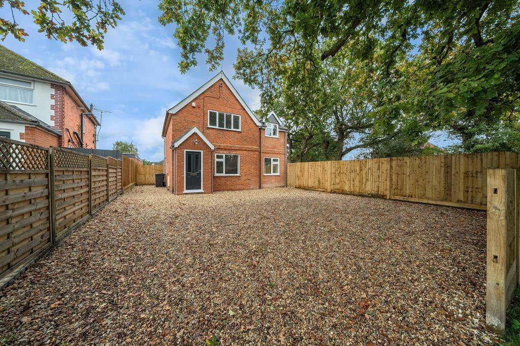
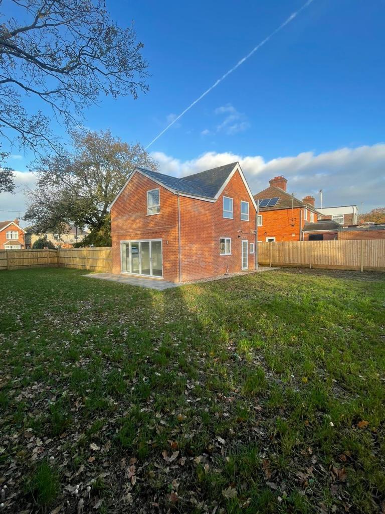
75 NORTHFIELD ROAD
THATCHAM, WEST BERKSHIRE RG18 3ER

Property details
Tenure
FREEHOLD
Floor area
86 m²
Council tax band
C
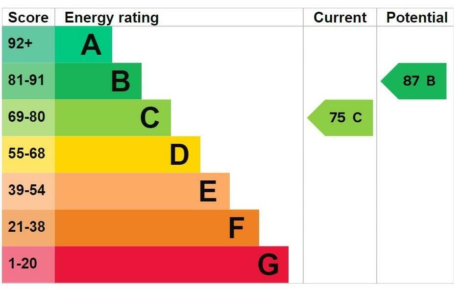
EPC rating
C
Year built
England and Wales: 1983-1990
Last sold
£500,000 Jul 2025
Price per m²
£5,756/m²
Local average
£762,940 (-35.1%)
Deprivation
Decile 10 (32,358 of 33,755)
Street crime
106 incidents within 1 mile (Apr 2026)
Key features
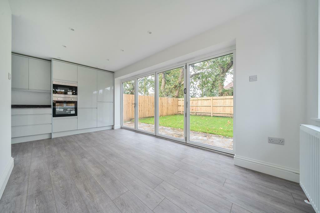
- Recently Renovated Detached Home
- Entrance Porch
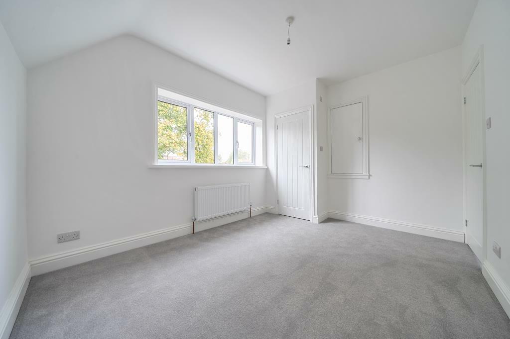
- Living Room
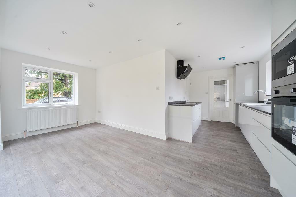
- Open Plan Kitchen and Dining
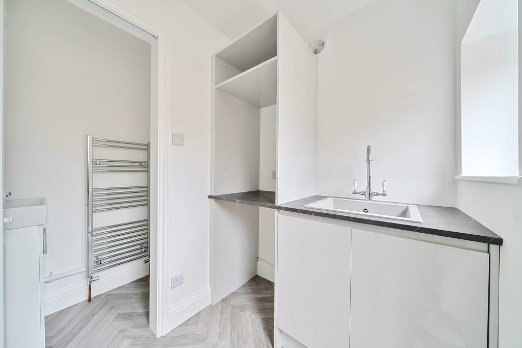
- Utility Room
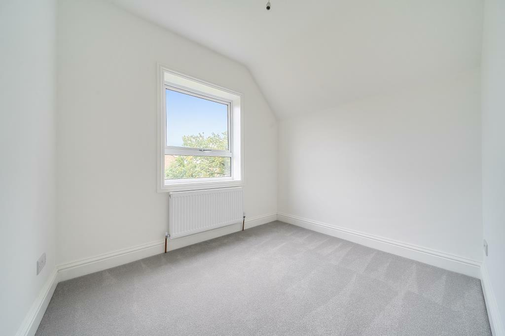
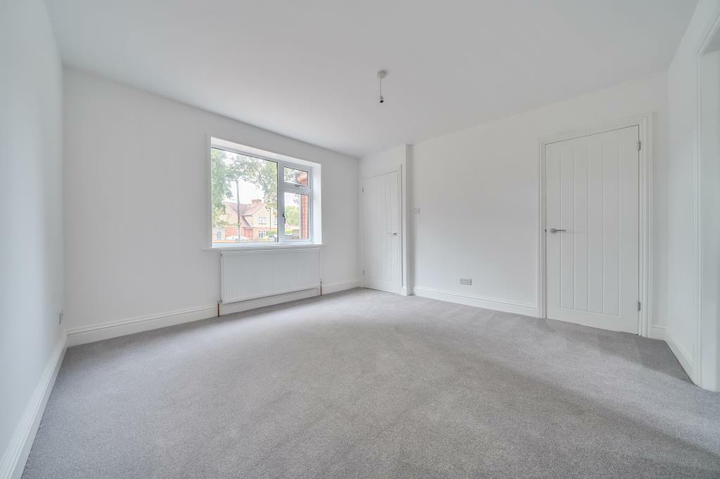
- Master Bedroom with En-Suite
- Family Bathroom
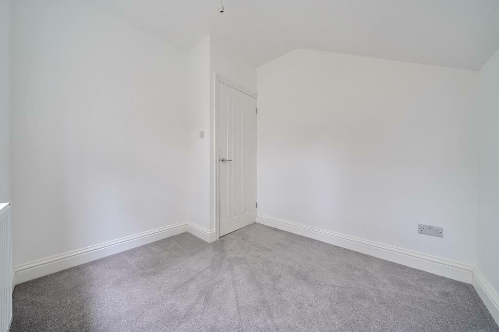
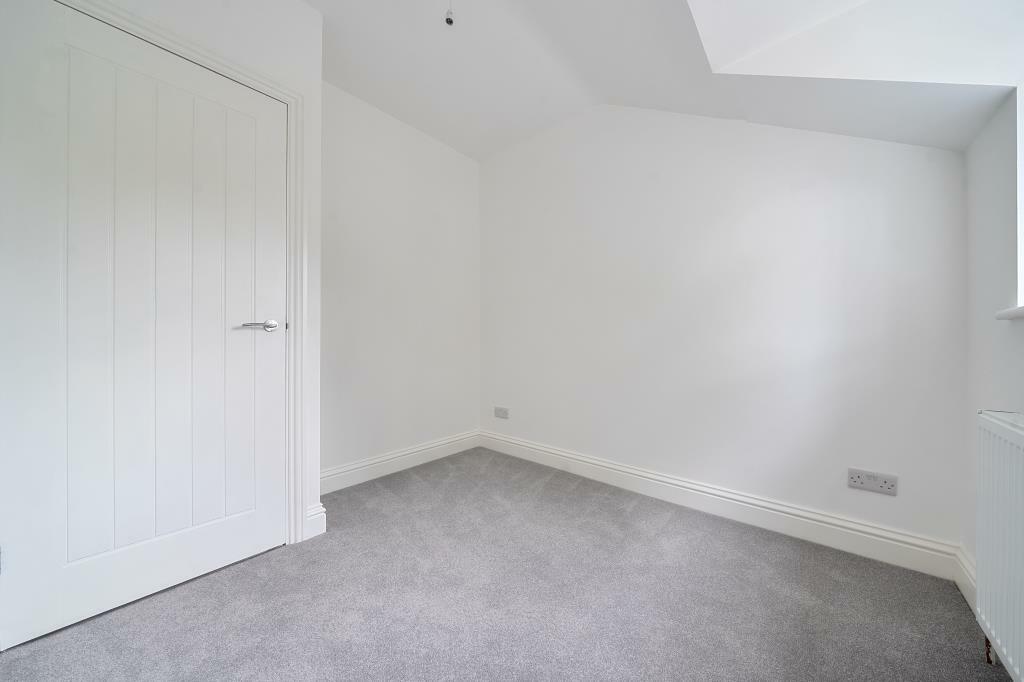
- Three Additional Bedrooms
- Large Driveway Parking
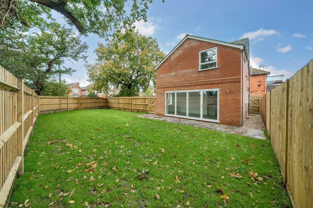
- Garden will be extended by a further 9 meters
Additional details
- Heating
- Night storage
- Parking
- Garage, Off street
- Garden
- Private garden
Description
The property has been extended and now includes an open plan kitchen/diner, separate utility room, downstairs WC, porch and storage cupboard. Upstairs has a master bedroom with en-suite, a further three bedrooms and main family bathroom. No onward chain.
Listed by
Thatcham
Leaders and Romans Group
Reference: 153732257
EPC Rating & Upgrade Cost
Current rating: C
Potential rating: B
Inspection date: 14/06/2024
Expiry date: 13/06/2034
Current heating cost: £748/year
Potential heating cost: £693/year
Est. upgrade cost to C: £14,500
Recommendations
- Floor insulation (solid floor) (£4,000 - £6,000)
- Solar water heating (£4,000 - £6,000)
- Solar photovoltaic panels, 2.5 kWp (£3,500 - £5,500)
Flood risk
Zone: 1
Risk: Low
Job (default Low)
Floorplans
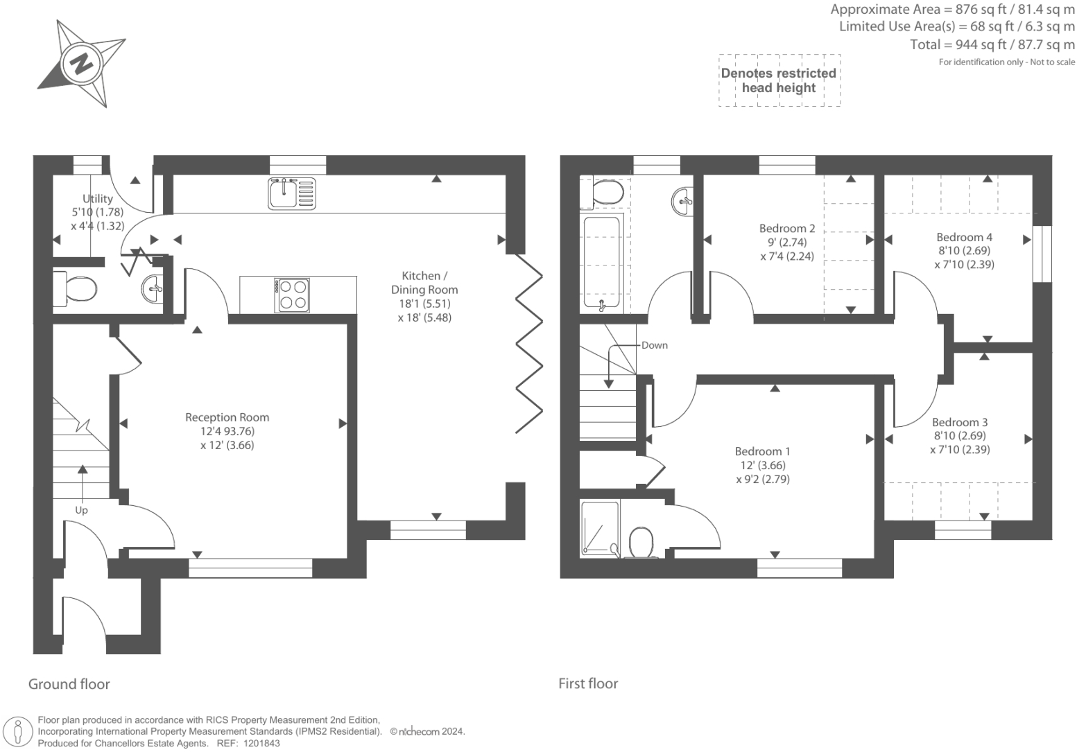
Floor Plan
EPC Graphs
EPC
FENSA Certificates
This property has 2 FENSA certificate(s) on record, indicating window/door installations by FENSA-approved installers.
FENSA Certificate #16157850 Recent
Property Details
Street: 75 Northfield Road
Town: THATCHAM
Postcode: RG18 3ER
Installation Details
Items: 2 doors
Certificate Issued: 11/02/2024
Work Completed: 11/01/2024
This certificate data was retrieved from FENSA's database
FENSA Certificate #16237998 Recent
Property Details
Street: 75 Northfield Road
Town: THATCHAM
Postcode: RG18 3ER
Installation Details
Items: 2 windows and 1 door
Certificate Issued: 07/04/2024
Work Completed: 20/03/2024
This certificate data was retrieved from FENSA's database
What is FENSA? FENSA (Fenestration Self-Assessment Scheme) is a government-authorised scheme that monitors building regulation compliance for replacement windows and doors. Certificates indicate that work was completed by FENSA-approved installers.
Price history
| Event | Date | Price | % change |
|---|---|---|---|
| Sold | 15/07/2025 (10 months ago) | £500,000 | — |
Source: HM Land Registry Price Paid Data. Crown copyright.
Sold Comparables
Same street and nearby sales within 0.25 miles (last 5 years). Data from Land Registry Price Paid.
| Address | Price | Date | Type |
|---|---|---|---|
| 2 THE LAURELS, THATCHAM, WEST BERKSHIRE, RG18 3EY | £465,750 | 05/12/2025 | Detached |
| 13 KENDAL CLOSE, THATCHAM, WEST BERKSHIRE, RG18 3FT | £485,000 | 24/10/2025 | Detached |
| 69 NORTHFIELD ROAD, THATCHAM, WEST BERKSHIRE, RG18 3EU | £675,000 | 04/05/2022 | Detached |
| 2 NORLANDS, THATCHAM, WEST BERKSHIRE, RG18 3FE | £360,000 | 28/02/2022 | Detached |
| 98 NORTHFIELD ROAD, THATCHAM, WEST BERKSHIRE, RG18 3EN | £547,500 | 30/06/2021 | Detached |
Area average: £506,650 (5 sales)
Capital growth trend
Land Registry outcode average: last 12 months vs 5y and 10y ago (from sold prices).
House Price Index (HM Land Registry — official index, not sold-price averages): West Berkshire. Series: Detached. As of March 2026.
Rental Range
Estimated market rent for West Berkshire. Low = conservative, Realistic = average, Optimistic = best case.
Based on Local Authority from postcode lookup → West Berkshire.
Location
Nearby
Nearest stations, universities and amenities (distance from property).
| Type | Name | Distance |
|---|---|---|
| Bus stop | Northway | 0.0 miles |
| Shop | Tesco Express | 0.0 miles |
| Shop | Costcutter | 0.3 miles |
| Hospital | West Berkshire Community Hospital | 1.1 miles |
| Train station | Thatcham | 1.5 miles |
| Train station | Newbury Racecourse | 1.9 miles |
| Hospital | Thornford Park | 2.1 miles |
Street-level crime
| Category | Count |
|---|---|
| Violence and sexual offences | 39 |
| Anti-social behaviour | 13 |
| Public order | 12 |
| Criminal damage and arson | 9 |
| Shoplifting | 9 |
| Other theft | 7 |
| Burglary | 4 |
| Other crime | 4 |
| Vehicle crime | 4 |
| Drugs | 3 |
| Bicycle theft | 2 |
| Total incidents | 106 |
Within 1 mile during Apr 2026. Source: data.police.uk (England & Wales).
Schools nearby
Nearest open schools with Ofsted ratings (England). Closed schools are not shown. Data from Get Information about Schools and Ofsted.
| Name | Type | Distance | Ofsted |
|---|---|---|---|
| Whitelands Park Primary School | Primary | 0.1 miles | Good — 1 Dec 2022 |
| Thatcham Park CofE Primary | Primary | 0.4 miles | Good — 11 Jun 2024 |
| Parsons Down Infant School | Primary | 0.5 miles | Good — 3 Feb 2019 |
| Parsons Down Junior School | Primary | 0.6 miles | Good — 13 Jul 2017 |
| Spurcroft Primary School | Primary | 0.9 miles | Good — 12 Jan 2023 |
Rental Comparables
Loading rental comparables for this postcode. Refresh in a few minutes.
Rent-driven metrics
Based on Area rent estimate.
- Rent ratio — Monthly rent ÷ purchase price (1% rule). 1%+ = strong, 0.8–1% = okay, <0.8% = weak for cashflow.
- Max investor price — Rent ÷ 0.8%; the price at which rent would be 0.8% of price (Stoke-style target).
- Target investor price — Rent ÷ 1%; the price at which rent would be 1% of price (strong cashflow band).
- Gross yield — Annual rent as % of purchase price (no costs).