Newcastle Lane
Penkhull, ST4 5DR
£675 pcm
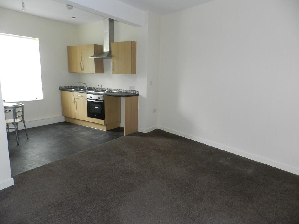
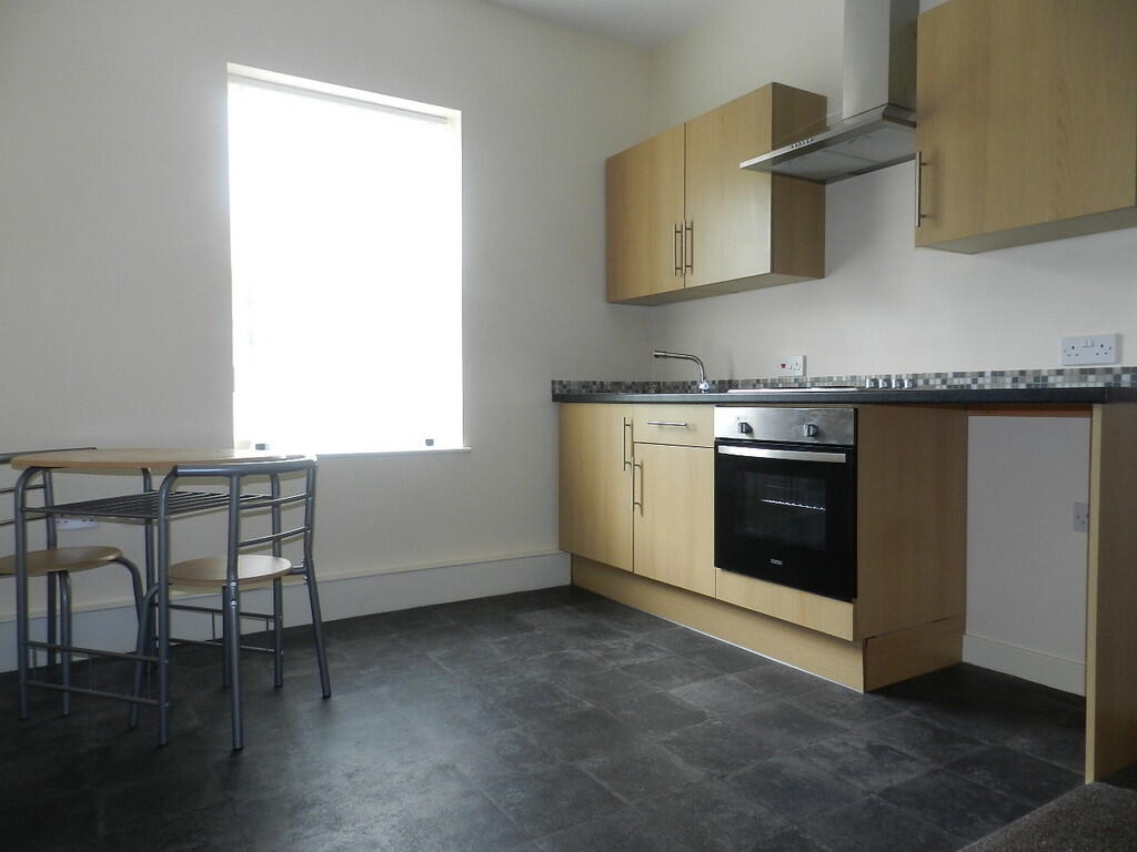
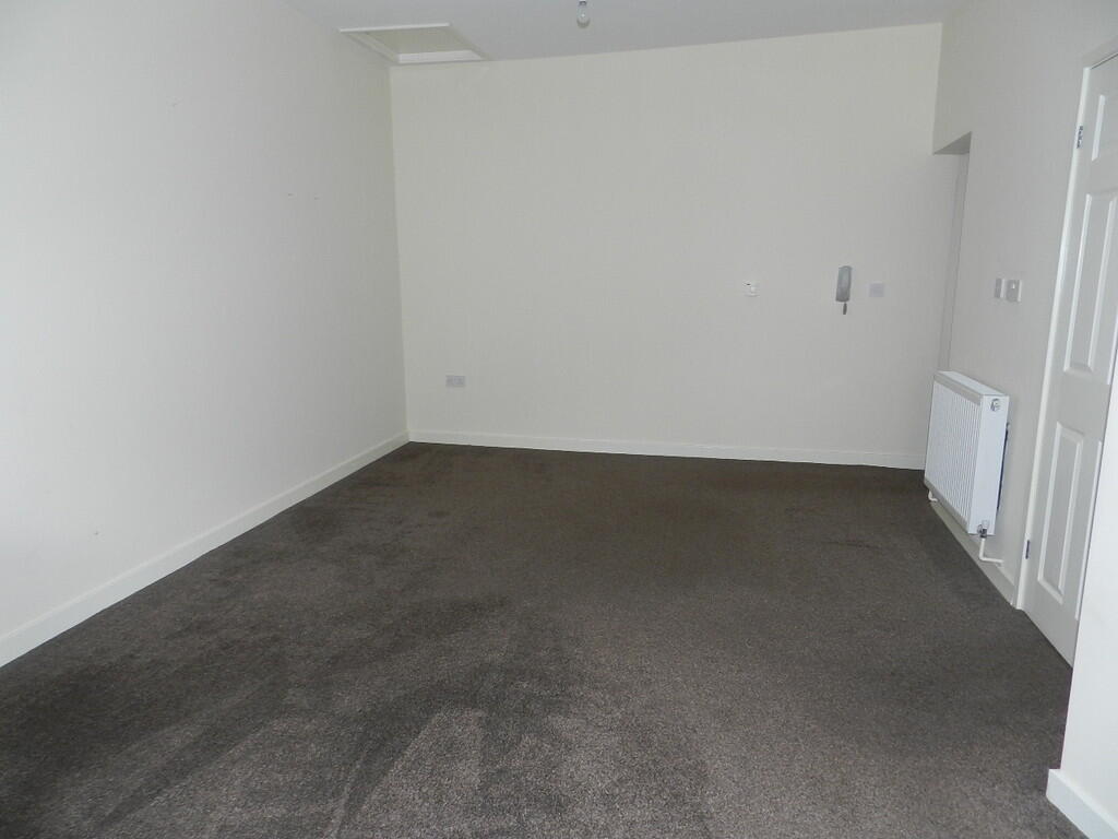
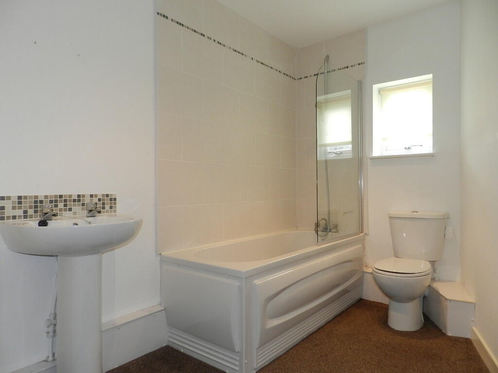
Photo 1 Photo 2 Photo 3 Photo 4
/ 4
Property details
Floor area
91 m²
Council tax band
A
Deprivation
Decile 6 (17,781 of 33,755)
Street crime
369 incidents within 1 mile (Apr 2026)
Key features
- First floor Flat
- One Bedroom
- Private front door
- Open plan lounge and kitchen
- Bathroom
- Walking distance from hospital
- Walking distance to local shops
- Council tax band A
- Highly sought after area
Additional details
- Heating
- Gas central
Description
Listed by
Stoke On Trent
The Property Franchise Group
Reference: 170838677
EPC Rating & Upgrade Cost
Fetching EPC data… Refresh this page in a moment.
Flood risk
Zone: 1
Risk: Low
Job (default Low)
EPC Graphs
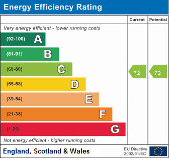
EPC 1
Rental Range
Estimated market rent for Stoke-on-Trent. Low = conservative, Realistic = average, Optimistic = best case.
Based on Local Authority from postcode lookup → Stoke-on-Trent.
LHA (30th percentile) floor for Staffordshire North: £424/mo (Apr 2025 – Mar 2026)
Location
Address
2 Franklin Road
Nearby
Nearest stations, universities and amenities (distance from property).
| Type | Name | Distance |
|---|---|---|
| Shop | W. Lewis Florist & Nursery | 0.0 miles |
| Shop | Penkhull Convenience Stores | 0.0 miles |
| Bus stop | Springfields Road | 0.4 miles |
| Bus stop | Unknown | 0.5 miles |
| Hospital | Royal Stoke University Hospital | 0.6 miles |
| Train station | Stoke-on-Trent | 0.9 miles |
| University | University of Staffordshire Stoke Campus | 1.0 miles |
| Hospital | North Staffordshire Nuffield Hospital | 1.4 miles |
| Train station | Longton | 2.7 miles |
Street-level crime
| Category | Count |
|---|---|
| Violence and sexual offences | 122 |
| Anti-social behaviour | 63 |
| Public order | 36 |
| Criminal damage and arson | 29 |
| Shoplifting | 28 |
| Burglary | 21 |
| Drugs | 16 |
| Other theft | 14 |
| Vehicle crime | 14 |
| Other crime | 10 |
| Possession of weapons | 7 |
| Robbery | 4 |
| Theft from the person | 3 |
| Bicycle theft | 2 |
| Total incidents | 369 |
Within 1 mile during Apr 2026. Source: data.police.uk (England & Wales).
Schools nearby
Nearest open schools with Ofsted ratings (England). Closed schools are not shown. Data from Get Information about Schools and Ofsted.
| Name | Type | Distance | Ofsted |
|---|---|---|---|
| Thistley Hough Academy | Secondary | 0.2 miles | Good — 26 Apr 2017 |
| The Willows Primary School | Primary | 0.2 miles | Good — 14 Dec 2010 |
| St John's CofE (A) Primary School | Primary | 0.5 miles | Requires improvement — 14 Jun 2023 |
| St Thomas Aquinas Catholic Primary School | Primary | 0.7 miles | Good — 15 Jan 2023 |
| Stoke Minster CofE Primary Academy | Primary | 0.7 miles | Inadequate — 27 Sep 2022 |
Rental Comparables
Residential lets from OpenRent and Rightmove for the area (same bedroom count). Use to validate rent estimates. Student lets are excluded.
Average rent: £620/mo (45 listings)