56 CHAMBERS STREET
CREWE, CHESHIRE EAST CW2 6HJ
£600 pcm
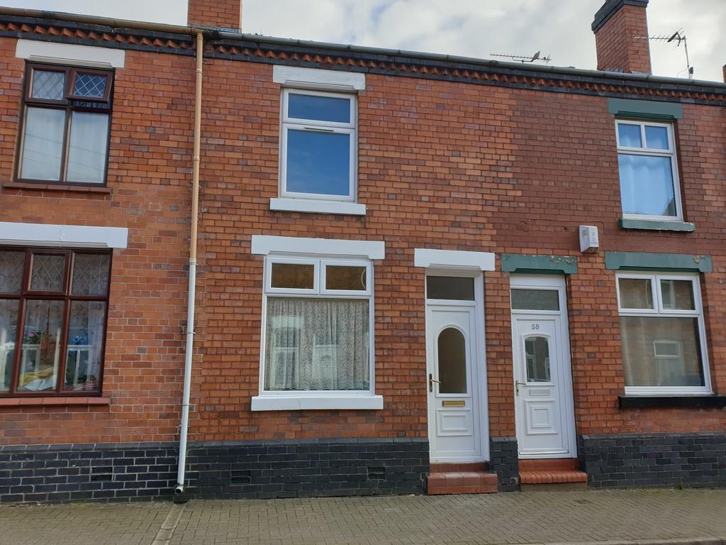
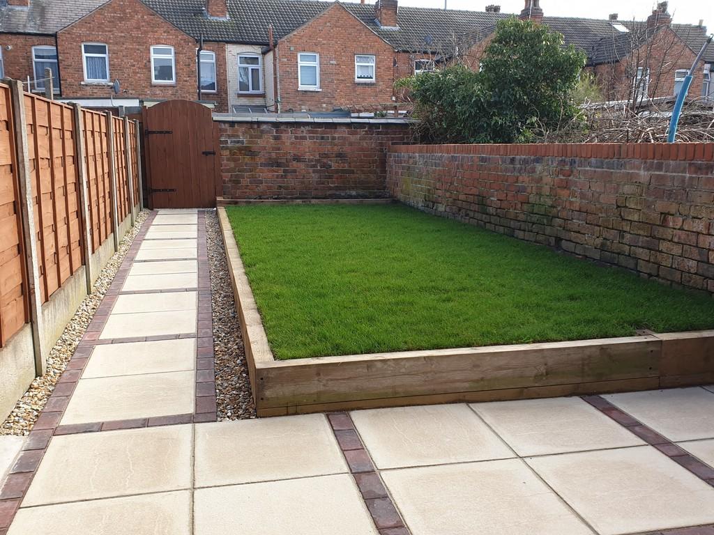
Photo 1 Photo 2
/ 2
Property details
Floor area
71 m²
EPC rating
D
Year built
England and Wales: before 1900
Deprivation
Decile 2 (5,873 of 33,755)
Street crime
352 incidents within 1 mile (Mar 2026)
Key features
- Fully refurbished
- Close to Train Station
- Two double Bedrooms
- Shops Nearby
Description
Listed by
Crewe
Stephenson Browne Ltd
Reference: 84082086
EPC Rating & Upgrade Cost
Current rating: D
Potential rating: B
Inspection date: 05/02/2021
Current heating cost: £643/year
Potential heating cost: £438/year
Est. upgrade cost to C: £19,915
Recommendations
- 50 mm internal or external wall insulation (£4,000 - £14,000)
- Floor insulation (suspended floor) (£800 - £1,200)
- Low energy lighting for all fixed outlets (£15)
- Upgrade heating controls (£350 - £450)
- Solar water heating (£4,000 - £6,000)
- Solar photovoltaic panels, 2.5 kWp (£3,500 - £5,500)
Flood risk
Zone: 1
Risk: Low
Job (default Low)
Floorplans
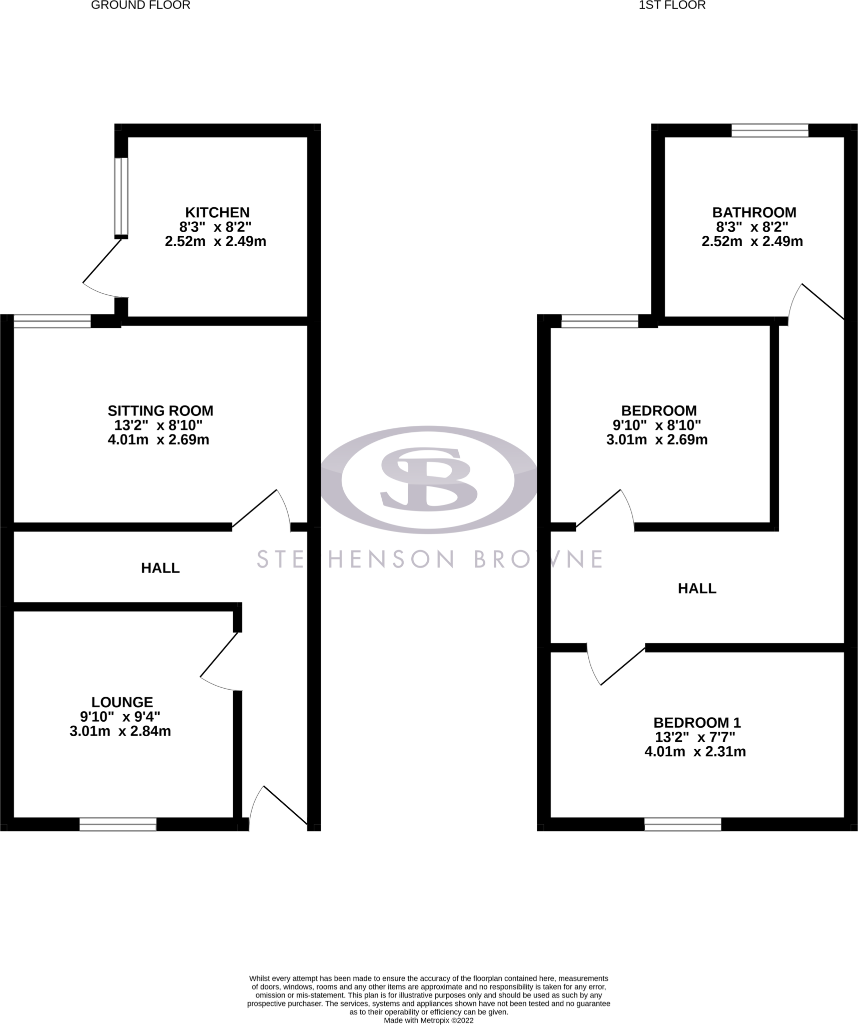
Floorplan 1
Rental Range
Estimated market rent for Cheshire East. Low = conservative, Realistic = average, Optimistic = best case.
Based on Local Authority from postcode lookup → Cheshire East.
LHA (30th percentile) floor for South Cheshire: £573/mo (Apr 2025 – Mar 2026)
Location
Nearby
Nearest stations, universities and amenities (distance from property).
| Type | Name | Distance |
|---|---|---|
| Shop | Jay's Computer Services | 0.1 miles |
| Shop | Top Gee | 0.1 miles |
| Bus stop | Crewe, Nantwich Road / The Brunswick | 0.1 miles |
| Train station | Crewe | 0.3 miles |
| University | University of Buckingham Crewe Campus | 0.8 miles |
| Hospital | Leighton Hospital | 2.6 miles |
| Train station | Nantwich | 3.7 miles |
| Hospital | Weaver Lodge Independent Hospital | 7.4 miles |
| University | Keele University | 9.2 miles |
Street-level crime
| Category | Count |
|---|---|
| Violence and sexual offences | 128 |
| Shoplifting | 58 |
| Public order | 34 |
| Anti-social behaviour | 33 |
| Drugs | 31 |
| Criminal damage and arson | 19 |
| Other theft | 14 |
| Bicycle theft | 9 |
| Other crime | 7 |
| Vehicle crime | 6 |
| Burglary | 5 |
| Possession of weapons | 4 |
| Robbery | 3 |
| Theft from the person | 1 |
| Total incidents | 352 |
Within 1 mile during Mar 2026. Source: data.police.uk (England & Wales).
Schools nearby
Nearest open schools with Ofsted ratings (England). Closed schools are not shown. Data from Get Information about Schools and Ofsted.
| Name | Type | Distance | Ofsted |
|---|---|---|---|
| Westminster Nursery School | Nursery | 0.2 miles | Good — 26 Nov 2014 |
| Ruskin Community High School | Secondary | 0.4 miles | Good — 1 Jul 2015 |
| Pebble Brook Primary School | Primary | 0.5 miles | Good — 25 Nov 2014 |
| Cheshire College - South & West | Other | 0.6 miles | — (No rating) |
| Edleston Primary School | Primary | 0.6 miles | Good — 10 Jun 2016 |
Rental Comparables
Rental listings exist nearby, but none matched the 2-bedroom estimate from EPC for this property.