85 BRANTWOOD ROAD
LONDON, GREATER LONDON N17 0DT
£1,250 pcm
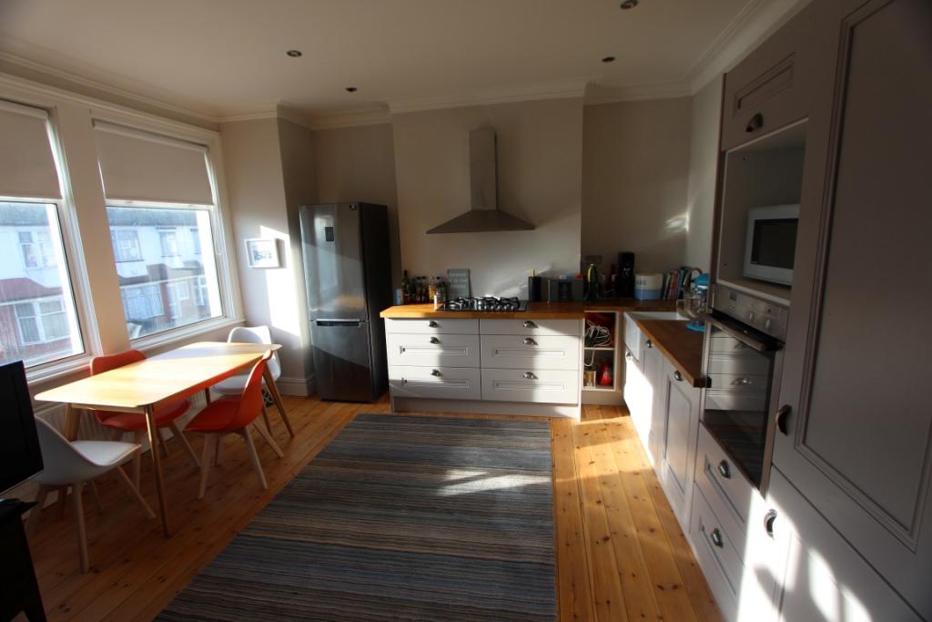
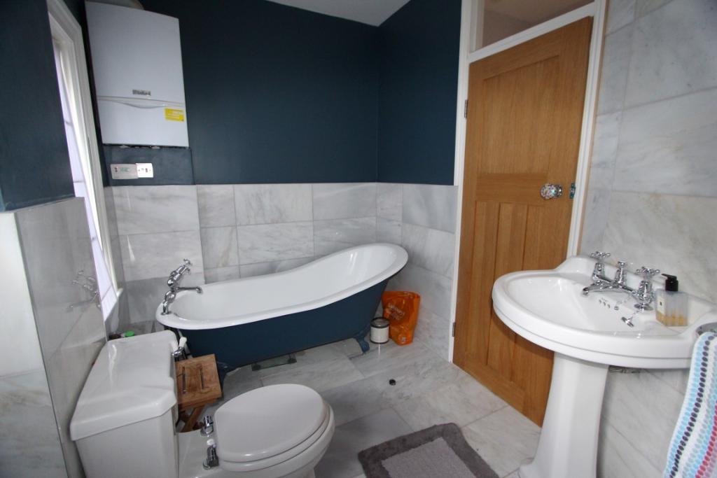
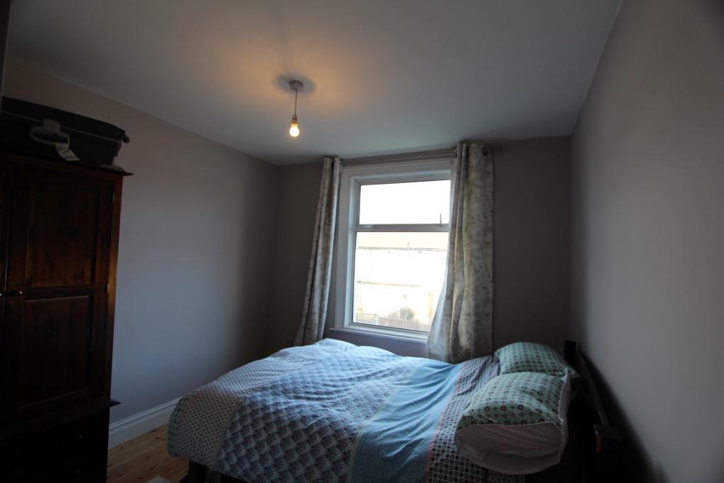
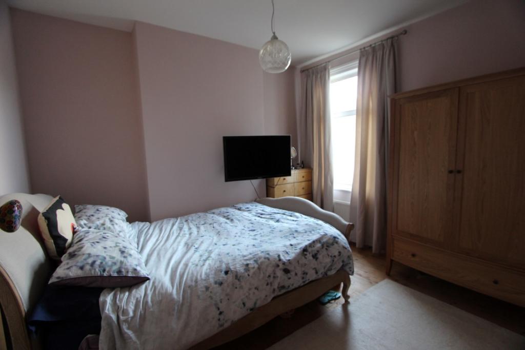
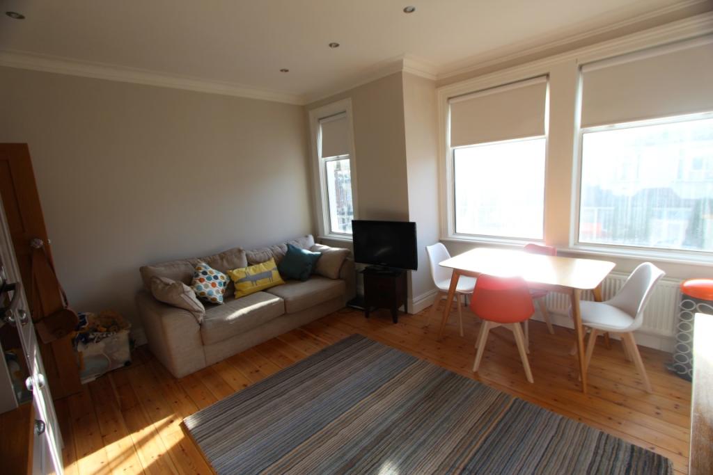
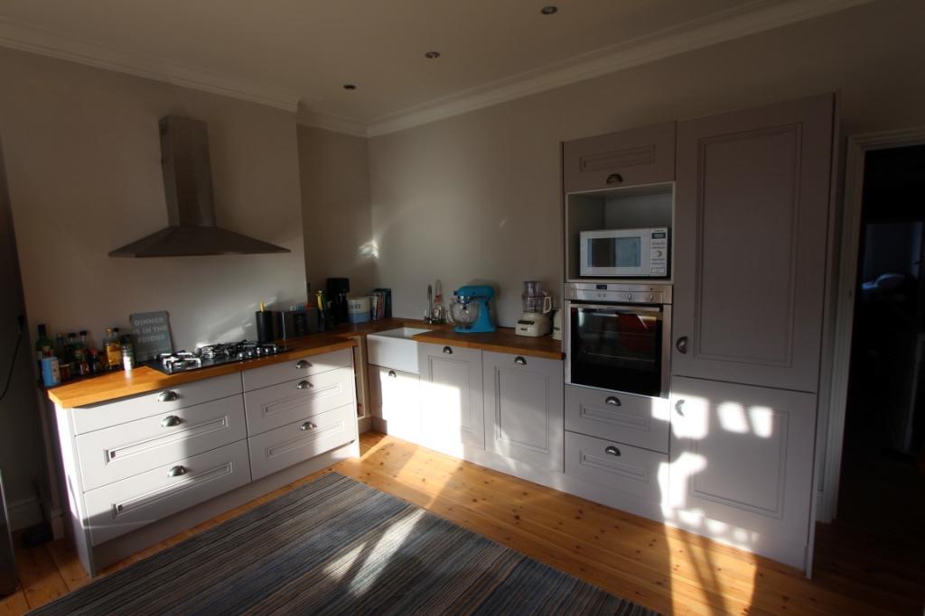
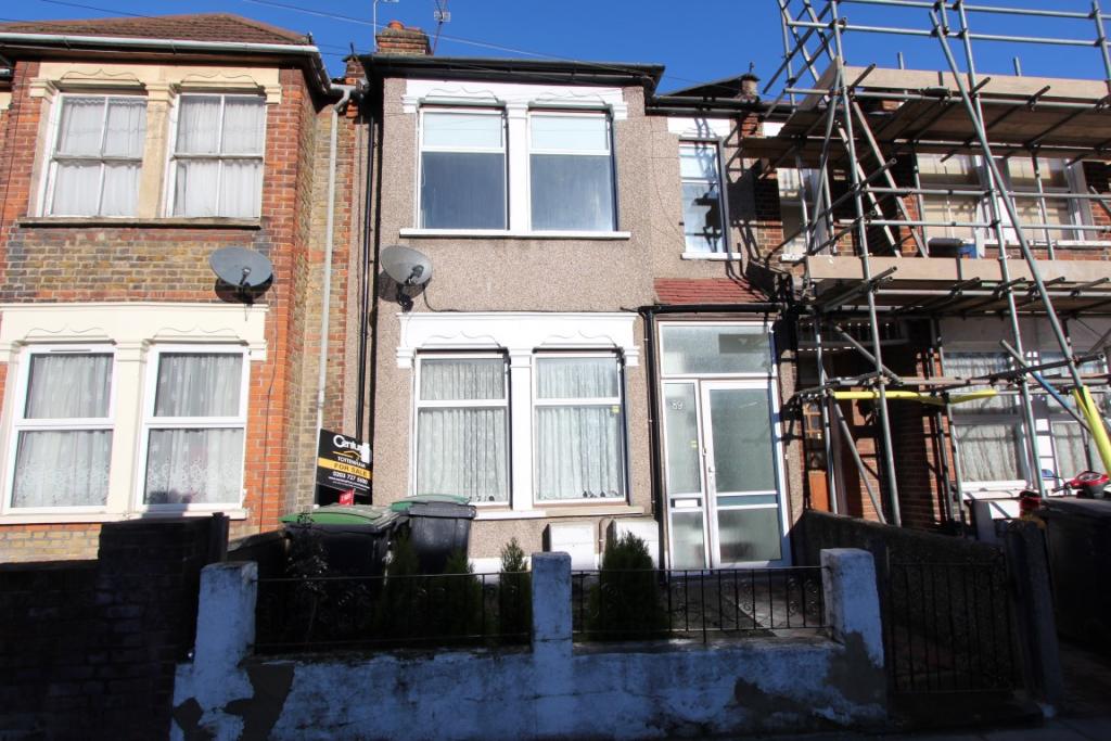
Photo 1 Photo 2 Photo 3 Photo 4 Photo 5 Photo 6 Photo 7
/ 7
Property details
Floor area
60 m²
Year built
England and Wales: 1930-1949
Deprivation
Decile 1 (565 of 33,755)
Street crime
929 incidents within 1 mile (Apr 2026)
Key features
- TWO DOUBLE BEDROOMS
- FIRST FLOOR FLAT
- WOOD FLOORING
- FITTED KITCHEN
- LOUNGE/DINER
- GAS CENTRAL HEATING
- DOUBLE GLAZING
- CLOSE TO TRANSPORT
- AVAILABLE NOW!
Additional details
- Heating
- Gas central
Description
Listed by
London
Knights Residential
Reference: 52354251
EPC Rating & Upgrade Cost
Fetching EPC data… Refresh this page in a moment.
Flood risk
Zone: 1
Risk: Low
Job (default Low)
FENSA Certificates
This property has 1 FENSA certificate(s) on record, indicating window/door installations by FENSA-approved installers.
FENSA Certificate #2887388
Property Details
Street: 85 Brantwood Road
Town: LONDON
Postcode: N17 0DT
Installation Details
Items: 7 windows
Certificate Issued: 19/07/2005
Work Completed: 20/06/2005
This certificate data was retrieved from FENSA's database
What is FENSA? FENSA (Fenestration Self-Assessment Scheme) is a government-authorised scheme that monitors building regulation compliance for replacement windows and doors. Certificates indicate that work was completed by FENSA-approved installers.
Rental Range
Estimated market rent for Haringey. Low = conservative, Realistic = average, Optimistic = best case.
Based on Local Authority from postcode lookup → Haringey.
LHA (30th percentile) floor for Cambridge: £947/mo (Apr 2025 – Mar 2026)
Location
Nearby
Nearest stations, universities and amenities (distance from property).
| Type | Name | Distance |
|---|---|---|
| Shop | Loon Fung Tottenham | 0.1 miles |
| Bus stop | Tottenham High Road | 0.1 miles |
| Bus stop | Gillham Terrace | 0.1 miles |
| Shop | Tottenham Food & Wine | 0.2 miles |
| Train station | White Hart Lane | 0.4 miles |
| Train station | Silver Street | 0.5 miles |
| Hospital | North London Hospice Winchmore Hill | 1.7 miles |
| Hospital | Priory Hospital | 2.9 miles |
| University | Arden University Stratford Campus | 5.1 miles |
| University | University of Wales Trinity Saint David London | 5.3 miles |
Street-level crime
| Category | Count |
|---|---|
| Violence and sexual offences | 252 |
| Anti-social behaviour | 210 |
| Vehicle crime | 73 |
| Other theft | 65 |
| Public order | 57 |
| Drugs | 45 |
| Criminal damage and arson | 44 |
| Shoplifting | 43 |
| Burglary | 42 |
| Theft from the person | 39 |
| Robbery | 31 |
| Possession of weapons | 12 |
| Other crime | 11 |
| Bicycle theft | 5 |
| Total incidents | 929 |
Within 1 mile during Apr 2026. Source: data.police.uk (England & Wales).
Schools nearby
Nearest open schools with Ofsted ratings (England). Closed schools are not shown. Data from Get Information about Schools and Ofsted.
| Name | Type | Distance | Ofsted |
|---|---|---|---|
| Vale School | Other | 0.2 miles | Good — 26 Oct 2012 |
| Duke's Aldridge | Secondary | 0.2 miles | Good — 9 Feb 2012 |
| St John and St James CofE Primary School | Primary | 0.2 miles | Good — 13 Jan 2022 |
| Brook House Primary School | Primary | 0.2 miles | Outstanding — 26 Sep 2023 |
| London Academy of Excellence Tottenham | Other | 0.3 miles | — (No rating) |
Rental Comparables
Residential lets from OpenRent and Rightmove for the area (same bedroom count). Use to validate rent estimates. Student lets are excluded.
| Title | Rent | Beds | Distance | As seen on |
|---|---|---|---|---|
| 2 Bed Maisonette, Northumberland Park, N17 | £1,895/mo | 2 | 0.19 miles | OpenRent |
Average rent: £1,895/mo (1 listing)