Sugar Lane
Bollington, Macclesfield, SK10 5SN
Property details
Tenure
FREEHOLD
Local average
£1,415,975 (-40%)
Deprivation
Decile 9 (29,107 of 33,755)
Street crime
26 incidents within 1 mile (Apr 2026)
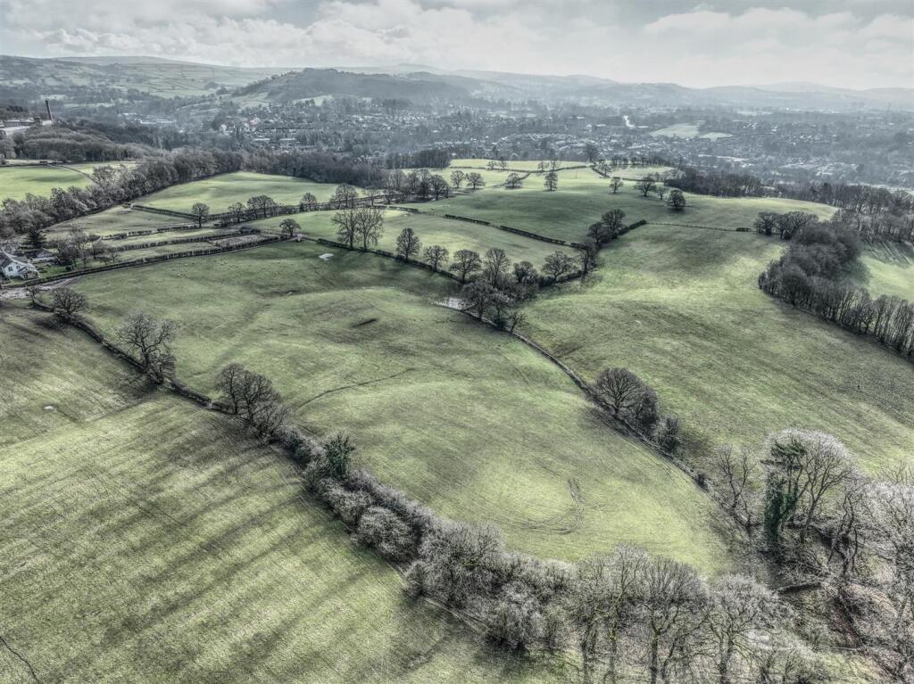
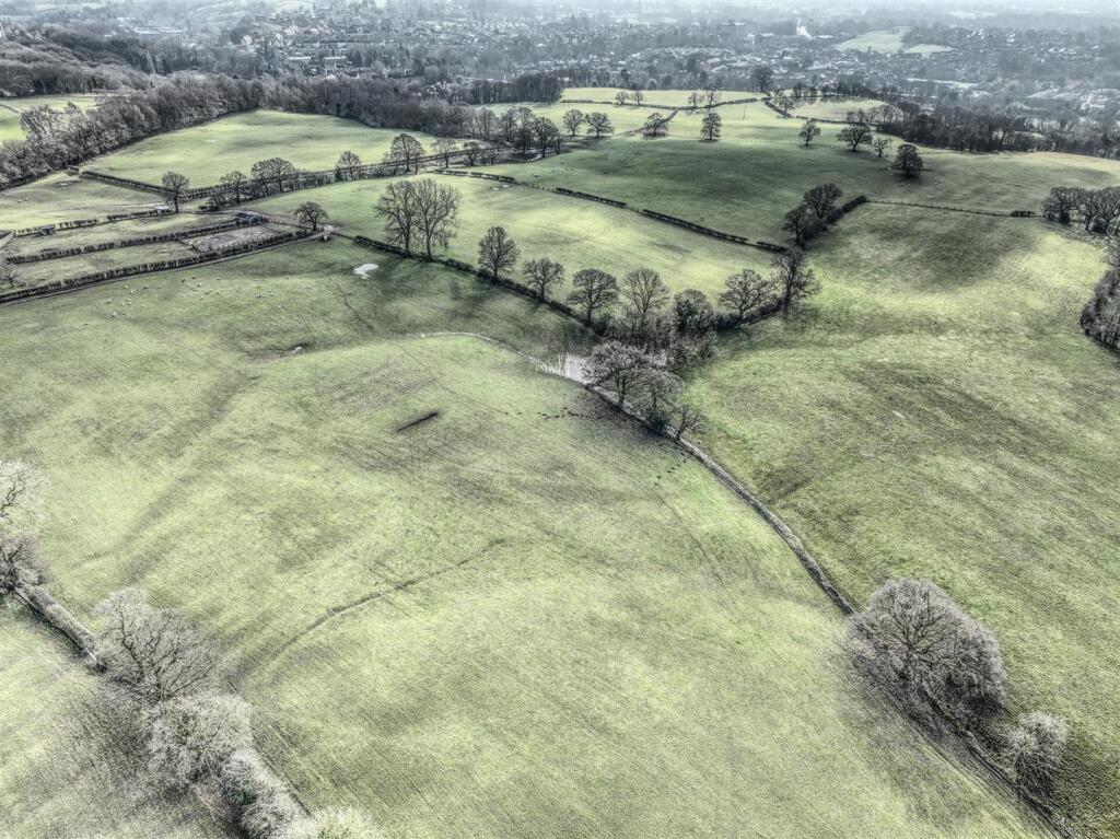
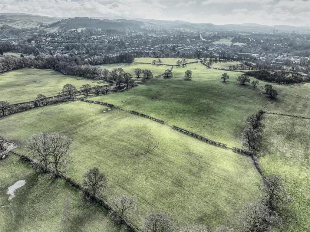
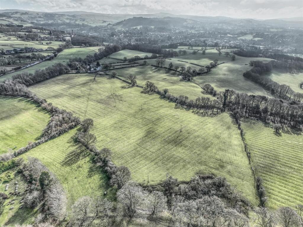
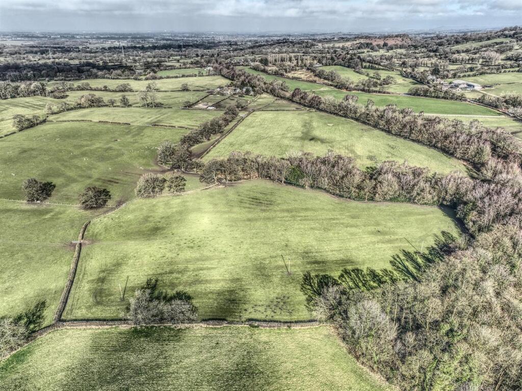
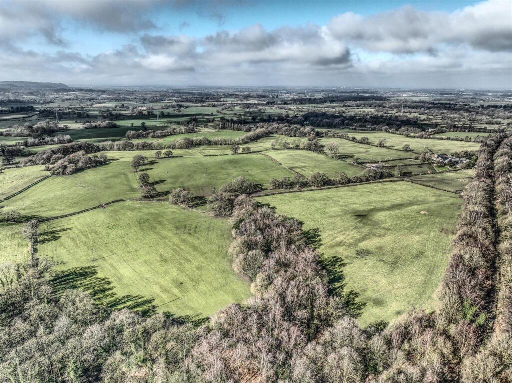
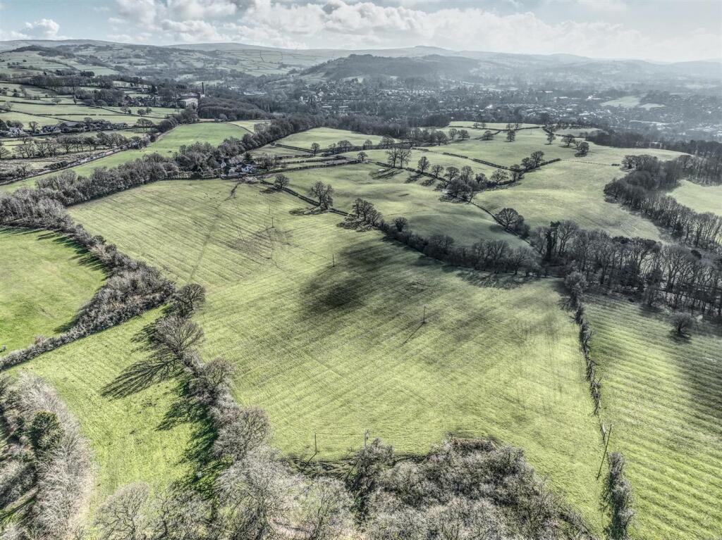
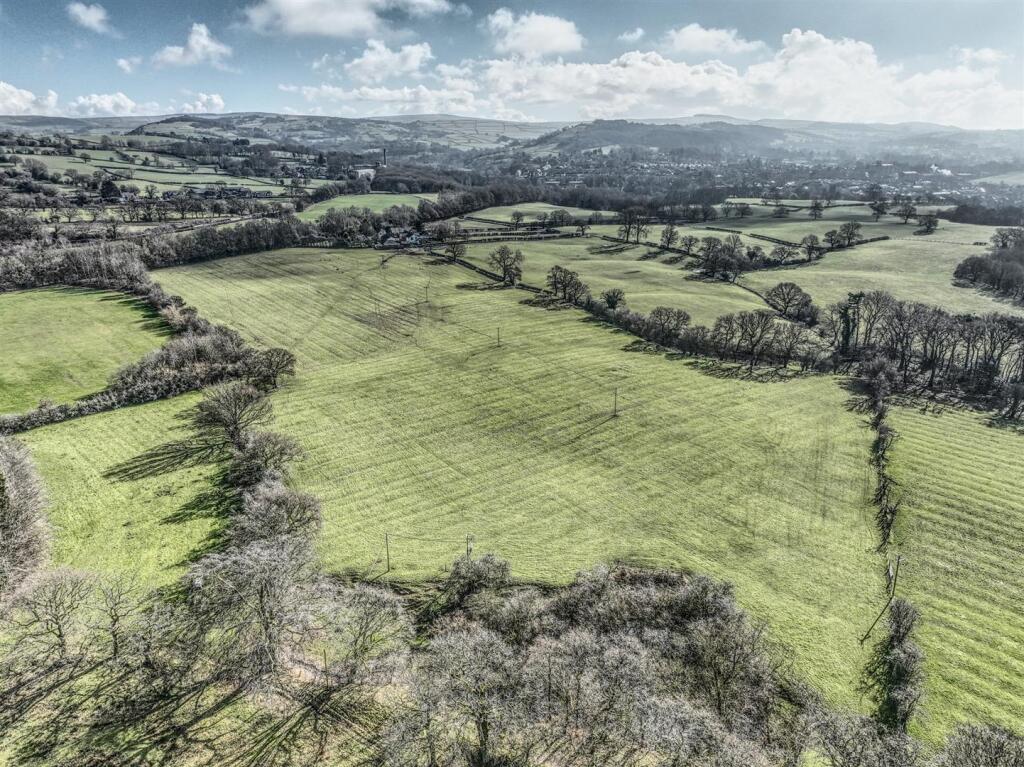
Description
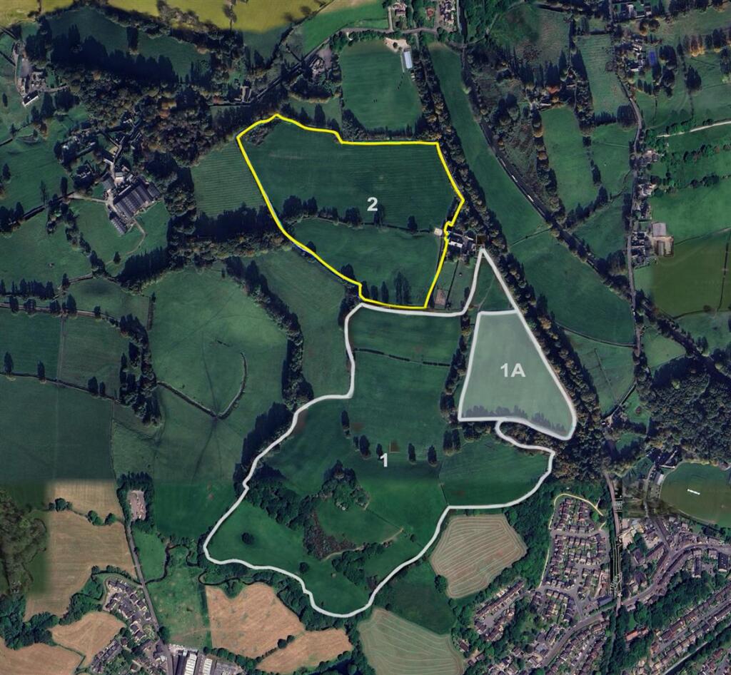
*GUIDE PRICE £10,000 - £20,000 PER ACRE*
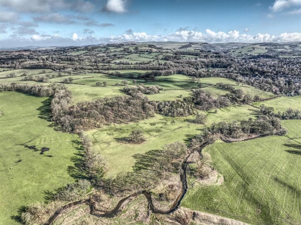
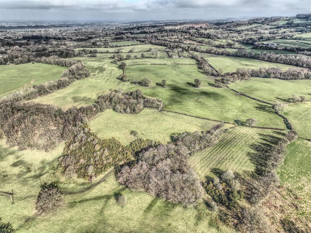
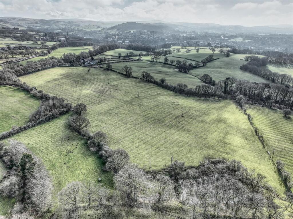
A rare opportunity to acquire 54 acres of meadowland/grass crops.
Lot 1 (outlined in white) 54 acres
Fully fenced with stock-proof fencing with water available (part mains, part natural), and has been well farmed for 38 years.
The land is of good heart, regularly fertilised and lymed, offering very productive fertile farmland with access to The Middlewood Way and immediately adjacent to Bollington Village.
Listed by
Prestbury
Holmes Naden (Estates) Ltd
Reference: 161687573
EPC ratings on this postcode
We don't have a matched EPC for this property yet. Below are efficiency scores and details for other addresses on this postcode.
| Address | Current | Potential | Floor area | Age band | Type |
|---|---|---|---|---|---|
| Four Winds, Sugar Lane, Bollington | 58 | 87 | 137 m² | England and Wales: 1967-1975 | House |
| Four Winds, Sugar Lane, Bollington, MACCLESFIELD | 58 | 87 | 137 m² | — | Detached |
| Lodge Farm, Sugar Lane, Bollington | 12 | 15 | 299 m² | England and Wales: before 1900 | House |
| Meadow Barn, Sugar Lane, Bollington | 58 | 64 | 383 m² | England and Wales: 1991-1995 | House |
| Meadow Barn, Sugar Lane, Bollington | 33 | 44 | 336 m² | England and Wales: 1991-1995 | House |
| Meadow Barn, Sugar Lane, Bollington, MACCLESFIELD | 58 | 64 | 383 m² | England and Wales: 1991-1995 | Detached |
| The Old Dairy, Sugar Lane, Bollington | 46 | 81 | 127 m² | England and Wales: 2003-2006 | House |
| The Old Dairy, Sugar Lane, Bollington | 44 | 56 | 141 m² | England and Wales: 2003-2006 | House |
| The Old Dairy, Sugar Lane, Bollington, MACCLESFIELD | 46 | 81 | 127 m² | England and Wales: 2003-2006 | Detached |
Flood risk
Zone: 1
Risk: Low
Job (default Low)
Price history
No sales history found for this property in Land Registry Price Paid data.
Sold Comparables
Same street and nearby sales within 0.25 miles (last 5 years). Data from Land Registry Price Paid.
| Address | Price | Date | Type |
|---|---|---|---|
| HIGHER SUGAR LANE FARM SUGAR LANE, ADLINGTON, MACCLESFIELD, CHESHIRE EAST, SK10 5SL | £1,450,000 | 11/02/2022 | Other |
| Same street FOUR WINDS SUGAR LANE, BOLLINGTON, MACCLESFIELD, CHESHIRE EAST, SK10 5SN | £1,000,000 | 20/08/2021 | Detached |
Street average: £1,000,000 (1 sale)
Area average: £1,450,000 (1 sale)
Capital growth trend
Land Registry outcode average: last 12 months vs 5y and 10y ago (from sold prices).
House Price Index (HM Land Registry — official index, not sold-price averages): Cheshire East. Series: All dwelling types. As of March 2026.
Rental Range
Estimated market rent for Cheshire East. Low = conservative, Realistic = average, Optimistic = best case.
Based on Local Authority from postcode lookup → Cheshire East.
LHA (30th percentile) floor for East Cheshire: Apr 2025 – Mar 2026
Location
Address
Sugar Lane
Nearby
Nearest stations, universities and amenities (distance from property).
| Type | Name | Distance |
|---|---|---|
| Bus stop | Bollington, Wellington Road / Council Offices | 0.5 miles |
| Shop | Co-op Food | 0.5 miles |
| Bus stop | Bollington, Wellington Road / Adlington Road | 0.5 miles |
| Shop | Bollington convenience Store | 0.6 miles |
| Train station | Adlington (Cheshire) | 1.6 miles |
| Train station | Prestbury | 1.8 miles |
| Hospital | Macclesfield District General Hospital | 3.3 miles |
| Hospital | Rosemount Resource Centre | 3.5 miles |
| University | University of Derby, Buxton | 8.4 miles |
| University | University of Manchester Fallowfield Campus | 10.6 miles |
Street-level crime
| Category | Count |
|---|---|
| Violence and sexual offences | 12 |
| Anti-social behaviour | 7 |
| Burglary | 1 |
| Criminal damage and arson | 1 |
| Other theft | 1 |
| Possession of weapons | 1 |
| Public order | 1 |
| Shoplifting | 1 |
| Vehicle crime | 1 |
| Total incidents | 26 |
Within 1 mile during Apr 2026. Source: data.police.uk (England & Wales).
Schools nearby
Nearest open schools with Ofsted ratings (England). Closed schools are not shown. Data from Get Information about Schools and Ofsted.
| Name | Type | Distance | Ofsted |
|---|---|---|---|
| Bollington St John's CofE Primary School | Primary | 0.8 miles | Good — 22 Jan 2023 |
| Dean Valley Community Primary School | Primary | 0.8 miles | Good — 1 Nov 2012 |
| Pott Shrigley Church School | Primary | 1.0 miles | Good — 8 May 2019 |
| Bollington Cross CofE Primary School | Primary | 1.0 miles | Good — 20 Mar 2023 |
| Adlington Primary School | Primary | 1.1 miles | Outstanding — 15 Nov 2011 |
Rental Comparables
Rental comparables are temporarily unavailable while listing-site fetches are paused. Try again later.
Rent-driven metrics
Based on Area rent estimate.
- Rent ratio — Monthly rent ÷ purchase price (1% rule). 1%+ = strong, 0.8–1% = okay, <0.8% = weak for cashflow.
- Max investor price — Rent ÷ 0.8%; the price at which rent would be 0.8% of price (Stoke-style target).
- Target investor price — Rent ÷ 1%; the price at which rent would be 1% of price (strong cashflow band).
- Gross yield — Annual rent as % of purchase price (no costs).
Enter House Number
Enter the house number to help us retrieve more accurate pricing history and property data.
Please log in to submit or correct the house number for this listing.
Log in to continue