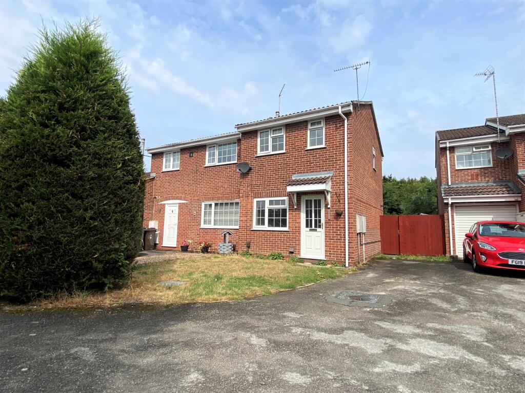
32 WOLVERLEY GRANGE
DERBY, ALVASTON, CITY OF DERBY DE24 0SS
£795 pcm
Property details
Floor area
46 m²
Council tax band
A
Deprivation
Decile 6 (18,572 of 33,755)
Street crime
162 incidents within 1 mile (Apr 2026)
Key features
- Two Bedroom Semi Detached Home
- Excellent Presentation Throughout
- Cul De Sac Location
- Driveway
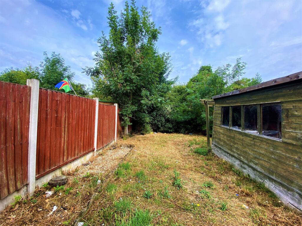
- Private Garden
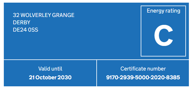
- EPC - C
- Council Tax Band - A
- AVAILABLE FROM MAY!
Additional details
- Parking
- Yes
- Garden
- Yes
Description
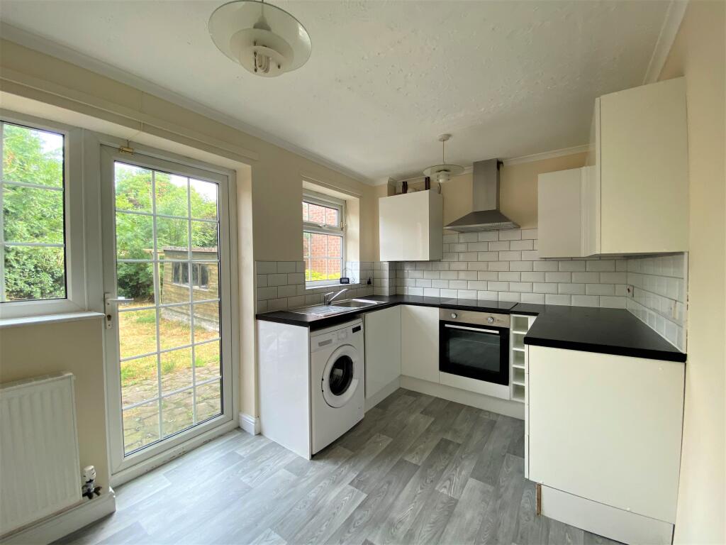
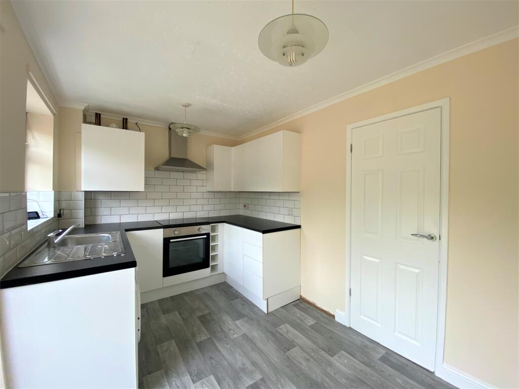
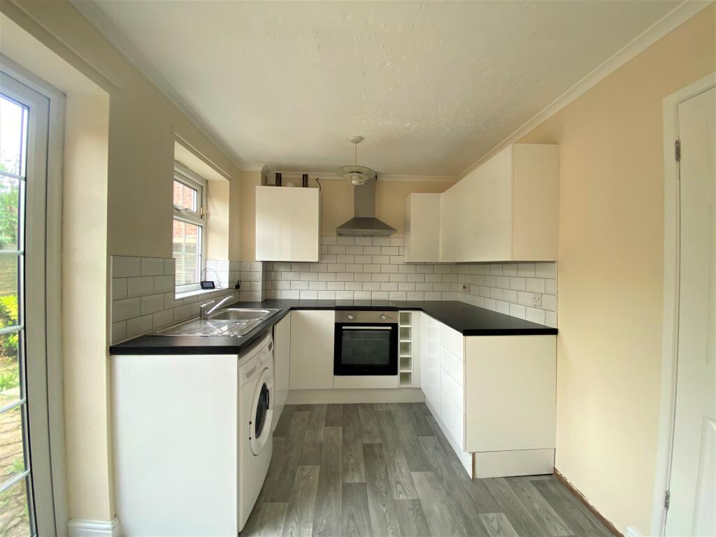
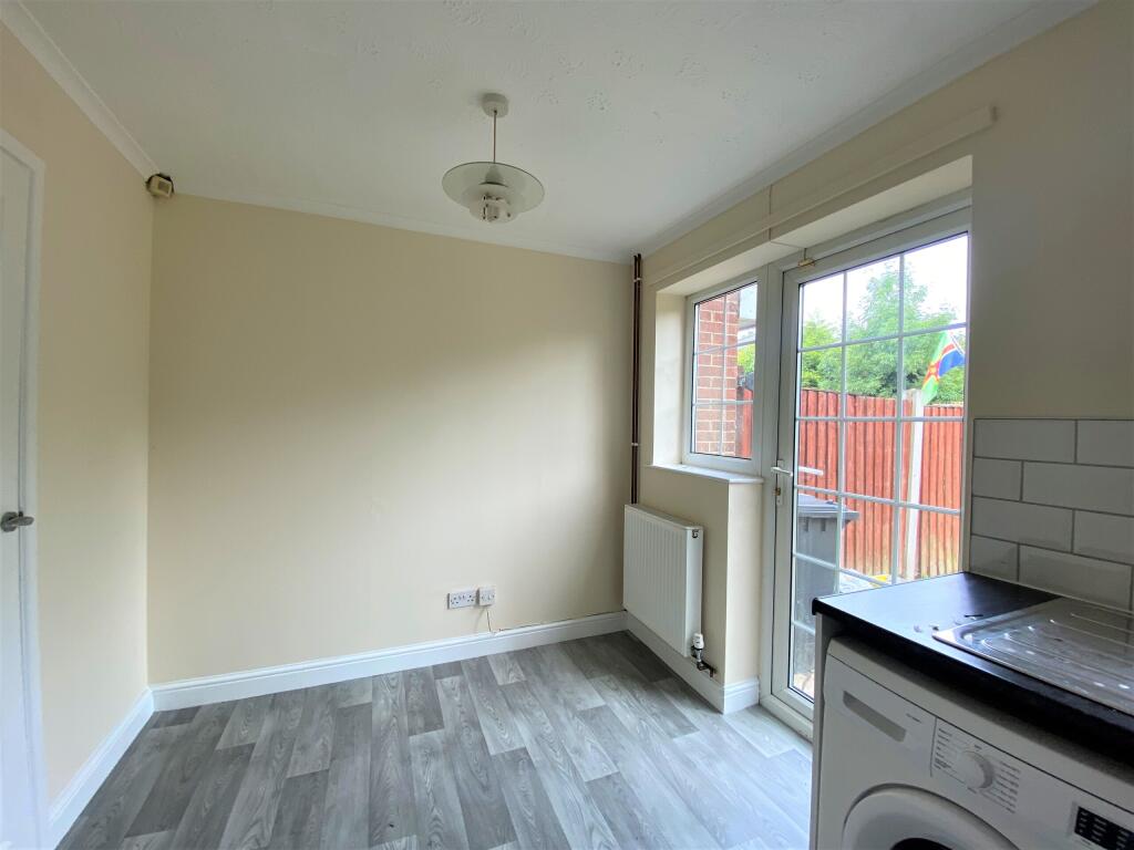
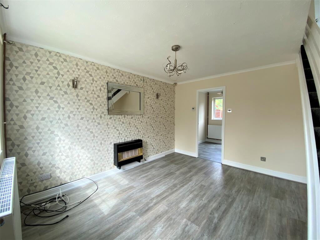
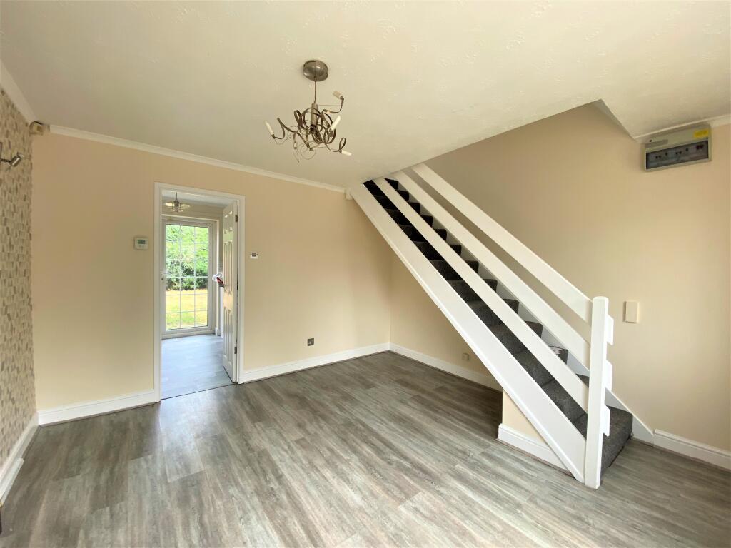
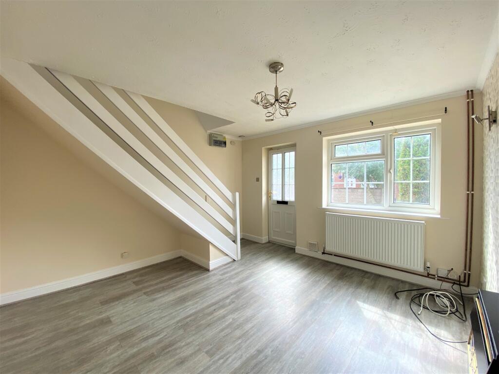
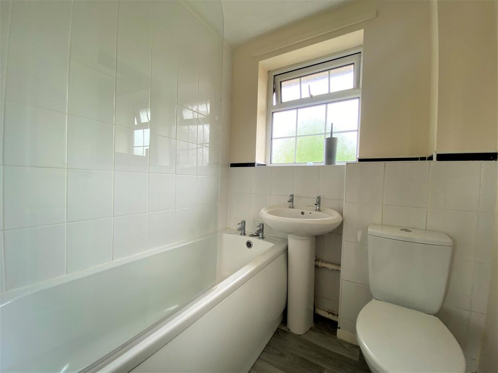
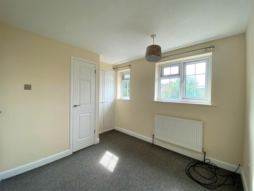
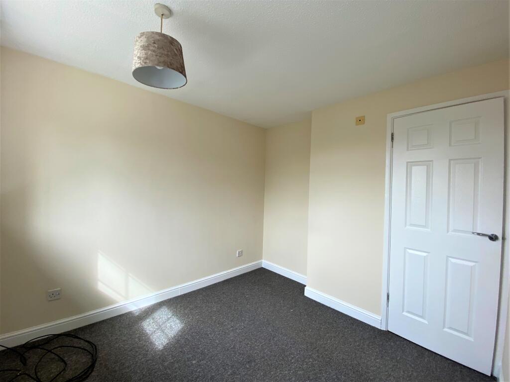
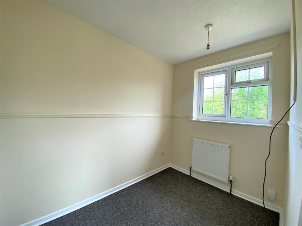
In brief, the property comprises; lounge, good size kitchen/diner, one double bedroom and one single bedroom, perfect for a home office, both offering built in storage and three piece suite bathroom with mains shower over bath. The property benefits from gas central heating and double glazing throughout.
Externally, the property offers driveway parking and front and rear gardens. A virtual tour of the property is available and would recommend this is viewed prior to arranging a viewing to fully appreciate the property on offer.
The property sits conveniently close to major road links, as well as bus routes and local amenities nearby. Please call to arrange an internal viewing NOW!
Listed by
Chellaston
Hannells Estate Agents
Reference: 164736821
EPC Rating & Upgrade Cost
Fetching EPC data… Refresh this page in a moment.
Flood risk
Zone: 1
Risk: Low
Job (default Low)
Floorplans
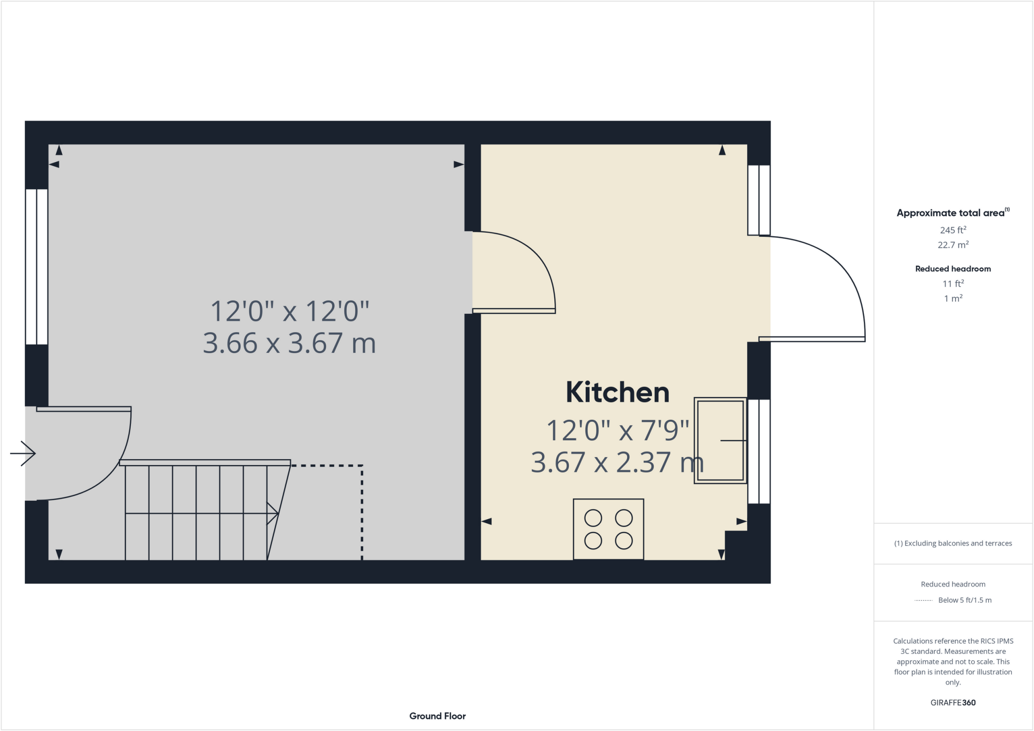
Ground floor
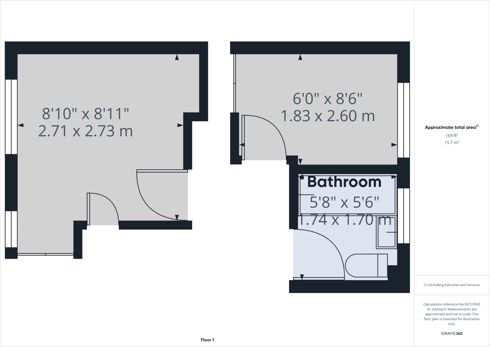
First floor
EPC Graphs
epc.PNG
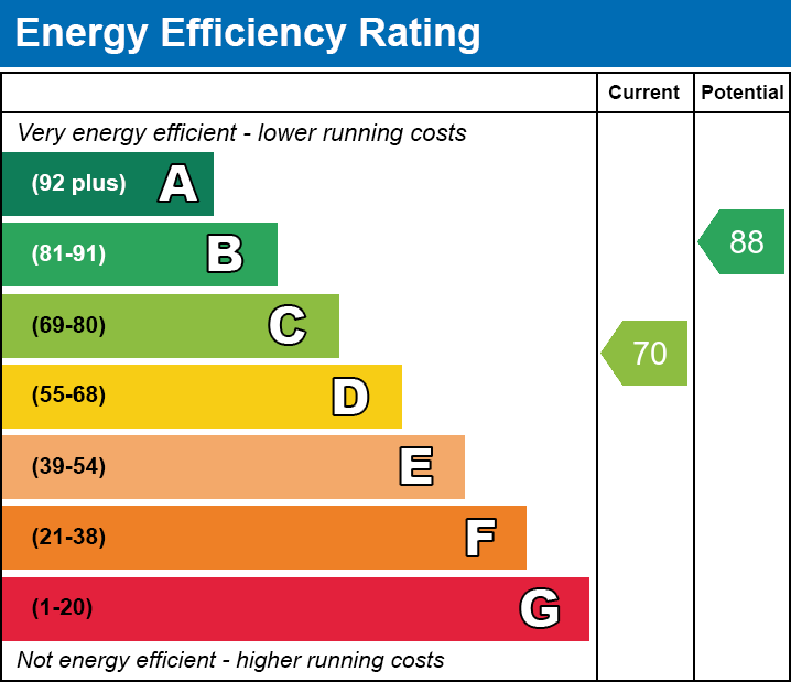
EE
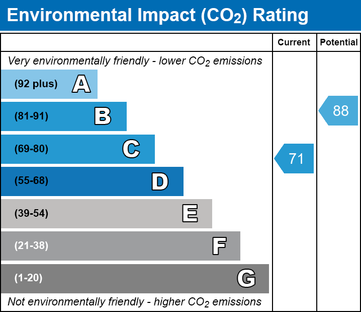
EI
Rental Range
Estimated market rent for Derby. Low = conservative, Realistic = average, Optimistic = best case.
Based on Local Authority from postcode lookup → Derby.
LHA (30th percentile) floor for Derby: £593/mo (Apr 2025 – Mar 2026)
Location
Nearby
Nearest stations, universities and amenities (distance from property).
| Type | Name | Distance |
|---|---|---|
| Bus stop | James Wyatt | 0.1 miles |
| Shop | Tesco Express | 0.2 miles |
| Shop | Sak + American Candy | 0.2 miles |
| Train station | Spondon | 1.4 miles |
| Train station | Peartree | 2.6 miles |
| Hospital | Royal Derby Hospital | 4.5 miles |
| University | University of Derby | 4.8 miles |
| Hospital | Nuffield Health Derby Hospital | 5.0 miles |
| University | Loughborough University | 11.4 miles |
Street-level crime
| Category | Count |
|---|---|
| Violence and sexual offences | 69 |
| Shoplifting | 33 |
| Anti-social behaviour | 21 |
| Vehicle crime | 10 |
| Public order | 9 |
| Other theft | 5 |
| Criminal damage and arson | 4 |
| Drugs | 3 |
| Other crime | 2 |
| Robbery | 2 |
| Bicycle theft | 1 |
| Burglary | 1 |
| Possession of weapons | 1 |
| Theft from the person | 1 |
| Total incidents | 162 |
Within 1 mile during Apr 2026. Source: data.police.uk (England & Wales).
Schools nearby
Nearest open schools with Ofsted ratings (England). Closed schools are not shown. Data from Get Information about Schools and Ofsted.
| Name | Type | Distance | Ofsted |
|---|---|---|---|
| Alvaston Infant and Nursery School | Primary | 0.4 miles | Good — 15 Nov 2017 |
| Alvaston Junior Academy | Primary | 0.4 miles | Requires improvement — 10 Sep 2024 |
| St John Fisher Catholic Voluntary Academy | Primary | 0.6 miles | Good — 3 Dec 2023 |
| Oakwood Infant and Nursery School | Primary | 0.8 miles | Good — 28 Feb 2018 |
| Clover Leys Spencer Academy | Primary | 0.9 miles | Good — 3 Jul 2024 |
Rental Comparables
Rental listings exist nearby, but none matched the 2-bedroom count for this property.