45 DAISY AVENUE
BURY ST EDMUNDS, SUFFOLK IP32 7PG
£475,000
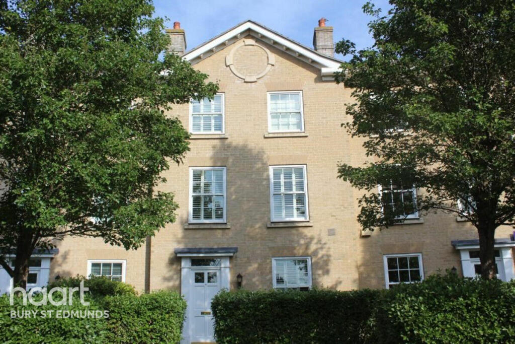
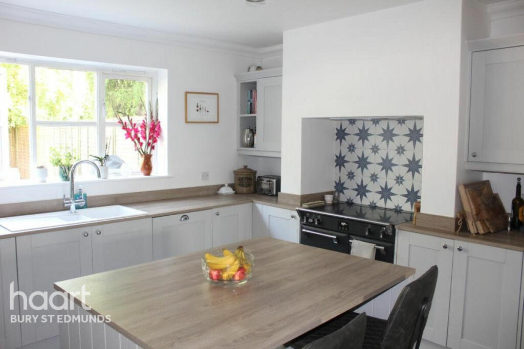
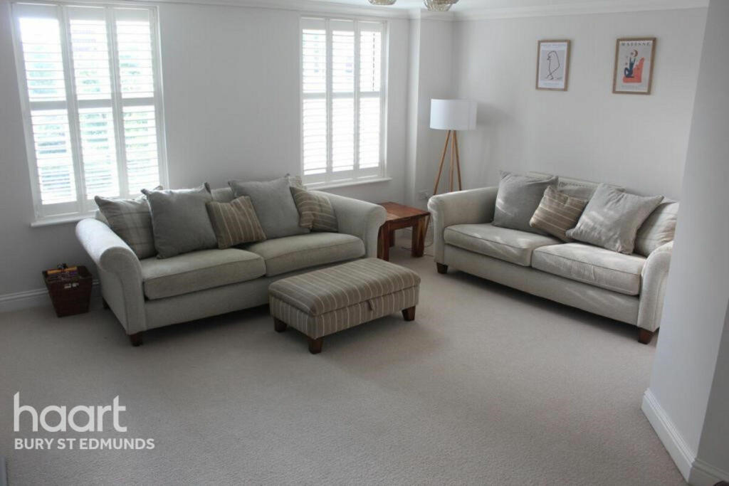
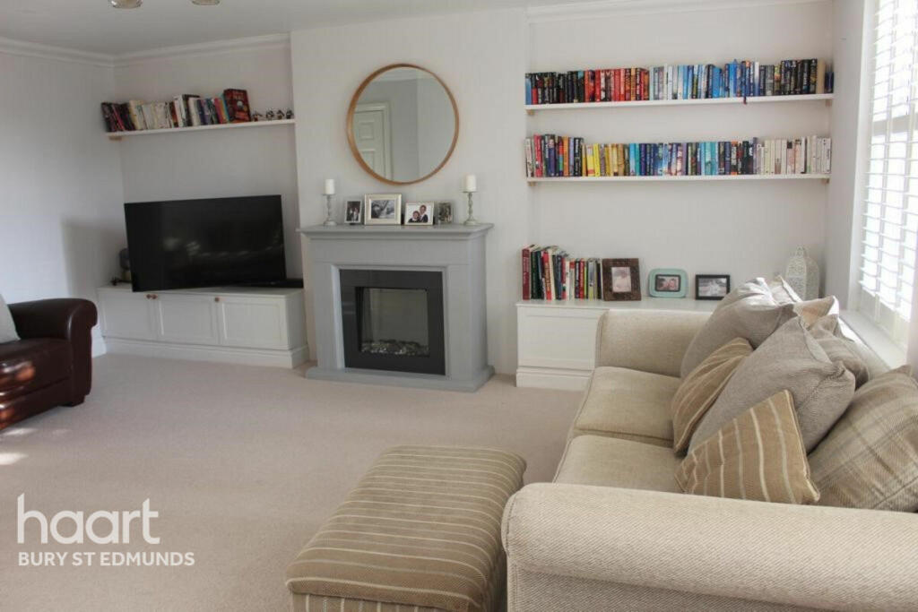
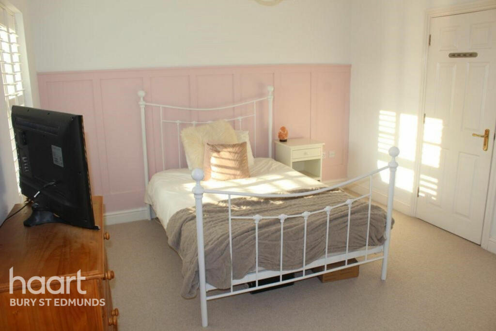
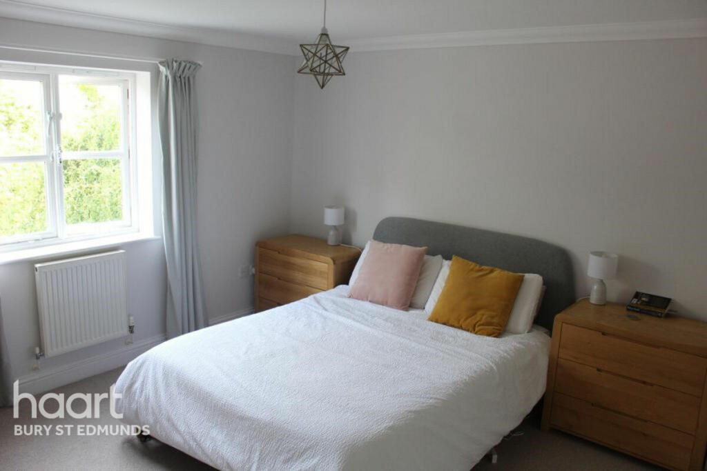
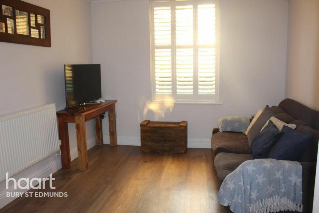
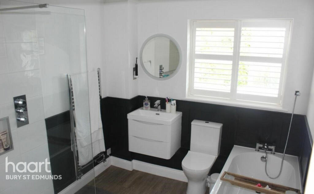
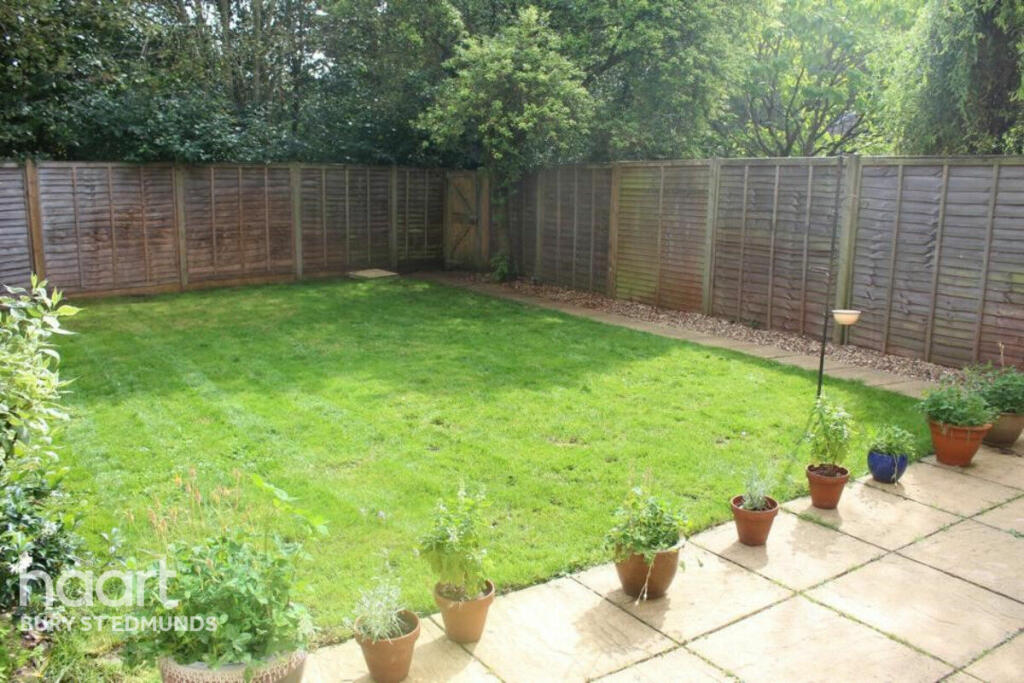
Photo 1 Photo 2 Photo 3 Photo 4 Photo 5 Photo 6 Photo 7 Photo 8 Photo 9
/ 9
Property details
Tenure
FREEHOLD
Floor area
167 m²
EPC rating
C
Year built
England and Wales: 2003-2006
Last sold
£410,000 Oct 2021
Price per m²
£2,844/m²
Local average
£245,088 (+93.8%)
Deprivation
Decile 10 (31,047 of 33,755)
Street crime
48 incidents within 1 mile (Mar 2026)
Key features
- 4 Generous Bedrooms
- Re-Fitted Kitchen/Breakfast Room
- Dining/Family Room
- 1st Floor Sitting Room
- Re Fitted Bathroom
- Ensuite
- Garage & Gardens
- UPVC Double Glazing
- Gas Fired Heating
- Chain Free
Additional details
- Parking
- Yes
- Garden
- Yes
Description
Listed by
Bury St. Edmunds
Spicerhaart
Reference: 86774820
EPC Rating & Upgrade Cost
Current rating: C
Potential rating: B
Inspection date: 06/11/2023
Current heating cost: £1,438/year
Potential heating cost: £1,438/year
Est. upgrade cost to C: £4,500
Recommendations
- Solar photovoltaic panels, 2.5 kWp (£3,500 - £5,500)
Flood risk
Zone: 1
Risk: Low
Job (default Low)
Floorplans
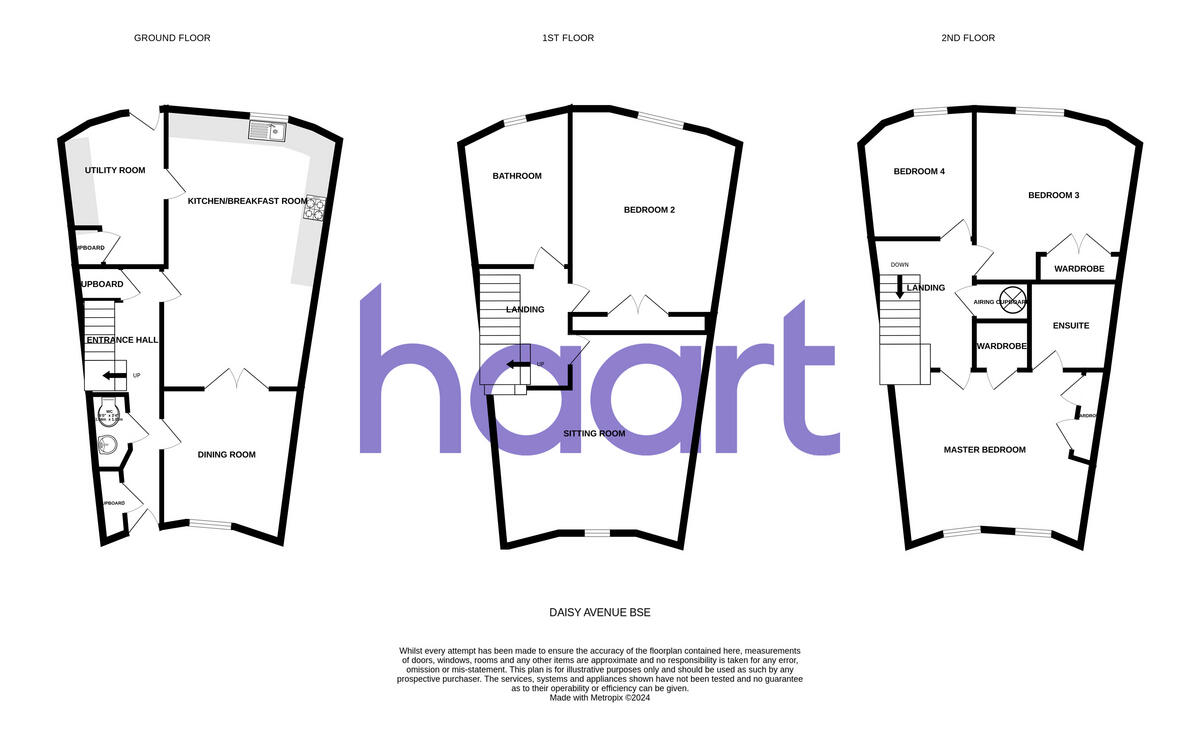
Floorplan 1
EPC Graphs
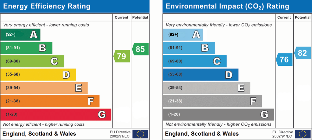
EPC 1
Price history
| Event | Date | Price | % change |
|---|---|---|---|
| Sold | 29/10/2021 (4 years ago) | £410,000 | — |
Source: HM Land Registry Price Paid Data. Crown copyright.
Sold Comparables
Same street and nearby sales within 0.25 miles (last 5 years). Data from Land Registry Price Paid.
| Address | Price | Date | Type |
|---|---|---|---|
| Same street 47 DAISY AVENUE, BURY ST EDMUNDS, WEST SUFFOLK, SUFFOLK, IP32 7PG | £365,000 | 20/10/2023 | Detached |
| Same street 71 DAISY AVENUE, BURY ST EDMUNDS, WEST SUFFOLK, SUFFOLK, IP32 7PG | £430,000 | 20/09/2023 | Terraced |
| Same street 1 DAISY AVENUE, BURY ST EDMUNDS, WEST SUFFOLK, SUFFOLK, IP32 7PG | £545,000 | 23/08/2023 | Detached |
| 18 SNOWDROP CLOSE, BURY ST EDMUNDS, WEST SUFFOLK, SUFFOLK, IP32 7LZ | £256,000 | 28/06/2023 | Terraced |
| 51 SELWAY DRIVE, BURY ST EDMUNDS, WEST SUFFOLK, SUFFOLK, IP32 7PL | £195,000 | 30/05/2023 | Terraced |
| 8 SNOWDROP CLOSE, BURY ST EDMUNDS, WEST SUFFOLK, SUFFOLK, IP32 7LZ | £244,000 | 14/04/2023 | Terraced |
| 29 COLTSFOOT CRESCENT, BURY ST EDMUNDS, WEST SUFFOLK, SUFFOLK, IP32 7NN | £255,000 | 20/03/2023 | Terraced |
| 5 SNOWDROP CLOSE, BURY ST EDMUNDS, WEST SUFFOLK, SUFFOLK, IP32 7LZ | £365,000 | 17/03/2023 | Terraced |
| Same street 33 DAISY AVENUE, BURY ST EDMUNDS, WEST SUFFOLK, SUFFOLK, IP32 7PG | £530,000 | 07/03/2023 | Detached |
| 4 VIOLET CLOSE, BURY ST EDMUNDS, WEST SUFFOLK, SUFFOLK, IP32 7JY | £245,000 | 18/11/2022 | Terraced |
| 26 SELWAY DRIVE, BURY ST EDMUNDS, WEST SUFFOLK, SUFFOLK, IP32 7PL | £275,000 | 28/10/2022 | Terraced |
| 14 KENDALL CLOSE, BURY ST EDMUNDS, WEST SUFFOLK, SUFFOLK, IP32 7PQ | £332,000 | 02/08/2022 | Terraced |
| 51 SELWAY DRIVE, BURY ST EDMUNDS, WEST SUFFOLK, SUFFOLK, IP32 7PL | £200,000 | 08/07/2022 | Terraced |
| 21 KENDALL CLOSE, BURY ST EDMUNDS, WEST SUFFOLK, SUFFOLK, IP32 7PQ | £230,000 | 27/05/2022 | Terraced |
| 34 BLUEBELL AVENUE, BURY ST EDMUNDS, WEST SUFFOLK, SUFFOLK, IP32 7JW | £240,000 | 17/05/2022 | Terraced |
| 8 KENDALL CLOSE, BURY ST EDMUNDS, WEST SUFFOLK, SUFFOLK, IP32 7PQ | £234,500 | 04/04/2022 | Terraced |
| Same street 25 DAISY AVENUE, BURY ST EDMUNDS, WEST SUFFOLK, SUFFOLK, IP32 7PG | £285,000 | 15/03/2022 | Semi-detached |
| Same street 81 DAISY AVENUE, BURY ST EDMUNDS, WEST SUFFOLK, SUFFOLK, IP32 7PG | £190,000 | 18/02/2022 | Flat |
| 36 MEAD ROAD, BURY ST EDMUNDS, WEST SUFFOLK, SUFFOLK, IP32 7PE | £277,500 | 21/12/2021 | Terraced |
| Same street 77 DAISY AVENUE, BURY ST EDMUNDS, WEST SUFFOLK, SUFFOLK, IP32 7PG | £399,500 | 15/12/2021 | Semi-detached |
| Same street 59 DAISY AVENUE, BURY ST EDMUNDS, WEST SUFFOLK, SUFFOLK, IP32 7PG | £607,250 | 25/11/2021 | Detached |
| 48 CRANESBILL DRIVE, BURY ST EDMUNDS, WEST SUFFOLK, SUFFOLK, IP32 7JU | £335,000 | 17/09/2021 | Terraced |
| 20 KENDALL CLOSE, BURY ST EDMUNDS, WEST SUFFOLK, SUFFOLK, IP32 7PQ | £291,000 | 10/08/2021 | Terraced |
| 11 VIOLET CLOSE, BURY ST EDMUNDS, WEST SUFFOLK, SUFFOLK, IP32 7JY | £235,000 | 30/06/2021 | Terraced |
| Same street 49 DAISY AVENUE, BURY ST EDMUNDS, WEST SUFFOLK, SUFFOLK, IP32 7PG | £390,000 | 08/06/2021 | Terraced |
Street average: £415,750 (9 sales)
Area average: £263,125 (16 sales)
Capital growth trend
Land Registry outcode average: last 12 months vs 5y and 10y ago (from sold prices).
House Price Index (HM Land Registry — official index, not sold-price averages): West Suffolk. Series: Terraced. As of March 2026.
Rental Range
Estimated market rent for West Suffolk. Low = conservative, Realistic = average, Optimistic = best case.
Based on Local Authority from postcode lookup → West Suffolk.
LHA (30th percentile) floor for Bury St Edmunds: £1,296/mo (Apr 2025 – Mar 2026)
Location
Nearby
Nearest stations, universities and amenities (distance from property).
| Type | Name | Distance |
|---|---|---|
| Bus stop | Roundabout | 0.1 miles |
| Shop | John Banks Group, Honda | 0.2 miles |
| Bus stop | Mead Road | 0.2 miles |
| Shop | Hubbards Butchers and Fine Foods | 0.4 miles |
| Hospital | St Edmunds Hospital | 1.4 miles |
| Train station | Bury St Edmunds | 1.7 miles |
| Hospital | West Suffolk Hospital | 2.1 miles |
| Train station | Thurston | 2.5 miles |
Street-level crime
| Category | Count |
|---|---|
| Violence and sexual offences | 20 |
| Shoplifting | 10 |
| Criminal damage and arson | 6 |
| Anti-social behaviour | 2 |
| Burglary | 2 |
| Other theft | 2 |
| Public order | 2 |
| Drugs | 1 |
| Other crime | 1 |
| Robbery | 1 |
| Vehicle crime | 1 |
| Total incidents | 48 |
Within 1 mile during Mar 2026. Source: data.police.uk (England & Wales).
Schools nearby
Nearest open schools with Ofsted ratings (England). Closed schools are not shown. Data from Get Information about Schools and Ofsted.
| Name | Type | Distance | Ofsted |
|---|---|---|---|
| First Base Bury St Edmunds | Other | 0.2 miles | Good — 19 Sep 2023 |
| Abbots Green Primary Academy | Primary | 0.2 miles | Good — 20 Jul 2022 |
| Sir Peter Hall School | Other | 0.2 miles | — (No rating) |
| Sybil Andrews Academy | Secondary | 0.3 miles | Good — 23 Nov 2023 |
| Sebert Wood Community Primary School | Primary | 0.5 miles | Good — 18 Dec 2023 |
Rental Comparables
Rental listings exist nearby, but none matched the 4-bedroom estimate from EPC for this property.
Rent-driven metrics
Based on Area rent estimate.
- Rent ratio — Monthly rent ÷ purchase price (1% rule). 1%+ = strong, 0.8–1% = okay, <0.8% = weak for cashflow.
- Max investor price — Rent ÷ 0.8%; the price at which rent would be 0.8% of price (Stoke-style target).
- Target investor price — Rent ÷ 1%; the price at which rent would be 1% of price (strong cashflow band).
- Gross yield — Annual rent as % of purchase price (no costs).