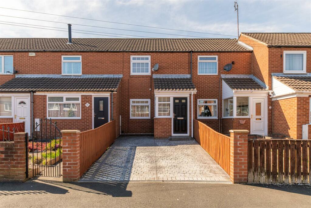
10 GILLIES STREET
NEWCASTLE UPON TYNE, TYNE AND WEAR NE6 2JP
Property details
Tenure
FREEHOLD
Floor area
45 m²
Last sold
£105,000 Jul 2023
Local average
£212,493 (-55.3%)
Deprivation
Decile 1 (747 of 33,755)
Street crime
493 incidents within 1 mile (Apr 2026)
Key features
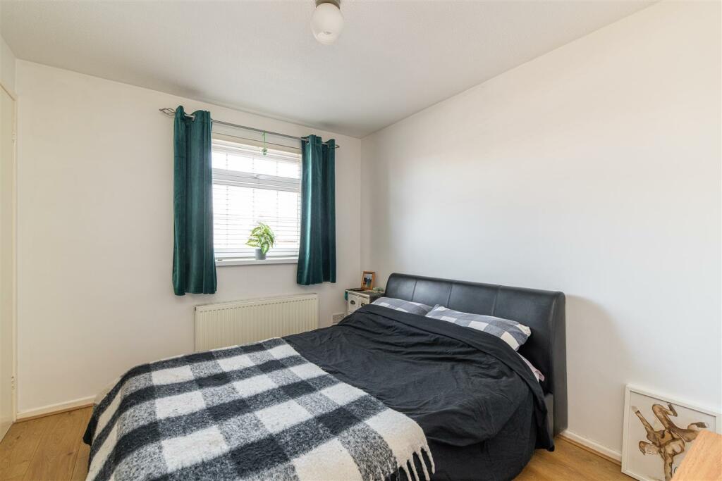
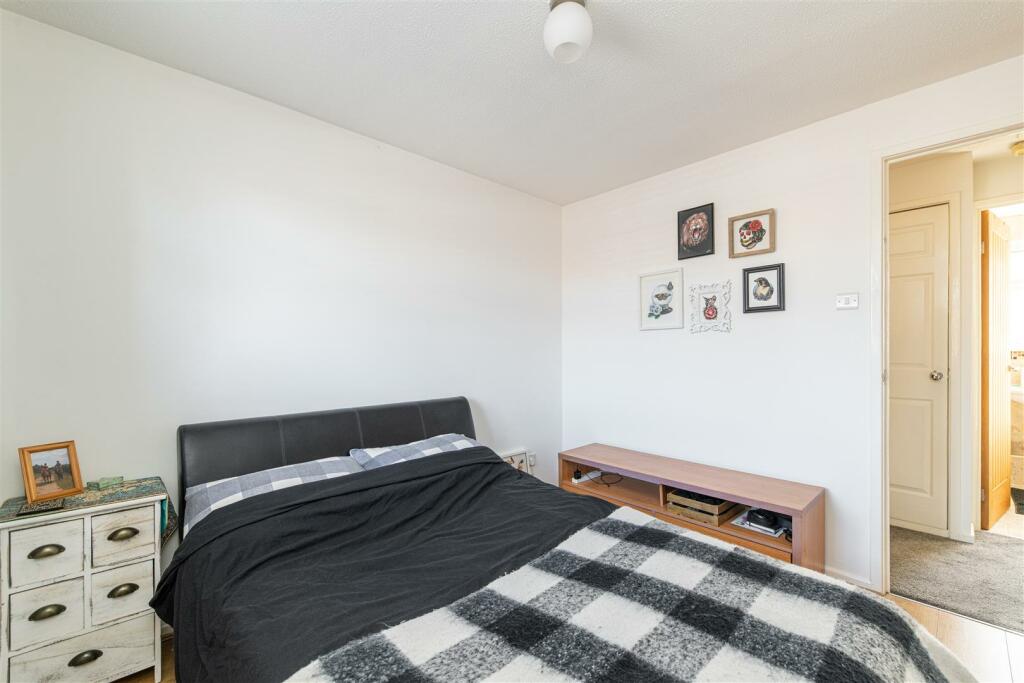
- Excellent two bedroom terraced home
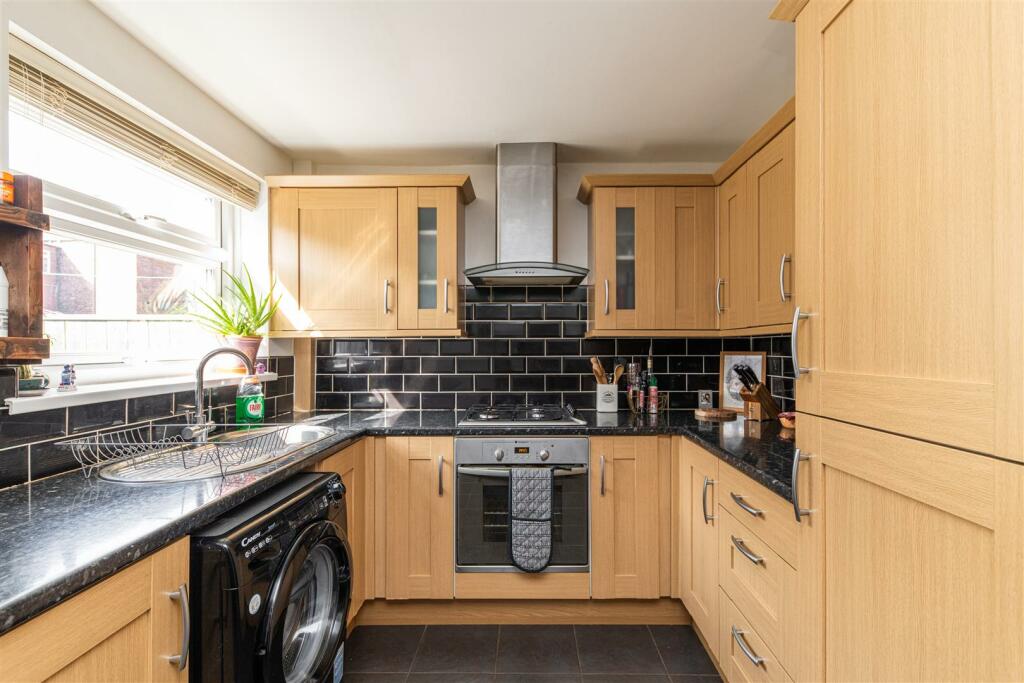
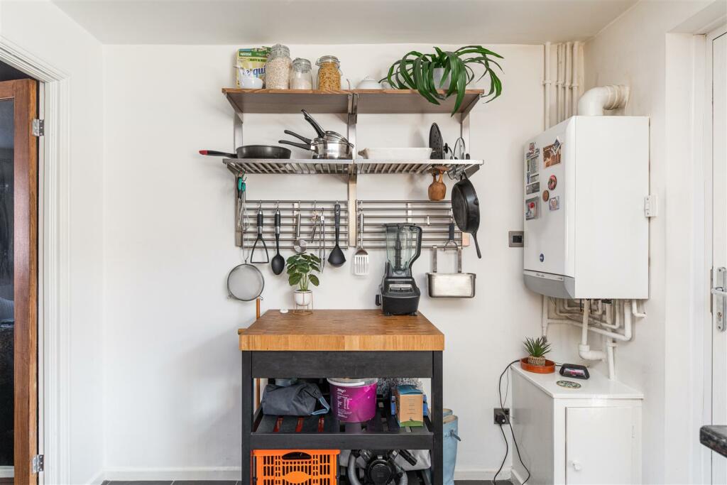
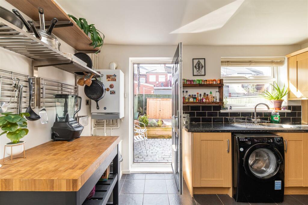
- Tiled modern fitted kitchen
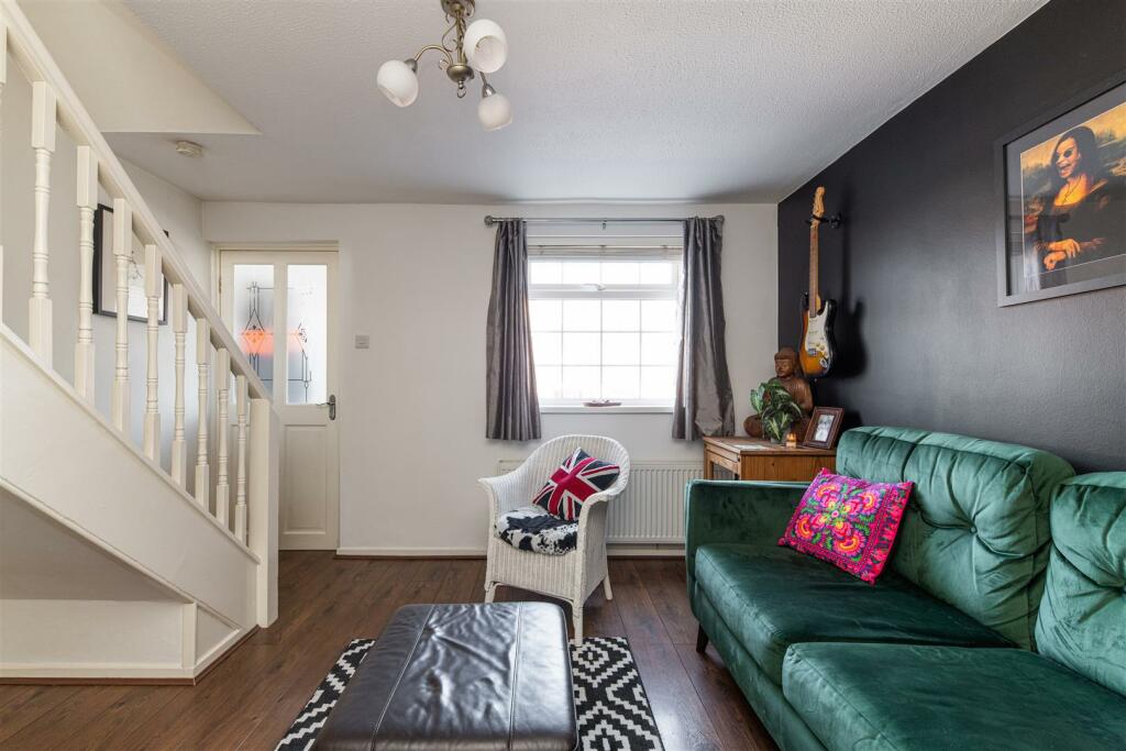
- Stylish living space
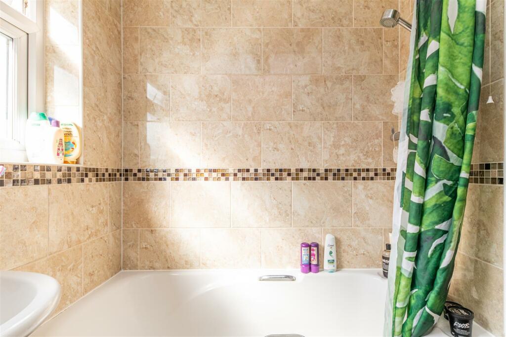
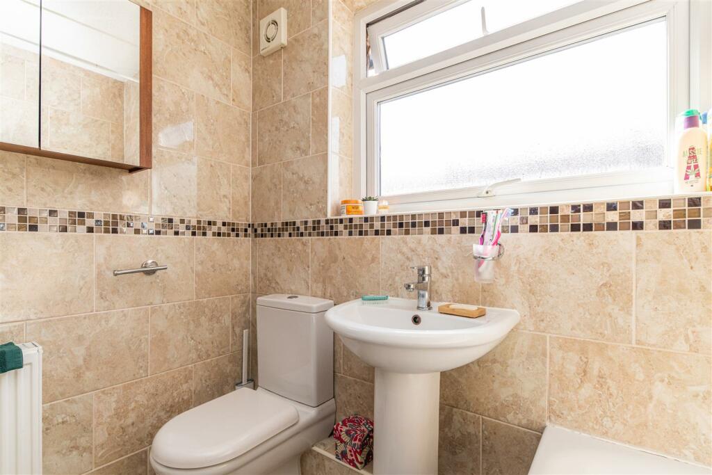
- Family bathroom with shower over bath
- Modern décor throughout
- Great residential location
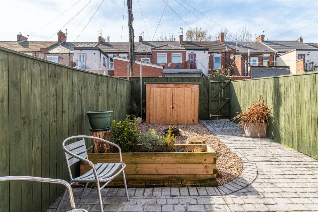
- Private garden
- Private driveway
- Central heating
- Light - filled rooms
Additional details
- Parking
- Yes
- Garden
- Yes
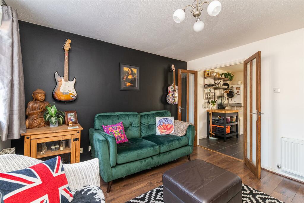
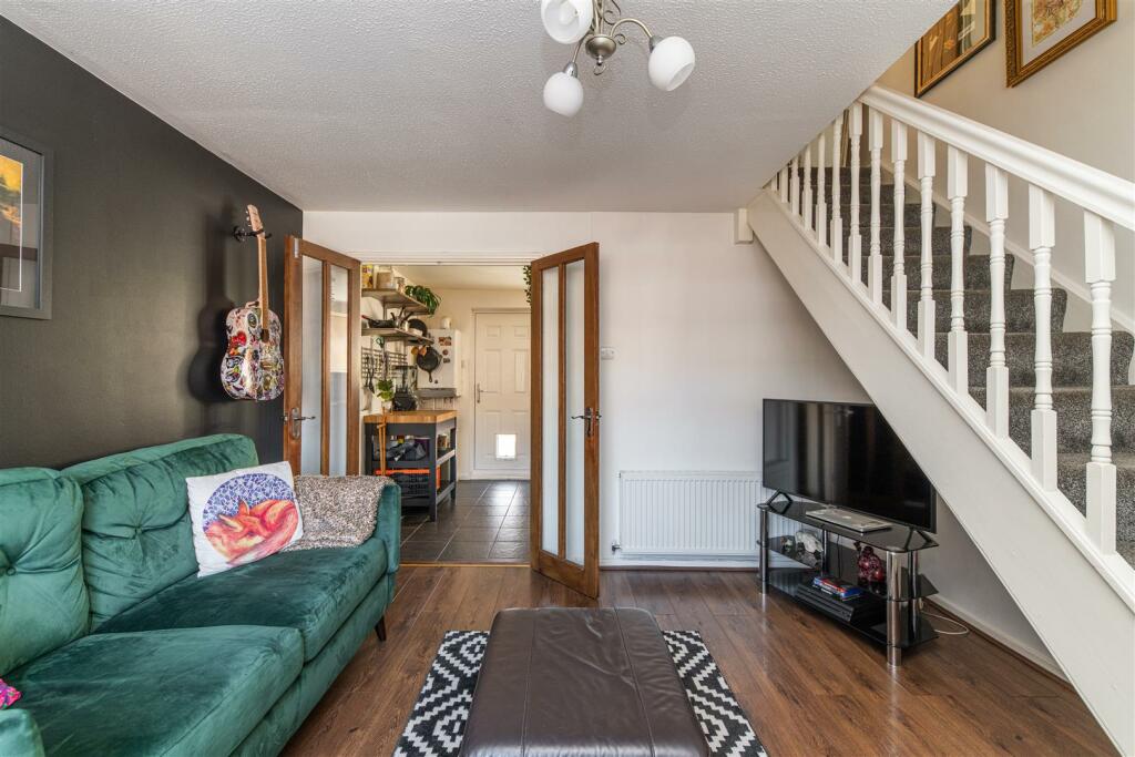
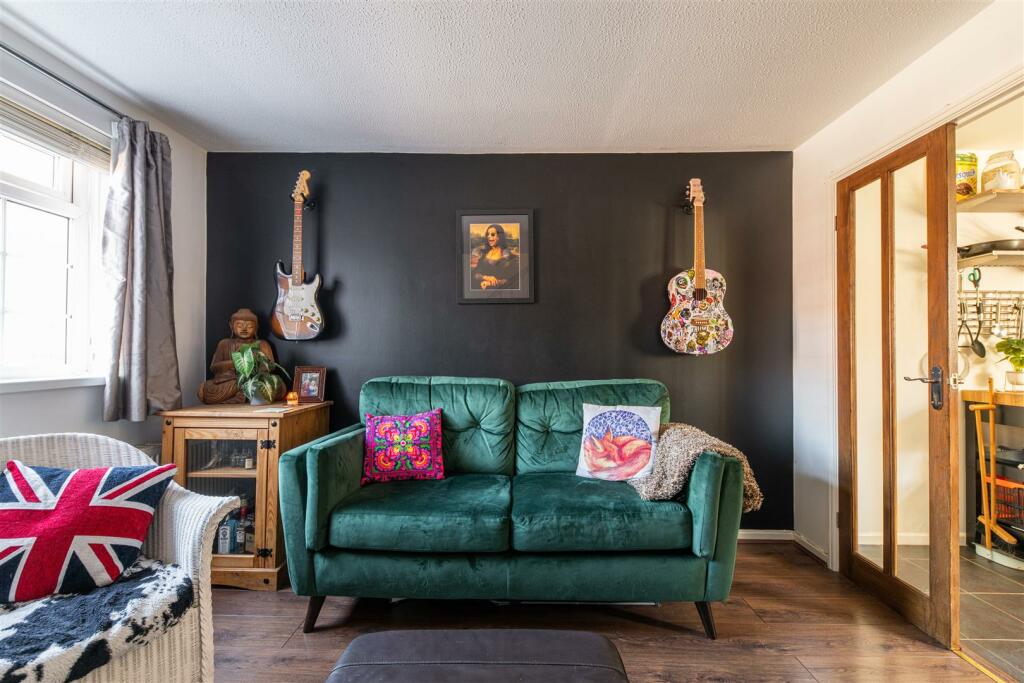
Description
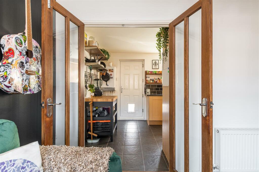
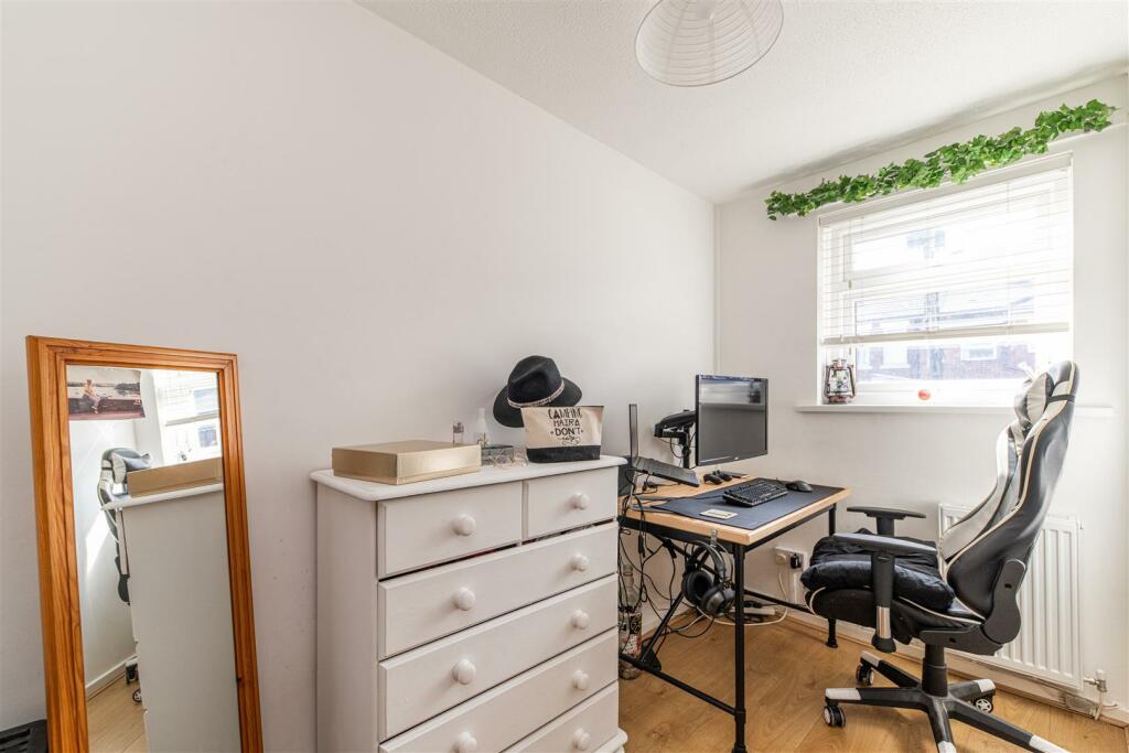
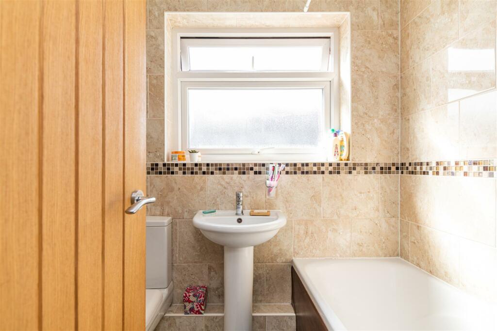
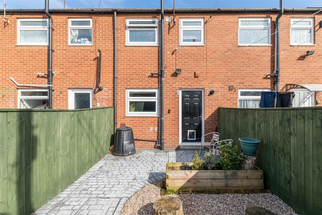
The private driveway is a great asset and the surroundings also allow free street parking. When you enter the property you are presented with an entrance porch that guides you through to the living room with stairs to the first floor. The chic living room has lots of natural light streaming in from the front of the property. Internal wooden doors feature as the staple partition, when closed keeping the room independent or if opened provide you with the alternative of a more casual layout and open concept. The kitchen has a range of integrated appliances such as hob, extractor fan and fridge. The back door then leads to the rear yard that is private and fully enclosed, it is beautifully landscaped to provide a fantastic entertaining/ family outdoor space with a back gate bringing you out onto the next street. Upstairs, the property also holds two good-sized bedrooms and a family bathroom.
In a great location, the property is close to bus routes and metro stations. With surrounding schools and shops nearby, this home would make a great first time buy.
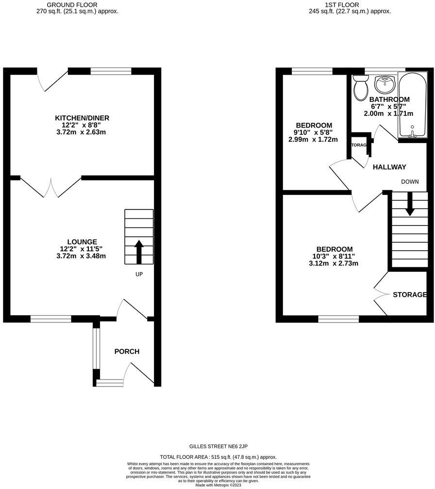
Lounge - 3.72 x 3.48 (12'2" x 11'5") -
Kitchen - 3.72 x 2.63 (12'2" x 8'7") -
Bedroom 1 - 3.12 x 2.73 (10'2" x 8'11") -
Bedroom 2 - 2.99 x 1.72 (9'9" x 5'7") -
Bathroom - 2.00 x 1.71 (6'6" x 5'7") -
Listed by
Newcastle upon Tyne
Hive Estates Limited
Reference: 133634441
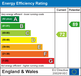
EPC Rating & Upgrade Cost
Fetching EPC data… Refresh this page in a moment.
Flood risk
Zone: 1
Risk: Low
Job (default Low)
Floorplans
GillesStreetNE62JP-High (2).png
EPC Graphs
EE Rating
FENSA Certificates
This property has 1 FENSA certificate(s) on record, indicating window/door installations by FENSA-approved installers.
FENSA Certificate #796601
Property Details
Street: 10 Gillies Street
Town: Newcastle upon Tyne
Postcode: NE6 2JP
Installation Details
Items: 8 windows and 1 door
Certificate Issued: 21/07/2003
Work Completed: 10/03/2003
This certificate data was retrieved from FENSA's database
What is FENSA? FENSA (Fenestration Self-Assessment Scheme) is a government-authorised scheme that monitors building regulation compliance for replacement windows and doors. Certificates indicate that work was completed by FENSA-approved installers.
Price history
27% since 2018
| Event | Date | Price | % change |
|---|---|---|---|
| Sold | 27/07/2023 (2 years ago) | £105,000 | +26.5% |
| Sold | 09/08/2018 (7 years ago) | £83,000 | — |
Source: HM Land Registry Price Paid Data. Crown copyright.
Sold Comparables
Same street and nearby sales within 0.25 miles (last 5 years). Data from Land Registry Price Paid.
| Address | Price | Date | Type |
|---|---|---|---|
| Same street 58 GILLIES STREET, NEWCASTLE UPON TYNE, TYNE AND WEAR, NE6 2JP | £130,000 | 22/04/2024 | Semi-detached |
| 109 SCARBOROUGH ROAD, NEWCASTLE UPON TYNE, TYNE AND WEAR, NE6 2RT | £78,000 | 23/10/2023 | Terraced |
| 62 CANTERBURY STREET, NEWCASTLE UPON TYNE, TYNE AND WEAR, NE6 2JD | £55,000 | 03/10/2023 | Terraced |
| Same street 29 GILLIES STREET, NEWCASTLE UPON TYNE, TYNE AND WEAR, NE6 2JP | £72,000 | 28/09/2023 | Flat |
| 87 SCARBOROUGH ROAD, NEWCASTLE UPON TYNE, TYNE AND WEAR, NE6 2RT | £130,000 | 16/12/2022 | Terraced |
| 7 VILLAGE PLACE, NEWCASTLE UPON TYNE, TYNE AND WEAR, NE6 2QF | £80,000 | 18/11/2022 | Terraced |
| 6 BENSON PLACE, NEWCASTLE UPON TYNE, TYNE AND WEAR, NE6 2QT | £92,500 | 28/10/2022 | Terraced |
| 25 DUNMORLIE STREET, NEWCASTLE UPON TYNE, TYNE AND WEAR, NE6 2JL | £121,000 | 14/10/2022 | Terraced |
| 253 BENSON ROAD, NEWCASTLE UPON TYNE, TYNE AND WEAR, NE6 2SD | £50,000 | 01/09/2022 | Terraced |
| Same street 60 GILLIES STREET, NEWCASTLE UPON TYNE, TYNE AND WEAR, NE6 2JP | £120,000 | 26/08/2022 | Semi-detached |
| Same street 23 GILLIES STREET, NEWCASTLE UPON TYNE, TYNE AND WEAR, NE6 2JP | £39,950 | 22/07/2022 | Flat |
| 58 MORTON STREET, NEWCASTLE UPON TYNE, TYNE AND WEAR, NE6 2JH | £72,000 | 06/05/2022 | Terraced |
| 4 RENWICK STREET, NEWCASTLE UPON TYNE, TYNE AND WEAR, NE6 2JE | £100,000 | 04/05/2022 | Terraced |
| 252 GRACE STREET, NEWCASTLE UPON TYNE, TYNE AND WEAR, NE6 2RR | £100,000 | 29/04/2022 | Terraced |
| Same street 7 GILLIES STREET, NEWCASTLE UPON TYNE, TYNE AND WEAR, NE6 2JP | £135,000 | 06/04/2022 | Other |
| Same street 4 GILLIES STREET, NEWCASTLE UPON TYNE, TYNE AND WEAR, NE6 2JP | £65,000 | 29/09/2021 | Terraced |
| 1 TUNSTALL AVENUE, NEWCASTLE UPON TYNE, TYNE AND WEAR, NE6 2RS | £85,000 | 13/07/2021 | Terraced |
| 18 CHIRTON WYND, NEWCASTLE UPON TYNE, TYNE AND WEAR, NE6 2PW | £77,000 | 24/06/2021 | Terraced |
Street average: £93,658 (6 sales)
Area average: £86,708 (12 sales)
Capital growth trend
Land Registry outcode average: last 12 months vs 5y and 10y ago (from sold prices).
House Price Index (HM Land Registry — official index, not sold-price averages): Newcastle upon Tyne. Series: Terraced. As of March 2026.
Rental Range
Estimated market rent for Newcastle upon Tyne. Low = conservative, Realistic = average, Optimistic = best case.
Based on Local Authority from postcode lookup → Newcastle upon Tyne.
LHA (30th percentile) floor for Tyneside: £549/mo (Apr 2025 – Mar 2026)
Location
Nearby
Nearest stations, universities and amenities (distance from property).
| Type | Name | Distance |
|---|---|---|
| Shop | Unknown | 0.0 miles |
| Shop | Little Tyre Centre | 0.1 miles |
| Bus stop | Bothal Street | 0.1 miles |
| Bus stop | Welbeck Road-Gillies Street | 0.1 miles |
| Train station | Byker | 0.4 miles |
| Train station | Chillingham Road | 0.6 miles |
| University | Northumbria University City Campus | 1.5 miles |
| University | Ellison Building B Block | 1.5 miles |
| Hospital | Priory Day Hospital | 5.2 miles |
| Hospital | Sunderland Primary care Trust | 5.9 miles |
Street-level crime
| Category | Count |
|---|---|
| Shoplifting | 91 |
| Violence and sexual offences | 91 |
| Anti-social behaviour | 88 |
| Criminal damage and arson | 67 |
| Vehicle crime | 37 |
| Public order | 34 |
| Burglary | 20 |
| Other theft | 19 |
| Robbery | 10 |
| Theft from the person | 10 |
| Other crime | 9 |
| Bicycle theft | 6 |
| Possession of weapons | 6 |
| Drugs | 5 |
| Total incidents | 493 |
Within 1 mile during Apr 2026. Source: data.police.uk (England & Wales).
Schools nearby
Nearest open schools with Ofsted ratings (England). Closed schools are not shown. Data from Get Information about Schools and Ofsted.
| Name | Type | Distance | Ofsted |
|---|---|---|---|
| St Lawrence's Catholic Primary School | Primary | 0.2 miles | Good — 17 Jan 2018 |
| Welbeck Academy | Primary | 0.2 miles | Requires improvement — 25 Feb 2024 |
| Monkchester Road Nursery School | Nursery | 0.4 miles | Outstanding — 12 Dec 2013 |
| Byker Primary School | Primary | 0.4 miles | Outstanding — 29 Sep 2017 |
| St Vincents Catholic Primary School, Newcastle | Primary | 0.6 miles | Good — 17 Sep 2023 |
Rental Comparables
Rental listings exist nearby, but none matched the 2-bedroom count for this property.
Rent-driven metrics
Based on Area rent estimate.
- Rent ratio — Monthly rent ÷ purchase price (1% rule). 1%+ = strong, 0.8–1% = okay, <0.8% = weak for cashflow.
- Max investor price — Rent ÷ 0.8%; the price at which rent would be 0.8% of price (Stoke-style target).
- Target investor price — Rent ÷ 1%; the price at which rent would be 1% of price (strong cashflow band).
- Gross yield — Annual rent as % of purchase price (no costs).