6 GIBSIDE COURT
GATESHEAD, GATESHEAD, TYNE AND WEAR NE11 9PT
£200,000
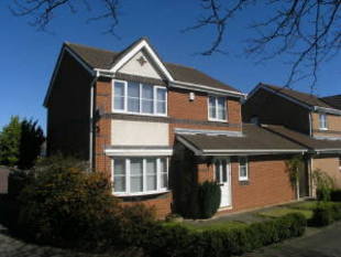
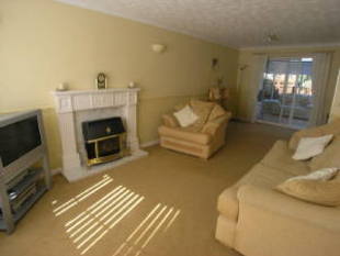
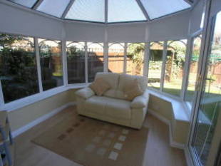
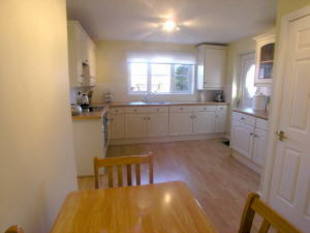
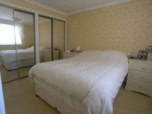
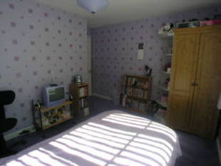
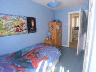
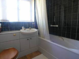
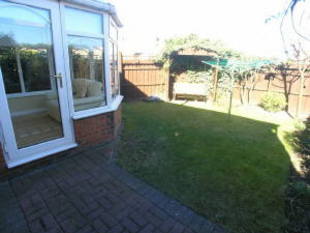
Photo 1 Photo 2 Photo 3 Photo 4 Photo 5 Photo 6 Photo 7 Photo 8 Photo 9
/ 9
Property details
Floor area
104 m²
Last sold
£200,000 Aug 2008
Local average
£335,833 (-40.4%)
Deprivation
Decile 9 (27,972 of 33,755)
Street crime
74 incidents within 1 mile (Apr 2026)
Key features
- Three Bedroom
- Detached House
- Double Glazing
- Gas Central Heating
- Lounge/dining Room
- Breakfasting Kitchen
- Conservatory
- Gardens & Garage
Additional details
- Parking
- Yes
- Garden
- Yes
Description
Listed by
Whickham
Sarah Mains Residential Sales
Reference: 17015300
EPC Rating & Upgrade Cost
Fetching EPC data… Refresh this page in a moment.
Flood risk
Zone: 1
Risk: Low
Job (default Low)
Price history
-1% since 2004
| Event | Date | Price | % change |
|---|---|---|---|
| Sold | 29/08/2008 (17 years ago) | £200,000 | -1% |
| Sold | 28/07/2004 (21 years ago) | £202,000 | — |
Source: HM Land Registry Price Paid Data. Crown copyright.
Sold Comparables
Same street and nearby sales within 0.25 miles (last 5 years). Data from Land Registry Price Paid.
| Address | Price | Date | Type |
|---|---|---|---|
| 4 WESTMINSTER DRIVE, GATESHEAD, TYNE AND WEAR, NE11 9PU | £345,000 | 19/09/2025 | Detached |
| 11 GIBSIDE COURT, GATESHEAD, TYNE AND WEAR, NE11 9PT | £435,000 | 12/09/2025 | Detached |
| 7 GIBSIDE COURT, GATESHEAD, TYNE AND WEAR, NE11 9PT | £385,000 | 27/06/2023 | Detached |
| 1 GIBSIDE COURT, GATESHEAD, TYNE AND WEAR, NE11 9PT | £330,000 | 01/02/2023 | Detached |
| 3 HEXHAM COURT, GATESHEAD, TYNE AND WEAR, NE11 9PZ | £240,100 | 25/08/2022 | Detached |
| 8 FINCHALE CLOSE, GATESHEAD, TYNE AND WEAR, NE11 9PW | £265,000 | 17/08/2022 | Detached |
| 8 BRACKEN DRIVE, GATESHEAD, TYNE AND WEAR, NE11 9QP | £349,950 | 07/09/2021 | Detached |
Area average: £335,721 (7 sales)
Capital growth trend
Land Registry outcode average: last 12 months vs 5y and 10y ago (from sold prices).
House Price Index (HM Land Registry — official index, not sold-price averages): Gateshead. Series: Detached. As of March 2026.
Rental Range
Estimated market rent for Gateshead. Low = conservative, Realistic = average, Optimistic = best case.
Based on Local Authority from postcode lookup → Gateshead.
LHA (30th percentile) floor for Tyneside: £648/mo (Apr 2025 – Mar 2026)
Location
Nearby
Nearest stations, universities and amenities (distance from property).
| Type | Name | Distance |
|---|---|---|
| Bus stop | Whickham Highway | 0.0 miles |
| Bus stop | Knightside Gardens-Whickham Highway | 0.1 miles |
| Shop | Chics | 0.2 miles |
| Shop | Nationwide Splicing & Rope Services Ltd | 0.2 miles |
| Train station | Dunston | 0.6 miles |
| Train station | MetroCentre | 1.5 miles |
| University | Northumbria University Coach Lane Campus | 5.3 miles |
| Hospital | Ferndene - Children and Young Peoples Inpatient Service | 7.8 miles |
| Hospital | Sunderland Primary care Trust | 7.9 miles |
Street-level crime
| Category | Count |
|---|---|
| Violence and sexual offences | 26 |
| Anti-social behaviour | 18 |
| Criminal damage and arson | 6 |
| Burglary | 5 |
| Other crime | 5 |
| Public order | 5 |
| Vehicle crime | 5 |
| Other theft | 2 |
| Drugs | 1 |
| Shoplifting | 1 |
| Total incidents | 74 |
Within 1 mile during Apr 2026. Source: data.police.uk (England & Wales).
Schools nearby
Nearest open schools with Ofsted ratings (England). Closed schools are not shown. Data from Get Information about Schools and Ofsted.
| Name | Type | Distance | Ofsted |
|---|---|---|---|
| Emmanuel College | Other | 0.2 miles | — (Inspected (no overall grade)) |
| Lobley Hill Primary School | Primary | 0.3 miles | Good — 9 Jun 2015 |
| Dunston Hill Community Primary School | Primary | 0.6 miles | Good — 27 Mar 2013 |
| Kingsmeadow Community School | Secondary | 0.7 miles | Good — 18 Oct 2021 |
| St Philip Neri Catholic Primary School, Dunston | Primary | 0.8 miles | Good — 21 May 2012 |
Rental Comparables
Residential lets from OpenRent and Rightmove for the area (same bedroom count). Use to validate rent estimates. Student lets are excluded.
| Title | Rent | Beds | Distance | As seen on |
|---|---|---|---|---|
| 3 Bed Semi-Detached House, Knightside Gardens, NE11 | £895/mo | 3 | 0.4 miles | OpenRent |
| 3 Bed Flat, Holly Avenue, NE11 | £875/mo | 3 | 0.42 miles | OpenRent |
| 3 Bed Semi-Detached House, Lobley Hill, NE11 | £975/mo | 3 | 0.62 miles | OpenRent |
| 3 Bed Semi-Detached House, The Granary, NE11 | £1,500/mo | 3 | 0.64 miles | OpenRent |
| 3 Bed Terraced House, Derwentwater Road, NE8 | £1,050/mo | 3 | 0.81 miles | OpenRent |
Average rent: £1,059/mo (5 listings)
Rent-driven metrics
Based on OpenRent comparables.
- Rent ratio — Monthly rent ÷ purchase price (1% rule). 1%+ = strong, 0.8–1% = okay, <0.8% = weak for cashflow.
- Max investor price — Rent ÷ 0.8%; the price at which rent would be 0.8% of price (Stoke-style target).
- Target investor price — Rent ÷ 1%; the price at which rent would be 1% of price (strong cashflow band).
- Gross yield — Annual rent as % of purchase price (no costs).
- Cost-to-rent — Price ÷ annual rent (from OpenRent comparables). Under 14× = strong, 14–16× = acceptable, 17×+ = compressed.
- Cashflow — Rent minus mortgage, 10% maintenance, £25/mo compliance. Assumes 75% LTV, 3.95% APR (5yr fixed), 25yr term.
- ROI — Annual profit ÷ cash in (deposit + 4% purchase costs).