72 PARKSTONE AVENUE
LEEDS, LEEDS, WEST YORKSHIRE LS16 6EN
£800 pcm
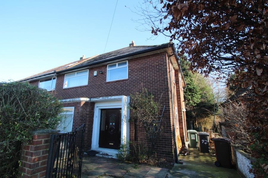
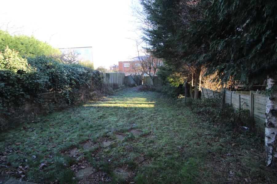
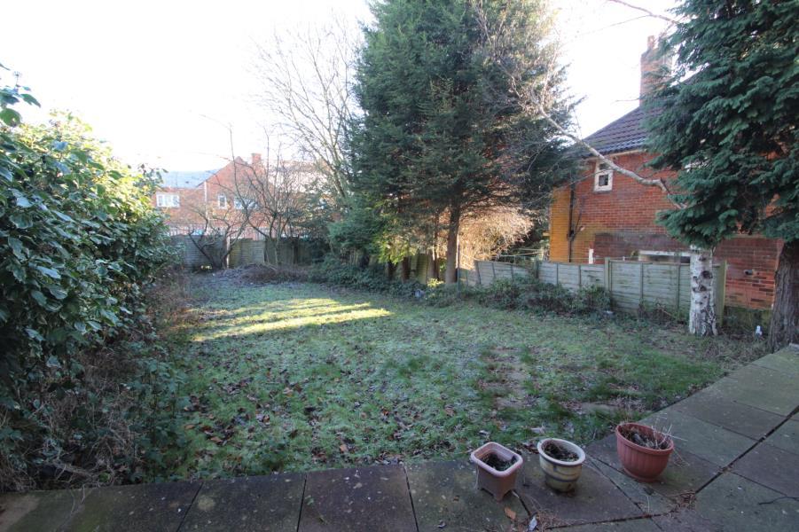
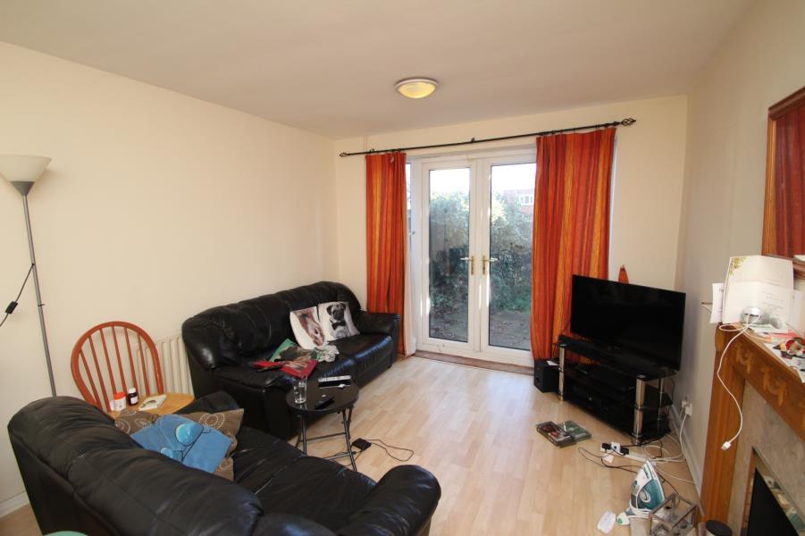
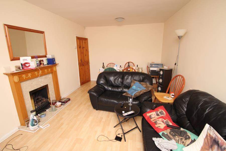
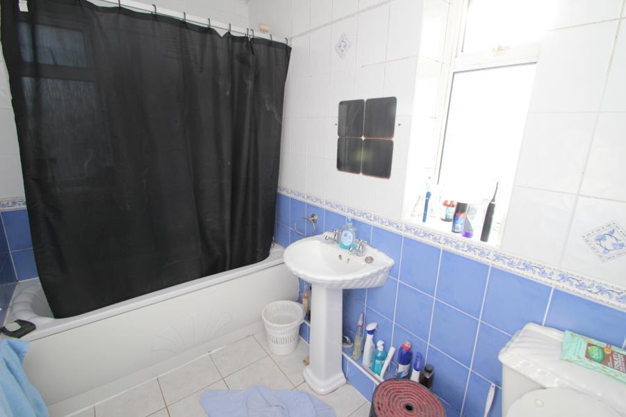
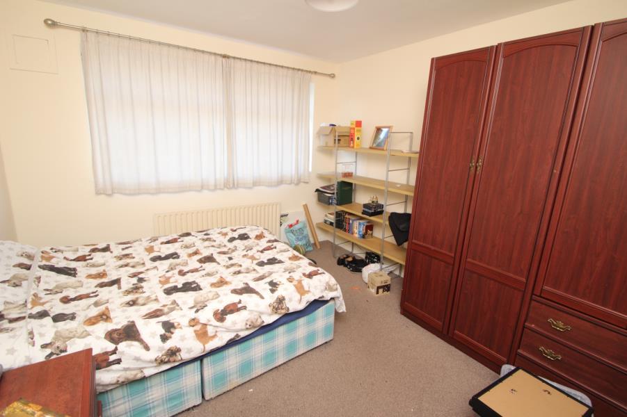
Photo 1 Photo 2 Photo 3 Photo 4 Photo 5 Photo 6 Photo 7
/ 7
Property details
Deprivation
Decile 8 (26,834 of 33,755)
Street crime
175 incidents within 1 mile (Apr 2026)
Key features
- FOUR BEDROOMS
- POPULAR LOCATION
- UNFURNISHED
- LARGE REAR GARDEN
- ON STREET PARKING
Additional details
- Garden
- Yes
Description
A four-bedroom semi-detached house providing UNFURNISHED accommodation. The property is located in a convenient position within easy reach of local shopping and schooling facilities.
The accommodation comprises; To the ground floor; Dining room/Family room with patio doors leading to the garden; Lounge; Kitchen with breakfast bar and white wall and base units; Downstairs WC; Utility Room.
To the first floor, Fully tiled Bathroom with shower over the bath; Three Double Bedrooms; One Single Bedroom/Study. Large garden to rear with patio.
Further benefits include Gas central heating. Double glazing. Appliances include Cooker, Washer, Tumble Dryer, Fridge/Freezer.
Deposit £920.00 Energy Efficiency Rating D
Listed by
Horsforth
The Lomond Group
Reference: 90135757
EPC Rating & Upgrade Cost
Fetching EPC data… Refresh this page in a moment.
Flood risk
Zone: 1
Risk: Low
Job (default Low)
Rental Range
Estimated market rent for Leeds. Low = conservative, Realistic = average, Optimistic = best case.
Based on Local Authority from postcode lookup → Leeds.
LHA (30th percentile) floor for Leeds: £1,197/mo (Apr 2025 – Mar 2026)
Location
Nearby
Nearest stations, universities and amenities (distance from property).
| Type | Name | Distance |
|---|---|---|
| Bus stop | Iveson Drive Spen Lane | 0.1 miles |
| Shop | Shop Local | 0.5 miles |
| Shop | Logan Stores | 0.6 miles |
| University | Reception/Helpzone | 1.0 miles |
| Train station | Horsforth | 1.2 miles |
| Train station | Kirkstall Forge | 1.5 miles |
| University | Carnegie Pavilion | 1.7 miles |
| Hospital | Sir Karl Cohen Square | 3.1 miles |
| Hospital | Paul Sykes Urology Centre | 4.0 miles |
Street-level crime
| Category | Count |
|---|---|
| Violence and sexual offences | 76 |
| Public order | 20 |
| Burglary | 16 |
| Vehicle crime | 15 |
| Anti-social behaviour | 10 |
| Criminal damage and arson | 10 |
| Other theft | 10 |
| Shoplifting | 8 |
| Other crime | 6 |
| Robbery | 4 |
| Total incidents | 175 |
Within 1 mile during Apr 2026. Source: data.police.uk (England & Wales).
Schools nearby
Nearest open schools with Ofsted ratings (England). Closed schools are not shown. Data from Get Information about Schools and Ofsted.
| Name | Type | Distance | Ofsted |
|---|---|---|---|
| Iveson Primary School | Primary | 0.2 miles | Good — 16 Jun 2015 |
| Holy Name Catholic Voluntary Academy | Primary | 0.5 miles | Good — 19 Sep 2018 |
| Lawnswood School | Secondary | 0.5 miles | Good — 30 Oct 2013 |
| Abbey Grange Church of England Academy | Secondary | 0.5 miles | Good — 6 Mar 2012 |
| Lighthouse School Leeds | Other | 0.5 miles | Good — 9 Apr 2014 |
Rental Comparables
Residential lets from OpenRent and Rightmove for the area (same bedroom count). Use to validate rent estimates. Student lets are excluded.
| Title | Rent | Beds | Distance | As seen on |
|---|---|---|---|---|
| 4 Bed Semi-Detached House, Woodbridge Fold, LS6 | £1,612/mo | 4 | 1.21 miles | OpenRent |
| 4 Bed Semi-Detached House, Woodbridge Fold, LS6 | £1,612/mo | 4 | 1.24 miles | OpenRent |
Average rent: £1,612/mo (2 listings)