33A
THE COLDRA, NEWPORT, NEWPORT NP18 2LS
£249,995
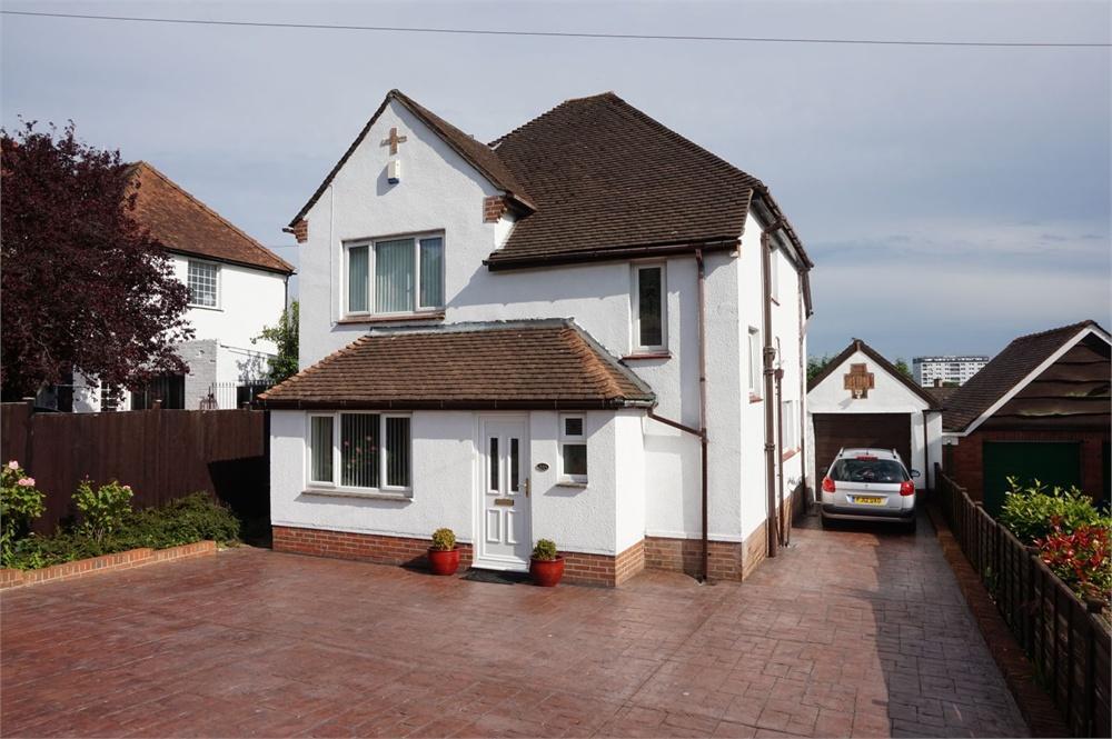
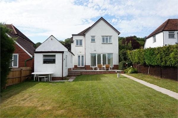
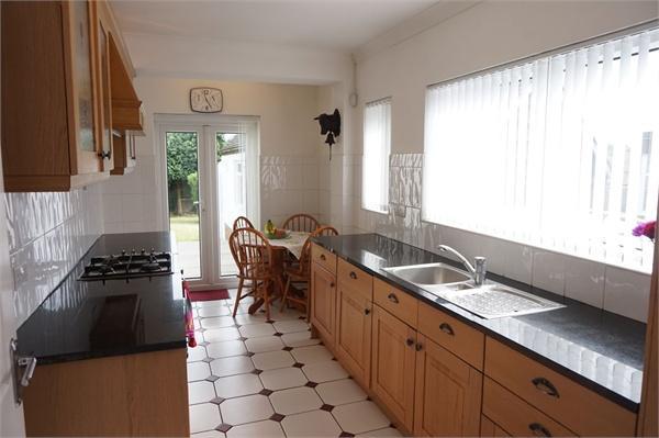
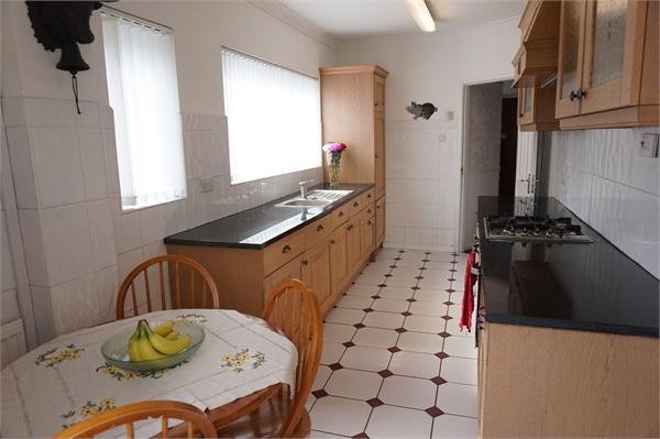
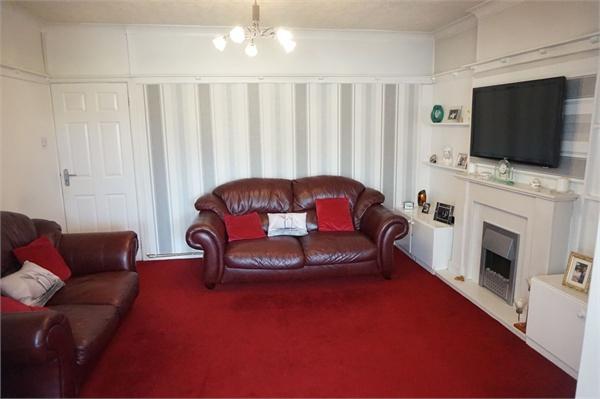
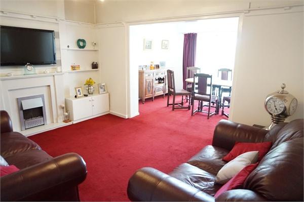
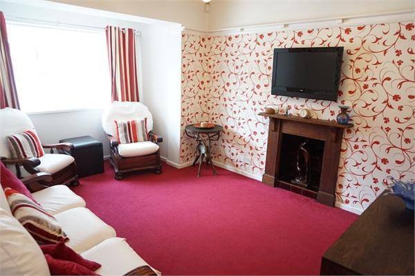
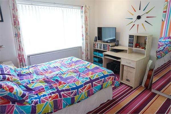
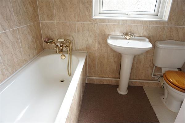
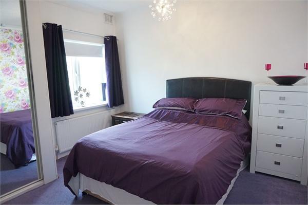
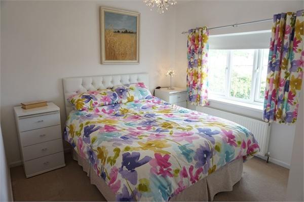
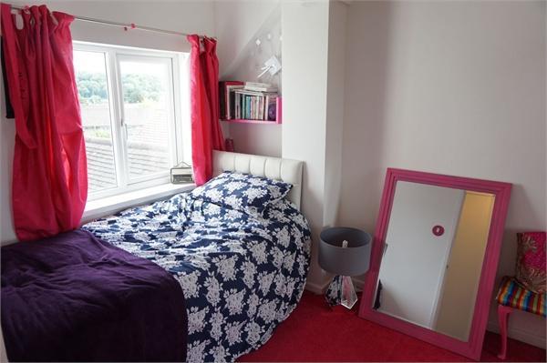
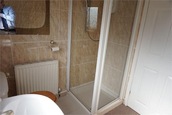
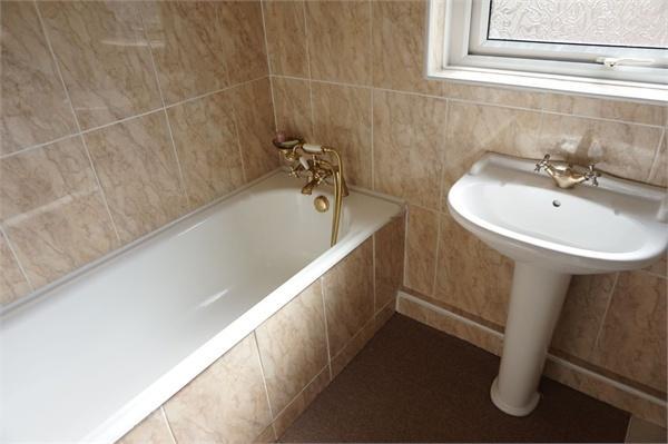
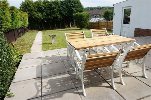
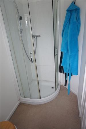
Photo 1 Photo 2 Photo 3 Photo 4 Photo 5 Photo 6 Photo 7 Photo 8 Photo 9 Photo 10 Photo 11 Photo 12 Photo 13 Photo 14 Photo 15 Photo 16
/ 16
Property details
Tenure
FREEHOLD
Floor area
113 m²
Last sold
£232,000 Nov 2015
Local average
£399,540 (-37.4%)
Street crime
0 incidents within 1 mile (Apr 2026)
Key features
- Extended Detached Family Home
- 4 Bedrooms with Master En Suite Shower Room
- 3 Separate Reception Rooms
- Kitchen/Breakfast Room
- Ground Floor Cloakroom
- First Floor Family Bathroom
- Double Glazing
- Gas Heating to Radiators
- Garage & Driveway
- Good Sized Gardens
Additional details
- Parking
- Garage, Yes
- Garden
- Yes
Description
The well planned accommodation briefly comprising to the Ground Floor: Entrance Porch. Hallway. Cloakroom. Lounge. Sitting Room. Dining Room. Kitchen/Breakfast Room.
To the First Floor: Master Bedroom with En Suite Shower Room. 3 Further Bedrooms. Family Bathroom.
The property also benefits from double glazing and gas heating to radiators.
Property ref: 121_1624_3679512
Listed by
Newport - Sales
Roberts & Co
Reference: 50939623
EPC Rating & Upgrade Cost
Fetching EPC data… Refresh this page in a moment.
Flood risk
Zone: 1
Risk: Low
Job (default Low)
EPC Graphs
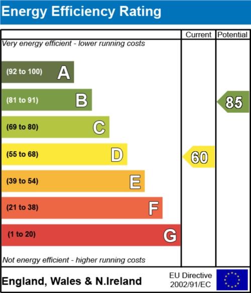
EER
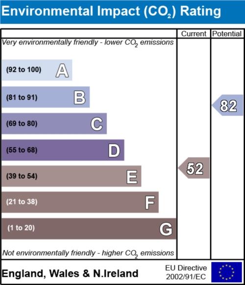
EIR
Price history
| Event | Date | Price | % change |
|---|---|---|---|
| Sold | 13/11/2015 (10 years ago) | £232,000 | — |
Source: HM Land Registry Price Paid Data. Crown copyright.
Sold Comparables
Same street and nearby sales within 0.25 miles (last 5 years). Data from Land Registry Price Paid.
| Address | Price | Date | Type |
|---|---|---|---|
| Same street 57A THE COLDRA, NEWPORT, NP18 2LS | £295,000 | 03/03/2023 | Semi-detached |
| 17 THE COLDRA, NEWPORT, NP18 2LP | £375,000 | 19/08/2022 | Detached |
| 34 THE COLDRA, NEWPORT, NP18 2LP | £370,000 | 05/08/2022 | Detached |
| 68 THE COLDRA, NEWPORT, NP18 2LR | £367,500 | 03/08/2021 | Detached |
Street average: £295,000 (1 sale)
Area average: £370,833 (3 sales)
Capital growth trend
Land Registry outcode average: last 12 months vs 5y and 10y ago (from sold prices).
House Price Index (HM Land Registry — official index, not sold-price averages): Newport. Series: Detached. As of March 2026.
Rental Range
Estimated market rent for Newport. Low = conservative, Realistic = average, Optimistic = best case.
Based on Local Authority from postcode lookup → Newport.
Location
Nearby
Nearest stations, universities and amenities (distance from property).
| Type | Name | Distance |
|---|---|---|
| Bus stop | Celtic Manor (W-bound) | 0.0 miles |
| Bus stop | Celtic Manor (E-bound) | 0.1 miles |
| Shop | Lifestyle Express | 0.2 miles |
| Shop | Ozzy's Barbers | 0.3 miles |
| University | University of South Wales (Newport City Campus) | 2.6 miles |
| University | National Software Academy (Cardiff University) | 2.9 miles |
| Train station | Newport | 3.0 miles |
| Hospital | Minor Injuries Unit | 3.0 miles |
| Hospital | St Anne's Hospice | 3.4 miles |
| Train station | Pye Corner | 4.8 miles |
Street-level crime
| Category | Count |
|---|---|
| Total incidents | 0 |
Within 1 mile during Apr 2026. Source: data.police.uk (England & Wales).
Schools nearby
Nearest open schools with Ofsted ratings (England). Closed schools are not shown. Data from Get Information about Schools and Ofsted.
| Name | Type | Distance | Ofsted |
|---|---|---|---|
| St Gabriel's R.C. Primary School | Other | 0.5 miles | — (No rating) |
| Ringland Primary | Other | 0.8 miles | — (No rating) |
| Llanwern High School | Other | 0.9 miles | — (No rating) |
| Ysgol Gymraeg Casnewydd | Other | 1.0 miles | — (No rating) |
| Alway Primary | Other | 1.2 miles | — (No rating) |
Rental Comparables
Loading rental comparables for this postcode. Refresh in a few minutes.
Rent-driven metrics
Based on Area rent estimate.
- Rent ratio — Monthly rent ÷ purchase price (1% rule). 1%+ = strong, 0.8–1% = okay, <0.8% = weak for cashflow.
- Max investor price — Rent ÷ 0.8%; the price at which rent would be 0.8% of price (Stoke-style target).
- Target investor price — Rent ÷ 1%; the price at which rent would be 1% of price (strong cashflow band).
- Gross yield — Annual rent as % of purchase price (no costs).