Heath Lane
Allostock, WA16, WA16 9JE
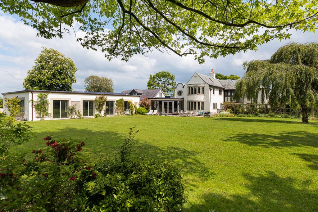
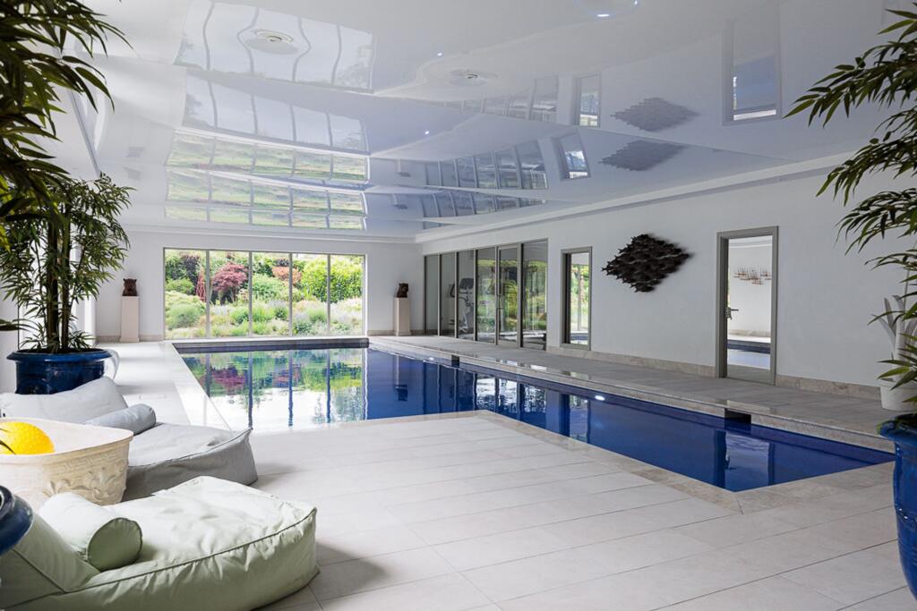
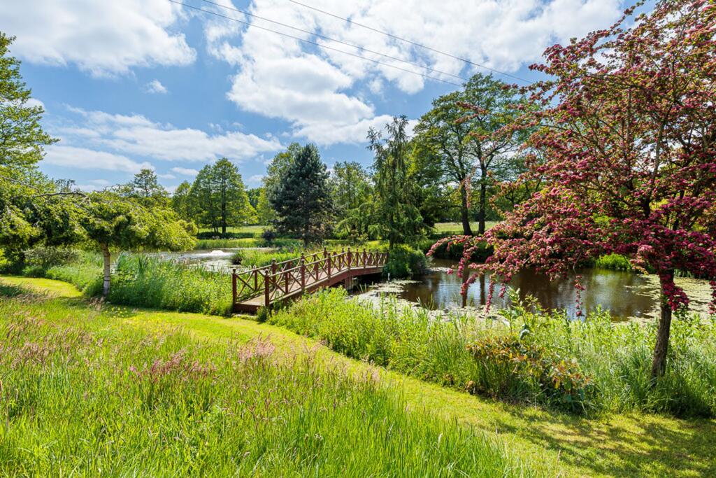
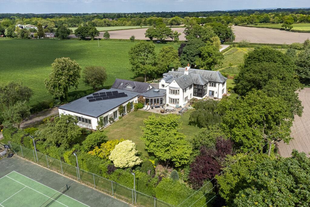
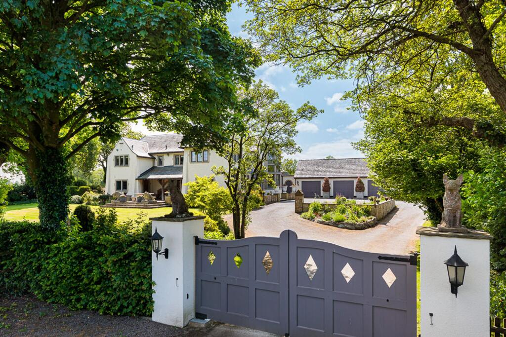
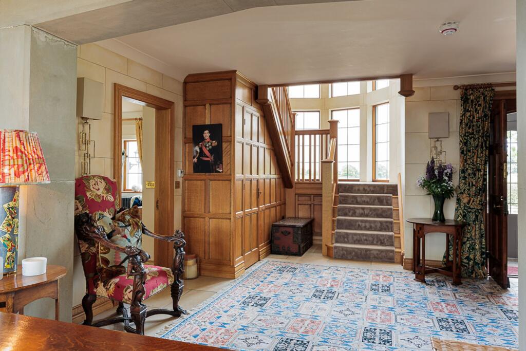
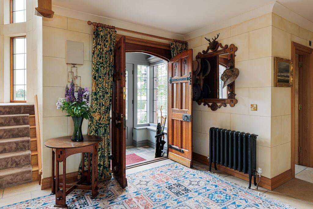

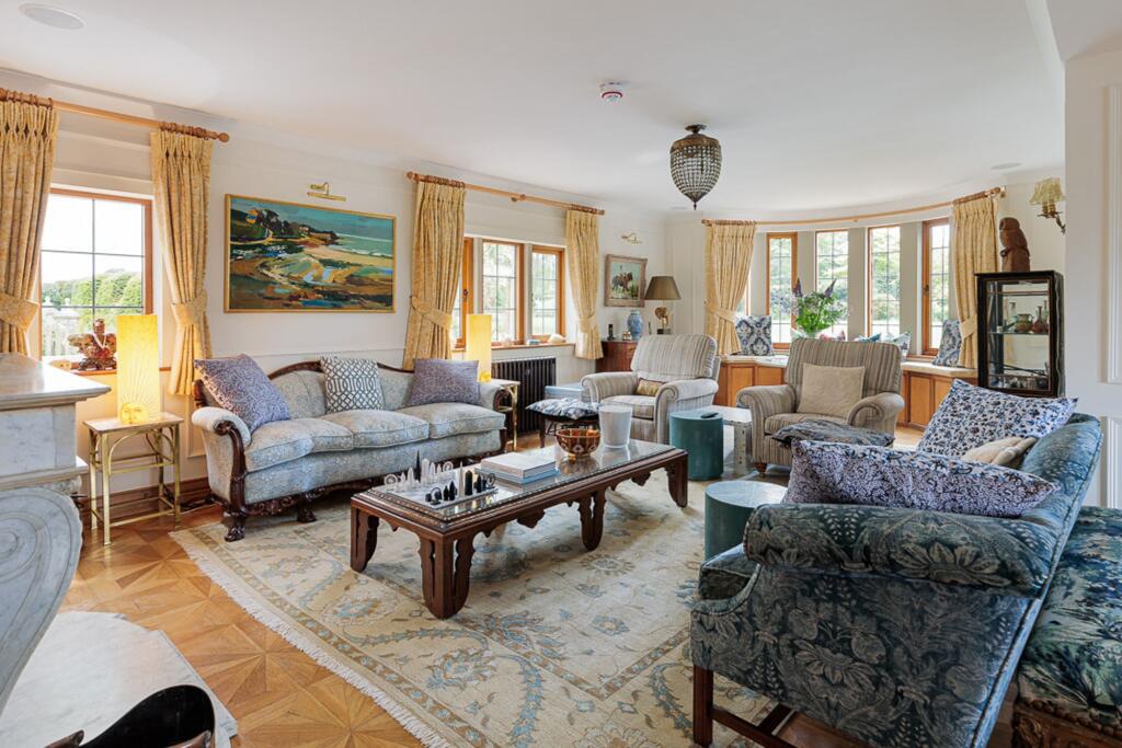
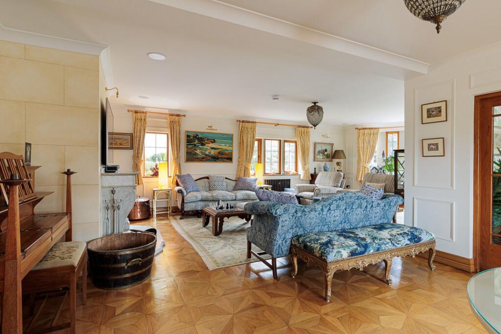
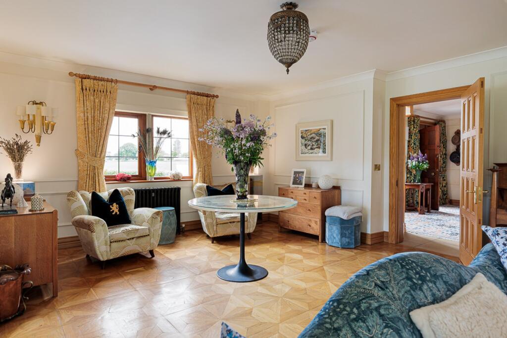
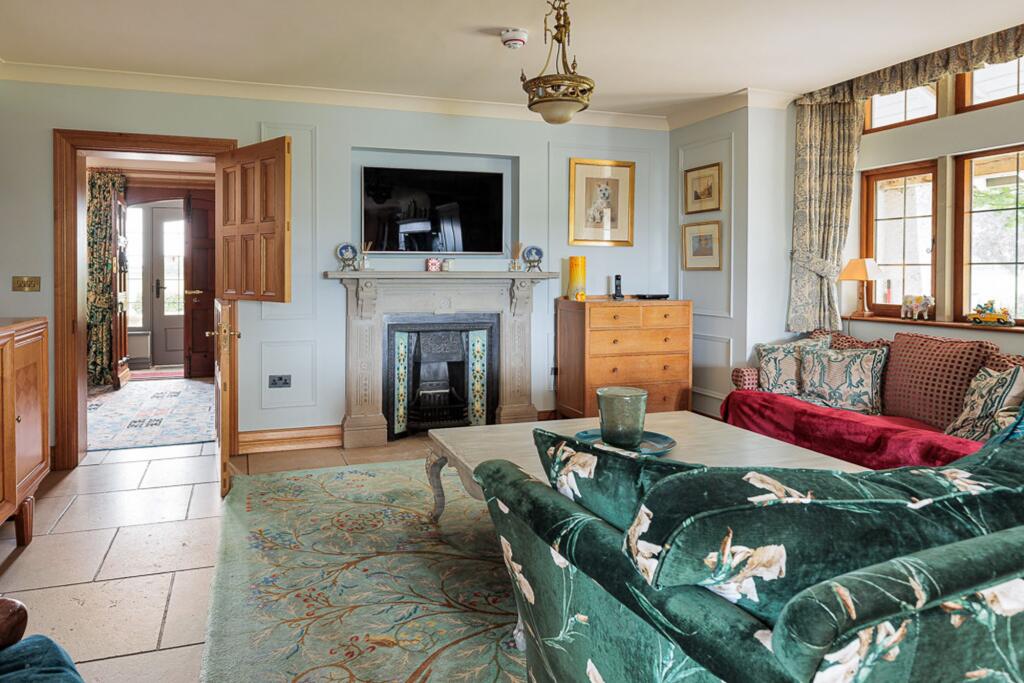
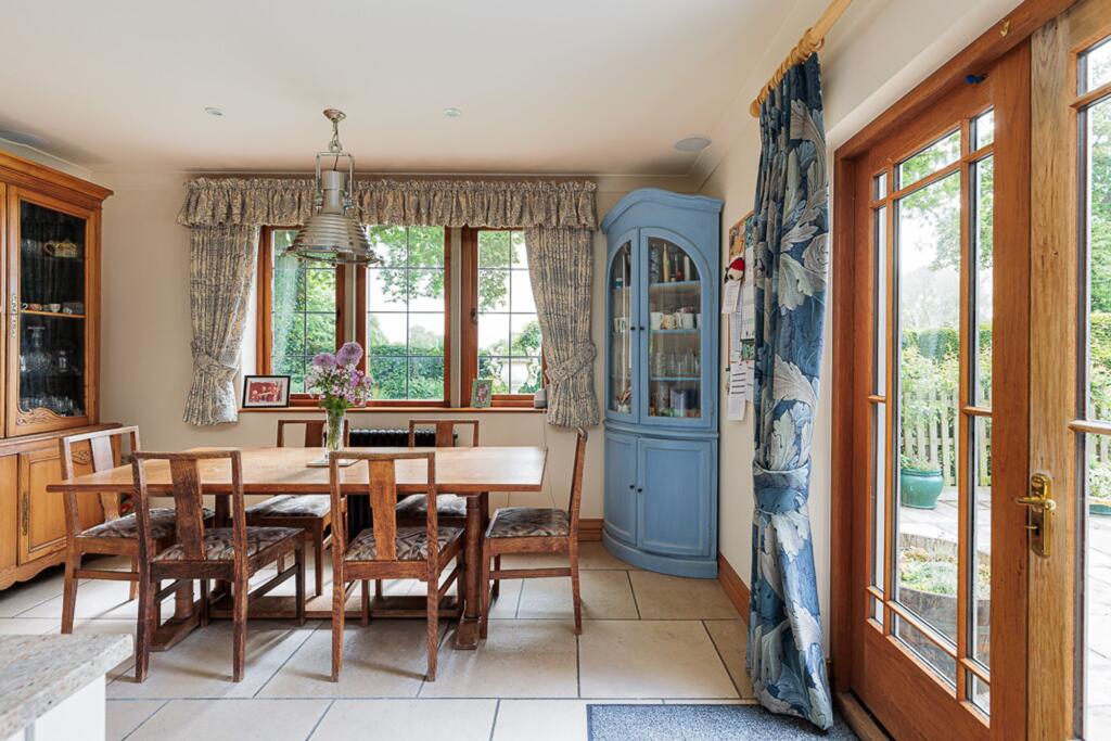
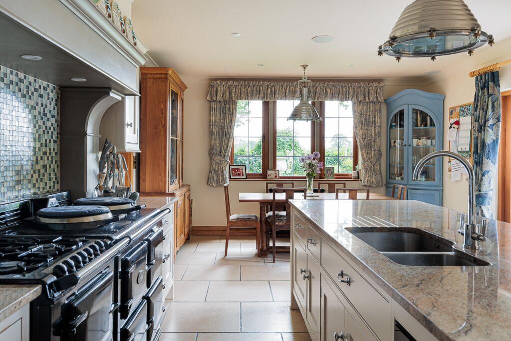
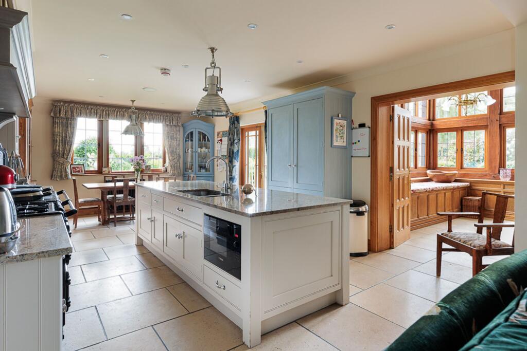
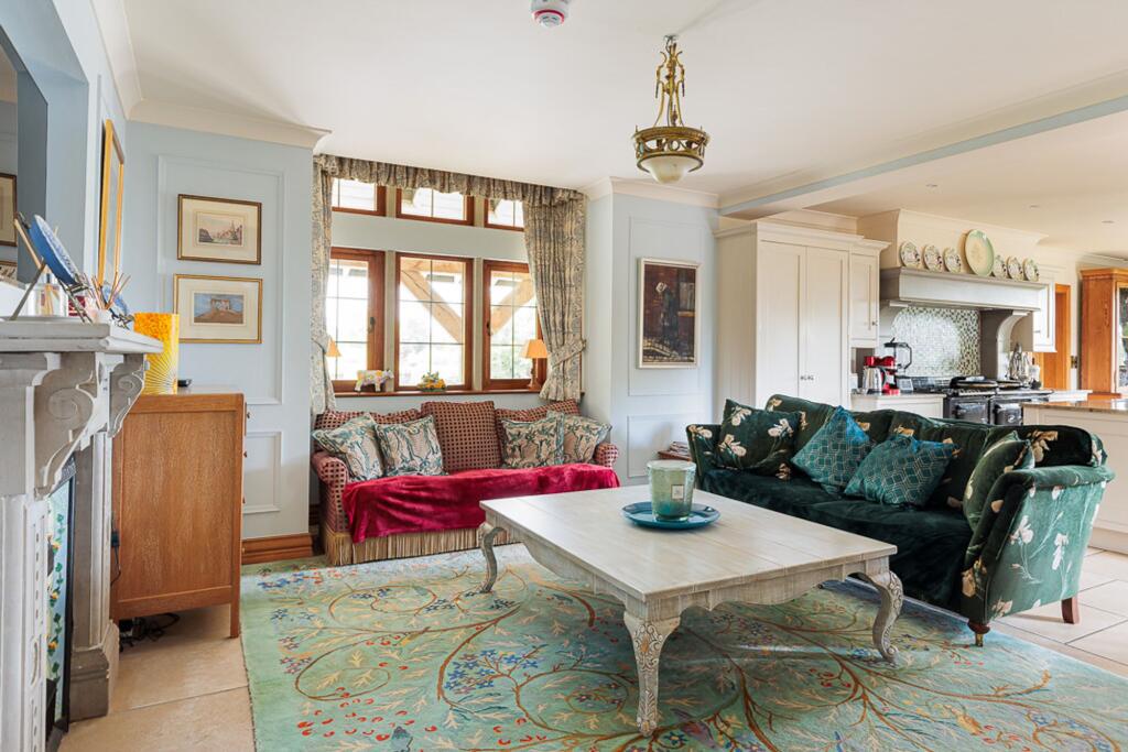
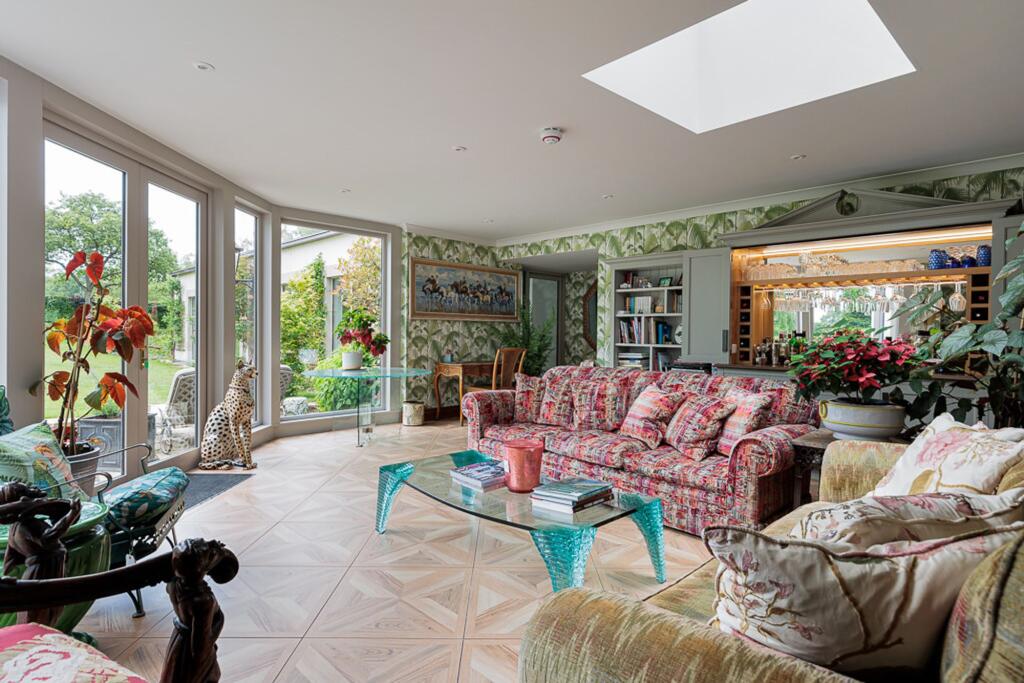
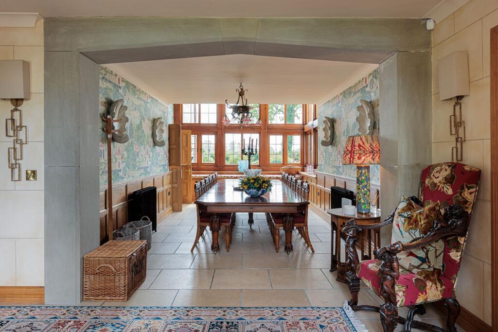
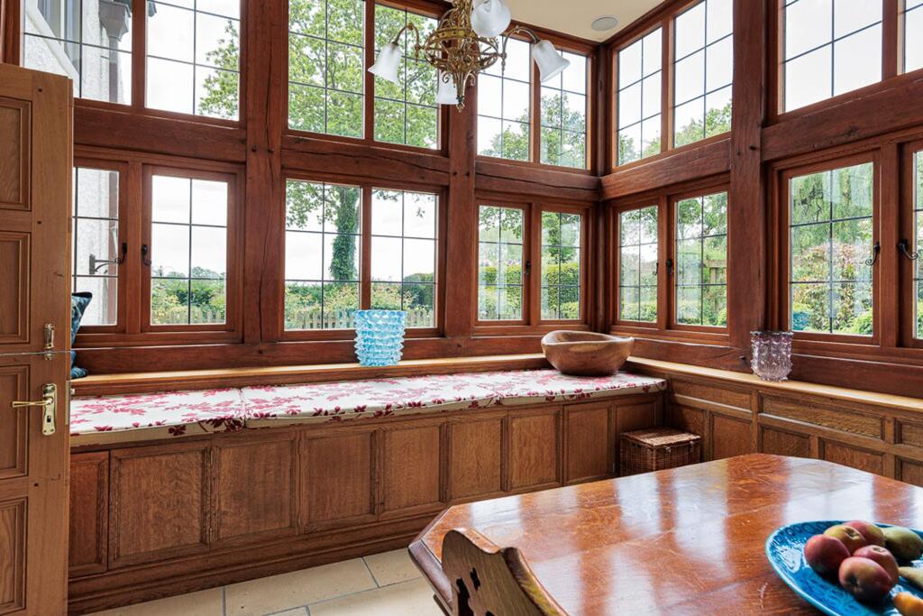
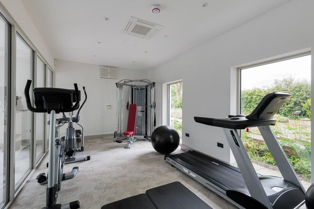
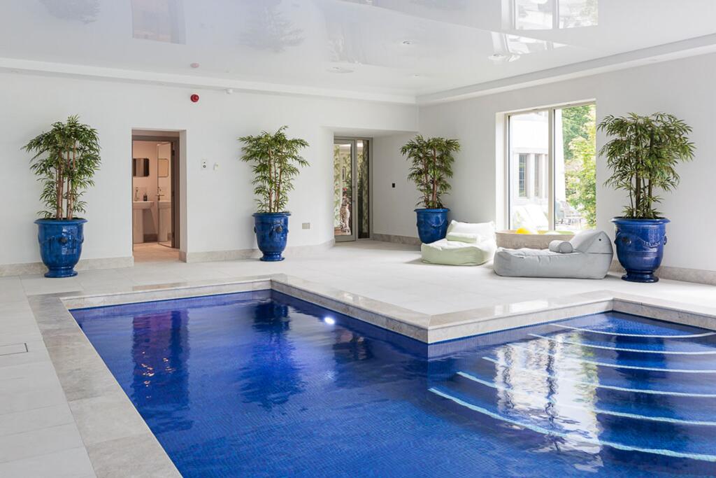
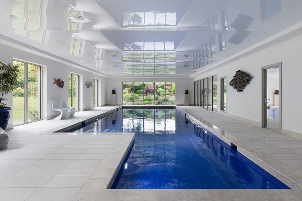
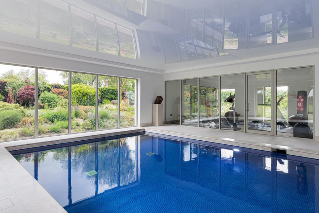
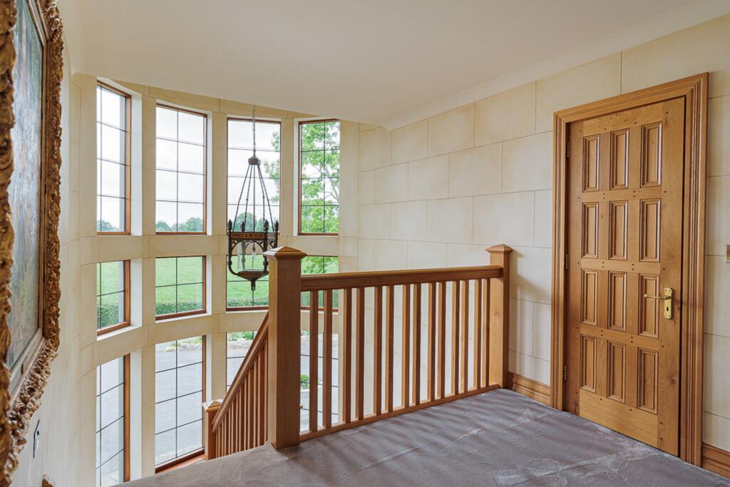
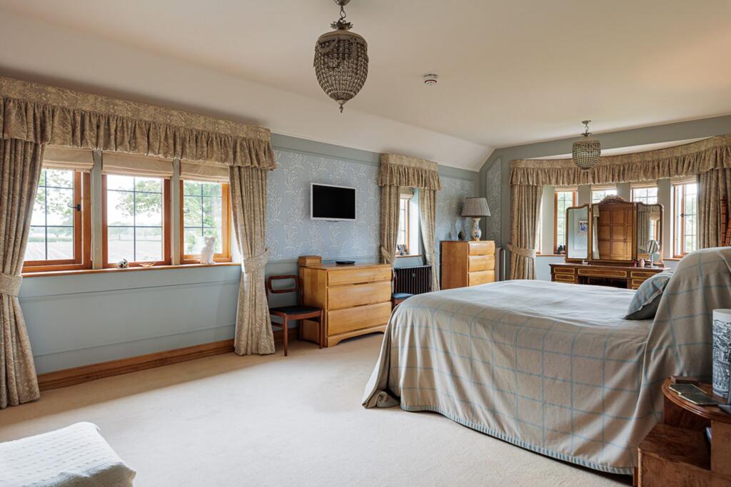
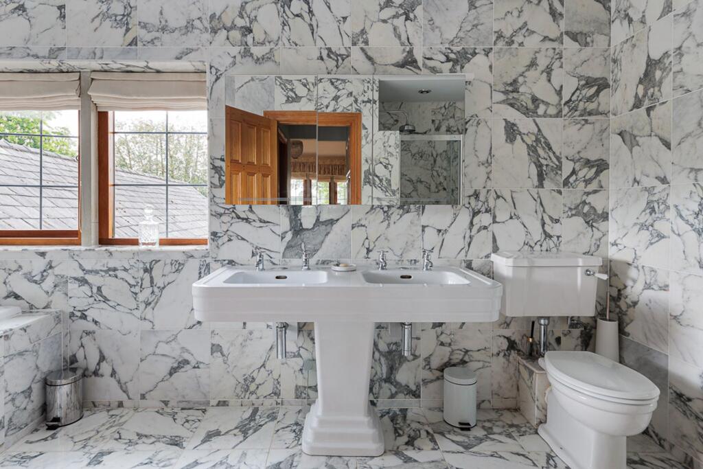
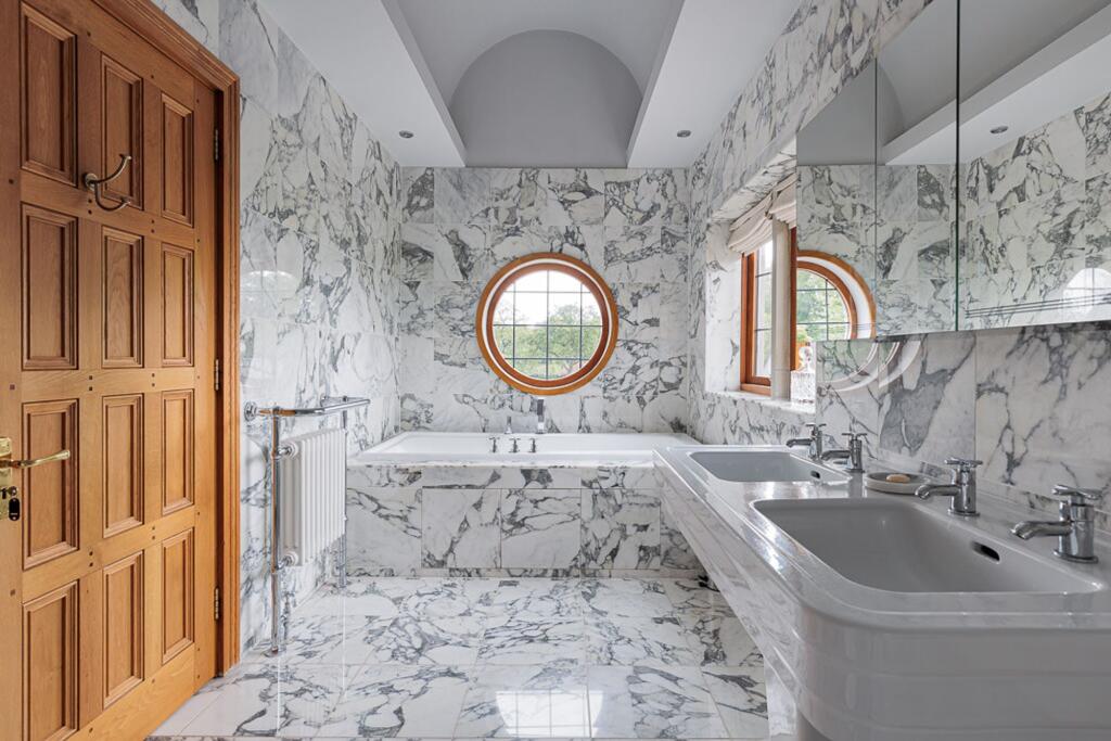
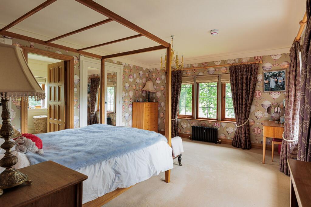
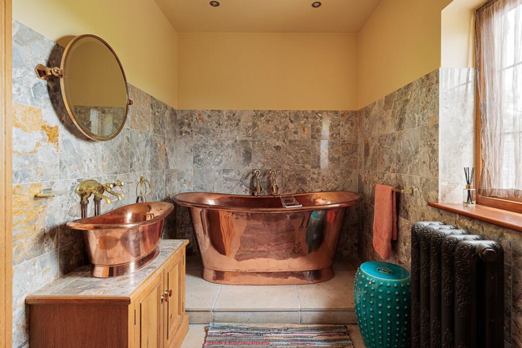
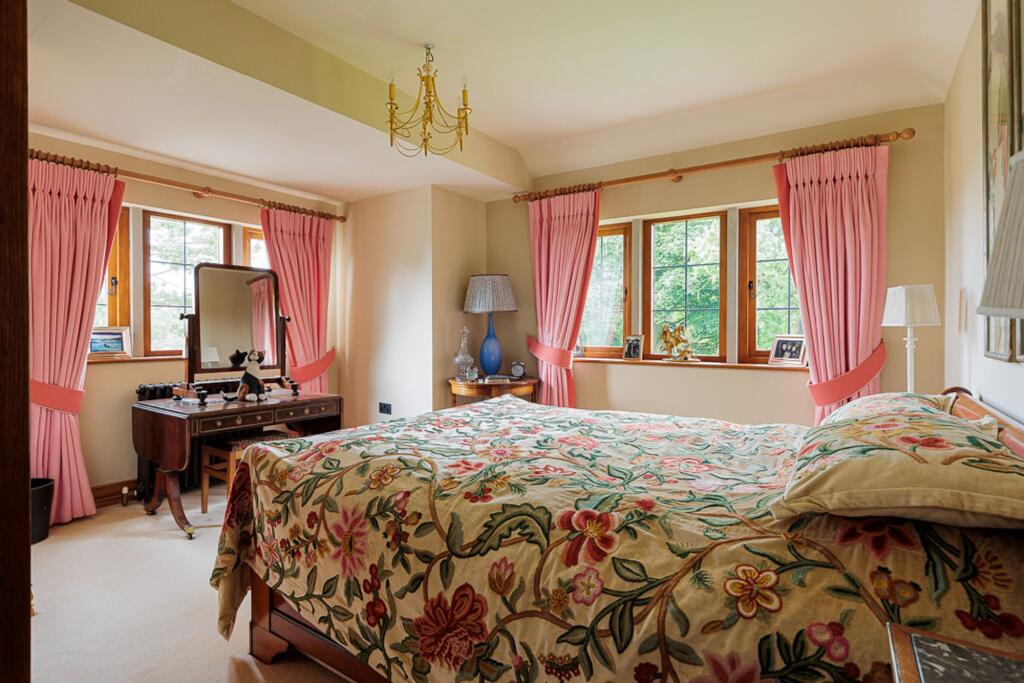
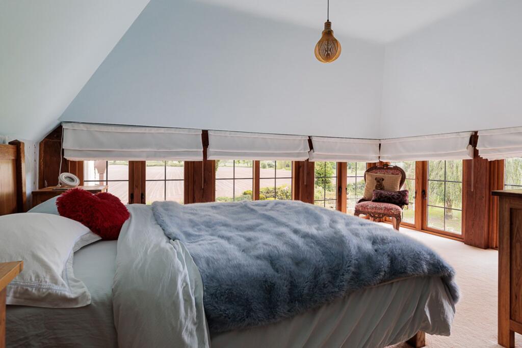
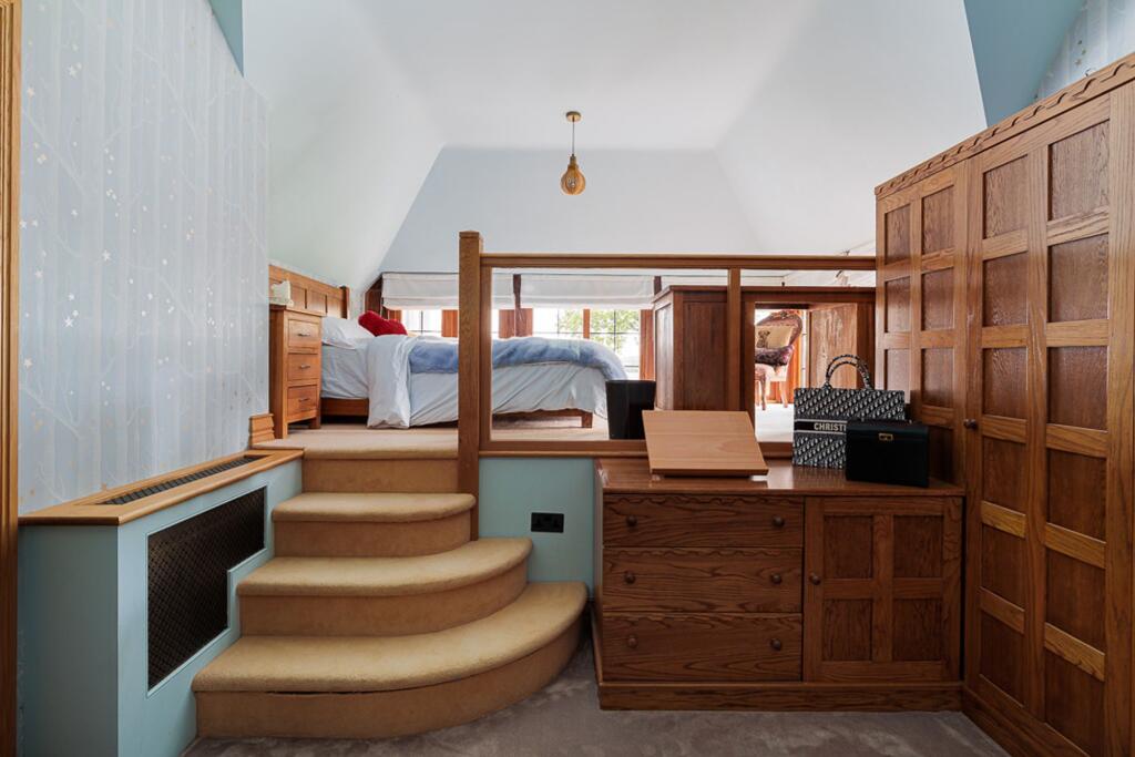
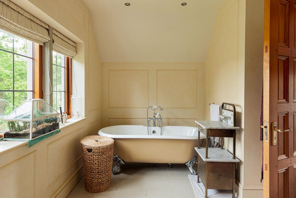
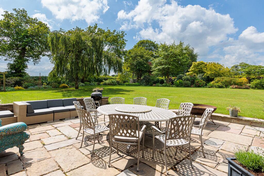
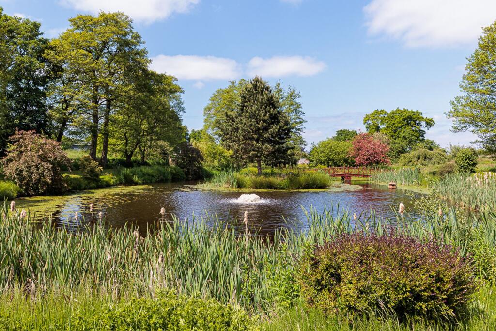
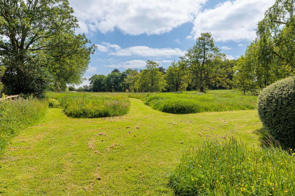
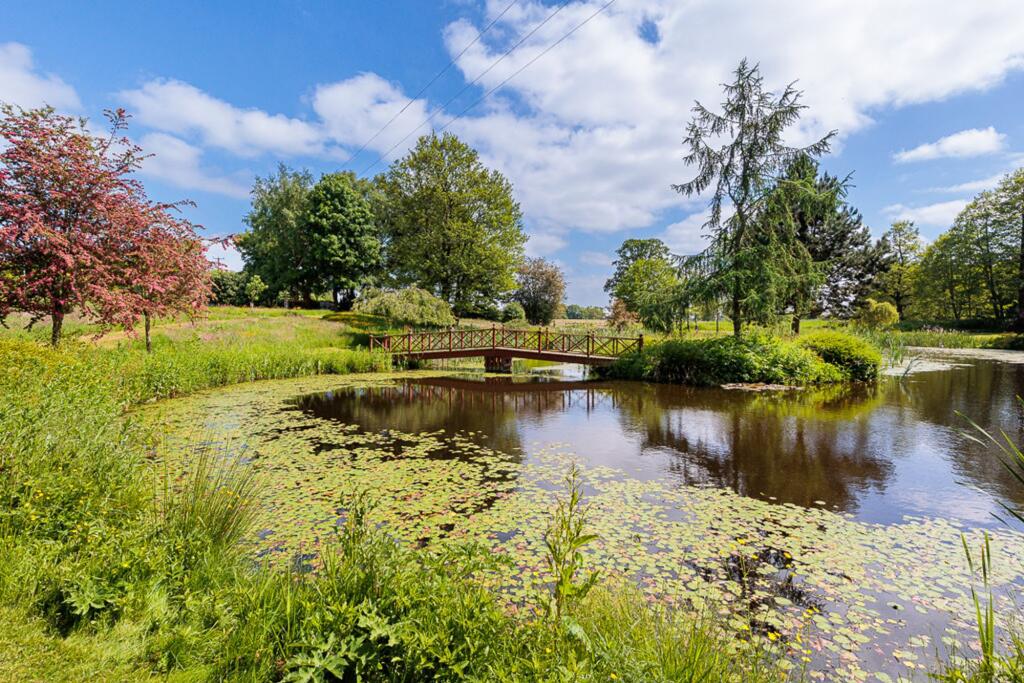
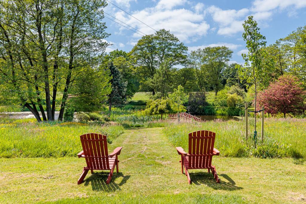
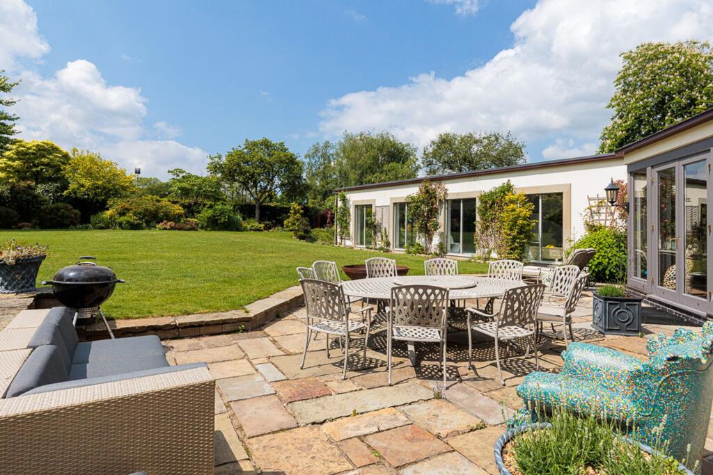
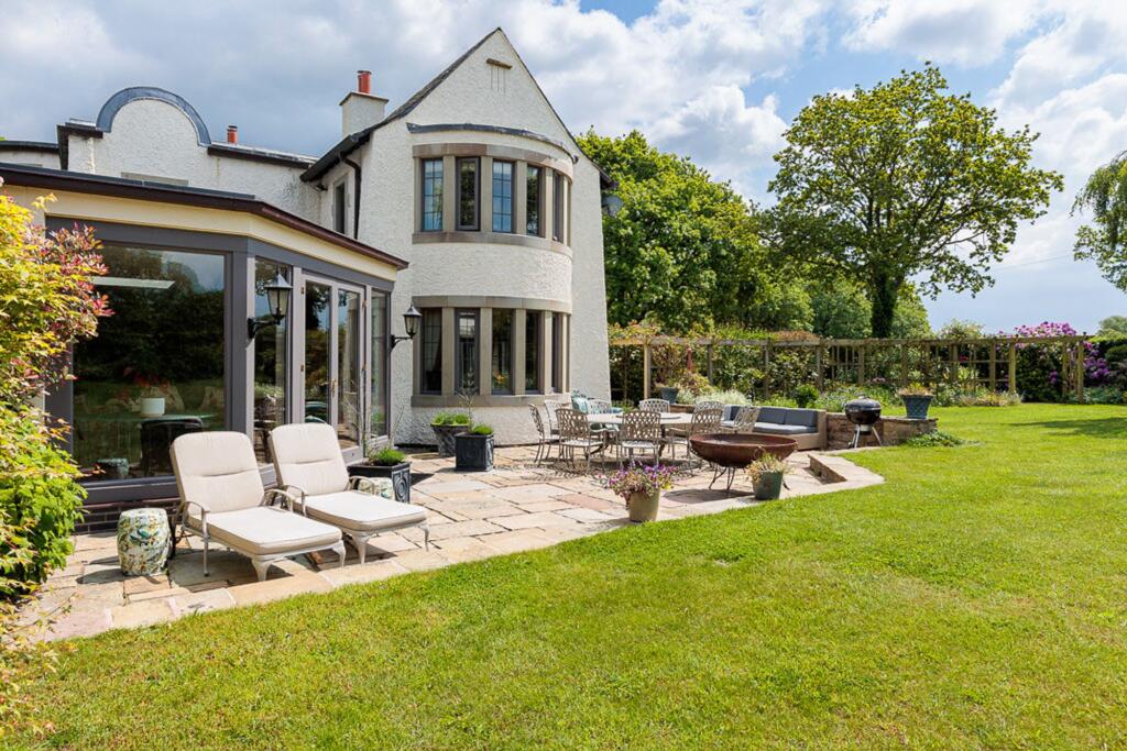
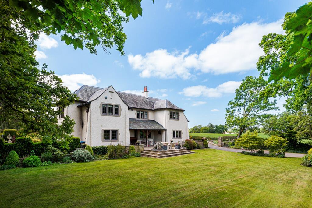
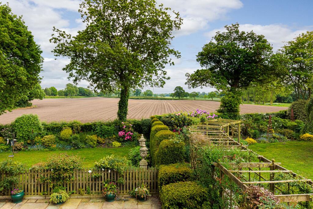
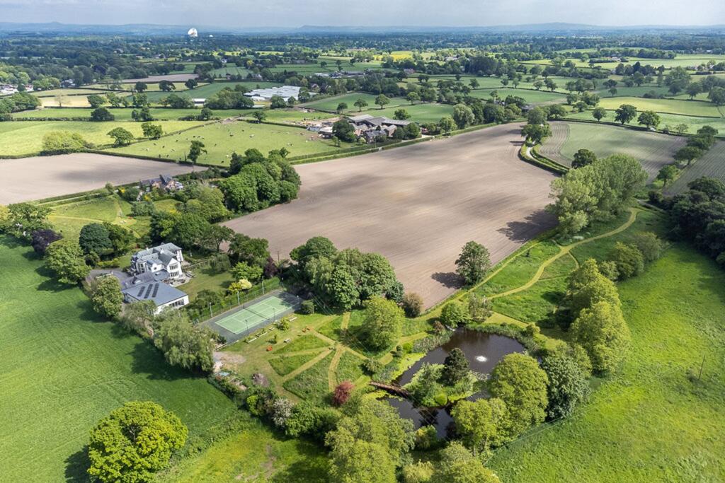
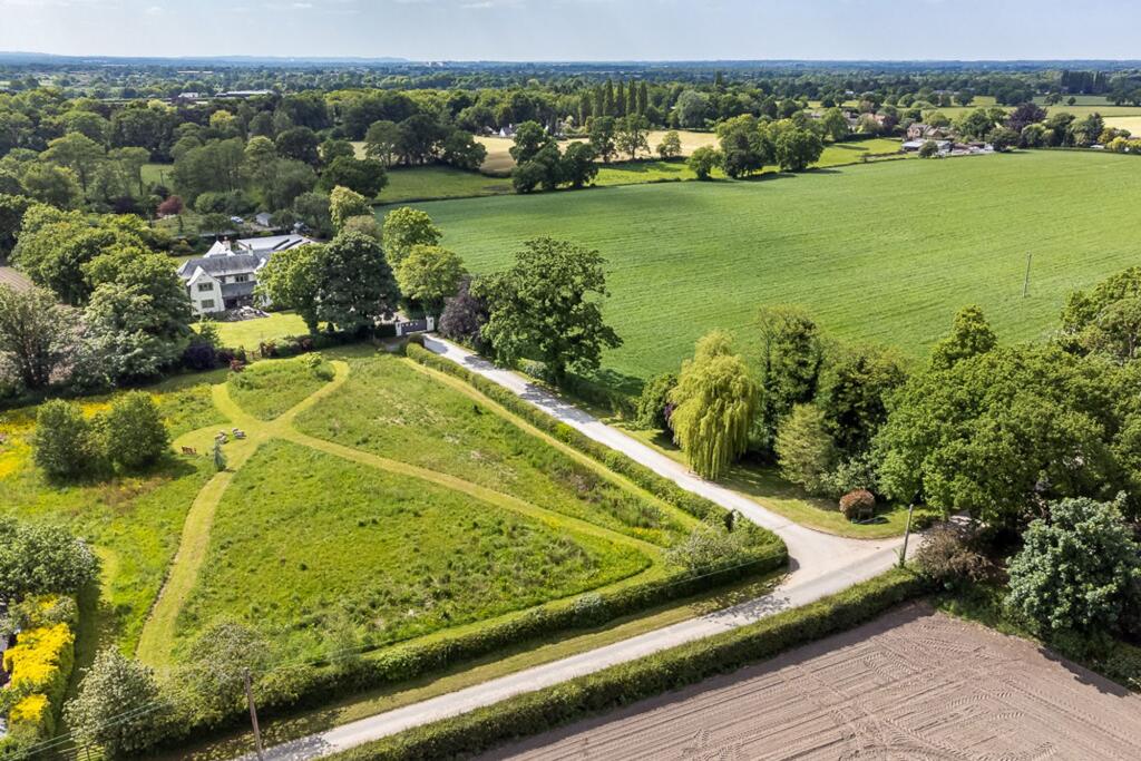
Photo 9 Photo 26 Photo 5 Photo 43 Photo 41 Photo 39 Photo 40 Photo 28 Photo 36 Photo 37 Photo 38 Photo 30 Photo 31 Photo 32 Photo 33 Photo 29 Photo 27 Photo 35 Photo 34 Photo 23 Photo 22 Photo 25 Photo 24 Photo 21 Photo 20 Photo 18 Photo 17 Photo 12 Photo 15 Photo 16 Photo 13 Photo 14 Photo 11 Photo 1 Photo 2 Photo 3 Photo 4 Photo 6 Photo 7 Photo 8 Photo 10 Photo 19 Photo 42 Photo 44
/ 44
Property details
Tenure
FREEHOLD
Council tax band
H
Local average
£865,297 (+280.8%)
Deprivation
Decile 7 (20,836 of 33,755)
Street crime
6 incidents within 1 mile (Apr 2026)
Key features
- An exceptional country house on the edge of Lower Peover village
- Stunning 6 acres gardens and grounds, with picturesque lake
- Over 8000 square feet in all, with separate staff flat
Additional details
- Parking
- Yes
- Garden
- Yes
- Listed property
- No
- Restrictions
- No
- Required access
- No
- Rights of way
- No
- Flooded in last 5 years
- No
- Flood defences
- No
Description
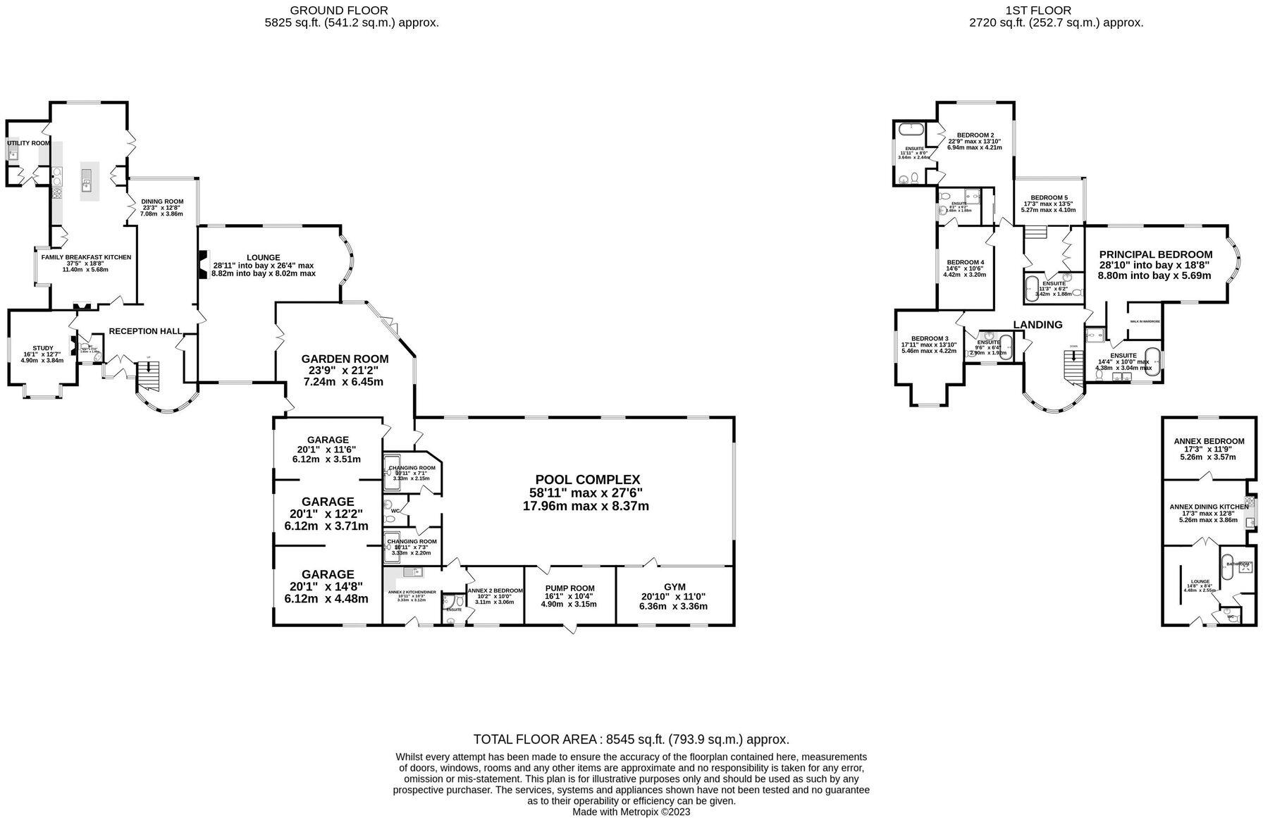
Porch, part panelled reception hall, lovely double size drawing room overlooking the garden, garden/sitting room, dining room, panelled study, large kitchen/breakfast/family room with planning consent to extend further, utility room. Five all en suite bedrooms enjoying lovely open views.
Triple attached garage with one bedroom staff flat above. Gardeners lodge (integral with bedroom, kitchen and shower room).
Stunning indoor leisure complex, beautifully finished and overlooking the main terrace and gardens with large 1100 square foot swimming pool room, gym, changing rooms.
Gated grounds and stunning surrounding formal gardens, in all just under 6 acres, with paddocks to the front and rear and a picturesque stocked lake. Hard tennis court, potting shed/tractor store.
EPC Rating: C
Listed by
Knutsford
Stuart Rushton & Co
Reference: 170049542
EPC ratings on this postcode
We don't have a matched EPC for this property yet. Below are efficiency scores and details for other addresses on this postcode.
| Address | Current | Potential | Floor area | Age band | Type |
|---|---|---|---|---|---|
| 1 Heath Cottage, Heath Lane, Allostock, KNUTSFORD | 26 | 92 | 126 m² | England and Wales: before 1900 | Detached |
| 2 Heath Cottage, Heath Lane, Allostock, KNUTSFORD | 49 | 89 | 154 m² | England and Wales: before 1900 | Detached |
| Hillside, Heath Lane, KNUTSFORD | 73 | 77 | 486 m² | England and Wales: 2003-2006 | Detached |
Flood risk
Zone: 1
Risk: Low
Job (default Low)
Floorplans
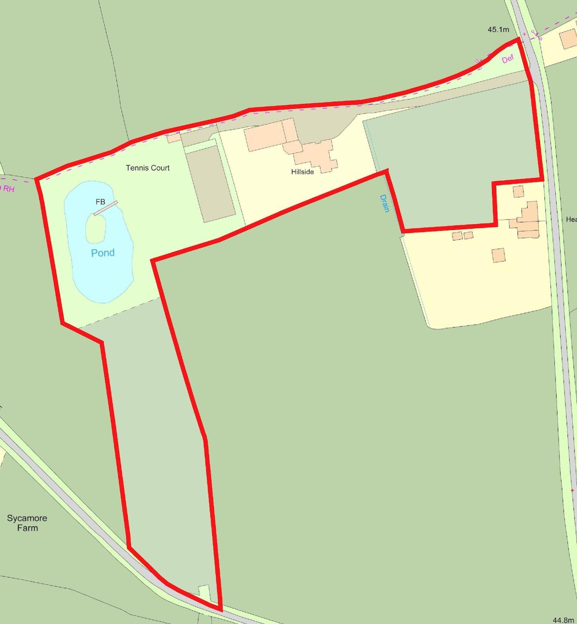
Site Plan
All
Price history
| Event | Date | Price | % change |
|---|---|---|---|
| Listed for sale | — | £3,295,000 | — |
Source: HM Land Registry Price Paid Data. Crown copyright.
Sold Comparables
Sold comparables data is not available for this property.
Capital growth trend
Land Registry outcode average: last 12 months vs 5y and 10y ago (from sold prices).
House Price Index (HM Land Registry — official index, not sold-price averages): Cheshire West and Chester. Series: Detached. As of March 2026.
Rental Range
Estimated market rent for Cheshire West and Chester. Low = conservative, Realistic = average, Optimistic = best case.
Based on Local Authority from postcode lookup → Cheshire West and Chester.
LHA (30th percentile) floor for East Lancs: £793/mo (Apr 2025 – Mar 2026)
Location
Address
Heath Lane
Nearby
Nearest stations, universities and amenities (distance from property).
| Type | Name | Distance |
|---|---|---|
| Bus stop | Boots Green, London Road / Townfield Lane | 0.5 miles |
| Shop | Equiport | 0.5 miles |
| Shop | The Country Store | 0.7 miles |
| Bus stop | Swan Green, Hulme Lane / Post Office | 0.7 miles |
| Train station | Plumley | 2.2 miles |
| Train station | Goostrey | 3.1 miles |
| Hospital | Knutsford and District Community Hospital | 3.4 miles |
| Hospital | Soss Moss Hospital | 5.3 miles |
| University | University of Buckingham Crewe Campus | 11.1 miles |
Street-level crime
| Category | Count |
|---|---|
| Criminal damage and arson | 3 |
| Drugs | 1 |
| Public order | 1 |
| Violence and sexual offences | 1 |
| Total incidents | 6 |
Within 1 mile during Apr 2026. Source: data.police.uk (England & Wales).
Schools nearby
Nearest open schools with Ofsted ratings (England). Closed schools are not shown. Data from Get Information about Schools and Ofsted.
| Name | Type | Distance | Ofsted |
|---|---|---|---|
| Lower Peover CofE Primary School | Primary | 0.8 miles | Outstanding — 22 Jul 2024 |
| Byley Primary School and Nursery | Primary | 2.6 miles | Good — 12 Mar 2023 |
| Peover Superior Endowed Primary School | Primary | 2.7 miles | Outstanding — 15 Jan 2018 |
| Goostrey Community Primary School | Primary | 2.8 miles | Good — 16 Mar 2022 |
| Bexton Primary School | Primary | 2.9 miles | Good — 5 Mar 2018 |
Rental Comparables
Loading rental comparables for this postcode. Refresh in a few minutes.
Rent-driven metrics
Based on Area rent estimate.
- Rent ratio — Monthly rent ÷ purchase price (1% rule). 1%+ = strong, 0.8–1% = okay, <0.8% = weak for cashflow.
- Max investor price — Rent ÷ 0.8%; the price at which rent would be 0.8% of price (Stoke-style target).
- Target investor price — Rent ÷ 1%; the price at which rent would be 1% of price (strong cashflow band).
- Gross yield — Annual rent as % of purchase price (no costs).
Enter House Number
Enter the house number to help us retrieve more accurate pricing history and property data.
Please log in to submit or correct the house number for this listing.
Log in to continue