High Street
Stoke-on-Trent, Staffordshire, ST6, ST6 5TA
£550 pcm
Property details
Council tax band
A
Deprivation
Decile 1 (807 of 33,755)
Street crime
365 incidents within 1 mile (Apr 2026)
Key features
- NEW TO THE MARKET!
- Available NOW!
- One Bedroom Apartment
- Neutral Throughout
- Close to Local Amenities
Additional details
- Heating
- Gas central
Description
Be the first to see this one bedroom property in the heart of the popular area of Tunstall. This property is situated perfectly for access to local amenities and due to the convenient access to the A500 and M6 motorway it’s perfect for those that need to commute.
This first floor property compromises as follows;
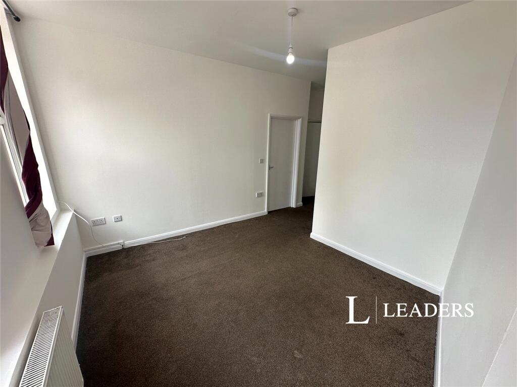
Spacious shared entrance with neutral décor and neutral carpet.
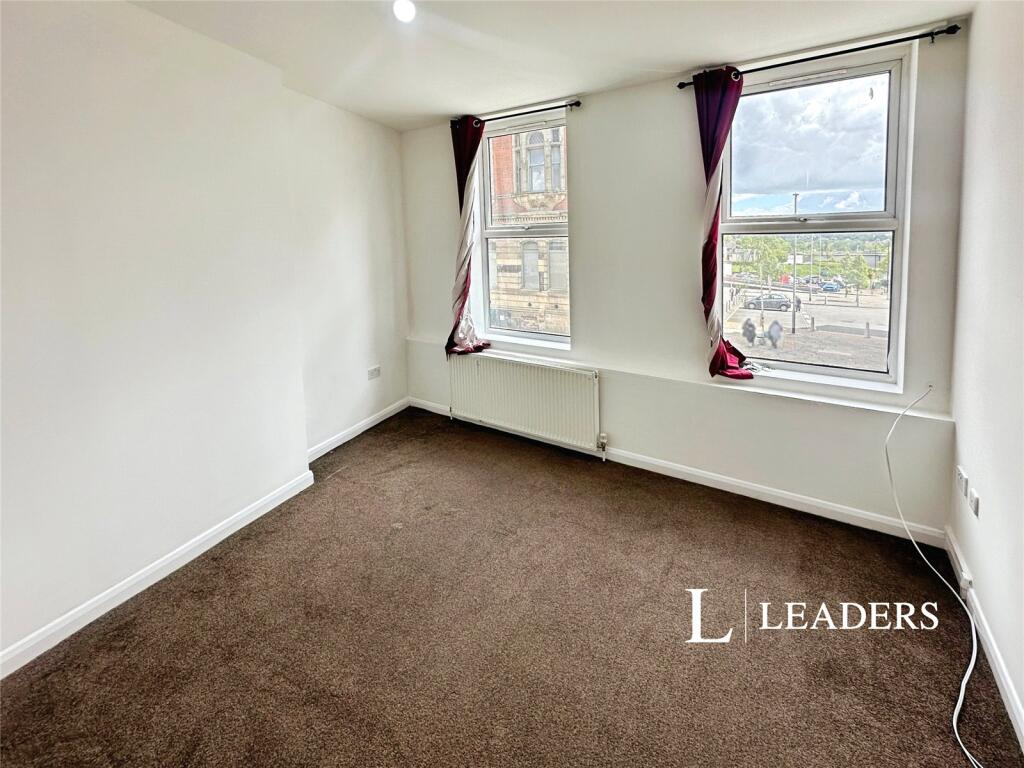
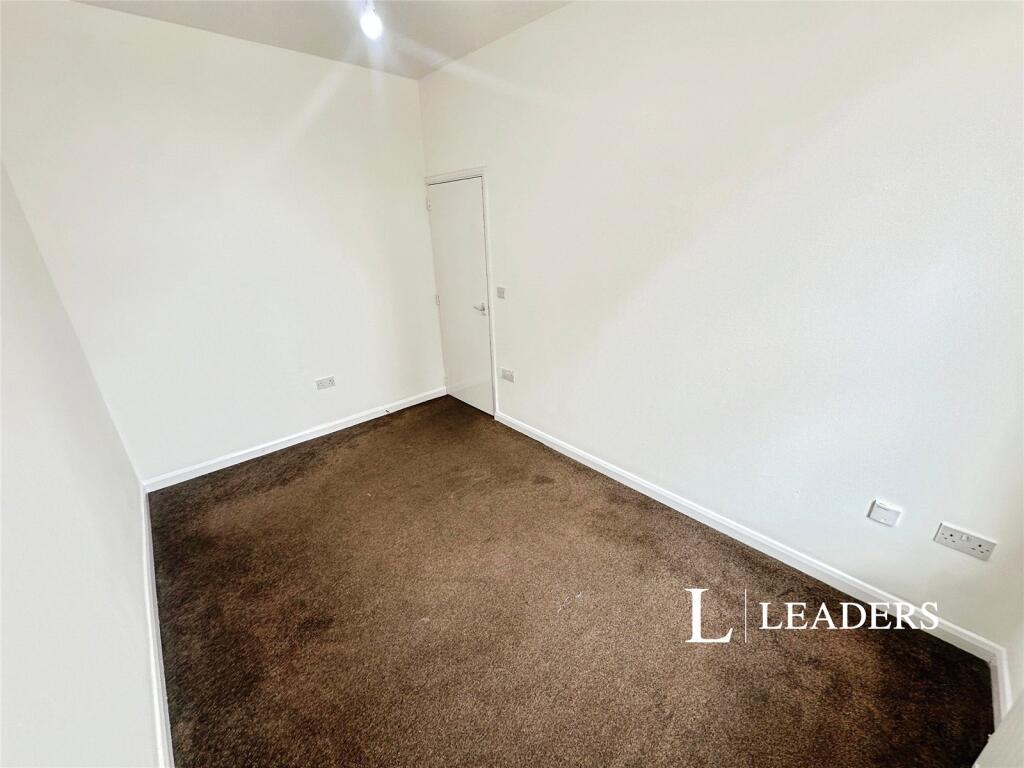
A good size reception room with fitted carpet and neutral décor.
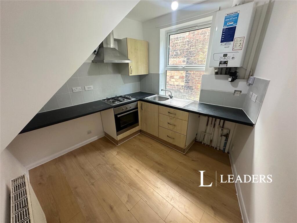
Modern fitted kitchen, with attractive worktops and base units and an integrated electric oven.
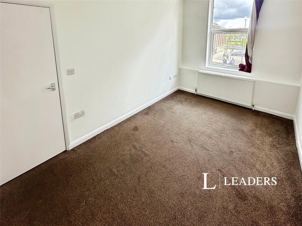
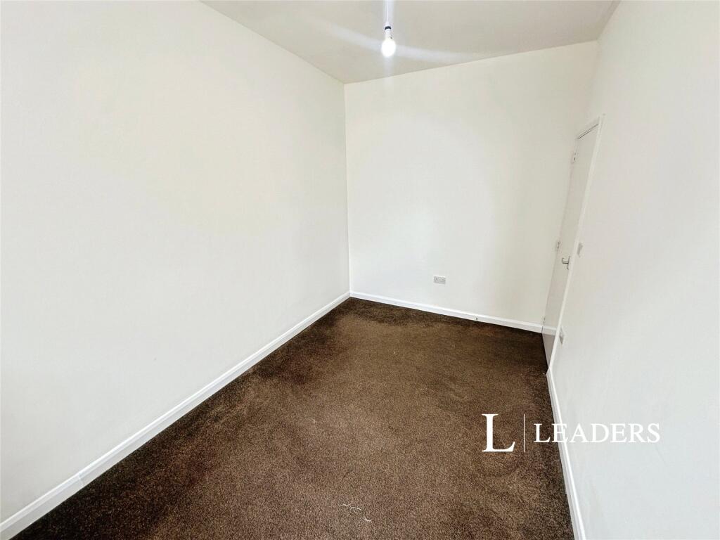
Double bedroom with neutral décor and carpet.
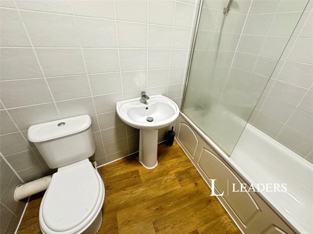
Attractive bathroom with white suite and shower over the bath.
Additional benefits include being within walking distance from amenities, full UPVC double glazing and gas central heating.
EPC rating D. Council tax band A. Rent excludes tenancy deposit and any other permitted payments. Deposit payable is 5 weeks worth of rent. A holding deposit of 1 weeks rent is required to reserve this property.
Listed by
Hartshill
Leaders and Romans Group
Reference: 88533321
EPC ratings on this postcode
We don't have a matched EPC for this property yet. Below are efficiency scores and details for other addresses on this postcode.
| Address | Current | Potential | Floor area | Age band | Type |
|---|---|---|---|---|---|
| 109a High Street, Tunstall | 72 | 75 | 47 m² | England and Wales: 1900-1929 | Flat |
| 109a High Street, Tunstall, Stoke-on-Trent | 72 | 75 | 47 m² | England and Wales: 1900-1929 | Flat |
| 109b High Street, Tunstall | 76 | 76 | 40 m² | England and Wales: 1900-1929 | Flat |
| 109b High Street, Tunstall, Stoke-on-Trent | 76 | 76 | 40 m² | England and Wales: 1900-1929 | Flat |
| 109c High Street, Tunstall | 73 | 75 | 60 m² | England and Wales: 1900-1929 | Maisonette |
| 109c High Street, Tunstall, Stoke-on-Trent | 73 | 75 | 60 m² | England and Wales: 1900-1929 | Flat |
| 65, High Street | 44 | 65 | 60 m² | England and Wales: before 1900 | Flat |
| 69a High Street | 63 | 69 | 84 m² | England and Wales: 1900-1929 | Maisonette |
| 69a High Street, STOKE-ON-TRENT | 63 | 69 | 84 m² | England and Wales: 1900-1929 | Flat |
| 75, High Street | 27 | 58 | 63 m² | England and Wales: before 1900 | Flat |
| 97a, High Street | 56 | 62 | 71 m² | England and Wales: 1967-1975 | Flat |
| 97a, High Street | 50 | 62 | 75 m² | England and Wales: 1950-1966 | Flat |
| 99a, High Street | 47 | 71 | 61 m² | England and Wales: 1967-1975 | Flat |
| 99a, High Street | 46 | 61 | 61 m² | England and Wales: 1950-1966 | Flat |
| 99a, High Street, STOKE-ON-TRENT | 47 | 71 | 61 m² | England and Wales: 1967-1975 | Flat |
Flood risk
Zone: 1
Risk: Low
Job (default Low)
Rental Range
Estimated market rent for Stoke-on-Trent. Low = conservative, Realistic = average, Optimistic = best case.
Based on Local Authority from postcode lookup → Stoke-on-Trent.
LHA (30th percentile) floor for Staffordshire North: £424/mo (Apr 2025 – Mar 2026)
Location
Address
Columbina Walk
Nearby
Nearest stations, universities and amenities (distance from property).
| Type | Name | Distance |
|---|---|---|
| Bus stop | Tunstall, High Street / Woodland Street (stop C) | 0.1 miles |
| Bus stop | Tunstall, High Street / Highgate | 0.1 miles |
| Shop | Vana Mini Market | 0.1 miles |
| Shop | Argos | 0.1 miles |
| Hospital | Haywood Hospital | 0.9 miles |
| Hospital | Haywood Hospital Walk-in Centre | 0.9 miles |
| Train station | Longport | 1.0 miles |
| Train station | Kidsgrove | 2.5 miles |
| University | University of Staffordshire Stoke Campus | 3.5 miles |
Street-level crime
| Category | Count |
|---|---|
| Violence and sexual offences | 116 |
| Anti-social behaviour | 64 |
| Vehicle crime | 38 |
| Other theft | 31 |
| Criminal damage and arson | 25 |
| Burglary | 22 |
| Public order | 20 |
| Shoplifting | 17 |
| Drugs | 8 |
| Other crime | 7 |
| Possession of weapons | 7 |
| Robbery | 7 |
| Bicycle theft | 2 |
| Theft from the person | 1 |
| Total incidents | 365 |
Within 1 mile during Apr 2026. Source: data.police.uk (England & Wales).
Schools nearby
Nearest open schools with Ofsted ratings (England). Closed schools are not shown. Data from Get Information about Schools and Ofsted.
| Name | Type | Distance | Ofsted |
|---|---|---|---|
| St Mary's Church of England Primary School | Primary | 0.0 miles | Outstanding — 13 Jun 2024 |
| The Nest | Other | 0.2 miles | Good — 13 Sep 2023 |
| Active Wellbeing School | Other | 0.2 miles | Requires improvement — 29 Nov 2023 |
| St Wilfrid's Catholic Primary School | Primary | 0.4 miles | Good — 12 Jun 2017 |
| Co-op Academy Stoke-On-Trent | Secondary | 0.4 miles | Good — 27 Mar 2013 |
Rental Comparables
Residential lets from OpenRent and Rightmove for the area (same bedroom count). Use to validate rent estimates. Student lets are excluded.
| Title | Rent | Beds | Distance | As seen on |
|---|---|---|---|---|
| High Street, Stoke-on-Trent, Staffordshire, ST6 | £550/mo | 1 | 0 miles | Rightmove |
| High Street, Tunstall | £550/mo | — | 0.09 miles | Rightmove |
| The Boulevard, Stoke-on-Trent, ST6 | £595/mo | — | 0.24 miles | Rightmove |
| 1 Bed Flat, Cheshire Cheese, ST6 | £640/mo | 1 | 0.36 miles | OpenRent |
| Lancashire Court, Federation Road, Burslem, Stoke-on-Trent, ST6 | £600/mo | 1 | 0.72 miles | Rightmove |
| Westport Road, Stoke-On-Trent, ST6 | £625/mo | 1 | 0.92 miles | Rightmove |
| Newcastle Street, Stoke-on-Trent, Staffordshire, ST6 | £750/mo | 1 | 0.97 miles | Rightmove |
| Railway Inn Apartments, Stoke-On-Trent, ST6 | £425/mo | 1 | 1 miles | Rightmove |
| Flat 1, 62 Scott Lidgett Road, Stoke-on Trent | £600/mo | 1 | 1.07 miles | Rightmove |
| Kingsware Road, Stoke On Trent | £825/mo | 1 | 1.15 miles | Rightmove |
| Kingsware Road, Burslem | £850/mo | 1 | 1.16 miles | Rightmove |
| Lingard Street, Burslem, Stoke-on-Trent, ST6 | £750/mo | — | 1.19 miles | Rightmove |
| Wade Street, Burslem | £675/mo | 1 | 1.21 miles | Rightmove |
Average rent: £649/mo (13 listings)
Enter House Number
Enter the house number to help us retrieve more accurate pricing history and property data.
Please log in to submit or correct the house number for this listing.
Log in to continue