Bonaire
LS12, LS12 1DL
£850 pcm
Property details
Council tax band
B
Deprivation
Decile 2 (6,531 of 33,755)
Street crime
1491 incidents within 1 mile (Apr 2026)
Key features
- One Double Bedroom
- Popular Location
- Part Furnished
- Close To All Amenities
- Allocated Parking
- Available Now
- EPC Rating B
- Council Tax Band C
Additional details
- Electricity
- Mains supply
- Broadband
- FTTP (fibre to the premises)
- Water
- Mains supply
- Sewerage
- Mains supply
- Heating
- Electric
- Accessibility
- Lift access
- Parking
- Yes
Description
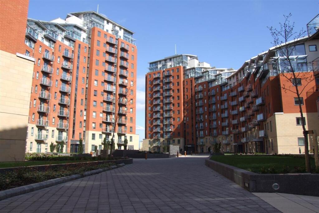
City Island itself is an incredibly popular development, situated around a central piazza and but a short stroll away from Leeds business and shopping districts, and is well placed for access to the motorway network and Ring Road. Internal inspection is highly recommended! Part furnished, council tax band C, EPC rating B, Deposit £980 Available Now.
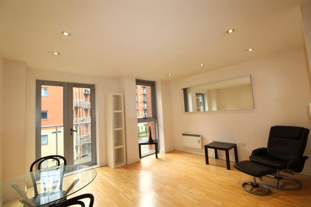
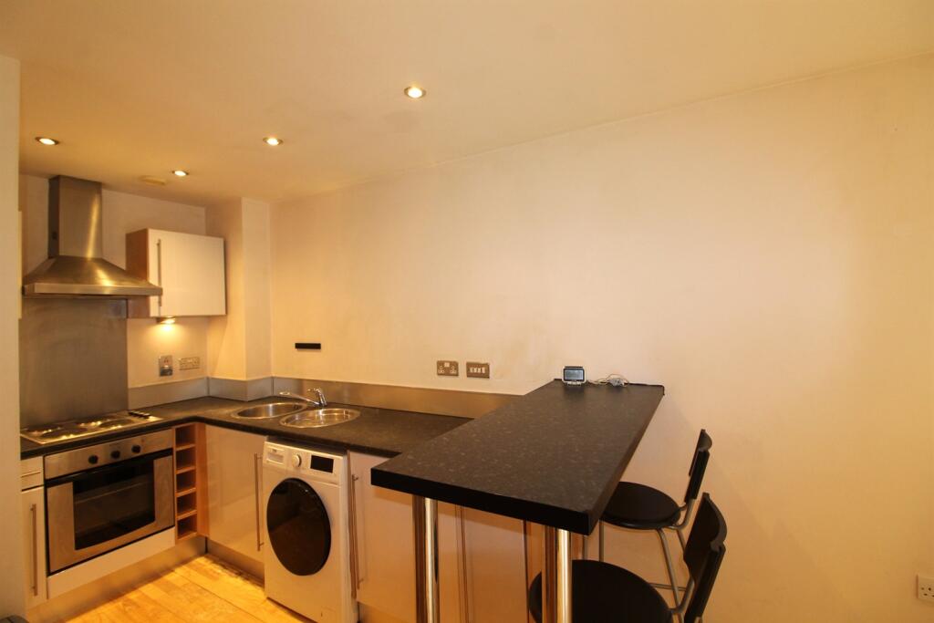
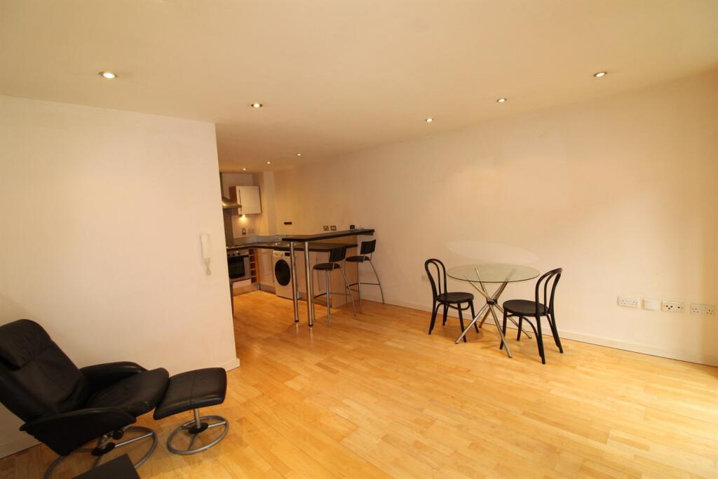
Open Plan Kitchen and Living Room
Open plan living /kitchen has a range of wall and base units, induction hob with electric oven, integrated fridge freezer, integrated washing machine and a balcony to the front over looking the communal gardens.
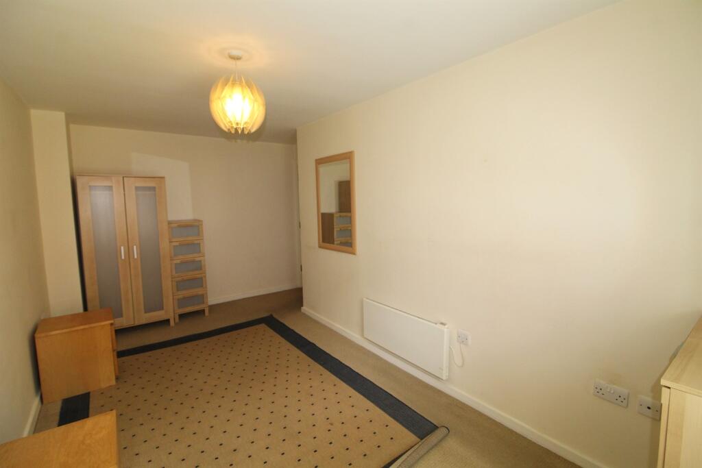
Bedroom 1
Double bedroom with built in wardrobes, electric wall heater and window.
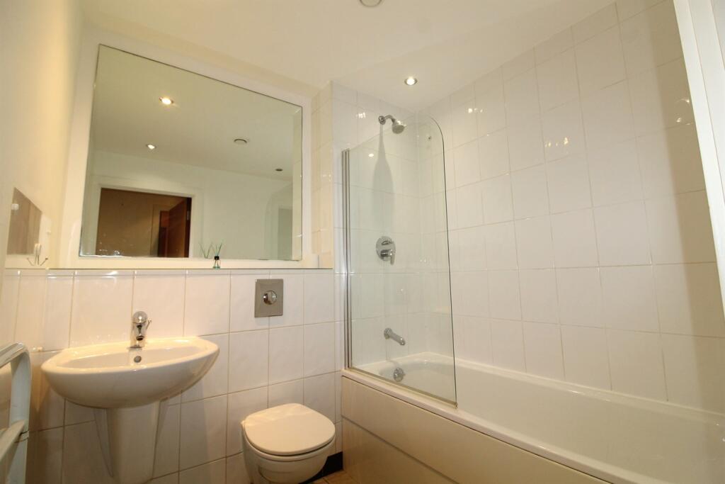
Bathroom
The modern shower room has a three piece suite consisting; bath with shower over shower screen, low flush W/C. tiled walls.
Communal Garden
Communal garden area.
Allocated Parking
Underground parking space.
Listed by
Leeds City Centre
Adair Paxton
Reference: 162557933
EPC ratings on this postcode
We don't have a matched EPC for this property yet. Below are efficiency scores and details for other addresses on this postcode.
| Address | Current | Potential | Floor area | Age band | Type |
|---|---|---|---|---|---|
| 14 BONAIRE, GOTTS ROAD, ARMLEY, LEEDS | 77 | 85 | 44 m² | England and Wales: 2003-2006 | Flat |
| 24 BONAIRE, GOTTS ROAD, ARMLEY, LEEDS | 78 | 83 | 47 m² | England and Wales: 2003-2006 | Flat |
| 38 BONAIRE, GOTTS ROAD, ARMLEY, LEEDS | 64 | 76 | 113 m² | England and Wales: 2003-2006 | Flat |
| Flat 1, Bonaire, Gotts Road, LEEDS | 79 | 85 | 48 m² | England and Wales: 2003-2006 | Flat |
| Flat 10 Bonaire, Gotts Road, LEEDS | 71 | 84 | 59 m² | England and Wales: 2003-2006 | Flat |
| Flat 10, Bonaire, Gotts Road, LEEDS | 80 | 85 | 62 m² | England and Wales: 2003-2006 | Flat |
| Flat 11 Bonaire, Gotts Road, LEEDS | 81 | 88 | 39 m² | England and Wales: 2007-2011 | Flat |
| Flat 11, Bonaire, Gotts Road, LEEDS | 80 | 87 | 45 m² | England and Wales: 2003-2006 | Flat |
| Flat 12 Bonaire, Gotts Road, LEEDS | 76 | 86 | 38 m² | England and Wales: 2003-2006 | Flat |
| Flat 13 Bonaire, Gotts Road, LEEDS | 71 | 84 | 60 m² | England and Wales: 2003-2006 | Flat |
| Flat 15, Bonaire, Gotts Road, LEEDS | 74 | 85 | 45 m² | England and Wales: 2003-2006 | Flat |
| Flat 16 Bonaire, Gotts Road, LEEDS | 82 | 84 | 52 m² | England and Wales: 2003-2006 | Flat |
| Flat 17, Bonaire, Gotts Road, LEEDS | 80 | 86 | 37 m² | England and Wales: 2003-2006 | Flat |
| Flat 18, Bonaire, Gotts Road, LEEDS | 77 | 84 | 60 m² | England and Wales: 2003-2006 | Flat |
| Flat 19, Bonaire, Gotts Road, LEEDS | 85 | 88 | 41 m² | England and Wales: 2003-2006 | Flat |
Flood risk
Zone: 1
Risk: Low
Job (default Low)
EPC Graphs

EPC Graph
Rental Range
Estimated market rent for Leeds. Low = conservative, Realistic = average, Optimistic = best case.
Based on Local Authority from postcode lookup → Leeds.
LHA (30th percentile) floor for Leeds: £673/mo (Apr 2025 – Mar 2026)
Location
Address
Gotts Road
Nearby
Nearest stations, universities and amenities (distance from property).
| Type | Name | Distance |
|---|---|---|
| Bus stop | Wellington P | 0.1 miles |
| Bus stop | Wellington N | 0.1 miles |
| Shop | Unknown | 0.2 miles |
| Shop | Harley-Davidson Leeds | 0.2 miles |
| Train station | Leeds | 0.5 miles |
| University | Leeds Law School | 0.5 miles |
| University | Northern Film School | 0.7 miles |
| Train station | Burley Park | 1.4 miles |
| Hospital | Sir Karl Cohen Square | 1.4 miles |
| Hospital | St James's Hospital A&E | 1.8 miles |
Street-level crime
| Category | Count |
|---|---|
| Violence and sexual offences | 411 |
| Shoplifting | 270 |
| Anti-social behaviour | 136 |
| Public order | 124 |
| Other theft | 107 |
| Criminal damage and arson | 78 |
| Vehicle crime | 74 |
| Drugs | 64 |
| Burglary | 59 |
| Theft from the person | 57 |
| Other crime | 40 |
| Robbery | 36 |
| Bicycle theft | 20 |
| Possession of weapons | 15 |
| Total incidents | 1491 |
Within 1 mile during Apr 2026. Source: data.police.uk (England & Wales).
Schools nearby
Nearest open schools with Ofsted ratings (England). Closed schools are not shown. Data from Get Information about Schools and Ofsted.
| Name | Type | Distance | Ofsted |
|---|---|---|---|
| Luminate Education Group | Other | 0.4 miles | — (No rating) |
| Swarthmore Education Centre | Other | 0.5 miles | — (No rating) |
| Castleton Primary School | Primary | 0.7 miles | Good — 22 Nov 2022 |
| Rosebank Primary School | Primary | 0.7 miles | Good — 5 Feb 2023 |
| Leeds Mathematics School | Other | 0.7 miles | — (No rating) |
Rental Comparables
Rental listings exist nearby, but none matched the 1-bedroom count for this property.
Enter House Number
Enter the house number to help us retrieve more accurate pricing history and property data.
Please log in to submit or correct the house number for this listing.
Log in to continue