38 BIRKBECK ROAD
LONDON, LONDON, GREATER LONDON W3 6BQ
£1,746 pcm
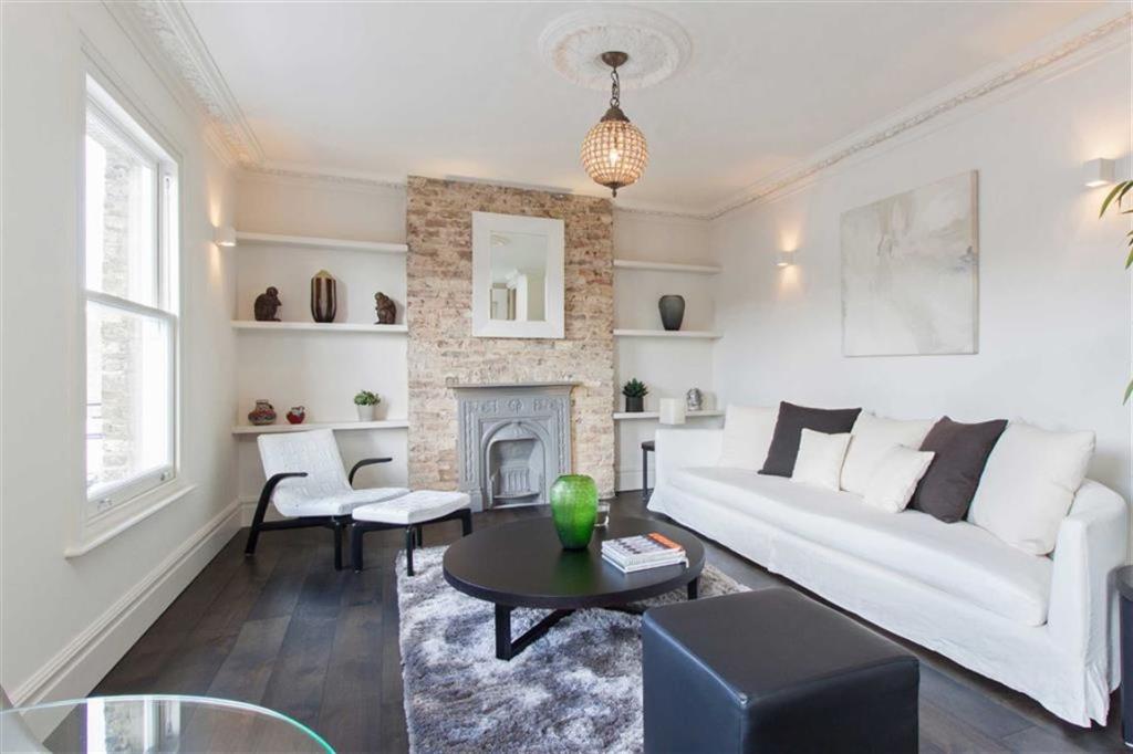
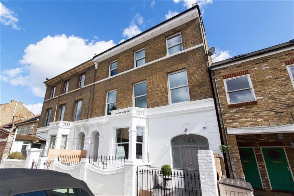
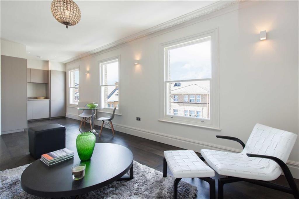
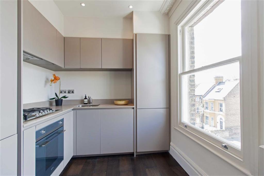
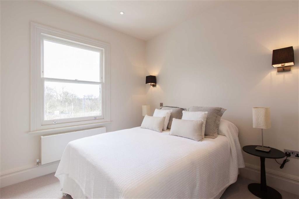
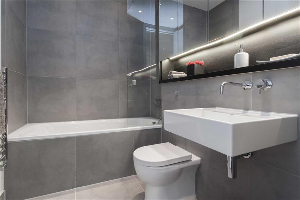
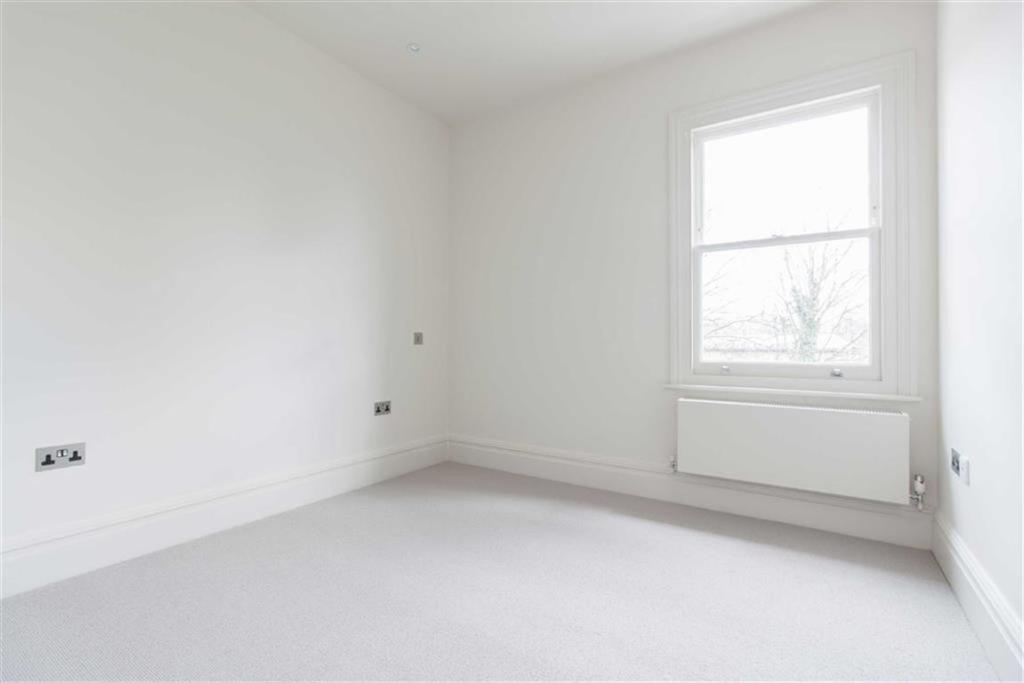
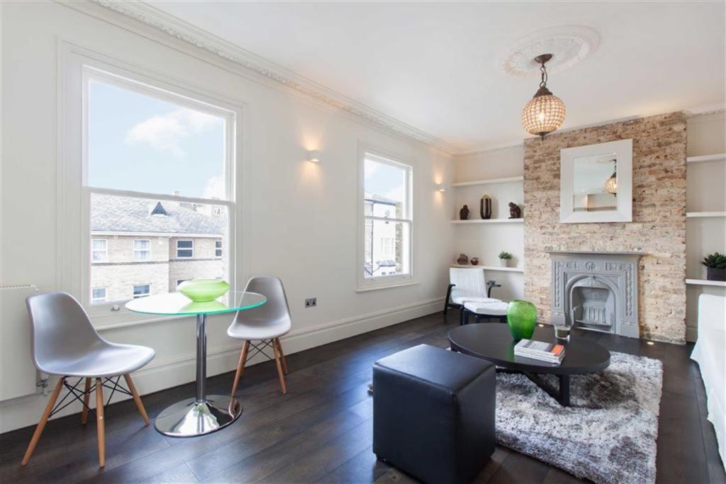
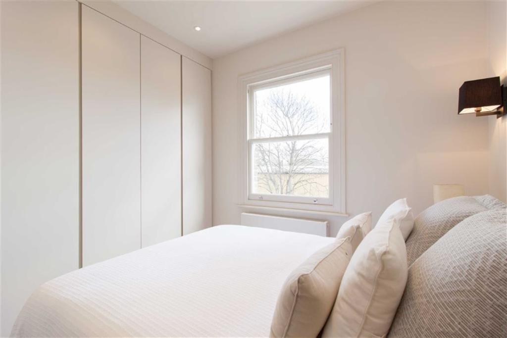
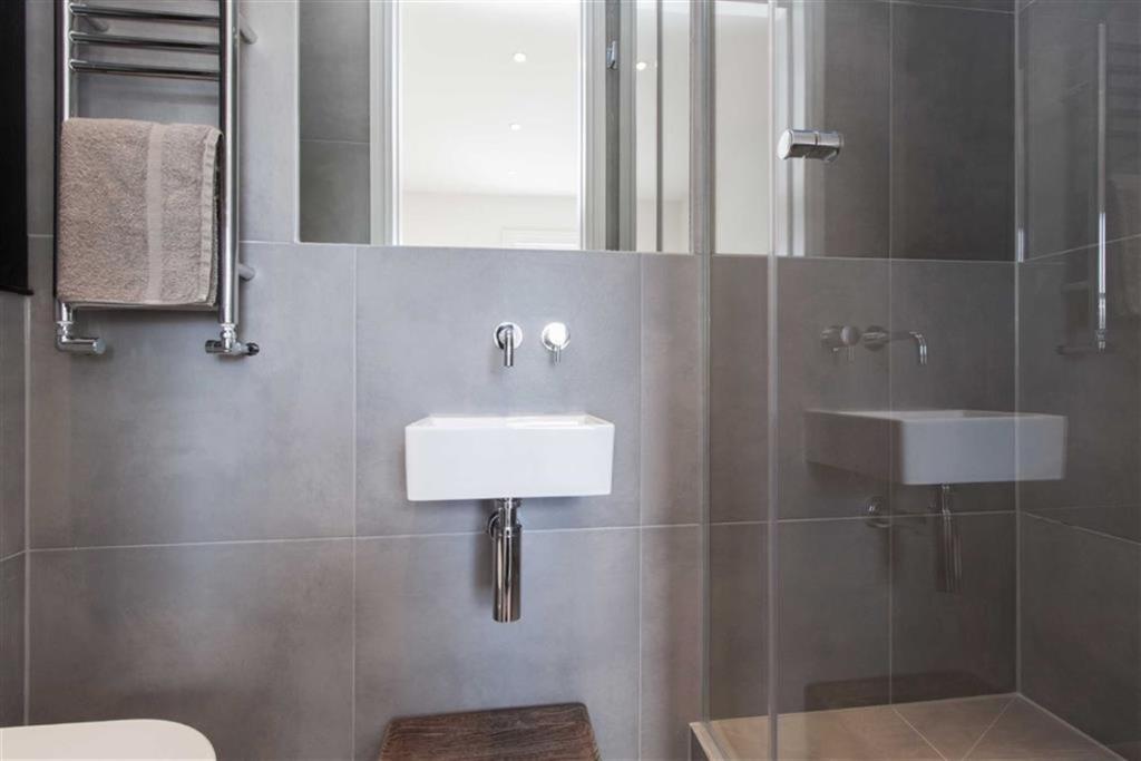
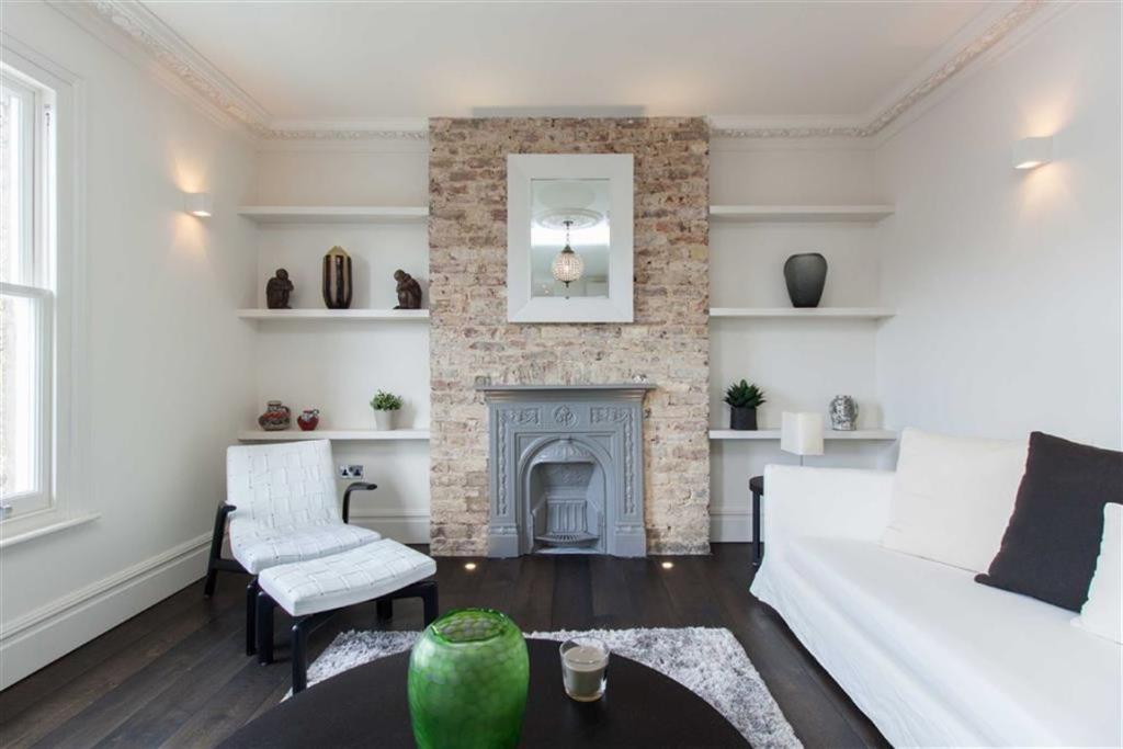
Photo 1 Photo 2 Photo 3 Photo 4 Photo 5 Photo 6 Photo 7 Photo 8 Photo 9 Photo 10 Photo 11
/ 11
Property details
Floor area
62 m²
Deprivation
Decile 2 (5,515 of 33,755)
Street crime
736 incidents within 1 mile (Apr 2026)
Key features
- Open plan living
- Two bathrooms
- Finished to a very high standard
Description
A stunning two bedroom flat in Acton Central
The property is within walking distance of good local primary schools including Derwentwater Primary. It is also well located for the new Crossrail service which will be running through Acton Main Line Station.
Directions - Birkbeck Road is on the peripheries of Poets Corner and is well located for the shops, bars and amenities of Churchfield Road.
You may download, store and use the material for your own personal use and research. You may not republish, retransmit, redistribute or otherwise make the material available to any party or make the same available on any website, online service or bulletin board of your own or of any other party or make the same available in hard copy or in any other media without the website owner's express prior written consent. The website owner's copyright must remain on all reproductions of material taken from this website.
Listed by
Acton
Aston Rowe
Reference: 66463801
EPC Rating & Upgrade Cost
Fetching EPC data… Refresh this page in a moment.
Flood risk
Zone: 1
Risk: Low
Job (default Low)
Floorplans
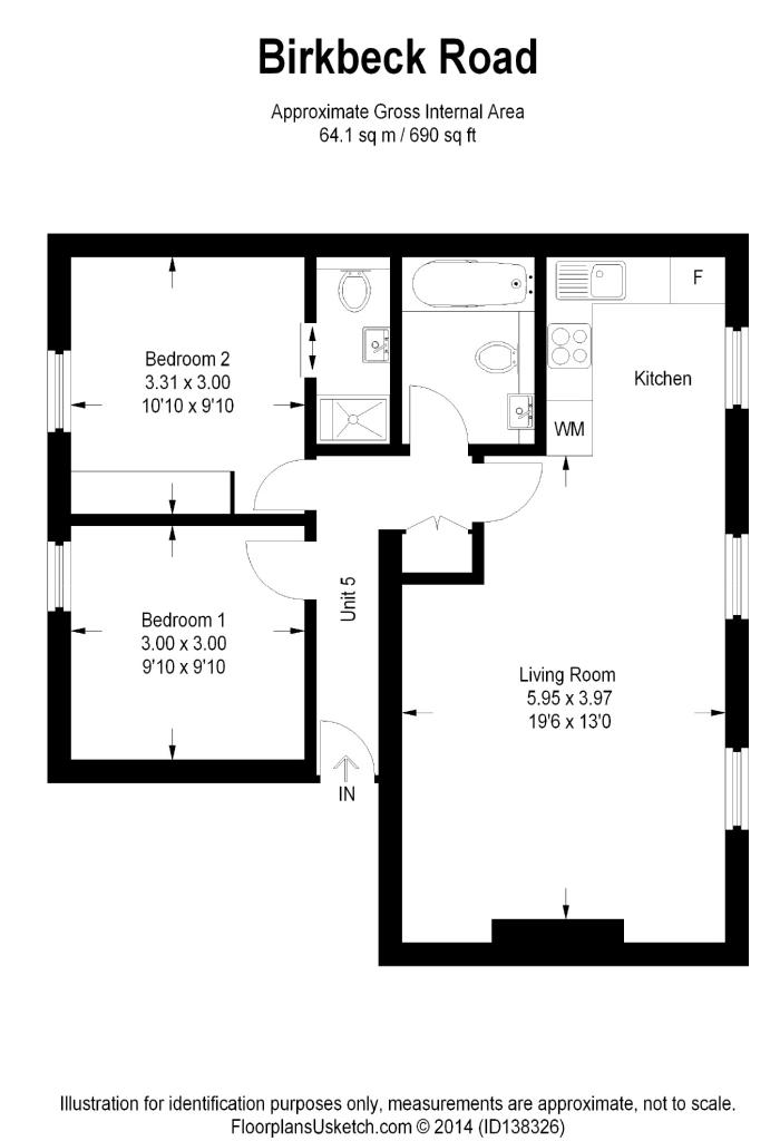
Floorplan 1
EPC Graphs
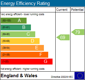
EPC 1

EPC 2
Company ownership
Registered legal owner is a company.
Rental Range
Estimated market rent for Ealing. Low = conservative, Realistic = average, Optimistic = best case.
Based on Local Authority from postcode lookup → Ealing.
LHA (30th percentile) floor for Bedford: £823/mo (Apr 2025 – Mar 2026)
Location
Nearby
Nearest stations, universities and amenities (distance from property).
| Type | Name | Distance |
|---|---|---|
| Shop | Jewson | 0.0 miles |
| Shop | Cloudy Vape | 0.1 miles |
| Train station | Acton Central | 0.1 miles |
| Bus stop | Acton Central Station | 0.1 miles |
| Train station | South Acton | 0.6 miles |
| University | Richmond American University London | 1.1 miles |
| University | Scale Space White City | 1.8 miles |
| Hospital | Bridge Lane Health Centre | 4.8 miles |
| Hospital | The Portland Hospital | 5.3 miles |
Street-level crime
| Category | Count |
|---|---|
| Anti-social behaviour | 195 |
| Violence and sexual offences | 189 |
| Vehicle crime | 78 |
| Shoplifting | 57 |
| Public order | 56 |
| Other theft | 48 |
| Criminal damage and arson | 31 |
| Drugs | 21 |
| Burglary | 18 |
| Bicycle theft | 11 |
| Robbery | 10 |
| Theft from the person | 9 |
| Possession of weapons | 8 |
| Other crime | 5 |
| Total incidents | 736 |
Within 1 mile during Apr 2026. Source: data.police.uk (England & Wales).
Schools nearby
Nearest open schools with Ofsted ratings (England). Closed schools are not shown. Data from Get Information about Schools and Ofsted.
| Name | Type | Distance | Ofsted |
|---|---|---|---|
| Ark Byron Primary Academy | Primary | 0.1 miles | Good — 11 Dec 2018 |
| Maples Nursery School and Children's Centre | Nursery | 0.1 miles | Requires improvement — 13 Jul 2023 |
| Ark Priory Primary Academy | Primary | 0.2 miles | Outstanding — 9 Jul 2015 |
| Derwentwater Primary School | Primary | 0.3 miles | Good — 24 Jul 2019 |
| East Acton Primary School | Primary | 0.4 miles | Good — 28 Mar 2013 |
Rental Comparables
Residential lets from OpenRent and Rightmove for the area (same bedroom count). Use to validate rent estimates. Student lets are excluded.
| Title | Rent | Beds | Distance | As seen on |
|---|---|---|---|---|
| 2 Bed Flat, Coopers Court, W3 | £2,000/mo | 2 | 0.36 miles | OpenRent |
| 2 Bed Flat, Beechwood Grove, W3 | £2,300/mo | 2 | 0.47 miles | OpenRent |
Average rent: £2,150/mo (2 listings)