8A
LEWIS ROAD, SUTTON, SUTTON, GREATER LONDON SM1 4EF
£700 pcm
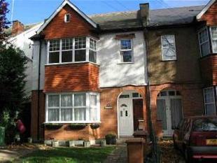
Photo 1
/ 1
Property details
Floor area
57 m²
EPC rating
D
Year built
England and Wales: 1950-1966
Deprivation
Decile 3 (7,399 of 33,755)
Street crime
509 incidents within 1 mile (Apr 2026)
Key features
- parking
- central heating
Description
Listed by
Sutton
Move South Limited - LSL Franchise
Reference: 5287531
EPC Rating & Upgrade Cost
Current rating: D
Potential rating: C
Inspection date: 13/02/2019
Expiry date: 12/02/2029
Current heating cost: £502/year
Potential heating cost: £301/year
Est. upgrade cost to C: £1,640
Recommendations
- Increase loft insulation to 270 mm (£100 - £350)
- Cavity wall insulation (£500 - £1,500)
- Low energy lighting for all fixed outlets (£15)
- Upgrade heating controls (£350 - £450)
Flood risk
Zone: 1
Risk: Low
Job (default Low)
Rental Range
Estimated market rent for Sutton. Low = conservative, Realistic = average, Optimistic = best case.
Based on Local Authority from postcode lookup → Sutton.
LHA (30th percentile) floor for Outer South London: £1,197/mo (Apr 2025 – Mar 2026)
Location
Nearby
Nearest stations, universities and amenities (distance from property).
| Type | Name | Distance |
|---|---|---|
| Bus stop | Sutton / Marshall's Road | 0.1 miles |
| Shop | Abi Nails | 0.1 miles |
| Shop | Sam Solicitors | 0.1 miles |
| Train station | Sutton Common | 0.5 miles |
| Train station | West Sutton | 0.5 miles |
| Hospital | Queen Mary's Childrens' Hospital | 0.9 miles |
| Hospital | Chapel Orchard Day Surgery | 2.5 miles |
| University | Horton Halls Reception | 4.7 miles |
| University | BIMM Institute London | 7.7 miles |
Street-level crime
| Category | Count |
|---|---|
| Violence and sexual offences | 151 |
| Anti-social behaviour | 124 |
| Vehicle crime | 45 |
| Other theft | 36 |
| Public order | 36 |
| Criminal damage and arson | 32 |
| Shoplifting | 27 |
| Drugs | 19 |
| Burglary | 16 |
| Other crime | 7 |
| Robbery | 5 |
| Bicycle theft | 4 |
| Theft from the person | 4 |
| Possession of weapons | 3 |
| Total incidents | 509 |
Within 1 mile during Apr 2026. Source: data.police.uk (England & Wales).
Schools nearby
Nearest open schools with Ofsted ratings (England). Closed schools are not shown. Data from Get Information about Schools and Ofsted.
| Name | Type | Distance | Ofsted |
|---|---|---|---|
| Robin Hood Junior School | Primary | 0.2 miles | Good — 30 Oct 2012 |
| Sutton Grammar School | Secondary | 0.3 miles | Good — 21 Sep 2022 |
| All Saints Benhilton CofE Primary School | Primary | 0.3 miles | Good — 4 Sep 2015 |
| Manor Park Primary Academy | Primary | 0.4 miles | Outstanding — 8 Jun 2015 |
| The Limes College | Other | 0.4 miles | Good — 15 Jan 2024 |
Rental Comparables
Residential lets from OpenRent and Rightmove for the area (same bedroom count). Use to validate rent estimates. Student lets are excluded.
| Title | Rent | Beds | Distance | As seen on |
|---|---|---|---|---|
| 2 Bed Flat, High St, SM1 | £1,850/mo | 2 | 0.09 miles | OpenRent |
| 2 Bed Flat, Gateway Court, SM1 | £1,700/mo | 2 | 0.19 miles | OpenRent |
| 2 Bed Terraced House, Collingwood Road, SM1 | £1,850/mo | 2 | 0.39 miles | OpenRent |
Average rent: £1,800/mo (3 listings)