73 BARROWMEAD DRIVE
BRISTOL, CITY OF BRISTOL BS11 0JH
£245,000
Property details
Tenure
FREEHOLD
Floor area
83 m²
Council tax band
B
EPC rating
D
Last sold
£240,000 Feb 2025
Price per m²
£2,952/m²
Local average
£313,292 (-21.8%)
Deprivation
Decile 2 (4,939 of 33,755)
Street crime
131 incidents within 1 mile (Aug 2026)
Key features
- Semi detached
- 3 bedrooms
- 2 reception rooms
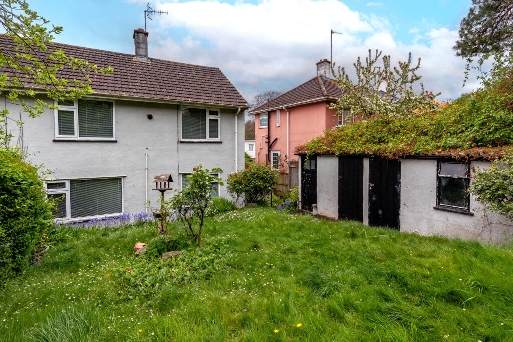
- Large garden
- Off road parking
- No chain
Additional details
- Accessibility
- No wheelchair access
- Parking
- Yes
- Garden
- Yes
Description
Overview
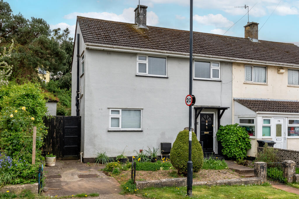
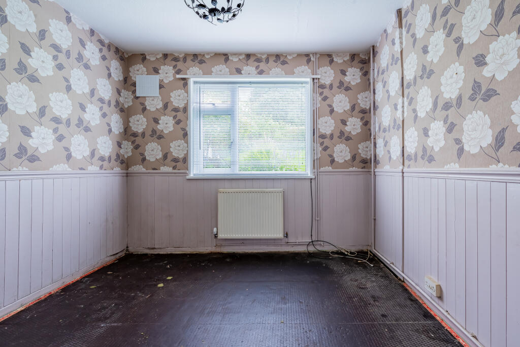
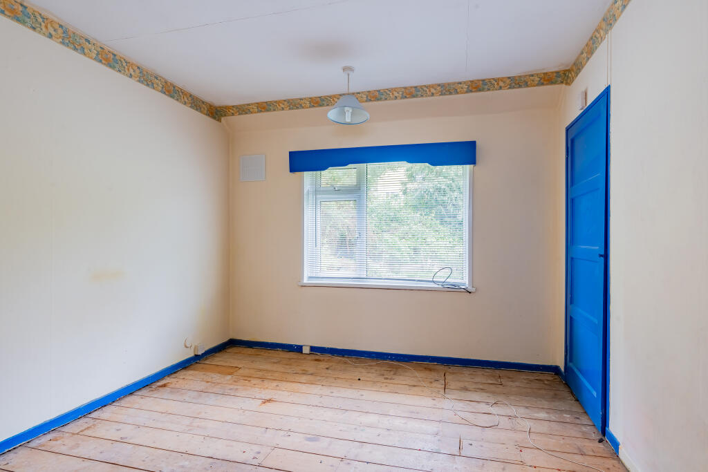
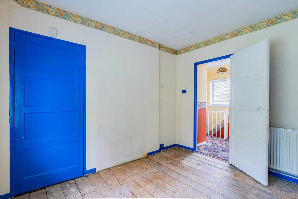
This semi detached home offers great potential and is being sold with no chain.
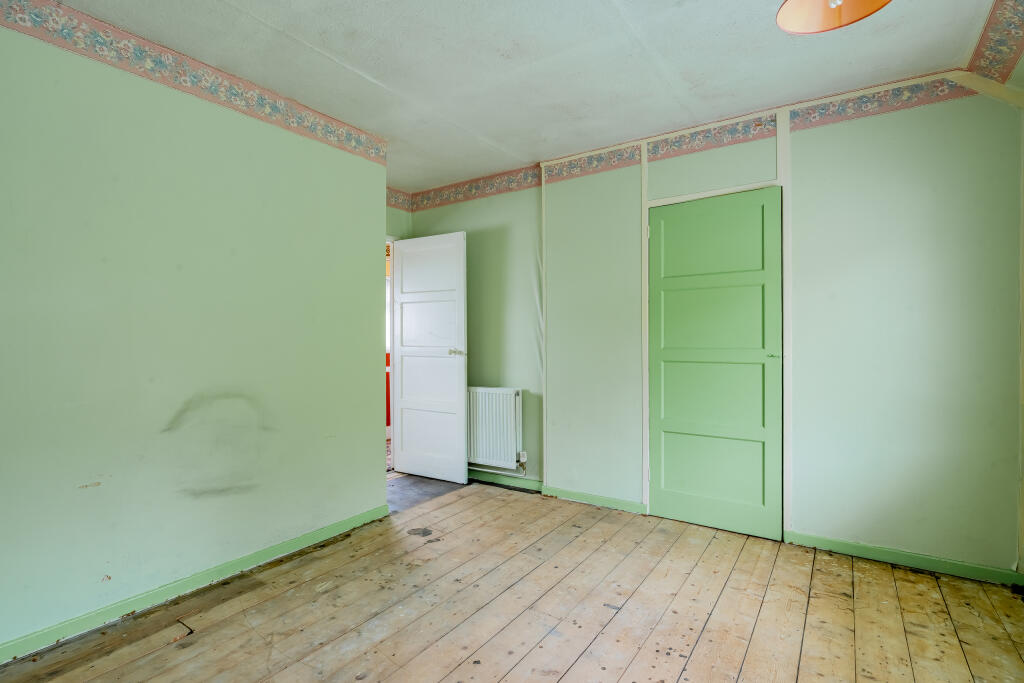
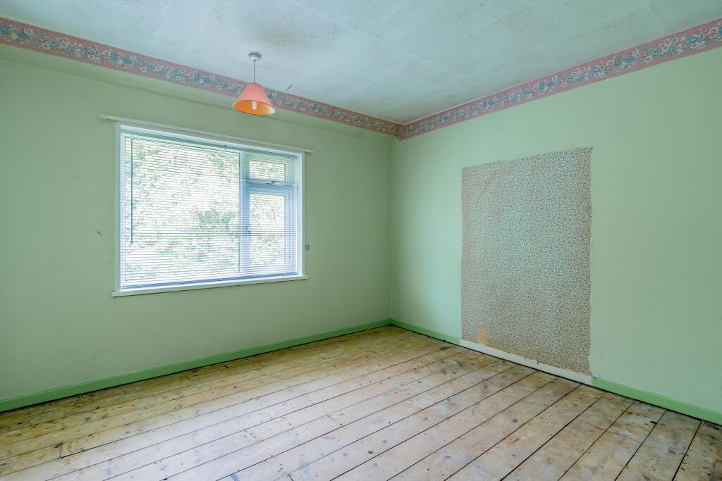
This house has lots going for it - decent sized rooms, large garden, parking and the scope to extend (subject to necessary consents) as well as being sold with no chain.
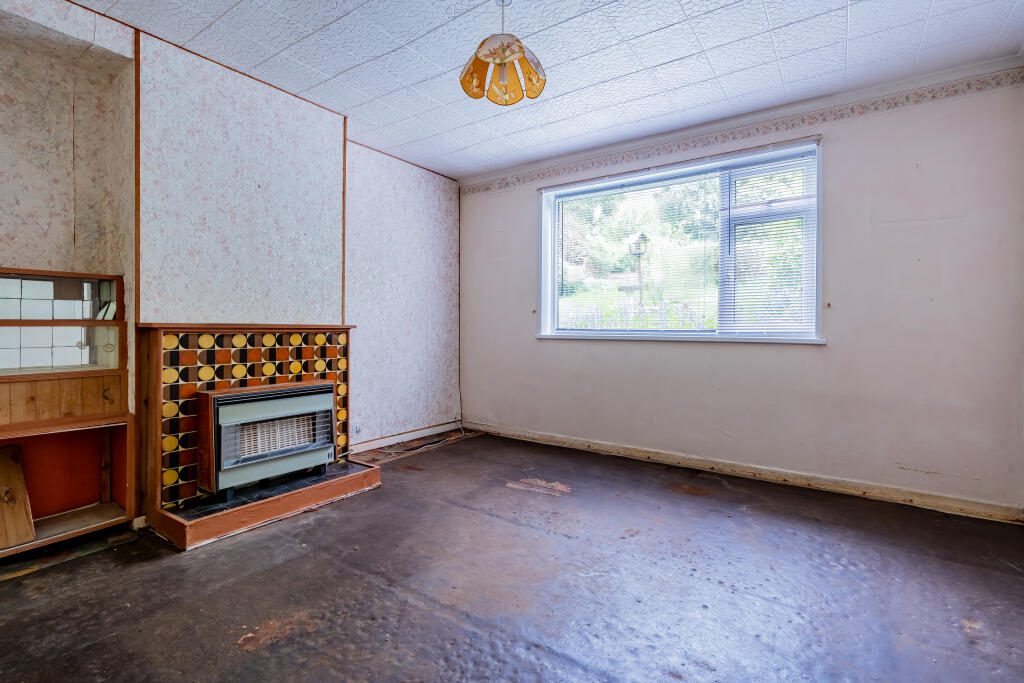
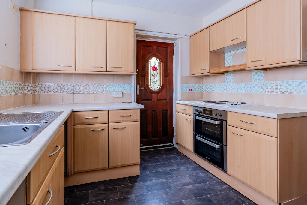
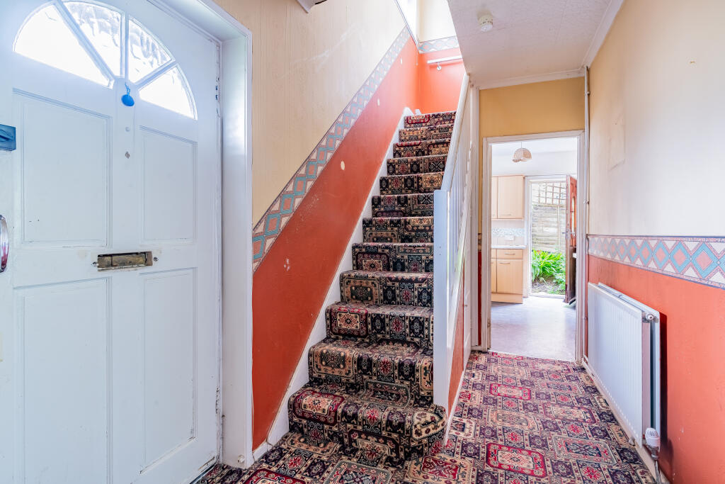
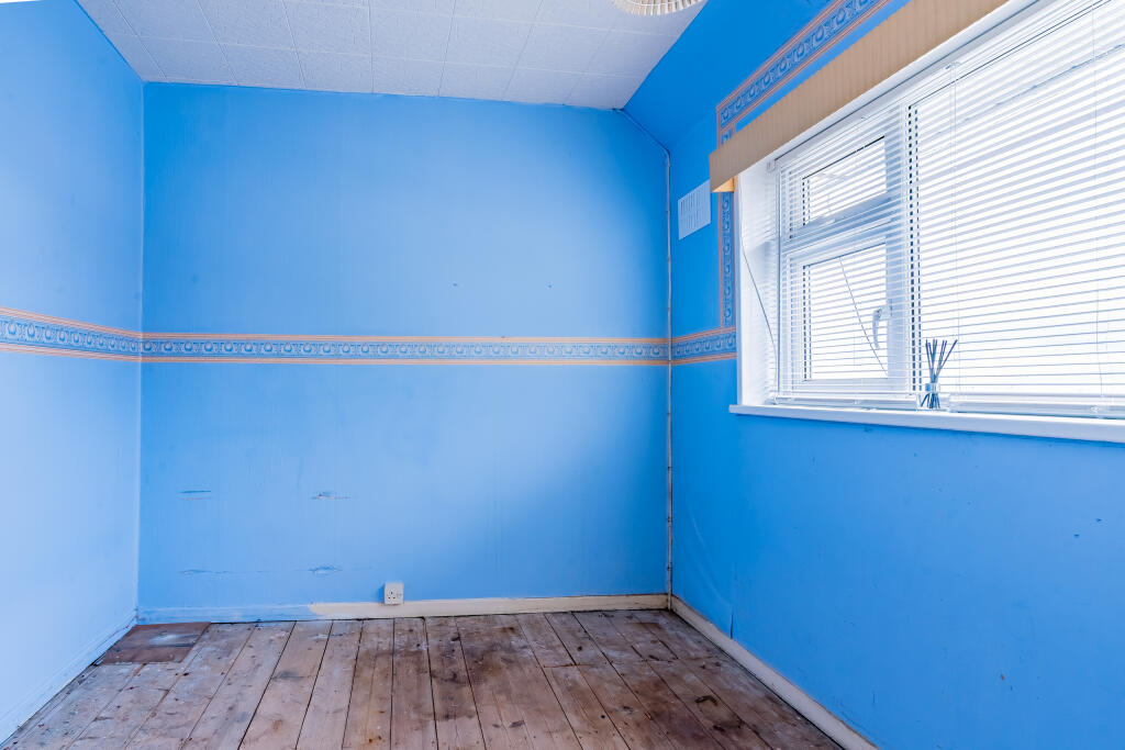
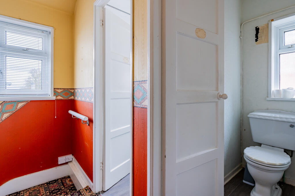
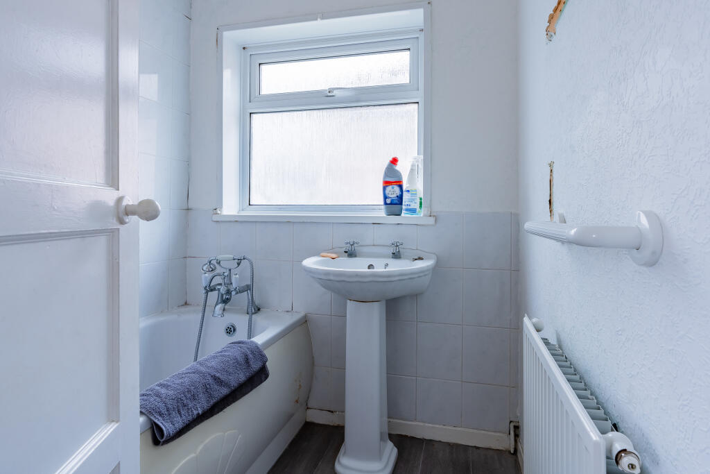
Although the house requires updating, it would make a great first home for those people looking to buy a house that they can make their own.
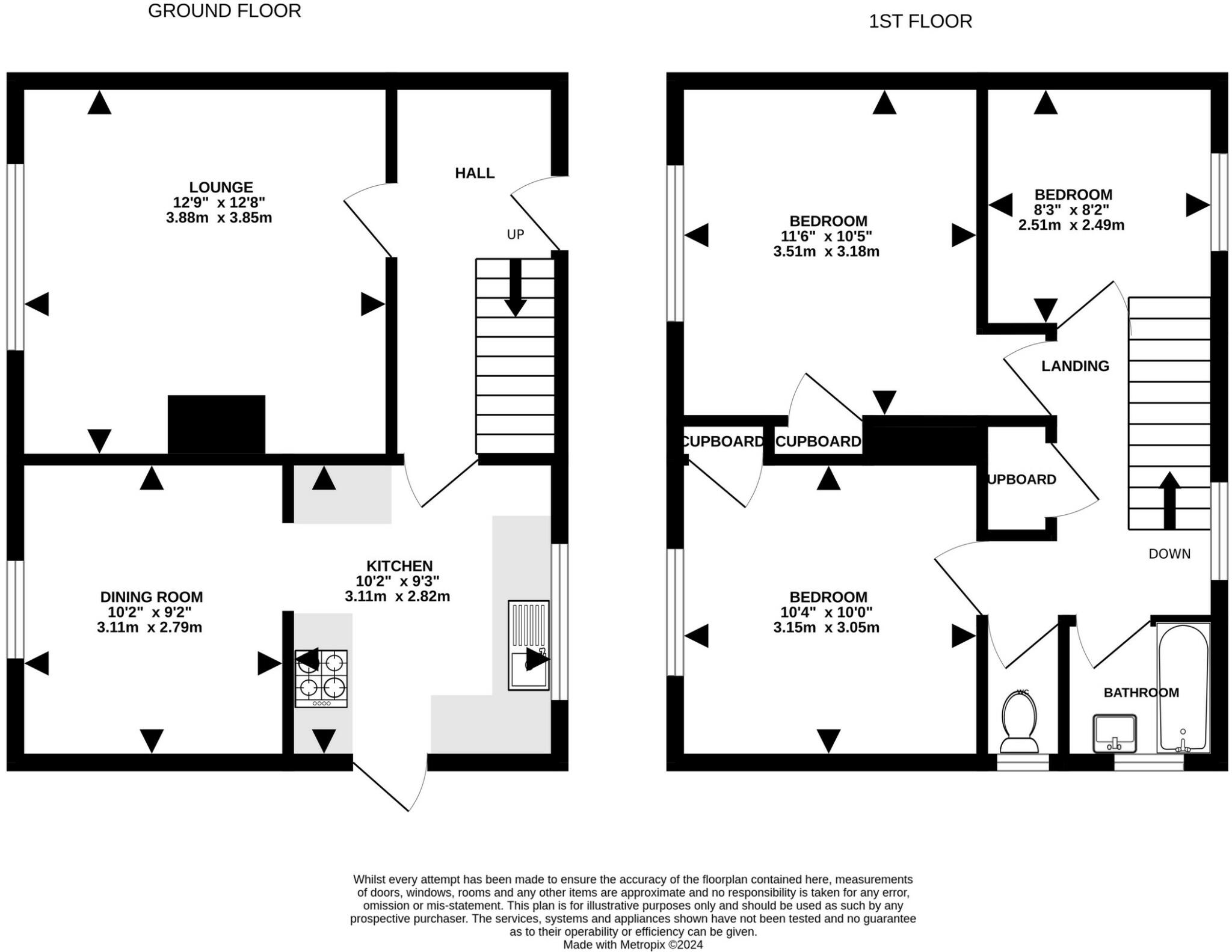
The ground floor has 2 reception rooms and the kitchen, whilst upstairs there are 3 bedrooms plus the bathroom.
Like many houses in the area, the property is of Laing-Easi construction so please check with your mortgage lender prior to viewing.
Outside
There is a good sized garden at the rear - perfect for a family. There is a garden area to the front, as well as a driveway allowing for off road parking.
Location
Barrowmead Drive is within walking distance to the local primary schools, plus St Bedes Secondary School.
The medical centre and shops on Ridingleaze are nearby, and there are woodland walks not far away.
We think...
This is a perfect property for someone who wants to put their own mark on a home. This house is full of potential.
Listed by
Shirehampton
The Lomond Group
Reference: 149103170
EPC Rating & Upgrade Cost
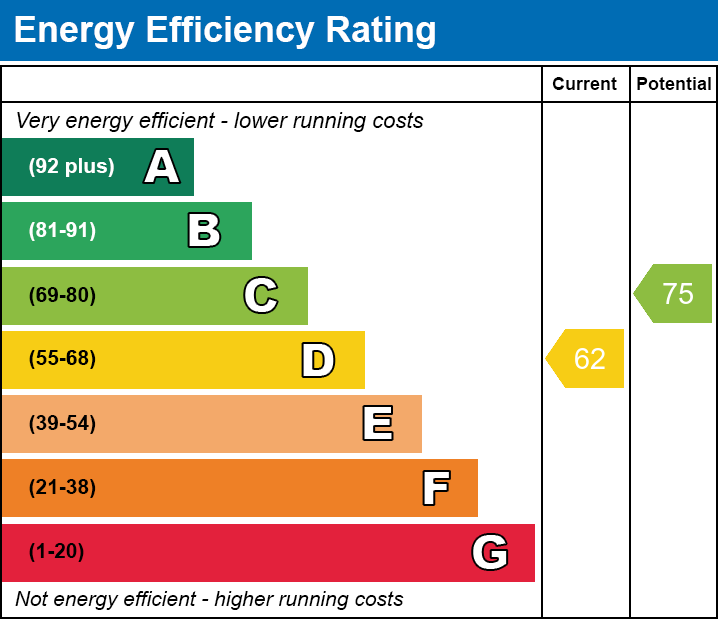
Current rating: D
Potential rating: C
Inspection date: 17/09/2024
Expiry date: 16/09/2034
Current heating cost: £1,176/year
Potential heating cost: £1,117/year
Est. upgrade cost to C: £14,500
Recommendations
- Floor insulation (solid floor) (£4,000 - £6,000)
- Solar water heating (£4,000 - £6,000)
- Solar photovoltaic panels, 2.5 kWp (£3,500 - £5,500)
Flood risk
Zone: 1
Risk: Low
Job (default Low)
Registered land (INSPIRE)
This location is outside the imported HM Land Registry INSPIRE registered freehold polygons.
Source: HM Land Registry INSPIRE Index Polygons.
Floorplans
73 BMD
EPC Graphs

73 Barrowmead House
EE
Price history
| Event | Date | Price | % change |
|---|---|---|---|
| Sold | 10/02/2025 (1 year ago) | £240,000 | — |
Source: HM Land Registry Price Paid Data. Crown copyright.
Sold Comparables
Same street and nearby sales within 0.25 miles (last 5 years). Data from Land Registry Price Paid.
| Address | Price | Date | Type |
|---|---|---|---|
| 104 BARROWMEAD DRIVE, BRISTOL, CITY OF BRISTOL, BS11 0JN | £290,000 | 19/12/2025 | Semi-detached |
| 4 MIDDLETON ROAD, BRISTOL, CITY OF BRISTOL, BS11 0JW | £235,000 | 28/10/2025 | Semi-detached |
| 12 MOOR GROVE, BRISTOL, CITY OF BRISTOL, BS11 0LR | £283,000 | 07/12/2023 | Semi-detached |
| 43 BADENHAM GROVE, BRISTOL, CITY OF BRISTOL, BS11 0LW | £235,000 | 01/12/2023 | Semi-detached |
| 19 HOPEWELL GARDENS, BRISTOL, CITY OF BRISTOL, BS11 0JS | £245,000 | 24/10/2023 | Semi-detached |
| 20 WINDCLIFF CRESCENT, BRISTOL, CITY OF BRISTOL, BS11 0JX | £258,000 | 26/04/2023 | Semi-detached |
| 12 MIDDLETON ROAD, BRISTOL, CITY OF BRISTOL, BS11 0JW | £148,050 | 27/03/2023 | Semi-detached |
| 96 MANCROFT AVENUE, BRISTOL, CITY OF BRISTOL, BS11 0HY | £265,000 | 02/12/2022 | Semi-detached |
| 51 MANCROFT AVENUE, BRISTOL, CITY OF BRISTOL, BS11 0HX | £298,500 | 12/09/2022 | Semi-detached |
| Same street 51 BARROWMEAD DRIVE, BRISTOL, CITY OF BRISTOL, BS11 0JH | £285,000 | 26/08/2022 | Semi-detached |
| 84 LONG CROSS, BRISTOL, CITY OF BRISTOL, BS11 0LP | £260,000 | 19/08/2022 | Semi-detached |
| Same street 57 BARROWMEAD DRIVE, BRISTOL, CITY OF BRISTOL, BS11 0JH | £209,000 | 29/06/2022 | Semi-detached |
| 87 BARROWMEAD DRIVE, BRISTOL, CITY OF BRISTOL, BS11 0JR | £305,000 | 27/05/2022 | Semi-detached |
| Same street 57 BARROWMEAD DRIVE, BRISTOL, CITY OF BRISTOL, BS11 0JH | £180,000 | 13/05/2022 | Semi-detached |
| 17 MOOREND GARDENS, BRISTOL, CITY OF BRISTOL, BS11 0JL | £275,000 | 17/02/2022 | Semi-detached |
| 222 MANCROFT AVENUE, BRISTOL, CITY OF BRISTOL, BS11 0JB | £226,000 | 27/01/2022 | Semi-detached |
| 68 LONG CROSS, BRISTOL, CITY OF BRISTOL, BS11 0LJ | £253,500 | 24/01/2022 | Semi-detached |
| 22 WINDCLIFF CRESCENT, BRISTOL, CITY OF BRISTOL, BS11 0JX | £241,000 | 30/11/2021 | Semi-detached |
| 66 LONG CROSS, BRISTOL, CITY OF BRISTOL, BS11 0LJ | £255,100 | 23/11/2021 | Semi-detached |
| 41 BADENHAM GROVE, BRISTOL, CITY OF BRISTOL, BS11 0LW | £220,000 | 15/11/2021 | Semi-detached |
Street average: £224,667 (3 sales)
Area average: £252,538 (17 sales)
Capital growth trend
Land Registry outcode average: last 12 months vs 5y and 10y ago (from sold prices).
House Price Index (HM Land Registry — official index, not sold-price averages): City of Bristol. Series: Semi-detached. As of July 2026.
Rental Range
Estimated market rent for Bristol, City of. Low = conservative, Realistic = average, Optimistic = best case.
Based on Local Authority from postcode lookup → Bristol, City of.
LHA (30th percentile) floor for Bristol: £1,296/mo (Apr 2025 – Mar 2026)
Location
Nearby
Nearest stations, universities and amenities (distance from property).
| Type | Name | Distance |
|---|---|---|
| Bus stop | Badenham Grove | 0.2 miles |
| Shop | Barnardo's | 0.2 miles |
| Train station | Shirehampton | 0.9 miles |
| Train station | Portway Park and Ride | 1.0 miles |
| Shop | Tesco Express | 1.2 miles |
| Hospital | Saint Peter's Hospice | 2.5 miles |
| Hospital | Southmead Hospital | 3.2 miles |
| University | 5 Priory Road, Life Sciences | 3.6 miles |
| University | dBs Institute Bristol Campus | 4.5 miles |
Street-level crime
| Category | Count |
|---|---|
| Violence and sexual offences | 59 |
| Anti-social behaviour | 17 |
| Criminal damage and arson | 11 |
| Vehicle crime | 11 |
| Other theft | 10 |
| Public order | 9 |
| Other crime | 5 |
| Shoplifting | 4 |
| Drugs | 2 |
| Burglary | 1 |
| Possession of weapons | 1 |
| Robbery | 1 |
| Total incidents | 131 |
Within 1 mile during Aug 2026. Source: data.police.uk (England & Wales).
Schools nearby
Nearest open schools with Ofsted ratings (England). Closed schools are not shown. Data from Get Information about Schools and Ofsted.
| Name | Type | Distance | Ofsted |
|---|---|---|---|
| Oasis Academy Long Cross | Primary | 0.2 miles | Good — 18 Oct 2016 |
| North Star 240° | Other | 0.3 miles | Good — 4 May 2023 |
| Kingsweston School | Other | 0.4 miles | Good — 18 Mar 2020 |
| Our Lady of the Rosary Catholic Primary School, Bristol | Primary | 0.4 miles | Good — 9 Oct 2023 |
| Oasis Academy Brightstowe | Secondary | 0.4 miles | — (Inspected (no overall grade)) |
Rental Comparables
Rental listings exist nearby, but none matched the 3-bedroom count for this property.
Rent-driven metrics
Based on Area rent estimate.
- Rent ratio — Monthly rent ÷ purchase price (1% rule). 1%+ = strong, 0.8–1% = okay, <0.8% = weak for cashflow.
- Max investor price — Rent ÷ 0.8%; the price at which rent would be 0.8% of price (Stoke-style target).
- Target investor price — Rent ÷ 1%; the price at which rent would be 1% of price (strong cashflow band).
- Gross yield — Annual rent as % of purchase price (no costs).