Saltwood Avenue
Worcester. WR4, WR4 0JP
£695 pcm
Property details
Deprivation
Decile 9 (27,676 of 33,755)
Street crime
154 incidents within 1 mile (Apr 2026)
Key features
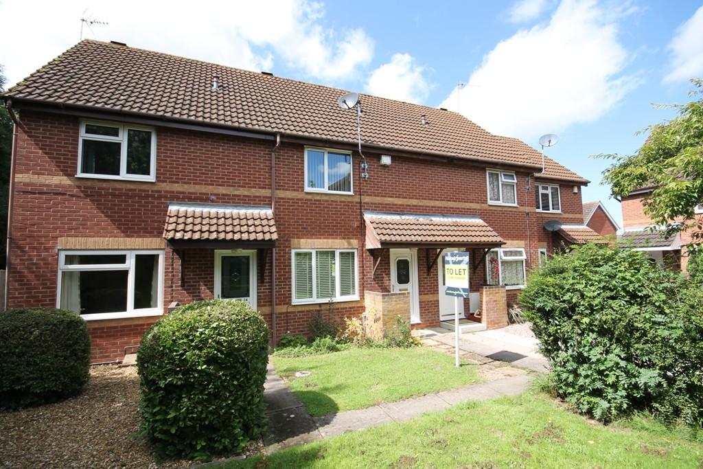
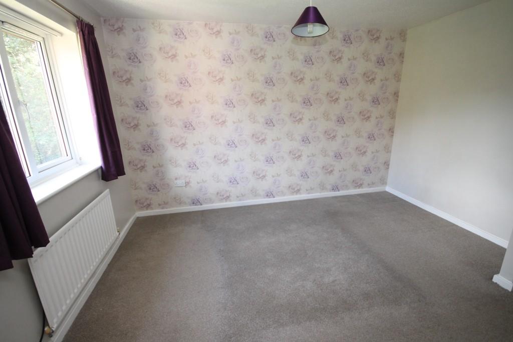
- Lovely Condition Throughout
- Quiet Location
- Re-Fitted Gas Boiler
- Quality Carpets
- Upvc D.G
- Good Motorway Access
- Open Until 8pm For Viewings Weekdays
- Available 20th August 2018
Additional details
- Parking
- Yes
- Garden
- Yes
Description
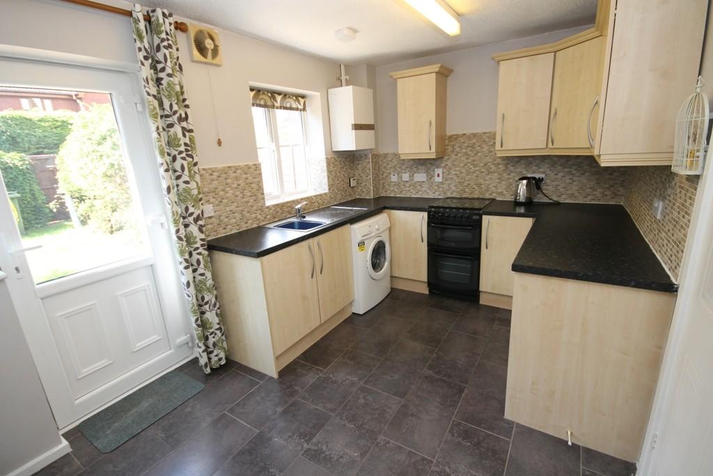
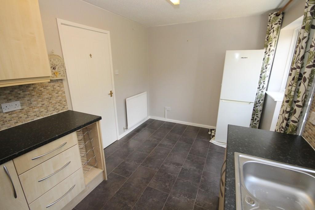
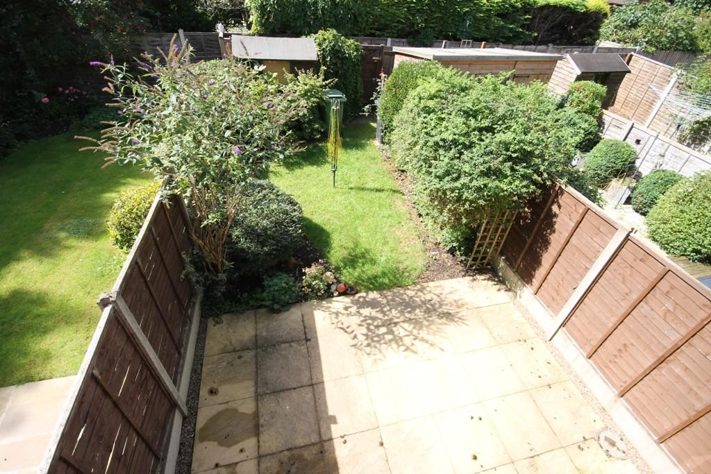
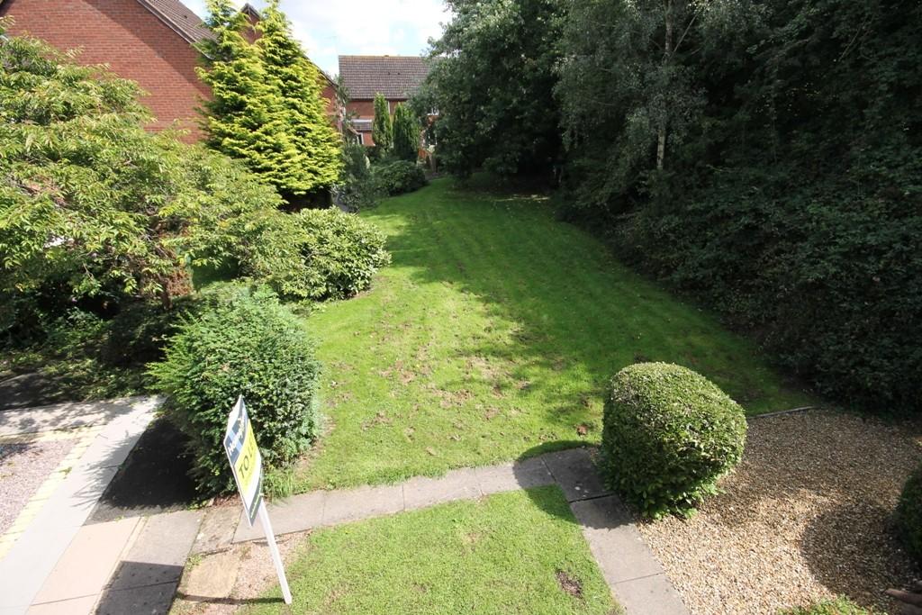
The property also benefits from Upvc double glazing and re-fitted gas central heating boiler. There is a good size rear garden and parking space.
A MUST SEE..
HomeXperts are open until 8pm weekdays & 5pm at weekends. Call 07710 525392 to book your viewing.
Register at: Worcester@hxea.co.uk
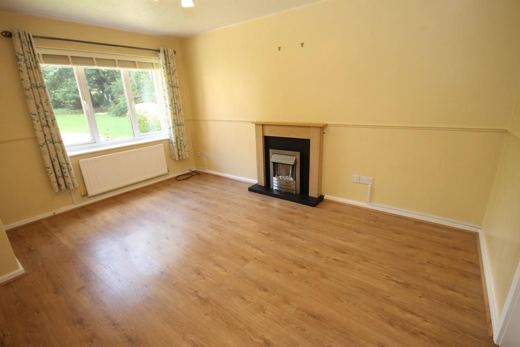
Lounge 4.27m (14'0) x 3.07m (10'1)
Kitchen 2.57m (8'5) x 4.11m (13'6)
Bedroom 1 3.84m (12'7) x 3.1m (10'2)
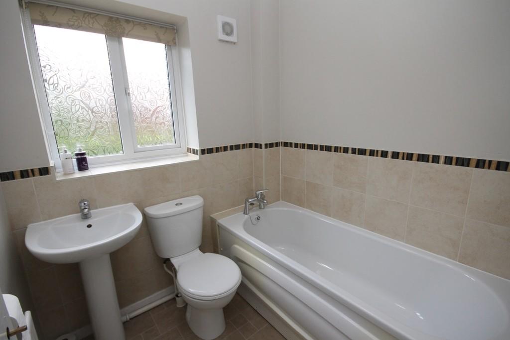
Shower Room
Bedroom 2 3.15m (10'4) x 2.18m (7'2)
Bathroom 1.75m (5'9) x 1.88m (6'2)
Parking
Central Heating
Double Glazing
Owner's opinions...
CHARGES
Tenant Application Fee for 1-2 people: £390 inc vat
Guarantor application: £48 inc vat
NO PETS ALLOWED
Transport links
Worcester Shrub Hill (1.7 mi)
Worcester Foregate Street (2.2 mi)
Droitwich Spa (4.3 mi)
Owners Opinion
Listed by
Your Local Property Xpert
HomeXperts
Reference: 51229785
EPC Rating & Upgrade Cost
Fetching EPC data… Refresh this page in a moment.
Flood risk
Zone: 1
Risk: Low
Job (default Low)
EPC Graphs

EPC

EPC Graph
Rental Range
Estimated market rent for Worcester. Low = conservative, Realistic = average, Optimistic = best case.
Based on Local Authority from postcode lookup → Worcester.
LHA (30th percentile) floor for Worcester South: £698/mo (Apr 2025 – Mar 2026)
Location
Address
2 Beeston Gardens
Nearby
Nearest stations, universities and amenities (distance from property).
| Type | Name | Distance |
|---|---|---|
| Bus stop | Saltwood Avenue | 0.1 miles |
| Bus stop | Tamworth Avenue | 0.1 miles |
| Shop | Avant Garde | 0.4 miles |
| Shop | Drinks | 0.4 miles |
| Hospital | Worcestershire Royal Hospital | 1.1 miles |
| Train station | Worcester Shrub Hill | 1.7 miles |
| Train station | Worcester Foregate Street | 2.1 miles |
| Hospital | Spire Southbank Hospital | 2.5 miles |
| University | University of Worcester Lakeside Campus | 4.6 miles |
Street-level crime
| Category | Count |
|---|---|
| Violence and sexual offences | 63 |
| Criminal damage and arson | 24 |
| Shoplifting | 20 |
| Public order | 12 |
| Other theft | 10 |
| Burglary | 7 |
| Other crime | 4 |
| Bicycle theft | 3 |
| Drugs | 3 |
| Robbery | 3 |
| Possession of weapons | 2 |
| Vehicle crime | 2 |
| Theft from the person | 1 |
| Total incidents | 154 |
Within 1 mile during Apr 2026. Source: data.police.uk (England & Wales).
Schools nearby
Nearest open schools with Ofsted ratings (England). Closed schools are not shown. Data from Get Information about Schools and Ofsted.
| Name | Type | Distance | Ofsted |
|---|---|---|---|
| St Joseph's Catholic Primary School | Primary | 0.4 miles | Good — 6 Feb 2013 |
| Oasis Academy Warndon | Primary | 0.5 miles | Outstanding — 23 Jan 2023 |
| The Lyppard Grange Primary School | Primary | 0.5 miles | Good — 30 Apr 2014 |
| The Aspire Academy | Other | 0.7 miles | Good — 6 Jun 2017 |
| Carnforth School | Primary | 0.7 miles | Good — 10 Feb 2022 |
Rental Comparables
Rental listings exist nearby, but none matched the 2-bedroom count for this property.