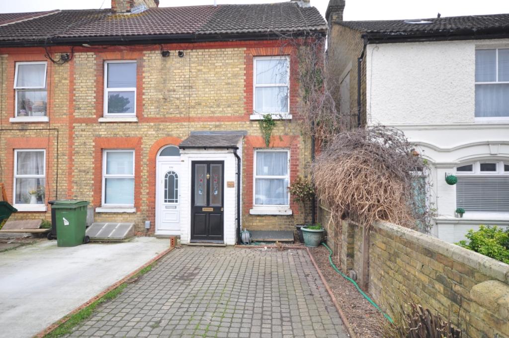
220 UPPER FANT ROAD
MAIDSTONE, KENT ME16 8DH
£1,000 pcm
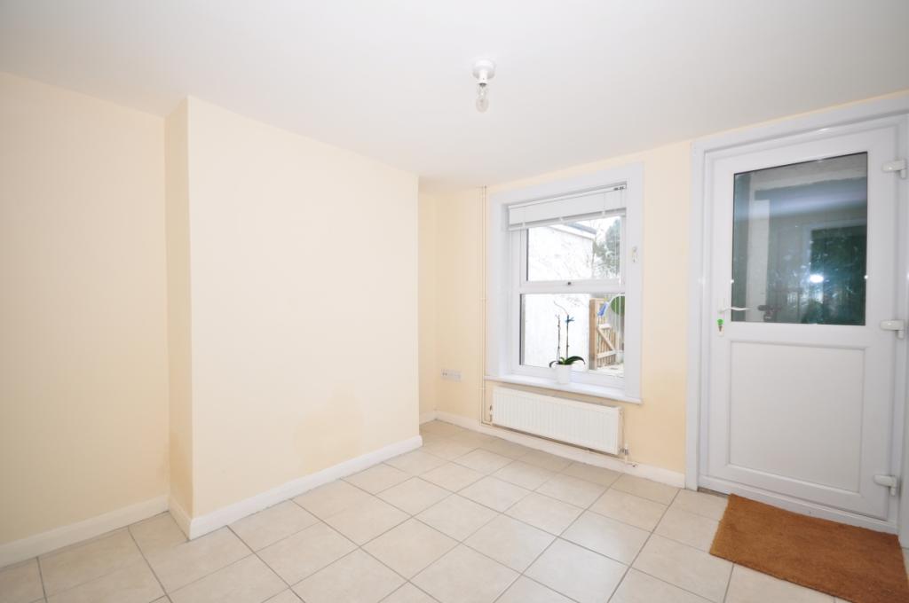
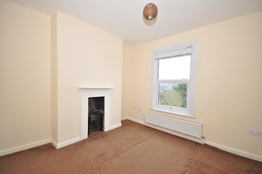
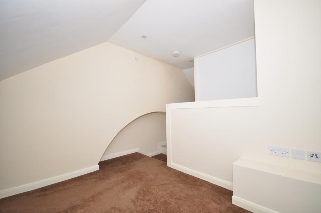
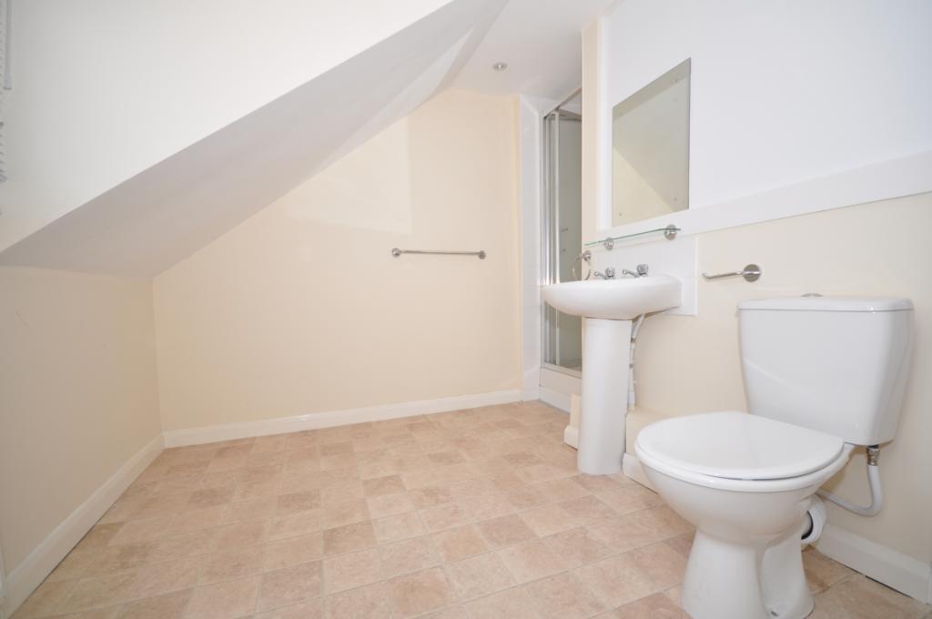
Property details
Floor area
92 m²
EPC rating
D
Deprivation
Decile 6 (18,072 of 33,755)
Street crime
340 incidents within 1 mile (Apr 2026)
Key features
- Spread Over Four Floors
- Well Presented
- Close To Town Centre
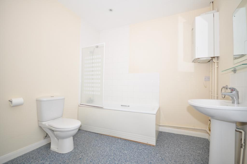
- Cloakroom And Shower Room
- Garden
- Driveway
Additional details
- Parking
- Communal
- Garden
- Private garden
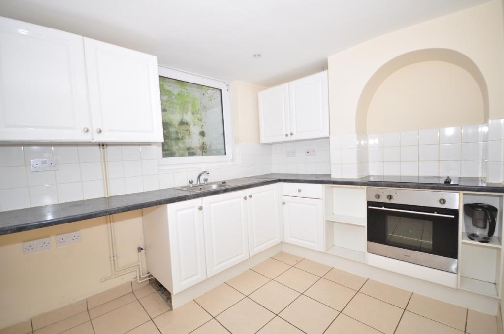
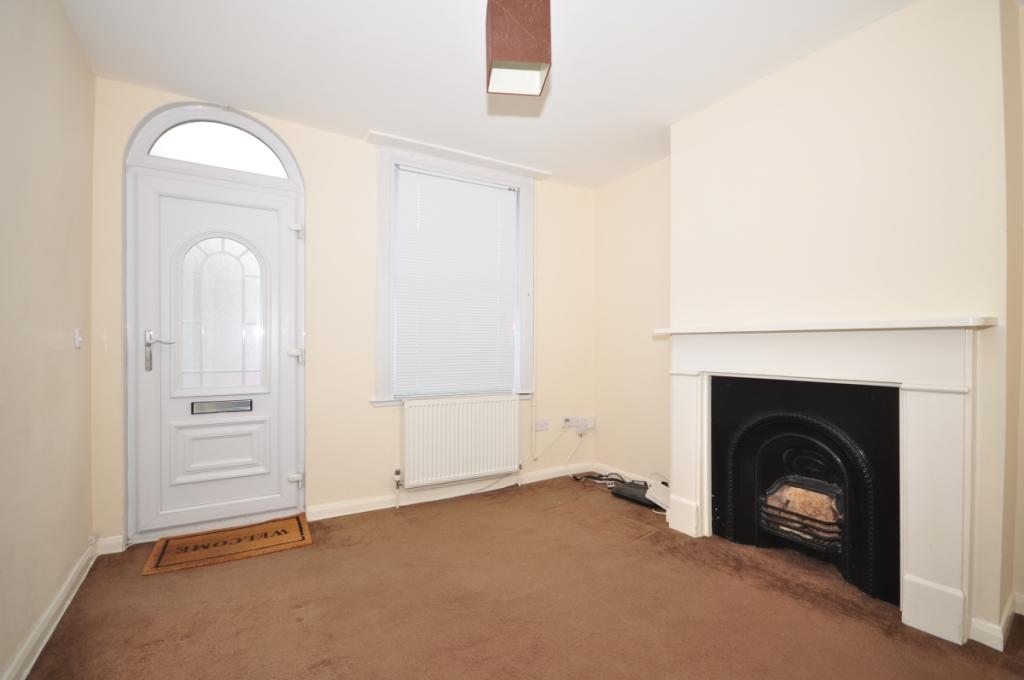
Description
Listed by
Maidstone
Arun Estates
Reference: 85041854
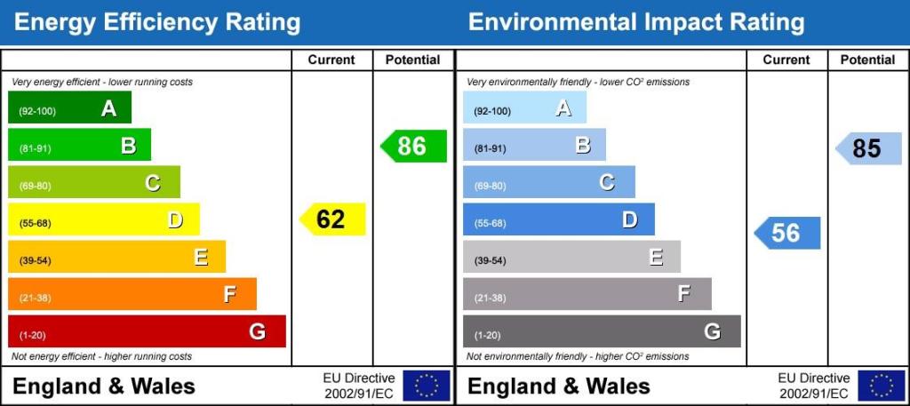
EPC Rating & Upgrade Cost
Current rating: D
Potential rating: B
Inspection date: 23/03/2016
Expiry date: 22/03/2026 (expired)
Current heating cost: £757/year
Potential heating cost: £433/year
Est. upgrade cost to C: £22,640
Recommendations
- Room-in-roof insulation (£1,500 - £2,700)
- 50 mm internal or external wall insulation (£4,000 - £14,000)
- Low energy lighting for all fixed outlets (£40)
- Solar water heating (£4,000 - £6,000)
- Solar photovoltaic panels, 2.5 kWp (£5,000 - £8,000)
Flood risk
Zone: 1
Risk: Low
Job (default Low)
Floorplans
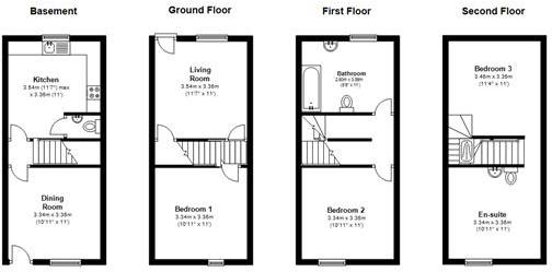
Floor Plan
EPC Graphs
Energy Performanc...
FENSA Certificates
This property has 1 FENSA certificate(s) on record, indicating window/door installations by FENSA-approved installers.
FENSA Certificate #6130796
Property Details
Street: 220 Upper Fant Road
Town: MAIDSTONE
Postcode: ME16 8DH
Installation Details
Items: 8 windows and 2 doors
Certificate Issued: 17/11/2008
Work Completed: 20/10/2008
This certificate data was retrieved from FENSA's database
What is FENSA? FENSA (Fenestration Self-Assessment Scheme) is a government-authorised scheme that monitors building regulation compliance for replacement windows and doors. Certificates indicate that work was completed by FENSA-approved installers.
Rental Range
Estimated market rent for Maidstone. Low = conservative, Realistic = average, Optimistic = best case.
Based on Local Authority from postcode lookup → Maidstone.
LHA (30th percentile) floor for Maidstone: £1,197/mo (Apr 2025 – Mar 2026)
Location
Nearby
Nearest stations, universities and amenities (distance from property).
| Type | Name | Distance |
|---|---|---|
| Bus stop | Whitmore Street | 0.1 miles |
| Bus stop | Upper Fant Road | 0.1 miles |
| Shop | Londis | 0.1 miles |
| Shop | Spar | 0.3 miles |
| University | University for the Creative Arts, Maidstone TV Studios | 0.4 miles |
| Train station | Maidstone West | 0.7 miles |
| Hospital | The Somerfield Hospital | 0.8 miles |
| Train station | Maidstone Barracks | 0.9 miles |
| University | UCA Maidstone Studios | 2.2 miles |
Street-level crime
| Category | Count |
|---|---|
| Violence and sexual offences | 109 |
| Anti-social behaviour | 93 |
| Criminal damage and arson | 30 |
| Shoplifting | 25 |
| Other theft | 24 |
| Public order | 19 |
| Drugs | 13 |
| Vehicle crime | 8 |
| Robbery | 5 |
| Bicycle theft | 4 |
| Other crime | 3 |
| Possession of weapons | 3 |
| Burglary | 2 |
| Theft from the person | 2 |
| Total incidents | 340 |
Within 1 mile during Apr 2026. Source: data.police.uk (England & Wales).
Schools nearby
Nearest open schools with Ofsted ratings (England). Closed schools are not shown. Data from Get Information about Schools and Ofsted.
| Name | Type | Distance | Ofsted |
|---|---|---|---|
| Oakwood Park Grammar School | Secondary | 0.3 miles | Good — 10 Mar 2019 |
| St Augustine Academy | Secondary | 0.3 miles | Requires improvement — 25 Sep 2023 |
| Maidstone, St Michael's Church of England Junior School | Primary | 0.4 miles | Good — 2 May 2018 |
| St Michael's Church of England Infant School Maidstone | Primary | 0.4 miles | Outstanding — 25 Feb 2014 |
| West Borough Primary School | Primary | 0.5 miles | Good — 20 Jul 2017 |
Rental Comparables
Rental listings exist nearby, but none matched the 3-bedroom count for this property.