70 PALM ROAD
SOUTHAMPTON, SOUTHAMPTON SO16 5HF
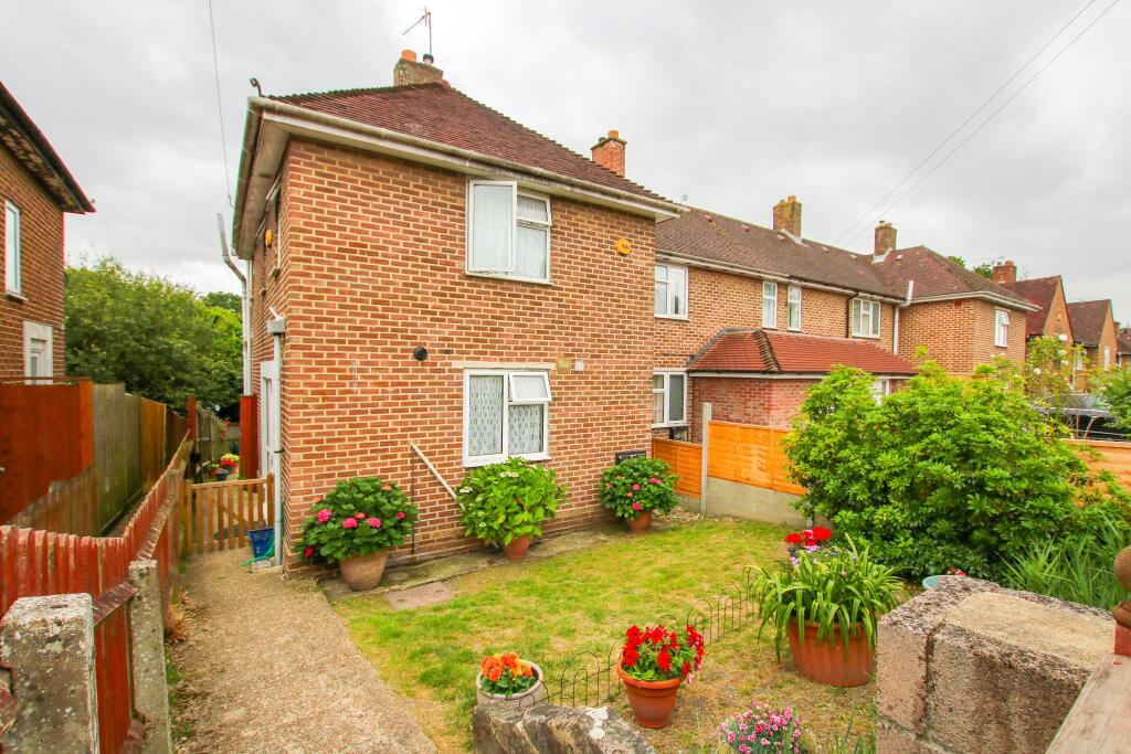
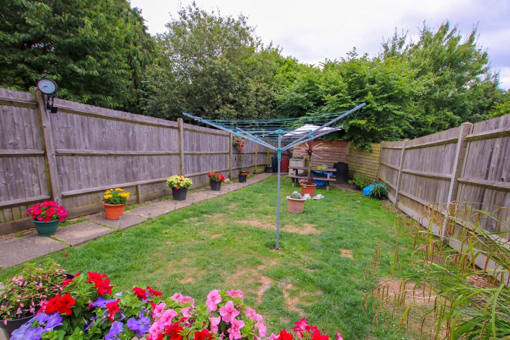
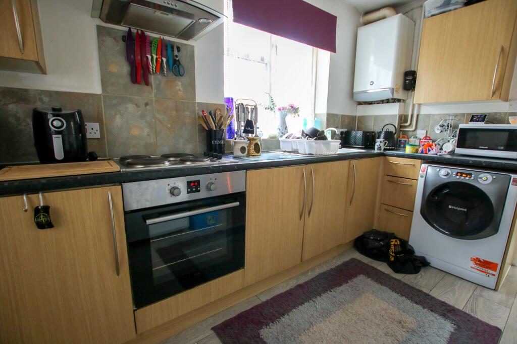
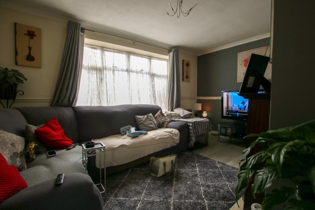
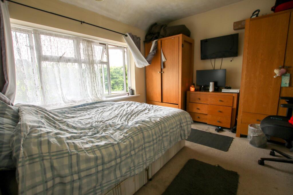
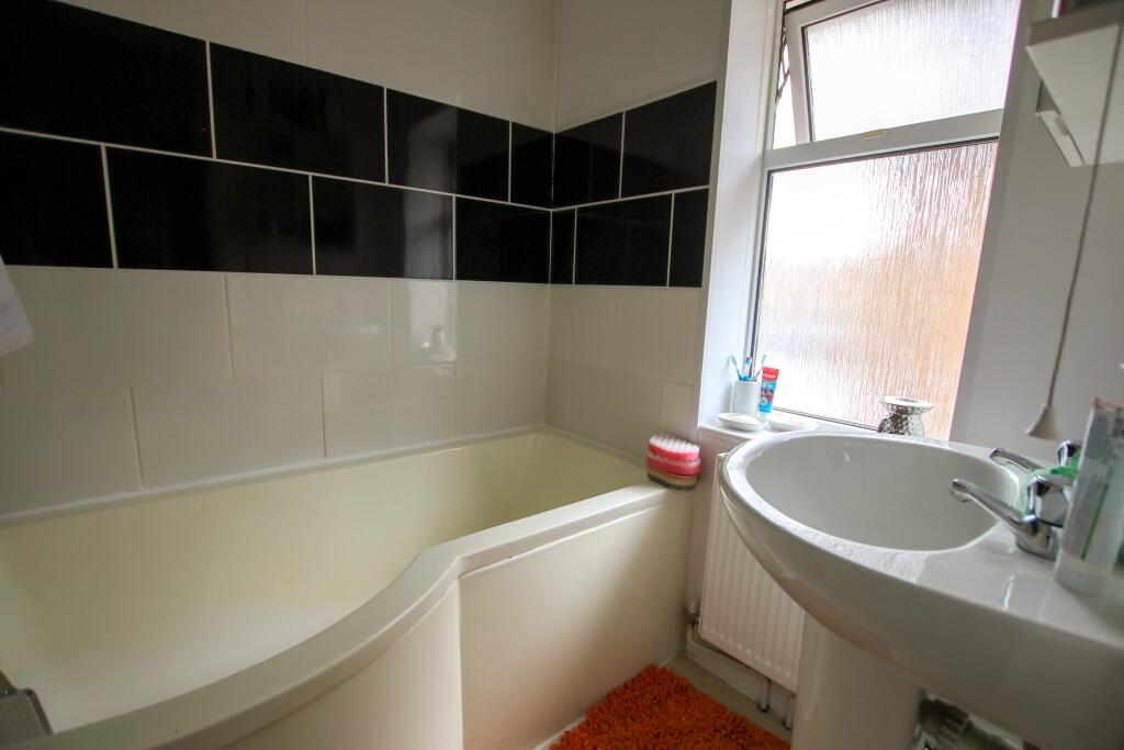
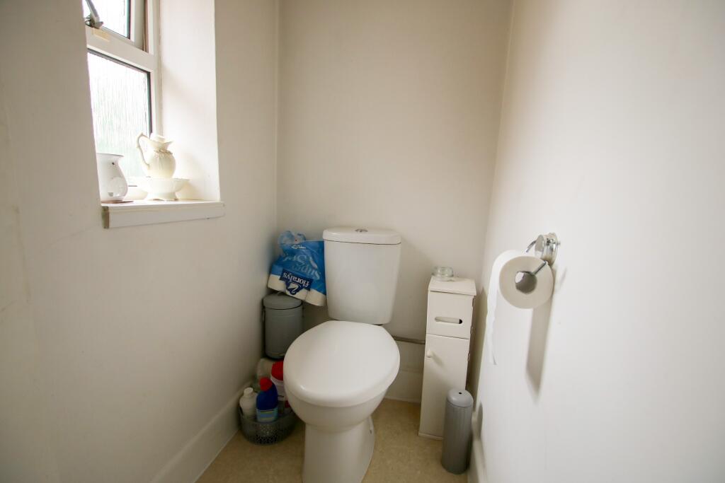
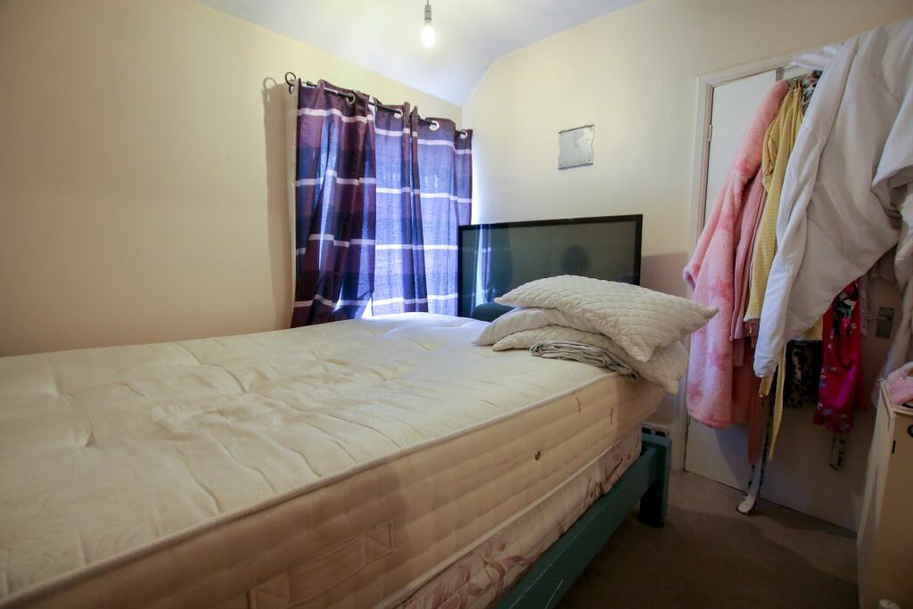
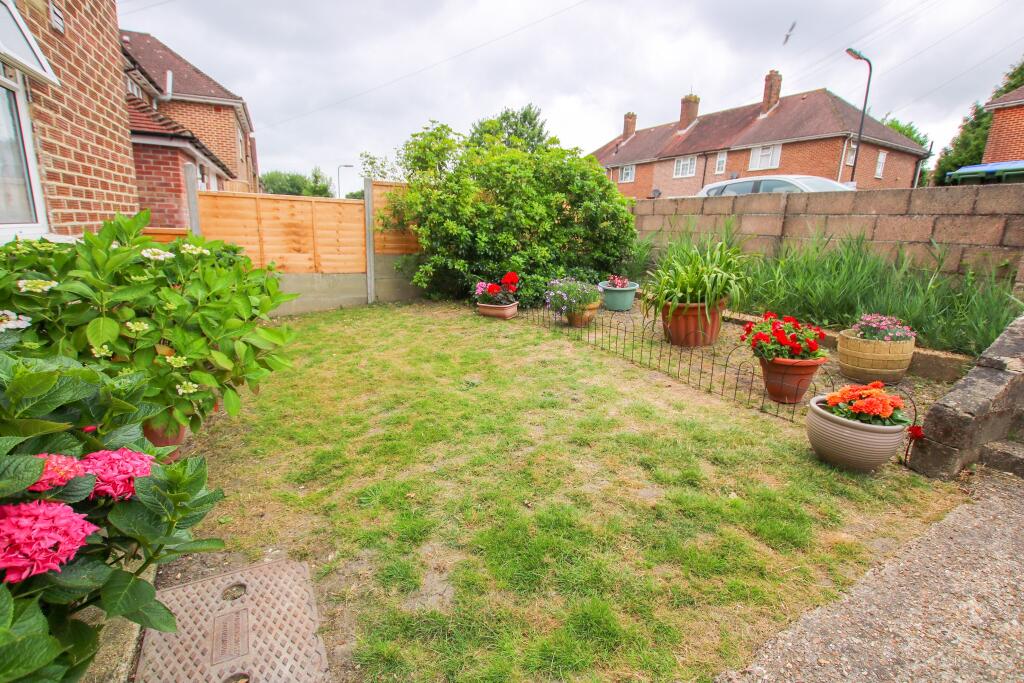
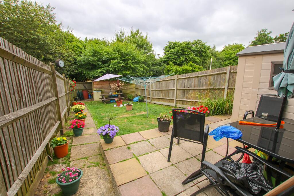
Photo 1 Photo 2 Photo 3 Photo 4 Photo 5 Photo 6 Photo 7 Photo 8 Photo 9 Photo 10
/ 10
Property details
Tenure
FREEHOLD
Floor area
61 m²
Council tax band
B
EPC rating
C
Year built
England and Wales: 1950-1966
Last sold
£215,000 Jan 2025
Price per m²
£3,607/m²
Local average
£259,740 (-15.3%)
Deprivation
Decile 2 (5,106 of 33,755)
Street crime
424 incidents within 1 mile (Apr 2026)
Key features
- TWO BEDROOMS
- END OF TERRACE HOUSE
- CLOSE TO GENERAL HOSPITAL
- NO FORWARD CHAIN
- GAS CENTRAL HEATING
- DOUBLE GLAZING
- GREAT INVESTMENT OR FTB
Additional details
- Electricity
- Mains supply
- Water
- Mains supply
- Sewerage
- Mains supply
- Heating
- Gas central
- Parking
- On street
- Garden
- Yes
- Listed property
- No
Description
The property accommodates a spacious living room with potential to extend further subject to planning permission. The property also benefits from gas central heating, double glazing throughout, kitchen, bathroom with separate WC, on-street parking but potential to convert into a drive and is being offered with no forward chain.
A viewing is highly recommended to appreciate what this property has to offer. Please call to arrange a viewing.
Entrance Hall:
Two storage cupboards, double glazed window to side elevation, smooth finish to ceiling, doors to kitchen and lounge.
Living Room
14' (4.27m) x 10' (3.05m):
Double glazed window to rear elevation, feature fireplace, radiator, dado rail, coving and textured finish to ceiling and door.
Kitchen
11' 6" (3.51m) x 7' 9" (2.36m):
Two double glazed windows, one to side elevation and one to rear elevation, base and eye level units, insert sink to counter top, tiled splashback, fitted cooker, electric hob, over hood extractor fan, wall mounted boiler, space for washing machine and fridge/freezer, smooth finish to ceiling, door to hall.
Hall:
Radiator, stairs to landing, textured ceiling with smoke alarm.
Landing:
Double glazed window to side elevation, doors to bedroom one, bedroom two, bathroom and WC, textured finish to ceiling.
Bathroom
5' 1" (1.55m) x 5' (1.52m):
Double glazed window to side elevation, radiator, bath suite with overhead shower attachment, hand wash basin, tiling to principal areas, smooth finish to ceiling with insert extractor fan.
Bedroom one
11' 4" (3.45m) x 10' 5" (3.17m):
Double glazed window to rear elevation, radiator, textured finish to ceiling.
Bedroom two
9' 4" (2.84m) x 8' 9" (2.67m):
Double glazed window to front elevation, radiator, built in wardrobe, smooth finish to ceiling with loft roof access.
W.C
6' 1" (1.85m) x 3' 1" (0.94m):
Double glazed window to side elevation, low level toilet, smooth finish to ceiling.
Front Garden:
Block wall and gate to frontage, paved steps and path leading to front door and gate for side access, laid to lawn, flower beds with shrubbery.
Rear Garden:
Block paved patio with path leading to rear, laid to lawn, shed at the rear garden.
Listed by
Shirley
Pearsons
Reference: 149939789
EPC Rating & Upgrade Cost
Current rating: C
Potential rating: B
Inspection date: 11/09/2024
Expiry date: 10/09/2034
Current heating cost: £655/year
Potential heating cost: £601/year
Est. upgrade cost to C: £14,500
Recommendations
- Floor insulation (solid floor) (£4,000 - £6,000)
- Solar water heating (£4,000 - £6,000)
- Solar photovoltaic panels, 2.5 kWp (£3,500 - £5,500)
Flood risk
Zone: 1
Risk: Low
Job (default Low)
Floorplans
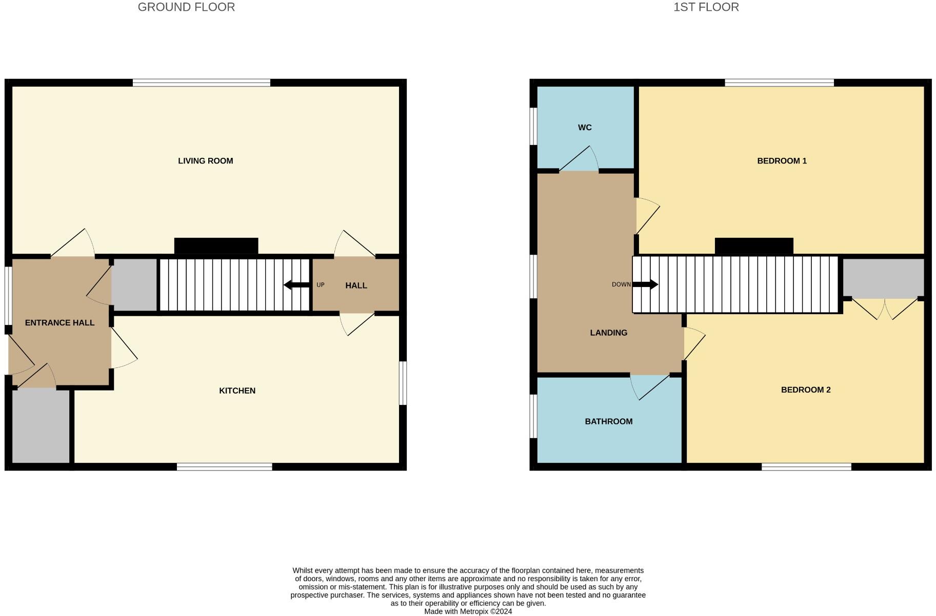
Floorplan 1
EPC Graphs
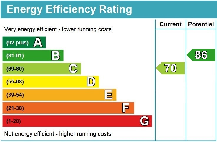
EPC
Price history
252% since 2000
| Event | Date | Price | % change |
|---|---|---|---|
| Sold | 24/01/2025 (1 year ago) | £215,000 | +252.5% |
| Sold | 29/09/2000 (25 years ago) | £61,000 | — |
Source: HM Land Registry Price Paid Data. Crown copyright.
Sold Comparables
Same street and nearby sales within 0.25 miles (last 5 years). Data from Land Registry Price Paid.
| Address | Price | Date | Type |
|---|---|---|---|
| 40 HOLLYOAK ROAD, SOUTHAMPTON, SO16 5GW | £240,000 | 27/11/2025 | Terraced |
| 75 VINE ROAD, SOUTHAMPTON, SO16 5TD | £240,000 | 31/10/2025 | Terraced |
| Same street 66 PALM ROAD, SOUTHAMPTON, SO16 5HF | £247,500 | 02/05/2023 | Terraced |
| 93 OUTER CIRCLE, SOUTHAMPTON, SO16 5GX | £238,000 | 07/10/2022 | Terraced |
| Same street 58 PALM ROAD, SOUTHAMPTON, SO16 5HF | £180,000 | 25/02/2022 | Terraced |
| Same street 124 PALM ROAD, SOUTHAMPTON, SO16 5HF | £255,000 | 25/02/2022 | Terraced |
| 113 COXFORD ROAD, SOUTHAMPTON, SO16 5JX | £228,000 | 28/01/2022 | Terraced |
| 85 PALM ROAD, SOUTHAMPTON, SO16 5HE | £212,000 | 03/11/2021 | Terraced |
| Same street 102 PALM ROAD, SOUTHAMPTON, SO16 5HF | £240,000 | 27/08/2021 | Terraced |
| Same street 82 PALM ROAD, SOUTHAMPTON, SO16 5HF | £165,800 | 15/07/2021 | Terraced |
Street average: £217,660 (5 sales)
Area average: £231,600 (5 sales)
Capital growth trend
Land Registry outcode average: last 12 months vs 5y and 10y ago (from sold prices).
House Price Index (HM Land Registry — official index, not sold-price averages): Southampton. Series: Terraced. As of March 2026.
Rental Range
Estimated market rent for Southampton. Low = conservative, Realistic = average, Optimistic = best case.
Based on Local Authority from postcode lookup → Southampton.
LHA (30th percentile) floor for Southampton: £873/mo (Apr 2025 – Mar 2026)
Location
Nearby
Nearest stations, universities and amenities (distance from property).
| Type | Name | Distance |
|---|---|---|
| Bus stop | Outer Circle | 0.0 miles |
| Shop | Rogues Barber Shop | 0.1 miles |
| Shop | Hollyoak Stores | 0.1 miles |
| Hospital | Princess Anne Hospital | 0.2 miles |
| University | South Academic Block | 0.3 miles |
| Hospital | Southampton General Hospital | 0.3 miles |
| University | Boldrewood Innovation Campus | 1.5 miles |
| Train station | Millbrook | 1.7 miles |
| Train station | Redbridge | 1.8 miles |
Street-level crime
| Category | Count |
|---|---|
| Violence and sexual offences | 146 |
| Anti-social behaviour | 66 |
| Criminal damage and arson | 40 |
| Shoplifting | 36 |
| Public order | 31 |
| Other theft | 25 |
| Vehicle crime | 22 |
| Burglary | 17 |
| Drugs | 12 |
| Other crime | 9 |
| Robbery | 8 |
| Possession of weapons | 6 |
| Theft from the person | 5 |
| Bicycle theft | 1 |
| Total incidents | 424 |
Within 1 mile during Apr 2026. Source: data.police.uk (England & Wales).
Schools nearby
Nearest open schools with Ofsted ratings (England). Closed schools are not shown. Data from Get Information about Schools and Ofsted.
| Name | Type | Distance | Ofsted |
|---|---|---|---|
| Southampton Hospital School | Other | 0.4 miles | Good — 4 Jan 2012 |
| Shirley Warren Primary & Nursery School | Primary | 0.5 miles | Requires improvement — 12 Jan 2023 |
| Rosewood Free School | Other | 0.5 miles | Outstanding — 12 Sep 2014 |
| Oasis Academy Lord's Hill | Secondary | 0.6 miles | Inadequate — 8 Jul 2024 |
| Oakwood Primary School | Primary | 0.7 miles | Good — 2 Dec 2016 |
Rental Comparables
Rental listings exist nearby, but none matched the 2-bedroom count for this property.
Rent-driven metrics
Based on Area rent estimate.
- Rent ratio — Monthly rent ÷ purchase price (1% rule). 1%+ = strong, 0.8–1% = okay, <0.8% = weak for cashflow.
- Max investor price — Rent ÷ 0.8%; the price at which rent would be 0.8% of price (Stoke-style target).
- Target investor price — Rent ÷ 1%; the price at which rent would be 1% of price (strong cashflow band).
- Gross yield — Annual rent as % of purchase price (no costs).