Wellswood
CHASE LANE, STOKE-ON-TRENT, TITTENSOR, STAFFORDSHIRE ST12 9HH
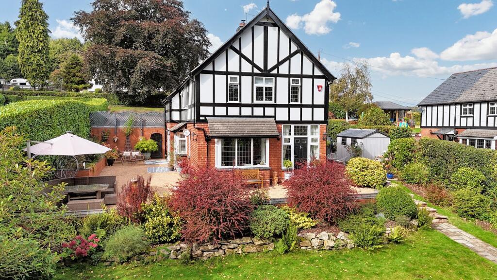
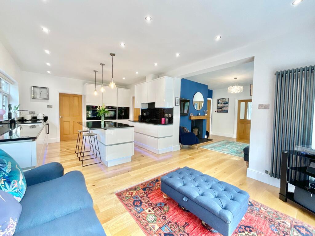
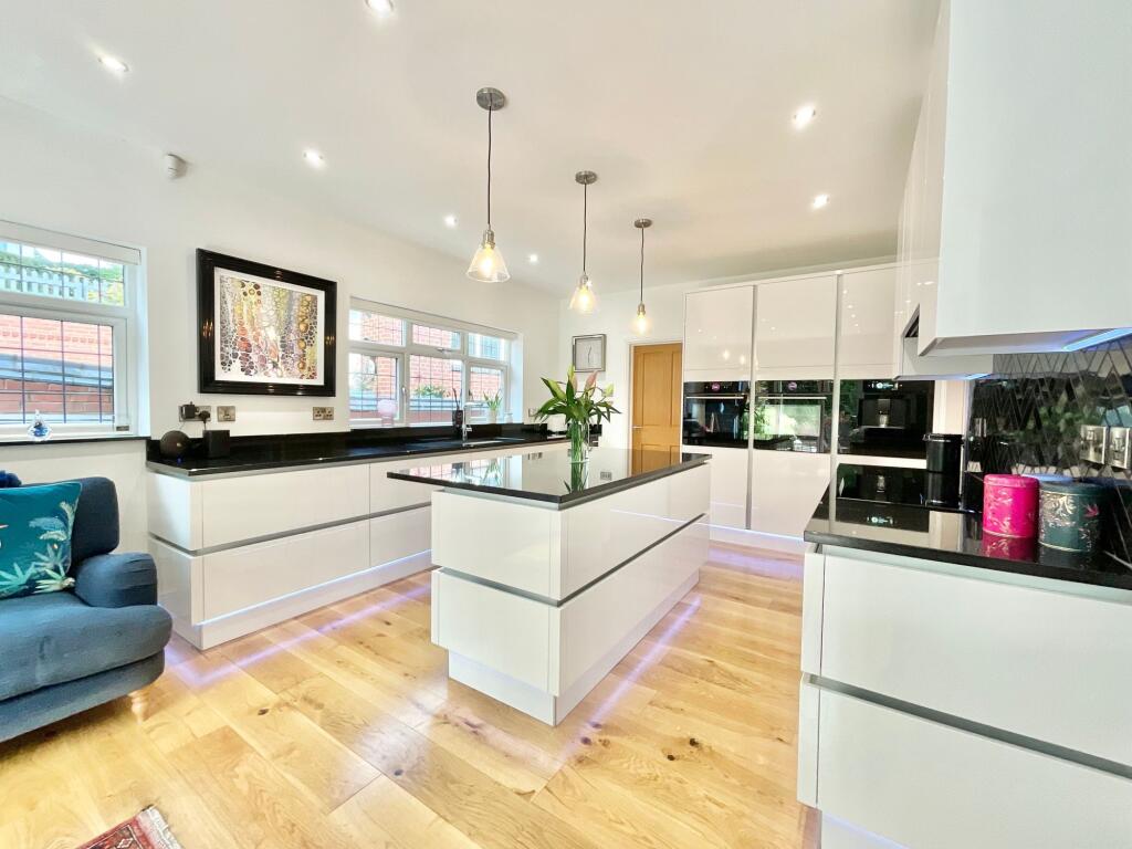
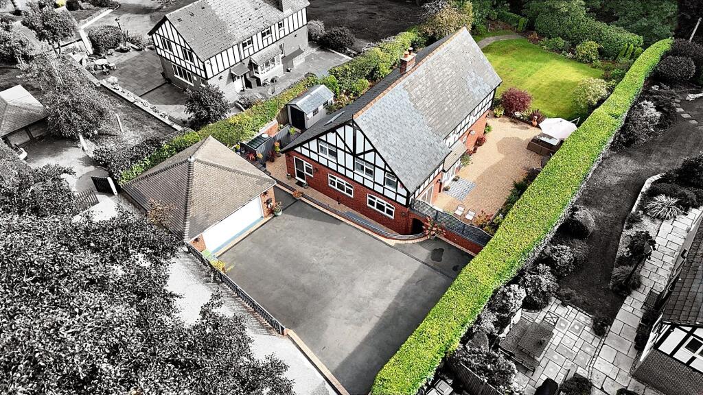
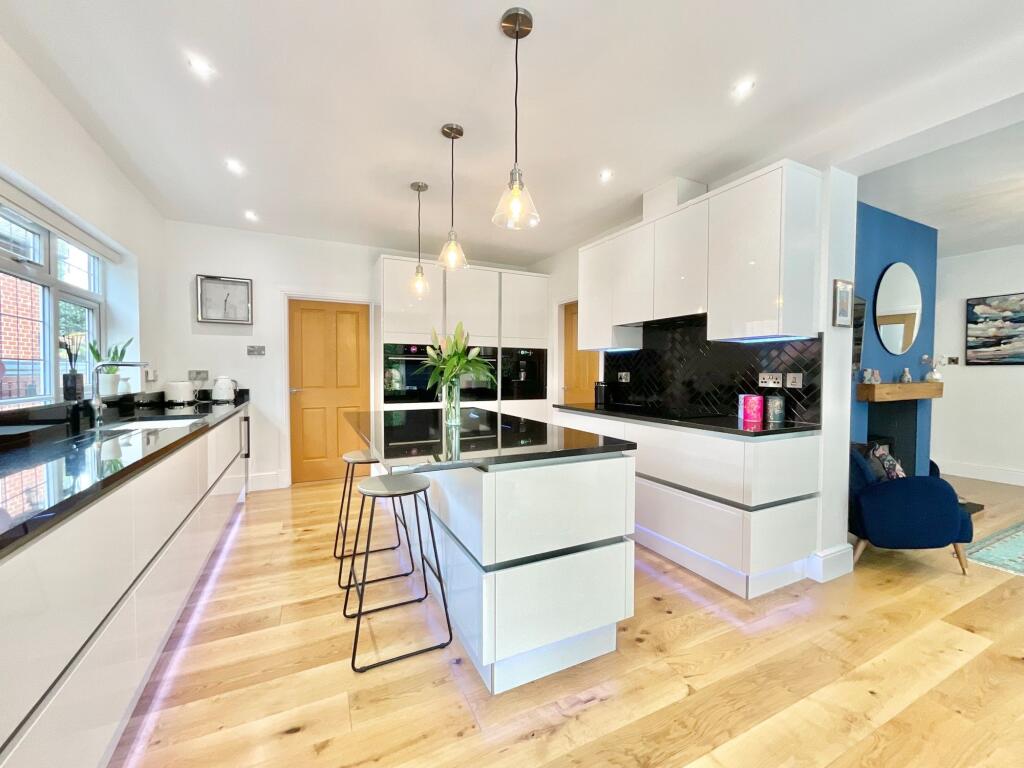
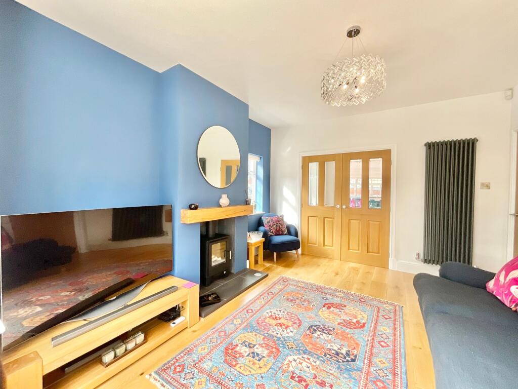
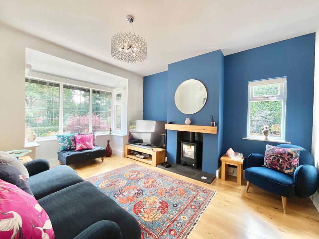
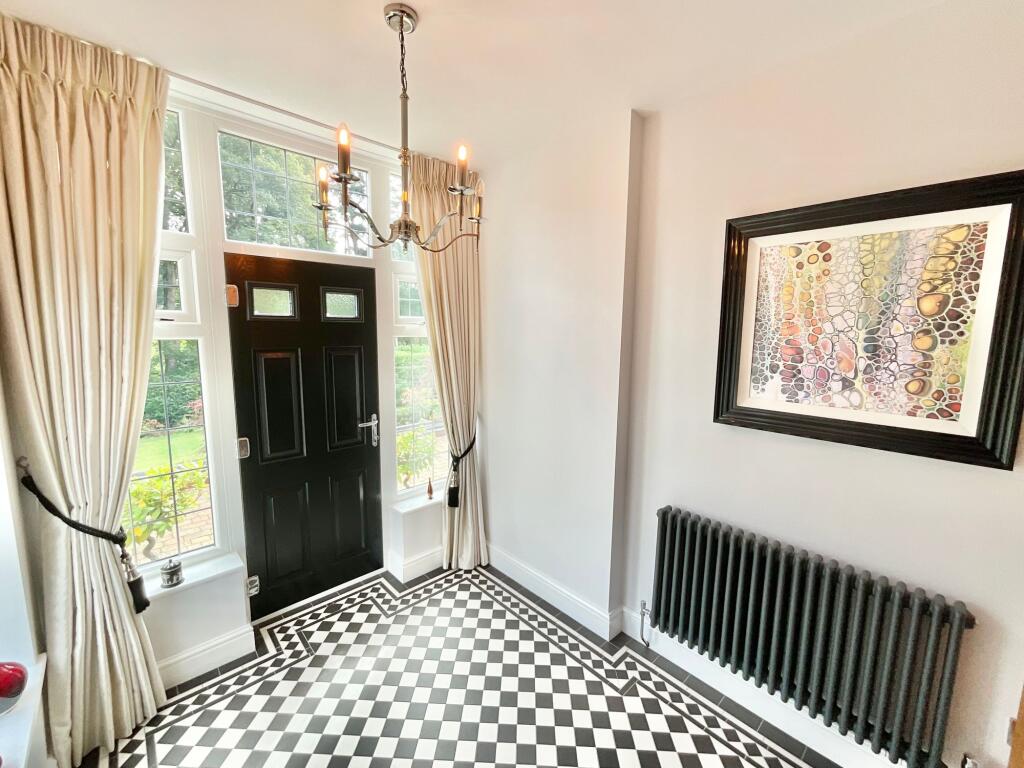


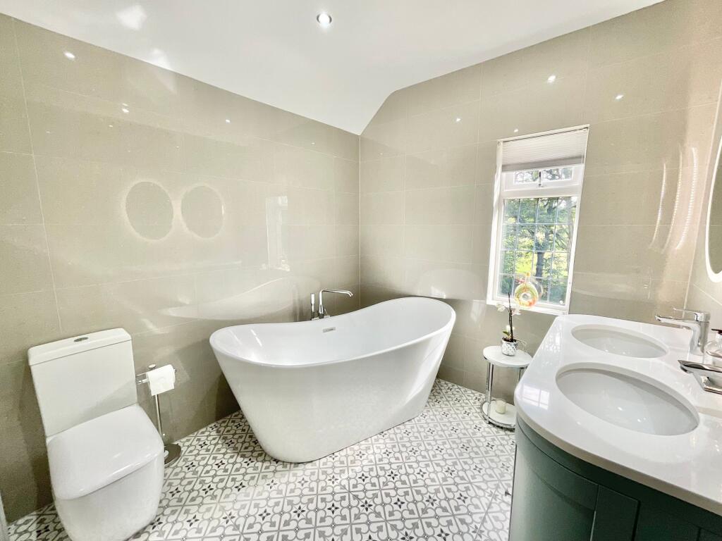


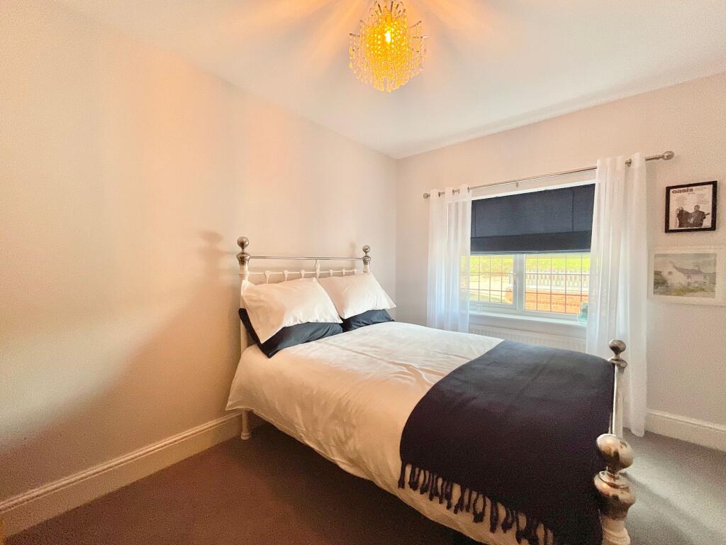

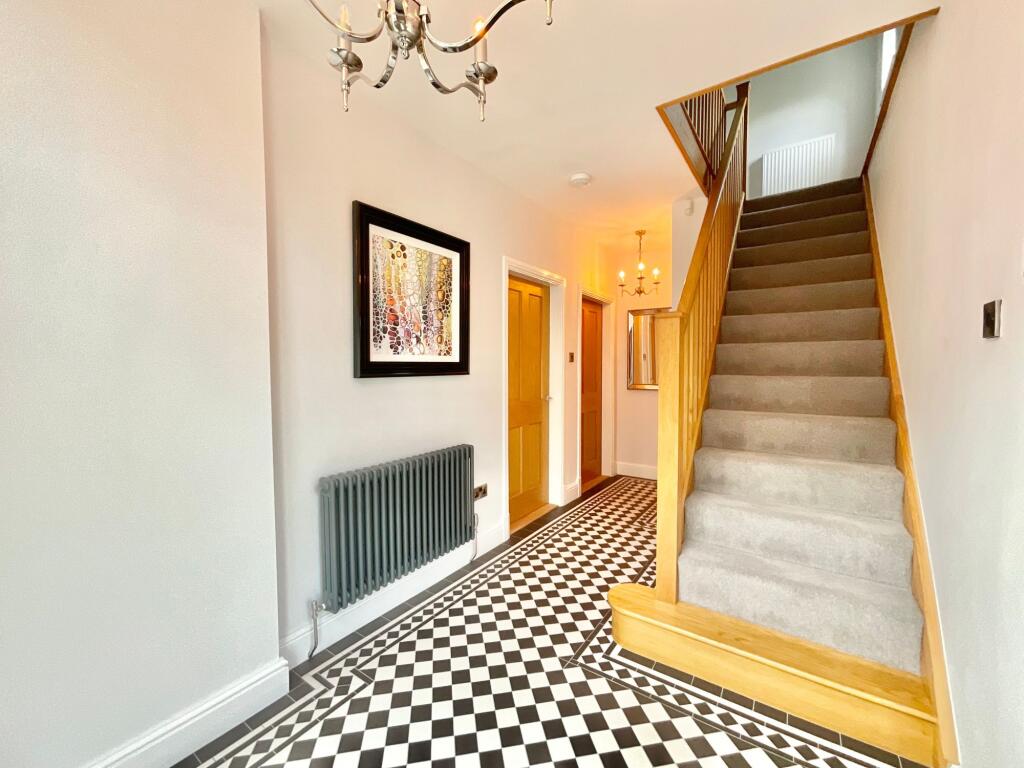
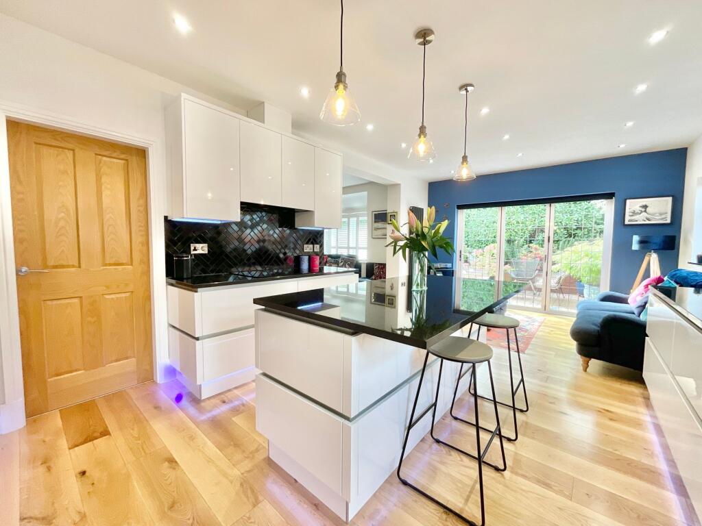
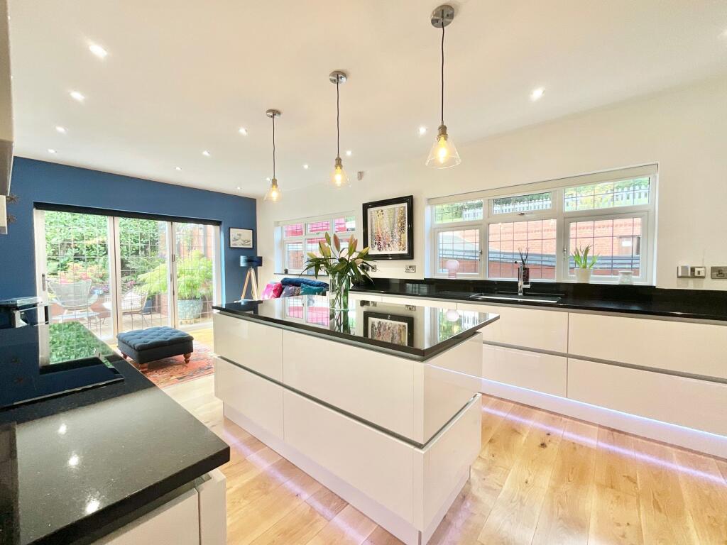
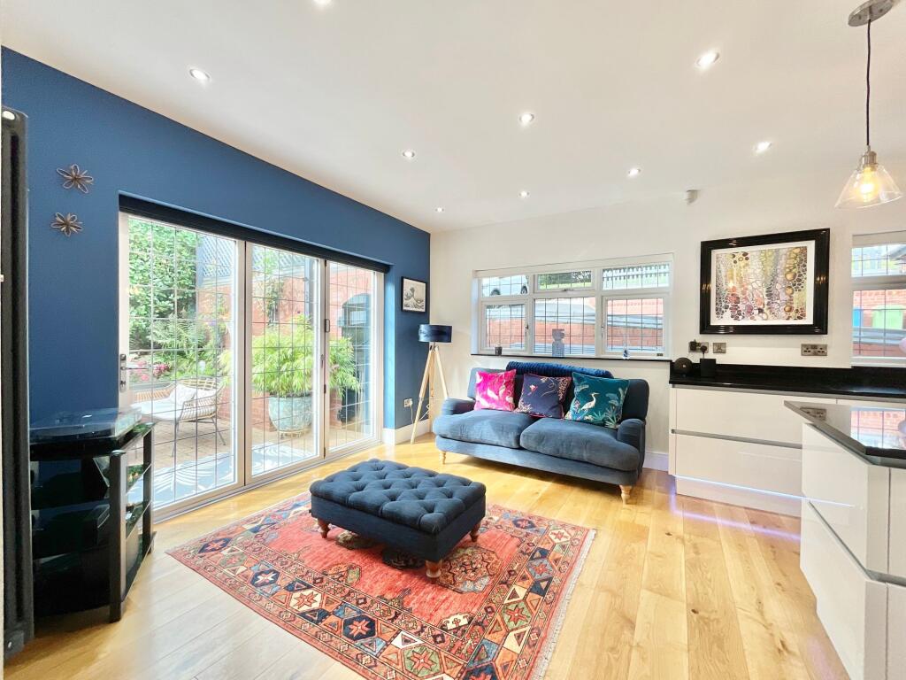

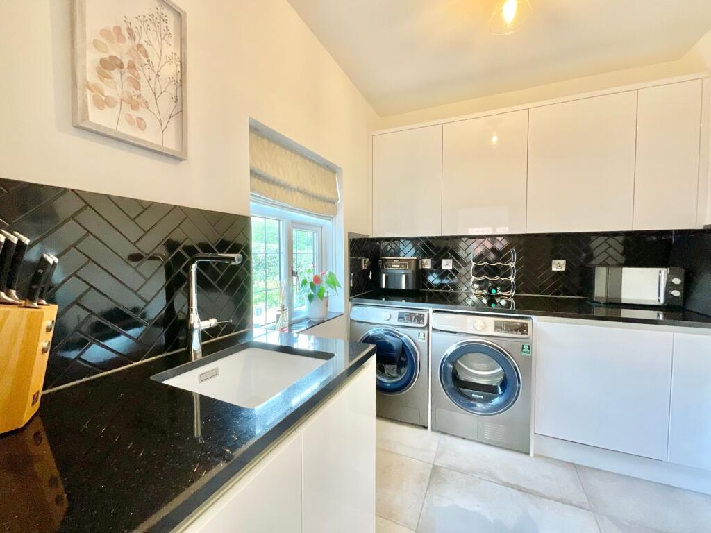
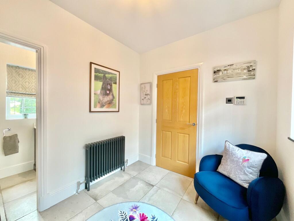
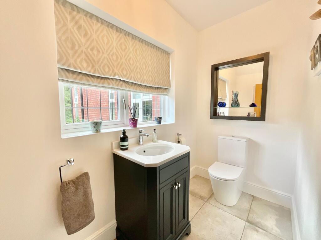
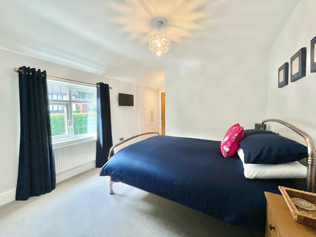
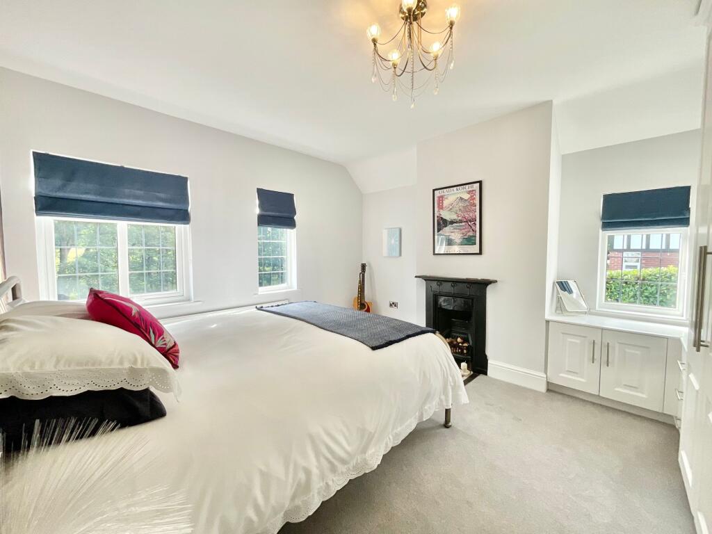
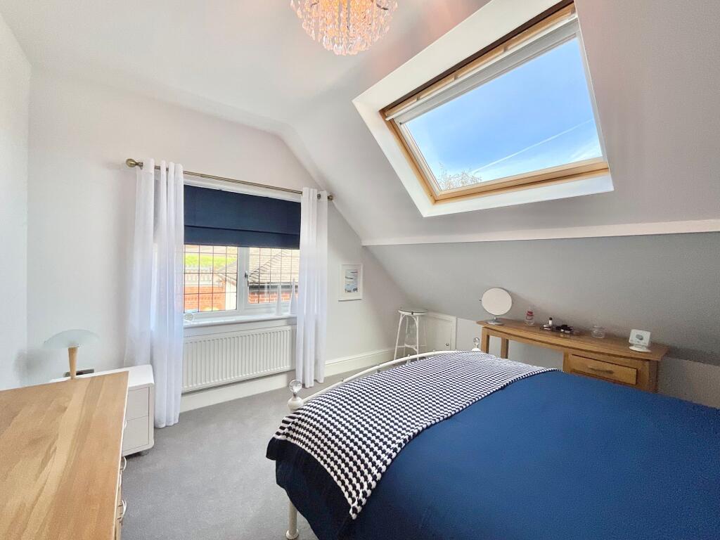
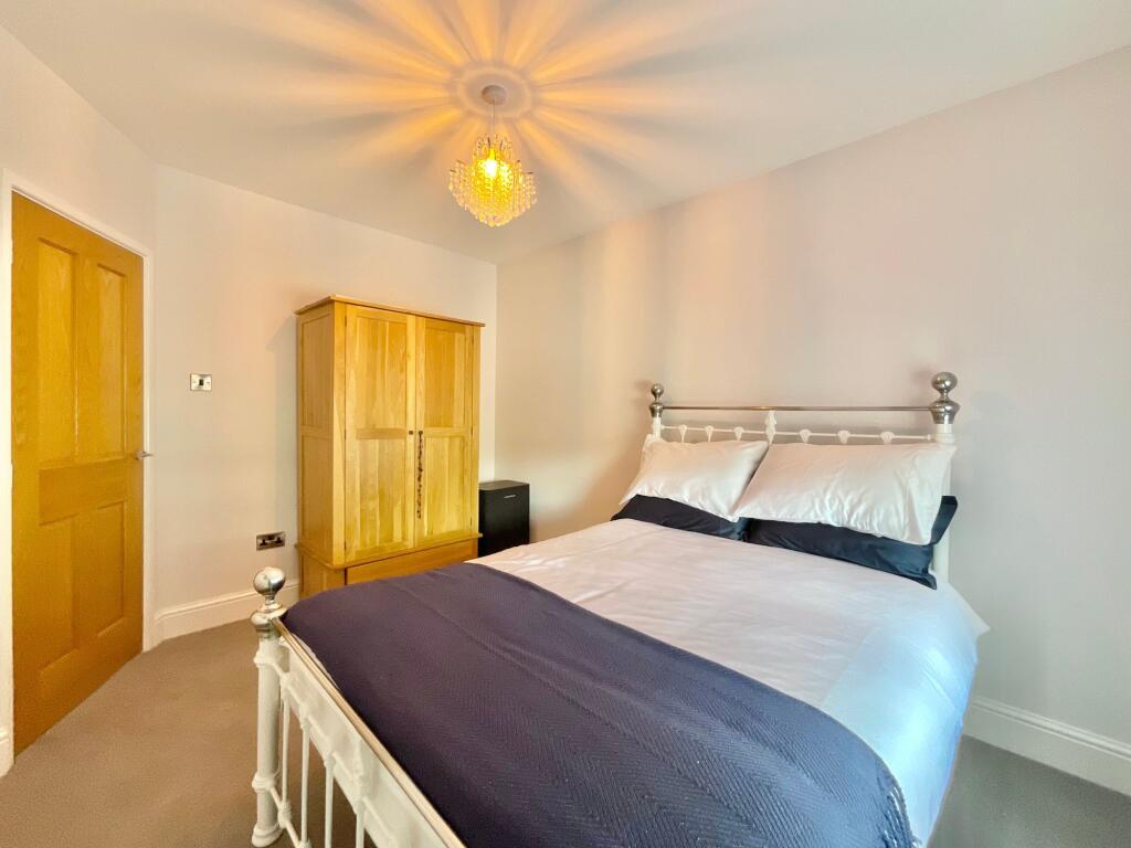
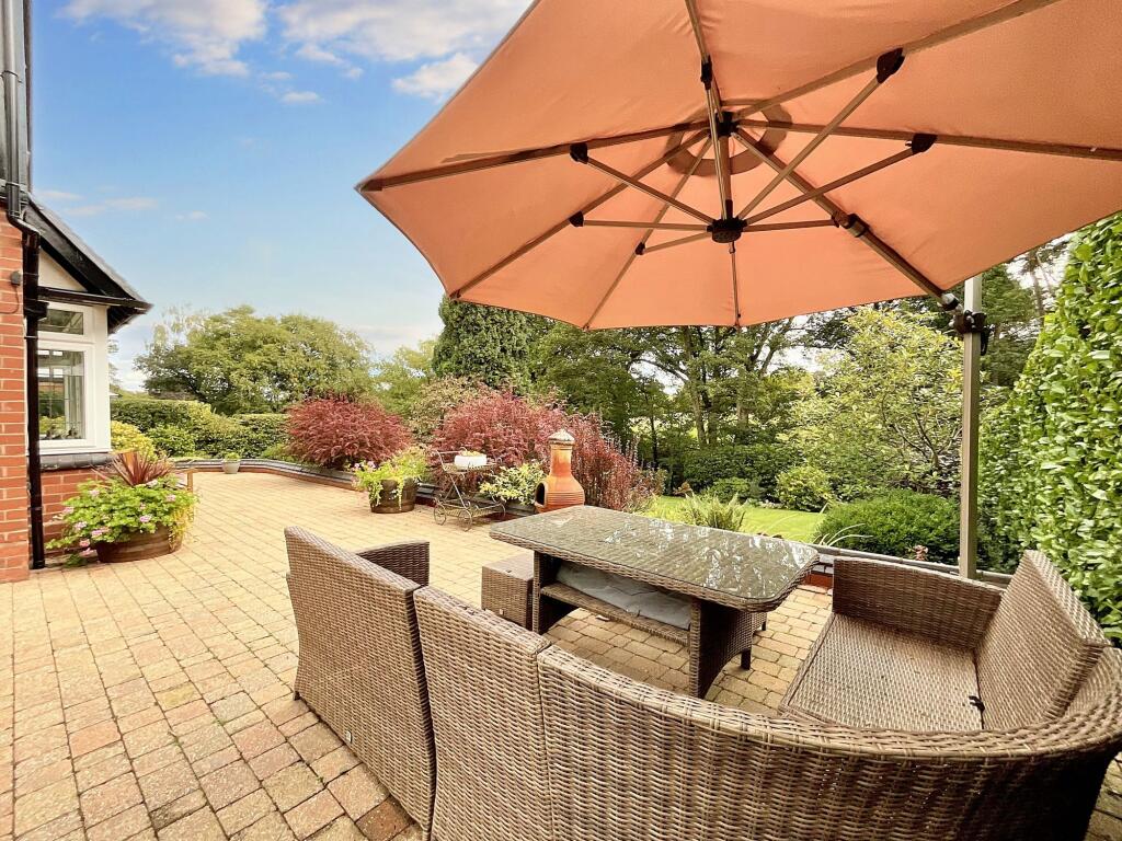
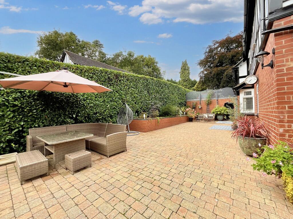
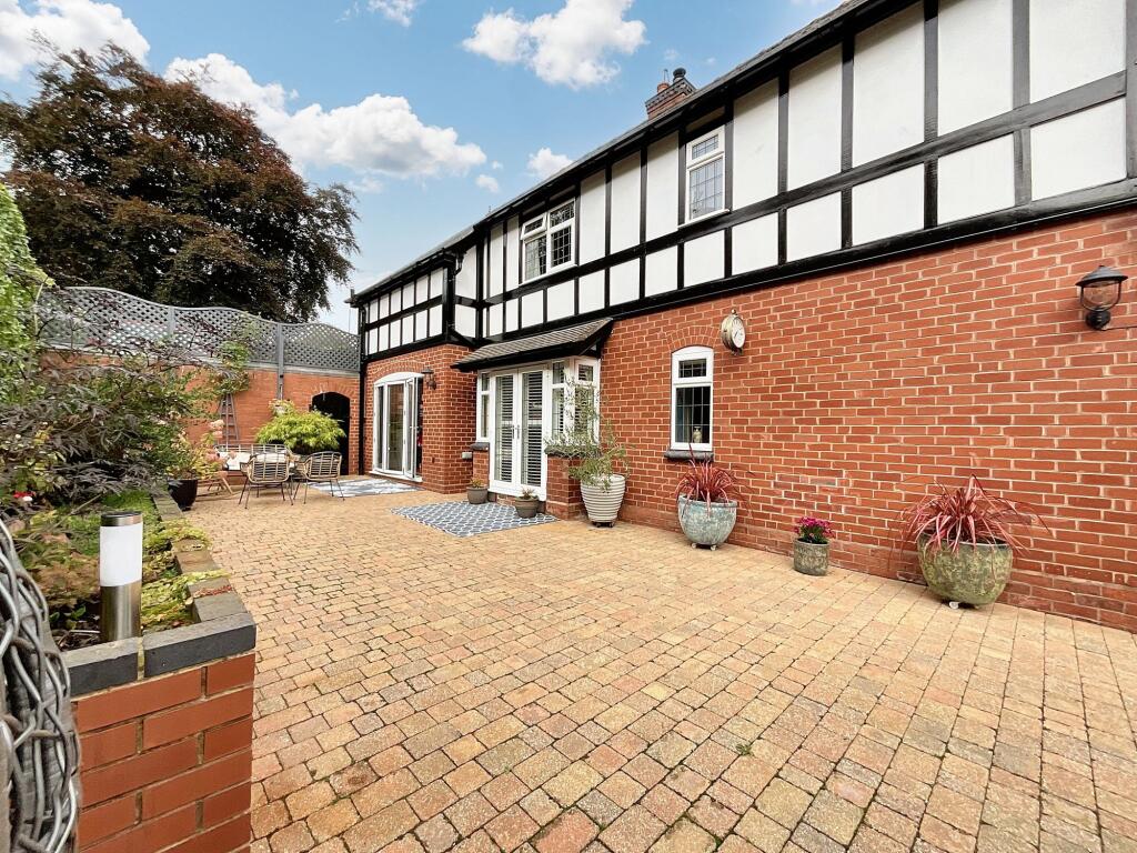
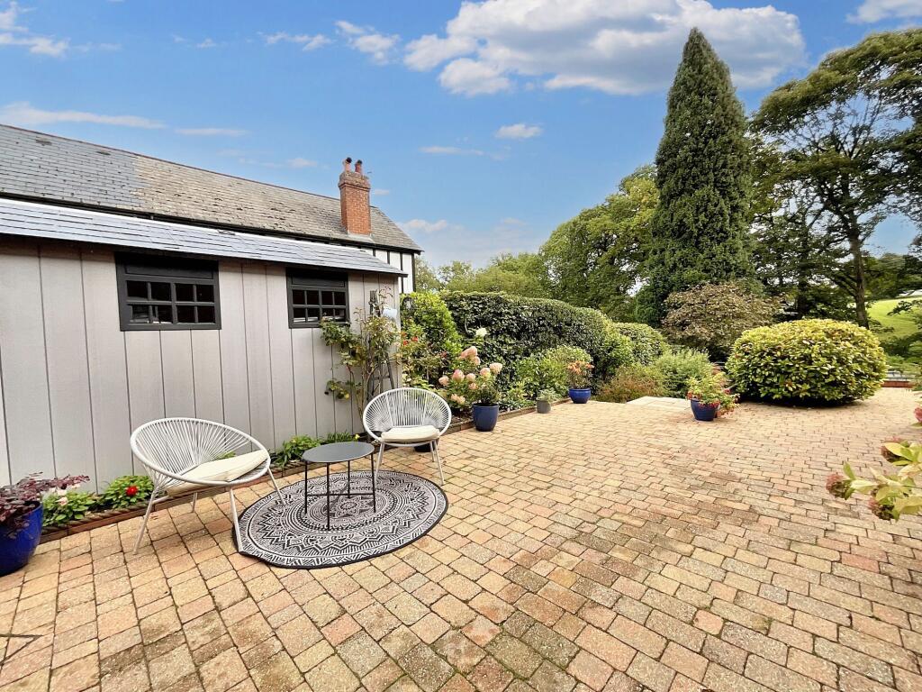
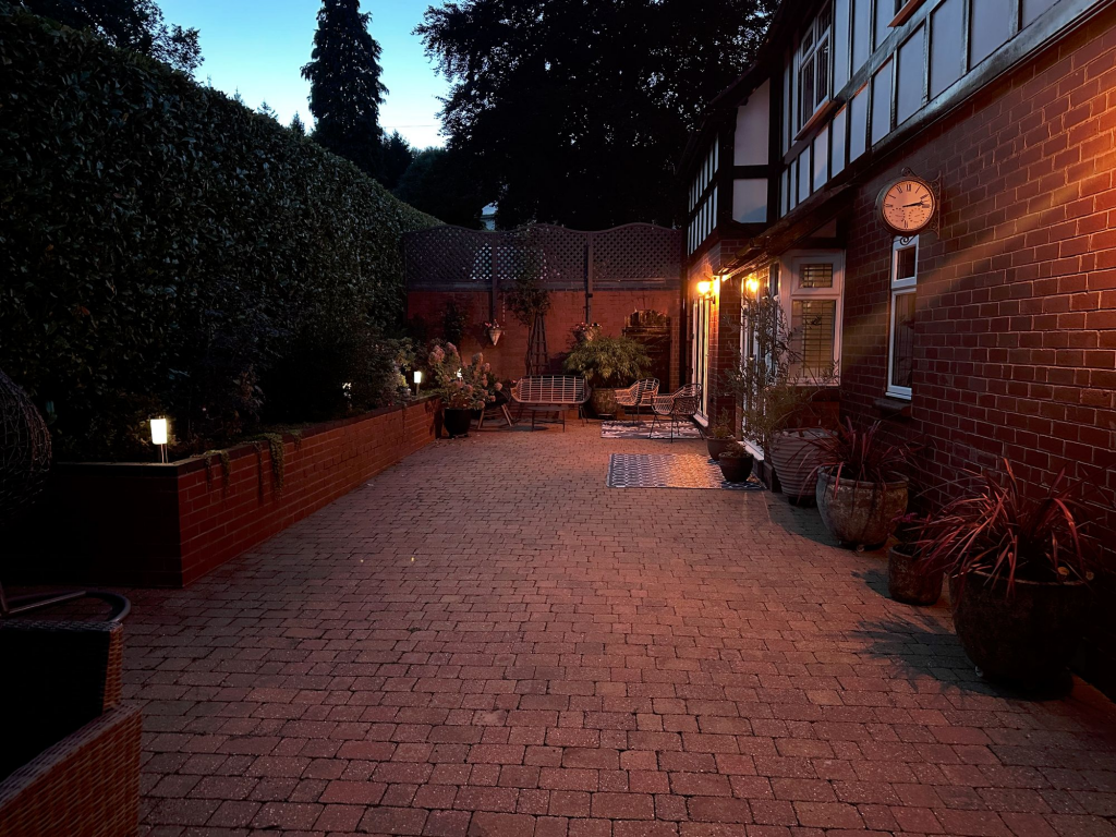
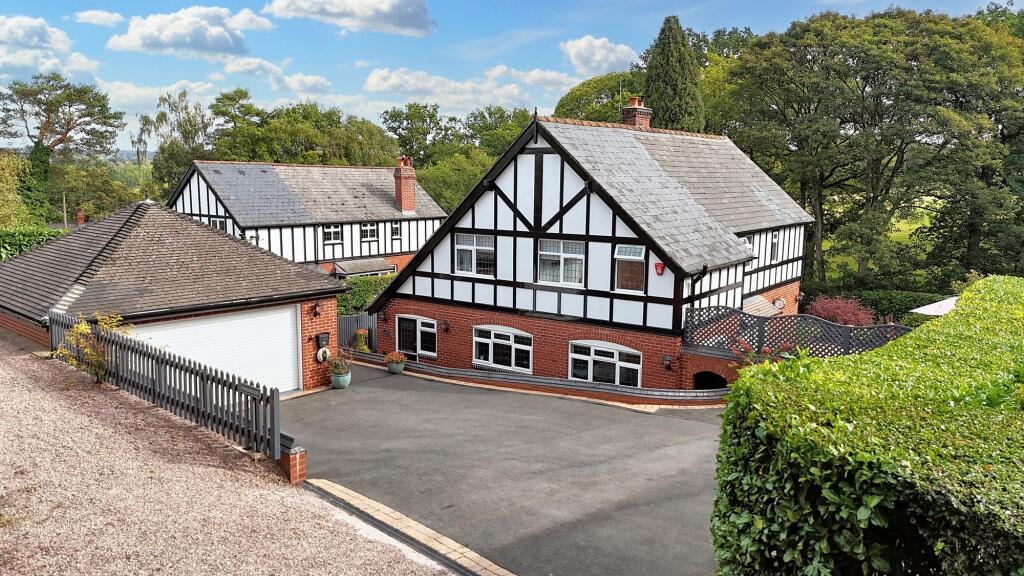
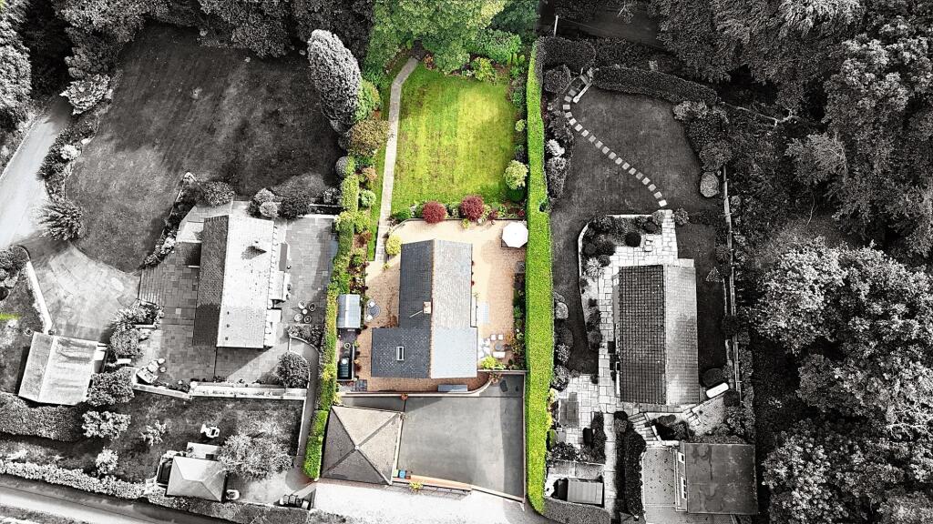
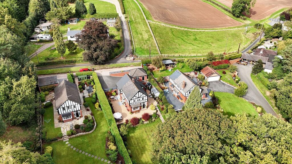
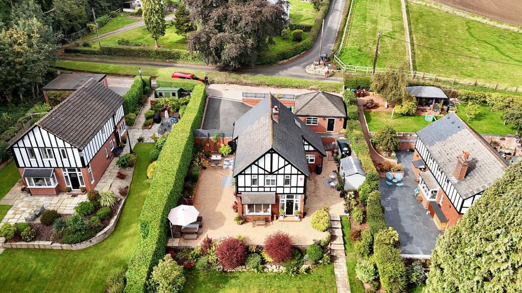
Photo 1 Photo 2 Photo 3 Photo 4 Photo 5 Photo 6 Photo 7 Photo 8 Photo 9 Photo 10 Photo 11 Photo 12 Photo 13 Photo 14 Photo 15 Photo 16 Photo 17 Photo 18 Photo 19 Photo 20 Photo 21 Photo 22 Photo 23 Photo 24 Photo 25 Photo 26 Photo 27 Photo 28 Photo 29 Photo 30 Photo 31 Photo 32 Photo 33 Photo 34 Photo 35 Photo 36 Photo 37 Photo 38
/ 38
Property details
Tenure
FREEHOLD
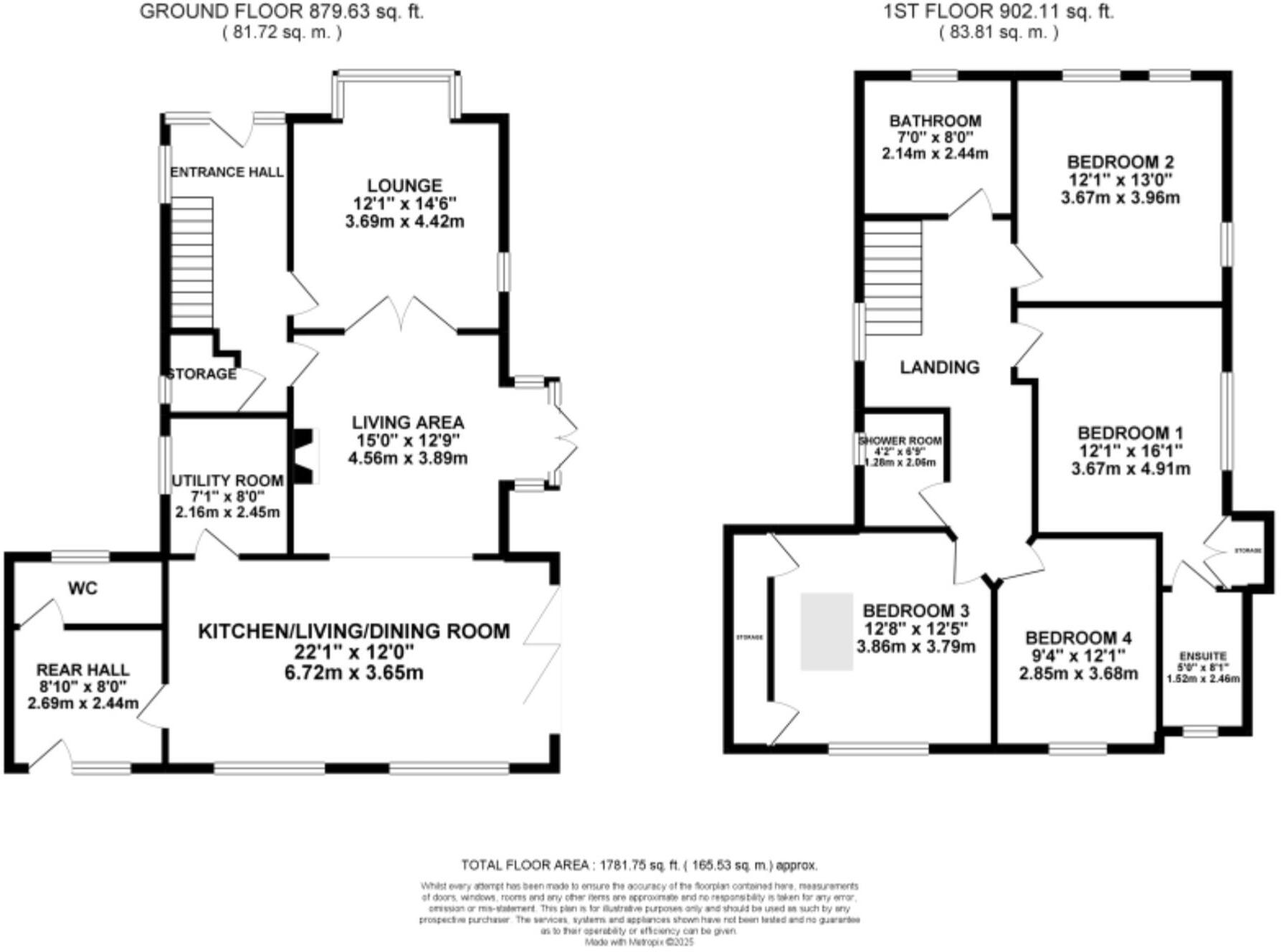
Floor area
151 m²
Council tax band
D
Year built
England and Wales: 1900-1929
Last sold
£510,000 Oct 2018
Price per m²
£4,967/m²
Local average
£491,000 (+52.7%)
Deprivation
Decile 7 (21,872 of 33,755)
Street crime
14 incidents within 1 mile (Apr 2026)
Key features
- Redesigned and newly fitted sleek and modern kitchen with integrated Bosch appliances including a coffee machine, granite worktops, soft-close cabinetry and drawers, plus an island with breakfast bar.
- Open-plan kitchen/living/dining space with bifolding doors to the patio, further living room with log burner, separate lounge, utility, and entrance hall with Minton-style tiles and an oak staircase.
- Four generous double bedrooms, two with fitted wardrobes, and the master with an en suite bathroom. Family bathroom with freestanding double-ended bath, plus shower room with a walk-in shower.
- Tucked proudly back from the sought-after Chase Lane, you have easy access to the A34, local bus routes and Stones busy centre with schools, shops, eateries and more.
- Off-road parking on a generous driveway, double garage with EV charger, and a South-East facing wrap-around garden with patio seating space, a lush grass lawn, and mature borders.
Additional details
- Parking
- Yes
- Garden
- Yes
- Listed property
- No
- Restrictions
- No
- Required access
- No
- Rights of way
- No
- Flooded in last 5 years
- No
- Flood defences
- No
Description
Listed by
Stone
James Du Pavey Ltd
Reference: 174746612
EPC ratings on this postcode
We don't have a matched EPC for this property yet. Below are efficiency scores and details for other addresses on this postcode.
| Address | Current | Potential | Floor area | Age band | Type |
|---|---|---|---|---|---|
| Wellswood, Chase Lane, Tittensor, STOKE-ON-TRENT | 49 | 70 | 151 m² | England and Wales: 1900-1929 | Detached |
Flood risk
Zone: 1
Risk: Low
Job (default Low)
Floorplans
All
Site Plan
Price history
21% since 2008
| Event | Date | Price | % change |
|---|---|---|---|
| Listed for sale | — | £750,000 | +47.1% |
| Sold | 26/10/2018 (7 years ago) | £510,000 | +21.4% |
| Sold | 09/06/2008 (18 years ago) | £420,000 | — |
Source: HM Land Registry Price Paid Data. Crown copyright.
Sold Comparables
Same street and nearby sales within 0.25 miles (last 5 years). Data from Land Registry Price Paid.
| Address | Price | Date | Type |
|---|---|---|---|
| ROCK SANDS STONE ROAD, TITTENSOR, STOKE-ON-TRENT, STAFFORD, STAFFORDSHIRE, ST12 9HH | £445,000 | 29/09/2021 | Detached |
Area average: £445,000 (1 sale)
Capital growth trend
Land Registry outcode average: last 12 months vs 5y and 10y ago (from sold prices).
House Price Index (HM Land Registry — official index, not sold-price averages): Stafford. Series: Detached. As of March 2026.
Rental Range
Estimated market rent for Stafford. Low = conservative, Realistic = average, Optimistic = best case.
Based on Local Authority from postcode lookup → Stafford.
LHA (30th percentile) floor for Staffordshire North: £798/mo (Apr 2025 – Mar 2026)
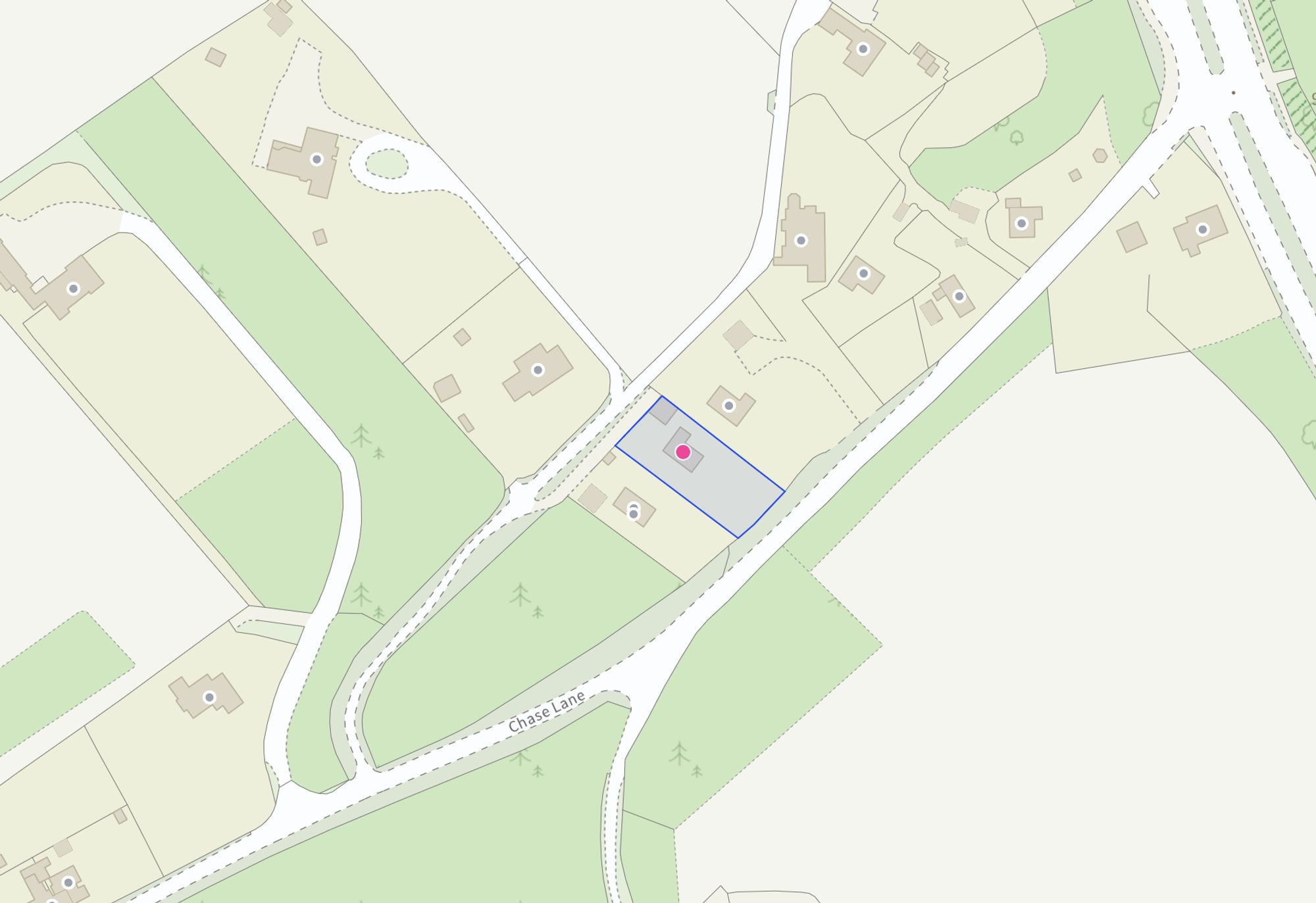
Location
Address
Swynnerton, Tittensor, Stafford, Staffordshire, England, ST12 9HH, United Kingdom
Nearby
Nearest stations, universities and amenities (distance from property).
| Type | Name | Distance |
|---|---|---|
| Bus stop | Chase Lane | 0.1 miles |
| Shop | Fox | 0.6 miles |
| Shop | Mark's Quality Meats | 0.9 miles |
| Train station | Unknown | 1.5 miles |
| Train station | Trentham Leisure | 1.8 miles |
| Hospital | North Staffordshire Nuffield Hospital | 3.9 miles |
| Hospital | Longton Cottage Hospital | 4.1 miles |
| University | University of Staffordshire Stoke Campus | 5.1 miles |
Street-level crime
| Category | Count |
|---|---|
| Violence and sexual offences | 6 |
| Anti-social behaviour | 4 |
| Other theft | 1 |
| Robbery | 1 |
| Shoplifting | 1 |
| Vehicle crime | 1 |
| Total incidents | 14 |
Within 1 mile during Apr 2026. Source: data.police.uk (England & Wales).
Schools nearby
Nearest open schools with Ofsted ratings (England). Closed schools are not shown. Data from Get Information about Schools and Ofsted.
| Name | Type | Distance | Ofsted |
|---|---|---|---|
| Tittensor CofE (C) First School | Primary | 0.6 miles | Good — 20 Sep 2023 |
| Barlaston CofE (VC) First School | Primary | 1.4 miles | Good — 19 Jun 2024 |
| Ash Green Primary Academy | Primary | 2.3 miles | Good — 3 Jun 2015 |
| Christ Church Academy | Primary | 2.5 miles | Good — 21 Dec 2012 |
| Strathmore College | Other | 2.6 miles | — (No rating) |
Rental Comparables
Loading rental comparables for this postcode. Refresh in a few minutes.
Rent-driven metrics
Based on Area rent estimate.
- Rent ratio — Monthly rent ÷ purchase price (1% rule). 1%+ = strong, 0.8–1% = okay, <0.8% = weak for cashflow.
- Max investor price — Rent ÷ 0.8%; the price at which rent would be 0.8% of price (Stoke-style target).
- Target investor price — Rent ÷ 1%; the price at which rent would be 1% of price (strong cashflow band).
- Gross yield — Annual rent as % of purchase price (no costs).
Enter House Number
Enter the house number to help us retrieve more accurate pricing history and property data.
Please log in to submit or correct the house number for this listing.
Log in to continue