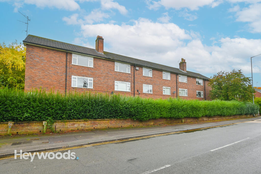
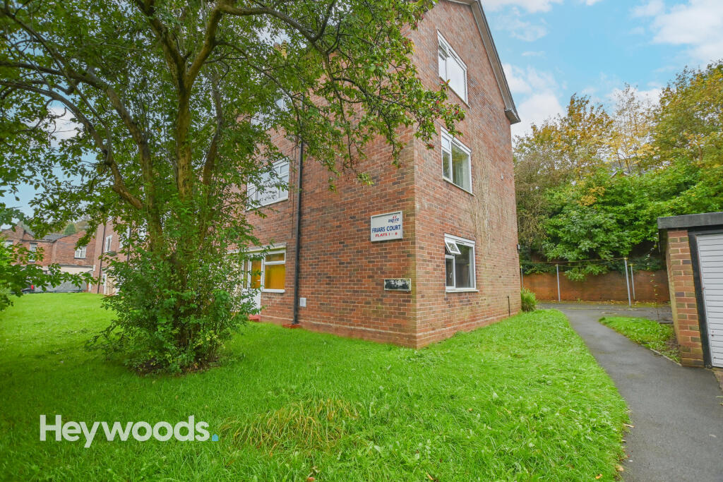
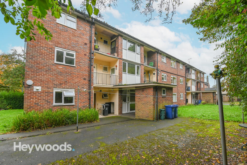
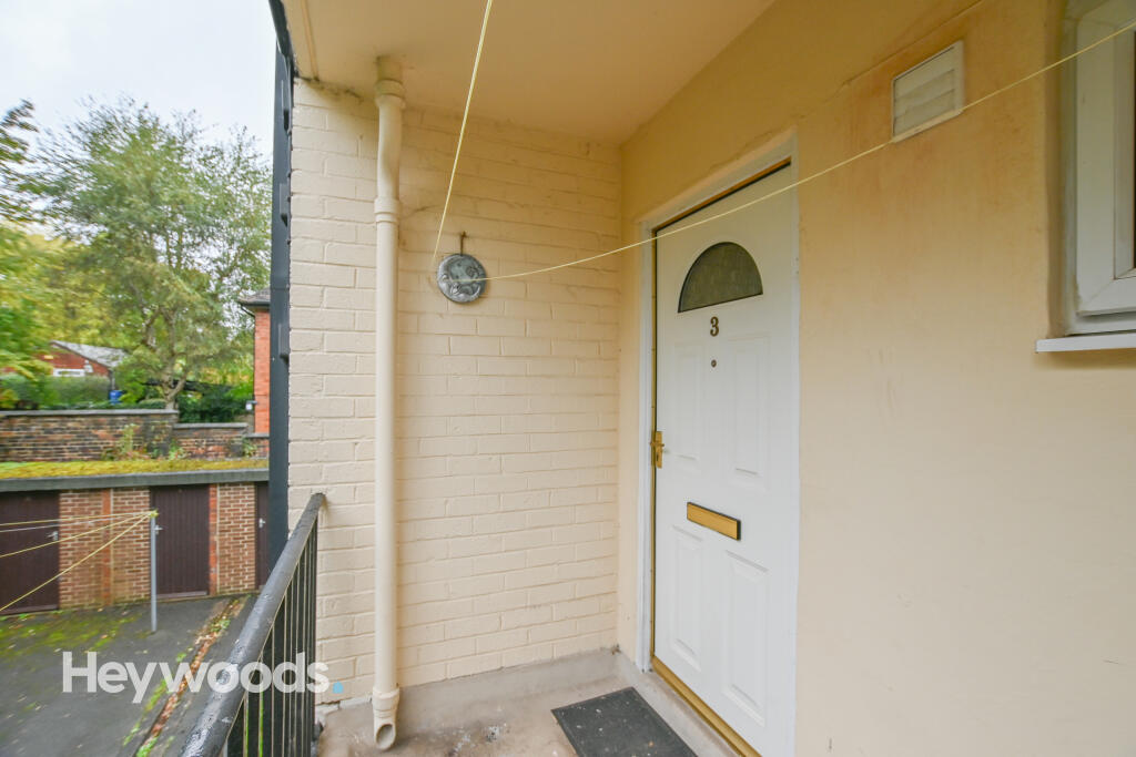
FLAT 3
FRIARS COURT, FRIARSWOOD ROAD, NEWCASTLE, STAFFORDSHIRE ST5 2EQ
£700 pcm
Property details
Floor area
44 m²
Council tax band
A
Deprivation
Decile 10 (32,714 of 33,755)
Street crime
305 incidents within 1 mile (Apr 2026)
Key features
- One Bedroom
- First Floor Flat
- Furnished
- Council Tax Band A
- Close To Royal Stoke & Keele University
- Electric Heating
- On-Street Parking
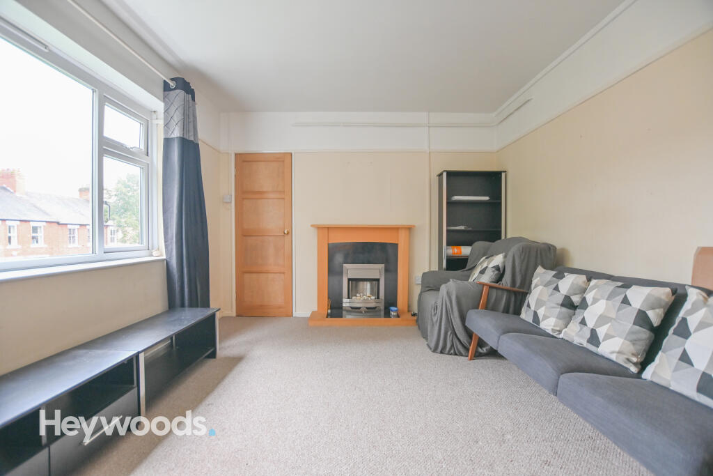
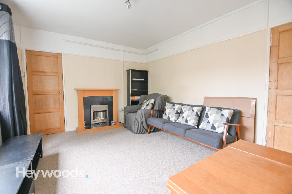
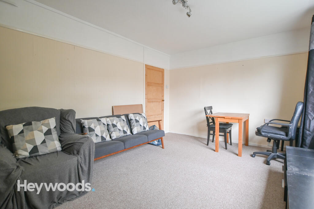
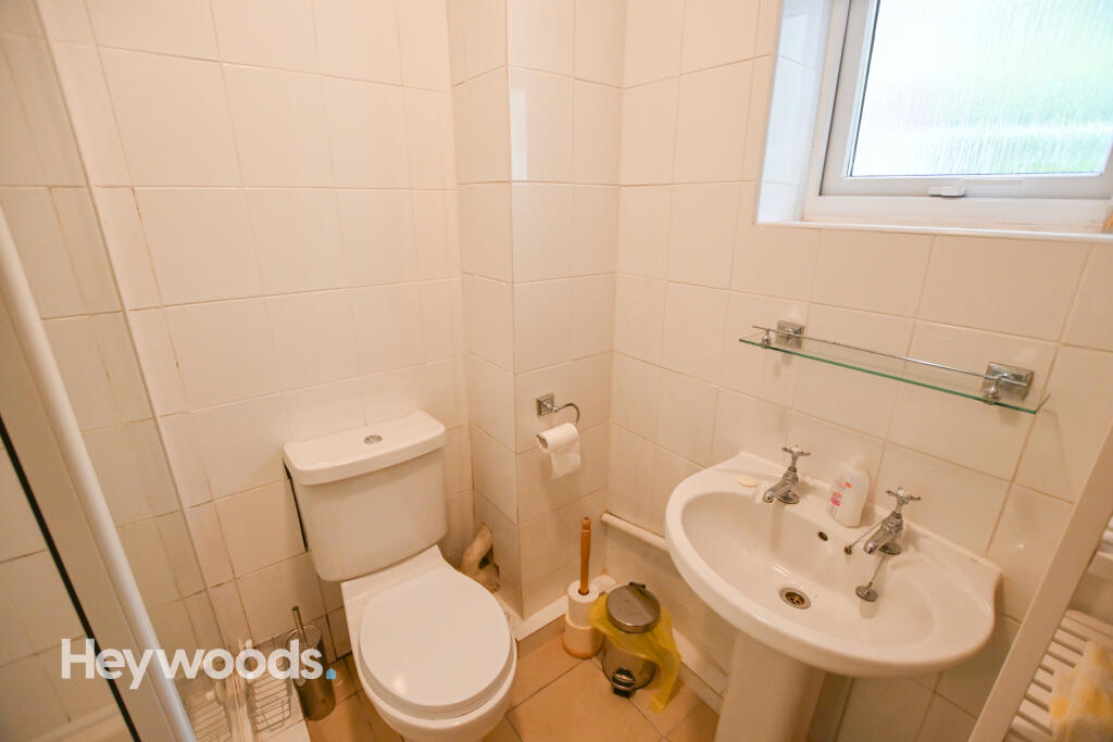
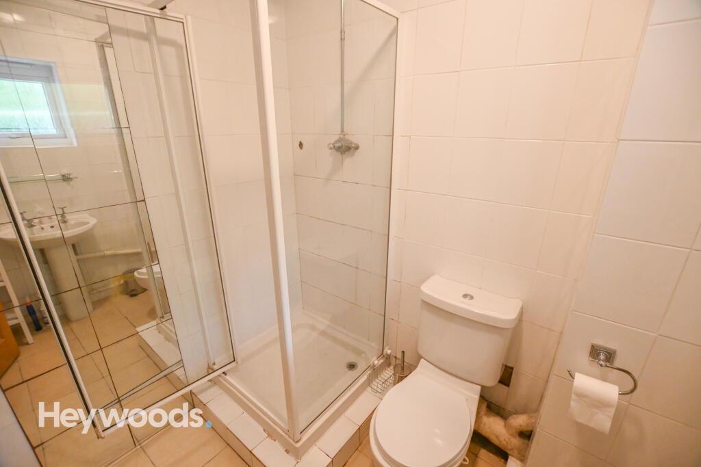
Description
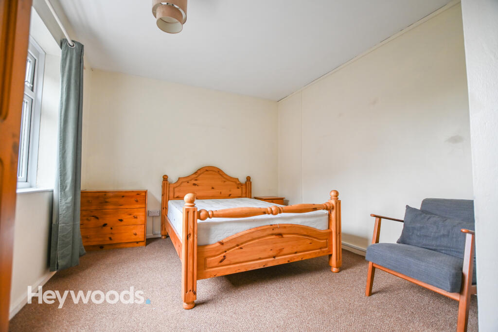
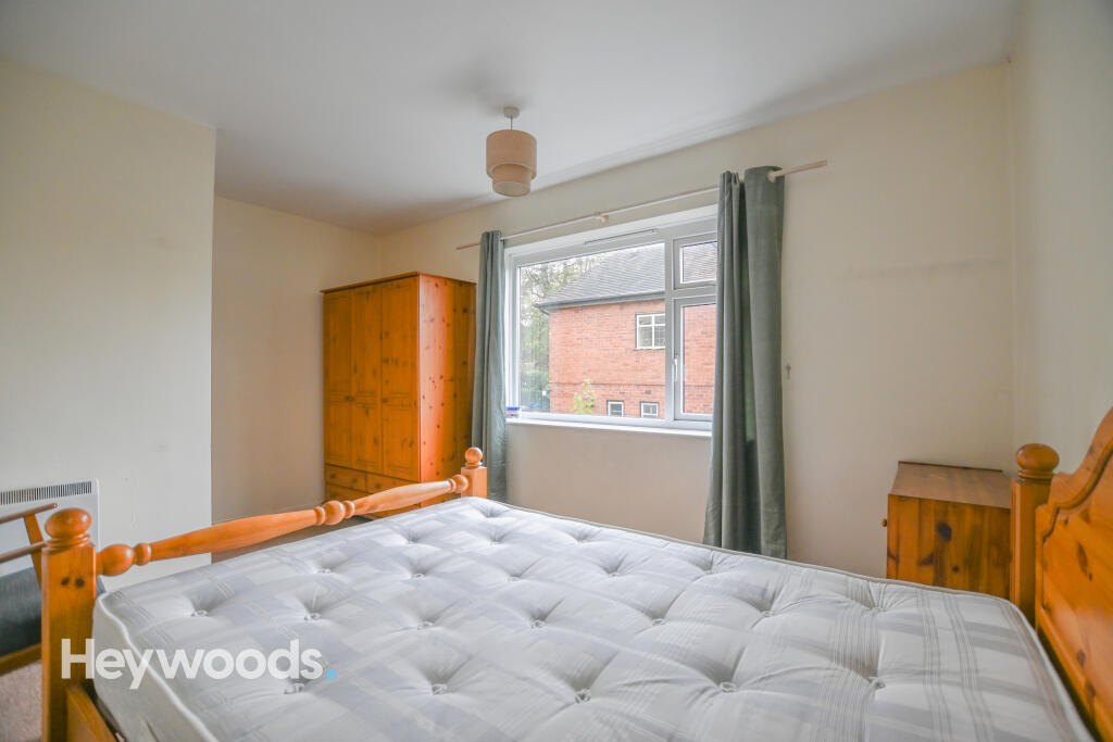
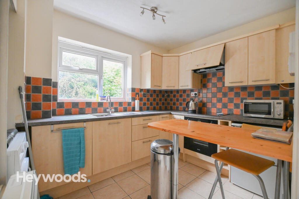
The communal entrance provides access with stairs leading up to the entrance door - an intercom system ensures this is a secure space and easy to allow guests in to visit from the comfort of the flat. Inside, you'll find a fitted kitchen with breakfast bar and space for white goods, a spacious double bedroom, a bright and airy living room and finally a shower room.
The property comes available on a furnished basis - it is possible that some furniture can be removed if required. It also benefits from electric heating and double glazing throughout.
Listed by
Newcastle-under-Lyme
Heywoods
Reference: 172010042
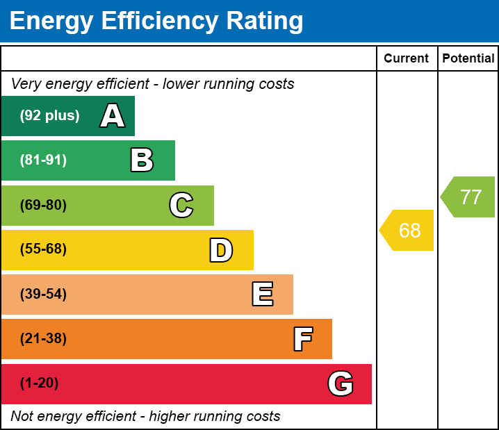
EPC Rating & Upgrade Cost
Fetching EPC data… Refresh this page in a moment.
Flood risk
Zone: 1
Risk: Low
Job (default Low)
EPC Graphs

Energy performance certificate (EPC) ¿ Find an ene
EE

EI
Rental Range
Estimated market rent for Newcastle-under-Lyme. Low = conservative, Realistic = average, Optimistic = best case.
Based on Local Authority from postcode lookup → Newcastle-under-Lyme.
LHA (30th percentile) floor for Staffordshire North: £424/mo (Apr 2025 – Mar 2026)
Location
Address
1;12 Friars Court
Nearby
Nearest stations, universities and amenities (distance from property).
| Type | Name | Distance |
|---|---|---|
| Bus stop | Morrison's | 0.1 miles |
| Shop | Timpson | 0.1 miles |
| Shop | News and Booze Express | 0.2 miles |
| Hospital | Royal Stoke University Hospital | 0.7 miles |
| Hospital | North Staffordshire Nuffield Hospital | 1.4 miles |
| University | Keele University | 1.8 miles |
| Train station | Stoke-on-Trent | 2.0 miles |
| University | University of Staffordshire Stoke Campus | 2.0 miles |
| Train station | Silverdale | 2.3 miles |
Street-level crime
| Category | Count |
|---|---|
| Violence and sexual offences | 89 |
| Anti-social behaviour | 62 |
| Public order | 31 |
| Shoplifting | 23 |
| Other theft | 20 |
| Criminal damage and arson | 18 |
| Burglary | 16 |
| Drugs | 13 |
| Other crime | 10 |
| Vehicle crime | 10 |
| Possession of weapons | 5 |
| Robbery | 5 |
| Theft from the person | 2 |
| Bicycle theft | 1 |
| Total incidents | 305 |
Within 1 mile during Apr 2026. Source: data.police.uk (England & Wales).
Schools nearby
Nearest open schools with Ofsted ratings (England). Closed schools are not shown. Data from Get Information about Schools and Ofsted.
| Name | Type | Distance | Ofsted |
|---|---|---|---|
| Blackfriars Academy | Other | 0.1 miles | Outstanding — 6 Feb 2013 |
| St Giles' and St George's Church of England Academy | Primary | 0.2 miles | Good — 21 May 2023 |
| Co-op Academy Friarswood | Primary | 0.3 miles | Good — 8 Mar 2013 |
| Hassell Primary School | Primary | 0.3 miles | Good — 25 Oct 2023 |
| St Mary's Catholic Primary School | Primary | 0.4 miles | Good — 17 Feb 2017 |
Rental Comparables
Residential lets from OpenRent and Rightmove for the area (same bedroom count). Use to validate rent estimates. Student lets are excluded.
Average rent: £636/mo (36 listings)