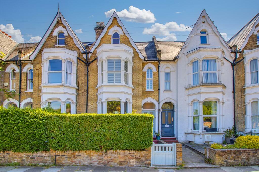
85 HARGRAVE PARK
LONDON, GREATER LONDON N19 5JW
£1,475,000


Property details
Tenure
FREEHOLD
Floor area
153 m²
Council tax band
F
Last sold
£1,500,000 Oct 2023
Local average
£445,000 (+231.5%)
Deprivation
Decile 4 (10,170 of 33,755)
Street crime
1050 incidents within 1 mile (Apr 2026)
Key features
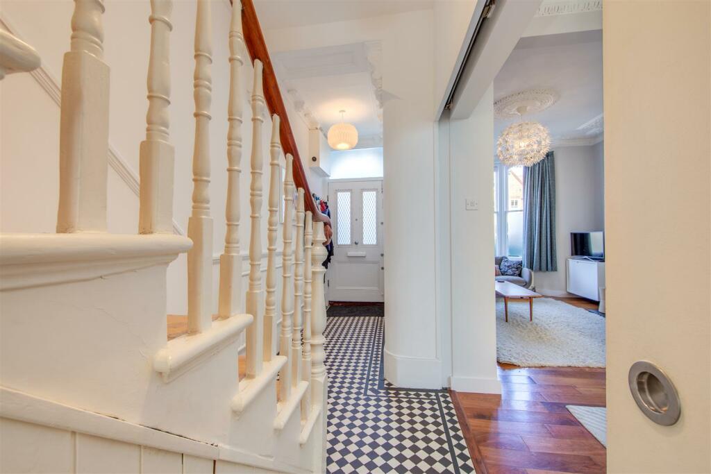
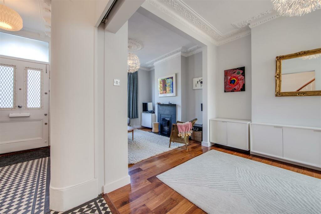
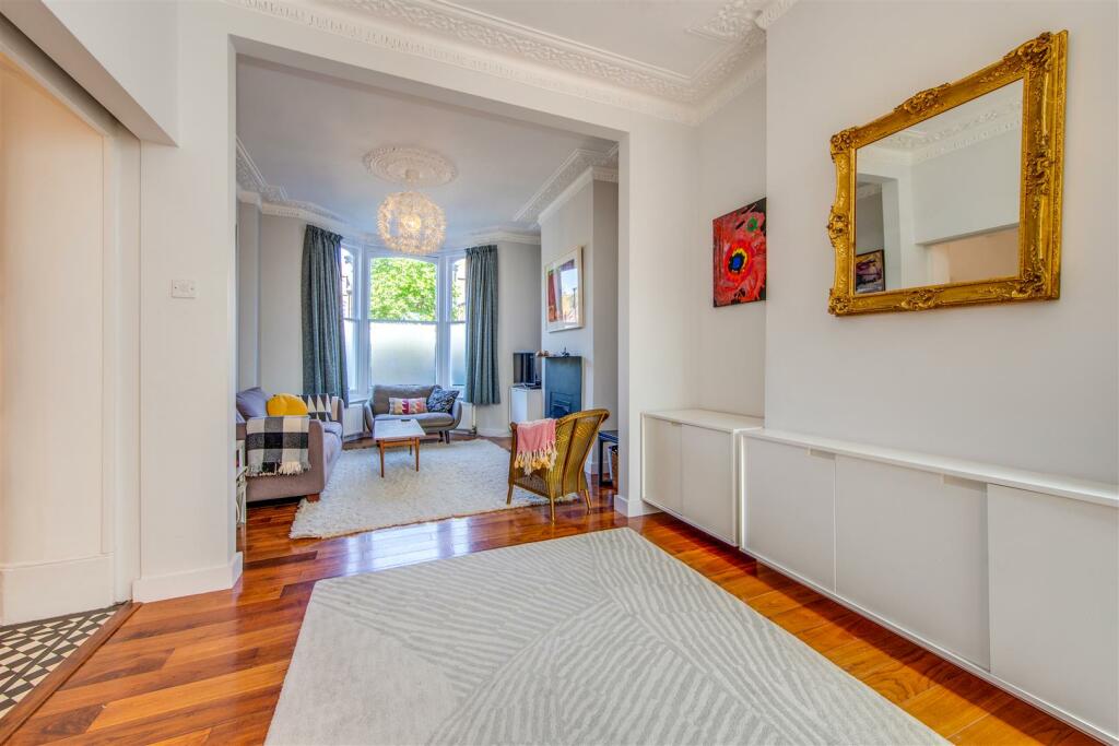
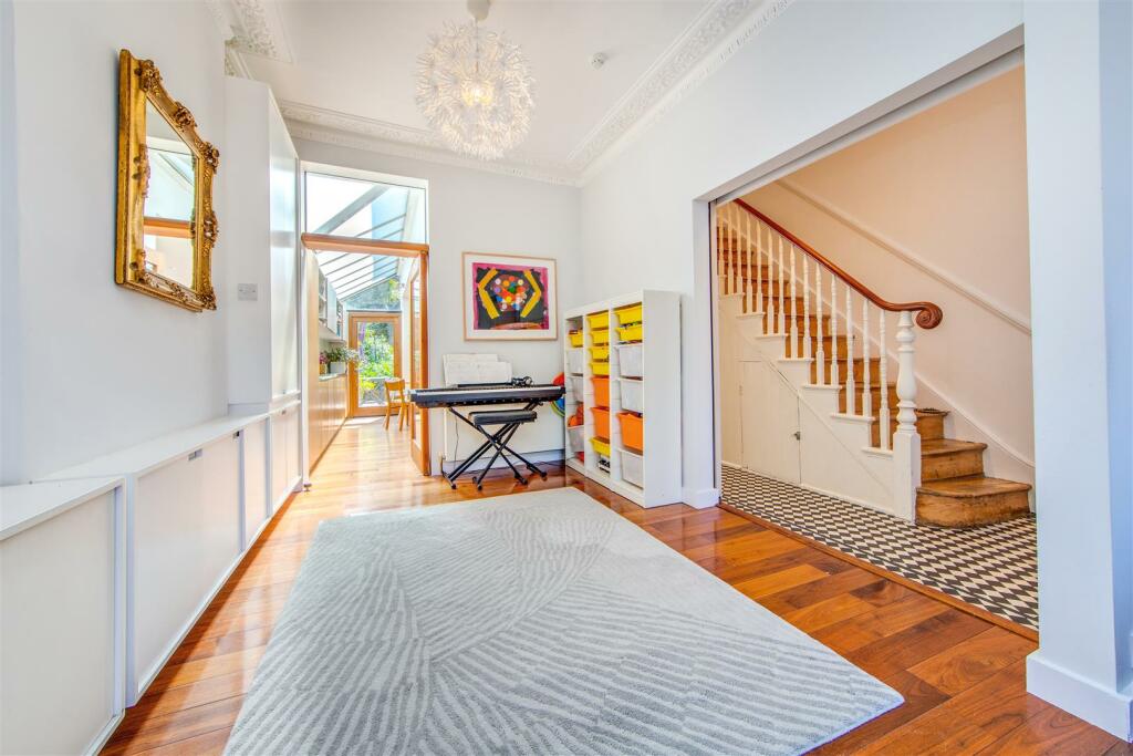
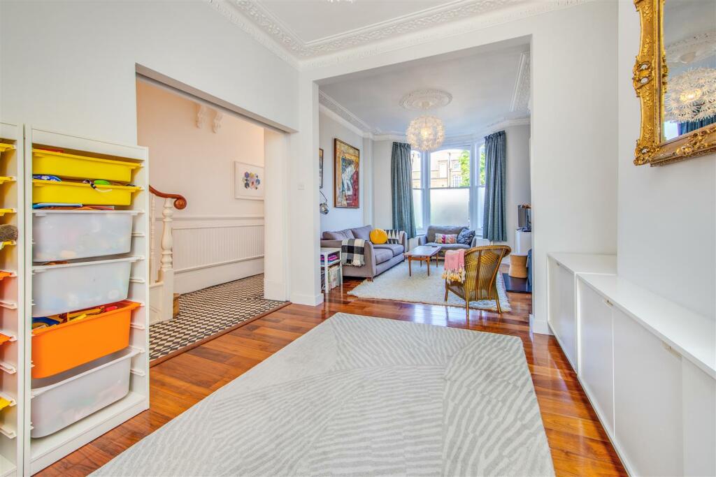
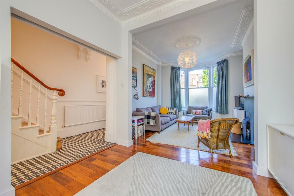
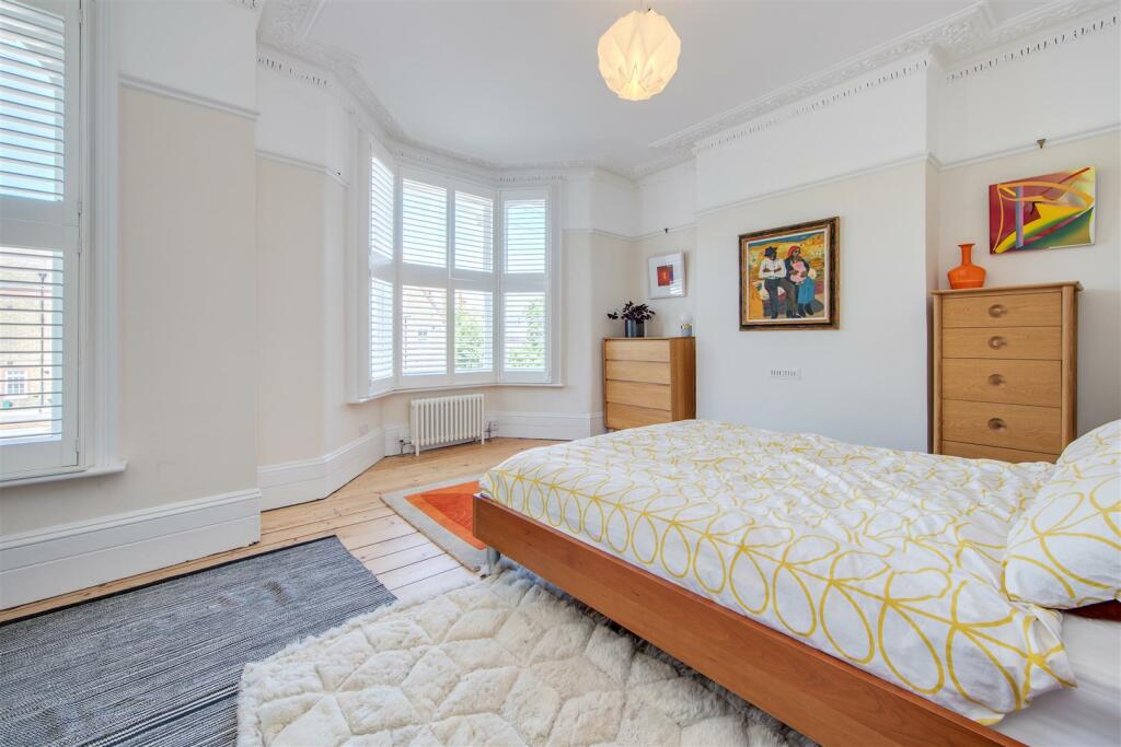
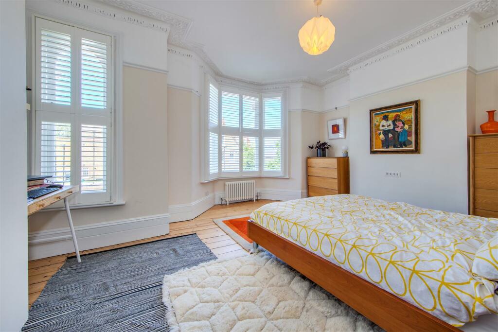
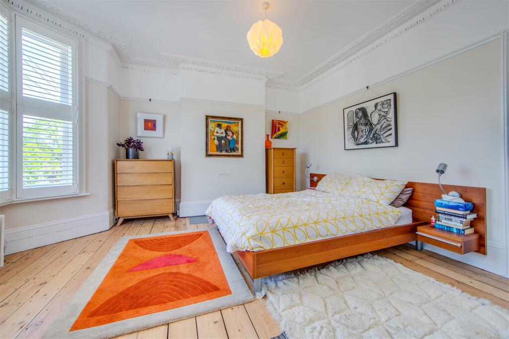
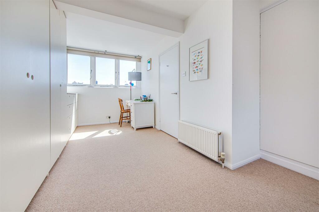
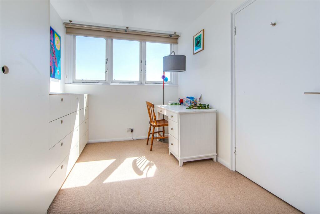
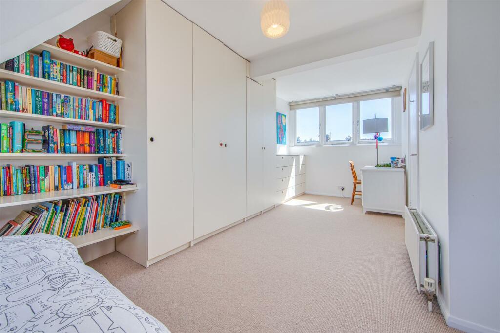
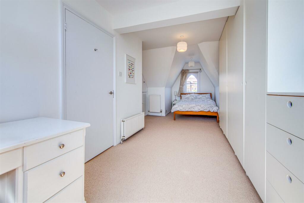
- VICTORIAN HOUSE
- PERIOD FEATURES
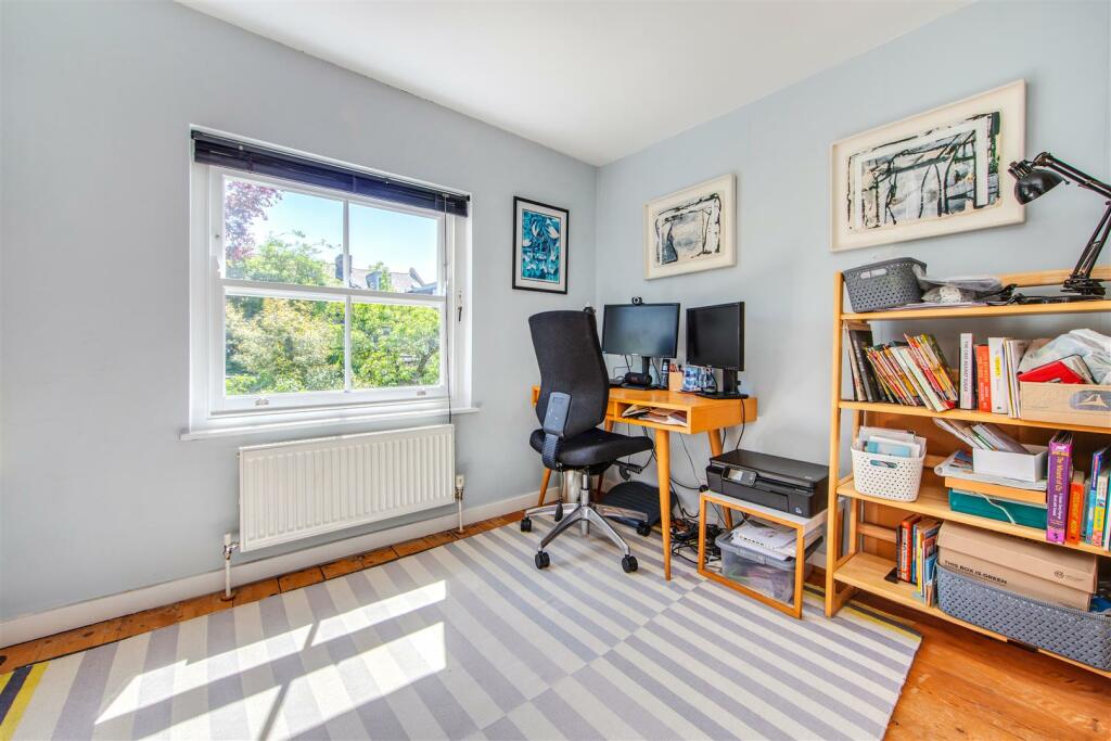
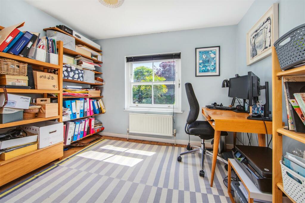
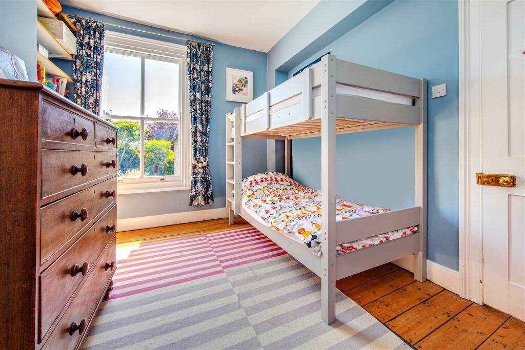
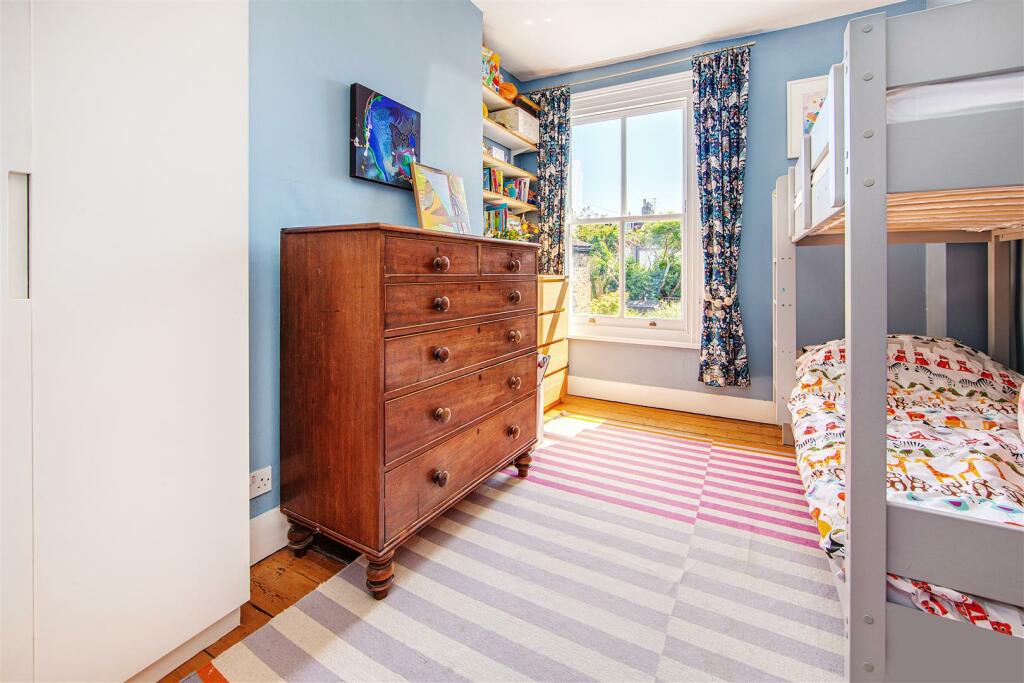
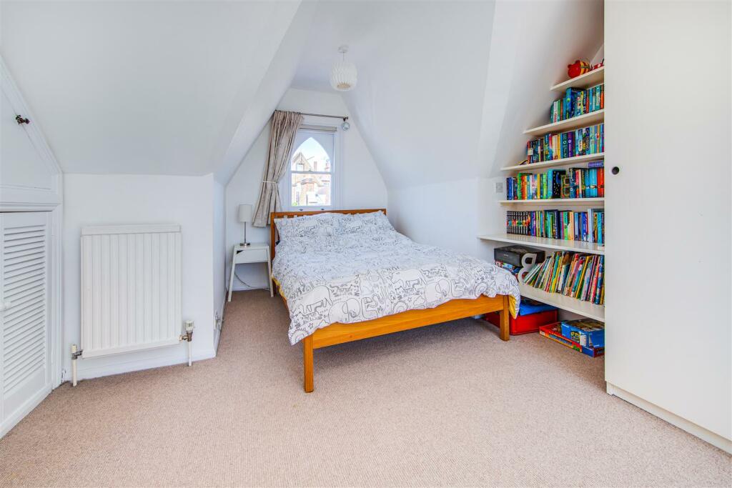
- 4 BEDROOMS
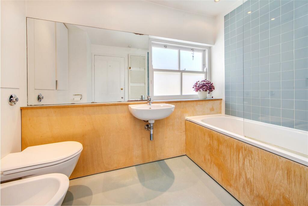
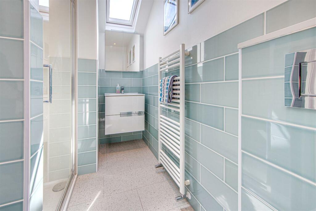
- SHOWER ROOM
- BATHROOM
- 2 RECEPTION ROOMS
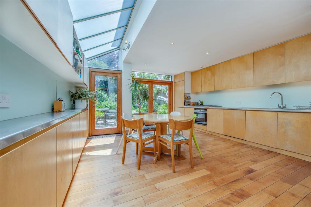
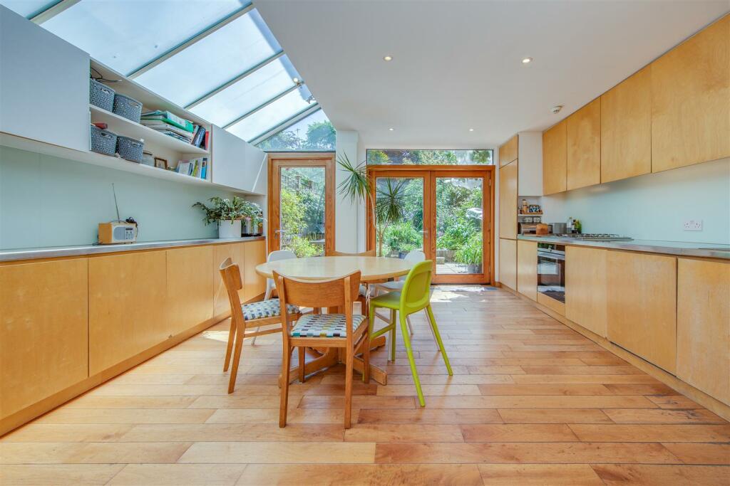
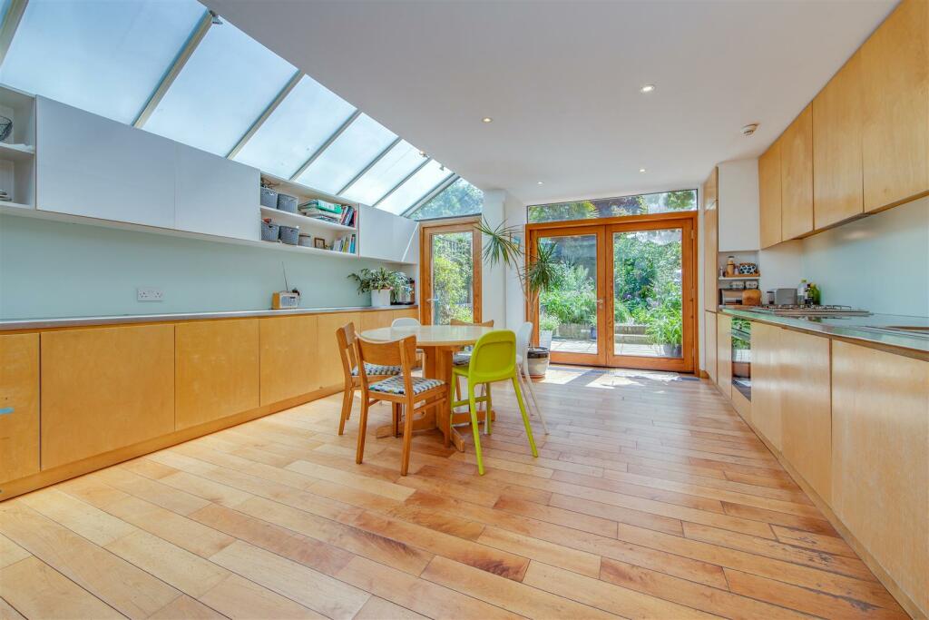
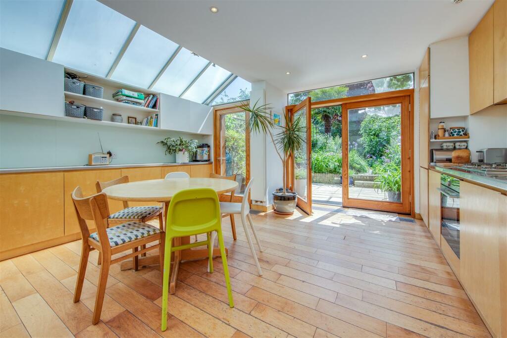
- KITCHEN/BREAKFAST ROOM
- CLOAKROOM
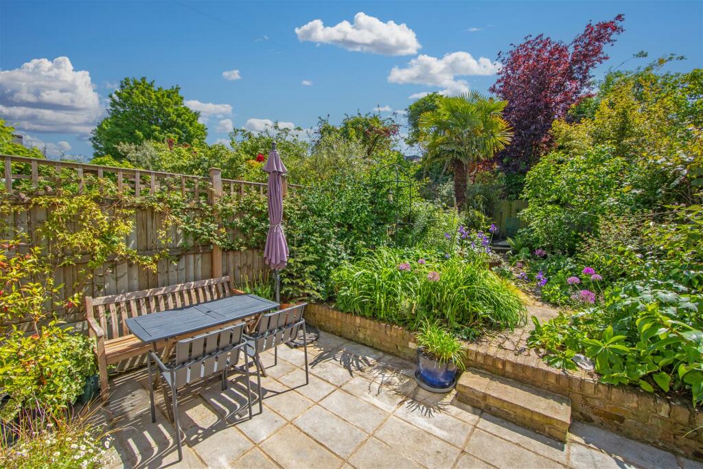
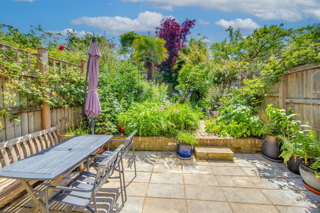
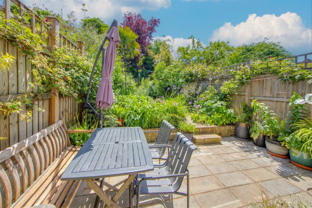
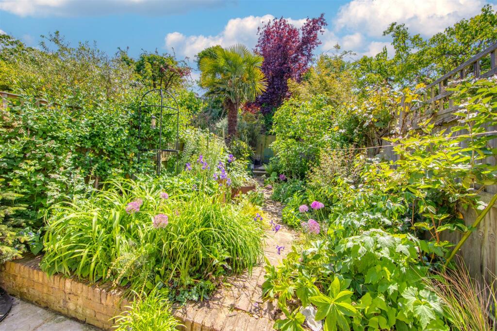
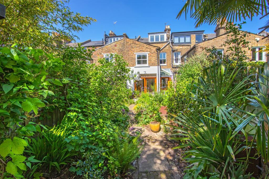
- SOUTH FACING GARDEN
- NEAR TUBE STATION
Additional details
- Garden
- Yes
Description
* 4 Bedrooms * Shower Room en Suite * Family Bathroom * 2 Reception Rooms * Extended Kitchen/Breakfast Room * Cloakroom * Delightful South Facing Garden * Council Tax Band F * EPC D *
Listed by
Highgate
Day Morris
Reference: 135844298
EPC Rating & Upgrade Cost
Fetching EPC data… Refresh this page in a moment.
Flood risk
Zone: 1
Risk: Low
Job (default Low)
Floorplans
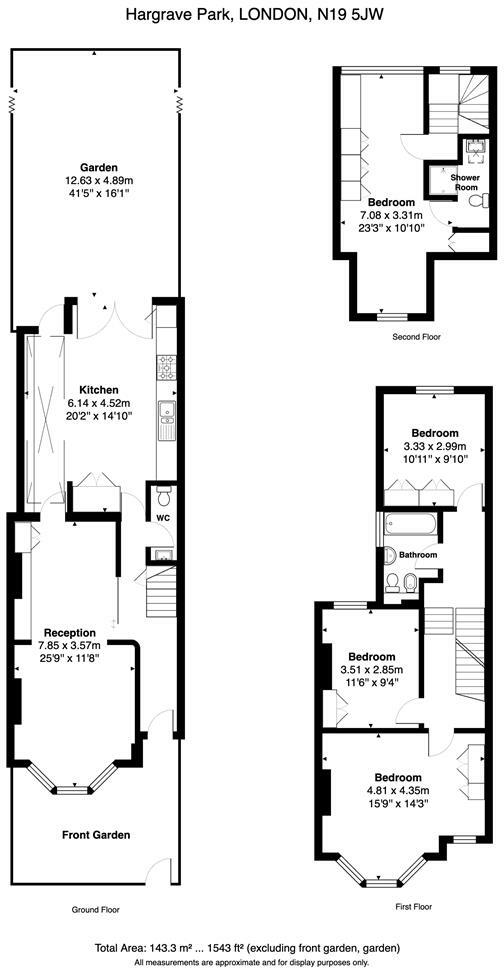
85 Hargrave Park.jpg
EPC Graphs
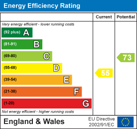
EE Rating
FENSA Certificates
This property has 2 FENSA certificate(s) on record, indicating window/door installations by FENSA-approved installers.
FENSA Certificate #11841113
Property Details
Street: 85 Hargrave Park
Town: LONDON
Postcode: N19 5JW
Installation Details
Items: 1 window
Certificate Issued: 12/09/2016
Work Completed: 21/03/2016
This certificate data was retrieved from FENSA's database
FENSA Certificate #11841117
Property Details
Street: 85 Hargrave Park
Town: LONDON
Postcode: N19 5JW
Installation Details
Items: 4 windows
Certificate Issued: 12/09/2016
Work Completed: 11/07/2016
This certificate data was retrieved from FENSA's database
What is FENSA? FENSA (Fenestration Self-Assessment Scheme) is a government-authorised scheme that monitors building regulation compliance for replacement windows and doors. Certificates indicate that work was completed by FENSA-approved installers.
Price history
417% since 1999
| Event | Date | Price | % change |
|---|---|---|---|
| Sold | 18/10/2023 (2 years ago) | £1,500,000 | +65.7% |
| Sold | 13/07/2012 (13 years ago) | £905,000 | +212.1% |
| Sold | 15/06/1999 (27 years ago) | £290,000 | — |
Source: HM Land Registry Price Paid Data. Crown copyright.
Sold Comparables
Same street and nearby sales within 0.25 miles (last 5 years). Data from Land Registry Price Paid.
| Address | Price | Date | Type |
|---|---|---|---|
| Same street 79 HARGRAVE PARK, LONDON, ISLINGTON, GREATER LONDON, N19 5JW | £1,065,000 | 30/06/2023 | Terraced |
| 22 - 24 WINSCOMBE STREET, LONDON, CAMDEN, GREATER LONDON, N19 5DG | £1,600,000 | 23/09/2022 | Other |
| ST PETERS CHURCH DARTMOUTH PARK HILL, LONDON, ISLINGTON, GREATER LONDON, N19 5HL | £30,000 | 27/01/2022 | Other |
Street average: £1,065,000 (1 sale)
Area average: £815,000 (2 sales)
Capital growth trend
House Price Index (HM Land Registry — official index, not sold-price averages): Islington. Series: All dwelling types. As of March 2026.
Rental Range
Estimated market rent for Islington. Low = conservative, Realistic = average, Optimistic = best case.
Based on Local Authority from postcode lookup → Islington.
LHA (30th percentile) floor for Huntingdon: £1,247/mo (Apr 2025 – Mar 2026)
Location
Nearby
Nearest stations, universities and amenities (distance from property).
| Type | Name | Distance |
|---|---|---|
| Bus stop | Chester Road | 0.0 miles |
| Shop | Infinity Beauty Salon | 0.1 miles |
| Shop | Luxury Beauty and Spa | 0.2 miles |
| Train station | Archway | 0.3 miles |
| Train station | Upper Holloway | 0.4 miles |
| University | Central Belsize Square | 1.7 miles |
| University | Paris Dauphine University - London Campus | 2.6 miles |
| Hospital | Proton International @ UCLH | 2.8 miles |
| Hospital | Sleep & Health Clinic | 2.8 miles |
Street-level crime
| Category | Count |
|---|---|
| Anti-social behaviour | 318 |
| Violence and sexual offences | 233 |
| Shoplifting | 91 |
| Vehicle crime | 80 |
| Other theft | 69 |
| Criminal damage and arson | 47 |
| Theft from the person | 47 |
| Public order | 43 |
| Burglary | 36 |
| Drugs | 32 |
| Robbery | 25 |
| Bicycle theft | 11 |
| Other crime | 10 |
| Possession of weapons | 8 |
| Total incidents | 1050 |
Within 1 mile during Apr 2026. Source: data.police.uk (England & Wales).
Schools nearby
Nearest open schools with Ofsted ratings (England). Closed schools are not shown. Data from Get Information about Schools and Ofsted.
| Name | Type | Distance | Ofsted |
|---|---|---|---|
| Hargrave Park Primary School | Primary | 0.1 miles | Good — 10 Jul 2023 |
| Brookfield Primary School | Primary | 0.2 miles | Good — 25 Jun 2014 |
| St John's Upper Holloway CofE Primary School | Primary | 0.3 miles | Good — 28 Feb 2012 |
| Wildwood Nature School | Other | 0.3 miles | — (No rating) |
| St Joseph's Catholic Primary School | Primary | 0.4 miles | Outstanding — 18 Jan 2024 |
Rental Comparables
Rental listings exist nearby, but none matched the 4-bedroom count for this property.
Rent-driven metrics
Based on Area rent estimate.
- Rent ratio — Monthly rent ÷ purchase price (1% rule). 1%+ = strong, 0.8–1% = okay, <0.8% = weak for cashflow.
- Max investor price — Rent ÷ 0.8%; the price at which rent would be 0.8% of price (Stoke-style target).
- Target investor price — Rent ÷ 1%; the price at which rent would be 1% of price (strong cashflow band).
- Gross yield — Annual rent as % of purchase price (no costs).