1 KNUTSFORD VIEW
ALTRINCHAM, HALE BARNS, GREATER MANCHESTER WA15 8SU
£550,000
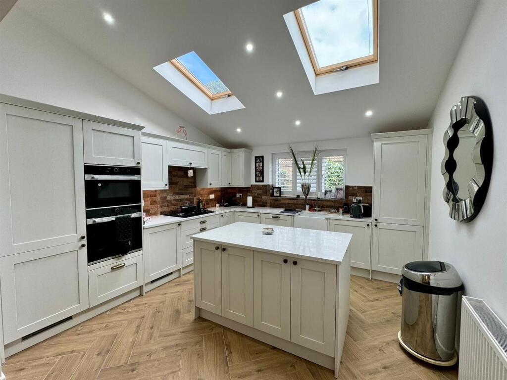
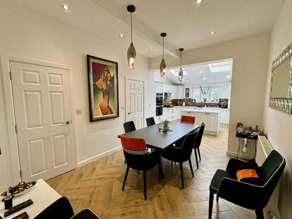
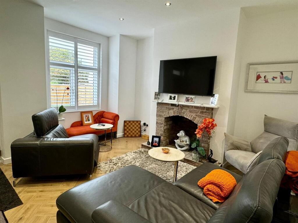
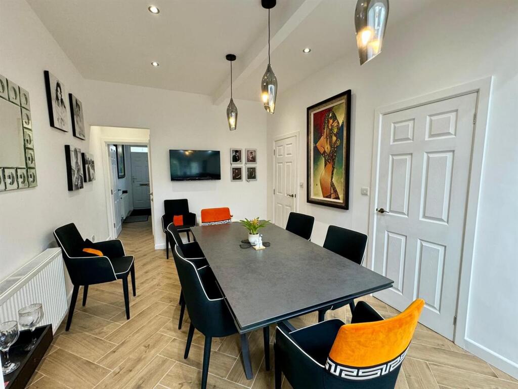
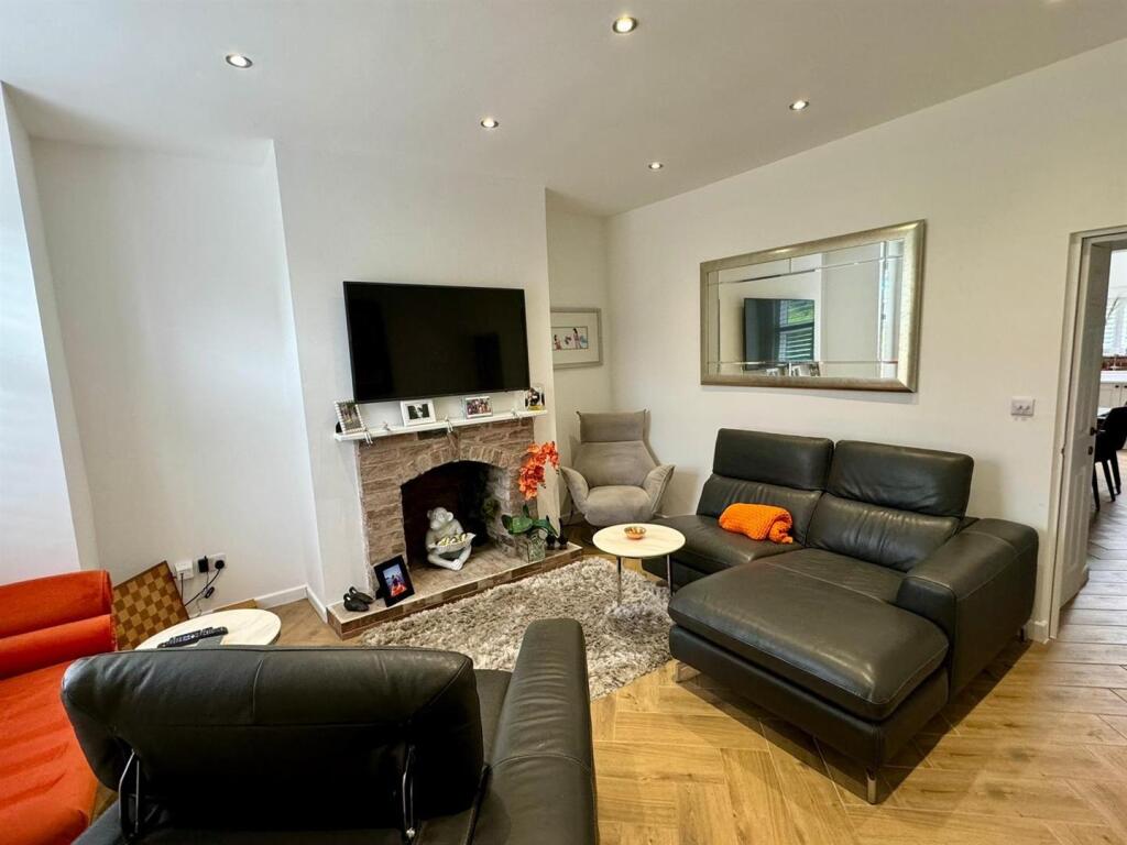
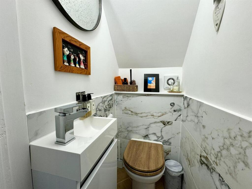
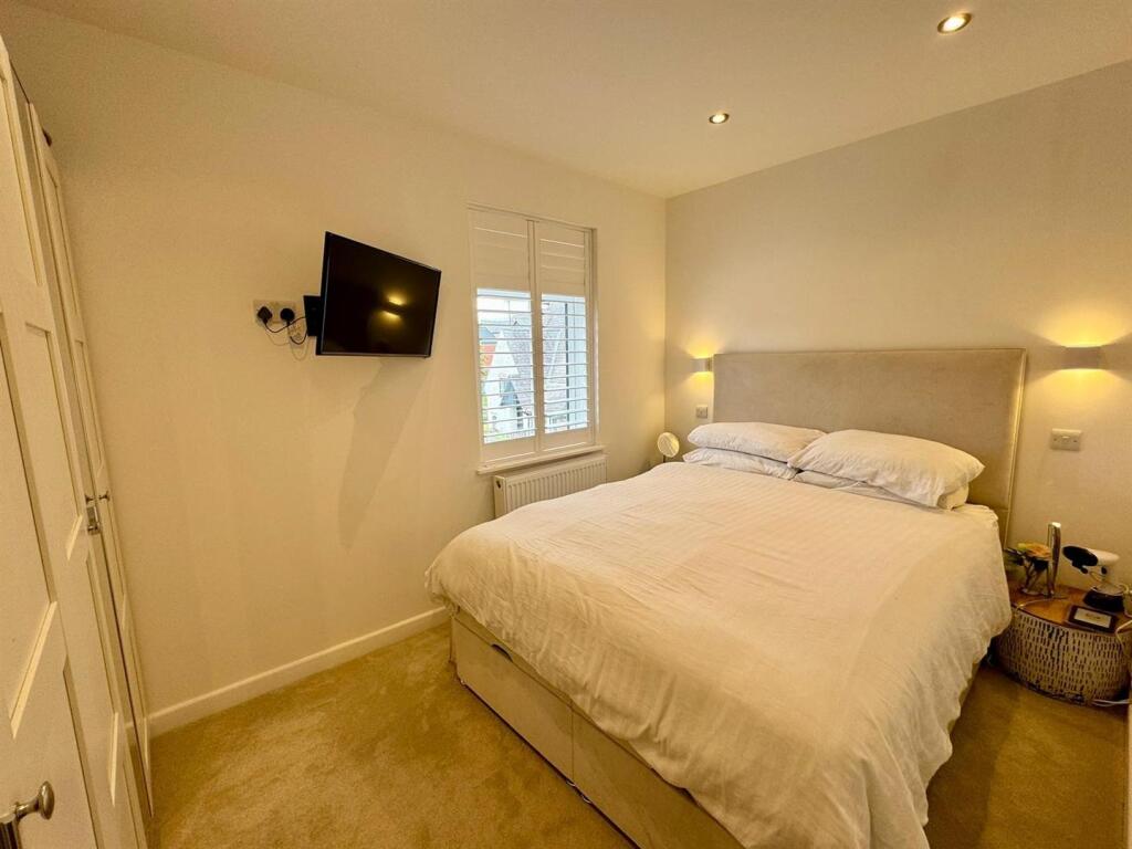
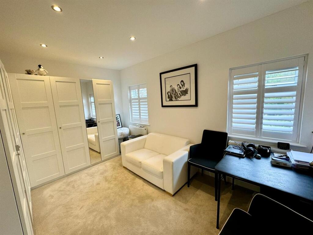
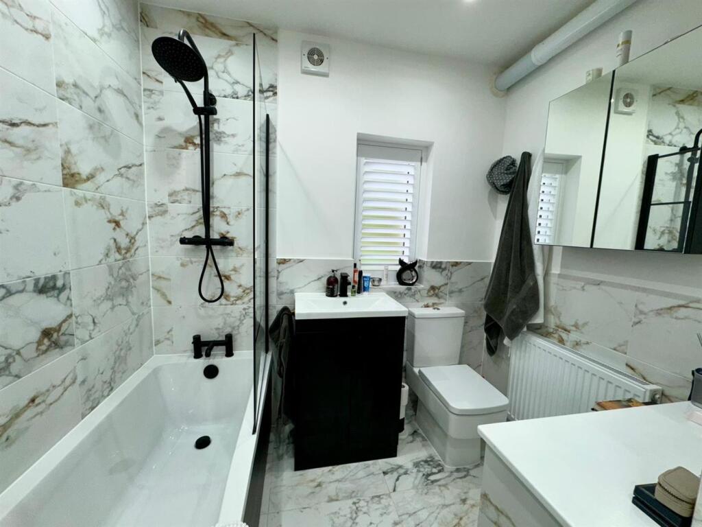
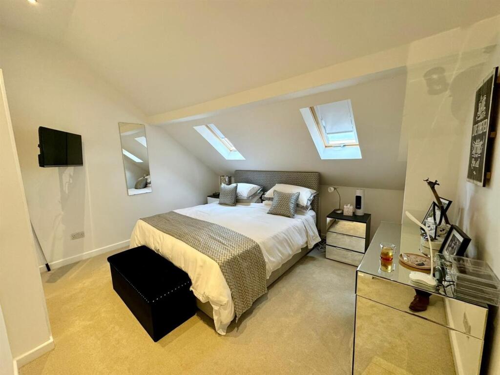
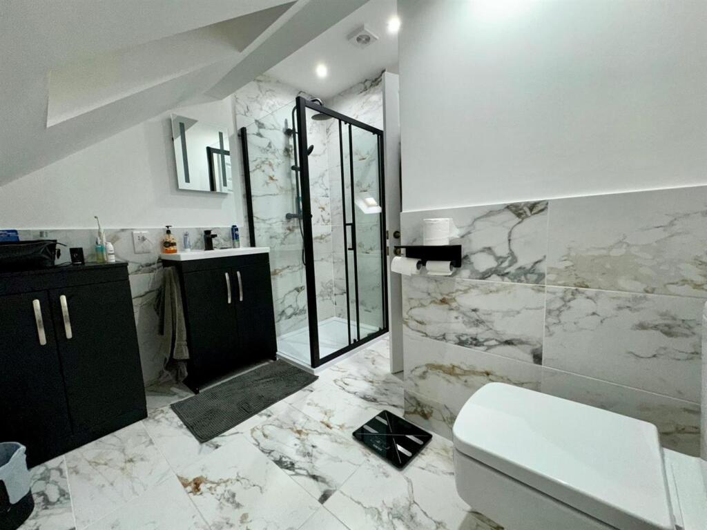
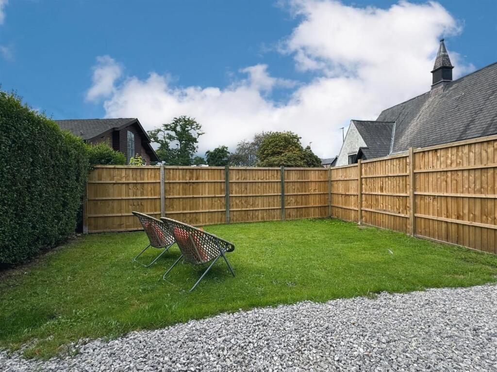
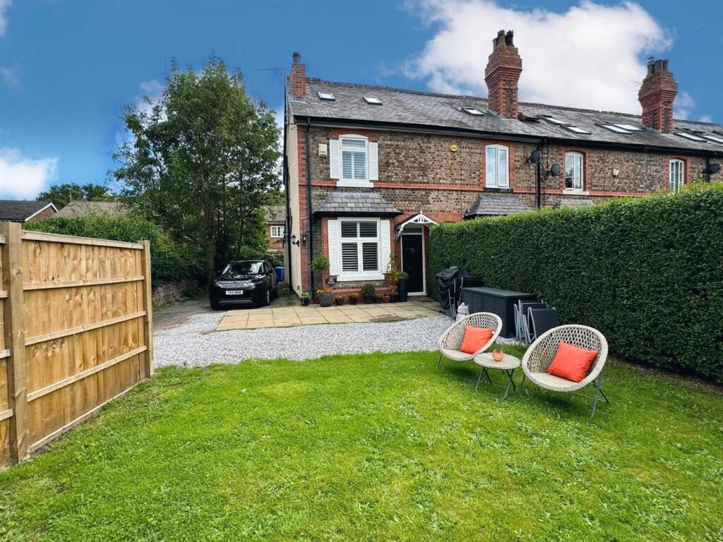
Photo 1 Photo 2 Photo 3 Photo 4 Photo 5 Photo 6 Photo 7 Photo 8 Photo 9 Photo 10 Photo 11 Photo 12 Photo 13
/ 13
Property details
Tenure
LEASEHOLD
Floor area
111 m²
Council tax band
D
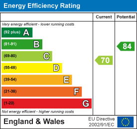
EPC rating
C
Year built
England and Wales: 1900-1929
Last sold
£190,000 Jun 2004
Price per m²
£4,955/m²
Local average
£527,777 (+4.2%)
Deprivation
Decile 10 (32,201 of 33,755)
Street crime
2 incidents within 1 mile (Mar 2026)
Key features
- Beautifully presented end of terrace home
- Spacious and versatile accommodation approaching 1,200 sq ft
- Open plan kitchen dining space
- Principal bedroom with ensuite
- Off road parking
- Private garden
- Walking distance to Hale Barns shops
- Catchment to the areas finest schools
- No Onward Chain
Additional details
- Electricity
- Mains supply
- Water
- Mains supply
- Sewerage
- Mains supply
- Heating
- Gas central
- Parking
- Driveway
- Garden
- Yes
- Restrictions
- Yes
- Flooded in last 5 years
- No
- Flood defences
- No
Description
Thoughtfully renovated by the current owner, the home has been carefully improved to create a distinctive and welcoming space that makes the most of natural light and its versatile layout. The ground floor comprises a living room, downstairs WC and an impressive open-plan kitchen and dining space, forming the true heart of the home.
To the first floor are two well-proportioned double bedrooms and a family bathroom. The second floor provides a superb principal bedroom suite with en-suite shower room and useful eaves storage, completing the accommodation.
Externally, the property enjoys a private garden and is only one of two homes within the terrace to benefit from off-road parking, a rare and valuable feature.
Positioned at the end of the attractive and well-known terrace known as Knutsford View, the property enjoys a peaceful, leafy setting tucked away just off Hale Road. This charming backwater provides a real sense of privacy while remaining within easy reach of local shops, amenities and the villages of Hale and Altrincham.
Directions - WA15 8SU
Note - N.B. The appliances at this property have not been tested by ourselves.
Approved by the vendor and prepared with care, these details are believed to be accurate. However, in line with Property Misdescription legislation, buyers should make their own enquiries, view the property, and confirm all information independently.
Listed by
Hale
Sheppard & Co Estate Agents Ltd
Reference: 173089925
EPC Rating & Upgrade Cost
Current rating: C
Potential rating: B
Inspection date: 09/09/2024
Current heating cost: £1,176/year
Potential heating cost: £951/year
Est. upgrade cost to C: £18,500
Recommendations
- 50 mm internal or external wall insulation (£4,000 - £14,000)
- Solar water heating (£4,000 - £6,000)
- Solar photovoltaic panels, 2.5 kWp (£3,500 - £5,500)
Flood risk
Zone: 1
Risk: Low
Job (default Low)
Floorplans
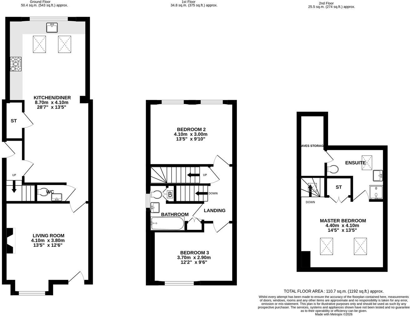
1 Knutsford View.jpg
EPC Graphs
EE Rating
Price history
12% since 2003
| Event | Date | Price | % change |
|---|---|---|---|
| Sold | 21/06/2004 (21 years ago) | £190,000 | +11.8% |
| Sold | 17/06/2003 (22 years ago) | £170,000 | — |
Source: HM Land Registry Price Paid Data. Crown copyright.
Sold Comparables
Same street and nearby sales within 0.25 miles (last 5 years). Data from Land Registry Price Paid.
| Address | Price | Date | Type |
|---|---|---|---|
| 345 HALE ROAD, HALE BARNS, ALTRINCHAM, TRAFFORD, GREATER MANCHESTER, WA15 8SX | £289,000 | 19/09/2025 | Terraced |
| 8 TITHEBARN ROAD, HALE BARNS, ALTRINCHAM, TRAFFORD, GREATER MANCHESTER, WA15 0HW | £755,000 | 03/10/2023 | Terraced |
| 364 HALE ROAD, HALE BARNS, ALTRINCHAM, TRAFFORD, GREATER MANCHESTER, WA15 8SY | £582,500 | 09/12/2022 | Terraced |
| 355 HALE ROAD, HALE BARNS, ALTRINCHAM, TRAFFORD, GREATER MANCHESTER, WA15 8SX | £257,500 | 31/08/2022 | Terraced |
| Same street 9 KNUTSFORD VIEW, HALE BARNS, ALTRINCHAM, TRAFFORD, GREATER MANCHESTER, WA15 8SU | £393,600 | 04/07/2022 | Terraced |
| 8 TITHEBARN ROAD, HALE BARNS, ALTRINCHAM, TRAFFORD, GREATER MANCHESTER, WA15 0HW | £428,500 | 14/12/2021 | Terraced |
Street average: £393,600 (1 sale)
Area average: £462,500 (5 sales)
Capital growth trend
Land Registry outcode average: last 12 months vs 5y and 10y ago (from sold prices).
House Price Index (HM Land Registry — official index, not sold-price averages): Trafford. Series: Terraced. As of February 2026.
Rental Range
Estimated market rent for Trafford. Low = conservative, Realistic = average, Optimistic = best case.
Based on Local Authority from postcode lookup → Trafford.
LHA (30th percentile) floor for North Cumbria: £588/mo (Apr 2025 – Mar 2026)
Location
Nearby
Nearest stations, universities and amenities (distance from property).
| Type | Name | Distance |
|---|---|---|
| Shop | Majestic | 0.0 miles |
| Shop | Roots | 0.1 miles |
| Bus stop | Hale Barns, Hale Road / outside All Saints Church | 0.1 miles |
| Bus stop | Hale Barns, Hale Road / opposite All Saints Church | 0.1 miles |
| Hospital | The Priory Hospital Altrincham | 0.6 miles |
| Train station | Ashley | 1.5 miles |
| Hospital | Wythenshawe Hospital | 1.6 miles |
| Train station | Hale | 1.6 miles |
| University | University Academy 92 | 6.3 miles |
| University | Fallowfield Reception and Richmond Amenities Building | 6.6 miles |
Street-level crime
| Category | Count |
|---|---|
| Anti-social behaviour | 1 |
| Public order | 1 |
| Total incidents | 2 |
Within 1 mile during Mar 2026. Source: data.police.uk (England & Wales).
Schools nearby
Nearest open schools with Ofsted ratings (England). Closed schools are not shown. Data from Get Information about Schools and Ofsted.
| Name | Type | Distance | Ofsted |
|---|---|---|---|
| Elmridge Primary School | Primary | 0.2 miles | Good — 18 Jan 2024 |
| St Ambrose Prep School | Other | 0.2 miles | — (No rating) |
| Saint Ambrose College | Secondary | 0.3 miles | Good — 16 Mar 2020 |
| Well Green Primary School | Primary | 0.5 miles | Good — 9 Dec 2021 |
| Altrincham College | Secondary | 1.1 miles | Good — 6 Jul 2022 |
Rental Comparables
Residential lets from OpenRent and Rightmove for the area (same bedroom count). Use to validate rent estimates. Student lets are excluded.
| Title | Rent | Beds | Distance | As seen on |
|---|---|---|---|---|
| 3 Bed End Terrace, Crowland Road, M23 | £1,275/mo | 3 | 1.22 miles | OpenRent |
Average rent: £1,275/mo (1 listing)
Rent-driven metrics
Based on OpenRent comparables.
- Rent ratio — Monthly rent ÷ purchase price (1% rule). 1%+ = strong, 0.8–1% = okay, <0.8% = weak for cashflow.
- Max investor price — Rent ÷ 0.8%; the price at which rent would be 0.8% of price (Stoke-style target).
- Target investor price — Rent ÷ 1%; the price at which rent would be 1% of price (strong cashflow band).
- Gross yield — Annual rent as % of purchase price (no costs).
- Cost-to-rent — Price ÷ annual rent (from OpenRent comparables). Under 14× = strong, 14–16× = acceptable, 17×+ = compressed.
- Cashflow — Rent minus mortgage, 10% maintenance, £25/mo compliance. Assumes 75% LTV, 3.95% APR (5yr fixed), 25yr term.
- ROI — Annual profit ÷ cash in (deposit + 4% purchase costs).