162A
WELLINGTON HILL WEST, BRISTOL, CITY OF BRISTOL BS9 4QP
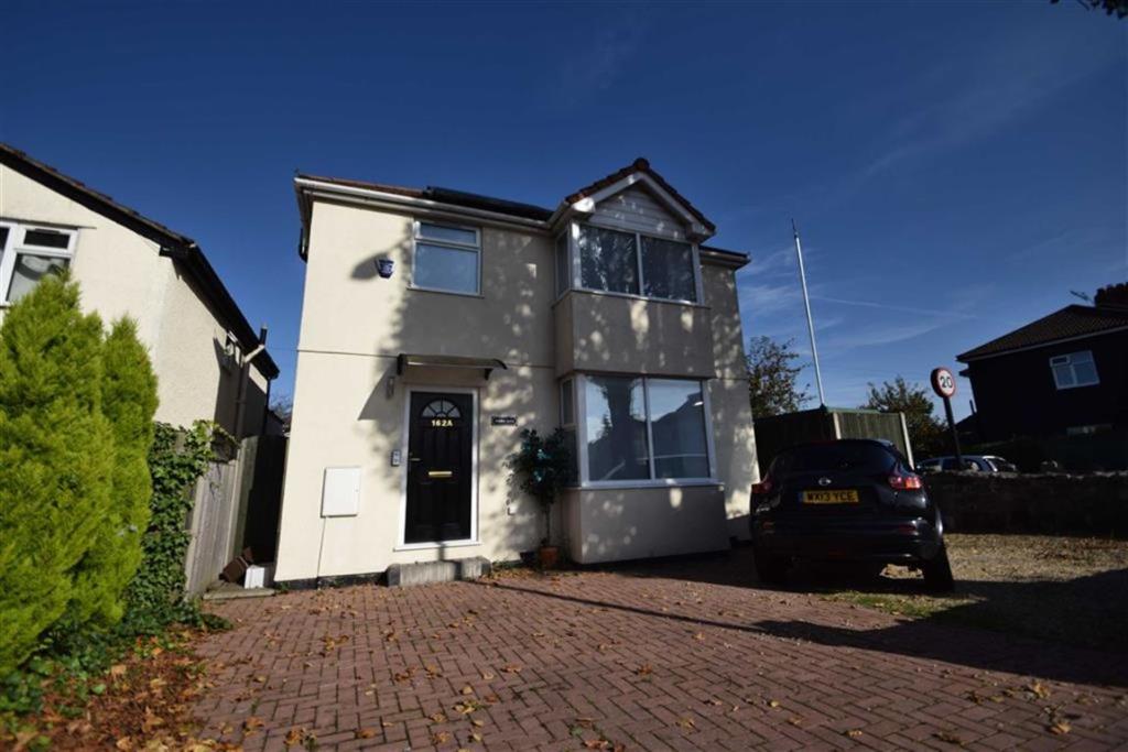
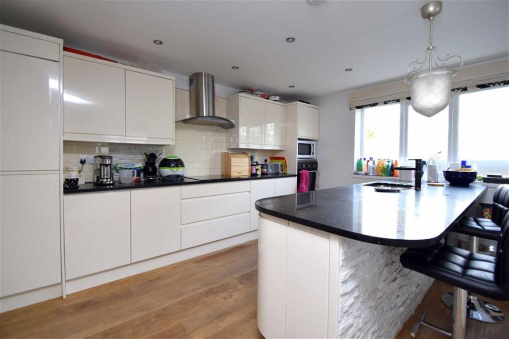
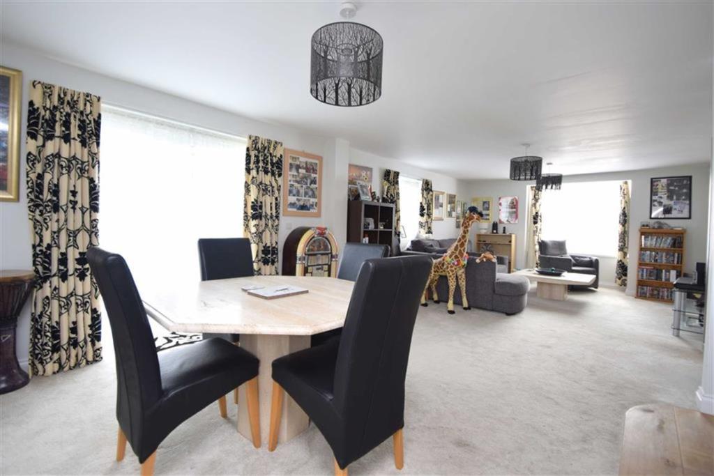
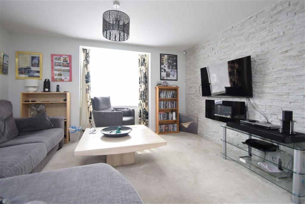
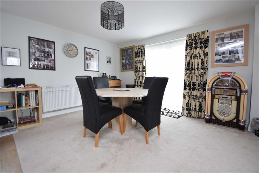
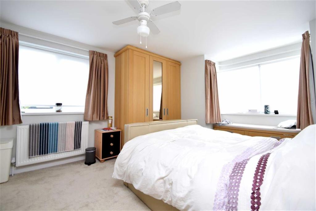
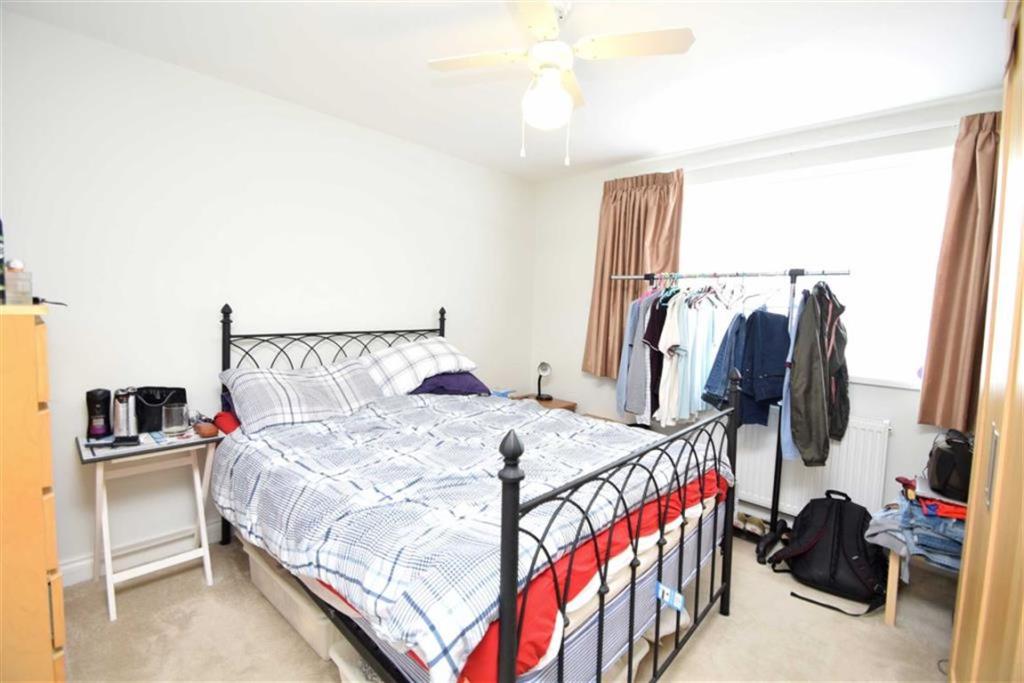
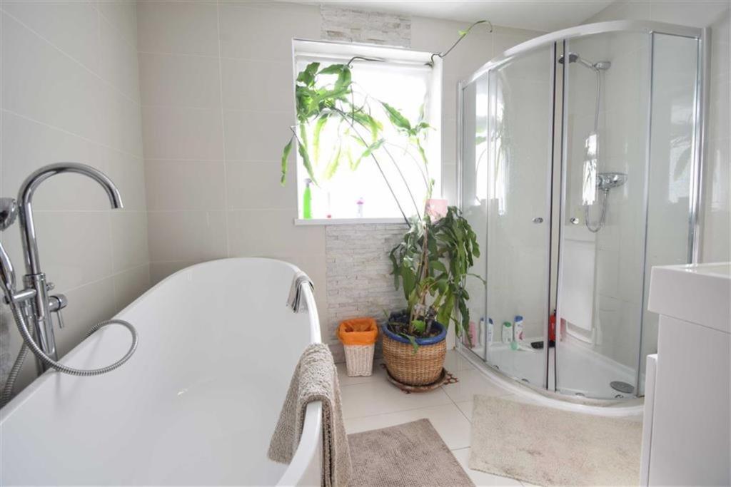
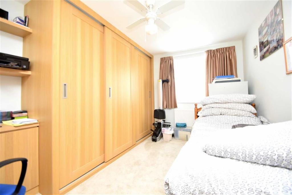

Photo 1 Photo 2 Photo 3 Photo 4 Photo 5 Photo 6 Photo 7 Photo 8 Photo 9 Photo 10 Photo 11
/ 11
Property details
Floor area
116 m²
EPC rating
B
Year built
England and Wales: 2007-2011
Last sold
£324,000 Jul 2014
Price per m²
£4,310/m²
Local average
£1,158,405 (-56.8%)
Deprivation
Decile 8 (25,013 of 33,755)
Street crime
402 incidents within 1 mile (Apr 2026)
Key features
- Detached home
- 3 double bedrooms
- light and spacious lounge
- kitchen / diner
- family bathroom plus WC
- off road parking
- no chain
- energy rating - B
Additional details
- Parking
- Yes
- Garden
- Yes
Description
To the first floor there is a master bedroom with en-suite, two double bedrooms and a family bathroom with four piece suite. The property has a courtyard garden which is fully decked, paved driveway to the front providing off street parking for two vehicles. An early internal viewings comes highly recommended.
You may download, store and use the material for your own personal use and research. You may not republish, retransmit, redistribute or otherwise make the material available to any party or make the same available on any website, online service or bulletin board of your own or of any other party or make the same available in hard copy or in any other media without the website owner's express prior written consent. The website owner's copyright must remain on all reproductions of material taken from this website.
Listed by
Westbury on Trym
Ocean
Reference: 57209595
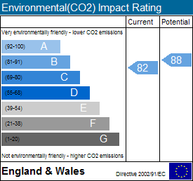
EPC Rating & Upgrade Cost
Current rating: B
Potential rating: B
Inspection date: 18/09/2013
Expiry date: 17/09/2023 (expired)
Est. upgrade cost to C: £16,500
Recommendations
- Solar water heating (£4,000 - £6,000)
- Solar photovoltaic panels, 2.5 kWp (£9,000 - £14,000)
Flood risk
Zone: 1
Risk: Low
Job (default Low)
Floorplans
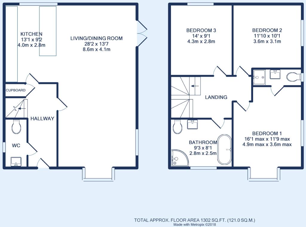
Floorplan 1
EPC Graphs
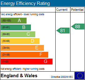
EPC 1
EPC 2
Price history
| Event | Date | Price | % change |
|---|---|---|---|
| Sold | 18/07/2014 (11 years ago) | £324,000 | — |
Source: HM Land Registry Price Paid Data. Crown copyright.
Sold Comparables
Same street and nearby sales within 0.25 miles (last 5 years). Data from Land Registry Price Paid.
| Address | Price | Date | Type |
|---|---|---|---|
| Same street ROOKWOOD, 164B WELLINGTON HILL WEST, BRISTOL, CITY OF BRISTOL, BS9 4QP | £575,000 | 23/05/2023 | Detached |
| Same street 162 WELLINGTON HILL WEST, BRISTOL, CITY OF BRISTOL, BS9 4QP | £540,000 | 12/01/2023 | Detached |
| 93 HILL VIEW, HENLEAZE, BRISTOL, CITY OF BRISTOL, BS9 4QQ | £551,500 | 30/09/2021 | Detached |
| 34 BIBURY CRESCENT, WESTBURY ON TRYM, BRISTOL, CITY OF BRISTOL, BS9 4PW | £615,000 | 16/06/2021 | Detached |
Street average: £557,500 (2 sales)
Area average: £583,250 (2 sales)
Capital growth trend
Land Registry outcode average: last 12 months vs 5y and 10y ago (from sold prices).
House Price Index (HM Land Registry — official index, not sold-price averages): City of Bristol. Series: Detached. As of March 2026.
Rental Range
Estimated market rent for Bristol, City of. Low = conservative, Realistic = average, Optimistic = best case.
Based on Local Authority from postcode lookup → Bristol, City of.
LHA (30th percentile) floor for Bristol: £1,296/mo (Apr 2025 – Mar 2026)
Location
Nearby
Nearest stations, universities and amenities (distance from property).
| Type | Name | Distance |
|---|---|---|
| Bus stop | Cherington Road | 0.0 miles |
| Shop | M&S Food | 0.4 miles |
| Shop | Unknown | 0.5 miles |
| Train station | Ashley Down | 1.4 miles |
| Hospital | Spire Bristol | 1.5 miles |
| Train station | Redland | 1.7 miles |
| Hospital | South West Regional Laboratories | 2.3 miles |
| University | School of Architecture and Environment | 2.3 miles |
| University | 5 Priory Road, Life Sciences | 2.3 miles |
Street-level crime
| Category | Count |
|---|---|
| Violence and sexual offences | 125 |
| Shoplifting | 70 |
| Anti-social behaviour | 39 |
| Vehicle crime | 36 |
| Public order | 31 |
| Other theft | 25 |
| Criminal damage and arson | 24 |
| Burglary | 14 |
| Other crime | 13 |
| Drugs | 9 |
| Robbery | 8 |
| Bicycle theft | 4 |
| Possession of weapons | 4 |
| Total incidents | 402 |
Within 1 mile during Apr 2026. Source: data.police.uk (England & Wales).
Schools nearby
Nearest open schools with Ofsted ratings (England). Closed schools are not shown. Data from Get Information about Schools and Ofsted.
| Name | Type | Distance | Ofsted |
|---|---|---|---|
| Horfield Church of England Primary School | Primary | 0.2 miles | Requires improvement — 22 May 2024 |
| Claremont School | Other | 0.6 miles | Good — 20 Mar 2013 |
| Badocks Wood E-ACT Academy | Primary | 0.6 miles | Good — 22 Jan 2023 |
| Henleaze Junior School | Primary | 0.6 miles | Requires improvement — 25 Jul 2024 |
| Henleaze Infant School | Primary | 0.6 miles | Good — 13 Nov 2022 |
Rental Comparables
Rental listings exist nearby, but none matched the 3-bedroom count for this property.
Rent-driven metrics
Based on Area rent estimate.
- Rent ratio — Monthly rent ÷ purchase price (1% rule). 1%+ = strong, 0.8–1% = okay, <0.8% = weak for cashflow.
- Max investor price — Rent ÷ 0.8%; the price at which rent would be 0.8% of price (Stoke-style target).
- Target investor price — Rent ÷ 1%; the price at which rent would be 1% of price (strong cashflow band).
- Gross yield — Annual rent as % of purchase price (no costs).