2 ROWLEY BANK GARDENS
STAFFORD, STAFFORDSHIRE ST17 9SJ
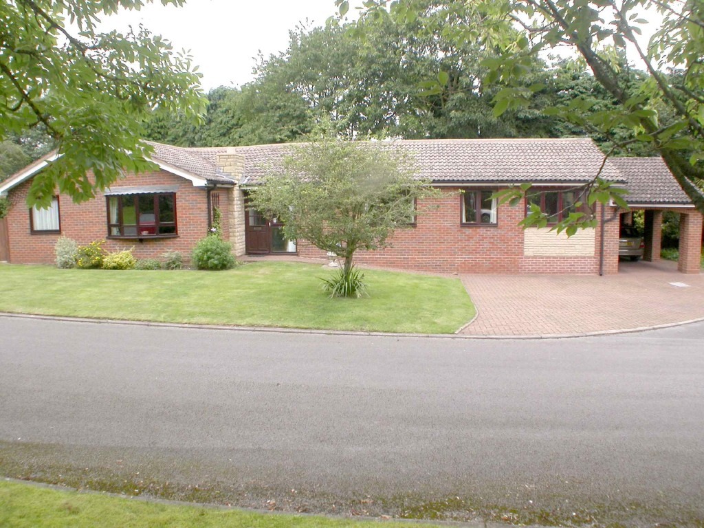
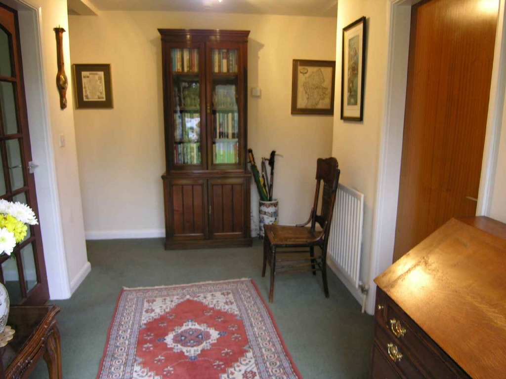
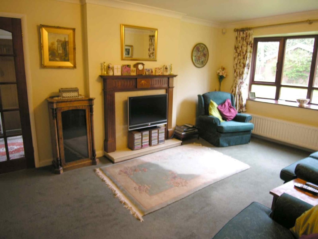
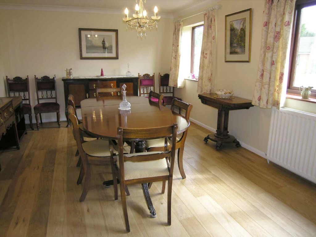
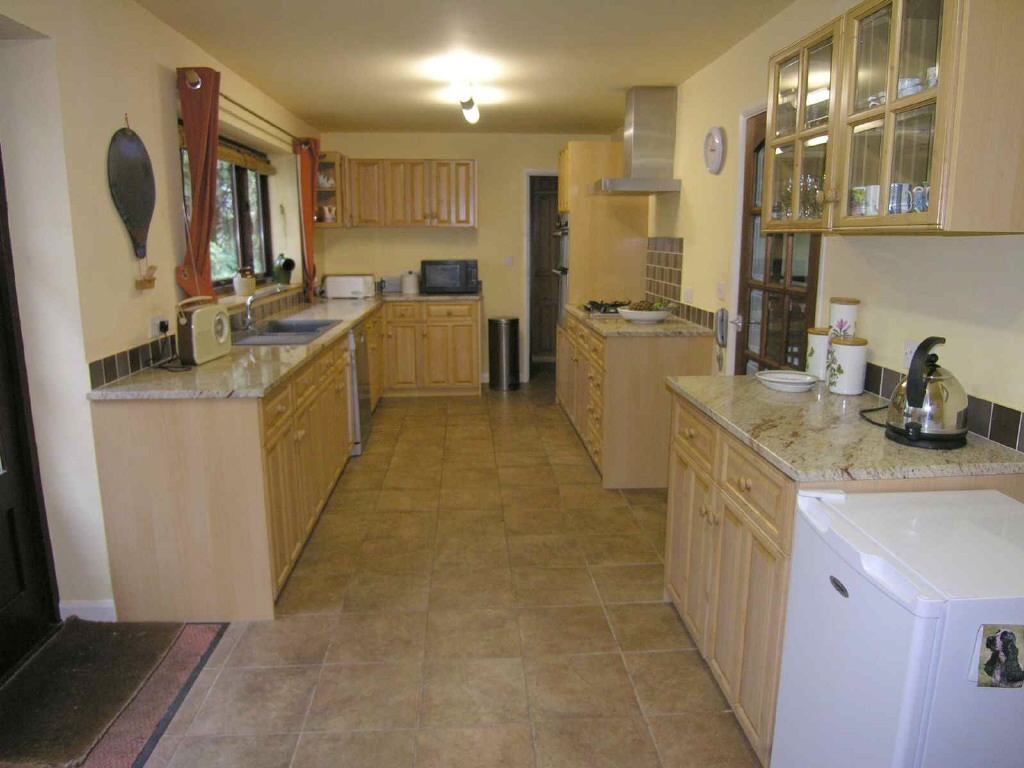
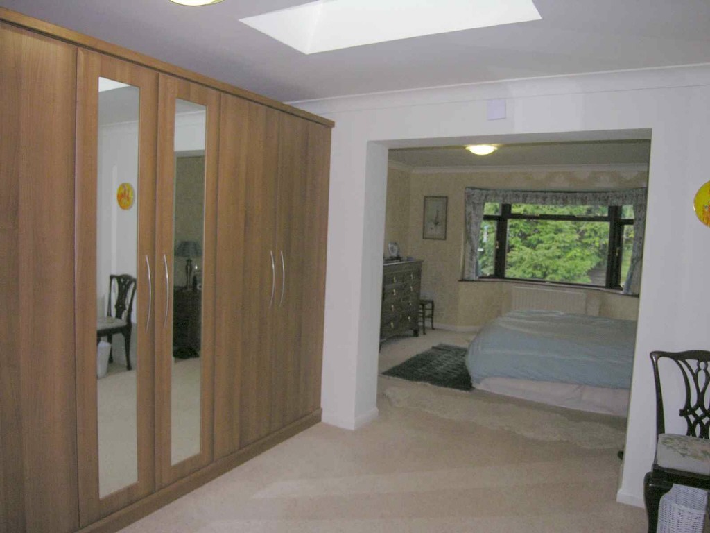
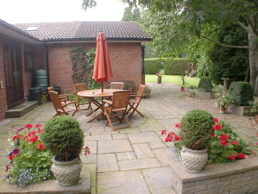
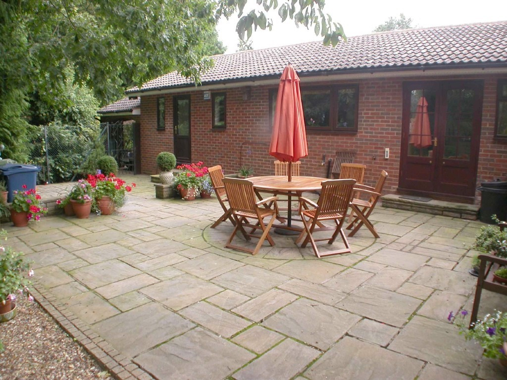
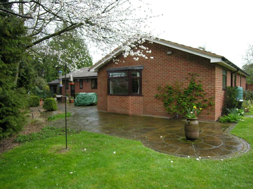
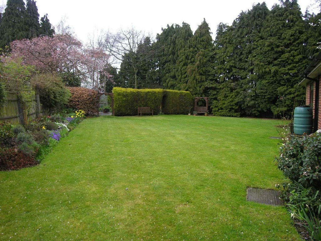
Photo 1 Photo 2 Photo 3 Photo 4 Photo 5 Photo 6 Photo 7 Photo 8 Photo 9 Photo 10
/ 10
Property details
Floor area
107 m²
Last sold
£450,000 Jan 2026
Local average
£409,104 (-12%)
Deprivation
Decile 10 (30,975 of 33,755)
Street crime
365 incidents within 1 mile (Apr 2026)
Additional details
- Parking
- Yes
- Garden
- Yes
Description
Room Dimensions
IMPRESSIVE ENTRANCE HALLWAY
GUESTS' WC
GOOD SIZE LOUNGE 17' X 12'2
SPLENDID DINING ROOM 18'2 X 12'
LARGE BREAKFAST KITCHEN 24' X 8'8
UTILITY ROOM 8'9 X 5'3
FOURTH BEDROOM/STUDY 14'3 plus recess X 7'10
STORE ROOM 6'8 X 4'
MASTER BEDROOM SUITE Comprising: -
DRESSING AREA 11'7 X 10'10 incl. wardrobes
BEDROOM AREA 13'6 incl. bay X 12'9
BATH/SHOWER ROOM 11'9 X 8'
BEDROOM TWO 11'6 X 10'1
BEDROOM THREE 13'6 X 8'6
SHOWER ROOM 6'3 X 5'5
OUTSIDE
FRONT GARDEN
CARPORT
LARGE AND WELL ESTABLISHED REAR GARDEN
Listed by
Stafford
Nicolsons The Estate Agents
Reference: 41443046
EPC Rating & Upgrade Cost
Fetching EPC data… Refresh this page in a moment.
Flood risk
Zone: 1
Risk: Low
Job (default Low)
Floorplans
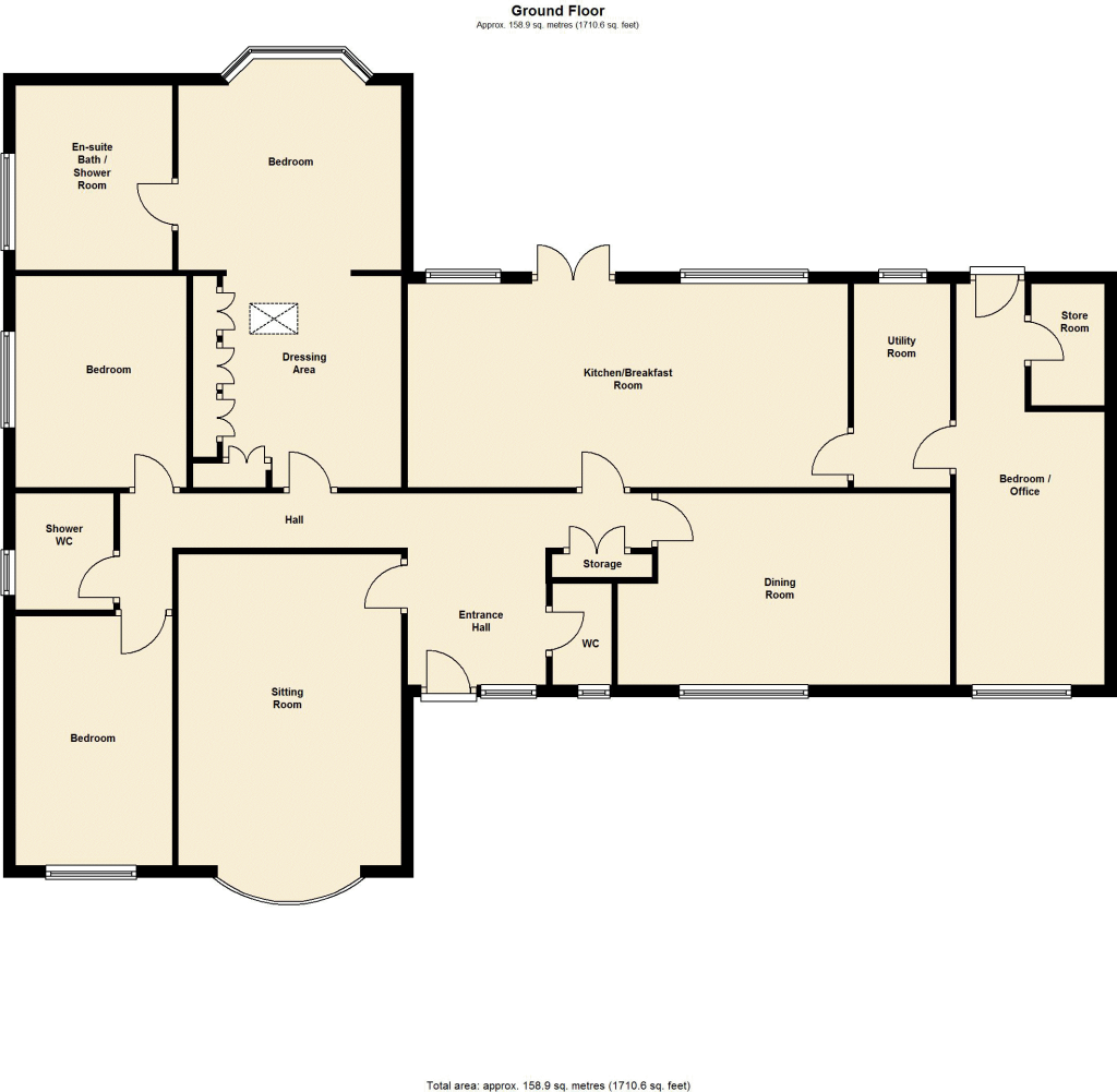
Floorplan 1
Price history
41% since 2006
| Event | Date | Price | % change |
|---|---|---|---|
| Sold | 30/01/2026 (4 months ago) | £450,000 | +26.8% |
| Sold | 12/09/2013 (12 years ago) | £355,000 | +10.9% |
| Sold | 01/06/2006 (20 years ago) | £320,000 | — |
Source: HM Land Registry Price Paid Data. Crown copyright.
Sold Comparables
Same street and nearby sales within 0.25 miles (last 5 years). Data from Land Registry Price Paid.
| Address | Price | Date | Type |
|---|---|---|---|
| 4 ROWLEY BANK GARDENS, STAFFORD, STAFFORDSHIRE, ST17 9SJ | £335,000 | 10/01/2025 | Detached |
| 8 RISING BROOK, STAFFORD, STAFFORDSHIRE, ST17 9DA | £335,000 | 30/11/2023 | Detached |
| 30 KINGSLEY ROAD, STAFFORD, STAFFORDSHIRE, ST17 9BS | £360,000 | 15/09/2023 | Detached |
| 1 CRESCENT ROAD, STAFFORD, STAFFORDSHIRE, ST17 9AW | £573,000 | 22/02/2023 | Detached |
| 19 ST JOHNS ROAD, STAFFORD, STAFFORDSHIRE, ST17 9AS | £820,000 | 03/11/2022 | Detached |
| ACREMEAD, 9 ST JOHNS ROAD, STAFFORD, STAFFORDSHIRE, ST17 9AS | £981,000 | 29/09/2022 | Detached |
| 52 CRESCENT ROAD, STAFFORD, STAFFORDSHIRE, ST17 9AW | £535,000 | 12/07/2022 | Detached |
| 25 SHERWOOD AVENUE, STAFFORD, STAFFORDSHIRE, ST17 9BX | £280,000 | 23/06/2022 | Detached |
| 8 SHERWOOD AVENUE, STAFFORD, STAFFORDSHIRE, ST17 9BX | £334,000 | 10/12/2021 | Detached |
| 25 SHERWOOD AVENUE, STAFFORD, STAFFORDSHIRE, ST17 9BX | £170,000 | 23/07/2021 | Detached |
| 48 ST JOHNS ROAD, STAFFORD, STAFFORDSHIRE, ST17 9AP | £495,000 | 29/06/2021 | Detached |
| 29 ST JOHNS ROAD, STAFFORD, STAFFORDSHIRE, ST17 9AP | £900,000 | 18/06/2021 | Detached |
Area average: £509,833 (12 sales)
Capital growth trend
Land Registry outcode average: last 12 months vs 5y and 10y ago (from sold prices).
House Price Index (HM Land Registry — official index, not sold-price averages): Stafford. Series: Detached. As of March 2026.
Rental Range
Estimated market rent for Stafford. Low = conservative, Realistic = average, Optimistic = best case.
Based on Local Authority from postcode lookup → Stafford.
LHA (30th percentile) floor for Mid Staffs: £992/mo (Apr 2025 – Mar 2026)
Location
Nearby
Nearest stations, universities and amenities (distance from property).
| Type | Name | Distance |
|---|---|---|
| Bus stop | Rowley Grove | 0.1 miles |
| Shop | Spartan Auto Parts | 0.3 miles |
| Shop | Unknown | 0.3 miles |
| Hospital | Rowley Hall Hospital | 0.4 miles |
| Train station | Stafford | 0.7 miles |
| Hospital | St George's Hospital | 1.1 miles |
| University | Staffordshire University Blackheath Lane Site | 2.2 miles |
| Train station | Penkridge | 4.9 miles |
Street-level crime
| Category | Count |
|---|---|
| Violence and sexual offences | 135 |
| Anti-social behaviour | 72 |
| Criminal damage and arson | 40 |
| Public order | 32 |
| Shoplifting | 31 |
| Other theft | 16 |
| Other crime | 10 |
| Drugs | 8 |
| Vehicle crime | 6 |
| Robbery | 5 |
| Burglary | 4 |
| Possession of weapons | 3 |
| Bicycle theft | 2 |
| Theft from the person | 1 |
| Total incidents | 365 |
Within 1 mile during Apr 2026. Source: data.police.uk (England & Wales).
Schools nearby
Nearest open schools with Ofsted ratings (England). Closed schools are not shown. Data from Get Information about Schools and Ofsted.
| Name | Type | Distance | Ofsted |
|---|---|---|---|
| Flash Ley Primary School | Primary | 0.4 miles | Good — 16 Jul 2023 |
| Rowley Park Primary Academy | Primary | 0.4 miles | Good — 26 May 2017 |
| St Paul's CofE (C) Primary School | Primary | 0.4 miles | Outstanding — 26 Jun 2018 |
| Blessed William Howard Catholic School | Secondary | 0.5 miles | Good — 6 Nov 2012 |
| St Austin's Catholic Primary School and Nursery | Primary | 0.5 miles | Good — 5 Dec 2011 |
Rental Comparables
Residential lets from OpenRent and Rightmove for the area (same bedroom count). Use to validate rent estimates. Student lets are excluded.
| Title | Rent | Beds | Distance | As seen on |
|---|---|---|---|---|
| 4 Bed Terraced House, Meyrick Road, ST17 | £2,800/mo | 4 | 0.32 miles | OpenRent |
Average rent: £2,800/mo (1 listing)
Rent-driven metrics
Based on OpenRent comparables.
- Rent ratio — Monthly rent ÷ purchase price (1% rule). 1%+ = strong, 0.8–1% = okay, <0.8% = weak for cashflow.
- Max investor price — Rent ÷ 0.8%; the price at which rent would be 0.8% of price (Stoke-style target).
- Target investor price — Rent ÷ 1%; the price at which rent would be 1% of price (strong cashflow band).
- Gross yield — Annual rent as % of purchase price (no costs).
- Cost-to-rent — Price ÷ annual rent (from OpenRent comparables). Under 14× = strong, 14–16× = acceptable, 17×+ = compressed.
- Cashflow — Rent minus mortgage, 10% maintenance, £25/mo compliance. Assumes 75% LTV, 3.95% APR (5yr fixed), 25yr term.
- ROI — Annual profit ÷ cash in (deposit + 4% purchase costs).