Larch Place
Newcastle, ST5 7BD
£800 pcm
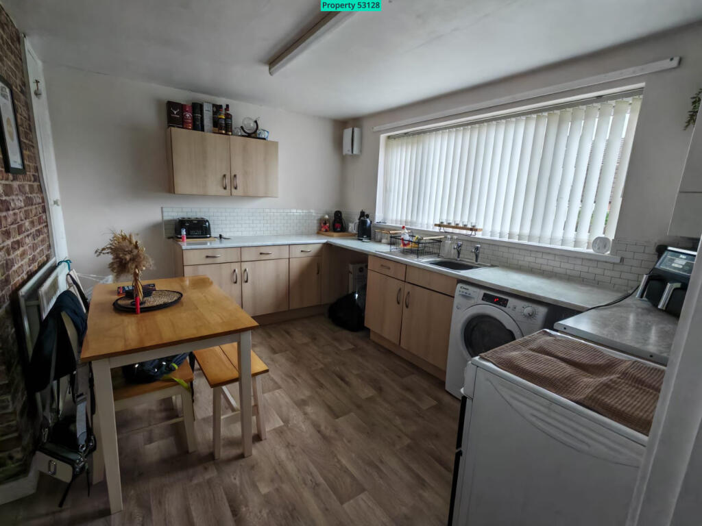
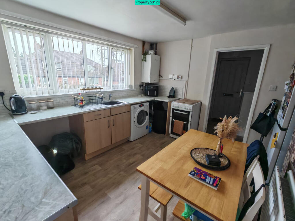
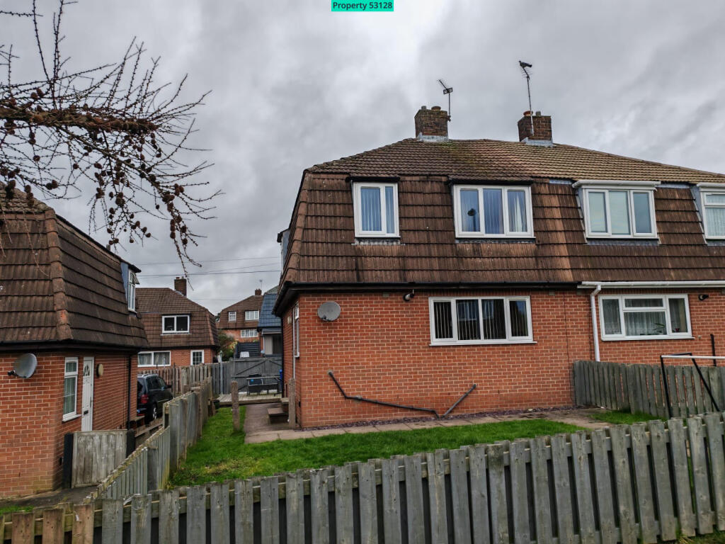
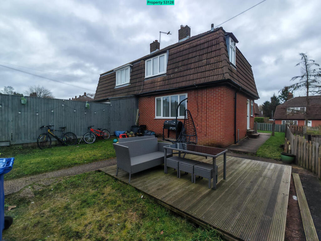
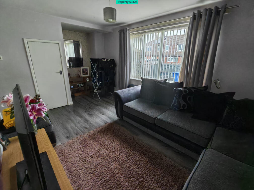
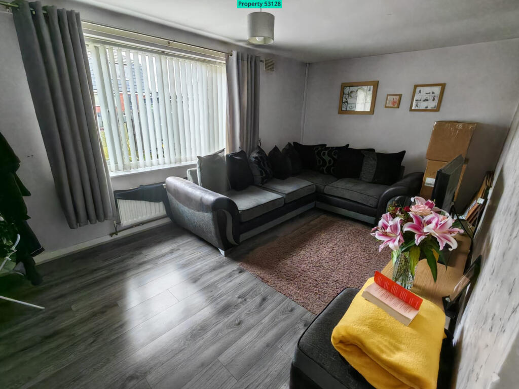
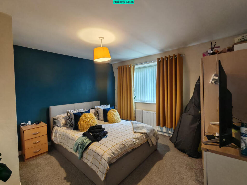
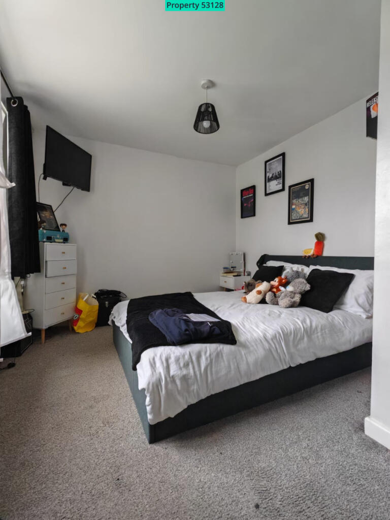
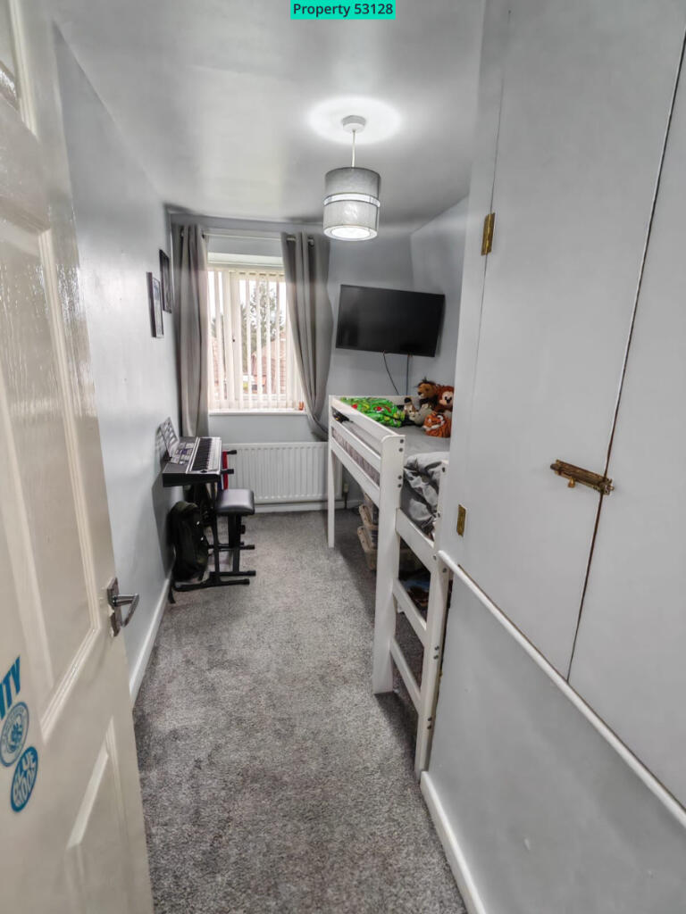
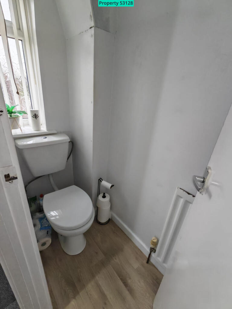
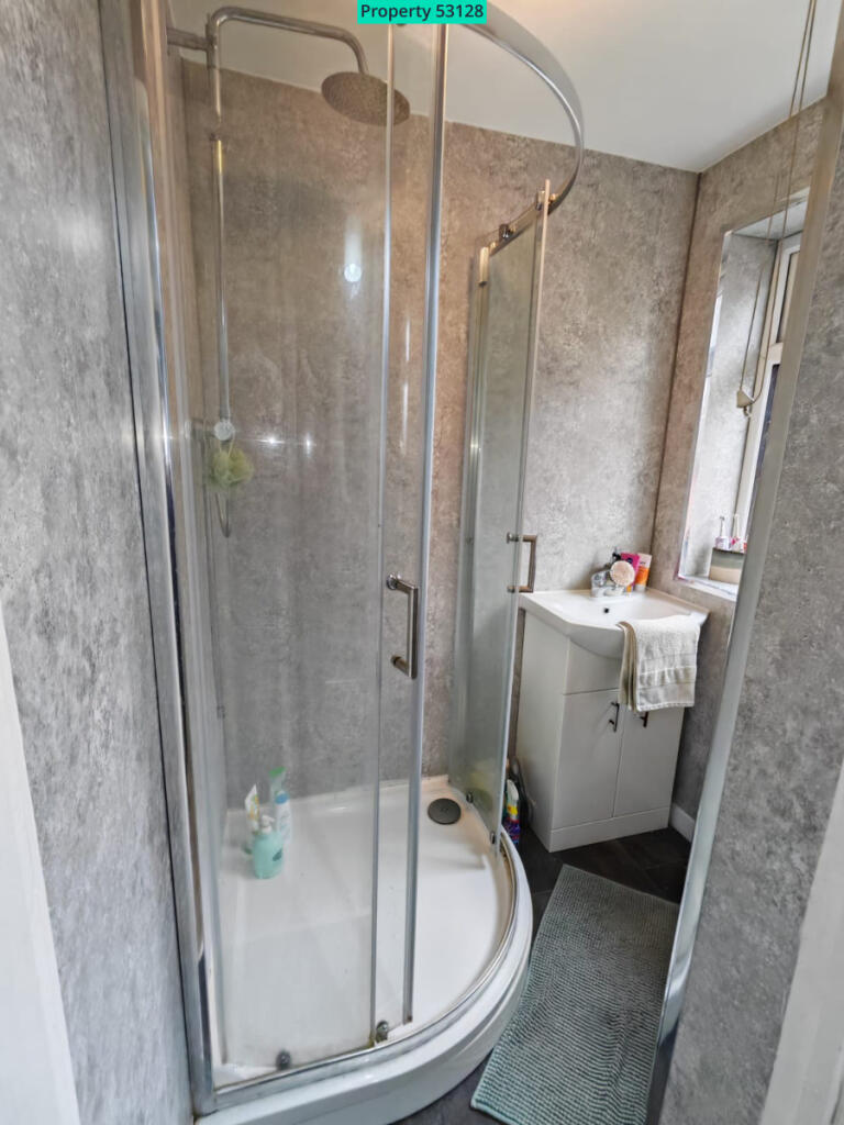
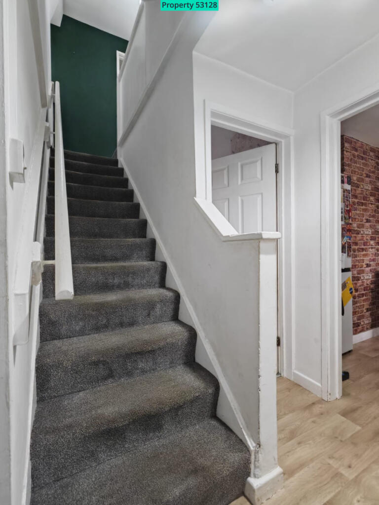
Photo 1 Photo 2 FRONT OF HOUSE REAR OF HOUSE LIVING ROOM LIVING ROOM BED 1 BED 2 BED 3 WC BATHROOM Photo 12
/ 12
Property details
Deprivation
Decile 2 (4,910 of 33,755)
Street crime
115 incidents within 1 mile (Mar 2026)
Key features
- Central heating
- Double glazed
- Garden
- Parking
Additional details
- Parking
- Yes
- Garden
- Yes
Description
• Spacious lounge
• Kitchen/diner
• Ground floor bathroom with corner shower
• Front garden laid to lawn
• Rear decked patio area
• Off-road parking to the rear (via double gates)
• Highly sought-after residential location
• Excellent access to Newcastle town centre and good bus routes
• Convenient for A34, A500 and M6
This attractive three-bedroom semi-detached home is ideally located within the popular residential area of Crackley, offering convenient access to local shops, schools and everyday amenities. The property is also perfectly positioned for commuters, with easy links to the A34, A500 and M6 road networks, as well as regular bus services into Newcastle town centre.
The accommodation briefly comprises a welcoming lounge, a fitted kitchen/diner providing ample space for family dining, and a ground floor bathroom featuring a corner shower enclosure.
To the first floor, there is a separate WC, two generously sized double bedrooms and a well-proportioned single bedroom, making the property ideal for families, couples or professional tenants requiring additional home office space.
Externally, the property benefits from a lawned front garden, while to the rear there is a decked patio area, ideal for outdoor seating and entertaining. Off-road parking for one vehicle is accessed via double gates to the rear.
We are a pet-friendly landlord, pets are considered subject to breed, size and quantity.
We credit-check prospective tenants, a guarantor may be required.
Listed by
Nationwide
Letmatch Ltd (t/a Visum)
Reference: 172993280
EPC ratings on this postcode
We don't have a matched EPC for this property yet. Below are efficiency scores and details for other addresses on this postcode.
| Address | Current | Potential | Floor area | Age band | Type |
|---|---|---|---|---|---|
| 1, Larch Place, NEWCASTLE | 65 | 81 | 77 m² | England and Wales: 1950-1966 | Detached |
| 10 Larch Place, NEWCASTLE | 72 | 87 | 73 m² | England and Wales: 1967-1975 | Detached |
| 10, Larch Place, NEWCASTLE | 49 | 82 | 74 m² | England and Wales: 1930-1949 | Detached |
| 11 Larch Place, NEWCASTLE | 66 | 80 | 73 m² | England and Wales: 1930-1949 | Detached |
| 11, Larch Place, NEWCASTLE | 65 | 81 | 73 m² | England and Wales: 1950-1966 | Detached |
| 12, Larch Place, NEWCASTLE | 63 | 84 | 105 m² | England and Wales: 1967-1975 | Detached |
| 13, Larch Place, NEWCASTLE | 60 | 85 | 73 m² | England and Wales: 1950-1966 | Detached |
| 13, Larch Place, NEWCASTLE | 68 | 86 | 72 m² | England and Wales: 1950-1966 | Detached |
| 14 Larch Place, NEWCASTLE | 67 | 80 | 73 m² | England and Wales: 1930-1949 | Detached |
| 15, Larch Place, NEWCASTLE | 69 | 85 | 72 m² | England and Wales: 1991-1995 | Detached |
| 2, Larch Place, NEWCASTLE | 50 | 81 | 73 m² | England and Wales: 1950-1966 | Detached |
| 3, Larch Place, NEWCASTLE | 64 | 84 | 76 m² | England and Wales: 1950-1966 | Detached |
| 3, Larch Place, NEWCASTLE | 62 | 78 | 72 m² | England and Wales: 1950-1966 | Detached |
| 4 Larch Place, NEWCASTLE | 66 | 80 | 73 m² | England and Wales: 1930-1949 | Detached |
| 6 Larch Place, NEWCASTLE | 73 | 87 | 73 m² | England and Wales: 1967-1975 | Detached |
Flood risk
Zone: 1
Risk: Low
Job (default Low)
EPC Graphs

EPC 1
Rental Range
Estimated market rent for Newcastle-under-Lyme. Low = conservative, Realistic = average, Optimistic = best case.
Based on Local Authority from postcode lookup → Newcastle-under-Lyme.
LHA (30th percentile) floor for Staffordshire North: £593/mo (Apr 2025 – Mar 2026)
Location
Address
Larch Place
Nearby
Nearest stations, universities and amenities (distance from property).
| Type | Name | Distance |
|---|---|---|
| Bus stop | Oakwood Place | 0.1 miles |
| Shop | The Co-operative Food | 0.3 miles |
| Shop | City Auto Repairs | 0.3 miles |
| Hospital | Bradwell Hospital | 0.8 miles |
| Train station | Apedale Road | 0.8 miles |
| Train station | Silverdale | 1.0 miles |
| Hospital | Haywood Hospital | 2.7 miles |
| University | Keele University | 3.2 miles |
| University | University of Staffordshire Stoke Campus | 3.9 miles |
Street-level crime
| Category | Count |
|---|---|
| Violence and sexual offences | 42 |
| Anti-social behaviour | 25 |
| Criminal damage and arson | 10 |
| Burglary | 8 |
| Other crime | 6 |
| Other theft | 6 |
| Public order | 6 |
| Drugs | 5 |
| Shoplifting | 3 |
| Bicycle theft | 2 |
| Vehicle crime | 2 |
| Total incidents | 115 |
Within 1 mile during Mar 2026. Source: data.police.uk (England & Wales).
Schools nearby
Nearest open schools with Ofsted ratings (England). Closed schools are not shown. Data from Get Information about Schools and Ofsted.
| Name | Type | Distance | Ofsted |
|---|---|---|---|
| Crackley Bank Primary School | Primary | 0.1 miles | Good — 21 May 2023 |
| Chesterton Primary School | Primary | 0.5 miles | Good — 8 Jul 2021 |
| Chesterton Community Sports College | Secondary | 0.5 miles | Good — 13 Nov 2022 |
| St Chad's CofE (C) Primary School | Primary | 0.6 miles | Good — 10 Apr 2014 |
| Churchfields Primary School | Primary | 0.8 miles | Outstanding — 15 Sep 2015 |
Rental Comparables
Residential lets from OpenRent and Rightmove for the area (same bedroom count). Use to validate rent estimates. Student lets are excluded.
Average rent: £921/mo (29 listings)
Enter House Number
Enter the house number to help us retrieve more accurate pricing history and property data.
Please log in to submit or correct the house number for this listing.
Log in to continue