9 BADGER ROAD
MACCLESFIELD, PRESTBURY, CHESHIRE EAST SK10 4JG
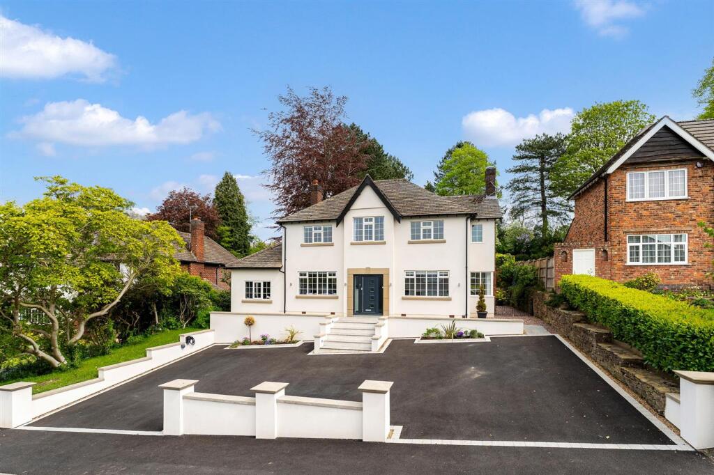
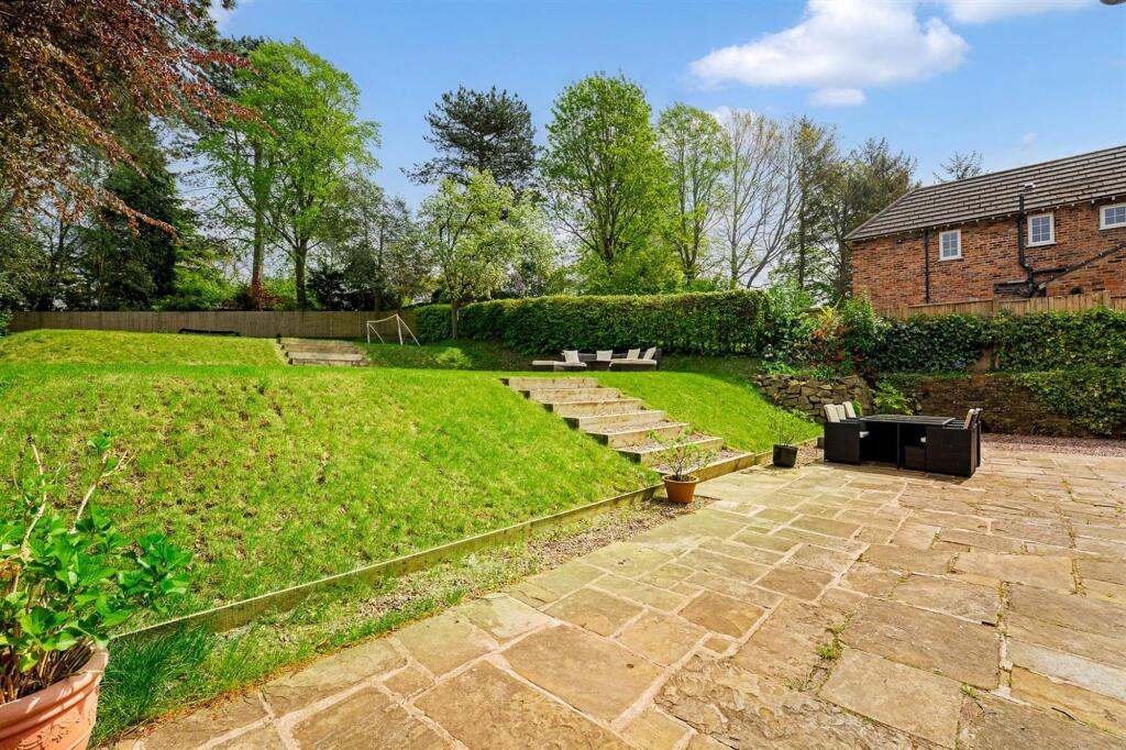
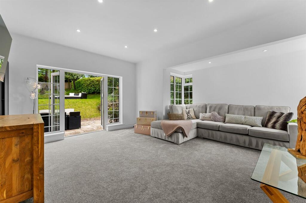
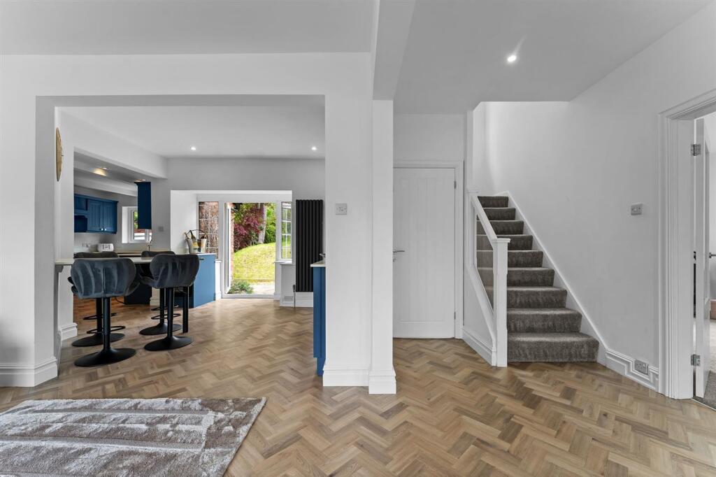
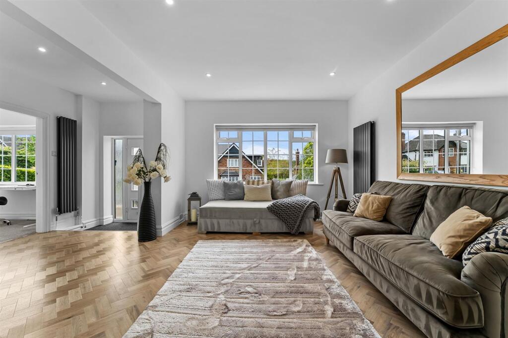
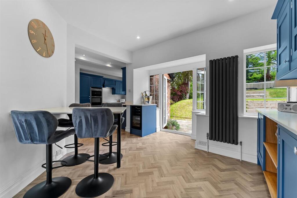
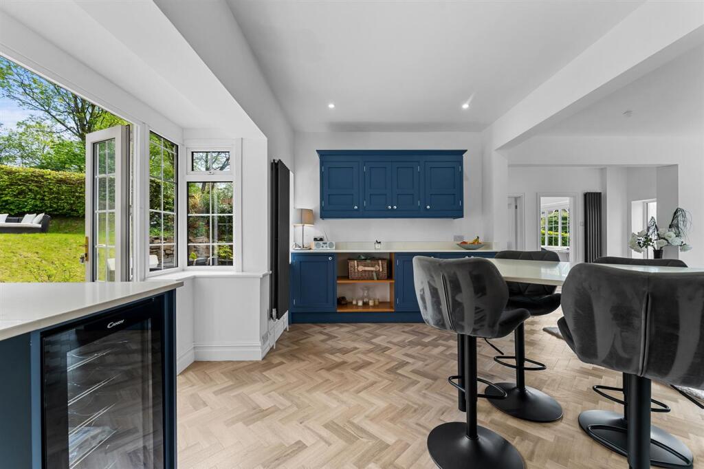
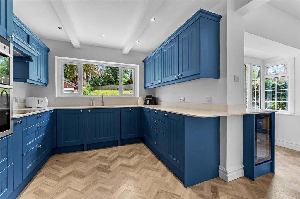
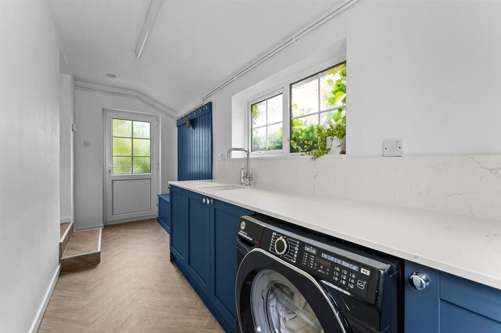
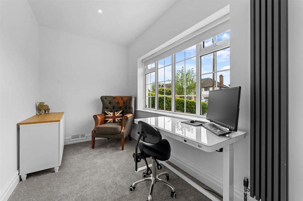
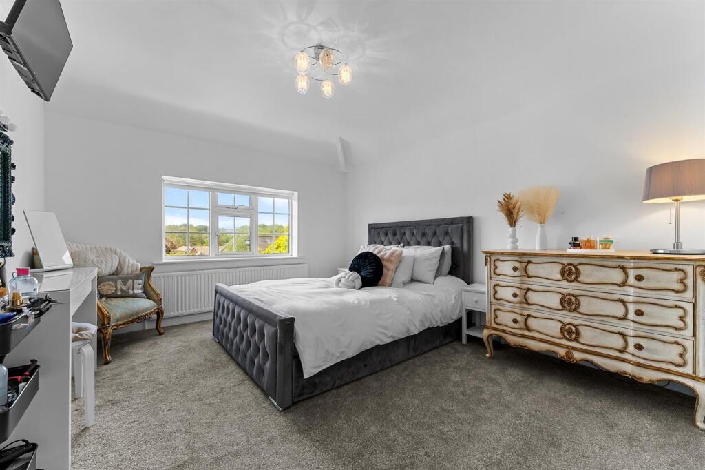
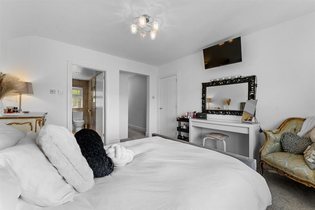


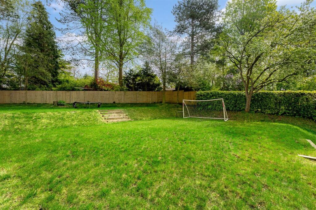
Photo 1 Photo 2 Photo 3 Photo 4 Photo 5 Photo 6 Photo 7 Photo 8 Photo 9 Photo 10 Photo 11 Photo 12 Photo 13 Photo 14 Photo 15 Photo 16 Photo 17 Photo 18 Photo 19
/ 19
Property details
Floor area
176 m²
Last sold
£915,000 Jul 2023
Local average
£854,632 (+11.2%)
Deprivation
Decile 10 (32,574 of 33,755)
Street crime
10 incidents within 1 mile (Apr 2026)
Key features
- Spacious Principal Suite
- Significantly Remodelled
- Open Plan Living
- Walking Distance of Prestbury Village
- Large Garden with Mature Trees
- Ample Off Road Parking
Additional details
- Parking
- Yes
- Garden
- Yes
- Listed property
- No
- Restrictions
- No
- Required access
- No
- Rights of way
- No
- Flooded in last 5 years
- No
- Flood defences
- No
Description
EPC Rating: C
Listed by
Alderley Edge
Mosley Jarman
Reference: 89815254
EPC Rating & Upgrade Cost
Fetching EPC data… Refresh this page in a moment.
Flood risk
Zone: 1
Risk: Low
Job (default Low)
Floorplans
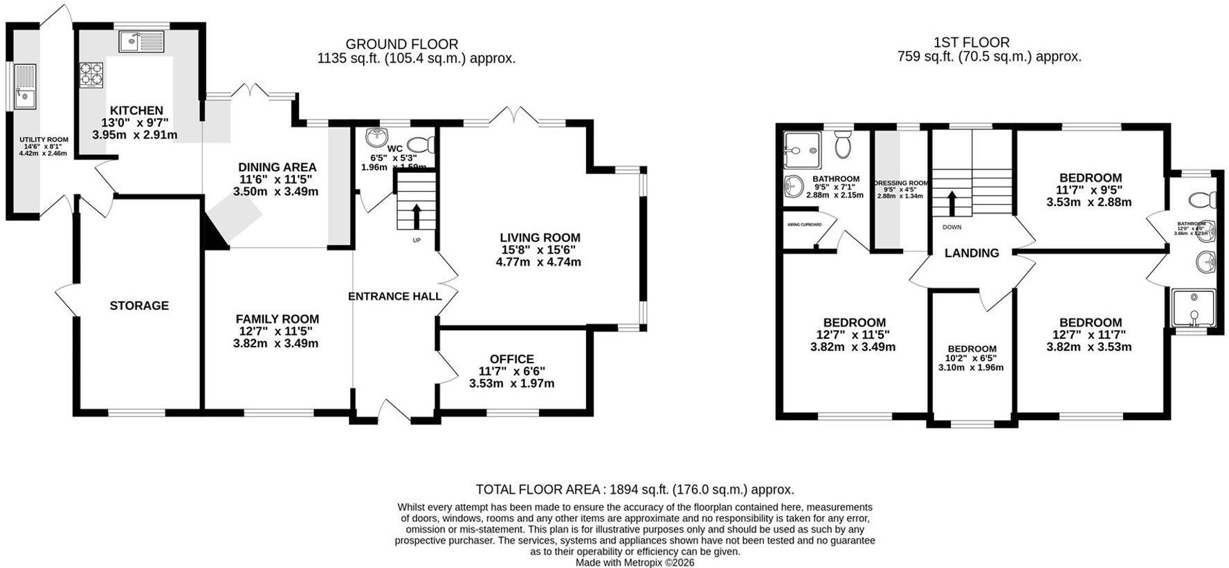
Floorplan 1
EPC Graphs
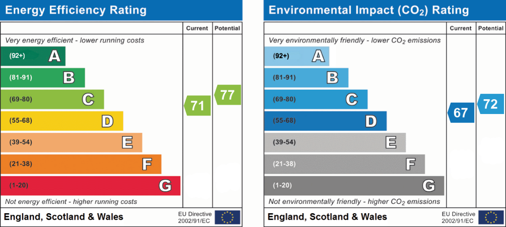
EPC 1
FENSA Certificates
This property has 1 FENSA certificate(s) on record, indicating window/door installations by FENSA-approved installers.
FENSA Certificate #4039765
Property Details
Street: 9 Badger Road
Town: Prestbury
Postcode: SK10 4JG
Installation Details
Items: 1 window
Certificate Issued: 11/09/2006
Work Completed: 31/08/2006
This certificate data was retrieved from FENSA's database
What is FENSA? FENSA (Fenestration Self-Assessment Scheme) is a government-authorised scheme that monitors building regulation compliance for replacement windows and doors. Certificates indicate that work was completed by FENSA-approved installers.
Price history
| Event | Date | Price | % change |
|---|---|---|---|
| Listed for sale | — | £950,000 | +3.8% |
| Sold | 14/07/2023 (2 years ago) | £915,000 | — |
Source: HM Land Registry Price Paid Data. Crown copyright.
Sold Comparables
Same street and nearby sales within 0.25 miles (last 5 years). Data from Land Registry Price Paid.
| Address | Price | Date | Type |
|---|---|---|---|
| 58 LEGH ROAD, PRESTBURY, MACCLESFIELD, CHESHIRE EAST, SK10 4HX | £845,000 | 31/03/2025 | Detached |
| 3 SCOTT ROAD, PRESTBURY, MACCLESFIELD, CHESHIRE EAST, SK10 4DN | £620,000 | 01/12/2022 | Detached |
| BROOKLANDS NEW ROAD, PRESTBURY, MACCLESFIELD, CHESHIRE EAST, SK10 4HT | £1,425,000 | 14/11/2022 | Detached |
| 4 BROCKLEHURST DRIVE, PRESTBURY, MACCLESFIELD, CHESHIRE EAST, SK10 4JD | £739,184 | 12/10/2022 | Detached |
| 4 BUTLEY LANES, PRESTBURY, MACCLESFIELD, CHESHIRE EAST, SK10 4HU | £940,000 | 30/09/2022 | Detached |
| WOODBANK BRIDGE END LANE, PRESTBURY, MACCLESFIELD, CHESHIRE EAST, SK10 4DJ | £950,000 | 31/03/2022 | Detached |
| 22 LEGH ROAD, PRESTBURY, MACCLESFIELD, CHESHIRE EAST, SK10 4HX | £960,000 | 17/11/2021 | Detached |
| GREEN ACRE BRIDGE END LANE, PRESTBURY, MACCLESFIELD, CHESHIRE EAST, SK10 4DJ | £1,500,000 | 16/11/2021 | Detached |
| 18 BROCKLEHURST DRIVE, PRESTBURY, MACCLESFIELD, CHESHIRE EAST, SK10 4JD | £1,500,000 | 16/11/2021 | Detached |
| 14 BUTLEY LANES, PRESTBURY, MACCLESFIELD, CHESHIRE EAST, SK10 4HU | £1,075,000 | 29/06/2021 | Detached |
Area average: £1,055,418 (10 sales)
Capital growth trend
Land Registry outcode average: last 12 months vs 5y and 10y ago (from sold prices).
House Price Index (HM Land Registry — official index, not sold-price averages): Cheshire East. Series: Detached. As of March 2026.
Rental Range
Estimated market rent for Cheshire East. Low = conservative, Realistic = average, Optimistic = best case.
Based on Local Authority from postcode lookup → Cheshire East.
LHA (30th percentile) floor for East Cheshire: £1,745/mo (Apr 2025 – Mar 2026)
Location
Nearby
Nearest stations, universities and amenities (distance from property).
| Type | Name | Distance |
|---|---|---|
| Bus stop | Prestbury, Butley Lanes / Prestbury Lane | 0.1 miles |
| Bus stop | Prestbury, Railway Station | 0.1 miles |
| Train station | Prestbury | 0.2 miles |
| Shop | Dress Cheshire | 0.2 miles |
| Shop | Victor Alan | 0.3 miles |
| Train station | Adlington (Cheshire) | 1.9 miles |
| Hospital | Rosemount Resource Centre | 2.3 miles |
| Hospital | Newlands Care Home | 9.0 miles |
| University | University of Derby, Buxton | 9.9 miles |
| University | University of Manchester Fallowfield Campus | 10.7 miles |
Street-level crime
| Category | Count |
|---|---|
| Violence and sexual offences | 5 |
| Anti-social behaviour | 1 |
| Drugs | 1 |
| Other theft | 1 |
| Public order | 1 |
| Robbery | 1 |
| Total incidents | 10 |
Within 1 mile during Apr 2026. Source: data.police.uk (England & Wales).
Schools nearby
Nearest open schools with Ofsted ratings (England). Closed schools are not shown. Data from Get Information about Schools and Ofsted.
| Name | Type | Distance | Ofsted |
|---|---|---|---|
| Prestbury CofE Primary School | Primary | 0.2 miles | Good — 12 May 2020 |
| Bollington Cross CofE Primary School | Primary | 1.2 miles | Good — 20 Mar 2023 |
| Dean Valley Community Primary School | Primary | 1.4 miles | Good — 1 Nov 2012 |
| The King's School In Macclesfield | Other | 1.4 miles | — (No rating) |
| Upton Priory School | Primary | 1.6 miles | Good — 28 Jan 2015 |
Rental Comparables
Loading rental comparables for this postcode. Refresh in a few minutes.
Rent-driven metrics
Based on Area rent estimate.
- Rent ratio — Monthly rent ÷ purchase price (1% rule). 1%+ = strong, 0.8–1% = okay, <0.8% = weak for cashflow.
- Max investor price — Rent ÷ 0.8%; the price at which rent would be 0.8% of price (Stoke-style target).
- Target investor price — Rent ÷ 1%; the price at which rent would be 1% of price (strong cashflow band).
- Gross yield — Annual rent as % of purchase price (no costs).