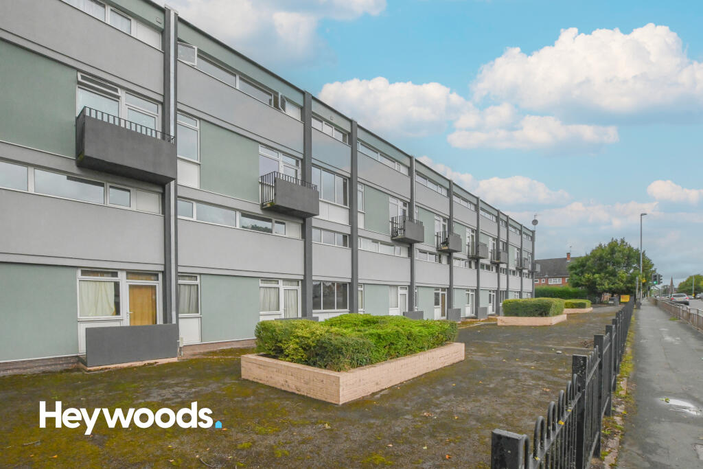
Bridge Court
Stone Road, Stoke-on-Trent, ST4 6SJ
£550 pcm
Property details
Deprivation
Decile 5 (13,956 of 33,755)
Street crime
425 incidents within 1 mile (Apr 2026)
Key features
- One Bedroom
- First Floor Flat
- Key Card Access To Communal Stairwell
- Great Location For Commuters
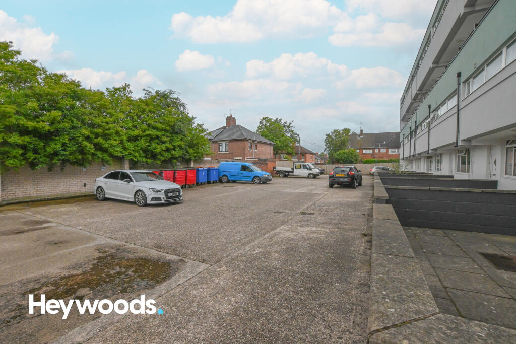
- Ample Communal Parking
- Close To Royal Stoke Hospital
- Electric Heating
- Unfurnished
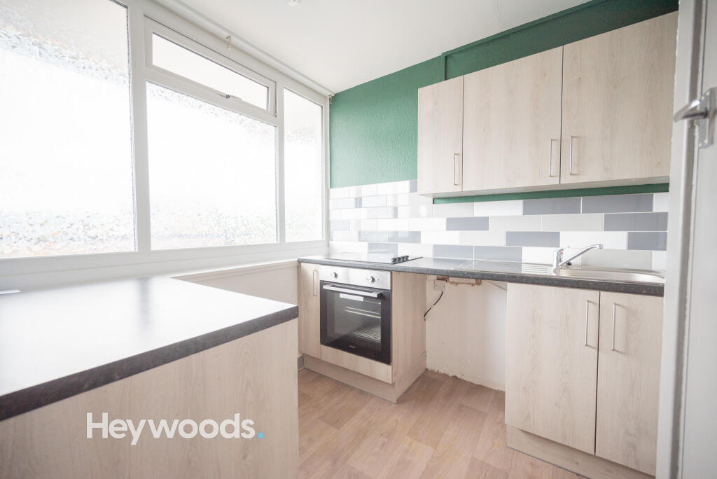
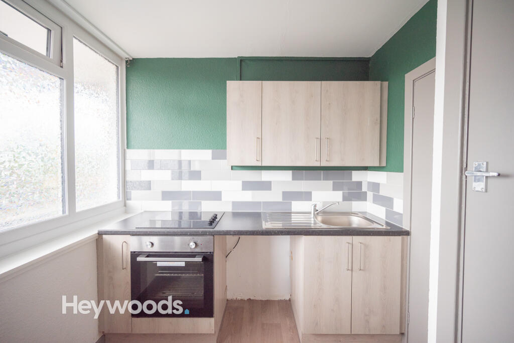
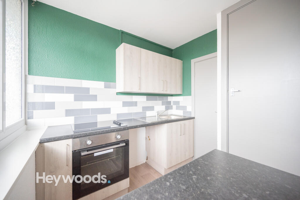
- Modern Kitchen
Additional details
- Parking
- Yes
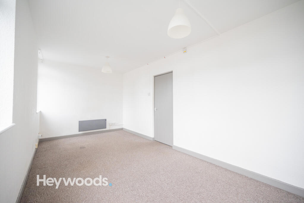
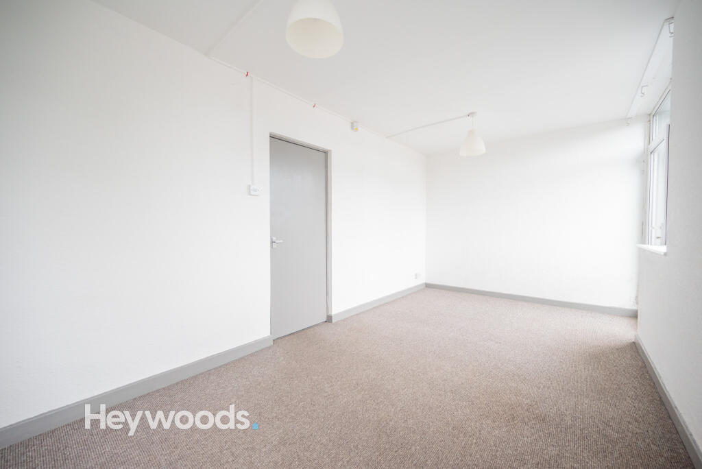
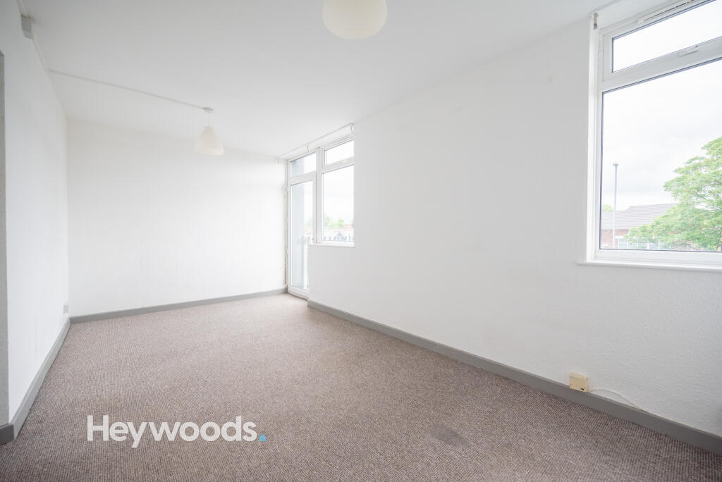
Description
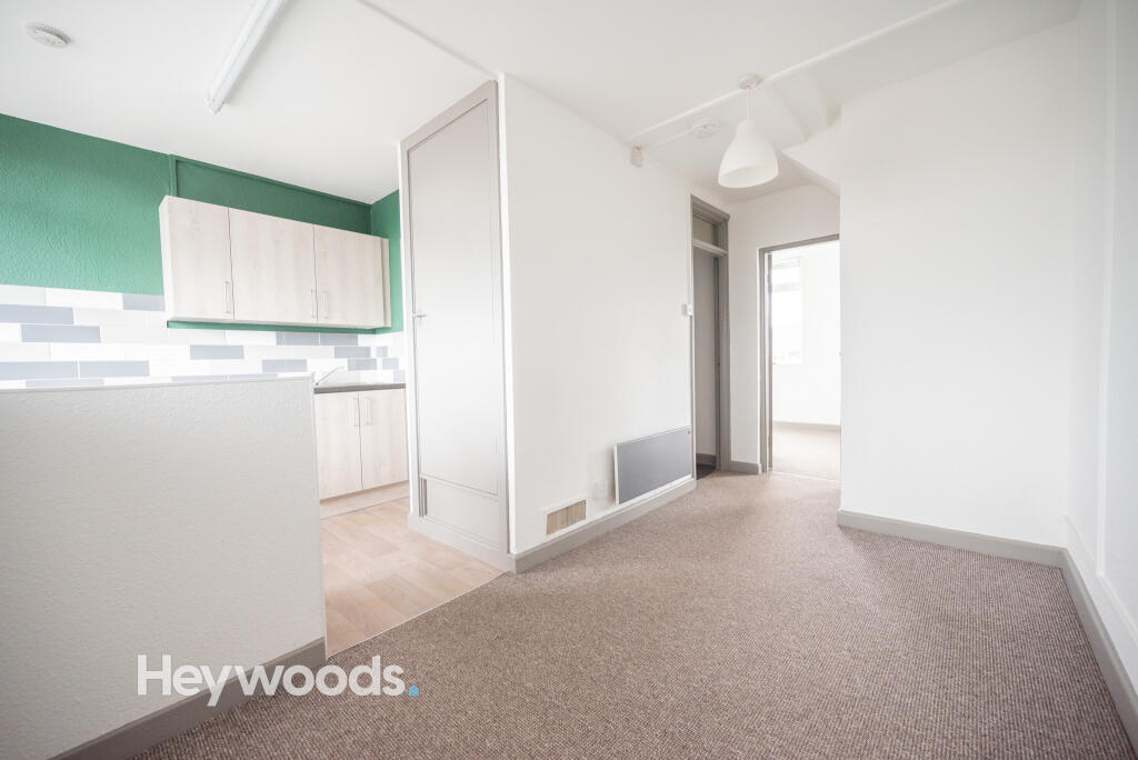
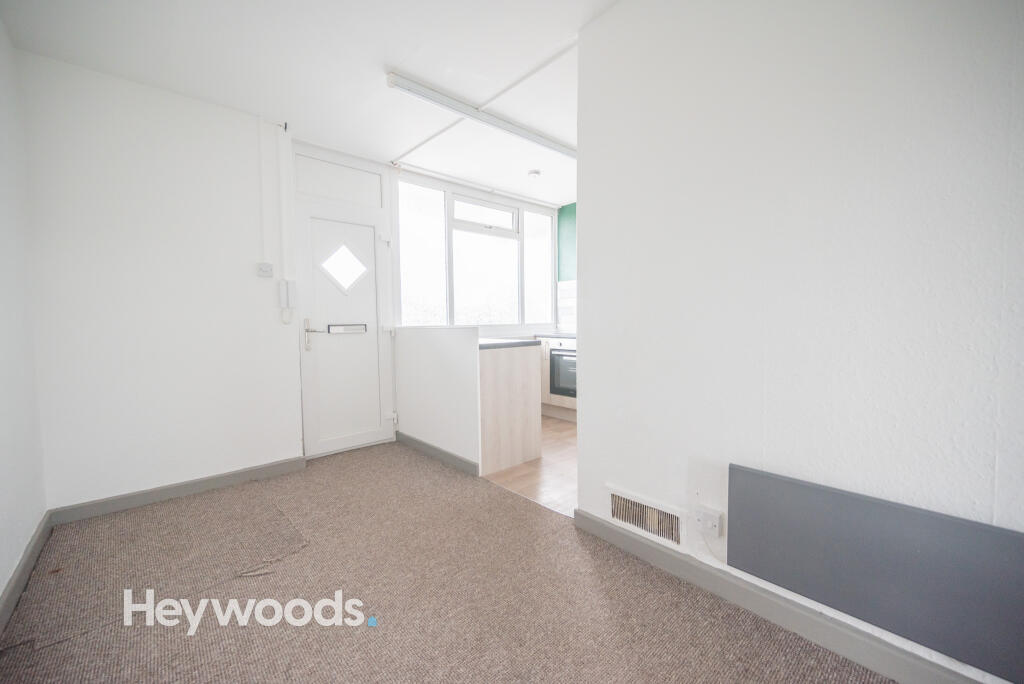
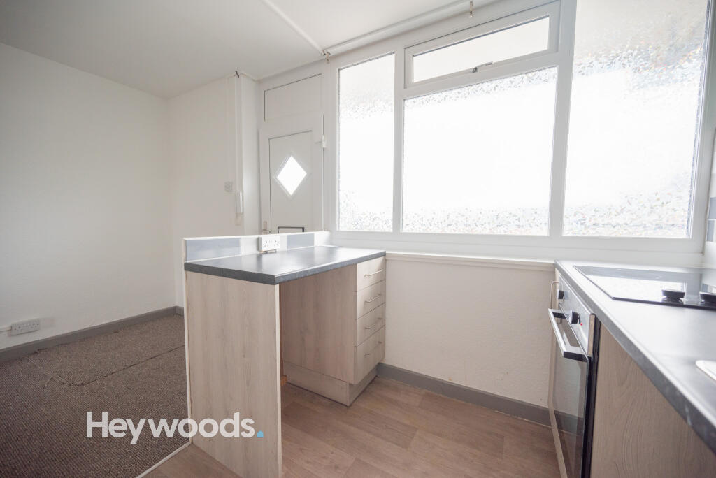
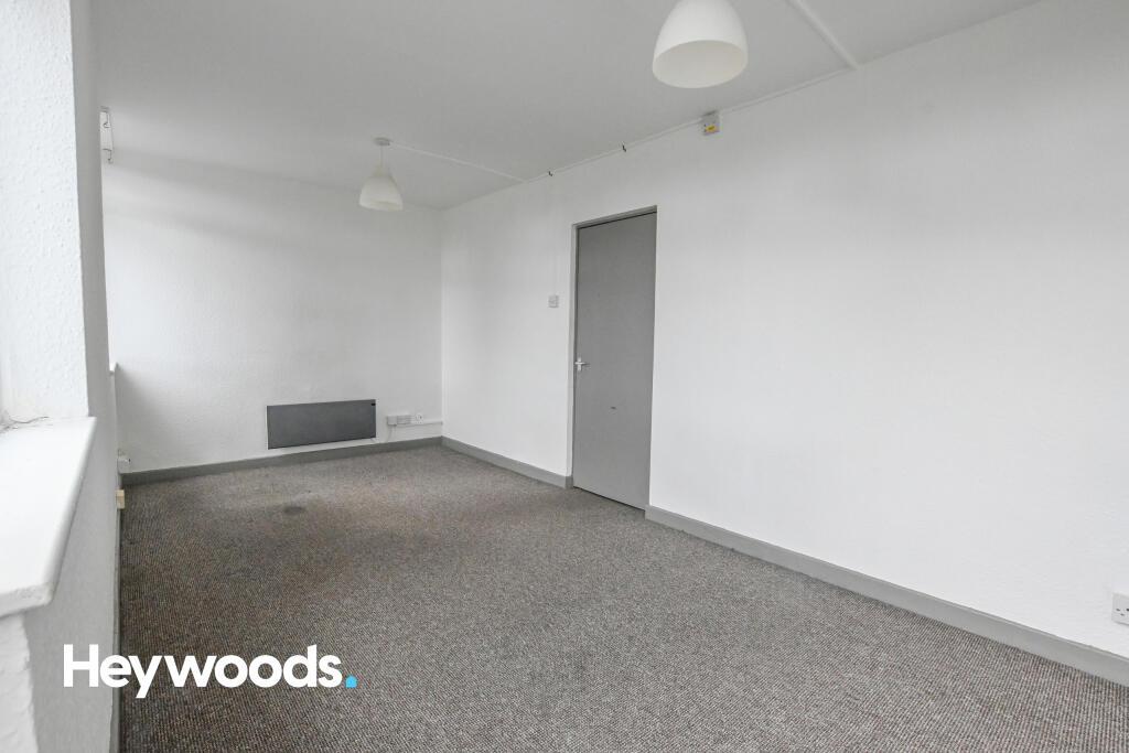
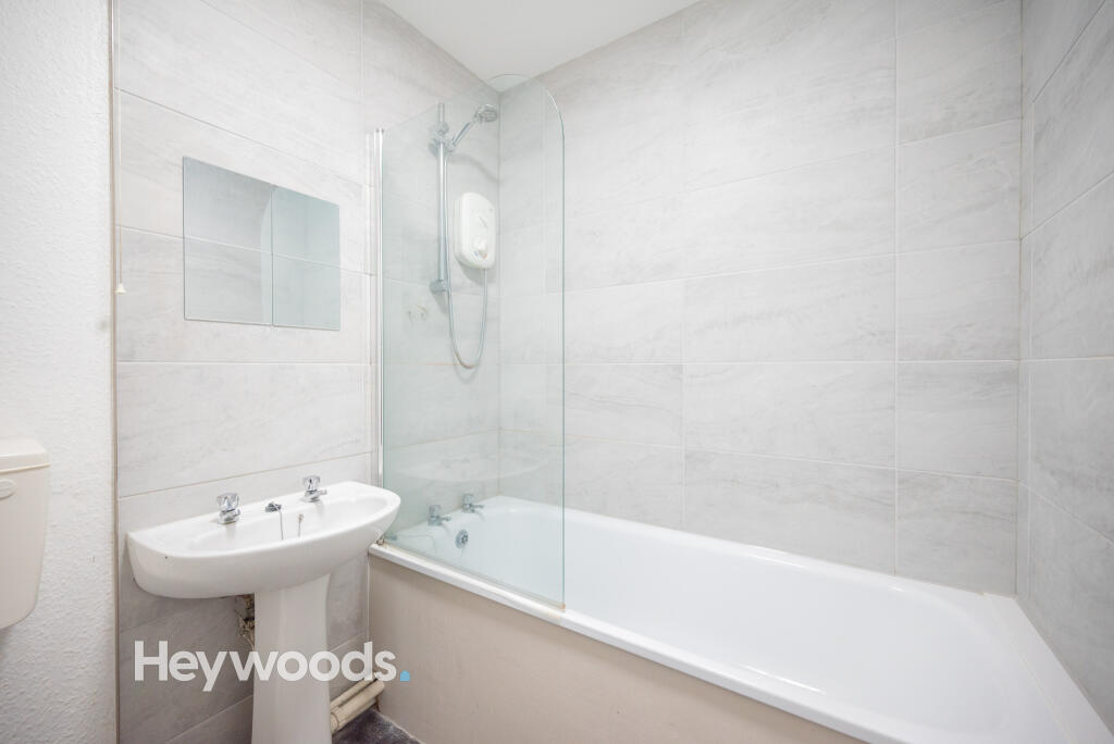
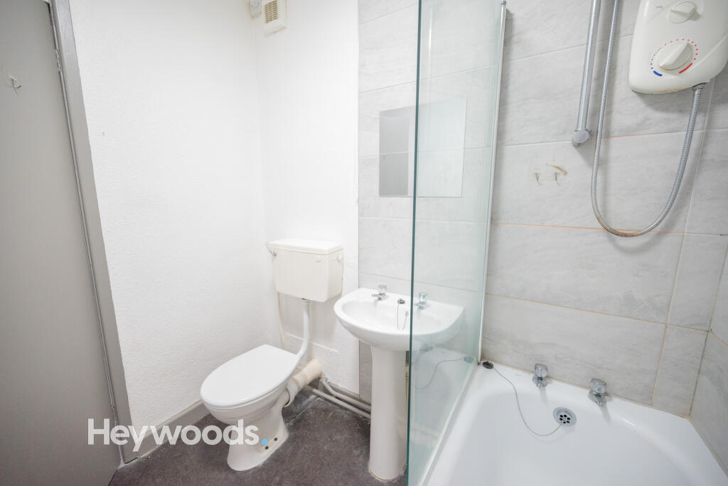
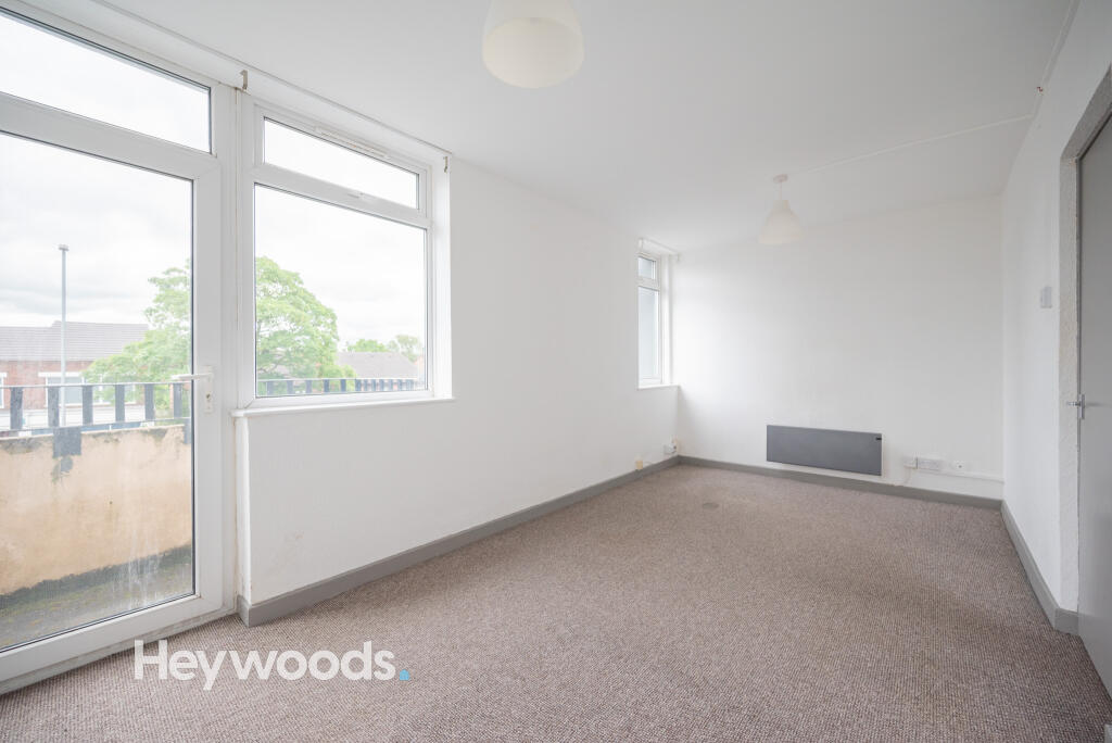
Inside, the flat boasts and open plan kitchen/living space with a fitted kitchen including integrated oven and hob and a convenient storage cupboard, spacious double bedroom with door opening out onto a small and private balcony and a bathroom with shower over the bath.
Outside, the complex offers ample communal parking. The communal stairwell used to access your flat is secured with an intercom system and key card access.
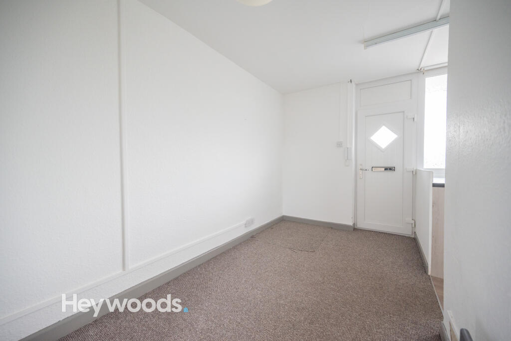
The flat is offered on an unfurnished basis and benefits from electric heating.
To book your viewing head over to the Heywoods website and fill out a tenant application form!
Listed by
Newcastle-under-Lyme
Heywoods
Reference: 171925628
EPC ratings on this postcode
We don't have a matched EPC for this property yet. Below are efficiency scores and details for other addresses on this postcode.
| Address | Current | Potential | Floor area | Age band | Type |
|---|---|---|---|---|---|
| Flat 1 Bridge Court, Stone Road, STOKE-ON-TRENT | 43 | 77 | 84 m² | England and Wales: 1967-1975 | Flat |
| Flat 1 Bridge Court, Stone Road, STOKE-ON-TRENT | 39 | 77 | 84 m² | England and Wales: 1967-1975 | Flat |
| Flat 10 Bridge Court, Stone Road, STOKE-ON-TRENT | 59 | 85 | 32 m² | England and Wales: 1967-1975 | Flat |
| Flat 10/A Bridge Court, Stone Road, STOKE-ON-TRENT | 60 | 78 | 58 m² | England and Wales: 1967-1975 | Flat |
| Flat 11 Bridge Court, Stone Road, STOKE-ON-TRENT | 54 | 79 | 86 m² | England and Wales: 1967-1975 | Flat |
| Flat 12 Bridge Court, Stone Road, STOKE-ON-TRENT | 54 | 78 | 88 m² | England and Wales: 1967-1975 | Flat |
| Flat 12 Bridge Court, Stone Road, STOKE-ON-TRENT | 20 | 60 | 80 m² | England and Wales: 1950-1966 | Flat |
| Flat 13 Bridge Court, Stone Road, STOKE-ON-TRENT | 52 | 78 | 88 m² | England and Wales: 1967-1975 | Flat |
| Flat 13 Bridge Court, Stone Road, STOKE-ON-TRENT | 32 | 81 | 88 m² | England and Wales: 1967-1975 | Flat |
| Flat 14 Bridge Court, Stone Road, STOKE-ON-TRENT | 73 | 85 | 34 m² | England and Wales: 1967-1975 | Flat |
| Flat 14/A Bridge Court, Stone Road, STOKE-ON-TRENT | 44 | 81 | 59 m² | England and Wales: 1967-1975 | Flat |
| Flat 15/A Bridge Court, Stone Road, STOKE-ON-TRENT | 60 | 78 | 58 m² | England and Wales: 1967-1975 | Flat |
| Flat 16 Bridge Court, Stone Road, STOKE-ON-TRENT | 40 | 74 | 83 m² | England and Wales: 1967-1975 | Flat |
| Flat 2 Bridge Court, Stone Road, STOKE-ON-TRENT | 41 | 81 | 84 m² | England and Wales: 1967-1975 | Flat |
| Flat 3 Bridge Court, Stone Road, STOKE-ON-TRENT | 74 | 86 | 46 m² | England and Wales: 1967-1975 | Flat |
Flood risk
Zone: 1
Risk: Low
Job (default Low)
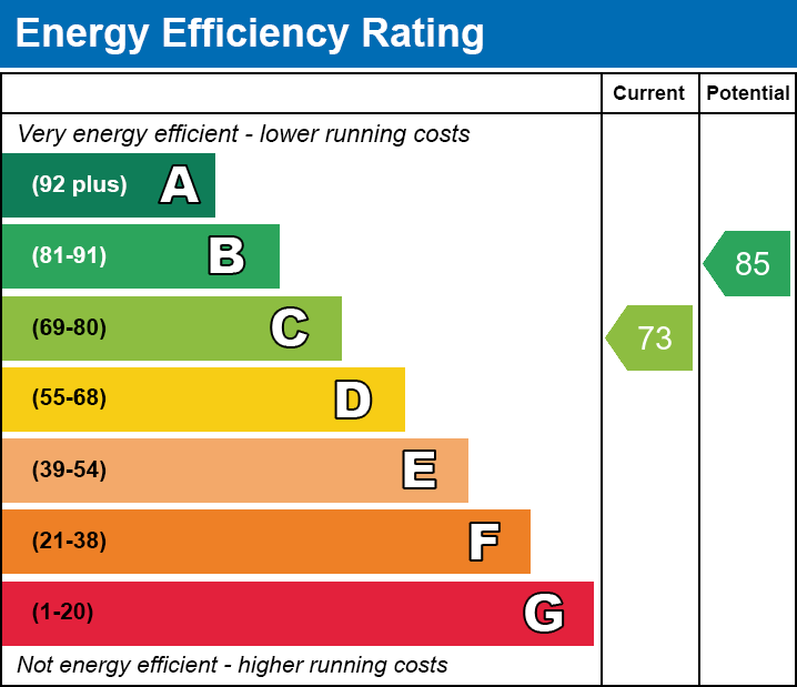
EPC Graphs

Flat 14 Bridge Court - EPC
EE
Rental Range
Estimated market rent for Stoke-on-Trent. Low = conservative, Realistic = average, Optimistic = best case.
Based on Local Authority from postcode lookup → Stoke-on-Trent.
LHA (30th percentile) floor for Staffordshire North: £424/mo (Apr 2025 – Mar 2026)
Location
Address
Church Street
Nearby
Nearest stations, universities and amenities (distance from property).
| Type | Name | Distance |
|---|---|---|
| Bus stop | Stop Q | 0.0 miles |
| Bus stop | Stop N | 0.1 miles |
| Shop | Card Factory | 0.1 miles |
| Shop | Wrights Pies | 0.1 miles |
| Train station | Stoke-on-Trent | 0.3 miles |
| University | University of Staffordshire Stoke Campus | 0.4 miles |
| Hospital | North Staffordshire Hospital | 1.0 miles |
| Hospital | Car park site | 1.1 miles |
| Train station | Longton | 2.1 miles |
Street-level crime
| Category | Count |
|---|---|
| Violence and sexual offences | 120 |
| Anti-social behaviour | 73 |
| Shoplifting | 51 |
| Public order | 37 |
| Criminal damage and arson | 34 |
| Other theft | 25 |
| Vehicle crime | 22 |
| Burglary | 19 |
| Drugs | 16 |
| Other crime | 11 |
| Bicycle theft | 6 |
| Possession of weapons | 6 |
| Robbery | 5 |
| Total incidents | 425 |
Within 1 mile during Apr 2026. Source: data.police.uk (England & Wales).
Schools nearby
Nearest open schools with Ofsted ratings (England). Closed schools are not shown. Data from Get Information about Schools and Ofsted.
| Name | Type | Distance | Ofsted |
|---|---|---|---|
| City of Stoke-On-Trent Sixth Form College | Other | 0.3 miles | — (No rating) |
| Stoke Minster CofE Primary Academy | Primary | 0.4 miles | Inadequate — 27 Sep 2022 |
| Staffordshire University | Other | 0.4 miles | — (No rating) |
| The Willows Primary School | Primary | 0.6 miles | Good — 14 Dec 2010 |
| St Peter's CofE Academy | Secondary | 0.6 miles | Requires improvement — 28 Mar 2023 |
Rental Comparables
Residential lets from OpenRent and Rightmove for the area (same bedroom count). Use to validate rent estimates. Student lets are excluded.
Average rent: £620/mo (45 listings)
Enter House Number
Enter the house number to help us retrieve more accurate pricing history and property data.
Please log in to submit or correct the house number for this listing.
Log in to continue