46 MARSHALL ROAD
MANCHESTER, MANCHESTER, GREATER MANCHESTER M19 2FQ
£325,000
Property details
Tenure
FREEHOLD
Council tax band
B
Last sold
£22,000 Sep 1998
Local average
£253,558 (+28.2%)
Deprivation
Decile 2 (5,092 of 33,755)
Street crime
0 incidents within 1 mile (Aug 2026)
Key features
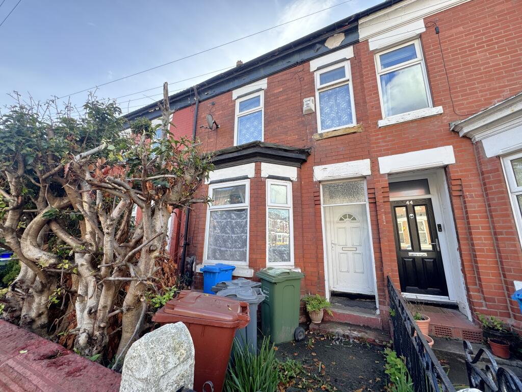
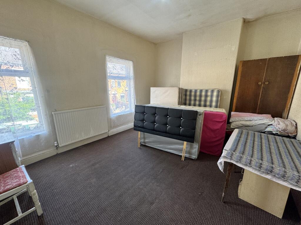
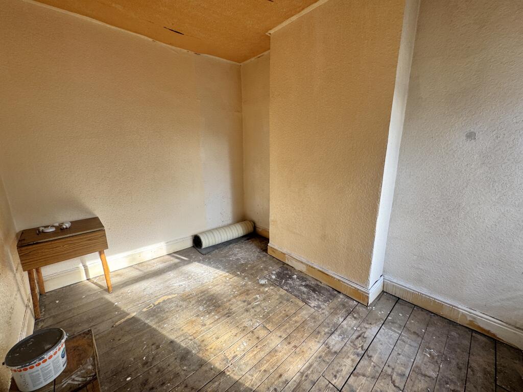
- Three Bedroom Terrace Home
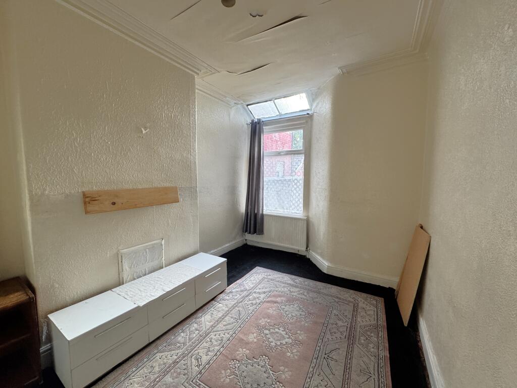
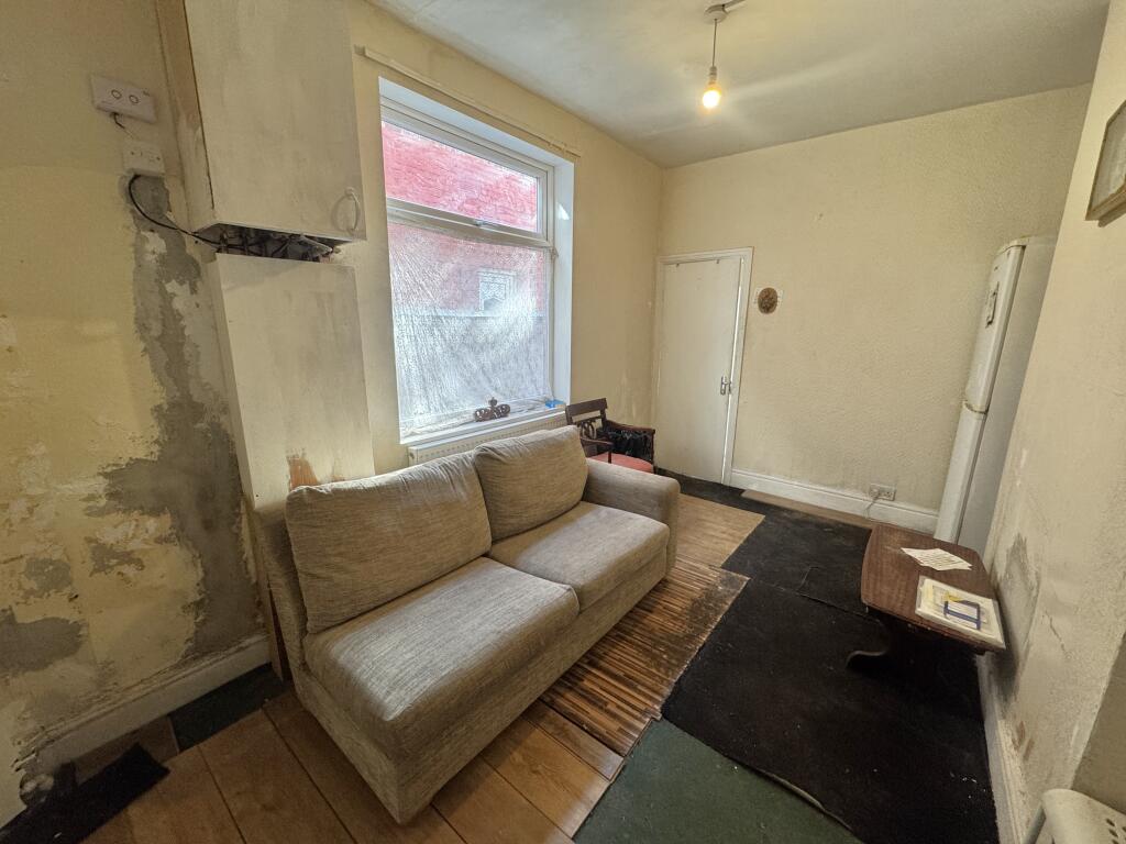
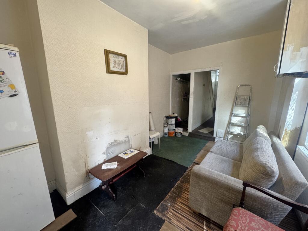
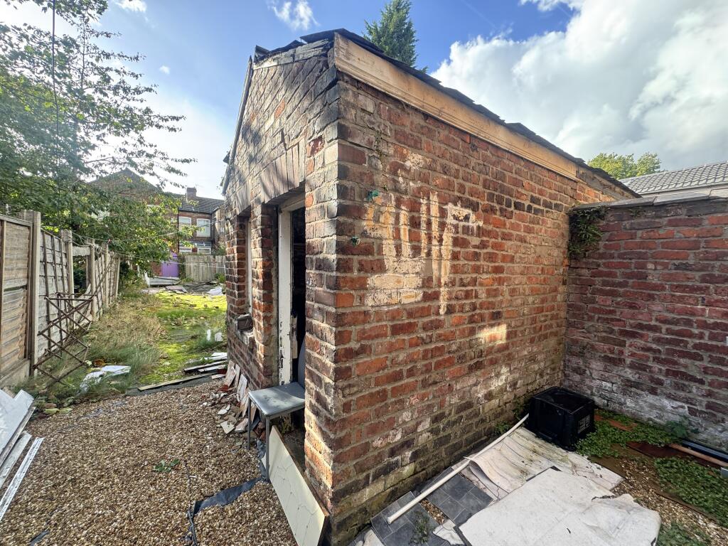
- Requires Modernization
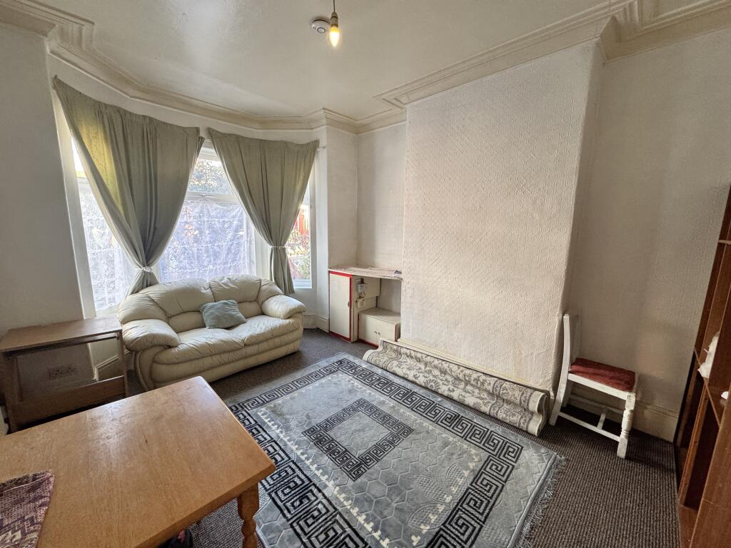
- Three Reception Rooms
- No Onwards Chain
- Popular Residential Location
Additional details
- Garden
- Yes
Description
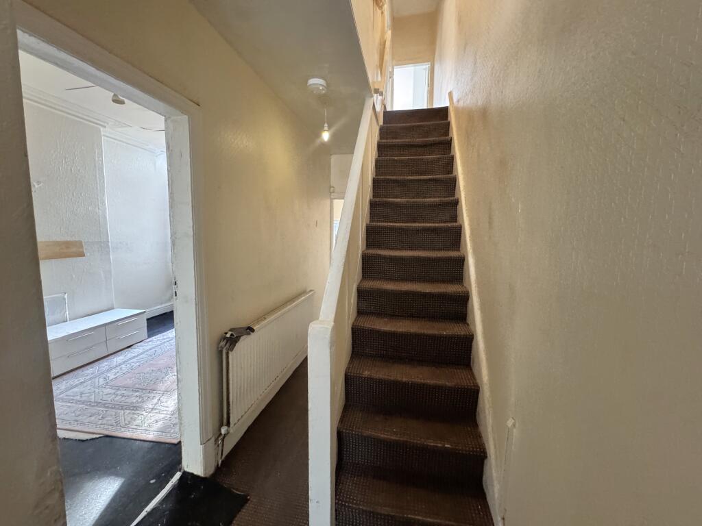
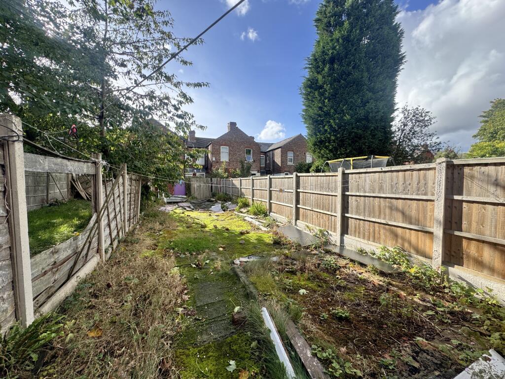
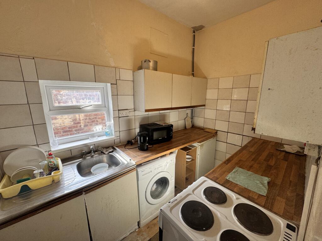
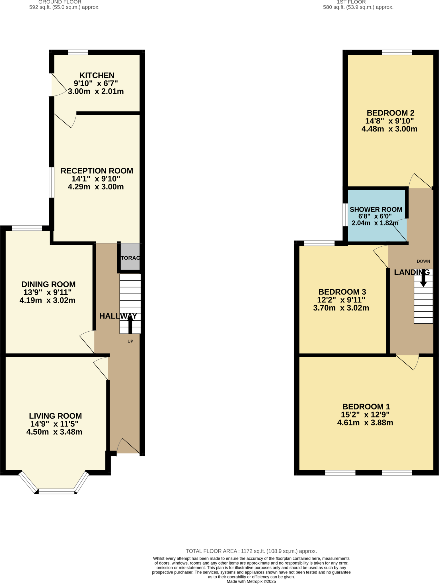
The ground floor comprises an entrance hall leading to three spacious reception rooms and a kitchen, providing a versatile layout with plenty of potential. To the rear, there is a private garden, offering outdoor space for relaxation or future landscaping.
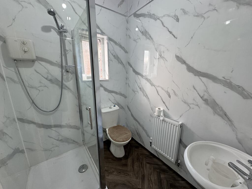
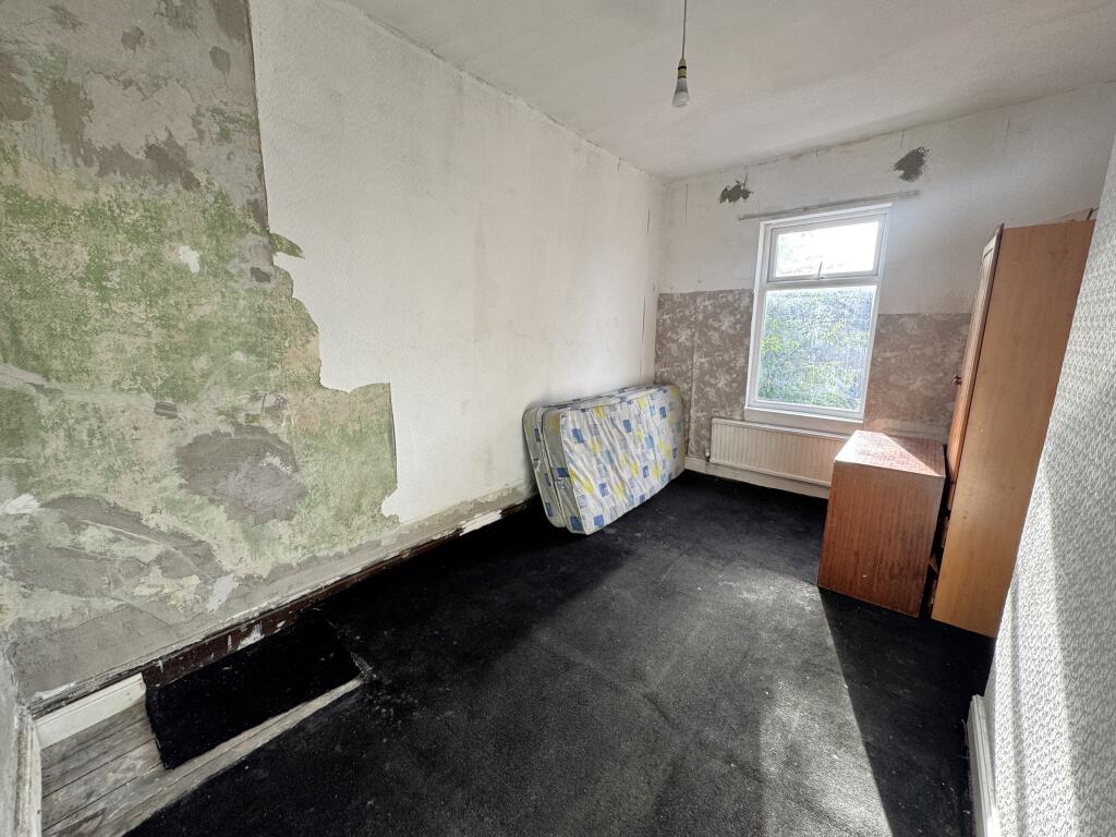
Upstairs, the property features three generously sized double bedrooms and a shower room. While the home requires modernisation throughout, it presents a fantastic opportunity for buyers looking to create a bespoke living space in a popular and well-connected area.
Listed by
Levenshulme
Edward Mellor Ltd
Reference: 94388832
Flood risk
Zone: 1
Risk: Low
Job (default Low)
Registered land (INSPIRE)
This location falls inside an HM Land Registry INSPIRE registered freehold polygon.
Plot: ~183 m² (0.05 acres)
Source: HM Land Registry INSPIRE Index Polygons.
Floorplans
floorplan.png
Price history
| Event | Date | Price | % change |
|---|---|---|---|
| Listed for sale | — | £325,000 | +1377.3% |
| Sold | 11/09/1998 (28 years ago) | £22,000 | — |
Source: HM Land Registry Price Paid Data. Crown copyright.
Sold Comparables
Same street and nearby sales within 0.25 miles (last 5 years). Data from Land Registry Price Paid.
| Address | Price | Date | Type |
|---|---|---|---|
| 972 STOCKPORT ROAD, MANCHESTER, GREATER MANCHESTER, M19 3NN | £155,000 | 17/12/2025 | Terraced |
| 15 BIRDHALL GROVE, MANCHESTER, GREATER MANCHESTER, M19 2FS | £261,000 | 12/12/2025 | Terraced |
| 47 FOREST RANGE, MANCHESTER, GREATER MANCHESTER, M19 2ES | £243,000 | 27/10/2023 | Terraced |
| 12 ERRWOOD ROAD, MANCHESTER, GREATER MANCHESTER, M19 2PA | £500,000 | 24/03/2023 | Terraced |
| 11 FIR GROVE, MANCHESTER, GREATER MANCHESTER, M19 2ET | £325,000 | 13/12/2022 | Terraced |
| 14 BIRDHALL GROVE, MANCHESTER, GREATER MANCHESTER, M19 2FS | £280,000 | 31/10/2022 | Terraced |
| Same street 50 MARSHALL ROAD, MANCHESTER, GREATER MANCHESTER, M19 2FQ | £344,000 | 30/09/2022 | Terraced |
| 44 PRESTON ROAD, MANCHESTER, GREATER MANCHESTER, M19 2FR | £265,000 | 16/08/2022 | Terraced |
| 7 BIRDHALL GROVE, MANCHESTER, GREATER MANCHESTER, M19 2FS | £250,000 | 08/07/2022 | Terraced |
| 31 MARSHALL ROAD, MANCHESTER, GREATER MANCHESTER, M19 2EG | £404,000 | 09/05/2022 | Terraced |
| 39 ALBERT ROAD, MANCHESTER, GREATER MANCHESTER, M19 2FT | £300,000 | 04/02/2022 | Terraced |
| 12 FIR GROVE, MANCHESTER, GREATER MANCHESTER, M19 2ET | £277,000 | 03/02/2022 | Terraced |
| 942 STOCKPORT ROAD, MANCHESTER, GREATER MANCHESTER, M19 3NN | £235,000 | 25/01/2022 | Terraced |
| 25 FOREST RANGE, MANCHESTER, GREATER MANCHESTER, M19 2ES | £235,000 | 17/12/2021 | Terraced |
Street average: £344,000 (1 sale)
Area average: £286,923 (13 sales)
Capital growth trend
Land Registry outcode average: last 12 months vs 5y and 10y ago (from sold prices).
House Price Index (HM Land Registry — official index, not sold-price averages): Manchester. Series: Terraced. As of August 2026.
Rental Range
Estimated market rent for Manchester. Low = conservative, Realistic = average, Optimistic = best case.
Based on Local Authority from postcode lookup → Manchester.
LHA (30th percentile) floor for West Pennine: £504/mo (Apr 2025 – Mar 2026)
Location
Nearby
Nearest stations, universities and amenities (distance from property).
| Type | Name | Distance |
|---|---|---|
| Bus stop | Levenshulme, Marshall Road / adjacent Alma Road | 0.0 miles |
| Bus stop | Levenshulme, Marshall Road / near Alma Road | 0.0 miles |
| Shop | Pound Palace | 0.1 miles |
| Shop | CyberLinks | 0.1 miles |
| Train station | Levenshulme | 0.2 miles |
| University | Fallowfield Reception and Richmond Amenities Building | 0.9 miles |
| Train station | Mauldeth Road | 0.9 miles |
| Hospital | Shiv Lodge Medical Centre | 1.0 miles |
| Hospital | The Ailsa Craig Medical Practise | 1.0 miles |
| University | Manchester School of Art | 2.6 miles |
Street-level crime
| Category | Count |
|---|---|
| Total incidents | 0 |
Within 1 mile during Aug 2026. Source: data.police.uk (England & Wales).
Schools nearby
Nearest open schools with Ofsted ratings (England). Closed schools are not shown. Data from Get Information about Schools and Ofsted.
| Name | Type | Distance | Ofsted |
|---|---|---|---|
| Alma Park Primary School | Primary | 0.1 miles | Good — 10 Jun 2013 |
| Manchester Vocational and Learning Academy | Other | 0.1 miles | Good — 16 Jan 2020 |
| St Mary's RC Primary School Manchester | Primary | 0.2 miles | Outstanding — 30 Jun 2022 |
| Chapel Street Community Primary School | Primary | 0.3 miles | Good — 14 Jul 2019 |
| Levenshulme High School | Secondary | 0.4 miles | Outstanding — 15 Nov 2016 |
Rental Comparables
Rental comparables data is not available for this property.
Rent-driven metrics
Based on Area rent estimate.
- Rent ratio — Monthly rent ÷ purchase price (1% rule). 1%+ = strong, 0.8–1% = okay, <0.8% = weak for cashflow.
- Max investor price — Rent ÷ 0.8%; the price at which rent would be 0.8% of price (Stoke-style target).
- Target investor price — Rent ÷ 1%; the price at which rent would be 1% of price (strong cashflow band).
- Gross yield — Annual rent as % of purchase price (no costs).