31 ST LAWRENCE AVENUE
RAMSGATE, KENT CT11 0HZ
£385,000
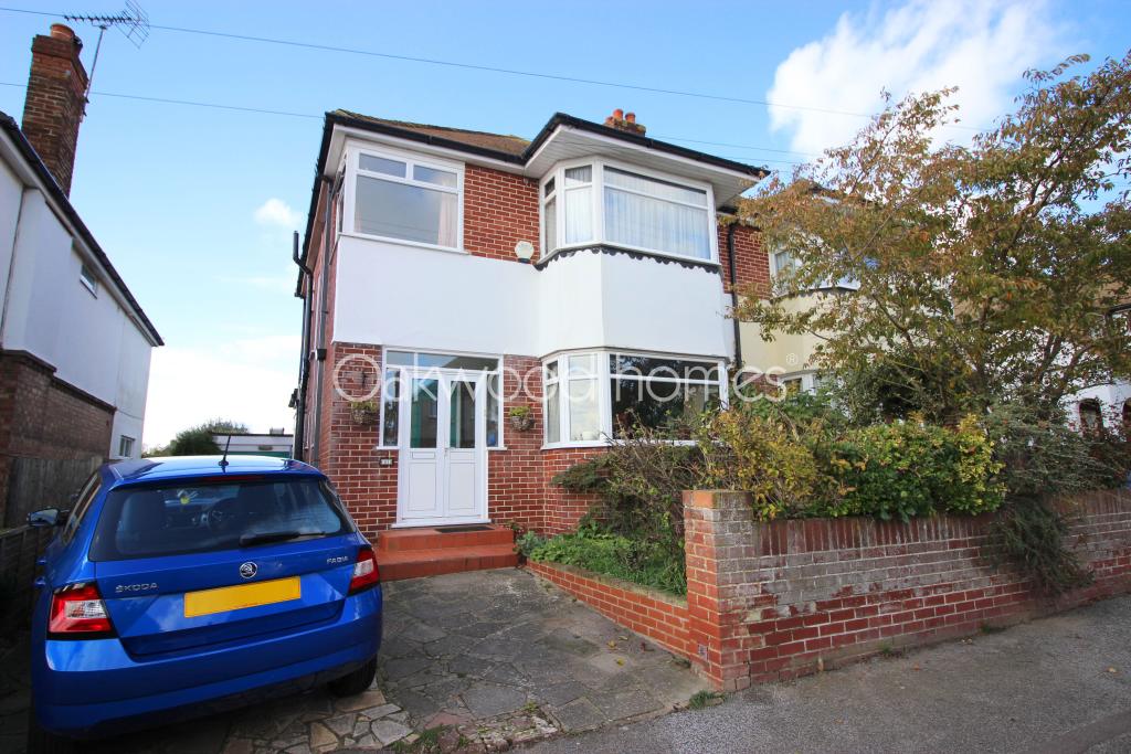
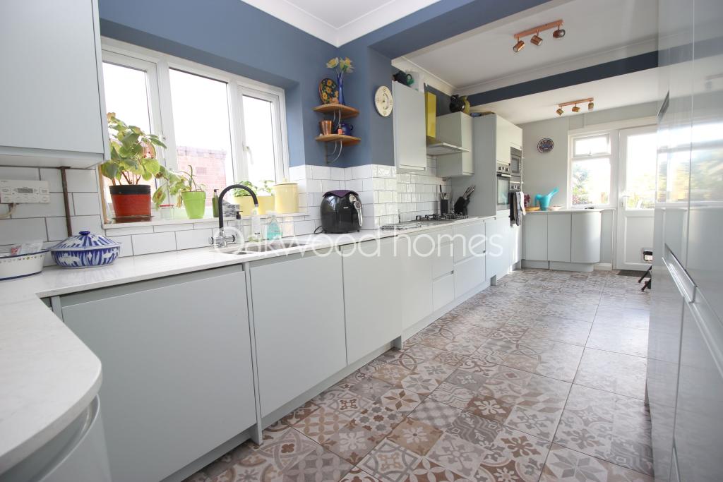
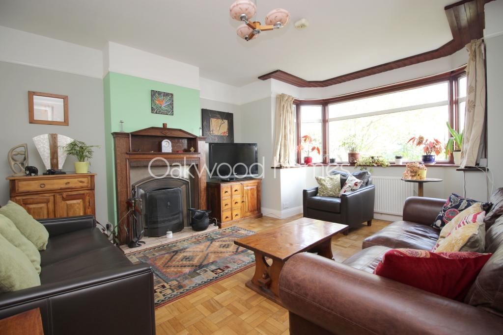
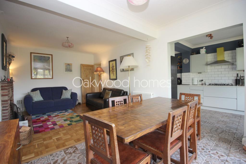
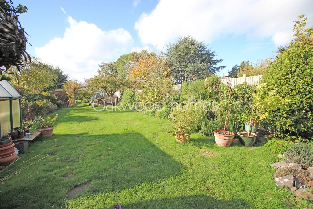
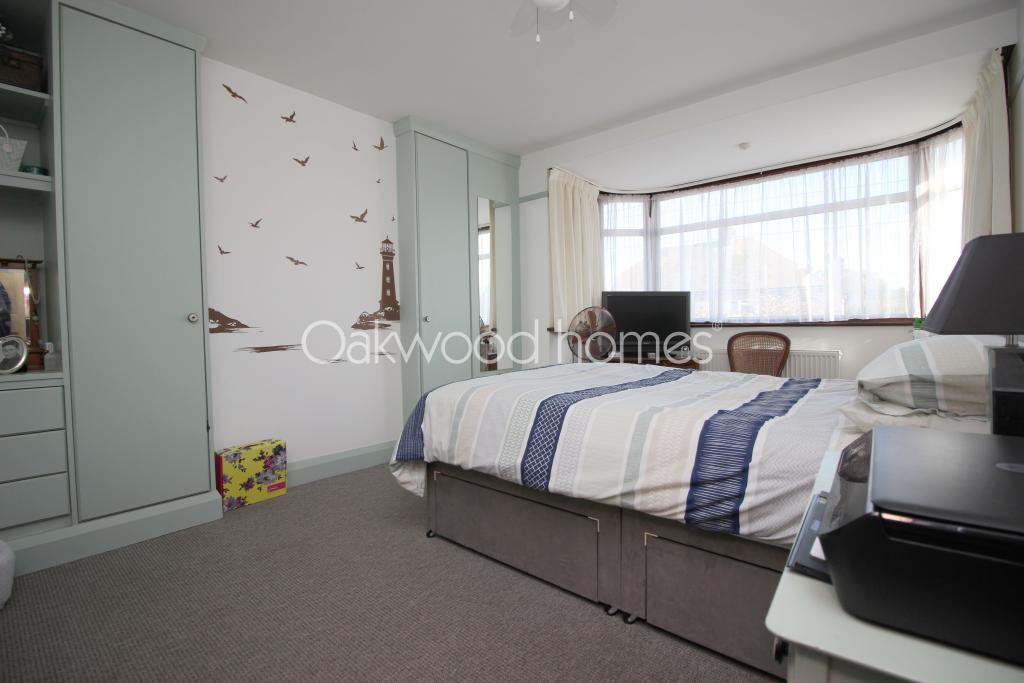
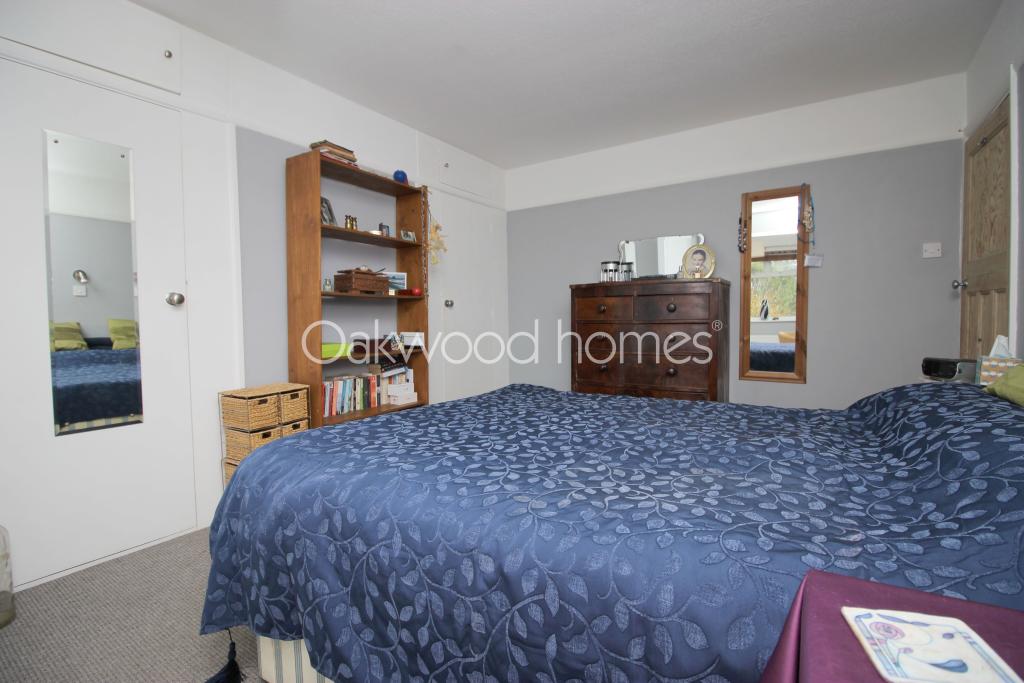
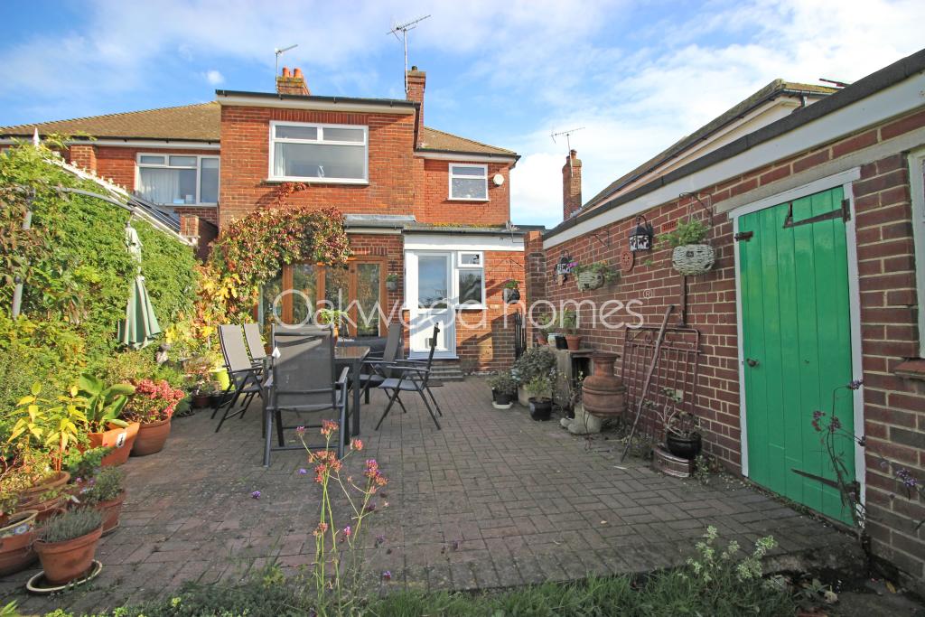
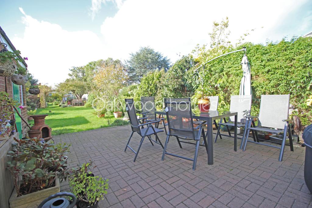
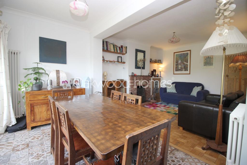
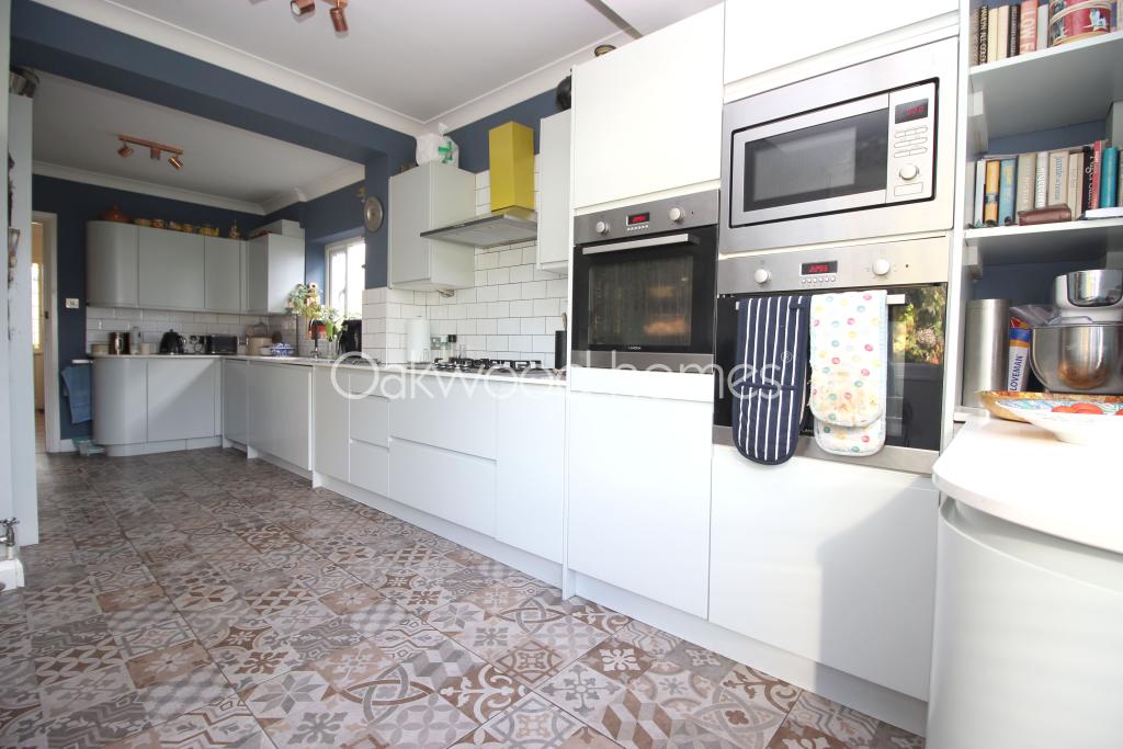
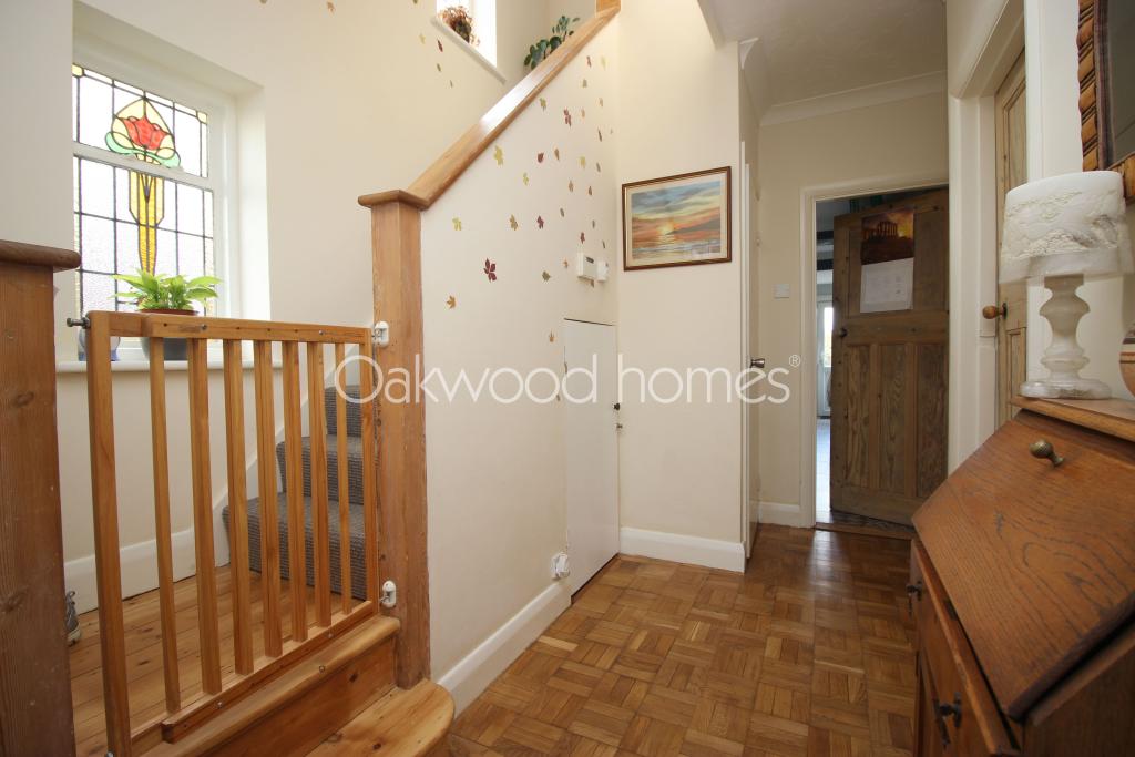
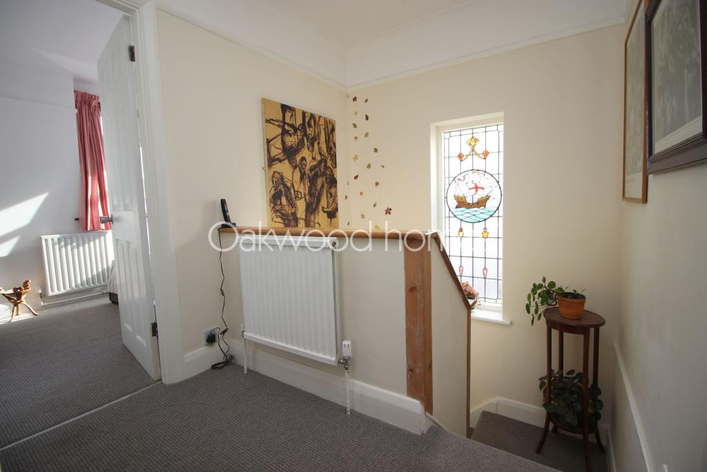
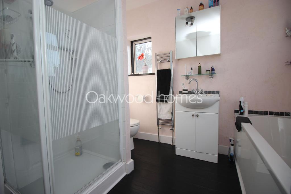
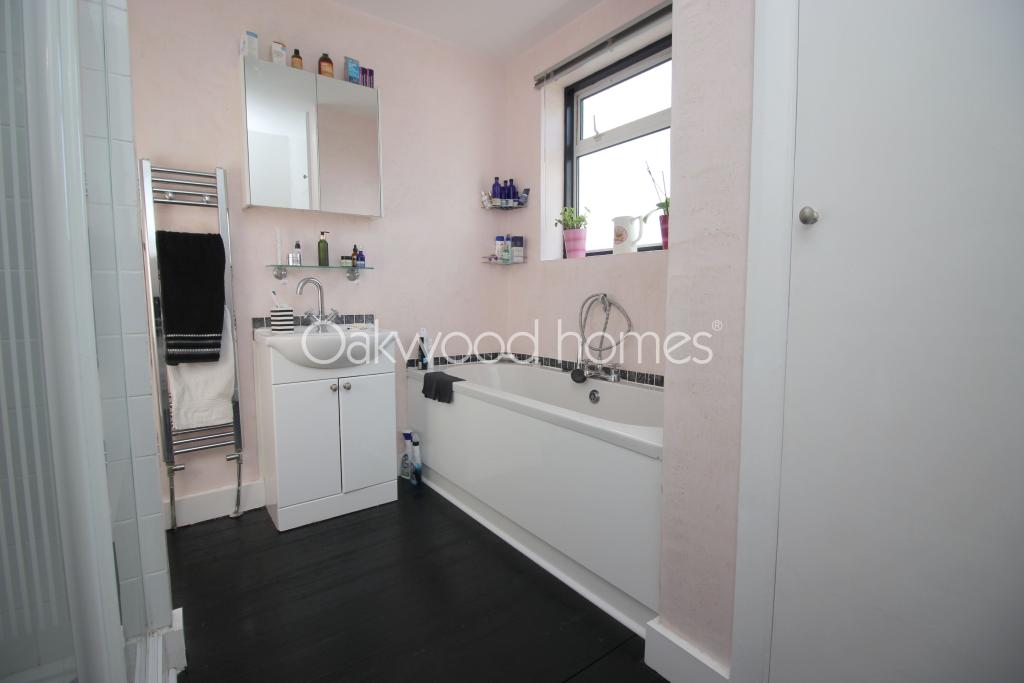
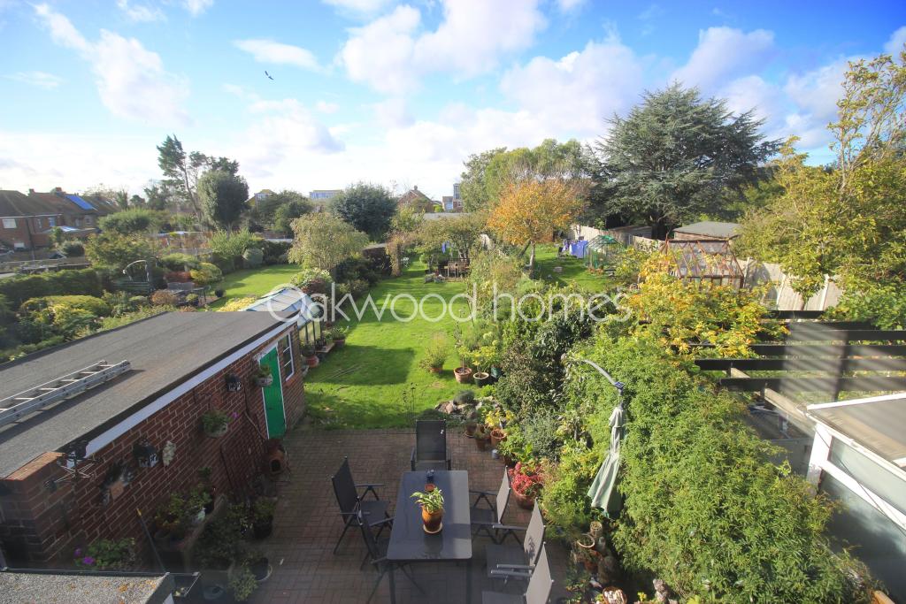
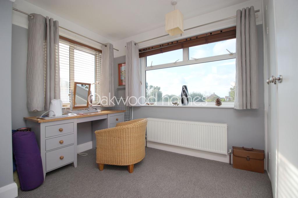
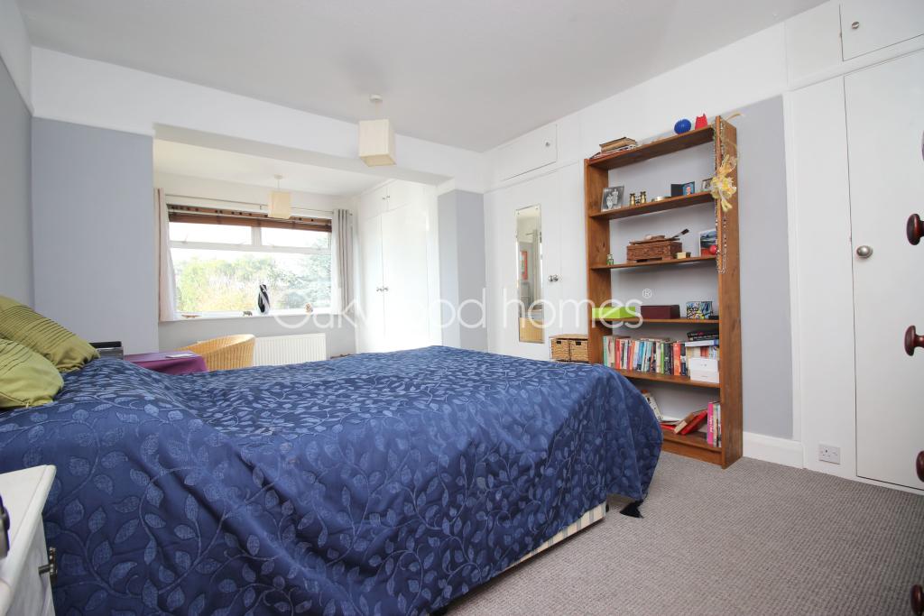
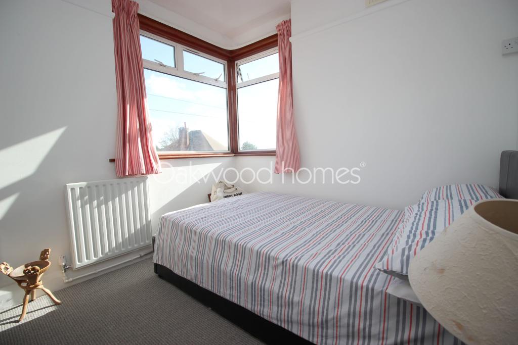
Photo 1 Photo 2 Photo 3 Photo 4 Photo 5 Photo 6 Photo 7 Photo 8 Photo 9 Photo 10 Photo 11 Photo 12 Photo 13 Photo 14 Photo 15 Photo 16 Photo 17 Photo 18 Photo 19
/ 19
Property details
Tenure
FREEHOLD
Last sold
£385,000 Mar 2021
Local average
£330,756 (+16.4%)
Deprivation
Decile 8 (26,778 of 33,755)
Street crime
185 incidents within 1 mile (Apr 2026)
Key features
- Three bedroom 1930's semi detached family home
- 2 storey extension to the rear
- 150 foot rear garden
- Driveway and garage
- Popular West Cliff location
- No onward chain
Additional details
- Parking
- Yes
- Garden
- Yes
Description
GROUND FLOOR:
Entrance porch
Hallway
WC
Lounge 16'3" (4.95m) x 13'1" (3.99m)
Dining Room 20'2" (6.15m) x 1'8" (0.51m)
Kitchen 21'0" (6.40m) x 8'2" (2.49m)
FIRST FLOOR
Bedroom 19'6" (5.94m) x 10'5" (3.18m)
Bedroom 16'0" (4.88m) x 10'7" (3.23m)
Bedroom 9'0" (2.74m) x 8'2" (2.49m)
Bathroom
OUTSIDE
Driveway to detached garage. Front garden. Rear garden approx 150' (45.72m) long
Listed by
Ramsgate
The Lomond Group
Reference: 86158078
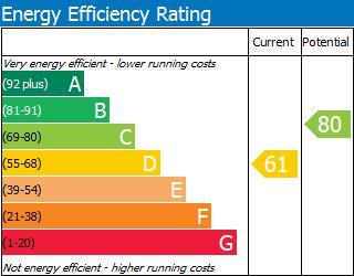
EPC Rating & Upgrade Cost
Fetching EPC data… Refresh this page in a moment.
Flood risk
Zone: 1
Risk: Low
Job (default Low)
Floorplans
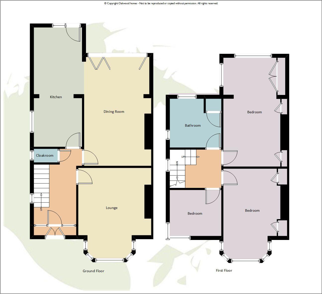
Floorplan 1
EPC Graphs
EPC - 1
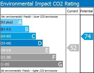
EPC - 2
FENSA Certificates
This property has 1 FENSA certificate(s) on record, indicating window/door installations by FENSA-approved installers.
FENSA Certificate #14926302 Recent
Property Details
Street: 31 St. Lawrence Avenue
Town: RAMSGATE
Postcode: CT11 0HZ
Installation Details
Items: 19 windows and 2 doors
Certificate Issued: 05/12/2021
Work Completed: 28/06/2021
This certificate data was retrieved from FENSA's database
What is FENSA? FENSA (Fenestration Self-Assessment Scheme) is a government-authorised scheme that monitors building regulation compliance for replacement windows and doors. Certificates indicate that work was completed by FENSA-approved installers.
Price history
| Event | Date | Price | % change |
|---|---|---|---|
| Sold | 05/03/2021 (5 years ago) | £385,000 | — |
Source: HM Land Registry Price Paid Data. Crown copyright.
Sold Comparables
Same street and nearby sales within 0.25 miles (last 5 years). Data from Land Registry Price Paid.
| Address | Price | Date | Type |
|---|---|---|---|
| 45 GOODWIN ROAD, RAMSGATE, THANET, KENT, CT11 0JJ | £447,000 | 13/05/2022 | Semi-detached |
| 29 PEGWELL ROAD, RAMSGATE, THANET, KENT, CT11 0JB | £440,500 | 28/01/2022 | Semi-detached |
| 10 HOMESTEAD VILLAGE, RAMSGATE, THANET, KENT, CT11 0AF | £360,000 | 18/11/2021 | Semi-detached |
| 54 ROYAL ESPLANADE, RAMSGATE, THANET, KENT, CT11 0HH | £900,000 | 24/09/2021 | Semi-detached |
| 7 VICTORIA ROW, RAMSGATE, THANET, KENT, CT11 0GE | £411,000 | 16/06/2021 | Semi-detached |
Area average: £511,700 (5 sales)
Capital growth trend
Land Registry outcode average: last 12 months vs 5y and 10y ago (from sold prices).
House Price Index (HM Land Registry — official index, not sold-price averages): Thanet. Series: Semi-detached. As of March 2026.
Rental Range
Estimated market rent for Thanet. Low = conservative, Realistic = average, Optimistic = best case.
Based on Local Authority from postcode lookup → Thanet.
Location
Nearby
Nearest stations, universities and amenities (distance from property).
| Type | Name | Distance |
|---|---|---|
| Bus stop | St Mildred's Avenue | 0.1 miles |
| Bus stop | Goodwin Road | 0.1 miles |
| Shop | Co-op Food | 0.4 miles |
| Shop | Londis | 0.4 miles |
| Train station | Ramsgate | 0.9 miles |
| Train station | Thanet Parkway | 1.6 miles |
| Hospital | Queen Elizabeth The Queen Mother Hospital | 3.3 miles |
| Hospital | Victoria Hospital | 7.6 miles |
Street-level crime
| Category | Count |
|---|---|
| Violence and sexual offences | 68 |
| Anti-social behaviour | 38 |
| Shoplifting | 21 |
| Criminal damage and arson | 18 |
| Drugs | 10 |
| Other theft | 7 |
| Public order | 6 |
| Other crime | 5 |
| Vehicle crime | 5 |
| Burglary | 4 |
| Possession of weapons | 3 |
| Total incidents | 185 |
Within 1 mile during Apr 2026. Source: data.police.uk (England & Wales).
Schools nearby
Nearest open schools with Ofsted ratings (England). Closed schools are not shown. Data from Get Information about Schools and Ofsted.
| Name | Type | Distance | Ofsted |
|---|---|---|---|
| Christ Church Church of England Junior School, Ramsgate | Primary | 0.3 miles | Good — 21 Nov 2016 |
| Chilton Primary School | Primary | 0.3 miles | Outstanding — 3 Feb 2019 |
| The Old Priory School | Other | 0.6 miles | Requires improvement — 24 Jan 2023 |
| Ellington Infant School | Primary | 0.6 miles | Good — 21 Mar 2017 |
| St Laurence In Thanet Church of England Junior Academy | Primary | 0.7 miles | Good — 6 May 2024 |
Rental Comparables
Residential lets from OpenRent and Rightmove for the area (same bedroom count). Use to validate rent estimates. Student lets are excluded.
| Title | Rent | Beds | Distance | As seen on |
|---|---|---|---|---|
| 3 Bed Terraced House, La Belle Alliance Square, CT11 | £3,250/mo | 3 | 1.12 miles | OpenRent |
Average rent: £3,250/mo (1 listing)
Rent-driven metrics
Based on OpenRent comparables.
- Rent ratio — Monthly rent ÷ purchase price (1% rule). 1%+ = strong, 0.8–1% = okay, <0.8% = weak for cashflow.
- Max investor price — Rent ÷ 0.8%; the price at which rent would be 0.8% of price (Stoke-style target).
- Target investor price — Rent ÷ 1%; the price at which rent would be 1% of price (strong cashflow band).
- Gross yield — Annual rent as % of purchase price (no costs).
- Cost-to-rent — Price ÷ annual rent (from OpenRent comparables). Under 14× = strong, 14–16× = acceptable, 17×+ = compressed.
- Cashflow — Rent minus mortgage, 10% maintenance, £25/mo compliance. Assumes 75% LTV, 3.95% APR (5yr fixed), 25yr term.
- ROI — Annual profit ÷ cash in (deposit + 4% purchase costs).