Flat 11
BONAIRE, GOTTS ROAD, LEEDS, WEST YORKSHIRE LS12 1DL
£850 pcm
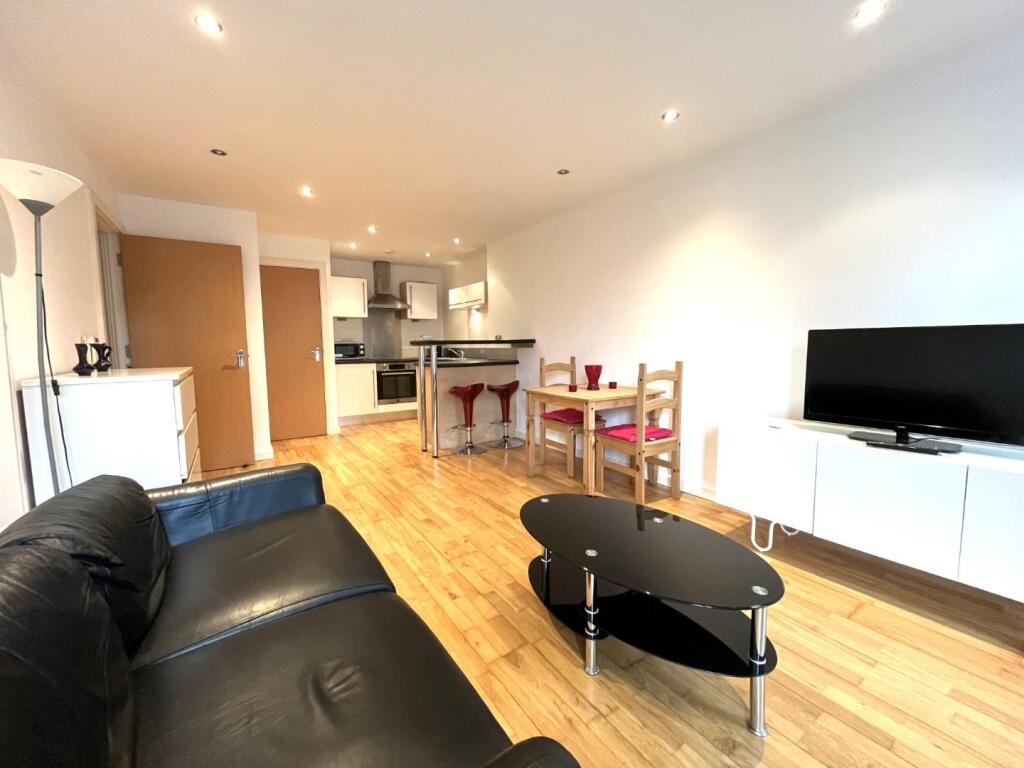
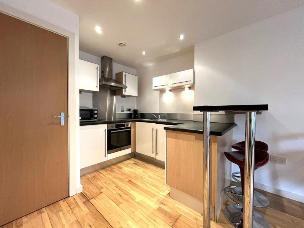
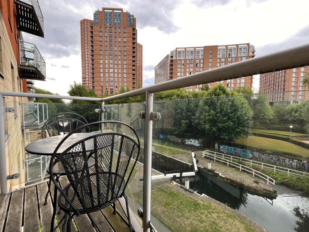
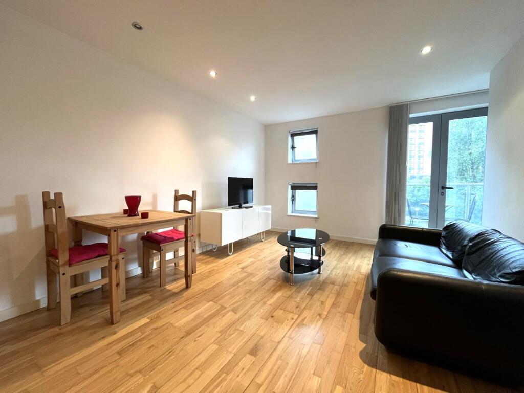
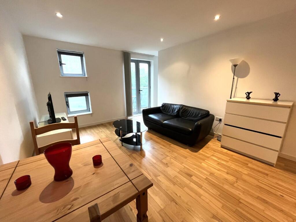
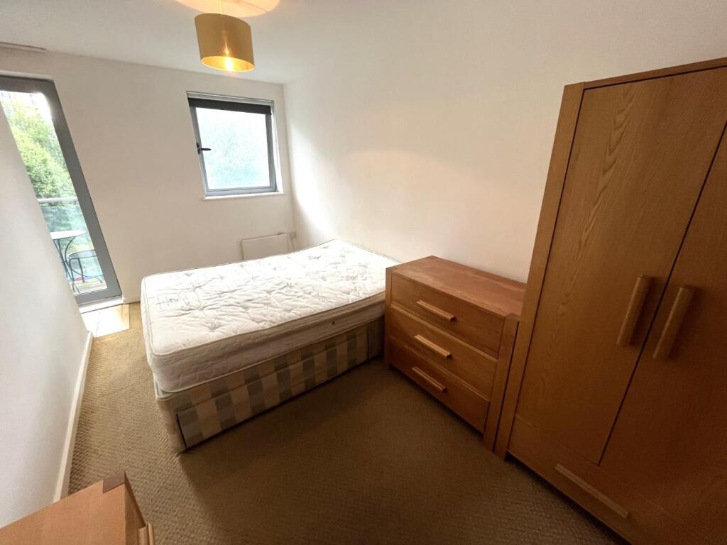
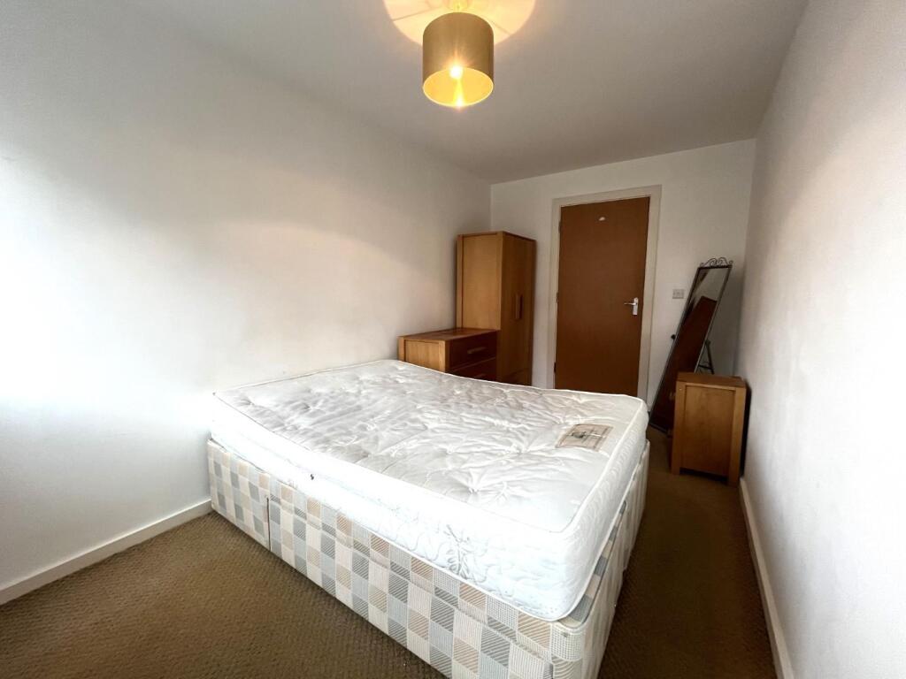
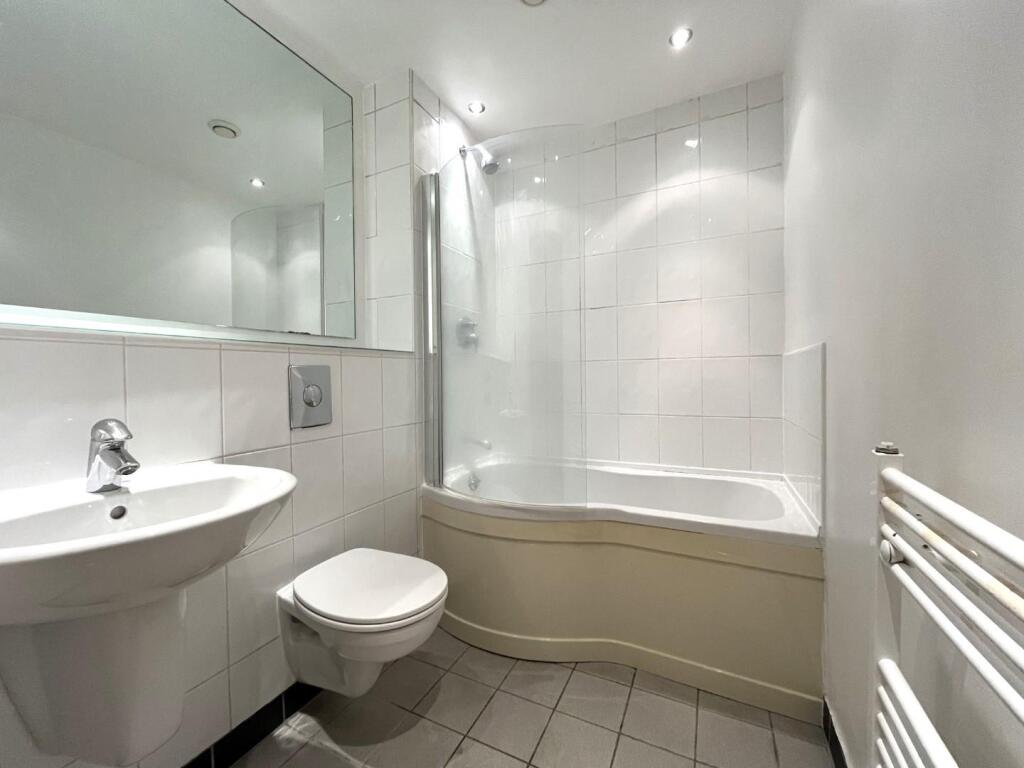
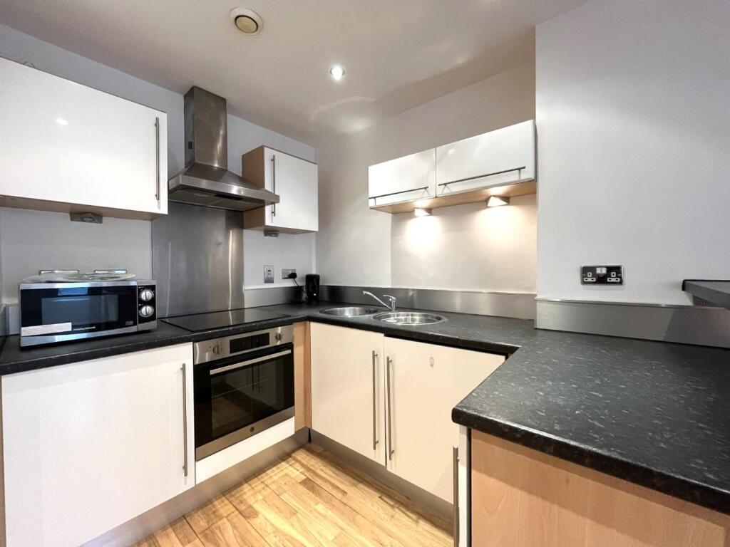
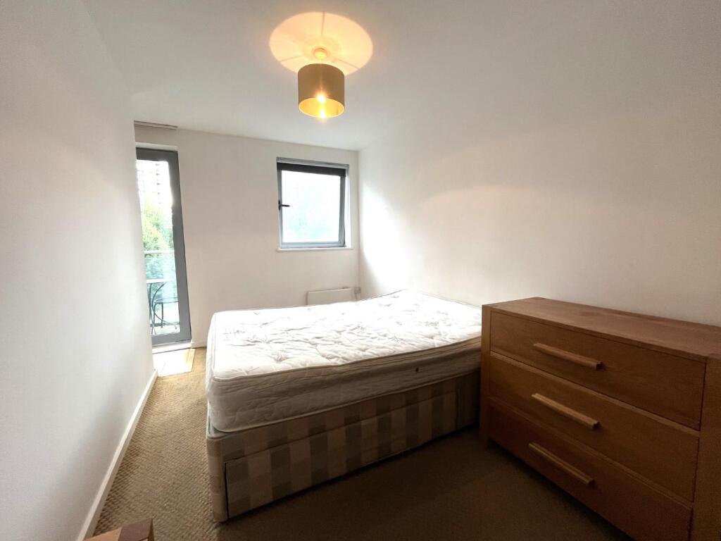

Photo 1 Photo 2 Photo 3 Photo 4 Photo 5 Photo 6 Photo 7 Photo 8 Photo 9 Photo 10 Photo 11
/ 11
Property details
Floor area
45 m²
Council tax band
C
Deprivation
Decile 2 (6,531 of 33,755)
Street crime
1355 incidents within 1 mile (Mar 2026)
Key features
- ONE DOUBLE BEDROOM
- FURNISHED
- BREAKFAST BAR
- BALCONY WITH RIVER VIEWS
- SECOND FLOOR
- 10 MINUTES WALK TO LEED TRAIN STATION
- EPC: B
- COUNCIL TAX BAND: C
- DEPOSIT FREE OPTION AVAILABLE OR DEPOSIT EQUIVALENT OF 5 WEEKS RENT
Additional details
- Electricity
- Mains supply
- Water
- Mains supply
- Sewerage
- Mains supply
- Heating
- Electric
- Accessibility
- Lift access
Description
The development itself benefits from a landscaped communal piazza with water feature and management suite providing concierge service and security.
This property will not be around for long so call the office to find out more !
SUCH A LOVELY ONE BED APARTMENT, FEATURING TRANQUIL CANALSIDE BALCONY, KITCHEN WITH BREAKFAST BAR AND MODERN FURNISHINGS THROUGHOUT. CLICK THROUGH FOR MORE DETAILS OR CALL TO ENQUIRE!
Bedroom
. - Bathroom
.. - Kitchen
Listed by
Leeds
Hunters Property Group Ltd
Reference: 163696643
EPC ratings on this postcode
We don't have a matched EPC for this property yet. Below are efficiency scores and details for other addresses on this postcode.
| Address | Current | Potential | Floor area | Age band | Type |
|---|---|---|---|---|---|
| 14 BONAIRE, GOTTS ROAD, ARMLEY, LEEDS | 77 | 85 | 44 m² | England and Wales: 2003-2006 | Flat |
| 24 BONAIRE, GOTTS ROAD, ARMLEY, LEEDS | 78 | 83 | 47 m² | England and Wales: 2003-2006 | Flat |
| 38 BONAIRE, GOTTS ROAD, ARMLEY, LEEDS | 64 | 76 | 113 m² | England and Wales: 2003-2006 | Flat |
| Flat 1, Bonaire, Gotts Road, LEEDS | 79 | 85 | 48 m² | England and Wales: 2003-2006 | Flat |
| Flat 10 Bonaire, Gotts Road, LEEDS | 71 | 84 | 59 m² | England and Wales: 2003-2006 | Flat |
| Flat 10, Bonaire, Gotts Road, LEEDS | 80 | 85 | 62 m² | England and Wales: 2003-2006 | Flat |
| Flat 11 Bonaire, Gotts Road, LEEDS | 81 | 88 | 39 m² | England and Wales: 2007-2011 | Flat |
| Flat 11, Bonaire, Gotts Road, LEEDS | 80 | 87 | 45 m² | England and Wales: 2003-2006 | Flat |
| Flat 12 Bonaire, Gotts Road, LEEDS | 76 | 86 | 38 m² | England and Wales: 2003-2006 | Flat |
| Flat 13 Bonaire, Gotts Road, LEEDS | 71 | 84 | 60 m² | England and Wales: 2003-2006 | Flat |
| Flat 15, Bonaire, Gotts Road, LEEDS | 74 | 85 | 45 m² | England and Wales: 2003-2006 | Flat |
| Flat 16 Bonaire, Gotts Road, LEEDS | 82 | 84 | 52 m² | England and Wales: 2003-2006 | Flat |
| Flat 17, Bonaire, Gotts Road, LEEDS | 80 | 86 | 37 m² | England and Wales: 2003-2006 | Flat |
| Flat 18, Bonaire, Gotts Road, LEEDS | 77 | 84 | 60 m² | England and Wales: 2003-2006 | Flat |
| Flat 19, Bonaire, Gotts Road, LEEDS | 85 | 88 | 41 m² | England and Wales: 2003-2006 | Flat |
Flood risk
Zone: 1
Risk: Low
Job (default Low)
Floorplans
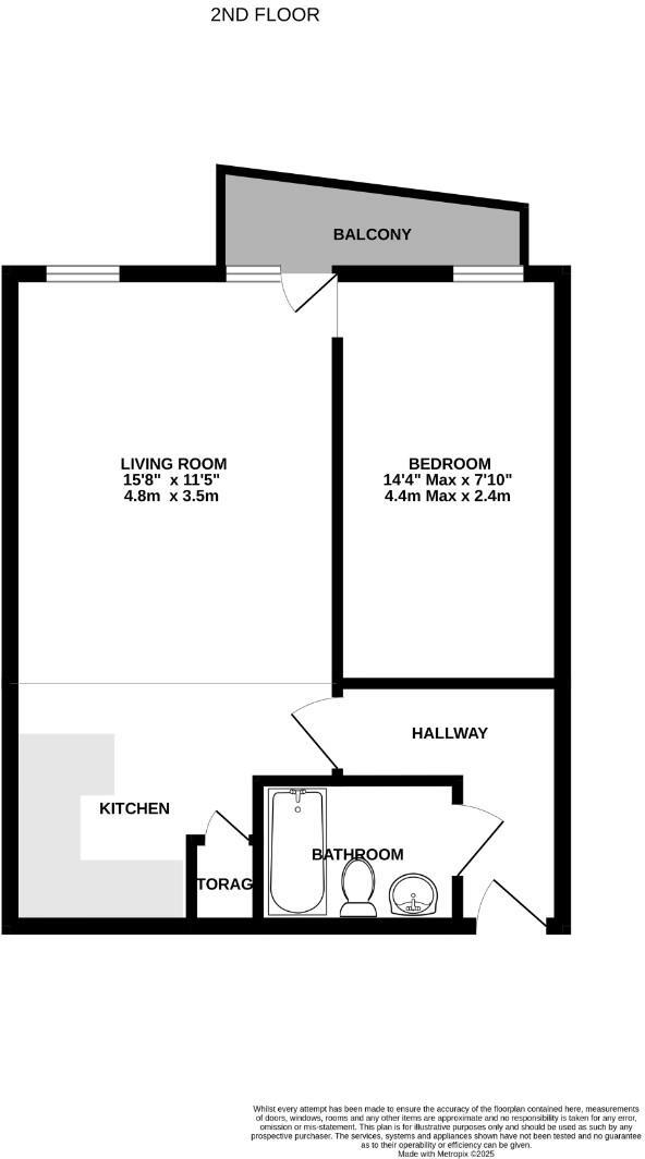
Floorplan 1
EPC Graphs
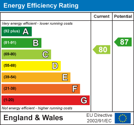
EE Rating
Rental Range
Estimated market rent for Leeds. Low = conservative, Realistic = average, Optimistic = best case.
Based on Local Authority from postcode lookup → Leeds.
LHA (30th percentile) floor for Leeds: £673/mo (Apr 2025 – Mar 2026)
Location
Address
Aire Valley Towpath
Nearby
Nearest stations, universities and amenities (distance from property).
| Type | Name | Distance |
|---|---|---|
| Shop | Harley-Davidson Leeds | 0.1 miles |
| Shop | Iron City Motorcycles | 0.1 miles |
| Bus stop | W12 Leeds Wellington Bridge | 0.1 miles |
| Bus stop | Wellington Road Armley Road | 0.1 miles |
| Train station | Leeds | 0.5 miles |
| University | Leeds Law School | 0.5 miles |
| University | Northern Film School | 0.7 miles |
| Train station | Burley Park | 1.4 miles |
| Hospital | Sir Karl Cohen Square | 1.4 miles |
| Hospital | St James's Hospital A&E | 1.8 miles |
Street-level crime
| Category | Count |
|---|---|
| Violence and sexual offences | 436 |
| Shoplifting | 201 |
| Other theft | 112 |
| Public order | 95 |
| Anti-social behaviour | 87 |
| Burglary | 79 |
| Criminal damage and arson | 79 |
| Drugs | 62 |
| Vehicle crime | 60 |
| Theft from the person | 36 |
| Robbery | 33 |
| Bicycle theft | 32 |
| Other crime | 32 |
| Possession of weapons | 11 |
| Total incidents | 1355 |
Within 1 mile during Mar 2026. Source: data.police.uk (England & Wales).
Schools nearby
Nearest open schools with Ofsted ratings (England). Closed schools are not shown. Data from Get Information about Schools and Ofsted.
| Name | Type | Distance | Ofsted |
|---|---|---|---|
| Luminate Education Group | Other | 0.4 miles | — (No rating) |
| Swarthmore Education Centre | Other | 0.5 miles | — (No rating) |
| Castleton Primary School | Primary | 0.6 miles | Good — 22 Nov 2022 |
| Rosebank Primary School | Primary | 0.6 miles | Good — 5 Feb 2023 |
| Leeds Mathematics School | Other | 0.7 miles | — (No rating) |
Rental Comparables
Rental listings exist nearby, but none matched the 1-bedroom estimate from EPC for this property.
Enter House Number
Enter the house number to help us retrieve more accurate pricing history and property data.
Please log in to submit or correct the house number for this listing.
Log in to continue