APARTMENT 1
SOUTH VIEW, 7, SOUTH TERRACE, NEWCASTLE, STAFFORDSHIRE ST5 8BY
£650 pcm
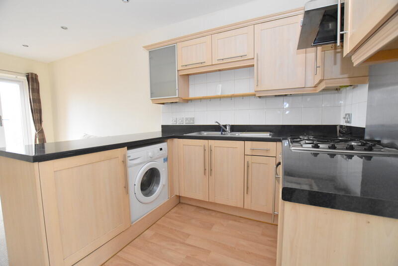
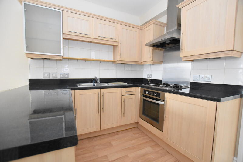
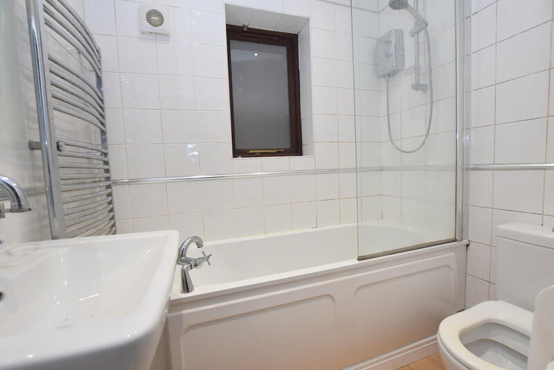
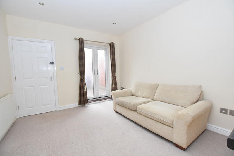
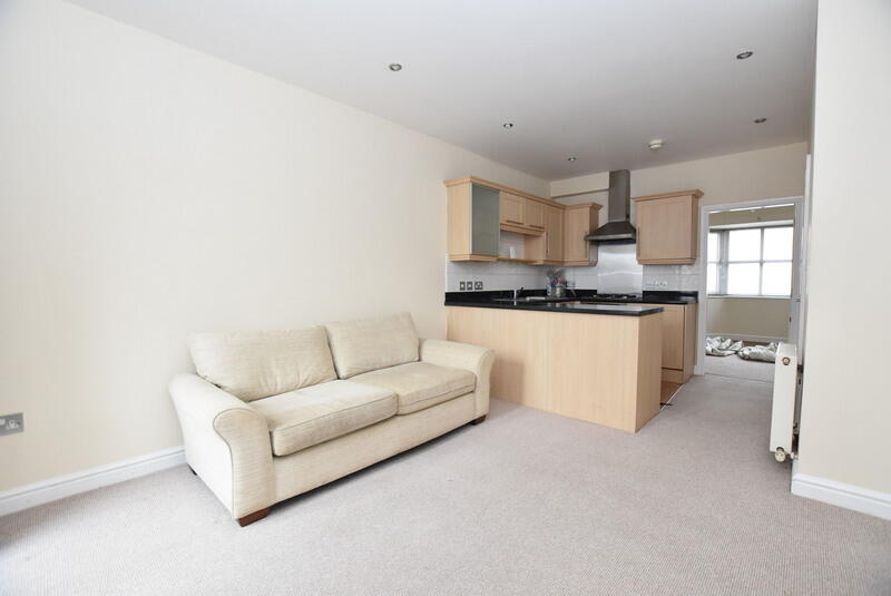
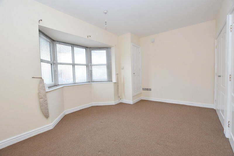
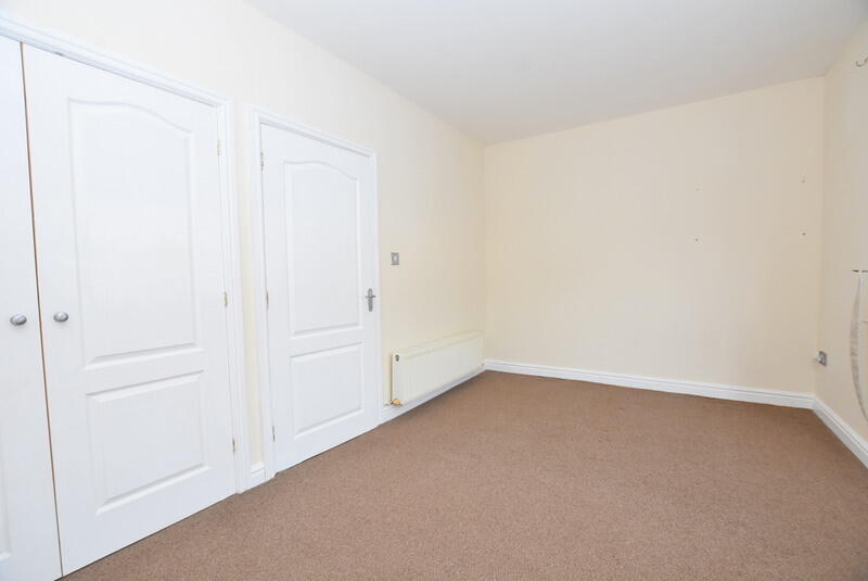
Photo 1 Photo 2 Photo 3 Photo 4 Photo 5 Photo 6 Photo 7
/ 7
Property details
Floor area
37 m²
EPC rating
C
Year built
England and Wales: 2003-2006
Deprivation
Decile 7 (20,468 of 33,755)
Street crime
217 incidents within 1 mile (May 2026)
Key features
- Available May
- Close to Local Amenities
- EPC - C
- Council Tax - A
- Ground Floor Apartment
- Allocated Parking
Additional details
- Heating
- Gas central
- Parking
- Off street, Private
- Listed property
- No
Description
The apartment features a bright and modern open-plan living and kitchen area, creating a welcoming space ideal for both relaxing and entertaining. The fitted kitchen is equipped with a gas hob.
The property offers a generously sized double bedroom, providing a comfortable and peaceful retreat. The bathroom is well-proportioned and fitted with a bath and overhead shower.
This attractive home is perfect for professionals or couples seeking a well-located and low-maintenance property.
Early viewing is highly recommended
Submit an online enquiry or contact the team today on to arrange your viewing. EPC rating: C.
Listed by
Stoke-on-Trent
The Property Franchise Group
Reference: 87897339
EPC Rating & Upgrade Cost
Current rating: C
Potential rating: C
Inspection date: 17/08/2020
Expiry date: 16/08/2030
Current heating cost: £253/year
Potential heating cost: £255/year
Recommendations
- Low energy lighting for all fixed outlets (15)
Flood risk
Zone: 1
Risk: Low
Job (default Low)
Rental Range
Estimated market rent for Newcastle-under-Lyme. Low = conservative, Realistic = average, Optimistic = best case.
Based on Local Authority from postcode lookup → Newcastle-under-Lyme.
LHA (30th percentile) floor for Staffordshire North: £424/mo (Apr 2025 – Mar 2026)
Location
Address
South Terrace
Nearby
Nearest stations, universities and amenities (distance from property).
| Type | Name | Distance |
|---|---|---|
| Bus stop | Hollinshead Avenue | 0.2 miles |
| Shop | The co-operative food | 0.3 miles |
| Shop | Coral | 0.3 miles |
| Hospital | Bradwell Hospital | 0.8 miles |
| Train station | Longport | 0.8 miles |
| Hospital | St Augustine's Hospital | 1.5 miles |
| Train station | Silverdale | 1.7 miles |
| University | University of Staffordshire Stoke Campus | 2.3 miles |
Street-level crime
| Category | Count |
|---|---|
| Violence and sexual offences | 76 |
| Anti-social behaviour | 49 |
| Public order | 19 |
| Criminal damage and arson | 17 |
| Shoplifting | 15 |
| Other theft | 14 |
| Drugs | 9 |
| Vehicle crime | 9 |
| Burglary | 3 |
| Other crime | 3 |
| Bicycle theft | 1 |
| Possession of weapons | 1 |
| Robbery | 1 |
| Total incidents | 217 |
Within 1 mile during May 2026. Source: data.police.uk (England & Wales).
Schools nearby
Nearest open schools with Ofsted ratings (England). Closed schools are not shown. Data from Get Information about Schools and Ofsted.
| Name | Type | Distance | Ofsted |
|---|---|---|---|
| Cedars - Newcastle, Moorlands and Darwin Bases | Other | 0.2 miles | Good — 26 Jun 2015 |
| The Orme Academy | Secondary | 0.3 miles | Good — 9 Jul 2024 |
| Ellison Primary Academy | Primary | 0.3 miles | Good — 14 Sep 2023 |
| St Margaret's CofE (VC) Junior School | Primary | 0.4 miles | Good — 1 May 2014 |
| Kaleidoscope School | Other | 0.4 miles | Good — 10 Dec 2023 |
Rental Comparables
Residential lets from OpenRent and Rightmove for the area (same bedroom count). Use to validate rent estimates. Student lets are excluded.
Average rent: £745/mo (31 listings)